


INTRODUCTION
Dogtown (or as the city would rather you refer to it — the “North Industrial District”) is both one of Los Angeles’s oldest and most obscure neighborhoods. It’s also occasionally referred to as either Naud Junction or Mission Junction, after two area junctions of the Southern Pacific Railroad, the entity perhaps most instrumental in the neighborhood’s development (it’s also sometimes referred to as the River Station Area). By the way, this is not the Dogtown neighborhood in Santa Monica, of Dogtown & Z-Boys fame.

CHARACTER

When I first visited Los Angeles in the late 1990s, I was charmed by this dusty corner between Downtown and the Eastside where there were pockets of red brick buildings that reminded me more of river towns like St. Louis, Hannibal or Davenport than Los Angeles. Then as now it was dominated by Chinese warehouses due to its proximity to Chinatown. Back then and it was separated from Elysian Park by a large brownfield that has since become Los Angeles State Historic Park.

LOCATION
Dogtown has been somewhat isolated from its neighbors since its beginnings in the 1880s. It was then separated from Sonoratown and Little Italy (both now part of Chinatown), Chavez Ravine and a large pigeon farm to the west by the railway (both now within Elysian Park). It was also separated from old Chinatown (now Civic Center) in the south by the railway. It was separated from East Los Angeles (now Lincoln Heights) by the Los Angeles River.

A wooden pedestrian bridge connected Dogtown to Little Italy and East Los Angeles was accessible by several bridges, most notably the Beaux Arts Buena Vista Street Viaduct built in 1911. Some people would describe Dogtown as being part of the greater Downtown area although it has a long history of being thought of as Northeast Los Angeles too.

YANG-NA TO THE AMERICAN ERA
Portuguese explorer Rodríguez Cabrillo noted its location during an exploration of the West Coast in 1542. In 1769 Gaspar de Portolà and his crew camped in the hills near the Tongva village of Yang-na on their way to Monterey Bay. In 1779 plans to found a Spanish pueblo (El Pueblo de la Reina de Los Angeles) nearby were approved. Water was brought from the Los Angeles River, which the Spanish called Porciúncula, via the zanja madre (“mother ditch”). The Tongva remained in the area in significant numbers until the 1830s. After 1821, the pueblo and all of California were part of Mexico, following its independence from Spain. In 1848, the US conquered the land.
Gold was discovered in Northern California the same year. For decades after the Americans took over Los Angeles, non-White Protestants were restricted as to where they could live and the marginalized neighborhoods around Downtown became the home to Armenians, Blacks, Chinese, Croats, Filipinos, French, Irish, Italians, Japanese, Jews, Mexicans, Native Americans, Russians, and other groups. A barrio called Sonoratown arose in the area around Ord and Spring — “Sonoran” and “Mexican” were used interchangeably by Anglos. Around the same time a French (and French Canadian) community centered around area vineyards (and reflected in street names like Bauchet, Beaudry, Bernard, Mesnager, Rondout, Sentous, and Vignes) arose and flourished. It was a Frenchman, Jean-Louis Sainsevain, who installed a waterwheel on the zanja madre in 1861.
THE LOS ANGELES INFIRMARY

In 1856, the Daughters of Charity of St. Vincent de Paul founded the city’s first orphanage, Institución Caratitiva, in the former residence of a former mayor, Benjamin Wilson. The order then opened the Los Angeles Infirmary in 1858. In 1870 they moved the infirmary to a new structure built in what became Dogtown at Naud and Ann Street (named after the orphanage’s supervisor, Sister Ann Gillen). Rail arrived a few years later and suddenly the location seemed less than ideal for an infirmary and the decision was made to relocate. Between 1883 and ’86 they sold lots of the New Depot Tract and Infirmary Tract to raise money for a new home. In 1891, the sisters moved their operations to Boyle Heights.
RIVER STATION & THE CORNFIELD

While Sonoratown and the French community grew at the base of the Elysian Hills, the area that now makes up Dogtown remained a mostly undeveloped flood plain. In 1873 the Southern Pacific Railroad acquired the land and opened the city’s first transcontinental railroad depot in 1875, creating an entry point (especially for European and Chinese immigrants) that has led some to refer to it as “The Ellis Island of Southern California.” The Pacific Hotel opened in 1879 and promised “25 minute meals” to River Station.

duringtheLosAngelesfloodo)
A community grew in the immediate vicinity, primarily to house the mostly Italian and Mexican railway workers. The railyard came to be known as the Cornfield after corn leaking from cars sprouted along the tracks.


The first River Station was demolished and replaced by the second River Station in 1901. It continued to ferry passengers to the area until 1904. The Cornfield remained in use as a freight yard until 1992 and the tracks weren’t removed for several more years. The zanja madre along the yard’s western edge was covered by brick in the 1880s and remained in use until 1913.

Passenger rail returned to Dogtown in 1992, after Metrolink took over the old Southern Pacific (now Union Pacific) right-of-way along the river.

On the other side of the neighborhood, along the western edge of the old rail yard, the Metro Gold Line began transporting passengers between Downtown Los Angeles and Pasadena in 2003.

A section of the zanja madre was uncovered in 2001 when the rail yard was in the process of converting into the 32 acre Los Angeles Historic Park and remains visible to visitors.
CALIFORNIA GLASS COMPANY & THE RIVER STATION AREA

In 1889, a red brick flatiron building was constructed and became home to California Ice Company and the New York Suspender Company. Its best-known tenant was Prussian-born businessman Charles Raphael, who operated the Rafael Glass Company there until he was crushed to death by a load of glass in 1905. His family continued operating there until 1934. It’s one of the oldest warehouses in the city (some of the Capitol Milling Company buildings were constructed in 1881 ). Although in 2007 it was declared Los Angeles Historic-Cultural Monument #872, today its red brick is now obscured by stucco and paint. It’s now home to Junction Block (formerly Chiparaki Cultural Center).


There are several other old brick warehouses in the old River Station area. Many are covered with an incredible amount of graffiti. Whilst exploring some in the past, I met a woman living in a shack behind one of them and she told me that they’re sometimes rented out for film shoots.

A building dating from 1910 at 1711 N. Spring was originally a Carnation Company warehouse is now home to City Studio. The building at 1701 North Spring Street was built in 1895 and is currently home to FEC Ginseng & Marine Products. The building at 1709 N Spring was also built in 1895 and is currently the home of Loh Sun International.

At 1727 N. Spring, the Standard Oil Company building was built in 1914. In 1975 it became the second location of The Woman’s Building, a feminist arts collective established in 1973 in Westlake by Arlene Raven, Judy Chicago, and Sheila Levrant de Bretteville. The arts collective left in 1991. 1640 N. Spring has recently housed Ghettogloss, The Punk Rock Museum, and KGB Studios. It was built in 1925 as a daylight factor for The Paper Company.


The site of a former Standard Oil refinery is now the site of Farmlab, an environmentalist laboratory and research space created by artist Lauren Bon. The work/exhibition space and offices are adjacent to the previous Not-A-Cornfield project and also include the Under Spring space, under the Spring Street Bridge.
CALIFORNIA DROP FORGE

From the same era as the buildings in the River Station area but further south near Naud Junction is The California Drop Forge, which opened in 1901. Inside masked workers forge aluminum, nickel base, steels, and titanium.

Behind and connected to it is LA Recycling Center. Throughout the day it belches smoke and steam and cold days, best seen from the Gold Line, the scene is quite pretty in an industrial way. In the 1900s, the non-union Llewellyn Iron Works was located nearby. On Christmas day in 1910, a bomb exploded there less than three months after the Los Angeles Times Bombing by John J. and James B. McNamara, two Irish-American trade unionists.
THE CHICKEN OR THE EGG – or – THE DOG OR THE POUND?


Two denizens at the Ann St. Animal Shelter in the 1940s (source: Paul Calvert for the LA Times)
Although some modern accounts claim that Dogtown’s nickname derived from the many stray dogs that roamed the rail yard, it’s more often assumed to be a reference to the city’s old animal shelter which was built near the Downey Street Bridge (at a date I haven’t been able to establish). A second pound, The LA Animal Shelter (aka Ann St. Animal Shelter), later opened on Ann Street between Weyse and Naud. It later moved to Lincoln Heights and became known as North Central Care & Control. There may be truth to both versions, however; if there was a part of town known for its roving packs of dogs, where better to open a dog pound?
DOG TOWN GANG

Though Dog Town is closely associated with the World War II-era William Mead Homes, its roots are often claimed to go back much further. The gang was mentioned in mentioned Beatrice Griffith’s 1948 book American Me. A 1943 article in the Los Angeles Times mentions Dogtown, Rose Hill, Eastside, Hazard, Alpine, La Loma and Happy Valley pledging “to maintain a harmonious relationship between their gang members” in the wake of violence brought upon Latinos (and Filipinos and Blacks) by white sailors during the Zoot Suit Riots that had erupted earlier that year. Though not a contemporaneous source, in William Dunn’s The Gangs of Los Angeles the author claims that the gang existed at least as early as 1904. Without citing any sources, Street Gangs claims it began around 1895.
LADWP – NORTH MAIN STREET STATION

The Los Angeles Department of Water and Power (the nation’s largest municipal utility) was founded in 1902 when the city of Los Angeles purchased the Los Angeles City Water Company. It began offering electricity in 1917. The North Main Street Station was built over the years on the Hollenbeck Tract of Dogtown. The test laboratory was constructed in 1916. A transformer house was built in 1918. A warehouse and repair shop date from 1923 and ’25 respectively.


WILLIAM MEAD HOMES


Photo of site chosen for William Mead Homes and the Homes after completion
Between 1941 and ’42, the 15 acres of homes built on the former site of an Almagamated Oil refinery and a Wiltco Corporation hazardous waste dump were cleared and replaced with the William Mead Homes, a public housing development designed by architects A.R.Walker, Norman R. Marsh, David D. Smith, Herbert J. Powell and Armand Monaco. The complex includes 415 residential units and to many of their residents they are synonymous with Dogtown (there are no other residences left in the neighborhood).

Dogtown murals and gang graffiti abound, as do a couple of 1980s murals painted by Pedro A. Pelayo and “assisted by residents and friends of William Mead Homes”; Dogtown and La Raza’s Struggle for Freedom.


In 1994 cancer-causing hydrocarbons on the site tested at nineteen times the safe level. It was cleaned up in 2003.
ANN REDEVELOPMENT PLAN


In 1954, the 33-acre area between the William Mead homes, the River Station area, and the Cornfield was approved for redevelopment. A report claimed that “66% of the 102 residential structures are substandard, many of which are unfit for human occupancy” and that “Crime, juvenile delinquency, and disease rates are considerably above the city-wide average.” Leonard Nadel, photographer for the Los Angeles Housing Authority from approximately 1949 to 1952, photographed the area and, in my opinion, suggests that the area was an attractive, vibrant, working-class neighborhood and hardly the slum that it was described as. Nonetheless, all of the neighborhood’s residents living outside of the projects were removed. In the place of their homes were constructed many of the warehouses that dominate the area.


CIVIC SUPPORT

Though rare, I’ve seen maps labeling the area south of Dogtown as “Civic Support” because, presumably, much of the Civic Center area is focused on related activities. Some of that spills over into the Dogtown neighborhood, including a couple of Naud Junction area parking lots that often contain various city vehicles (often smashed up cop cars) in need of repair. Further north is VTLACMTA, (within the Ann Redevelopment area) where MTA vehicles (mostly buses) are serviced. Further north still is the Gold Line Shops & Yard.
NICKS CAFÉ

There are only a handful of places to eat in Dogtown; the oldest is Nick’s Café. Nick’s has been open since 1948 and their claim to fame is their ham & eggs. Being a vegetarian I have never checked it out but omnivorous food critics Jonathan Gold and Tien Nguyen have praised it in the LA Weekly. (UPDATE: I’ve eaten there and it was great!)
LITTLE XISHUANGBANNA DAI

Amongst the mostly Chinese warehouses of Dogtown is a small pocket of Thai businesses in an area I call Little Xishuangbanna Dai. The first thing one notices as one approaches the area is the large, abandoned and gutted Kelite (or KeLite) Building, located between the Thai businesses and the Dogtown projects. The utilitarian Art Deco industrial loft, built in 1924, produced industrial cleaning products (although the building – aka Plant One — was used as a Navy brig during World War II until 1954. It has long stood empty, used primarily as shelter by feral cats, homeless people and possibly ghosts.

The centerpiece of Little Xishuangbanna Dai is the gargantuan LAX-C. LAX-C was established in 1996 and is often described as being the Thai Costco. I’ve only been to one Costco (in La Quinta), and it was a huge warehouse as spotless and sterile as a burn ward. On the other hand, LAX-C is chaotic and, well, kind of dirty. It is absolutely huge and labyrinthine and even a little mysterious. I once wandered into some dusty, quiet wing with furniture and art where the only other living things I saw was a family of apparently feral cats. In other words, LAX-X is an obsessive-compulsive’s nightmare.

The exterior wall facing the parking lot is decorated with a huge, flaking mural of Native Americans hunting bison. According to their website, LAX-C Inc is the largest Thai company in the US (really? Bigger than Thai Airways?) They have a huge selection of food and restaurant supplies, a food court; and even though it’s wholesale, there’s no paid membership. When new inhabitants of nearby Chinatown voice their support for a Wal-Mart market, claiming that there are no markets in the area, you have to wonder what their beef with LAX-C (not to mention Ai Hoa Market, B J Market, Chinatown Store, Far East Supermarket, G & G Market, GW Market, JC Market, Lau’s Ranch Market, Lien Hoa Deli & Seafood Market, Namhoa Fish Market, Tin Bo, Yue Wa Market, and others) is or if they’re somehow merely ignorant of the dozen markets in the immediate area.

Other Thai businesses in the Little Xishuangbanna Dai complex include Chimney Coffee Shop, E-Sea Fresh Seafood (aka E-Sea Fresh Noodle), Mae Ting’s Coconut Cakes, Rajprasong, Thong Lo, Thai Books & Music-Dokya, and Thai LA Newspaper.
HOMEGIRL CAFE

Inside Homegirl Cafe (image source: Inside JVC)
The newest restaurant in the area is Homegirl Café. The café is one of Homeboy Industries enterprises designed to provide proper jobs for high-risk and former gang members. Although it opened in 2004 and is vegetarian-friendly, I haven’t eaten there yet.
DOGTOWN IN FILM


I’d be surprised if there weren’t more films including at least scenes shot in Dogtown although my research only turned up films with scenes including the Cornfield, including This Gun for Hire (1942), Roadblock (1951), To Live and Die in LA (1985), and Tough Guys (1986). By all means, let me know if you know of more! Oh, there’s also a production studio, East Down Town Studio, where Electric Six, K’naan, Kanye West, and Seal have filmed music videos.

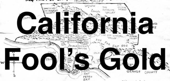
Historic maps here shown in detail can be seen in whole on BIG Map Blog.
To vote for any communities you’d like to see covered in California Fool’s Gold, name them in the comments. If you’d like a bit of inspiration, there are primers for:
- Imperial County
- Kern County
- Los Angeles County
- Angeles Forest
- the Antelope Valley
- the Channel Islands
- Downtown
- the Eastside
- the Harbor
- Hollywood
- Mideast Los Angeles
- Midtown
- Northeast Los Angeles
- Northwest Los Angeles
- the Pomona Valley
- the San Fernando Valley
- the San Gabriel Valley
- the Santa Monica Mountains
- the South Bay
- South Los Angeles’s Eastside
- South Los Angeles’s Westside
- Southeast Los Angeles
- the Verdugos
- the Westside
- Orange County
- Riverside County
- San Bernardino County
- San Diego County
- San Luis Obispo County
- Santa Barbara County
- Ventura County

Eric Brightwell is an adventurer, essayist, rambler, explorer, cartographer, and guerrilla gardener who is always seeking paid writing, speaking, traveling, and art opportunities. He is not interested in generating advertorials, cranking out clickbait, or laboring away in a listicle mill “for exposure.”
Brightwell has written for Angels Walk LA, Amoeblog, Boom: A Journal of California, diaCRITICS, Hidden Los Angeles, and KCET Departures. His art has been featured by the American Institute of Architects, the Architecture & Design Museum, the Craft Contemporary, Form Follows Function, Los Angeles County Store, the book Sidewalking, Skid Row Housing Trust, and 1650 Gallery. Brightwell has been featured as subject in The Los Angeles Times, Huffington Post, Los Angeles Magazine, LAist, CurbedLA, Eastsider LA, Boing Boing, Los Angeles, I’m Yours, and on Notebook on Cities and Culture. He has been a guest speaker on KCRW‘s Which Way, LA?, at Emerson College, and the University of Southern California.
Brightwell is currently writing a book about Los Angeles and you can follow him on Ameba, Duolingo, Facebook, Goodreads, Instagram, Mubi, and Twitter.


Most of the images don’t show up, but I’d love to see them. Great article, thanks!
LikeLike
Thank you, Nick! I’m in the process of restoring broken images — which were broken because my old employer, Amoeba, attempted to scrub them from the internet. That means finding them, slowly but surely, on the Wayback Machine. I’ll try to fix this entry soon.
LikeLike