

San Luis Obispo County is a county in the northwest corner of Southern California, located along the Central Coast. The Central Coast refers to the roughly 600 kilometer coastal region between Point Mugu in the south and Monterey Bay in the north. In Southern California, only Imperial County has a smaller population and no community presently has a population of even 50,000. The San Luis Obispo-Paso Robles-Arroyo Grande, CA Metropolitan Statistical Area, is home to more than a third of the county’s population with the remaining two thirds spread across a mostly rural countryside.
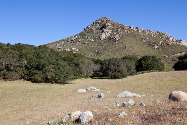
Being largely rural, San Luis Obispo County is home to several natural attractions including Cambria State Marine Conservation Area, Morro Bay State Marine Recreational Management Area and Morro Bay State Marine Reserve, Piedras Blancas State Marine Reserve and Marine Conservation Area, Point Buchon State Marine Reserve and Marine Conservation Area, White Rock (Cambria) State Marine Conservation Area as well as portions of Carrizo Plain National Monument, Guadalupe-Nipomo Dunes National Wildlife Refuge, and Los Padres National Forest.
Before the arrival of humans, the desert grasslands, riparian woodlands, marshes, rolling hills, sand dunes, chaparral, alkali lakes, coastal sage scrubland, streams, and coastal prairie of the region were home to a variety of animal species including American peregrine falcon, California brown pelican, California condor, California red-legged frog, San Joaquin antelope squirrel, San Joaquin kit fox, Sandhill cranes, Western pond turtle, blunt-nosed leopard lizard, bobcats, giant kangaroo rat, golden eagles, grizzly bears, mountain plovers, pronghorn, southern rubber boa, southern sea otter, tule elk, and white-tailed kite.

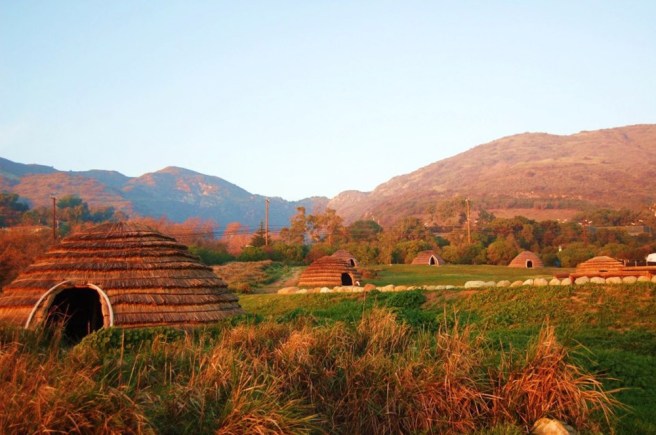
For roughly 13,000 years, the region’s primary inhabitants were the seafaring Chumash people and related archaeological sites include Painted Rock and Archeological Site 4 SLO 834 (near Atascadero). Prior to the Spanish Conquest, the Chumash homeland extended from Morro Bay in the north to Malibu and the Channel Islands in the south. Before the arrival of the Spanish there was an estimated population of 10,000 to 18,000. Today their numbers are estimated as 2,000 to 5,000.
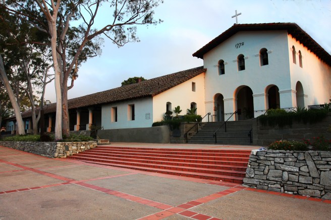
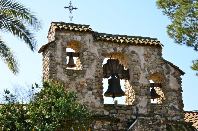
The Spanish claimed the Island of California for their empire after Juan Rodríguez Cabrillo sailed along the coast. The claim remained almost completely nominal and in 1579 Sir Francis Drake claimed California as Nova Albion for England. It wasn’t until Gaspar de Portolá led an overland expedition in 1769 that the Spanish Conquest of California really began. Portolá, Father Juan Crespí, and 63 soldiers entered what’s now San Luis Obispo County in August of that year. Mission San Luis Obispo de Tolosa was founded on 1 September 1 1772 in what’s now the city of San Luis Obispo.

With the independence of Mexico in 1821, California changed hands once again but not for the last time. In 1848, the United States conquered much of Mexico and on 9 September 1850, California became the 31st state. Nowadays the economy is largely agricultural. The largest crop is strawberries. The second largest, wine grapes, are surpassed in California production only by Napa and Sonoma counties.
As of 2010 San Luis Obispo County had a population of 269,637. 83% of the population identified as white, 3% Asian (mostly Filipino, Chinese, Japanese, Indian, Korean, and Vietnamese), 2% black, 1% Native American, 7% of other races, 4% mixed race, and 21% Latino (mostly Mexican, Puerto Rican, and Salvadoran) of any race.
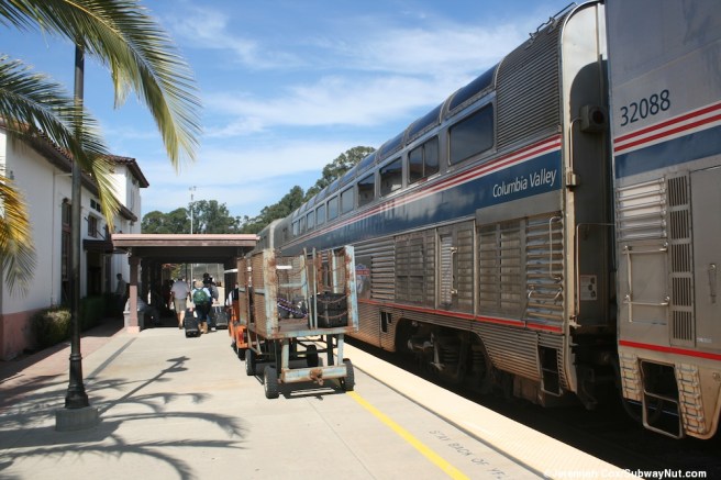
Regional transportation is provided by Amtrak, Greyhound, Orange Belt Stages, the San Luis Obispo Regional Transit Authority. Additional local transportation is provided by Atascadero Transit, Paso Express, and SLO Transit. There are also three airports: San Luis Obispo County Regional Airport, Paso Robles Municipal Airport (also home of the Estrella Warbird Museum), and Oceano County Airport.
*****
ARROYO GRANDE
Arroyo Grande is a city in the Arroyo Grande Valley which in 2013 reported a population of 17,716, making it the third largest town in San Luis Obispo after . Historic attractions include the the Romanesque-style Arroyo Grande IOOF Hall, (built in 1902). Other attractions include the South County Historical Society.
ATASCADERO
Atascadero is a city which, as of 2013, had a population of 29,096. It was founded by a flamboyant political activist and publisher from Missouri, Edward Gardner Lewis, as a utopian colony in 1913. “Atascadero” is a Spanish word for “mire” or “bog.” Historic attractions include the City Hall-Administration Building (1918) and the Atascadero Printery (1915).
AVILA BEACH
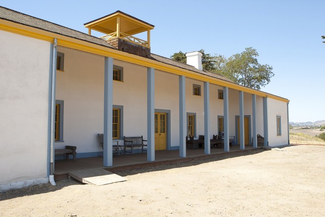
Avila Beach is a historic port town which as of 2010 reported a population of 1,627. Its name is derived from Miguel Ávila, granted Rancho San Miguelito in 1842. The town arose in the 19th Century as the primary port for San Luis Obispo. Historic attractions include the Prairie Victorian-style Port San Luis Light Station, built in 1890.
BLACKLAKE
Blacklake is a Census-Designated Place (CDP) which in 2010 had a population of 930.
CALIFORNIA VALLEY
California Valley is an unincorporated community in the northern portion of the Carrizo Plain. The area parceled out in 1960 by optimistic real estate developers into over 7,200 properties. Apparently they didn’t appear in the last census but only a few hundred of the lots have seen the construction of houses.
CALLENDER
Callender is a CDP which as of 2010 had a population of 1,262.
CAMBRIA
Cambria is a seaside village located in a Monterey pine forest. It was renamed from the Latin name for Wales in 1869. Before that it was known as Slabtown, Rosaville, San Simeon, and Santa Rosa. As of 2010 it had a population of 6,032. Historic attractions include the Guthrie-Bianchini House (1870), Old Santa Rosa Catholic Church and Cemetery (1870), folk-art/home Nitt Witt Ridge.
CAYUCOS
Cayucos is a coastal town which as of 2010 had a population of 2,592. It’s name is derived from the Mexican Rancho Moro y Cayucos. The town was founded in 1867 by Captain James Cass.
CHOLAME
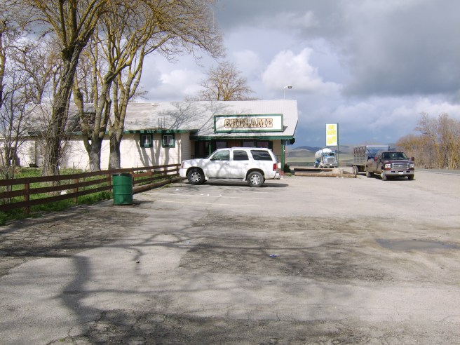
Cholame is an unincorporated community, established on Rancho Cholame by Robert Edgar Jack and William Welles Hollister. Its name is derived from the Chumash “Tc!ola’M,” or “Tco’alamtram.”The land was sold to the Hearst Corporation in 1966. Cholame apparently didn’t participate in the last census.
CRESTON
Creston is a CDP founded in 1884 and named after Calvin J. Cressy‘s Cardiff Stud Farm, Creston Farms. The stud farm was sold in 2008 and is now an even center known as Windfall Farms. In 2014, Creston was made an American Viticultural Area called the Creston District AVA. As of 2010 had a population of 94.
EDNA
Edna is a CDP which as of 2010 had a population of 193. It was founded in 1883 by Lynford Maxwell, who named it Maxwellton. At some point it was renamed Edna.
GARDEN FARMS
Garden Farms is a CDP which as of 2010 had a population of 386.
GROVER BEACH
Grover Beach is a city in which in 2010 had a population of 13,156.
HALCYON
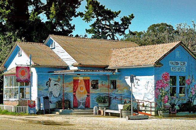
Halcyon is an unincorporated community which was founded in 1898 by The Temple of the People, a sect of the Theosophy.
HARMONY
Harmony is an unincorporated community which in 2010 had a population of 18. According to Wikipedia:
Harmony consists of one street off of SR 1. To one side is a long abandoned house, a large dumpster, and a former art gallery, with some portable toilets. In front of the house is the “treecar” – an old grey Nissan Z-car with a tree collapsed upon it.
It formerly held a “Doo Dah Parade” along its only road; being only a block long it was rather short. A Maine Coon named Freddy Cheenie Alfredo served as the town’s mayor until his death at the age of 22 in 1995.
LAKE NACIMIENTO
Lake Nacimiento is a resort town named after the Lake Nacimiento reservoir, created in 1956. As of 2010 it had a population of 2,411.
LOS BERROS
Los Berros is a CDP which in 2010 had a population of 641. Its name comes from the Spanish word for watercress.
LOS OSOS
Los Osos is a CDP which in 2010 had a population of 14,276. “Oso” is Spanish for “bear.”
LOS RANCHOS
Los Ranchos is a CDP which as of 2010 had a population of 1,477.
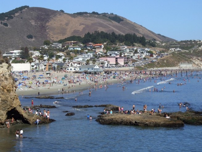
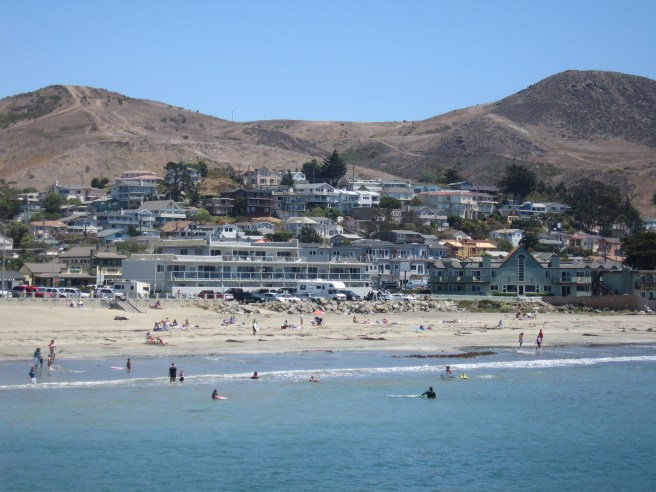
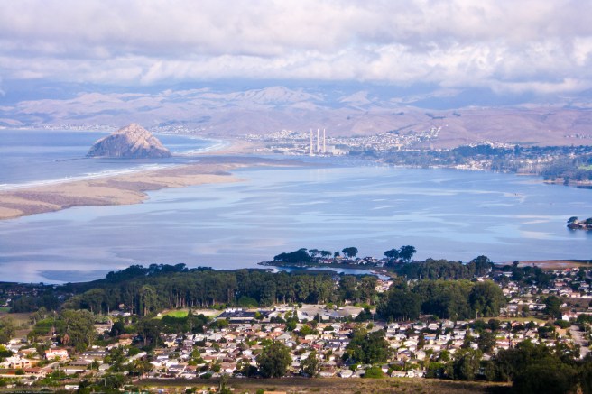
MORRO BAY
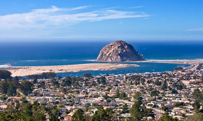
Morro Bay is a coastal city which in 2010 had a population of 10,234. It is named after an offshore volcanic plug known as Morro Rock. A Spanish galleon, Nuestra Señora de Esperanza, arrived in 1587, bringing the first Filipinos to the Americas. The town of Morro Bay was founded by Franklin Riley in 1870. Attractions include the Morro Bay State Marine Recreational Management Area and Morro Bay State Marine Reserve, Morro Bay State Park Museum of Natural History, and Morro Bay State Park Trailer and Tent Campground.
NIPOMO
Nipomo is a CDP which in 2010 had a population of 16,714. In Chumash, “ne-po-mah” means “foot of the hill.” It was founded by sea captain William Goodwin Dana. Its home to the historic Dana Adobe (1839).
OAK SHORES
Oak Shores is a CDP which as of 2010 had a population of 337.
OCEANO
Oceano is a CDP which in 2010 had a population of 7,286. It’s known for the Oceano Dunes and the Oceano Dunes State Vehicular Recreation Area.
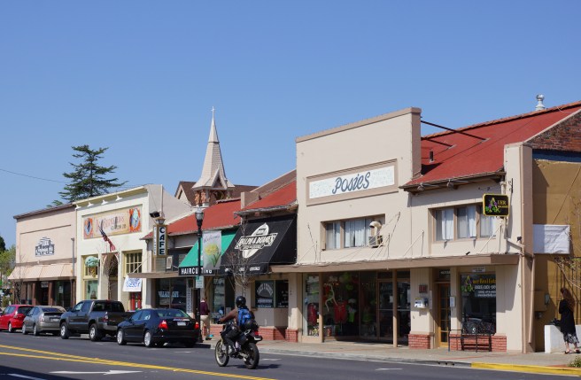
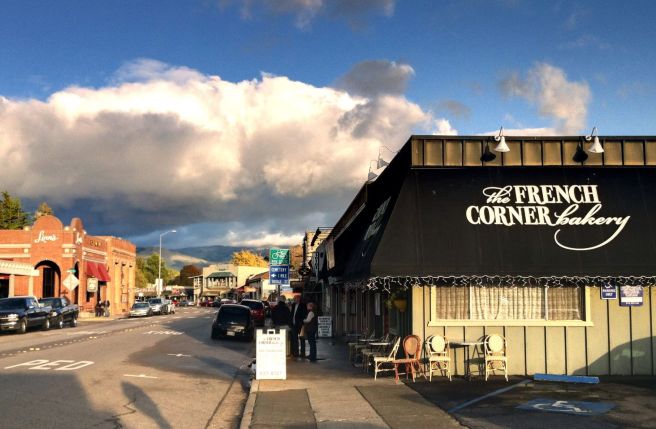
PASO ROBLES
Paso Robles is a town widely known for its wine production. Wine grapes were introduced by the Spanish in 1797 and it’s part of the Paso Robles Wine Country is an American Viticultural Area. It’s also known for its hot springs, olive oil production, and almond orchards.
Historic buildings in the city include Estrella Adobe Church (1879), the Brewster-Dutra House (1890), the Call-Booth House (1893), Paso Robles Carnegie Library (1908), Lincoln-Adelaida School (1917), and the Bank of Italy (1921). Other attractions include the Paso Robles Children’s Museum at the Volunteer Firehouse and Paso Robles Pioneer Museum. As of 2010 it had a population of 29,793, enough to make it the second largest town in San Luis Obispo County.
PISMO BEACH
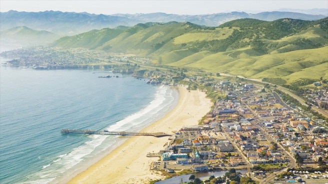
Pismo Beach is a city which in 2014 had a population of 7,931. The town was founded by John Michael Price in 1891. It’s still home to the John Price House, built in 1894. Its old motto, “Clam Capital of the World,” was retired after they were hunted into near local extinction.
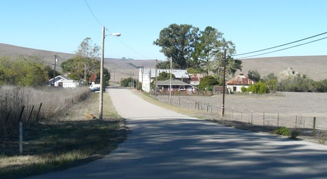
POZO
Pozo is an unincorporated town established along the Butterfield Overland Mail stagecoach route. It was named by George Washington Lingo, Esquire. The Pozo Saloon was established in 1858.
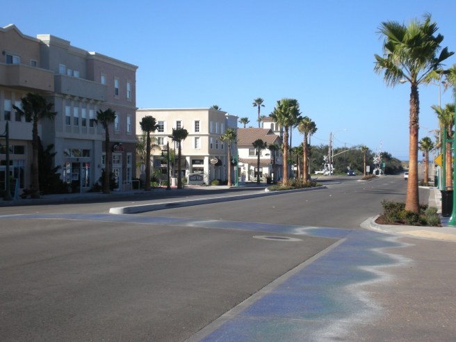
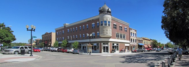
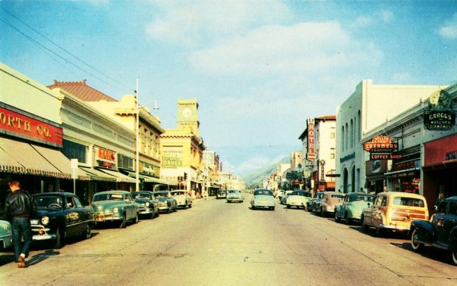
SAN LUIS OBISPO
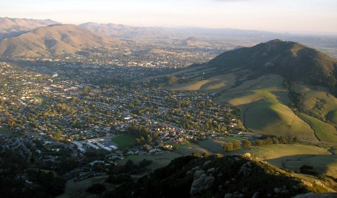
San Luis Obispo is the largest city in and county seat of San Luis Obispo County. It’s home to several historic attractions, including Bubblegum Alley (a disgusting, 21 meter long alley lined with chewed gum begun in the 1940s or ‘50s), Central Coast Veterans Memorial Museum, Conservation Corps State Museum, History Center of San Luis Obispo, San Luis Obispo Children’s Museum, San Luis Obispo Museum of Art, San Luis Obispo Railroad Museum, and the Madonna Inn, a landmark resort hotel established in 1958 and known for its kitschy themed rooms. As of 2010 it had a population of 45,119.
Historic attractions include Mission San Luis Obispo de Tolosa, Dallidet Adobe (1856), the Tribune-Republic Building (1873), Ah Louis Store (1874), Myron Angel House (c. 1880), Pacific Coast Railway Company Grain Warehouse (1885, possibly rebuilt in 1893), William Shipsey House (1894), Dorn Pyramid (1905), San Luis Obispo Carnegie Library (1905), Pereira Octagon Barn (1906), the Robert Jack House, and The Powerhouse (1910).
SAN MIGUEL
San Miguel is a CDP which in 2910 had a population of 2,336.It is home to Mission San Miguel Arcángel, founded in 1797. Most of the original mission was destroyed by fire in 1806 and the current mission was built between 1816 and 1818. It’s also home to the historic Rios-Caledonia Adobe (1835).
SAN SIMEON
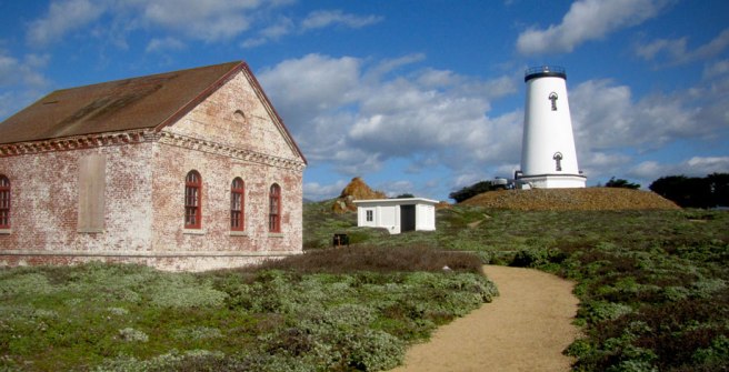
San Simeon is a CDP, named after Rancho San Simeon, an asistencia founded in 1797. Located on the former Rancho Piedra Blanca, the land on which it lies was sold to George Hearst in 1865. Hearst built a wharf in 1878, around which a small village arose. The town, home as of 2010 to 462 people, is known for the Sebastian’s General Store (1852), Piedras Blancas Light Station (1874), and La Cuesta Encantada and the Casa Grande (aka “Hearst Castle,” built in 1919).
SANTA MARGARITA

Santa Margarita is a CDP named after the Mexican Rancho Santa Margarita. It was established in 188 and is home to the historic Santa Margarita de Cortona Asistencia (1787) and Eight Mile House (c. 1877). As of 2010 it had a population of 1,259.
SHANDON
Shandon is a CDP located in the San Juan Valley near the confluence of San Juan and Cholame creeks. As of 2010 it had a population of 1,295.
TEMPLETON
Templeton is a CDP which as of 2010 has a population of 7,674 Templetonians. It’s home to the Templeton Historical Museum.
WHITLEY GARDENS
Whitley Gardens is CDP which as of 2010 had a population of 285 Whitley Gardeners.
WOODLANDS
Woodlands is a CDP which as of 2010 had a population of 576 Woodlanders.
*****
Now, your interest suitably piqued by this primer, vote for as many communities of San Luis Obispo County that you’d like me to visit and explore for an episode of California Fool’s Gold by clicking here.
*****
Eric Brightwell is an adventurer, writer, rambler, explorer, cartographer, and guerrilla gardener who is always seeking writing, speaking, traveling, and art opportunities — or salaried work. He is not interested in writing advertorials, clickbait, listicles, or other 21st century varieties of spam. Brightwell’s written work has appeared in Amoeblog, diaCRITICS, and KCET Departures. His work has been featured by the American Institute of Architects, the Architecture & Design Museum, the Craft & Folk Art Museum, Form Follows Function, Los Angeles County Store, Skid Row Housing Trust, and 1650 Gallery. Brightwell has been featured in the Los Angeles Times, Huffington Post, Los Angeles Magazine, LAist, Eastsider LA, Boing Boing, Los Angeles, I’m Yours, and on Notebook on Cities and Culture. He has been a guest speaker on KCRW‘s Which Way, LA? and at Emerson College. Art prints of his maps are available from 1650 Gallery and on other products from Cal31. He is currently writing a book about Los Angeles and you can follow him on Facebook, Instagram, and Twitter.
Click here to offer financial support and thank you!


73 thoughts on “California Fool’s Gold — A San Luis Obispo County Primer”