

This primer, you’ve by no doubt gathered from the title, is about San Diego County, one of the ten counties that make up Southern California. San Diego County is a county in Southern California’s Southern Border region. The region’s other county, Imperial County, has little in common with its more populous neighbor to the west. For example, Imperial County is California’s least populated whereas San Diego is its second most. Imperial is California’s poorest county whereas San Diego, whilst not in the top ten, is home to its fair share of affluent, coastal resort towns. Imperial County is almost entirely rural whereas San Diego County is largely urbanized and home to California’s second largest city, (and North America’s 17th), San Diego.
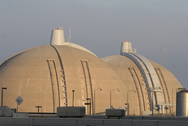
Although I love to explore, most of my experiences in San Diego Couny have primarily involved driving through it, along the 5 Freeway, between Los Angeles and various cities in Mexico. Whether fair or not, my impression of everything between State Route 55 and the Mexican border is a series of scrub-covered hills and valleys containing indistinguishable master planned communities. The only distinct impression is made by the San Onofre Nuclear Generating Station, colloquially known for obvious reasons as the “San Onofre Nuclear Boobies.” Though a large-ish city and one separated from Los Angeles by a less-than-three hour train ride, I’ve so far visited it only a handful of times.
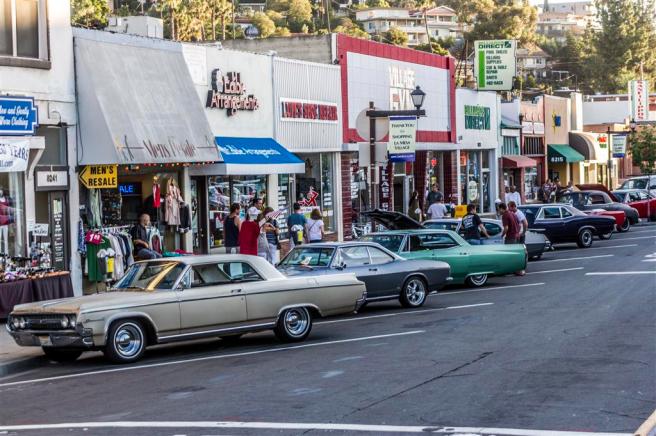
I have fairly vivid memories of my view visits to San Diego. I drove to the zoo a couple of times because it had a hyena. The last time I went, a zookeeper told me the hyena was long-gone and I ended up getting locked inside the zoo after getting lost in conversation with some Howler monkeys. At least once I remember exploring a corner of Downtown San Diego on foot and finding myself surprisingly underwhelmed. After hearing that there was a sizable Ethiopian community in North Park, I went there looking for Ethiopian restaurants and although I found none, I did have a good time at a hip-hop club. For a few years I even had a friend who lived in San Diego. I usually persuaded him, without much difficulty, to come to Los Angeles rather than for me to go to San Diego although I did at least once and we went to a rave of sorts which took place in an office park. Just over a year ago I was commissioned to paint a map of Little Italy. I may not have caught the San Diego bug yet, but that only makes me want to investigate more closely.
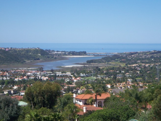
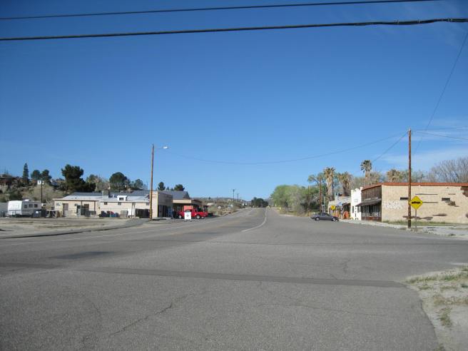
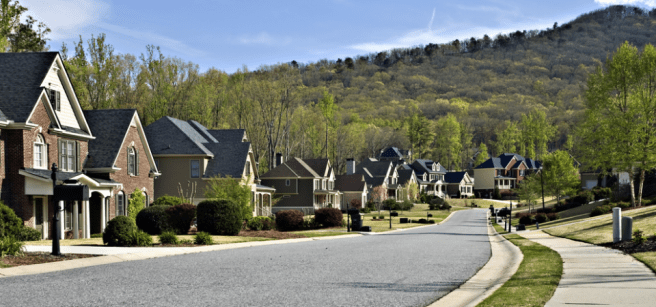
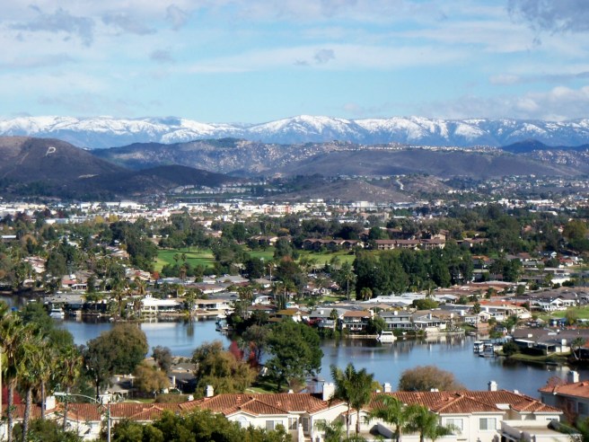
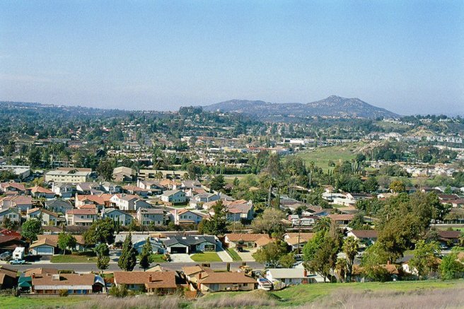
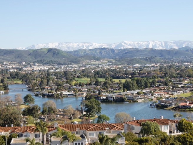
There’s more to San Diego County than the city of San Diego. San Diego might be home to 42% of the county’s population but that means that 58% percent live elsewhere, in those red-tiled suburbs, military bases, rural hamlets, and reservations. It’s a large county. It’s area, 11,720 square kilometers, makes it slightly larger than the countries of Qatar, Gambia, Jamaica, Lebanon, Puerto Rico, and about 40 others. Most of the urban development is contained in the coastal region. To the east, the mostly-residential suburbs dissolving into commuter towns, bedroom communities, and tiny settlements about which little seems to have been thus far written.
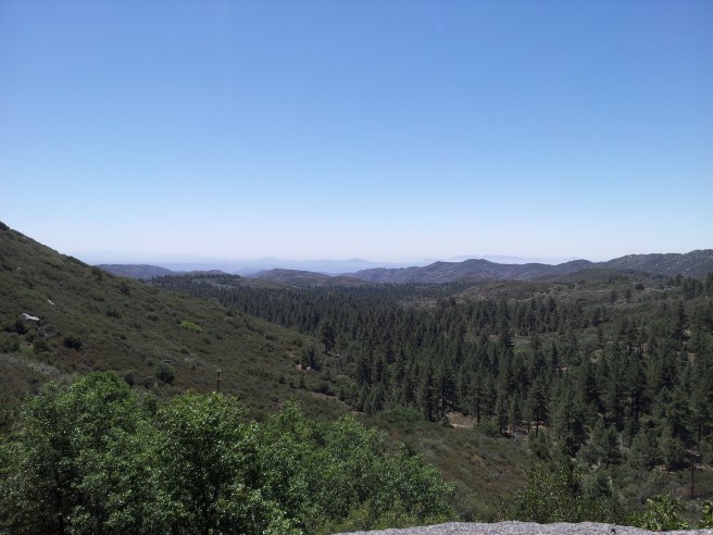
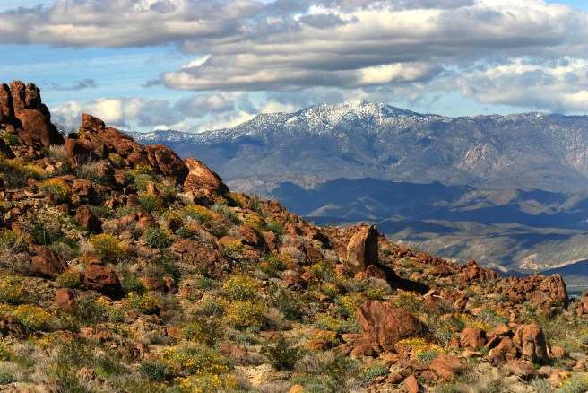
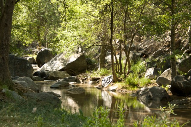
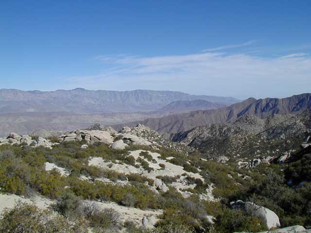
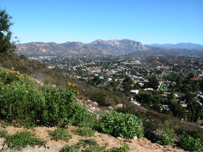
Most of the county is characterized by a chaparral climate (similar to that of much of Southern California, central Chile, the Capetown area of South Africa, parts of Australia, and the Mediterranean region) although on the other side of the peninsular Laguna Mountains range is the Sonoran Desert. The central chaparral scrubland and riparian woods characterize the large, Cleveland National Forest. In the northeast is Anza-Borrego Desert State Park, California’s largest state park. Other natural areas include Cabrillo National Monument, Carrizo Gorge Wilderness, the Otay Mountain Wilderness, the San Diego National Wildlife Refuge, San Diego Bay National Wildlife Refuge, Sawtooth Mountains Wilderness, Tijuana Slough National Wildlife Refuge, and parts of the Agua Tibia and San Mateo Canyon wildernesses — the latter two located mostly within Riverside County.
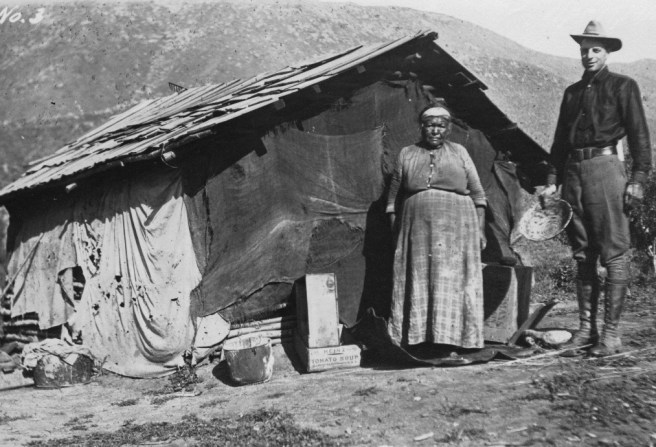
San Diego’s human history begins roughly 10,000 years ago. For most of the millennia that followed, the region was home to the Iviatim, Kumeyaay, Kuupangaxwichem, and Payómkawichum. Today there are eighteen Native American-operated reservations and the county contains numerous geoglyphs, pictographs, and other sites of archaeological significance, although most of their locations are secret to prevent their being vandalized.
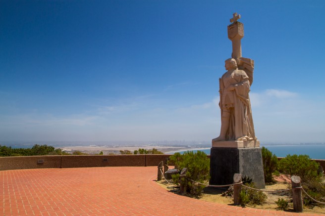
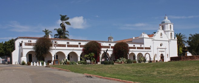
The first European, Juan Rodríguez Cabrillo, stopped in San Diego Bay (which he named “San Miguel”) and claimed the region for Spain in 1542. In 1602, Sebastián Vizcaíno surveyed the area and re-named it “San Diego.” The Spanish founded the first European settlement in California, the San Diego Presidio and Mission San Diego de Alcalá, in 1769. The region was subsequently designated Alta California by the Viceroyalty of New Spain. In 1810, Mexico declared independence from Spain and spent eleven years fighting for recognition. In 1848, California and other future American states were conquered by the US.
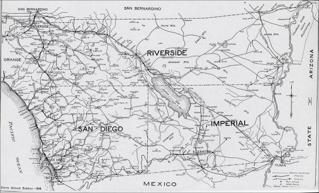
California was made the 31s state in 1850 and San Diego County was one of state’s original counties. At the time of its establishment it included parts of what are now Inyo and San Bernardino counties as well as all of Imperial and Riverside. Its current borders were finalized in 1907, with the establishment of Imperial County to the east. The county’s population remained small for years, only reaching 61,665 in 1910 after a decade which saw 76% growth.
Growth rates remained high and continued to increase until the Great Depression after which it resumed and the population nearly doubled in the 1940s and again in the 1950s. It surpassed one million in the 1950s, two million in the 1980s, and three million in the 2000s.
San Diego County is often divided into the geographically imprecise North County, East County, South Bay, and Mountain Empire regions. Today roughly 71% of the population identifies as white, 11% as Asian, 5% as black, 4% mixed race, less than one percent Native American, Pacific Islander, and 7% some other race. About 32% of the population are Latino of any race. The most common first language, English, is spoken by 67% of the population whilst 22 speak Spanish, 3% speak Tagalog, and 1% speak Vietnamese. A plurality of residents are registered members of the Democratic Party.
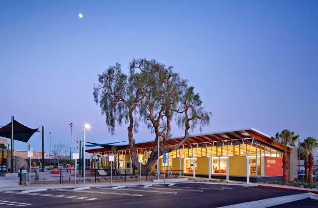
Even if you’re not in school, it’s my belief that where there are colleges and universities, there is culture. San Diego County is home to seven major universities: Alliant International University, California State University, San Marcos, National University, Point Loma Nazarene University, San Diego State University, University of California, San Diego, and University of San Diego.
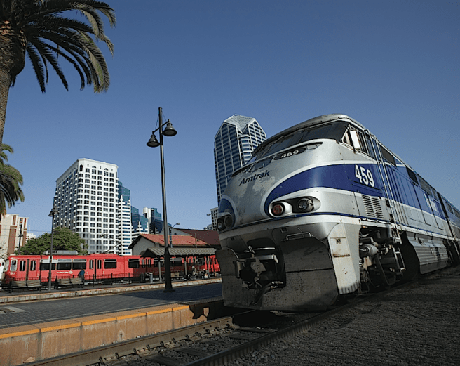
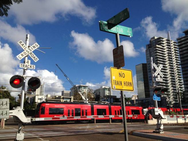
San Diego County is served by several passenger rail agencies, including Amtrak, Metrolink, The Coaster, North County Transit District, San Diego and Arizona Eastern Railway, San Diego and Imperial Valley Railroad, San Diego Metropolitan Transit System, San Diego Trolley, and Sprinter. Sadly, the website Walkscore only gives San Diego a walk score of 49, a bike score of 46, and a transit score of 37 and declares it to be a “car-dependent city.”
If you’d like to see me to visit and explore San Diego County for future episodes of California Fool’s Gold, please vote for as many communities as interest you by leaving a comment. In order to pique your interest, here are brief descriptions of the communities of San Diego County.
ALPINE
Alpine is a census-designated place (CDP) in the Cuyamaca Mountains which as of 2010 had a population of 14,236. Alpine’s name was suggested by a Swiss resident of the community who lived there in the 1880s. Local attractions include some dinosaur sculptures, salvaged from a defunct theme park, Dinosaur Land (1962-1964), and now residing in an RV park.
BALLENA
Ballena is an unincorporated community in the Ballena Valley. Its name comes from the nearby Whale Mountain in the Cuyamaca Mountains. Before they Spanish named it “Ballena,” the Ipai called it “Epank,” which also means “whale.” In 1870, Ballena was established as a remote layover point between distant gold mining camps and ports. Sam Warnock opened a general store and a post office operated from 1870 to 1894, and then 1896 to 1902.
BARONA INDIAN RESERVATION
The Barona Indian Reservation was purchased by members of the Capitan Grande band of Native Americans (now the Barona Band of Mission Indians) in 1932. In 1994 they opened the Big Top Casino, which evolved into the Barona Valley Ranch Resort and Casino.
BONITA
Bonita is a CDP which as of 2010 had a population of 12,538. Its name comes from Henry E. Cooper’s Bonita Ranch. The ranch grew lemons and originated the the Bonnie Brae Lemon. Points of interest include the Bonita Museum & Cultural Center and the annual Bonitafest.
BONSALL
Bonsall is a CDP which as of 2010 had a population of 3,982. It was originally known as Mount Fairview, which had a post office with that designation from 1871 to 1880. In 1881 it was renamed Osgood after California Southern Railroad chief engineer Joseph O. Osgood. It was again renamed, after local minister James A. Bonsall, in 1890.
BORREGO SPRINGS
Borrego Springs is a CDP which in 2010 had a population of 3,429. It is entirely surrounded by Anza-Borrego State Park. There are a couple of shops and at one, after the sole melted off my hiking boots, I bought a bafflingly expensive pair of flip-flops which I thereafter wore on hikes in the park. Area attractions include a roundabout known as Christmas Circle, Fages-De Anza Trail-Southern Emigrant Road, the Liar Peg Leg Smith Monument, and the status of dinosoaurs and monsters located in Galleta Meadows Estate.
BOSTONIA
Bostonia is a CDP which as of 2010 had a population of 15,379.
BOULEVARD
Boulevard is a CDP in the Mountain Empire area of southeastern San Diego County. As of the 2010 census it had a population of 315. The CDP includes the hamlets of Manzanita, Live Oak Springs, and Tierra Del Sol. In , it was featured on a 1963 episode of The Alfred Hitchcock Hour titled “Goodbye, George.”
CAMP PENDLETON
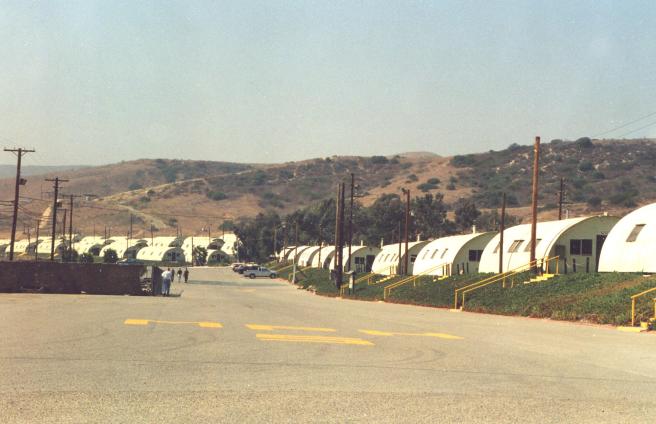
Camp Pendleton (also known as Marine Corps Base Camp Pendleton) is the major West Coast base of the United States Marine Corps. It was established in 1942 to train US Marines during World War II. It was made a permanent installation in 1944. Attractions include a 31-room adobe from the 1840s known as the Rancho Santa Margarita Ranch House.
CAMP PENDLETON NORTH
Camp Pendleton North is a CDP which as of 2010 had a population of 5,200. It’s located at the southeast corner of the Marine Corps Base Camp Pendleton, relatively north, however, of Camp Pendleton South.
CAMP PENDLETON SOUTH
Camp Pendleton South is a CDP located at the southwest corner of the Marine Corps Base Camp Pendleton. As of 2010 it had a population of 10,616.
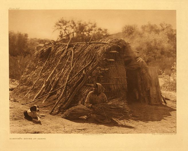
CAMPO
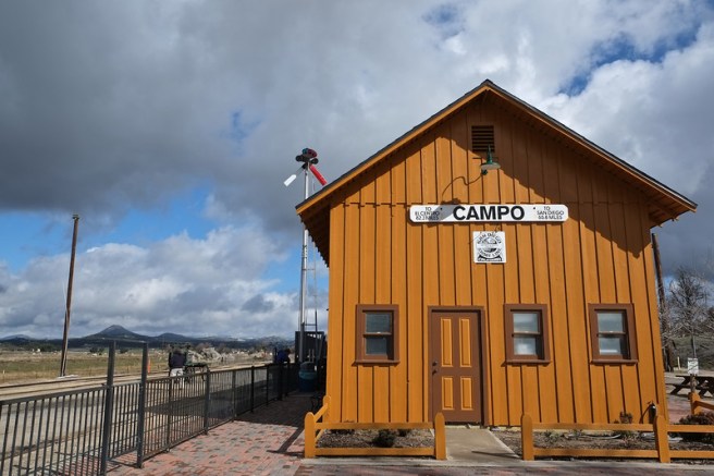
Campo is a CDP located in the Mountain Empire. As of 2010 it had a population of 2,684 (the CDP includes the smaller communities of Cameron Corners and Lake Morena). Attractions include the Pacific Southwest Railway Museum, founded in 1959.
CAMPO INDIAN RESERVATION
The Campo Indian Reservation is located in the southern Laguna Mountains and operated by the Campo Kumeyaay Nation. It was founded in 1893.
CAPITAN GRANDE RESERVATION
The Capitan Grande Reservation is jointly operated by the Barona Group of Capitan Grande Band of Mission Indians and the Viejas Group of Capitan Grande Band of Mission Indians. It is located in the Cuyamaca Mountains, contains 6375 hectares of land, and is currently uninhabited.
CARLSBAD
Carlsbad is a seaside resort community which as of 2010 had a population of 105,328. Its name comes from the Bohemian spa town of Karlsbad. The water from John Frazier’s Miracle Mineral Water of Carlsbad well (still one display at Alt Karlsbad) led to the formation of the Carlsbad Land and Mineral Water Company. Carlsbad incorporated as a city in 1952, to avoid annexation by Oceanside. Other attractions include the Carlsbad Santa Fe Depot (1887), The Flower Fields at Carlsbad Ranch, Rancho De Los Kiotes, LEGOLAND California Resort (1999), The Joe Martin Foundation Craftsmanship Museum (2006), and a leftover windmill from a former location of an Andersen’s Pea Soup.
CASA DE ORO-MOUNT HELIX
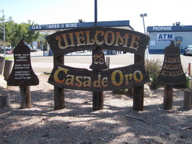
Casa de Oro-Mount Helix is CDP which included the communities of Casa de Oro and Mount Helix. As of 2010 it had a population of 18,762.
CHULA VISTA
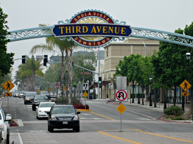
The second largest city in the county is Chula Vista. Chula Vista attractions include the OnStage Playhouse, the Chula Vista Nature Center, the Chula Vista Rose Festival, the J Street Harbor, the Lemon Festival, Sleep Train Amphitheatre, the Starlight Parade, Third Avenue Village, Lower Otay Reservoir, and the Olympic Training Center. Chula Vista is noteworthy for having been the birthplace of El Vez and the hometown of his punk band, The Zeros.
CORONADO
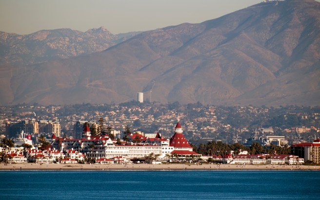
Coronado is an affluent resort town located on San Diego Bay’s Coronado Island, a tied island connected to the mainland by a tombolo. As of 2010 had a population of 24,697 and had the lowest crime rate in the county. The Coronado Beach Company formed in 1886 with the purpose of creating a resort town. It incorporated as a city in 1890. Attractions include Hotel del Coronado (1888) and the Heilman Villas, a 1920s Mission Revival-style complex of bungalows and a duplex.
CREST
Crest is a CDP which in 2010 had a population of 2,593. It was formed from the joining of two smaller communities, La Cresta and Suncrest. It’s home to the Crest Branch Library.
DE LUZ

De Luz is an unincorporated community located at the southern end of the Santa Ana Mountains.
DEHESA
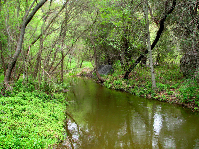
Dehesa is an agricultural community located in the Dehesa Valley along the Sweetwater River.
DEL DIOS
Del Dios is an unincorporated community located near the western shore of Lake Hodges. Attractions include Del Dios Community Park.
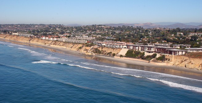
DEL MAR
Del Mar is an seaside town which as of 2020 had a population of 4,161. The land on which Del Mar is located was purchased by Colonel Jacob Taylor in 1885 with the purpose of developing a seaside resort. Local attractions include the San Diego County Fairgrounds, Torrey Pines State Beach, the Del Mar Antique Show, and the Canfield-Wright House, built in 1910 for Charles A. Canfield.
DESCANSO
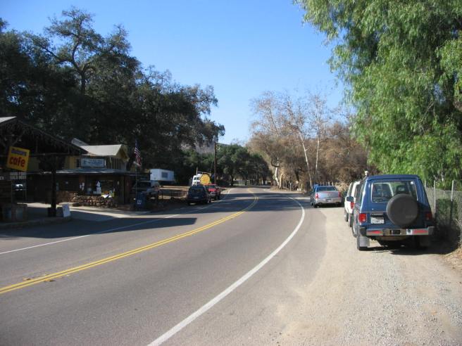
Descanso is a CDP in the Cuyamaca Mountains, within the Mountain Empire, at the edge of Cuyamaca Rancho State Park. As of 2010 it had a population of 1,423. Local businesses include the Descanso Junction restaurant, the Perkins Store and Deli, a feed store, a fruit stand, and community radio station KNSJ.
DULZURA
Dulzura is an unincorporated community with an approximate population of 700. It’s name is derived from the Spanish word for “sweetness,” possibly a reference to the local honey industry. From 1908 to 1914 it gave the world Clark’s Pickelized Figs, produced at Frank and Lila Clark’s still extant Clark Ranch. It’s also home to the one-room Dulzura Schoolhouse.
EL CAJON
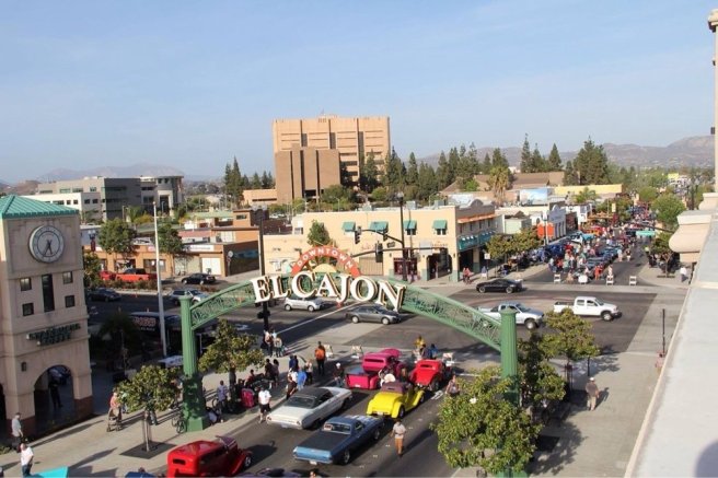
El Cajon is a city, the name of which is derived from the Spanish from the Spanish “el cajón” which means “the big box” and refers to the boxed in nature of the valley in which it’s situated. The earliest written reference to El Cajon comes from 1821. Maps in the 1870s listed it simply as “Cajon” and when it acquired a post office, it was listed as “Elcajon.” It was re-named El Cajon in 1905, at the insistence of an historian named Zoeth Skinner Eldredge (who apparently didn’t care for the acute accent). Attractions include the Museums, Exhibits, and Art at Gillespie Field, the Mariam Mother of Life Shrine at St. Ephrem Maronite Catholic Church, and the Unarius Academy of Science, operated by a UFO religion established in 1954.
ELFIN FOREST
Elfin Forest is an unincorporated San Diego suburb in the foothills of the Santa Rosa Mountains. After a fire in the 1940s, the founders of Questhaven Retreat, Flower and Lawrence Newhouse, invited the then-director of the Santa Barbara Botanical Gardens to consult on the area’s replanting.
ENCINITAS
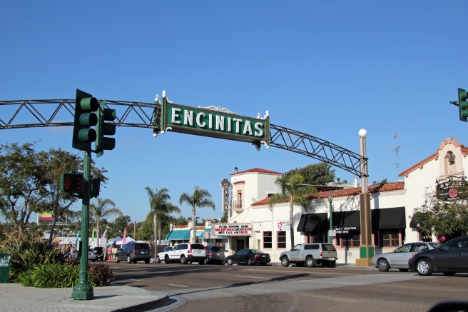
Encinitas is a coastal town in North County which as of 2010 had a population of 59,518. It was incorporated as a city in 1986. Attractions include the wood frame Olivenhain Town Meeting Hall (constructed in 1895), Mark Patterson’s Surfing Madonna mosaic, Matthew Antichevich’s bronze Magic Carpet Ride sculpture, the SS Encinitas and SS Moonlight (two boat-shaped homes built in the 1920s), and the moai carved from a tree trunk at Swami’s Seaside Park.
ESCONDIDO
Escondido is a city located in North County region which as of 2010 had a population of 143,911. It incorporated in 1888. Historic attractions include the Hotel Charlotta (1886), Thomas House (1886), and several Queen Anne-style homes, including the Howell House (c. 1890), Julius H. Anderson House (1891), and A.H. Beach House (1896). It’s also home to the art park/playground Queen Califia’s Magical Circle Garden, Deer Park Winery And Car Museum, Lawrence Welk Museum, the fiberglass Joor Muffler Man, a grape-themed slide (in Grape Day Park), and El Indio de Tijuana (a Mexican food stand shaped like a giant barrel).
EUCALYPTUS HILLS
Eucalyptus Hills is a CDP which in 2010 had a population of 5,313.
EWIIAAPAAYP INDIAN RESERVATION
The Ewiiaapaayp Indian Reservation is operated by the Ewiiaapaayp Band of Kumeyaay Indians. “Ewiiaapaayp” is Kumeyaay for “leaning rock” and refers to a prominent local feature. It was previously known as the Cuyapaipe Reservation. In 1973, two of the five enrolled members of the band lived on the reservation.
FAIRBANKS RANCH

Fairbanks Ranch is a CDP which in 2010 had a population of 3,148. All residents live in one of two gated communities, separated by San Dieguito Road. Attractions include The Farms Golf Club and Morgan Run Club & Resort.
FALLBROOK
Fallbrook is an unincorporated community in North County which as of 2010 had a population of 30,534. Efforts to incorporated failed in 1981 and 1987. The town is claims to be the “Avocado Capital of the World” an annually holds the Avocado Festival. It was named by settlers from Pennsylvania after their hometown.
FERNBROOK
Fernbrook is an unincorporated community.
FLINN SPRINGS
Flinn Springs is an unincorporated community.
FOUR CORNERS
Four Corners is an unincorporated community residential community located at the edge of Cleveland National Forest.
4S RANCH
4S Ranch is an unincorporated master planned community community in North County. Rancho San Bernardo, which includes 4S Ranch, was acquired by an Englishman in 1842. In 1845 he became a Mexican and changed his name to Jose Francisco Snook. In 1938 it was purchased by Albert G. Ralphs of the Ralphs grocery store chain. Development of 4S Ranch began in 1987, with the construction of a business park. Housing followed in the 2000s.
GRANITE HILLS
Granite Hills is a CDP which as of 2010 had a population of 3,035.
GUATAY
Guatay is an unincorporated community in the Cuyamaca Mountains, in the Mountain Empire area. In the 19th century it was home to a stagecoach station on the San Antonio-San Diego Mail Line.
HARBISON CANYON
Harbison Canyon is a CDP which as of 2010 had a population of 3,841. It’s name comes from John Stewart Harbison, a beekeeper who moved to the valley in 1874.
HIDDEN MEADOWS
Hidden Meadows is a CDP in North County which as of 2010 had a population of 3,485.
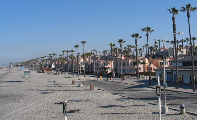
IMPERIAL BEACH
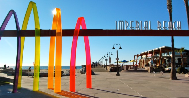
Imperial Beach is a coastal community which as of 2010 had a population of 26,324. It was founded in 1887 and incorporated as a city in 1956. Its motto is “Classic Southern California.” Attractions include the Boulevard of Historic Surfboard Silhouettes.
INAJA AND COSMIT INDIAN RESERVATION
Inaja and Cosmit Indian Reservation is operated by the Inaja Band of Diegueño Mission Indians of the Inaja and Cosmit Reservation, a band of the Kumeyaay nation. The reservation was established in 1875 but as of 1973, none of the 21 enrolled members lived on the 356 hectare reservation.
JACUMBA HOT SPRINGS
Jacumba Hot Springs is a CDP in the Mountain Empire. As of 2010 it had a population of 561. Before 2013 it was simply known as Jacumba. Its attractions include a supposed “gravity hill” and a 6 meter long, 500 kilogram, metal sculpture of a rattlesnake, created by a Ricardo Breceda.
JAMUL
Jamul is a CDP which as of 2010 had a population of 6,163. As of 1999, 64 members of the Tipai Band of Kumeyaay Indians lived on a parcel of sovereign land known as the Jamul Indian Village.
JULIAN
Julian is a former mining town which in 2010 had a population of 1,502. Historic attractions include the Robinson Hotel (1887) and the old Eagle and High Creek Mine.
KENTWOOD-IN-THE-PINES
Kentwood-In-The-Pines is an unincorporated community.
LA JOLLA INDIAN RESERVATION
The La Jolla Indian Reservation is operated by the La Jolla Band of Luiseño Indians band of the Payómkawichum nation. The reservation contains a public campground, which is open from April to October. It was established in 1875 by executive order of Ulysses S. Grant.
LA MESA
La Mesa is a San Diego suburb which as of 2010 had a population of 57,065. Its motto is “the Jewel of the Hills.” The town was founded in 1869 and incorporated as a city in 1912. It hosts several regular events including a Flag Day parade, Oktoberfest, Back to the 50’s Car Show, Christmas in the Village, and a free summer concert series, Sundays at Six.
LA POSTA INDIAN RESERVATION
La Posta Indian Reservation is operated by the La Posta Band of Diegueño Mission Indians of the La Posta Reservation, a band of the Kumeyaay nation. It was established in 1893 but as of 1973, no one lived on the reservation’s 1,439 hectares.
LA PRESA
La Presa (Spanish for “the Dam”) is a San Diego suburb which as of 2010 had a population of 32,721. It’s restaurant scene boasts Sammy’s Mexican Cafe, Jilberto’s Mexican Food & Taco Shops, and Panda House.
LAKE SAN MARCOS
Lake San Marcos is a North County resort community which as of 2010 had a population of 4,437. The titular lake is a manufactured body of water created in 1962.
LAKESIDE
Lakeside is an unincorporated East County suburb of San Diego which as of 2010 had a population of 20,648. It was founded in 1886 by the El Cajon Valley Land Company, who purchased a large area of land surrounding Lindo Lake.
LEMON GROVE
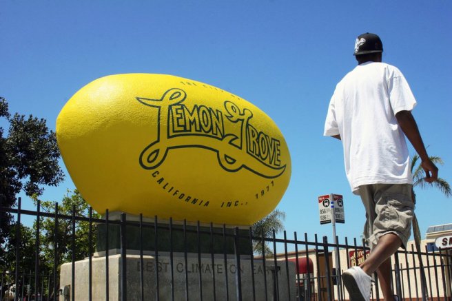
Lemon Grove is a city which in 2010 had a population of 25,320. The Giant Lemon of Lemon Grove, supposedly the world’s largest “lemon,” had been a roadside attraction since 1963. In 1931 it was famously the site of a boycott of segregated schools by Mexican-Americans, which led to the first court-ordered school desegregation in the US. Lemon Grove was incorporated into a city in 1977.
LINCOLN ACRES
Lincoln Acres is an unincorporated community surrounded by National City. As of 2010 it had a population of approximately 2,100. It’s home to a fire station, library, and post office but the largest portion of the community is occupied by La Vista Cemetery.
LOS COYOTES INDIAN RESERVATION
The Los Coyotes Indian Reservation is operated by the Los Coyotes Band of Cahuilla and Cupeño Indians, a band of Native Americans descended from both the Iviatim and Kuupangaxwichem nations. The reservation was founded in 1889 and as of 2010, about 74 people live there.
MANZANITA INDIAN RESERVATION
The Manzanita Indian Reservation is operated by the Manzanita Band of Diegueño Mission Indians of the Manzanita Reservation, a band of the Kumeyaay nation. It was established in 1893 and as of 1973, 6 people lived on the reservation.
MESA GRANDE INDIAN RESERVATION
Mesa Grande Indian Reservation is operated by the Mesa Grande Band of Diegueño Mission Indians, a band of the Kumeyaay nation. The reservation was founded in East County in1875.
MOUNT LAGUNA
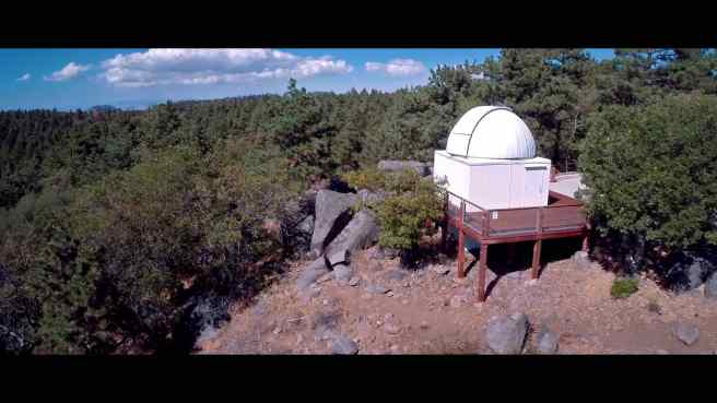
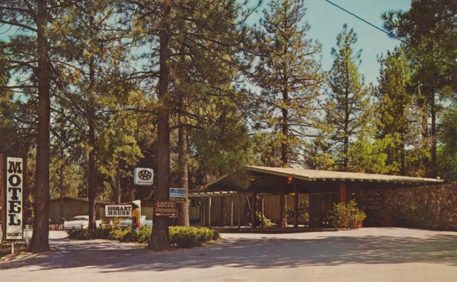
Mount Laguna is a woodland community located within a forest of Jeffrey pine (Pinus jeffreyi) on the eastern edge of the Cleveland National Forest. The community is home to a general store, lodges and cabins, a post office, and the Mount Laguna Observatory, built in 1968 and operated by San Diego State University.
NATIONAL CITY
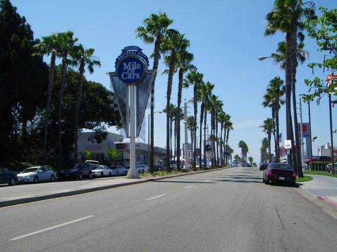
National City is the second oldest city in San Diego County — a more dubious distinction is its having the highest crime rate in the county. As of 2010 it had a population of 58,582. Its name comes from the Mexican Rancho de la Nación. Historic ttractions include National City Depot (1882), historic Brick Row, St. Matthew’s Episcopal Church (1887), and Granger Hall (1898). Popular, established restaurants include Cafe La Maze (established in 1941), Niederfrank’s Ice Cream (1948), and Napoleone Pizza House (1958).
OAK GROVE
Oak Grove was the site of the Oak Grove Butterfield Stage Station and the second location of Camp Wright, structures of which still stand. Today it’s also home to the Oak Grove Campground.
OCEANSIDE
Oceanside is a coastal town and the third largest city in San Diego County. As of 2010 it had a population of 167,086. It incorporated in 1888. Local attractions include the Oceanside Pier (first built in 188 and now in its sixth incarnation), the California Surf Museum, the Americanization School (built in 1931 and now the Crown Heights Resource Center), the Victorian-style Charles Libby House (1902), the Oceanside City Hall and Fire Station (1929), Rosicrucian Fellowship Temple known as The Ecclesia (1920), the house featured in Top Gun, the 101 Cafe (and its Highway 101 Museum), and a fiberglass statue of Papa Burger, a member of the A & W Family, outside Angelo’s Burgers.
OCOTILLO WELLS
Ocotillo Wells is an unincorporated community in East County. It is also known as Ocotillo, although there’s another community with that name 37 kilometers southeast, in Imperial County. It’s home to Ocotillo Wells County Airport, a bar (Iron Door), and a few RV parks.
PALA INDIAN RESERVATION
The Pala Indian Reservation is located in the San Luis Rey River Valley. The Pala Band of Luiseño Mission Indians are descended from the Kuupangaxwichem and Payómkawichum nations. Contained within is the community of Pala.
PAUMA VALLEY
Pauma Valley is an unincorporated community located within a valley of the same name, characterized by the presence of many avocado and citrus groves.
PINE HILLS
Pine Hills is an unincorporated community located near the edge of the Cleveland National Forest. From 1913 until 1931 it had its own post office, since relocated to neighboring Julian. Today it is dotted with cabins, lodges, and other rustic rentals.
PINE VALLEY
Pine Valley is a community in the Cuyamaca Mountains of the Mountain Empire. As of 2010 it had a population of 1,510. It’s name is derived from the presence of Jeffrey pine found along Pine Valley Creek.
POTRERO
Potrero is a CDP in the Mountain Empire area. As of 2010 it had a population of 656. The town has a post office, a library, a general store, Potrero Grub and Pub, and Potrero’s Cafe.
POWAY
Poway incorporated as a city in 1980 and as of 2010 had a population of 47,811. The name is derived from the indigenous Kumeyaay, who called the area Pawiiy. The Spanish grazed cattle there and called the area “Paguay.” Attractions include Aubrey Park, Blue Sky Ecological Reserve, Old Poway Park, Poway Community Park, Starridge Park, and Lake Poway.
RAINBOW
Rainbow is a CDP in North County which as of 2010 had a population of 1,832. It’s name comes from James Peebles Marshall Rainbow, who bought a homestead there in the 1880s. Today its known for its palm tree farms.
RAMONA
Ramona is a community which as of 2010 had a population of 20,292. The first building constructed in the town was the Amos Verlaque House, completed in 1883, and today the home of the Guy Woodward Museum. At first the town was known as Nuevo, but after another California town called Ramona languished (Helen Hunt Jackson’s novel, Ramona, was tremendously popular at the time), the residents of Nuevo coopted it in the late 19th century. Other attractions include the Ramona Town Hall (1894), the Theophile Verlaque House (1886), and the Craftsman-style Mt. Woodson Castle (1921). Just a bit southwest of town is a street named Airmail Lane upon which stands a gag mailbox, a 6 meter tall pipe labeled “Air Mail.” Just a bit northeast of town is the Oasis Dairy Camel Farm, the nation’s first (only?) dairy camel farm.
RANCHITA
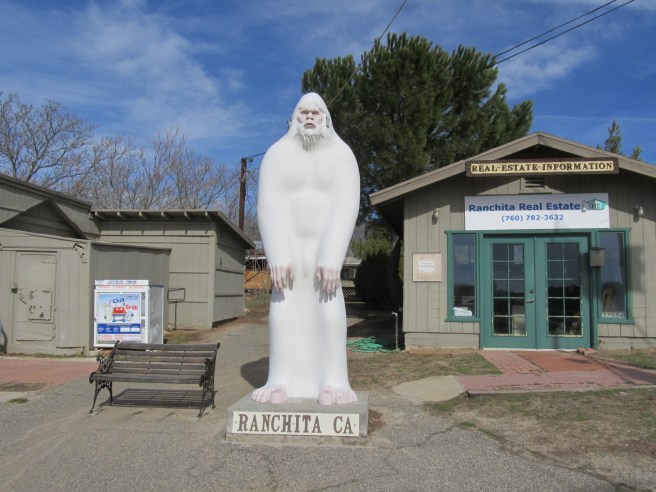
Ranchita is an unincorporated community. It’s home to the Ranchita County Store, which has a statue, the Ranchita Yeti, in front of it.
RANCHO SAN DIEGO
Rancho San Diego is a CDP which in 2010 had a population of 21,208. Its development began in the 1970s.
RANCHO SANTA FE
Rancho Santa Fe is a San Diego suburb which as of 2010 had a population of 3,117. It’s mostly residential but home to several notable, historic homes including the Charles A. Shaffer House, the Claude and Florence Terwilliger House, the Ellis Bishop House, the George A. C. Christiancy House, the Lilian Jenette Rice House, the Norman and Florence B. Carmichael House, the Pearl Baker Row House, the Reginald M. and Constance Clotfelter Row House, the Samuel Bingham House, and the Rancho Santa Fe Land and Improvement Company Office. Another house of interest is the Heaven’s Gate Suicide House. Heaven’s Gate was a UFO religious Millenarian group founded in the early 1970s. In 1997, 39 members commit suicide in the apparent belief that doing so would transport them to an alien spacecraft following the comet, Hale-Bopp.
RINCON
Rincon is an unincorporated community which derives its name from the Rincon Indian Reservation.
RINCON INDIAN RESERVATION
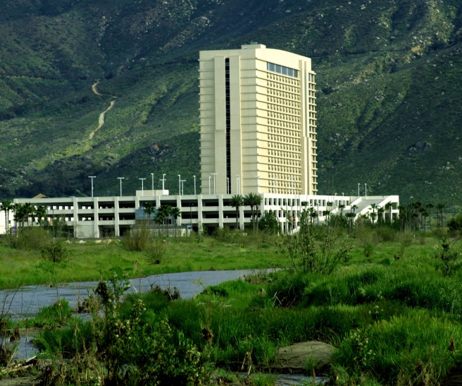
The Rincon Indian Reservation is owned by the Rincon band of Luiseño Indians, a band of the Payómkawichum nation with approximately 650 members. It’s home to the Harrah’s Rincon Casino and Resort.
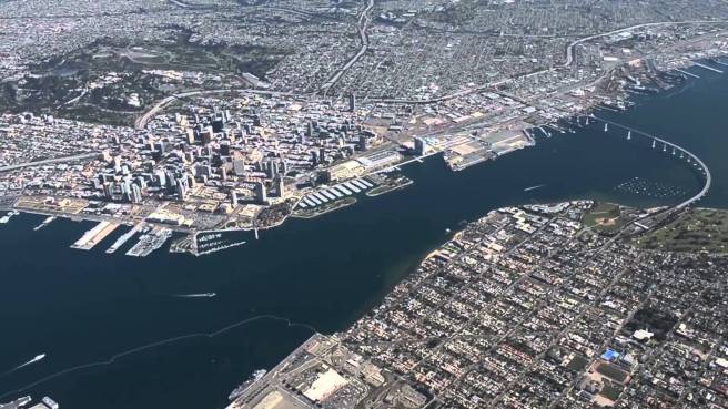
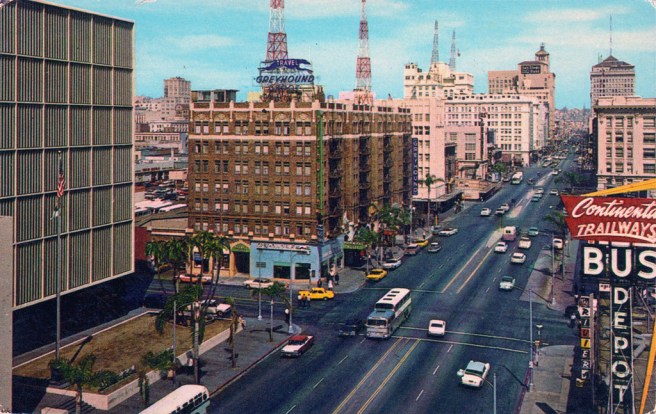
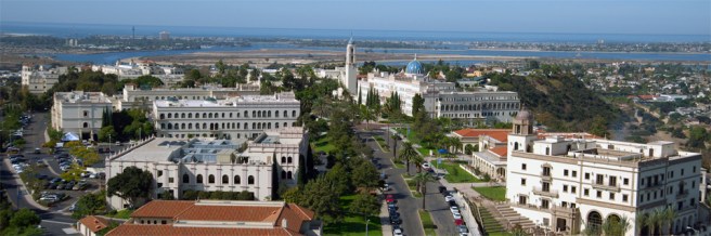
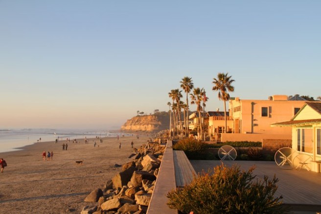
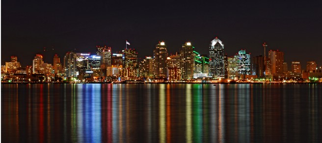
SAN DIEGO
San Diego, as one of only three California cities whose populations exceed one million (the others being Los Angeles and in Northern California, San Jose), deserves to be explored on a neighborhood level and therefore I’ve created a separate poll for San Diego Neighborhoods.
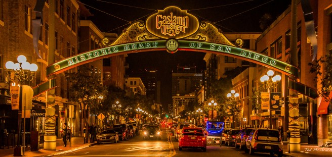
San Diego’s two main industries are tourism and the military. Tourists come to visit or attend events at the San Diego Zoo, La Jolla Playhouse, Little Italy, Old Town San Diego State Historic Park, San Diego Museum of Art, San Diego Natural History Museum, Museum of Contemporary Art San Diego, San Diego Museum of Man, Museum of Photographic Arts, San Diego Maritime Museum, San Diego Air & Space Museum, San Diego Aircraft Carrier Museum, San Diego Beer Week, San Diego Opera, San Diego Symphony, to name but a few.
SAN DIEGO COUNTY ESTATES
San Diego Country Estates is an affluent resort community in the San Vicente Valley. As of 2010 it had a population of 10,109. The community began in 1970 when Raymond A. Watt purchased 1,315 hectares in the valley. One of its main features is Swartz Canyon County Park.
SAN LUIS REY
San Luis Rey is an unincorporated community. It is named after the Mission San Luis Rey de Francia, founded in 1798 (although the current church was built in 1811). It was featured in the first season of the television series, Zorro, in 1957. San Luis Rey’s first post office opened in 1861.
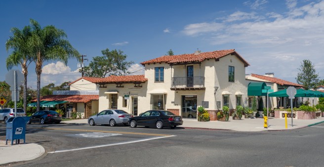
SAN MARCOS
San Marcos is a city in North County which as of 2010 had a population of 83,781. It is home to California State University, San Marcos. Its name is derived from Rancho Vallecitos de San Marcos, granted in 1840. In 1883, John H. Barham founded the first town which in 1884 had a post office, blacksmith, feed store, and newspaper. The town was purchased by the San Marcos Land Company in 1887 and subdivided.
SANTA YSABEL
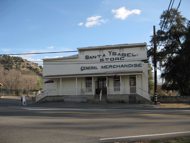
Santa Ysabel, is an unincorporated community in the Santa Ysabel Valley. In 1818, the Santa Ysabel Asistencia was built there to serve Mission San Diego de Alcalá. In 1878, C. R. Wellington opened a store which in the years which followed was joined by an hotel and a blacksmith. In 1889, the first post office opened. Attractions include Dudley’s Bakery and the Julian Apple Pie factory.
SANTEE
Santee is an East County suburb of San Diego. As of 2010 it had a population of 53,413. One of its primary attractions is the San Diego River, which bisects the city. Edgemoor Farm Dairy Farm was built in 1913 by Walter Hamlin Dupee for use as a dairy farm, polo pony ranch, and tourist attraction. Santee is also home to the Museum of Creation and Earth History, a whimsical museum with displays which that counterfactually suggest that the flood which floated Noah’s Ark also carved the Grand Canyon and wiped out the dinosaurs and dragons.
SHELTER VALLEY

Shelter Valley is an unincorporated community located within Anza-Borrego Desert State Park, which acquired the property to the community’s north in 1998, thereby completely surrounding it. As of 2010 it had a population of 320.
SOLANA BEACH
Solana Beach is an affluent, coastal city which as of 2010 had a population of 12,867. It was first settled in modern times by the George H. Jones, who arrived in 1886. The main part of what’s now Solana Beach until 1923 known as Lockwood Mesa.
SPRING VALLEY
Spring Valley is a CDP which as of 2010 had a population of 28,205. Its name is derived from the presence of a natural spring which formerly supported the Kumeyaay settlement of Neti (also spelled “Meti”). In 1863, Judge Augustus S. Ensworth filed a claim for the lands on which the spring springs and built an still-extant adobe named after a subsequent owner, the Hubert Howe Bancroft Ranch House.
TECATE
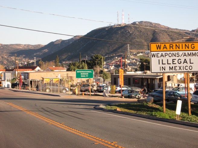
Tecate is an unincorporated community in the Mountain Empire, directly across the border from Tecate, Mexico. The US Inspection Station-Tecate, built in 1933, is likely its most-visited attraction. Nearby is Tecate Peak, also known as Kuuchamaa — a sacred site for the indigenous Kumeyaay.
TIERRA DEL SOL
Tierra del Sol is a small town near the Mexican border with one paved road, Tierra del Sol Road, and a church, Lighthouse Baptist Church.
VALLEY CENTER
Valley Center is a small farming and agricultural town which as of 2010 had a population of 3,277. It annually hosts the Western Days Parade. I small settlement had no formal name until a 1,000 kilogram California Grizzly (now extinct) was killed in the area in 1866. At that time it became known as Bear Valley. The name was subsequently changed to Valley in 1874, to Valley Centre in 1878, and to Valley Center in 1887.
VISTA
Vista is a city which in 2010 had a population of 93,834. The first Vista post office opened in 1882, after settler John Frazier found both Frazier’s Crossing and Buena Vista were already taken. In the post-World War II era the agricultural town transformed into a suburb and it was incorporated as a city in 1963. Attractions include Alta Vista Gardens, the Charles A. Braun House, and the Guajome Ranch Adobe.
WARNER SPRINGS
Warner Springs is a small, unincorporated community in North County. It was founded by Juan Jose Warner, who received a 108 km2 land grant, Rancho San Jose del Valle, in 1844. It later became a stop on the San Antonio-San Diego Mail Line. The The Warner’s Ranch adobe complex remains an historic attraction.
WHISPERING PINES
Whispering Pines is a small, woodland community. It’s home to a couple of bed and breakfasts including Butterfield Bed & Breakfast and Wikiup Bed & Breakfast.
WINTER GARDENS
Winter Gardens is a CDP in East County which in 2010 had a population of 20,631. Most of the attractions seem to be restaurants.
WYNOLA
Wynola is an unincorporated community located in the Spencer Valley. It’s home to the one room Spencer Valley School, built in 1905.

Eric Brightwell is an adventurer, essayist, rambler, explorer, cartographer, and guerrilla gardener who is always seeking paid writing, speaking, traveling, and art opportunities. He is not interested in generating advertorials, cranking out clickbait, or laboring away in a listicle mill “for exposure.”
Brightwell has written for Angels Walk LA, Amoeblog, Boom: A Journal of California, diaCRITICS, Hidden Los Angeles, and KCET Departures. His art has been featured by the American Institute of Architects, the Architecture & Design Museum, the Craft Contemporary, Form Follows Function, Los Angeles County Store, the book Sidewalking, Skid Row Housing Trust, and 1650 Gallery. Brightwell has been featured as subject in The Los Angeles Times, Huffington Post, Los Angeles Magazine, LAist, CurbedLA, Eastsider LA, Boing Boing, Los Angeles, I’m Yours, and on Notebook on Cities and Culture. He has been a guest speaker on KCRW‘s Which Way, LA?, at Emerson College, and the University of Southern California.
Brightwell is currently writing a book about Los Angeles and you can follow him on Ameba, Duolingo, Facebook, Goodreads, Instagram, Mubi, and Twitter.


79 thoughts on “California Fool’s Gold — A San Diego County Primer”