

INTRODUCTION
I recently explored Downtown‘s Historic Core neighborhood. The exploration was undertaken in two parts. I first began exploring the district a few days before Christmas. Thus the days were short and the sun set when I was only halfway done. The distractions of the holidays caused me to forget about finishing the task for several weeks, and then my tricorder crashed and all of my images from the exploration were lost. I again returned to the Historic Core, with my friend Mike, a couple of weekends ago to complete the adventure. I may update this post with some of Mike’s photos so check back if interested.
THE HISTORIC CORE
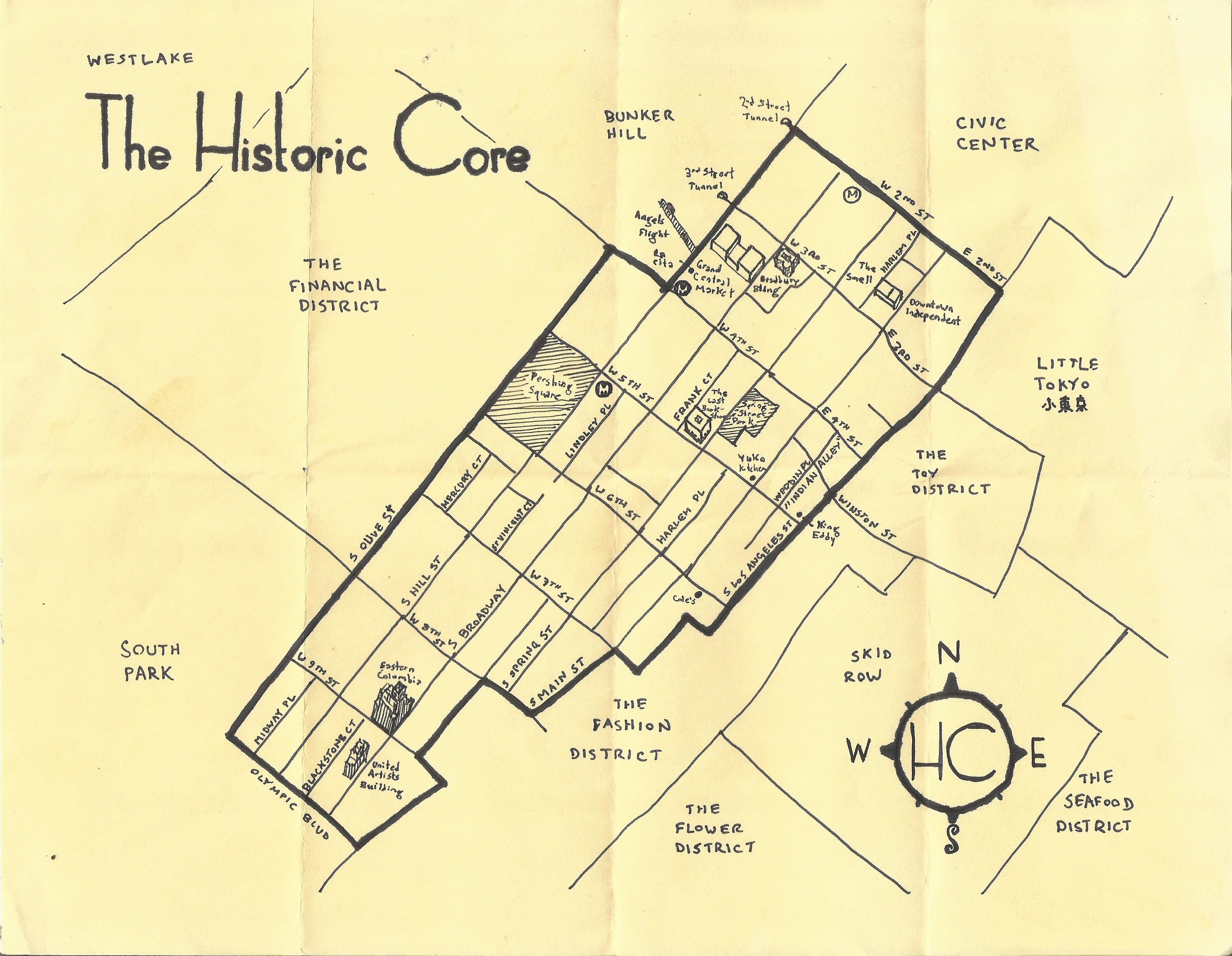
Different sources provide different definitions of what constitutes the core but even the most liberal are in agreement that it extends no further north than 1st Street, no further east than Los Angeles Street, no further south than 9th Street, and no further than Hill Street. Within its borders — and in some cases overlapping — are the Broadway Theater District, Gallery Row, the Jewelry District, the Old Bank District, and — depending on the source — portions of the Fashion District.
It seems obvious that the “historic core” designation is meant to suggest that this part of the city was its historical center but Los Angeles is not only a city with multiple “centers” but they’ve never been particularly stationary. The Spanish founded their Pueblo de Nuestra Señora la Reina de los Ángeles where they did, in large part, to build on the ancient Tongva village of Yaanga. Yaangna wasn’t stationary, however, and in 1836 the inhabitants of the village relocated to what’s now the border between Little Tokyo and the Arts District before again moving, in 1845, to what’s now Boyle Heights. Meanwhile, Los Angeles Plaza, in between modern day Chinatown and the Civic Center, remained the “core” of the Pueblo for about a century after its founding. Meanwhile, Pershing Square — located within the modern Historic Core — was tellingly known as La Plaza Abaja until 1870, when it was officially named Los Angeles Park (the first of several re-designations).
The heyday of the area that came to be designated the Historic Core was roughly 1900-1930 — a relatively short period of Los Angeles’s 238-year history (and Yaangna’s 3,500 or so years). It’s a period of Los Angeles history that tends to be romanticized a lot, though, I suspect because it’s safely located between the bookends of the Native, Spanish, and Mexican eras before it and before era of immigration, desegregation, and white flight after. “Historic Core” was also first applied to the area in an era when sticking “historic” onto a neighborhood’s name (e.g. Historic Filipinotown and Historic South Central) was almost as much in vogue as was adding “village” (e.g. Atwater Village, Franklin Village, Los Feliz Village, and Virgil Village).
The “Historic Core” tag, interestingly, was first used in Los Angeles in reference to another Downtown — Downtown Hollywood. Back in 1970, the City Planning Commission adopted a plan to restore the luster to that degraded district’s formerly glamorous heart. In the 1980s, when many American downtowns were at their most neglected, “historic core” became a buzzword employed in many cities hoping to lure back those who’d fled to the suburbs. The earliest reference I’ve seen to Downtown Los Angeles’s Historic Core date from 1990 when the Community Redevelopment Agency (CRA) turned its attention from the anonymous, gleaming skyscrapers of “New Downtown” (i.e. the redeveloped Bunker Hill and new Financial District to the “Old Downtown” in its shadow.
It took nearly a century after the founding of Los Angeles for development to make its way to the Core. The original plaza, “Plaza Viejo” had been washed away in a flood and replaced with “Plaza Nuevo.” La Plaza Abaja was established in 1866 by Mayor Cristobal Aguilar. In 1868, the small Beaudry and Bellevue Terrace tracts were subdivided nearby. The larger Mott Tract followed in 1869 and included much of what’s now the Historic Core, including the blocks along Fort (now Broadway), Hill, Olive, Charity (now Grand), Hope, Flower, and Grasshopper (now Figueroa) streets, between Temple and 5th streets. In a census conducted the following year, Los Angeles’s population had only grown to 5,728 residents.
The Atchison, Topeka and Santa Fe Railway arrived in Los Angeles in 1887 and ignited the city’s first real estate boom. The oldest surviving building in the Historic Core, Charnock Block (now New Pershing Apartments) was built the following year.
By 1890, Los Angeles’s population had ballooned to 50,395 and nearly every block of what’s now Downtown was topped with modest, two-to-five story wooden structures or larger brick blocks. On 24 February 1898, Frederick Blechynden — an employee of Thomas Edison and commissioned by the Southern Pacific Railroad — headed to South Spring Street (then still an unpaved dirt road) and let his camera roll for thirty seconds.
By then, many residents were already literally heading for the hills, deserting central Downtown Los Angeles for hilly residential suburbs like Bunker Hill, Angeleño Heights, Crown Hill, East Los Angeles (now Lincoln Heights), Boyle Heights, Pico Heights, and Victor Heights. Even the development of Westlake, which then stretched to the city’s western border, did little to shift the center of gravity away from Downtown.
“MANHATTANIZATION” OF THE HISTORIC CORE
In 1903, the thirteen-story/46-meter tall Braly Block (408 South Spring Street) became, by most measures, Los Angeles’s first skyscraper. In 1979, the building and 19 others were collectively designated — as the “Spring Street Financial District” — No. 200 on the National Register of Historic Places. The building has gone by a number of names and is currently known as the Continental Building.
In 1907, the Braly Block was surpassed in height by the 50-meter-tall Security Building (510 South Spring Street), which was surpassed by the 58-meter-tall Union Oil Building (215 West 7th St Street) in 1911. That same year, a height limit of 150 feet (46 meters) was passed for aesthetic reasons. Namely, there was a desire to avoid replicating the “dark, walled-in streets” of eastern cities (and absolutely nothing to do with earthquakes, as is often assumed).
The first skyscraper built away from Spring was the Park Central Building (412 West Sixth) in what’s now the Jewelry District. It was the tallest building from 1916-1927. The 74-meter-tall Texaco Building (929 South Broadway) was tallest from 1927-1928, at which point it was overtaken by Los Angeles City Hall, in the Civic Center, which remained the tallest building in the city for the next four decades.
JOHN PARKINSON
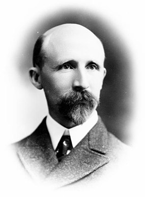
The aforementioned Braly Block, Security Building, and Union Oil Building were all designed or co-designed — as with so many buildings in the historic core — by John Parkinson. Parkinson was an immigrant from Scorton, Lancashire who lived in several North American cities before settling in Los Angeles in 1894, where he first partnered with established architect James Lee Burton and shared an office in the Stowell Block at 226 South Spring Street. From 1905-1915, Parkinson partnered with George Edwin Bergstrom. In 1920, he formed Parkinson & Parkinson — a partnership with his son, Donald B. Parkinson. Parkinson the Elder died in 1935. His life and career were celebrated in Stephen Gee‘s 2008 book and documentary of the same name, Iconic Vision: John Parkinson, Architect of Los Angeles.
Naturally, Parkinson looms large over the Historic Core but there are several architects whose designs are found throughout the district. Octavius W. Morgan and John A. Walls of Morgan and Walls worked on several key buildings of the era. Morgan’s son, Octavius W. Morgan, Jr., was also an architect and after his father’s retirement, Morgan, Walls, and Clements (a partnership with Stiles O. Clements) continued to have a hand in Downtown’s design.
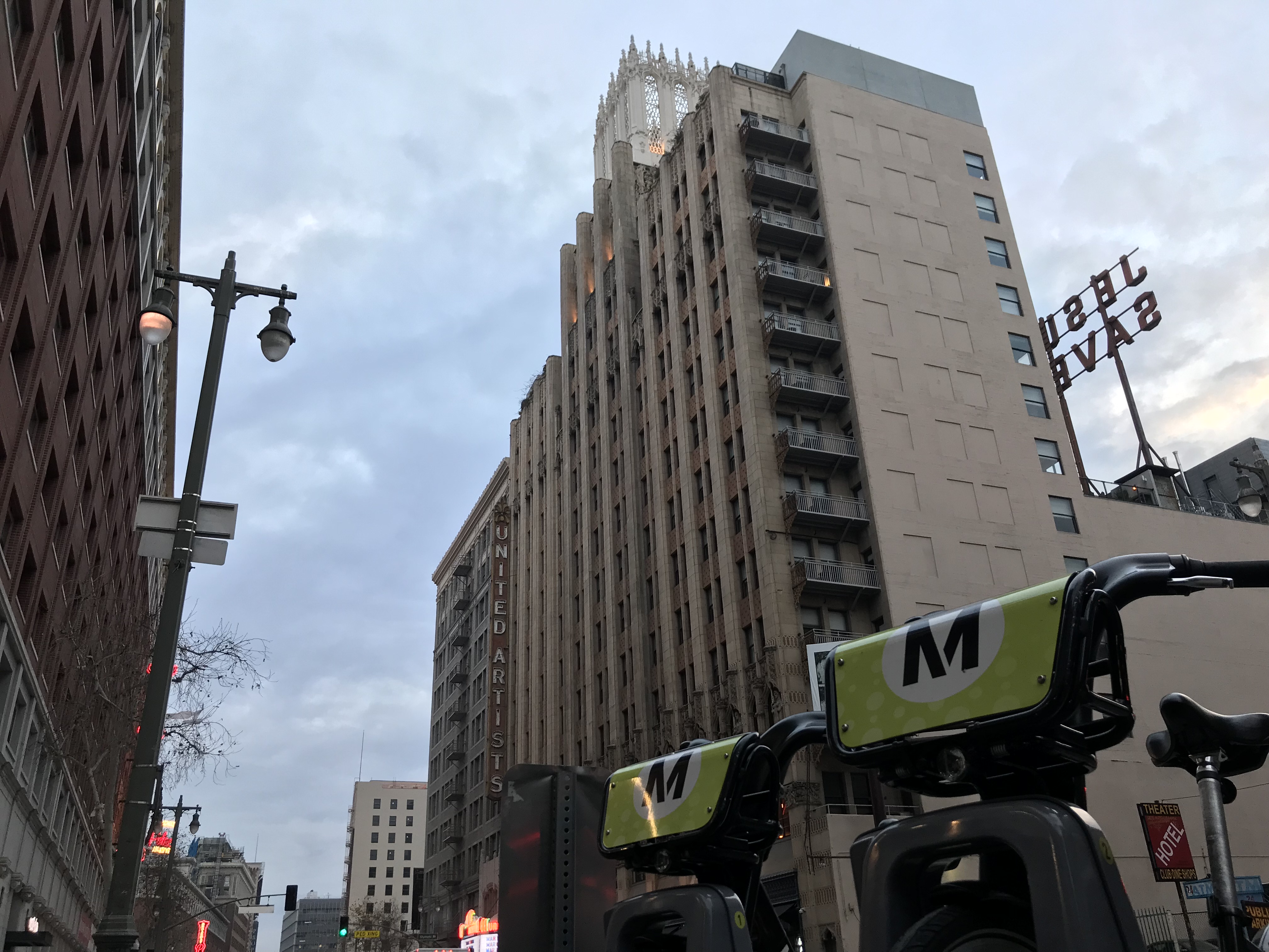
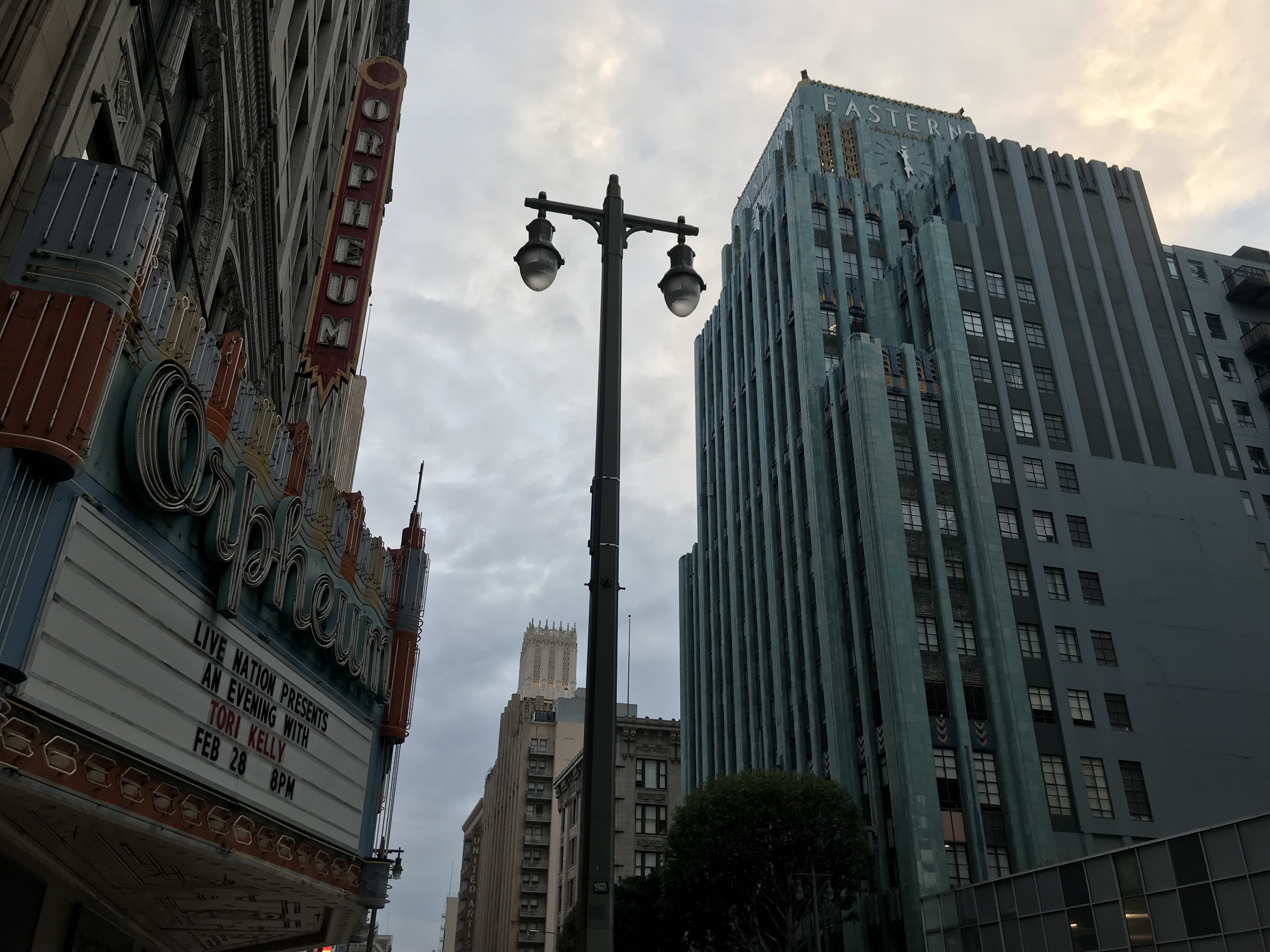
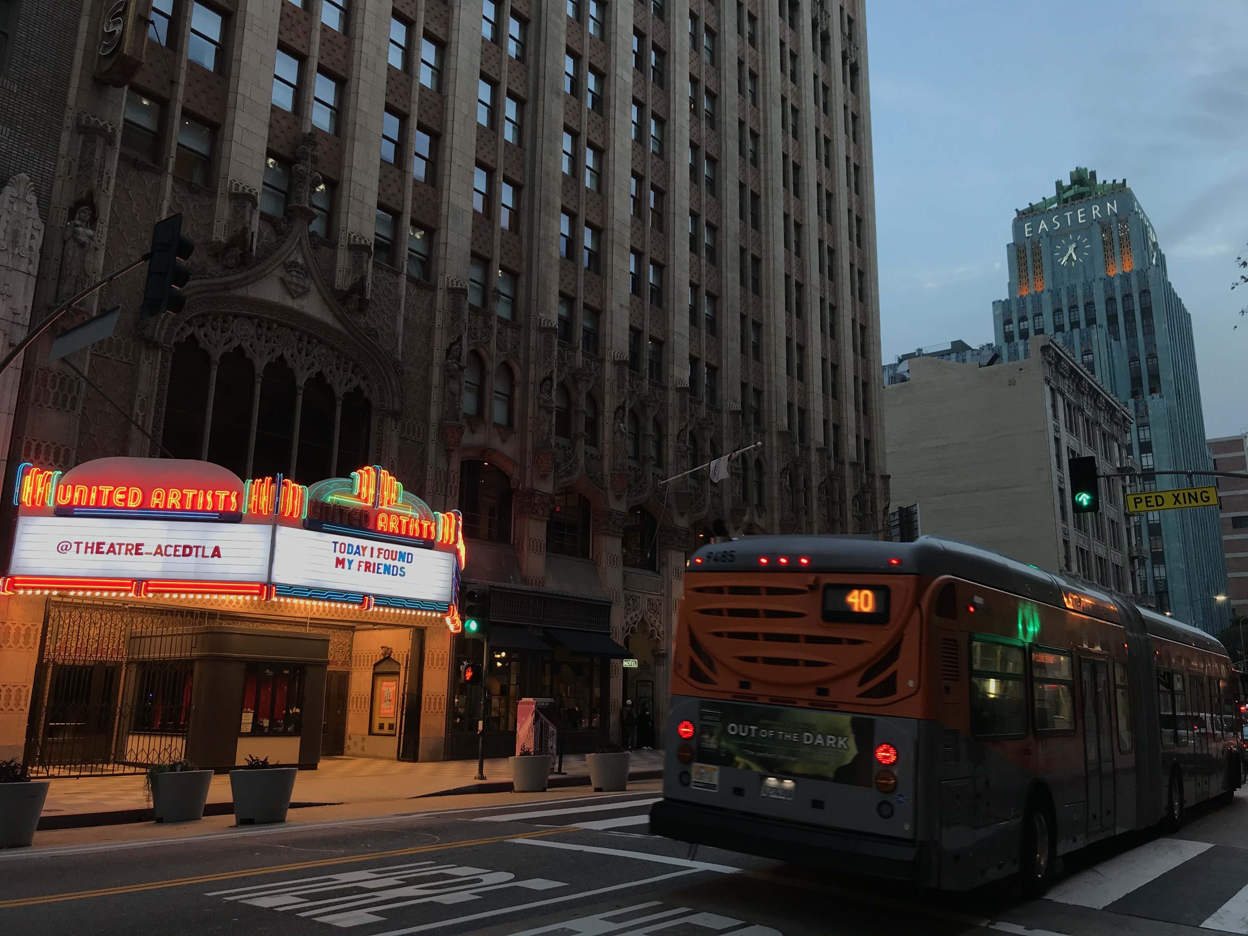
By the 1920s, new construction was slowing — in part because most of the area had by then been developed. It was during that 1920s, however, that Walker & Eisen (a partnership of Albert R. Walker and Percy A. Eisen) designed several new buildings, including the United Artists Building. Claud Beelman also launched his architectural career in the neighborhood with the Beaux-Arts prevailing style but really made his mark with his striking Art Deco creations such as the turquoise-colored Eastern Columbia and jade-colored Sun Realty Building.
By then, Broadway boasted the world’s largest collection picture palaces — grand ornately designed cinemas built without consideration for sound since talkies were still a few years away. Main Street, lined as it was with nickelodeons, bars, and arcades, had an unpretentious appeal. The Great Depression hit in 1929 but in 1931, the Parkinson & Parkinson and Samuel E. Lunden-designed Los Angeles Stock Exchange defiantly opened its doors on Spring Street — then still known as “the Wall Street of the West.” Even if the Great Depression seems to have been felt less acutely in Los Angeles than in more established cities, the stock exchange would prove to be one of the only buildings of note built in the district during that decade.
SUBURBANIZATION OF LOS ANGELES (THE ROTTING OF THE CORE)
The population of Los Angeles continued to grow during the depression, although less quickly than it had before (no surprise, given the mass deportation of Latino-Angelenos euphemistically referred to as the Mexican Repatriation). More deleterious to the city’s existence than deportations and depression, though, was the rise in popularity of the automobile.
Eight annexations during the first five years of the 1930s added 25 square kilometers of suburbia to the city’s frontiers which increasingly receded into the distance. As early as 1930, beautiful buildings of the core began to be demolisehd and replaced with surface parking lots in a bid to attract the car-dependent back Downtown to at least spend their money, if not live. Most of the Italian residents of Downtown deserted Little Italy in favor of the newly-developed suburbs of the San Gabriel and San Fernando valleys. In 1940, the Arroyo Seco Parkway — a new-type of road built solely for cars (i.e. no sidewalks, no streetcars, and no bicycles — ironic given its location along a right-of-way originally intended for the California Cycleway). Downtown had become a neighborhood into which respectable Angelenos drove in and out of rather than lived in.
There were still Downtown residents, of course. Skid Row’s population has only grown over time. The once-posh mansions of Bunker Hill and Dogtown were subdivided and home to poor and working-class Angelenos of diverse ethnicities. The Japanese were infamously relocated to concentration camps during World War II and Little Tokyo was temporarily transformed into the cramped but culturally-vibrant black neighborhood of Bronzeville. Despite their prominence in downtown business, Jews remained excluded from political circles and in the 1940s, there was a mass exodus to the San Fernando Valley, the Westside, and Midtown. Many Jewish-owned department stores which had begun their existences Downtown relocated to the automobile-oriented stretch of Wilshire Boulevard known as the Miracle Mile.
Following the conclusion of World War II, more master-planned communities and cookie-cutter suburbs sprang up like a fairy ring at the edge of the metropolis. The 1948 Supreme Court decision of Shelley v. Kraemer declared Race Restrictive Housing Covenants to be unconstitutional and black Angelenos, previously confined for the most part to South Central — just south of Downtown — began to move south and west. The result of 1952’s Fuji v. California was that Asian-Angelenos could buy property and many of the Chinese, Filipinos, and Japanese who’d rented rooms in the Historic Core’s residential hotels headed elsewhere to make their homes.
In the 1950s, Dogtown and Bunker Hill were both leveled in the name of “slum clearance.” To accommodate the dispossessed, the William Mead Homes housing projects were built in Dogtown and several large residential developments sprang up on Bunker Hill. From the 1940s through the 1970s, virtually no new buildings were constructed in the largely vacated Historic Core — just a smattering of small, single-story huts and a couple of multi-story parking garages — especially ironic given the repeal of the height limit in 1957.
Despite claims to the contrary, however, “old downtown” never really died — although even those who remember the pre-“renaissance” era with any fondness will find it difficult to argue that it was then operating at peak efficiency. During daylight hours, Broadway was a bustling Latino commercial corridor, full of clothing shops, swap meets, churches, and cinemas which switched to Spanish language programming. Main Street still had a vibrant nightlife. In Kent MacKenzie‘s 1961 film, The Exiles, it is to Main that a group of young Native Americans living on Bunker Hill make a pilgrimage to hang out, dance, drink, and occasionally scuffle. It was Main which formed the core of a network of gay and gay-friendly businesses known as “the Run.” It was also there, too, in 1959, that a group of trans and others famously rose up against the police at Cooper Do-nuts, an event recounted by participant John Rechy, author of City of Night.
Having neither been present nor even yet born, I hesitate to declare that the 1960s and ’70s were the Historic Core’s nadir but there’s a lot of evidence which suggests it. For one, it was in 1961 that the last Pacific Electric Railway red car departed for Long Beach, drawing the curtain on what had once been the world’s largest interurban rail network. In 1963, the last six lines of the even more popular Los Angeles Railway were taken out of service. By 1966, Downtown was encircled and garroted by three freeways, like some Ballardian dystopia. Filming of the post-apocalyptic Omega Man began in 1970, about the last man on earth (aside from the infected members of “the Family”). Downtown Los Angeles was chosen by the filmmakers in part because it looked so convincingly de-populated. Mayor Tom Bradley, with the support of the CRA, successfully pushed for the city’s homeless resources to be concentrated in Historic Core-adjacent Skid Row.
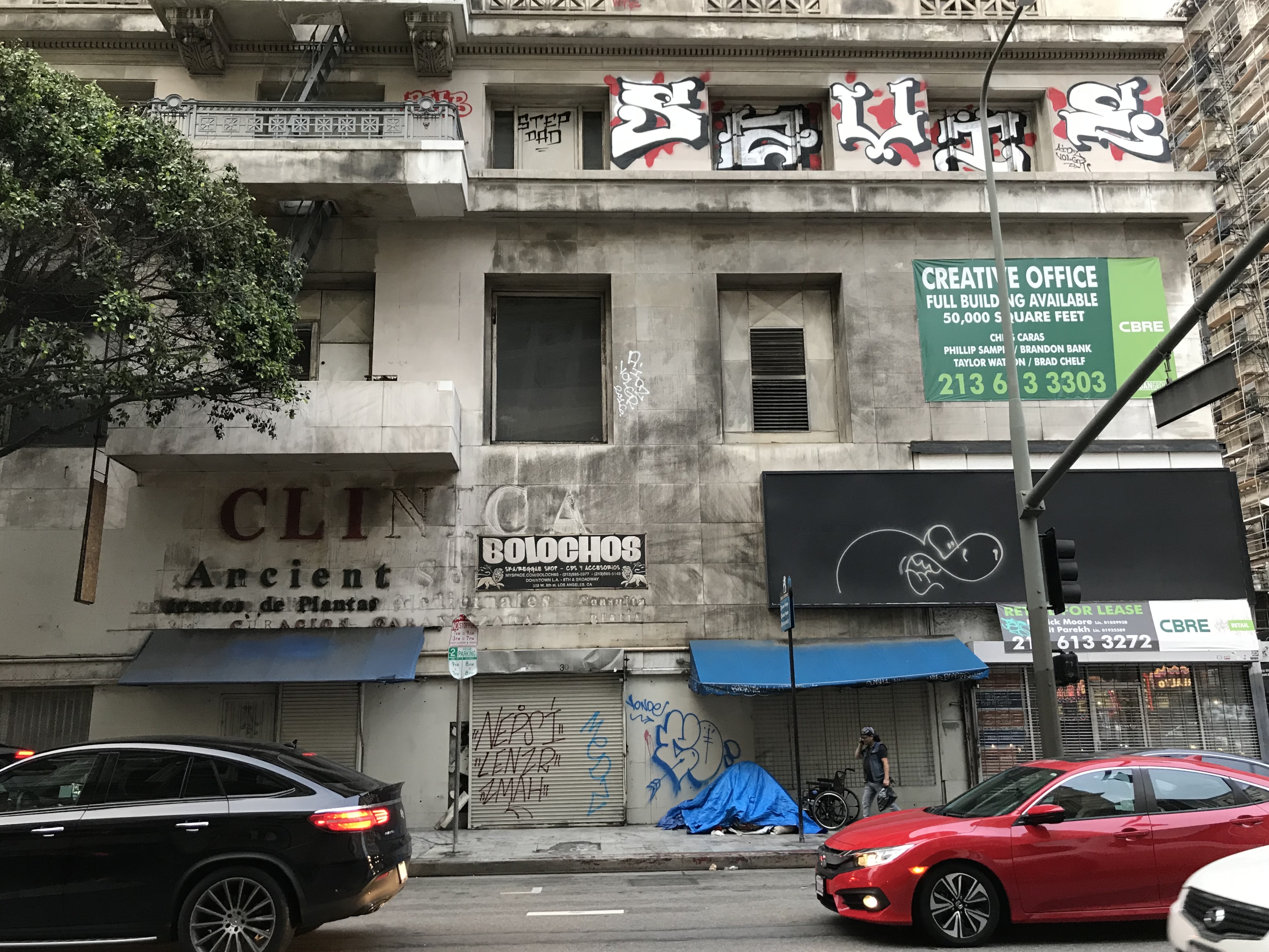
Al’s Bar (in the Arts District), the Atomic Café (in Little Tokyo), and the Hong Kong Cafe and Madame Wong‘s (both in Chinatown) attracted punks to downtown’s periphery. In 1981, the Artists-In-Residence ordinance was passed, allowing artists who’d for years been squatting in the industrial-zoned Arts District to do so legitimately. The buildings of the Historic Core, however, were still devoid of most signs of life aside from tagged windows and the occasional bedsheet-curtained window when I first visited in 1998 — at least after hours — before the metal blast doors came down over the shop entrances and the tents were set up on the sidewalk.
In a tour of Los Angeles, a Native Angeleno (and American) friend took me for a bit to Grand Central Market and to pick up some supplies from Farmacia y Botanica Million Dollar. When I needed new clothes, I often headed to Broadway. At night, I’d often go to the Smell, which moved downtown in 1999. At other times, I’d pop into the still-in-cafeteria mode Clifton’s, Sassony Arcade, or Craby Joe’s. Occasionally, I’d head inside the mostly vacant buildings for underground art shows, experimental film exhibitions, and live music. Today, the beautiful, 12-story Garfield Building is the last of the grand Historic Core structures which is still vacant. Although I had no sense of it then, looking back now, it seems as though it was the end of one era and the beginning of another — the so-called “Downtown Los Angeles Renaissance.”
For decades, mostly unsuccessful efforts to lure Angelenos back downtown were focused on government employees and financial workers whose offices were in Bunker Hill, the Financial District, and Civic Center. The Music Center opened on Grand Avenue in 1967 — offering classical music and live theater as incentives. The Los Angeles Mall and Triforium were completed in 1975. MOCA Grand Avenue was completed in 1986. The Metro Blue Line opened in 1990, connecting Long Beach to 7th Street/Metro Center but, with no shops nor even restrooms, it’s hardly the destination train stations are in other cities. The Red Line opened in 1993, bringing a little traffic back to beautiful Union Station — although more substantial rejuvenation would take another two decades. The Staples Center, completed in 1999, sparked the redevelopment of South Park — a neighborhood which is as close as Los Angeles gets to a Little Orlando. None of them, however, played nearly as much role in Downtown’s revitalization as the passage of the Adaptive Reuse Ordinance — which allowed buildings zoned for commercial purposes to be repurposed as residences but waived the parking minimums which had de-urbanized Los Angeles since the 1930s.
ADAPTIVE REUSE ORDINANCE
The mostly-vacant buildings of Downtown’s Historic Core had long been eyed dreamily by Angelenos who longed to live in a dense, vibrant, and walkable downtown. However, despite the presence of 18.6 million parking spots (or 3.3 for every automobile in the city), parking regulations in place for decades would’ve required adding even more parking to any office-to-residence conversions. That effectively would’ve meant destroying what was left of the Historic Core in order to build more parking spaces — something no one needs — especially in a city where Downtown is to a fault, the nexus of mass transit. In other words, everything that would make one want to live and work Downtown would have to be replaced with a vast parking lot.
The Adaptive Reuse Ordinance abolished those parking minimums for Downtown, allowing long-vacant properties to be transformed into apartments and condominiums for people willing to walk, bicycle, or take mass transit. Abolishing requirements for car storage reversed a 70-year decline. Twenty years after abolishing parking minimums saved Downtown, I’m left wondering why we haven’t done the same in other dense, walkable, transit-served neighborhoods like Koreatown, Westlake, and Hollywood (for starters).
As for the Adaptive Reuse Ordinance — perhaps its time we extend it from Old Downtown to New. Aesthetic tastes are predictably cyclical and I’m sure that the exposed brick, ducts, and mismatched furniture of Historic Core’s co-working spaces will someday give way to a renewed appreciation for the corporate sterility of low pile greige carpet, drop ceilings, and matching furniture of an accountants office. I, for one, find strange charm in the idea of living in a converted cubicle farm near the top of a 1980s highrise.
DISTRICTS OF THE HISTORIC CORE
As mentioned in the introduction, the Historic Core contains within it parts or all of several smaller districts. The day will hopefully come when I cover them all of them more in-depth so, for the time being, I will merely summarize.
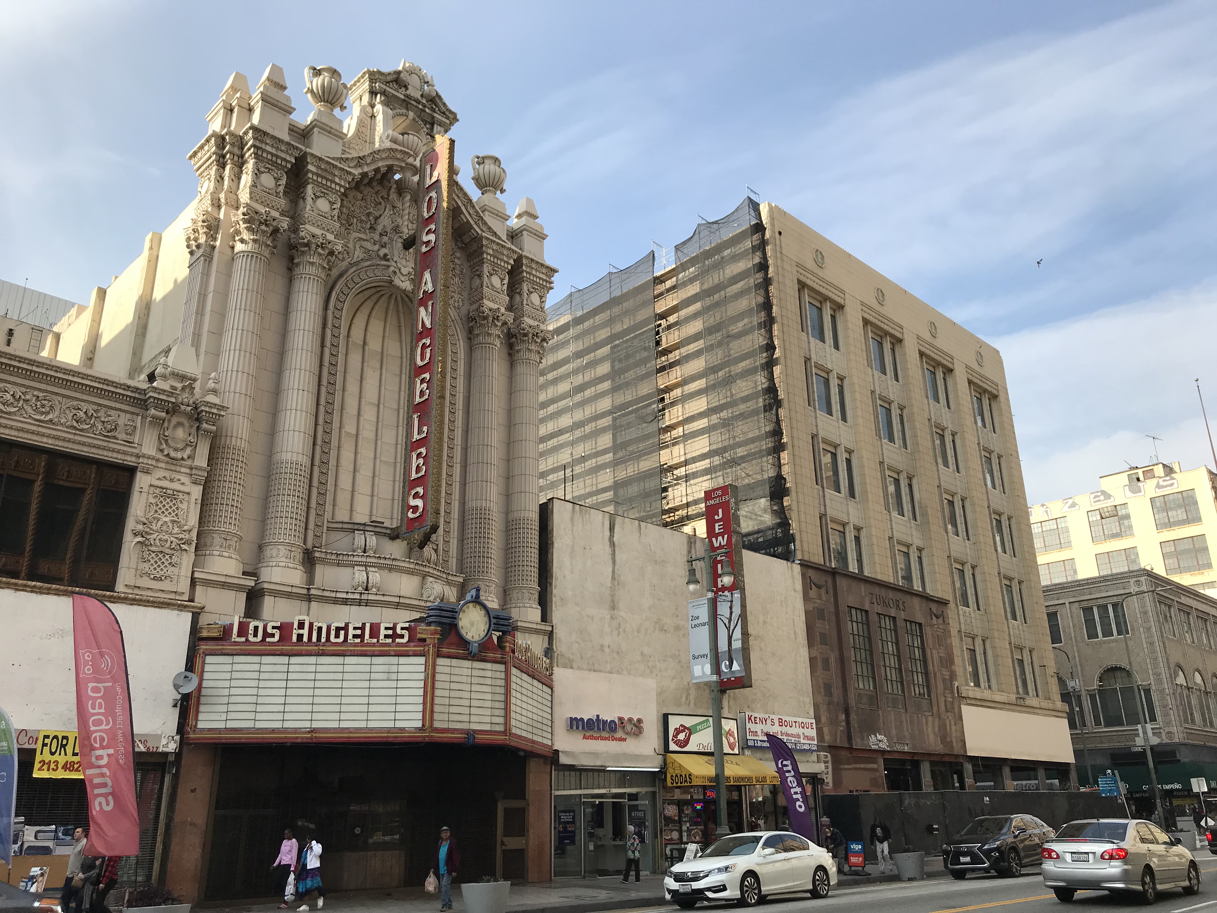
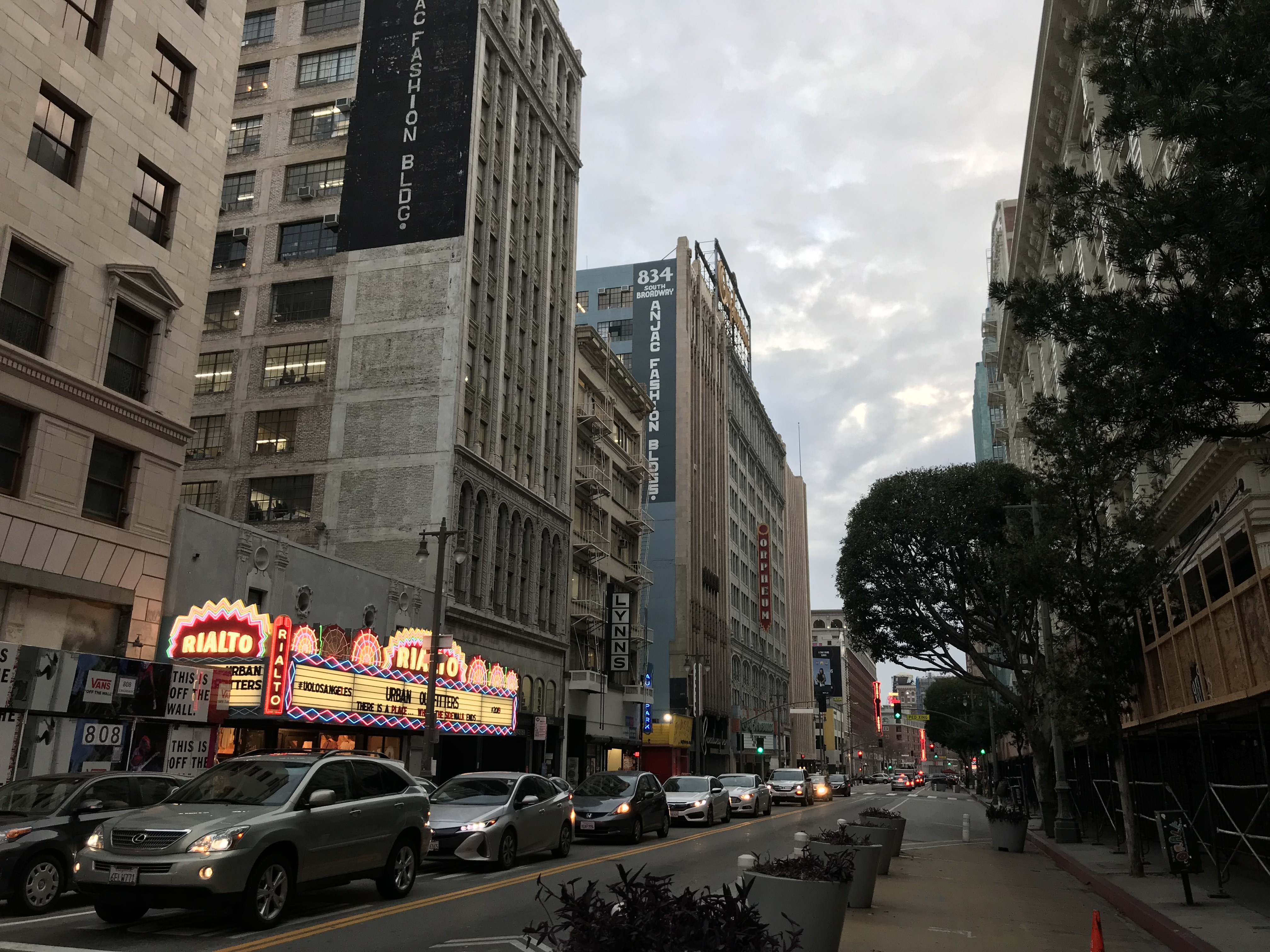
The Broadway Theater District – The nation’s oldest and largest historic theater district — home to twelve picture palaces situated on a six-block stretch. Although Los Angeles isn’t the birthplace of cinema, it’s more closely associated with it than any city and it seems to me that to honor that heritage, those cinemas should be maintained and, whatever their daytime use, still regularly screen films. Toward that aim, the Los Angeles Conservancy launched “Last Remaining Seats” in 1987, a program which brought summer screenings to the surviving theaters. In 2008, a campaign named “Bringing Back Broadway” has attempted to restore the luster to the street — or, depending on who you ask — gentrification.
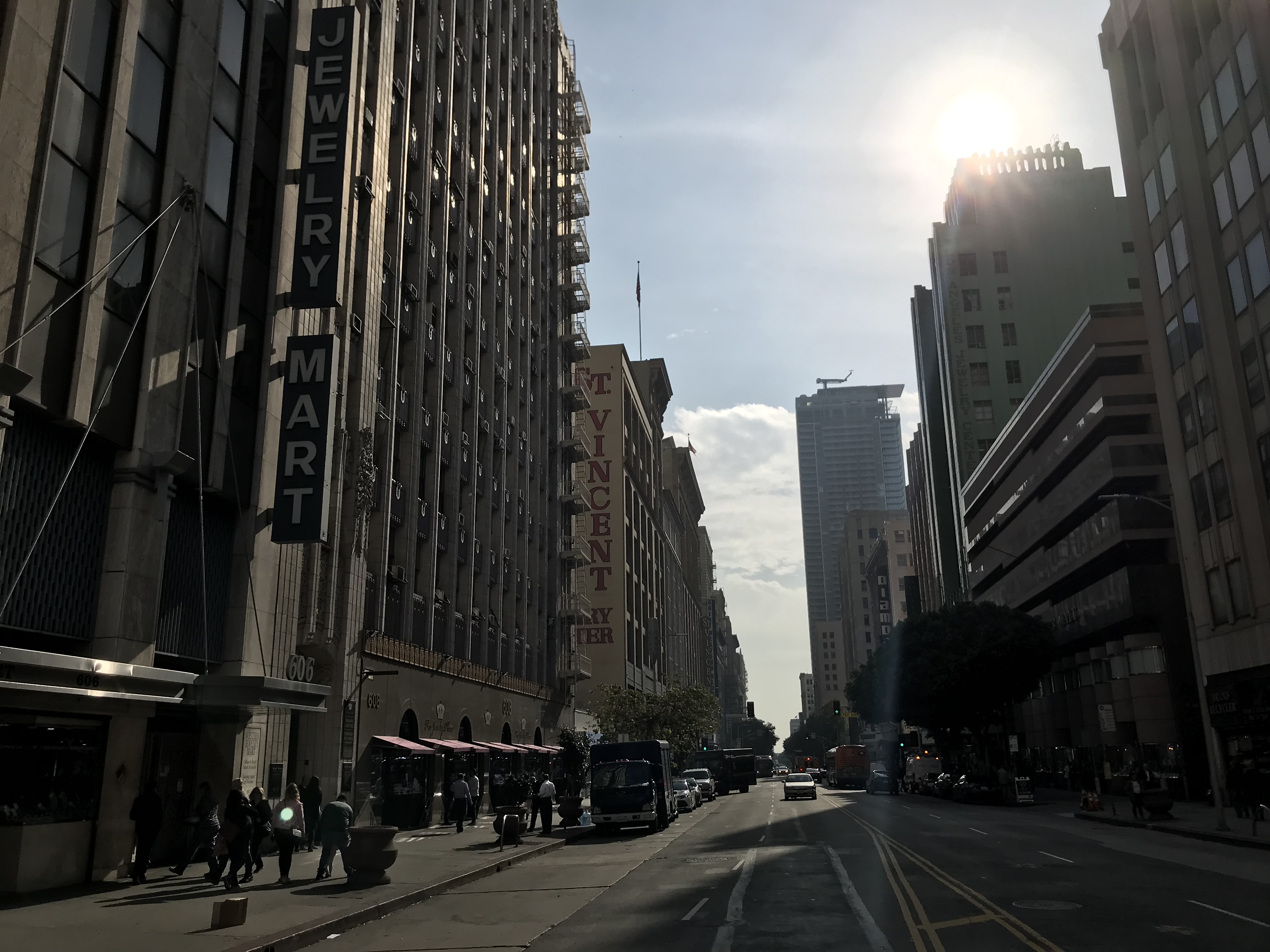
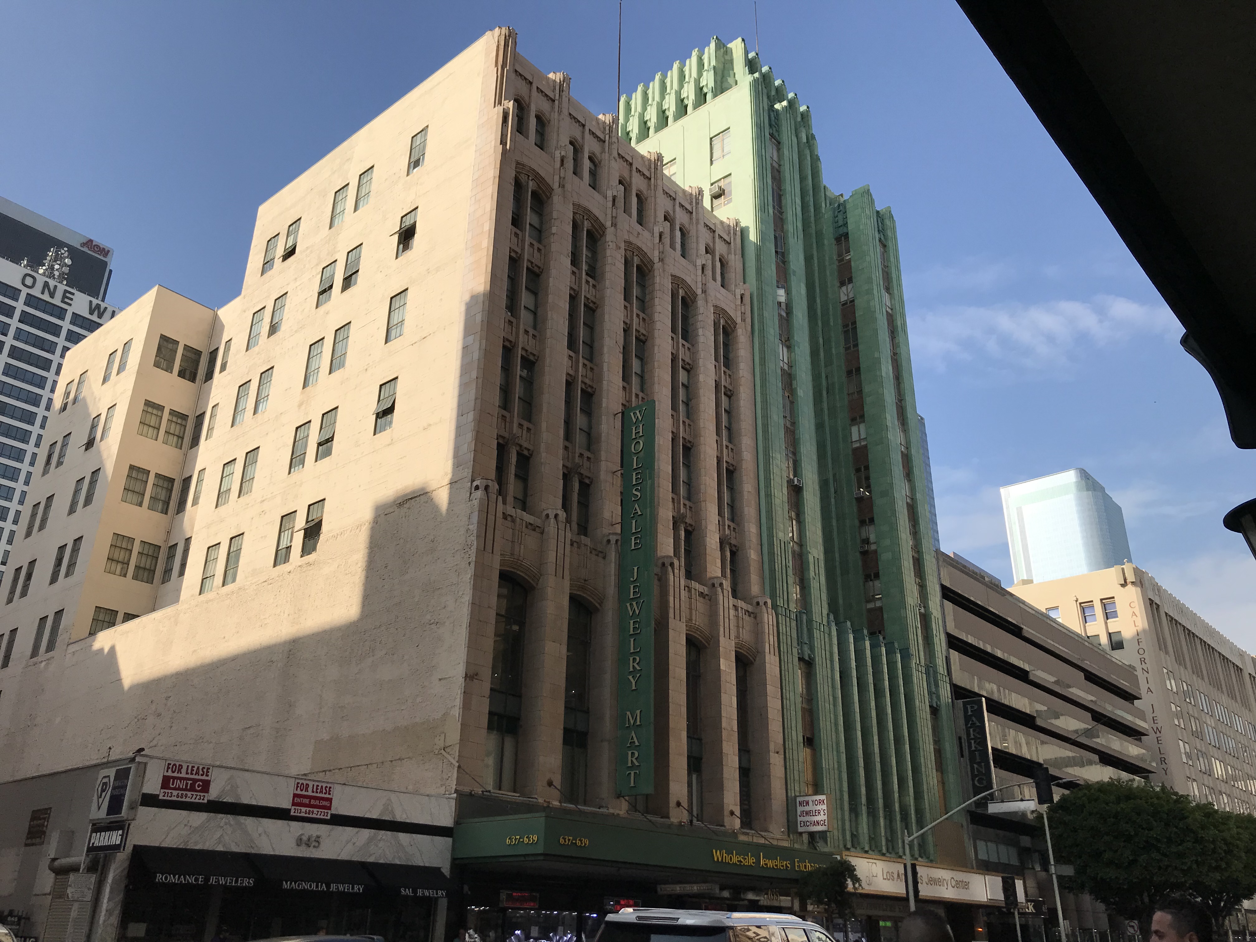
The Jewelry District — the nation’s largest jewelry district. According to the Los Angeles Convention Center and Visitor’s Bureau, it’s home to roughly 5,000 jewelry businesses that generate just under $3 billion annually in sales. The district began to arise around the late 1960s/early 1970s when some came to see gold as a safer investment than US dollars — and men began to wear huge wristwatches, chunky gold chains, and attention-grabbing medallions.
The Old Bank District — includes 23 financial structures along a four-block stretch of Spring Street. Although nicknamed the “Wall Street of the West,” there is, perhaps somewhat confusingly, a street four blocks to the east which is actually named Wall Street. It was officially designated the Old Bank District in 2004. Designated the Spring Street Financial District in 1979, it borders were extended to Main and it was renamed the Old Bank District in 2000.
Gallery Row — originally just three galleries (Inshallah Gallery, Lorraine Molina‘s bank, and Adrian Rivas and James Rojas‘s 727 Gallery), the idea to designate a seven-block stretch of Main and Spring streets “Gallery Row” was first proposed by artists Nic Cha Kim and Kjell Hagen — then members of the Arts, Aesthetics, and Culture Committee of the Downtown Los Angeles Neighborhood Council. It was officially recognized by the city in 2003.
The Fashion District — Formerly known as the Garment District, the area has been one of textile trade since at least the 1930s. A Business Improvement District was established in 1995. In 1996, business owners decided to change its name to the Los Angeles Fashion District. The bulk of the district is located east and south of the Historic Core but some maps depict it overlapping the neighborhood.
THE STREETS OF HISTORIC CORE
Whether by design, chance, or simply my perception — the main north-south streets seem to have more distinct personalities than the numbered east-west ones.
Hill Street – Hill Street was laid out in 1849 by Edward Ord and was named after Fort Moore (nicknamed Fort Hill). It was extended along North Hill (formerly Castelar and before that, Calle del Toro) in 1960. It runs along the base of Bunker Hill, with the eastern entrances of both the 2nd and 3rd Street tunnels located along it as well as the base of Angels Flight.
Broadway – Broadway runs all the way from Lincoln Heights to Carson and was another street laid out by Ord. Its name was changed in 1890 and it is famous for the aforementioned movie theaters which line it. The intersection of 7th Street and Broadway was the original terminus of Route 66. An initiative called “Bringing Back Broadway” was launched in 2008 by Los Angeles Councilmember José Huizar.
Spring Street – Spring Street is still notable for its handsome Beaux-Arts skyscrapers (many designed by John Parkinson) and large trees which line it, making it one of the most pleasant to look at and walk along. Thanks to a bicycle lane, it’s also a nice street to cycle along.
Main Street – Main Street stretches all the way from Lincoln Heights to Wilmington. It was downtown’s main entertainment corridor before Broadway’s rise, lined as it was by nickelodeons and other amusements. After Broadway stole some of its thunder, many of the old theaters turned to featuring burlesque shows and later, porn, and Main Street (or “Pain Street”) came to be regarded as something of downtown’s “gay ghetto.”
Los Angeles Street – Los Angeles Street stretches from Civic Center to — like Olive — 23rd Street in South Central and to the east, building heights are dramatically lower. It’s neighbors to the east are the Toy District, Fashion District, and Skid Row.
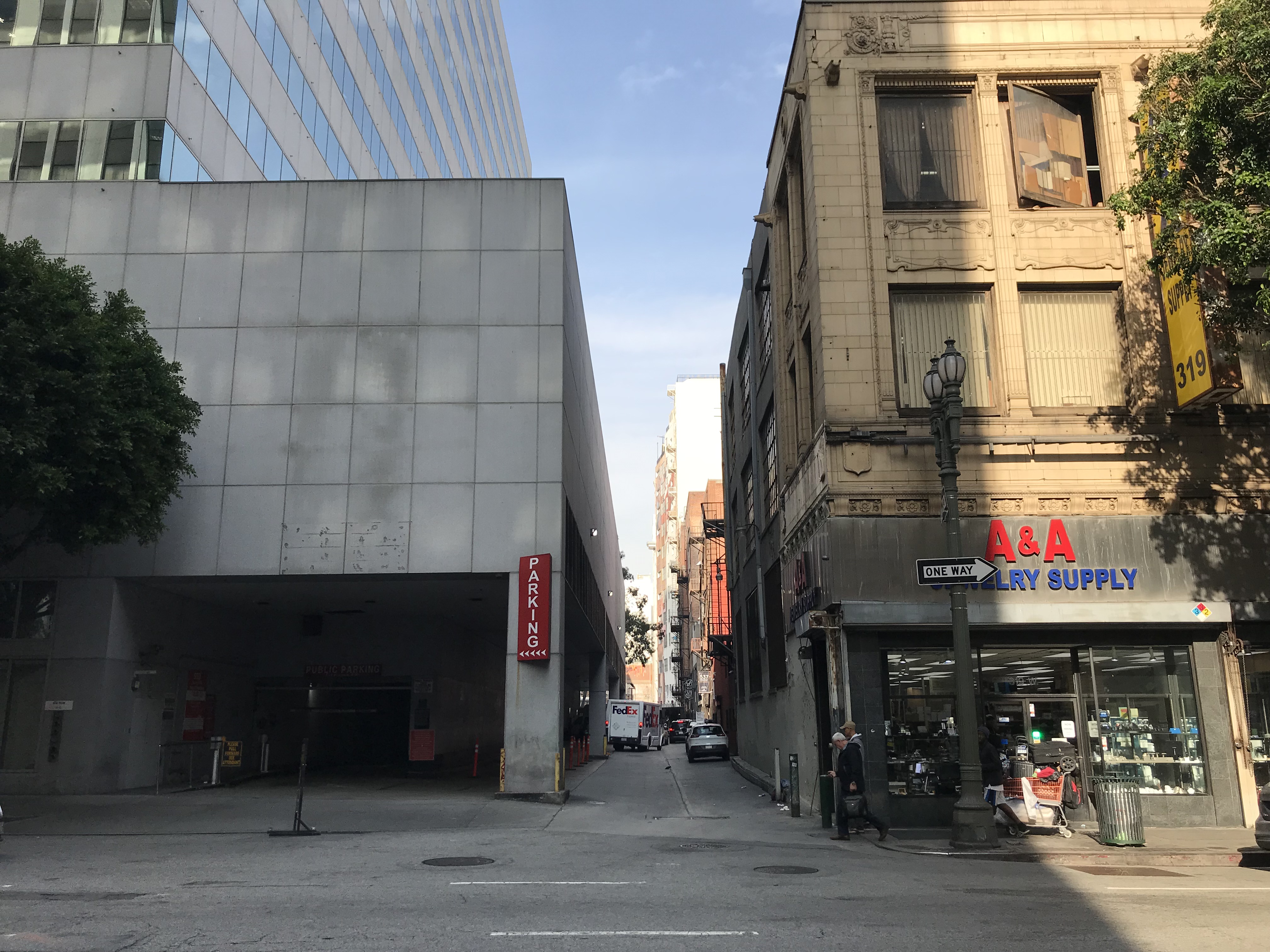
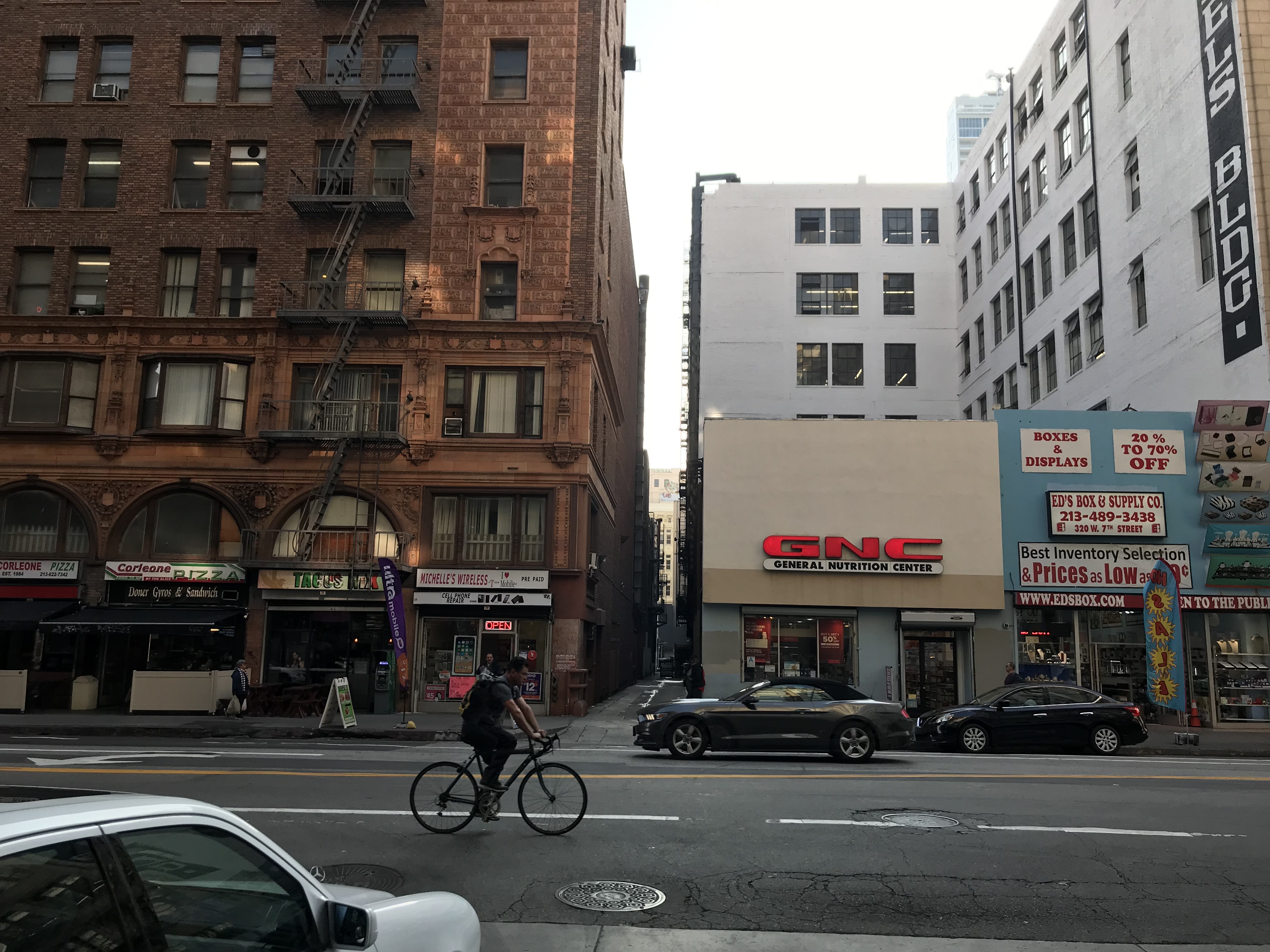
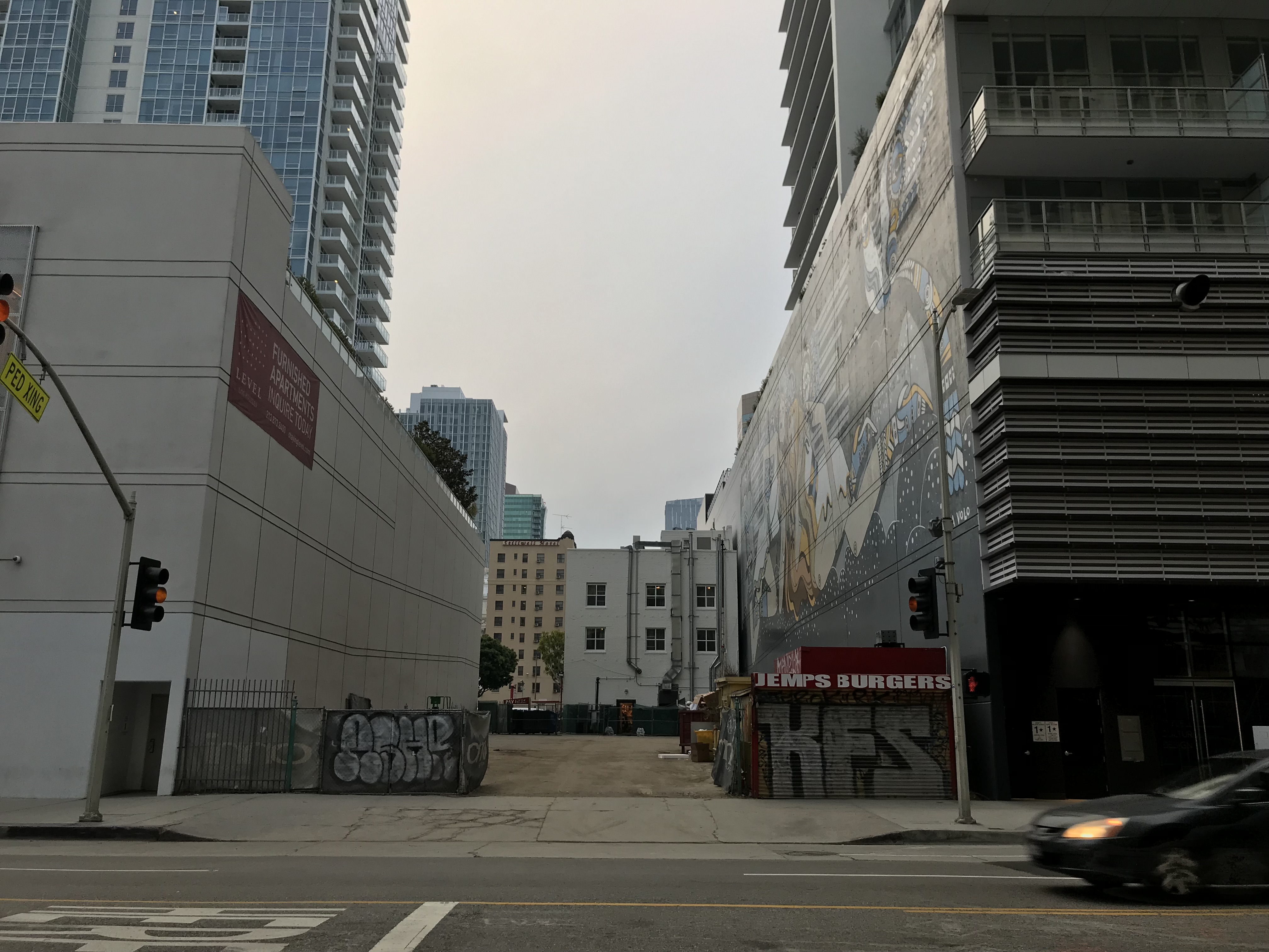
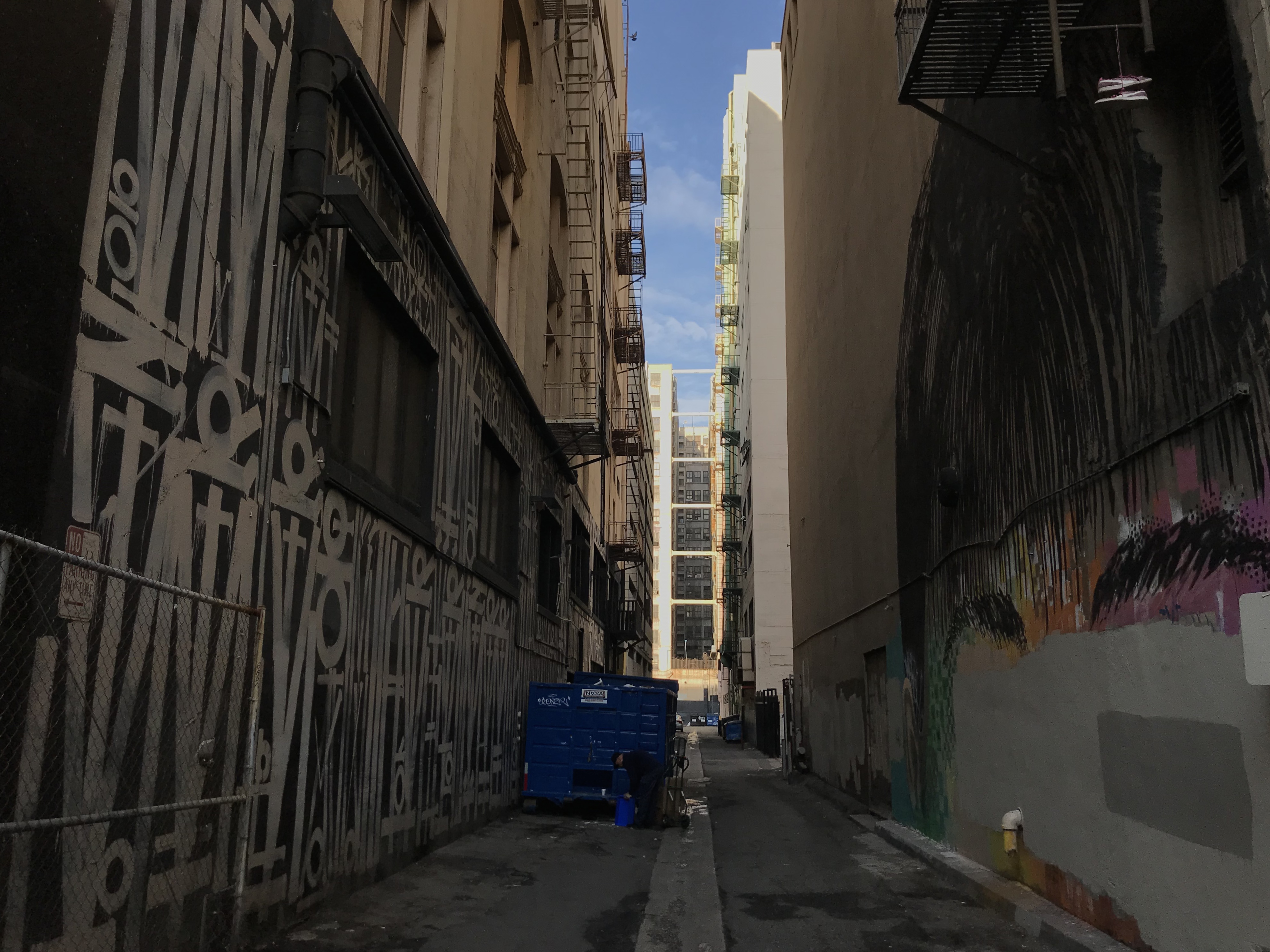
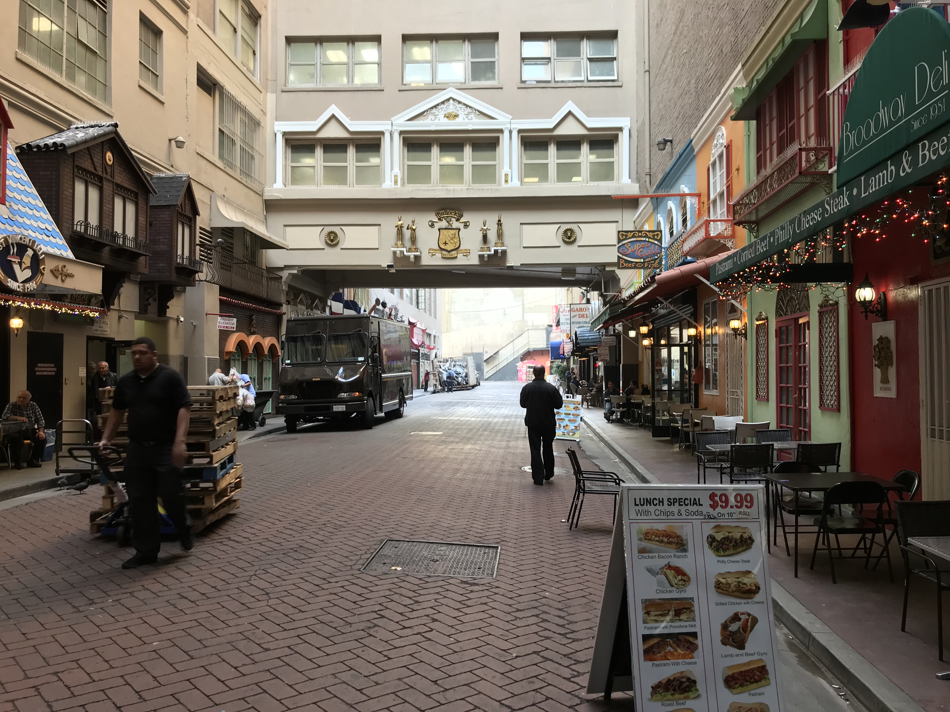
There are also numerous minor streets and narrow alleys — which although generally as underutilized as those in most American cities — are still worth exploring. Blackstone Court, Harlem Place (formerly known as Center Place, gated at 5th and the alley on which The Smell is located), Frank Court (formerly Angelus Court and also gated at 5th, 6th, and 7th), Lindley Place (named in 1921 for Dr. Walter Lindley), Mercury Court, Midway Place, truly charming St. Vincent Court, Werdin Place (nicknamed Indian Alley for its historic population of homeless Native Americans and street art but now gated at both ends), and Winston Street (also associated with homeless Native Americans and street art — but un-gated). (See also Elisabeth L. Uyeda‘s “The Alleys of Downtown L.A.: Infamous, Invisible, Indispensable“).
Although some definitions of the Historic Core extend all the way to 1st Street, it seems to me much more oriented toward the Civic Center. None of the buildings along that street are more than a decade old except those built by the Los Angeles Times, which I would suggest has — although not officially part of Los Angeles government — often had an unhealthily close relationship to it. Between 2nd and 3rd streets, the Civic Center vibes continue with offices for all sorts of State of California boards, divisions, &c. The City Employees Club of Los Angeles, established in 1928, is civic center-oriented, historic, and worth a visit.
HOUSES OF WORSHIP
I was surprised at how few houses of worship there are located in the Historic Core. Then again, when you’re only open for a few hours each week and rely largely on donations, I suppose Downtown rents are prohibitively expensive. A church called Fearless LA holds its services in the old stock exchange building. Although not exactly churches, there are a couple of church-adjacent “chapels” which do business in both weddings and divorces, including La Catedral de los Angeles Wedding Chapel and Guadalupe Wedding Chapel.
The grandest church in the neighborhood is the former cathedral of the Archdiocese of Los Angeles, which opened its doors in 1876. Its Italian Baroque style was designed by Ezra F. Kysor and W.J. Matthews; enlargements were designed in 1922 by John C. Austin. In 1963, it was designated Los Angeles Historic-Cultural Monument No. 17. Despite its historic value and the absence of an environmental review or even permit, the Archdiocese began to illegally demolish the then 120-year-old property in 1996. The Los Angeles Conservancy successfully stopped City Council, who voted 14-1 to revoke its Historic-Cultural Monument status, and the church is now an event space known as Vibiana Place. The old rectory, meanwhile, is now a restaurant, Redbird.
FOOD & DRINK
Not long ago the food scene throughout much of non-enclave downtown (i.e. Little Tokyo and Chinatown) was decidedly limited. My ex lived near the border between the Historic Core and Financial District. One day she sent me on a hunt to find “anything but sandwiches.” After a more than an hour, I returned empty-handed as I’d passed by nothing but cafés hawking sandwiches to office workers on their lunch breaks… and not bánh mì, mind you, but the uninspired sort usually stuffed with alfalfa sprouts, flavorless tomatoes, and dressed with “yellow mustard.”
Then as now, however, there were bright spots like Grand Central Market — an open stall food hall and bazaar which has occupied the ground floor of the Homer Laughlin Building since 1917. Some of today’s tenants — Ana Maria, Chiles Secos, China Café, Sarita’s Pupuseria, Tacos Tumbras a Tomas, and others — were around back then. Some bemoan the shift which occurred in the 2010s away from market stalls to upscale (and pricey) restaurant stalls. I remember the old Grand Central Market fondly — although it was also usually dishearteningly quiet and it seemed like half the stalls were vacant. It is never less than packed these days, it seems — except in the weird, underutilized basement level, which hosts a discount store, the public restrooms, and a lot of empty space.
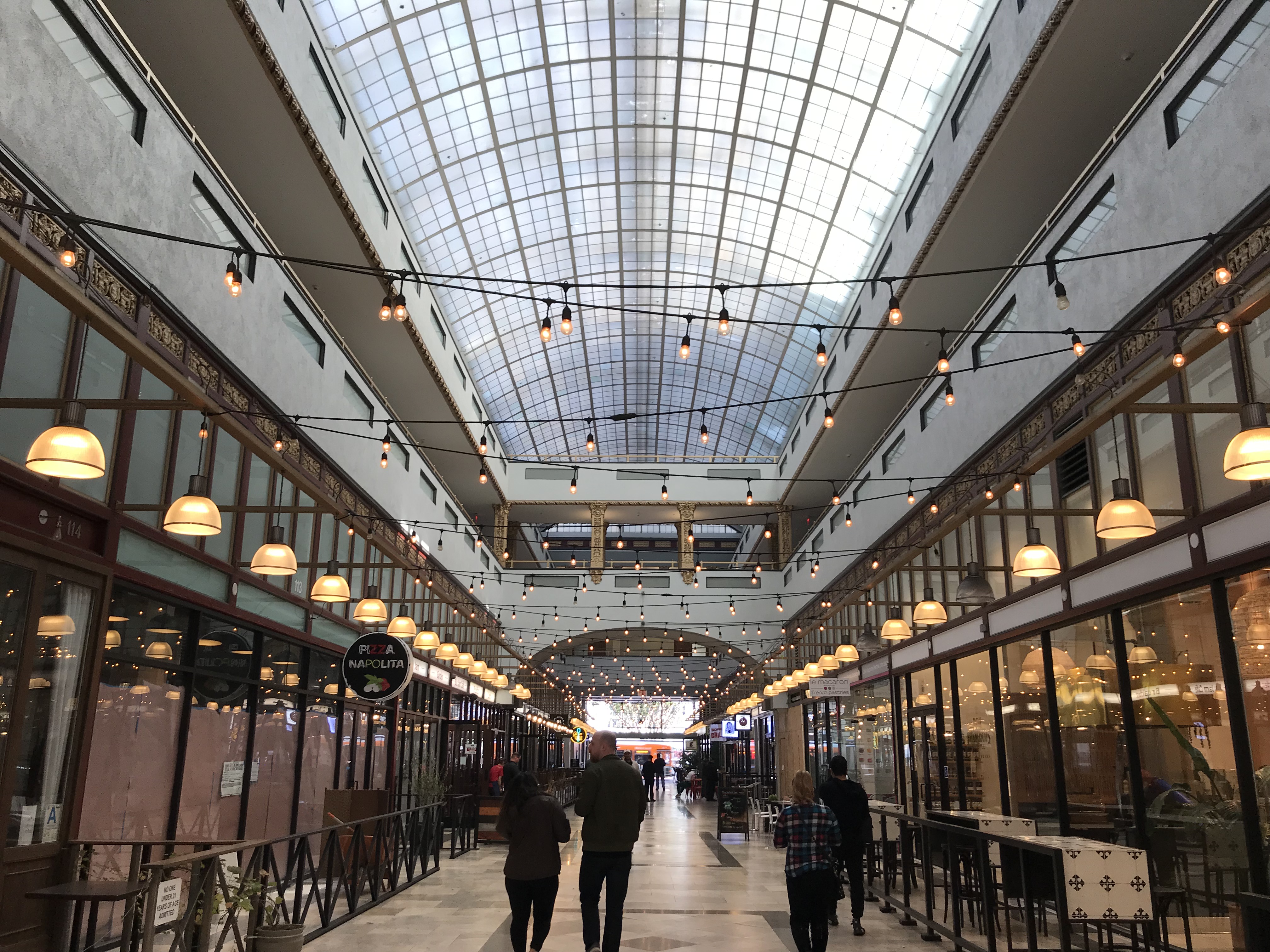
The Spring Arcade Building opened in 1924 but it was only in 2014 that it re-opened with a food hall-like emphasis on food. It looks great but I’ve yet to eat there — even though I do like Guisados and formerly frequented Royal Clayton’s — the predecessor of Clayton’s Public House. The vibe though, weirdly, is somehow as much mall food court as it is adaptive reuse food hall. Perhaps that has to do with the stomach-turning musical selection invasively piped over the speakers. As Mike and I walked through, we were assaulted by the sounds of Justin Bieber bawling and begging someone letting him “love” them. An even smaller food hall (food closet) named Corporation Food Hall opened in 2017.
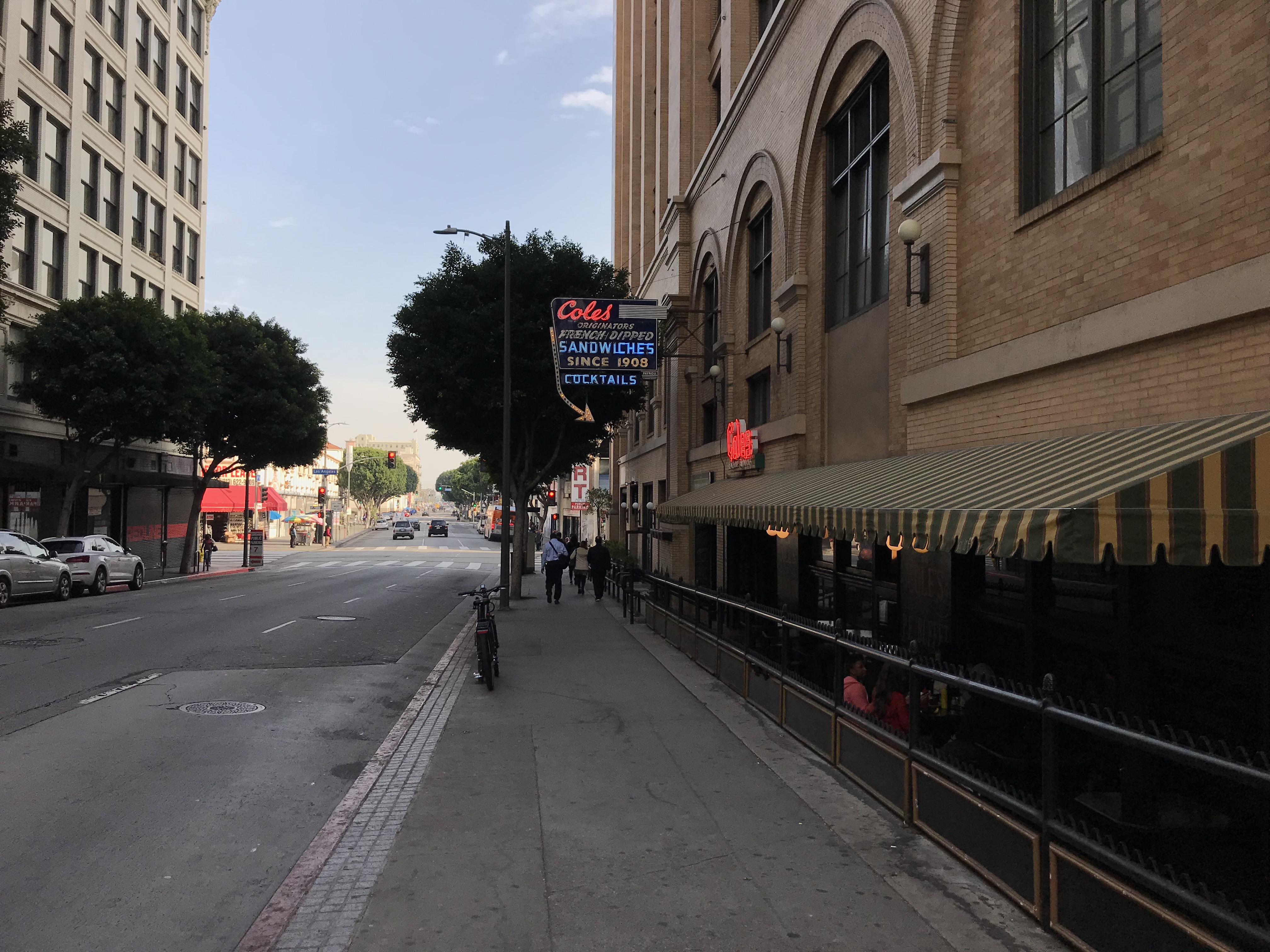
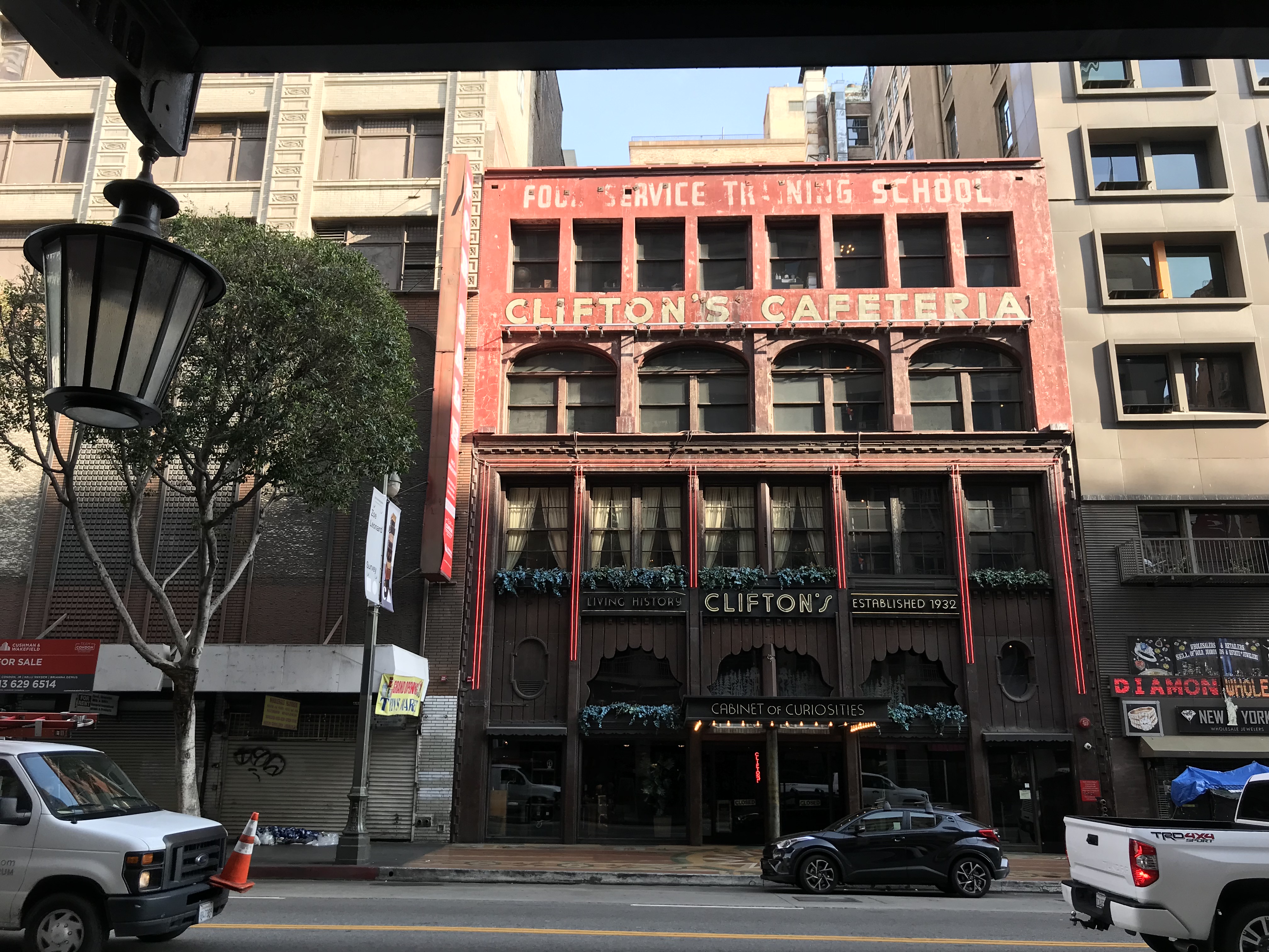
The gloriously kitschy Clifton’s Republic has been around, in some form or other, since 1935. I used to go when the food was still proper cafeteria style. However, since reopening in 2015, the food concept has changed several times now and you may want to check ahead to make sure that there’s food at all.
Normally I steer clear of restaurant chains — certainly most multi-national ones — but Downtown remains home to a few worth mentioning. Firstly, there’s a Subway located inside the historic Bradbury Building. Not that I’m recommending eating there — just that you stop to appreciate the weird juxtaposition of the building’s glorious interior thoroughly infused with the unmistakable “Subway smell.”
Across the street is a sort of mini-chain food hall worth a visit. Located inside a Spanish Colonial Revival building (with elements of Korean Strip Mall Revival) are a Carl’s Jr., El Pollo Loco, and LA Pizza & More (which replaced what may’ve been the world’s last Sbarro located outside of a mall food court). There are also historic photos inside, as well as a painted portrait of Carl’s Jr.’s founders – Carl and Margaret Karcher. It was built in 1970. It should be a regular stop for tourists but then it didn’t appear in 500 Days of Summer and so doesn’t account.
PARKS
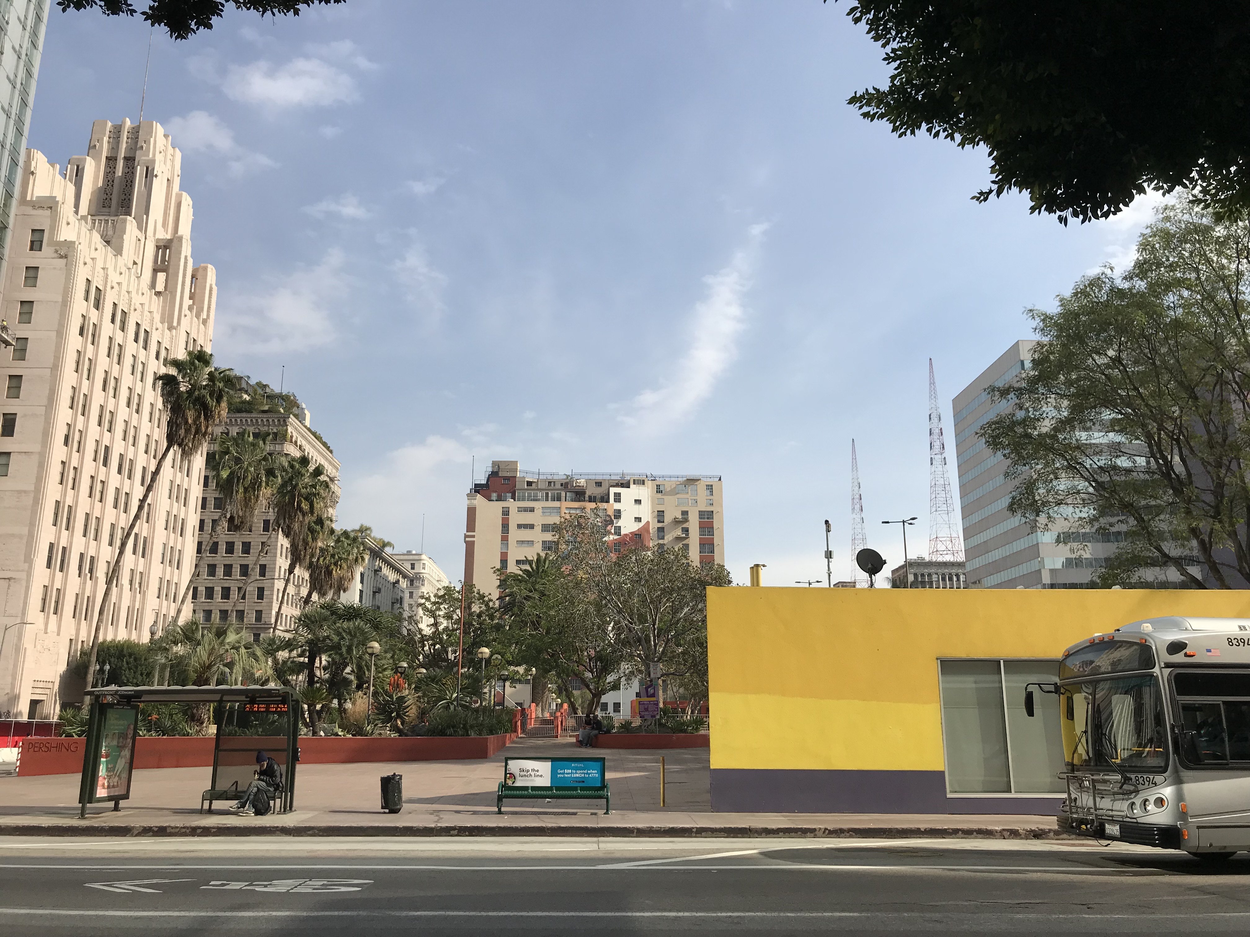
The main park in the Historic Core is Pershing Square, which was founded in 1866, as Plaza Abaja. After St. Vincent’s College opened across the street, it became informally known as St. Vincent’s Park. As mentioned earlier, it was officially named Los Angeles Park in 1870. In 1886, it was renamed 6th Street Park and was given a redesign by Frederick Eaton. In the 1890s, it was renamed, Central Park. In 1918, it was renamed Pershing Square. The entire park was ripped out in 1952 to build a three-level underground parking garage. In 1992, the park was given a postmodern makeover by Ricardo Legorreta and Laurie Olin and reopened in 1994, with a purple bell tower, fountains, lots of hardscape, and very little shade or greenery. Despite the inevitable cyclical re-appraisement of aesthetics, it remains widely loathed even in an age where all sorts of other hideous remnants of the ’90s are beloved again. A redesign was announced in 2015 and the proposal Paris-based Agence Ter was chosen but redevelopment has yet to begin. When Mike and I passed through, the temporary ice-skating rink which appears annually was in use. On Sundays, it also hosts the Historic Downtown Farmers Market, which began in 2012.
Other parks include Biddy Mason Memorial Park (including the public art piece, Biddy Mason: Time and Place, established in 1990), Spring Street Park (opened in 2013), and Spring Street Community Garden (established in 2016).
BOOKS
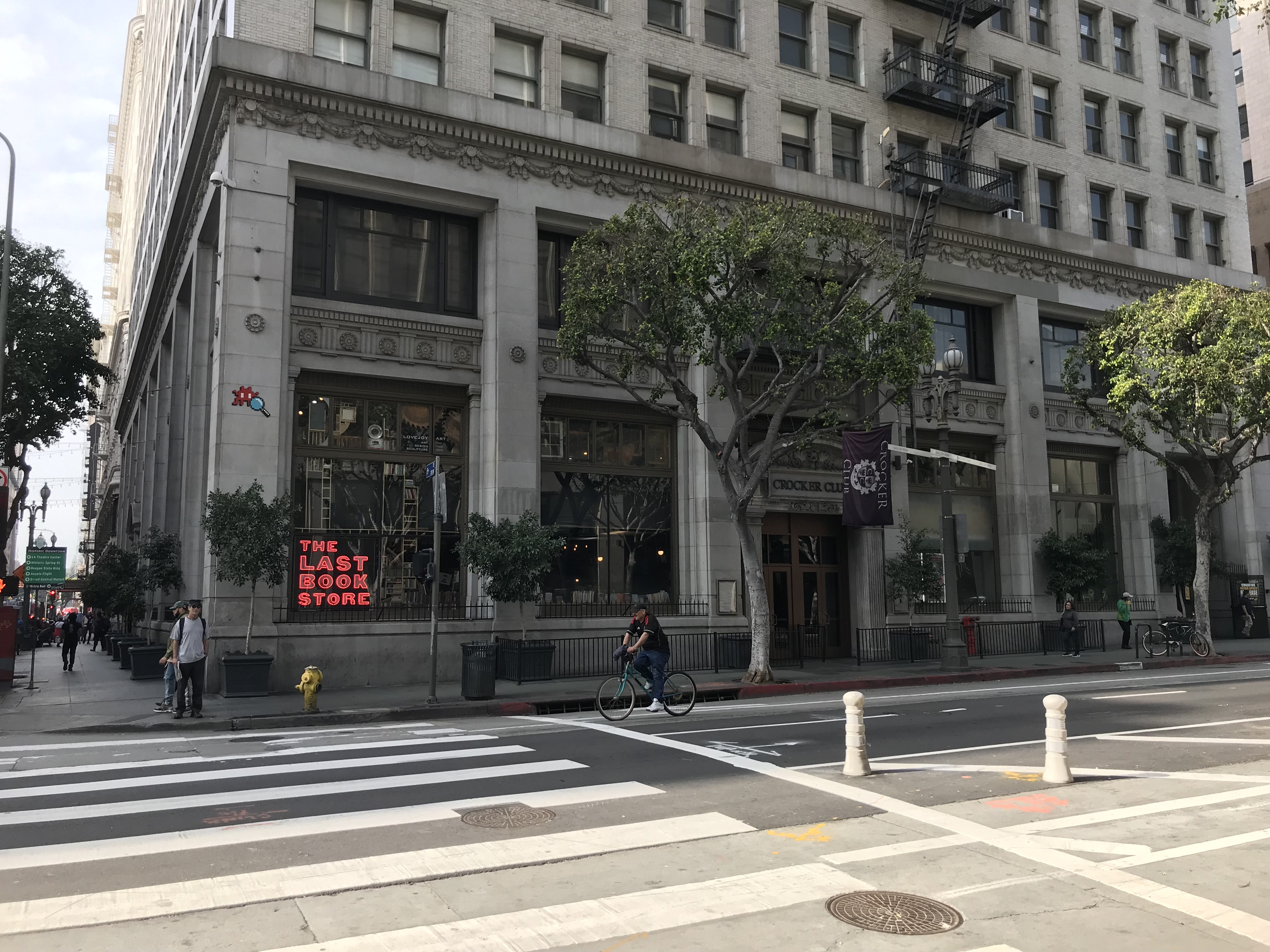
The Little Tokyo Library is located on the border of Little Tokyo and the Historic Core and is the only public library in the area (although the much larger Central Library is within walking distance). The most popular bookstore in the neighborhood is the Last Bookstore — although according to a friend who worked there — it’s perhaps more popular as a setting for selfie-taking than it is for book purchasing. Still, it has a large, impressive collection of books as well as art and small shops on the second floor.
HISTORIC CORE TRANSIT
The Historic Core has always been blessed with transit options as Downtown has always been the primary transit hub of Los Angeles. The Thornton Fitzhugh-designed Pacific Electric Building opened on Main as PE’s terminal in 1905. Los Angeles Railway’s Terminal Building was also downtown, albeit just south of the Historic Core. The Los Angeles Metropolitan Transit Authority (which had assumed operation of the interurban trains and streetcars in 1951) was absorbed into Southern California Rapid Transit District, which maintained its terminal building in the basement of the Greyhound terminal at Los Angeles and 6th. The largest concentration of transit lines, naturally, passed through Downtown and the Historic Core.
Today the Historic Core is served by Metro’s Red Line, Purple Line, and Silver Lines — as well as 36 commuter buses, and six rapid buses. When the Regional Connector is completed (currently scheduled for 2021), lines connecting the San Gabriel Valley, Harbor, Eastside, and Westside will pass through and there will be three subway stops in the neighborhood. The district is also served by Foothill Transit‘s Silver Streak, LADOT‘s Commuter Express lines 409 and 419, and four DASH lines, and (who can forget) Angels Flight (which has served the neighborhood intermittently since 1901). The website Walkscore assigns the district a transit score of 100/100.
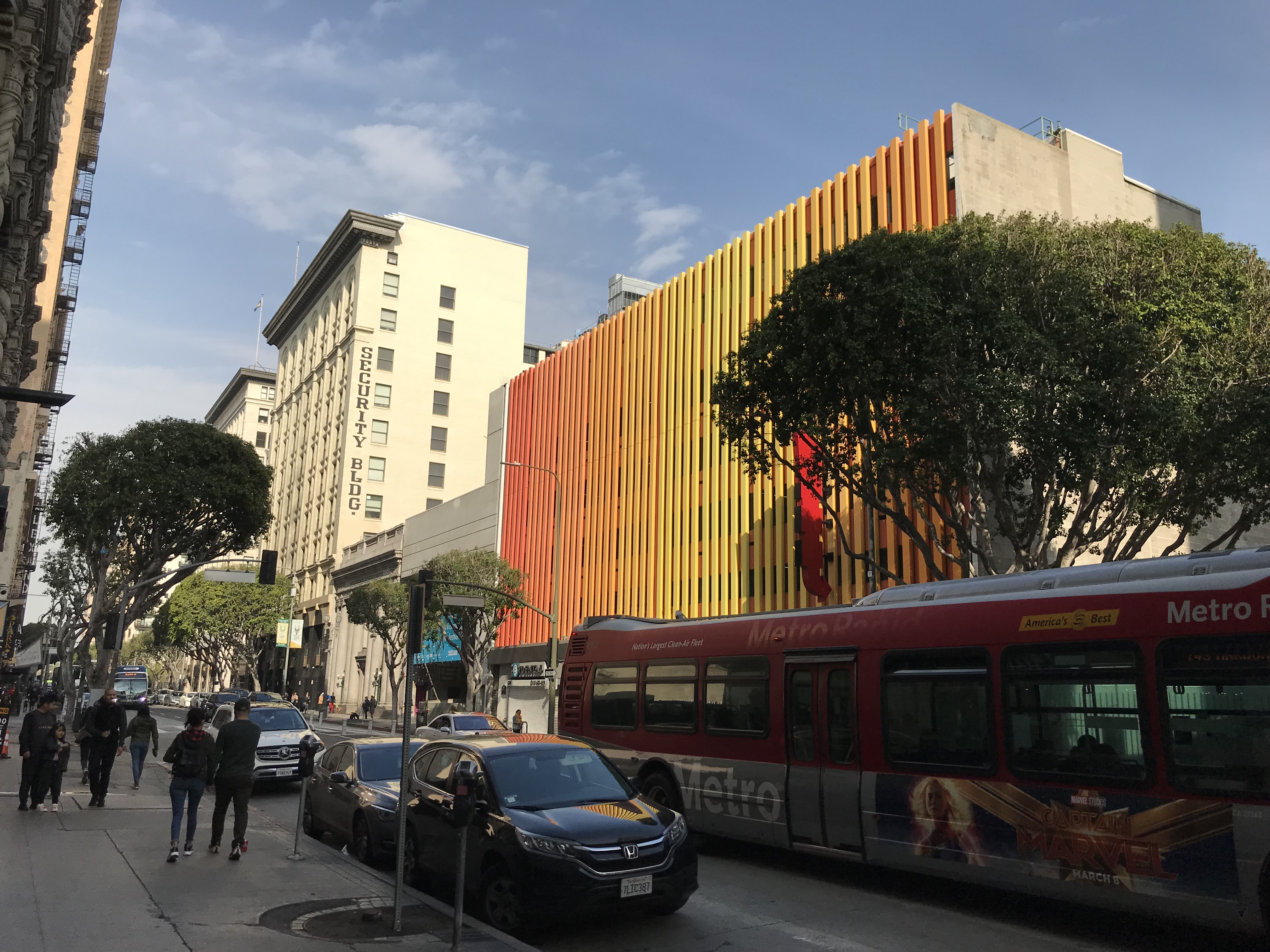
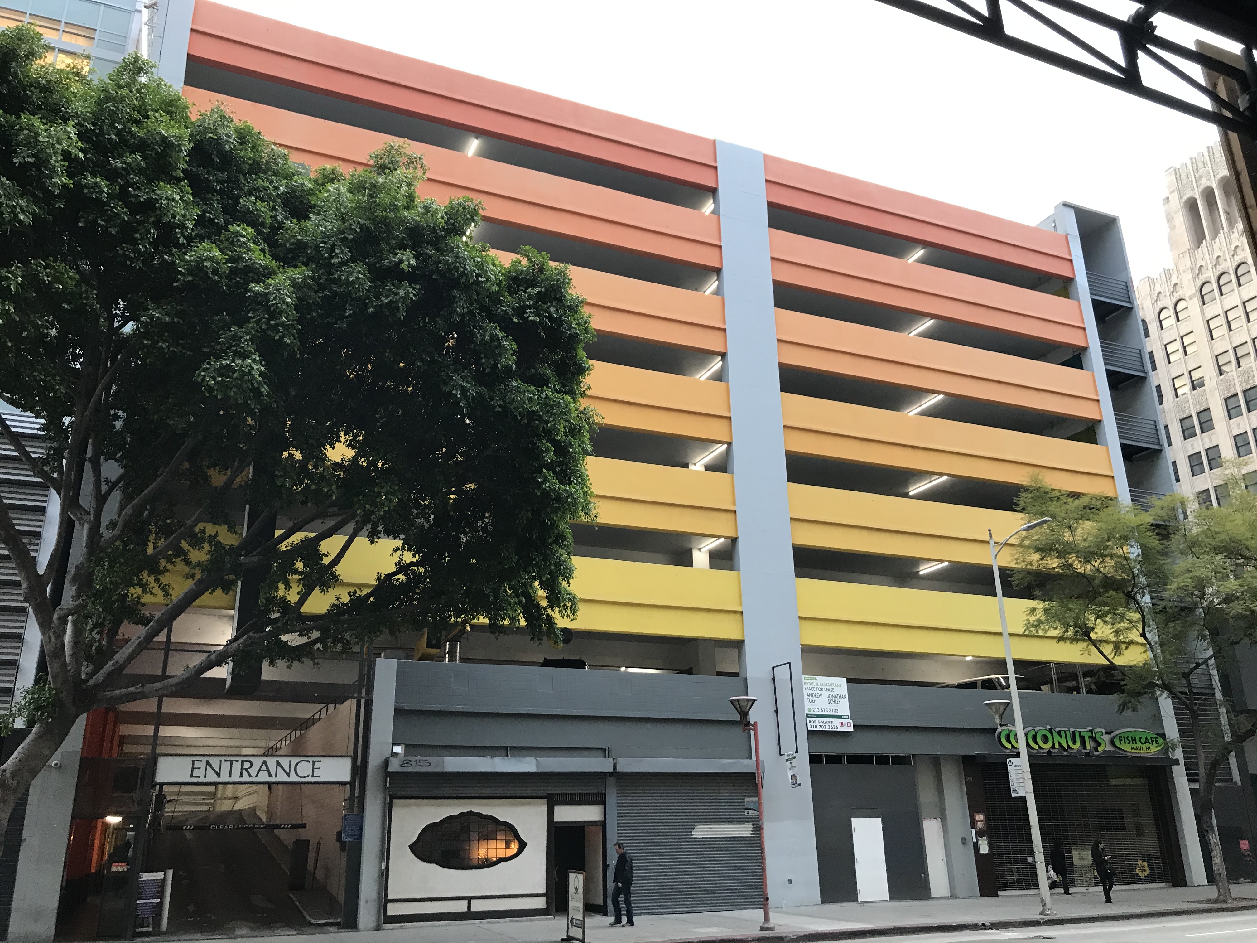
Walkscore also assigns the neighborhood a bike score of 90/100. There are currently three Metro bike share stations in the neighborhood. 7th Street, Broadway, and Spring Street have dedicated bicycle lanes. In 2018, Spring Street’s was upgraded to a protected lane. It’s also assigned a walk score of 98/100. And yet, there are still plenty of car-dependent chawbacons who are unperturbed by car-wrought climate destruction and unwilling to relieve themselves of the luxury of sitting in traffic and paying for car storage. For them, there are still a whopping nineteen surface parking lots and garages where otherwise might be residences, businesses, parks, community gardens, &c.
Support Eric Brightwell on Patreon

Eric Brightwell is an adventurer, essayist, rambler, explorer, cartographer, and guerrilla gardener who is always seeking paid writing, speaking, traveling, and art opportunities. He is not interested in generating advertorials, cranking out clickbait, or laboring away in a listicle mill “for exposure.”
Brightwell has written for Angels Walk LA, Amoeblog, Boom: A Journal of California, diaCRITICS, Hidden Los Angeles, and KCET Departures. His art has been featured by the American Institute of Architects, the Architecture & Design Museum, the Craft Contemporary, Form Follows Function, Los Angeles County Store, the book Sidewalking, Skid Row Housing Trust, and 1650 Gallery.
Brightwell has been featured as subject in The Los Angeles Times, VICE, Huffington Post, Los Angeles Magazine, LAist, CurbedLA, Eastsider LA, Boing Boing, Los Angeles, I’m Yours, and on Notebook on Cities and Culture.
Brightwell has been a guest speaker on KCRW‘s Which Way, LA?, at Emerson College, and the University of Southern California.
Brightwell is currently writing a book about Los Angeles.
You can follow him on Ameba, Duolingo, Facebook, Goodreads, iNaturalist, Instagram, Mastodon, Medium, Mubi, the StoryGraph, and Twitter.


9 thoughts on “California Fool’s Gold — Exploring the Historic Core”