

This is an introduction to Santa Barbara County, designed to pique the reader’s interest so that they’ll vote for communities to be explored in future episodes of Santa Barbara County. To vote for as many Santa Barbara Counties as interest you, click on this link.
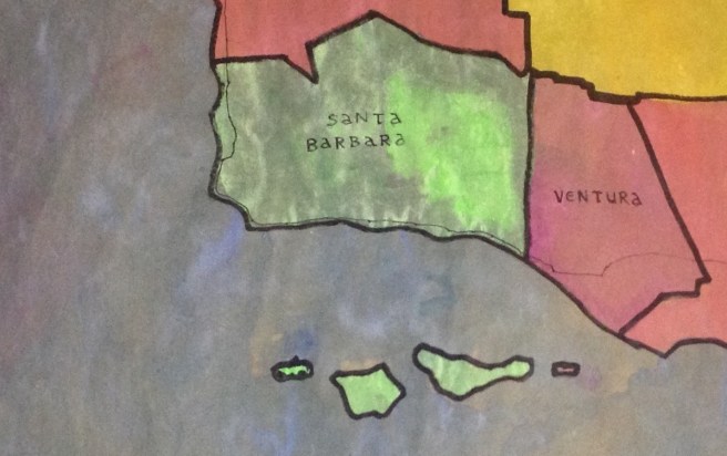
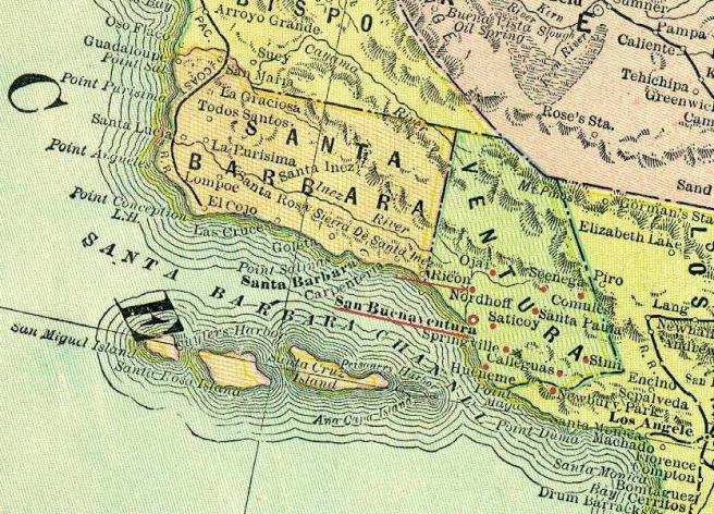
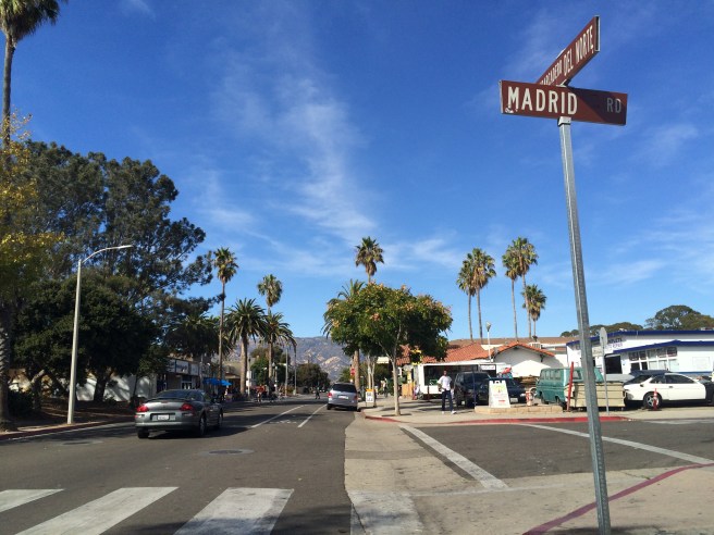
Santa Barbara County is located along the Central Coast, a 600 kilometer long region between Point Mugu in the south and Monterey Bay in the north. The Chaparral coastal plains of the west are separated from the semi-arid and sparsely populated Cuyama Valley to the east by a mountainous interior, principally the Santa Ynez, San Rafael, and Sierra Madre mountains. Natural attractions include the Burton Mesa Ecological Reserve, Chumash Painted Cave State Historic Park, and parts of Channel Islands National Park, Guadalupe-Nipomo Dunes National Wildlife Refuge, and the Los Padres National Forest.
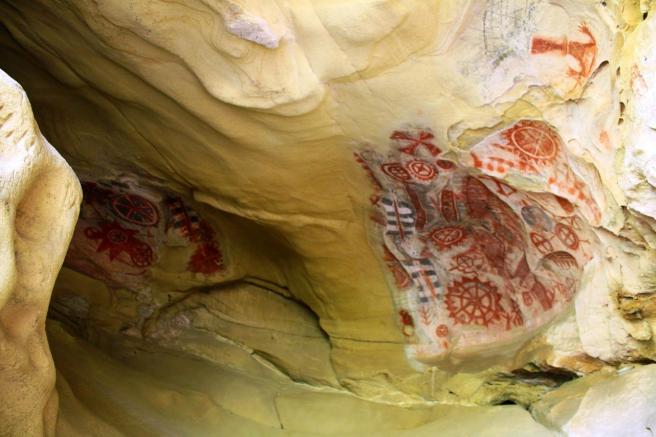
For at least 13,000 years much of the region was dominated by the ancestors of the deep-seafaring Chumash. The oldest human remains found in the Americas were those of the so-called Arlington Springs Man (actually a woman), found on Santa Rosa Island in 1953. Today there are several important archaeological sites including Burton Mound (believed to be a relic of the the Chumash village of Syujton) in Santa Barbara as well as the restricted Hammond’s Estate Site; the San Miguel Island Archeological District, the Santa Barbara Island Archeological District, the Santa Cruz Island Archeological District, Painted Cave (near Santa Barbara), and Point Sal Ataje (near the Point Sal Highlands). Part of what’s today Santa Barbara County is also the homeland of the Yokuts, a people who may be responsible for the artifacts of the (restricted) Eastern Sierra Madre Ridge Archeological District (near New Cuyama).
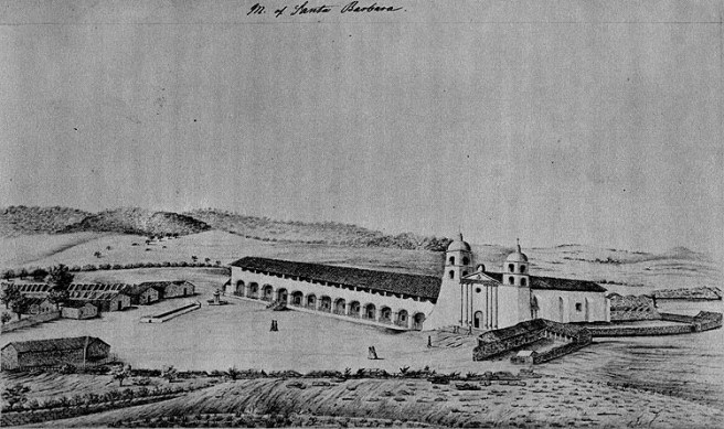
The Spanish arrived in 1542, led by explorer Juan Rodríguez Cabrillo. The Santa Barbara Channel was named by explorer Sebastián Vizcaíno when he sailed along the California coast in 1602, arriving in the channel on the Feast of Santa Barbara (4 December). The Spanish established the Presidio of Santa Barbara in 1782. The Spanish planted the first wine grapes in Santa Barbara County at Mission Santa Barbara, founded in 1786, and today Santa Barbara County Wine Country is widely known for its many wine viticultural areas.
During the Mexican period, the missions were secularized and vast ranch land were granted to individuals. It became part of the US in 1848, and when California became the 31st state in 1850, it was one of the original 26 counties. In 1873, a large piece broke of to form Ventura County.
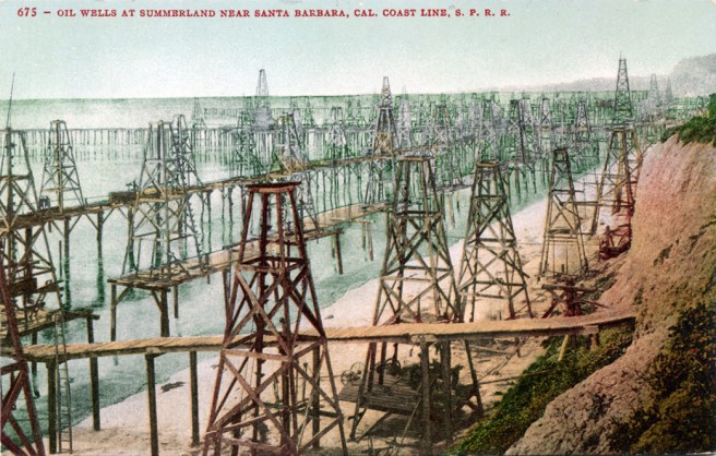
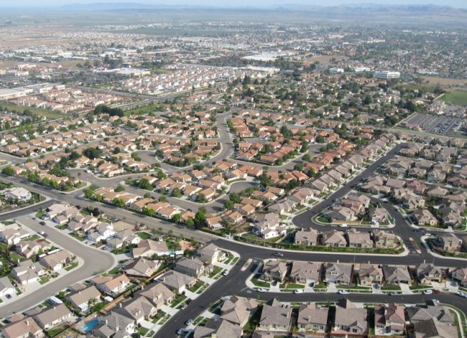
Nowadays most of the population, 423,895 in 2010, is centered along the South Coast region. Tourism and winemaking fuel much of the economy, as does oil. Vast oilfields include the Orcutt, Lompoc, and Cat Canyon fields. The largest spill in California history occurred in Santa Barbara Harbor in 1969.
Santa Barbara County is served by Santa Barbara Municipal, Santa Cruz Island, Santa Maria Public, Lompoc, and Santa Ynez airports. Amtrak maintains three train stations, served by the Coast Starlight and Pacific Surfliner trains. The county is also served by Greyhound Bus, as well as local agencies including City of Lompoc Transit (COLT), Santa Maria Area Transit (SMAT), and the Breeze Bus weekday commuter service.
And now for short descriptions of Santa Barbara County’s communities…
*****
BALLARD
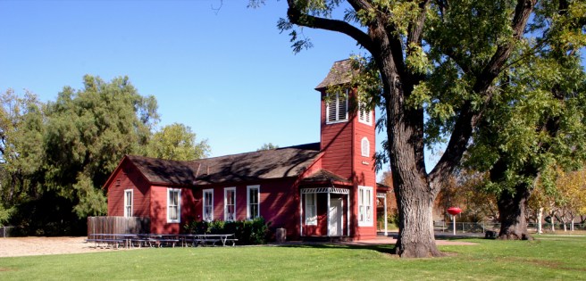
Ballard is a census-designated place (CDP) in the Santa Ynez Valley which as of 2010 had a population of 467. It’s named after William Ballard, who there ran a Wells Fargo stage line station from 1862 to 1870. It’s main attraction is Ballard’s Little Red School House (built in 1882). It’s also home to the Restaurant at the Ballard Inn and the Ballard Country Church (1898).
BETTERAVIA
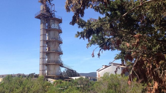
Betteravia is a ghost town located along Betteravia Road, developed around the Betteravia Sugar Plant. A sugar beet farm was established by the Union Sugar Refining Company in 1897. It closed in 1993.
BUELLTON
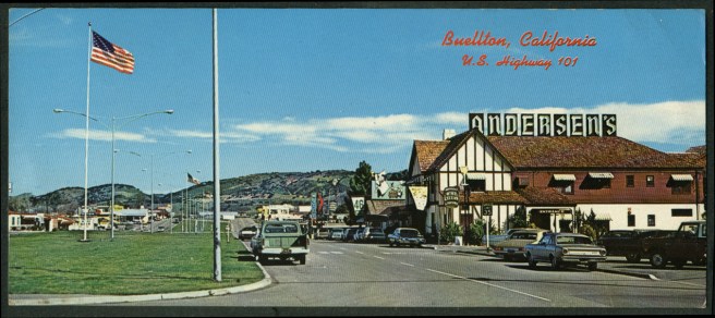
Buellton is a city in the Santa Ynez Valley which as of 2010 had a population of 4,828. Its name derived from one time owner of Rancho San Carlos de Jonata, R.T. Buell. It is the home of Pea Soup Andersen’s, a landmark since 1924. It’s also home to the Terravant Winery Restaurant, Mendenhall’s Museum of Gas Pumps and Petroliana, and OstrichLand USA.
CARPINTERIA
Carpinteria is a coastal town which as of 2010 had a population of 13,040. Since 1987 it has hosted the annual California Avocado Festival. It’s also home to Carpinteria State Beach, the Carpinteria Valley History Museum, the Wardholme Torrey Pine (the largest known Torrey pine), and planted in 1888.
CASMALIA
Casmalia, from the Chumash “Kasma’li,” is a CDP which as of 2010 had a population of 138. It’s located on the Mexican Rancho Casmalia, granted in 1840. The town was founded as Someo by Antonio Tognazzini, whose family came from Someo, Switzerland. Another California town already had that name and it was changed to Casmalia. The town’s population was larger before the Casmalia Resources Hazardous Waste Management Facility opened in 1973. It closed in 1989 and was designated a Superfund site.
CUYAMA
Cuyama, from the Chumash, “Kuyam,” is a CDP located in the Cuyama Valley near the banks of the Cuyama River. The town is located on the former, 9,000 hectare Rancho Cuyama, granted to Jose Maria Rojo in 1843. As of 2010 it had a population of 57.
GAREY
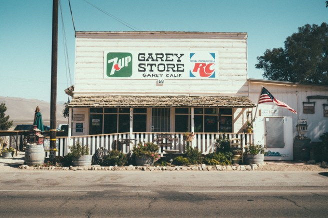
Garey is a CDP which as of 2010 had a population of 68. The town was founded in 1889 and was named after horticulturalist Thomas Garey.
GAVIOTA
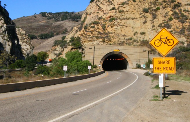
Gaviota, Spanish for “seagull,” is an unincorporated community which as of 2010 had a population of . It’s home to the Channel Islands Marine & Wildlife Institute, a marine mammal rehabilitation center which opened in 2006. Nearby is the 130 meter long Gaviota Gorge Tunnel.
GOLETA
Goleta is a city which as of 2010 had a population of 29,888. Goleta, Spanish for “schooner,” refers to a ship which sank in a local lagoon and remained visible for many years. In 1942, a Japanese submarine surfaced off the coast and began shelling Goleta, a fact commemorated by an historical marker. The city incorporated in 2002. Attractions include the Goleta Depot (1901 — home of the South Coast Railroad Museum), the Goleta Monarch Butterfly Grove, and the Stow House (1873).
GUADALUPE
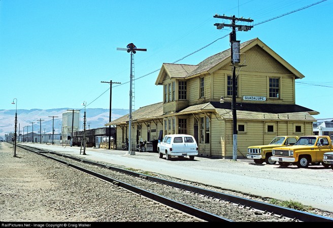
Guadalupe is a city located which as of 2010 had a population of 7,080. Following the secularization of the missions, it became part of Rancho Guadalupe in 1840. It incorporated as a city in 1946. Attractions include the Rancho de Guadalupe Historical Society and the Guadalupe-Nipomo Dunes, which contain large set pieces from Cecil B. DeMille’s 1923 film, The Ten Commandments.
HOLLISTER RANCH
Hollister Ranch is an active cattle ranch and private community. It was acquired by the Hollister Family in 1869. It was subdivided in 1971 and today is home to about 90 households.
HOPE RANCH
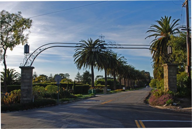
Hope Ranch is an unincorporated suburb of Santa Barbara which as of 2010 had population of 2,200. Its name comes from Irishman Thomas Hope, who purchased the land in 1861 for sheep ranching. It was only developed, however, in 1923, by Harold Chase. It’s home to the historic Thomas Hope House (1875).
ISLA VISTA
Isla Vista is an unincorporated beachside community which as of 2010 had a population of 23,096. The community was subdivided by John and Pauline Ilharreguy in 1925. The community is home to the AlloSphere, a sort of giant digital microscope/virtual reality chamber.
LOMPOC
Lompoc is a city which as of 2010 had a population of 42,434. Its name is derived from the Chumash “lum poc,” meaning “stagnant waters.” It was included in the Mexican Rancho Lompoc, granted in 1837. It was sold to Thomas Dibblee, Albert Dibblee, and William Welles Hollister, the latter of whom sold his portion to the Lompoc Valley Land Company on which the town of Lompoc was founded as a temperance colony. It incorporated in 1888.
Purportedly the flower seed capital of the world, it annually hosts the Lompoc Valley Flower Festival. Other attractions include the Lompoc Museum (housed in a former Carnegie Library built in 1911), the wreckage of the SS Yankee Blade (shipwrecked in 1954), the ruins of original Misión de La Purísima Concepción de la Santísima Virgen María (1787), and the rebuilt Mission La Purisima Concepción (1812).
LOS ALAMOS
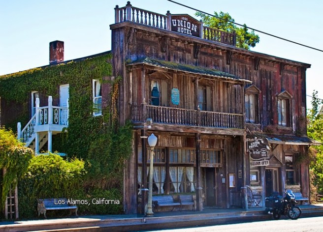
Los Alamos is a CDP located in the Santa Ynez Valley which as of 2010 had a population of 1,890. The Mexican Rancho Los Alamos was granted to José Antonio de la Guerra y Noriega in 1839. The Los Alamos Ranch House, built in 1840, still stands today. It would probably be the town’s chief historic attraction were it not located on private property. The town is also home to a themed Victorian Mansion at Los Alamos, moved there in 1980.
LOS OLIVOS
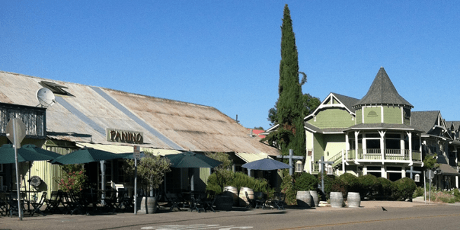
Los Olivos is a CDP in the Santa Ynez Valley which as of 2010 had a population of 1,132. The towns roots lie in the 64-hectare Rancho De Los Olivos, established in 1885. It’s known for its many vineyards and tasting rooms and was featured in the 2004 film, Sideways.
MISSION CANYON
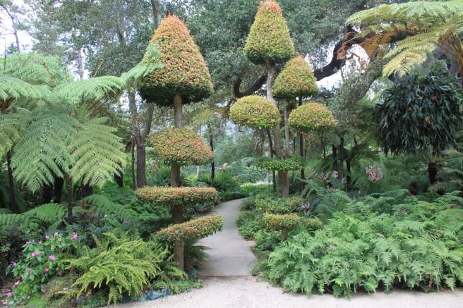
Mission Canyon is an unincorporated suburb of Santa Barbara which as of 2010 had a population of 2,381. It’s home to the 32-hectare Santa Barbara Botanic Garden.
MISSION HILLS
Mission Hills is a CDP which as of 2010 had a population of 3,576.
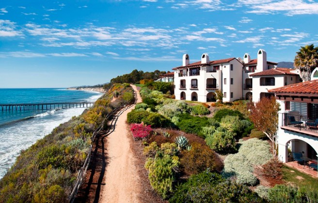
MONTECITO
Montecito is a suburb of Santa Barbara which as of 2010 had a population of 8,965. The town is home of the Music Academy of the West. Montecito is best known for its Spanish Colonial Revival, Mediterranean Revival, and Mission Revival buildings. Some of the community’s best known buildings are the Bertram Grosvenor Goodhue-designed El Fureidis/James Waldron Gillespie Estate (1906), the George Washington Smith-designed Casa del Herrero aka Steedman Estate (1925), Reginald Johnson and landscape architect Ralph Stevens’s Santa Barbara Biltmore (1927), and the Montecito Inn, developed by Charlie Chaplin and Roscoe “Fatty” Arbuckle (1928). It’s also home to Ganna Walksa Lotusland.
NEW CUYAMA
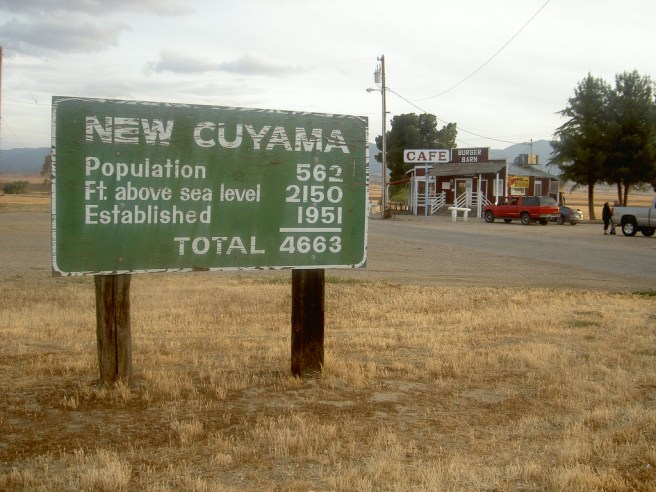
New Cuyama is a CDP place in the Cuyama Valley. As of 2010 it had a population of 517.
OGILVY RANCH
Ogilvy Ranch was purchased in 1971 by the spiritual community known as Sunburst, and renamed Lemuria by their leader, Norman Paulsen. Internal disagreements led to the hippies later vacating the ranch.
ORCUTT
Orcutt is a CDP located in the Santa Maria Valley of California, named for William Warren Orcutt, the manager of the Geological, Land and Engineering Departments of the Union Oil Company. As of 2010 it had a population of 35,262.
PAINTED CAVE
Painted Cave is an unincorporated community located in the Santa Ynez Mountains, named for its proximity to Painted Cave State Historic Park. It’s comprised of roughly 100 homes.
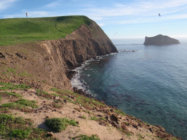
SAN MIGUEL ISLAND
San Miguel Island is the westernmost of the Channel Islands. Its area is 38 square kilometers and it includes offshore islands and rocks, most notably Prince Island. The highest point is the 253 meter high San Miguel Hill. The Chumash called the island Tuqan and it supported at least two Chumash villages but today supports no permanent human population.
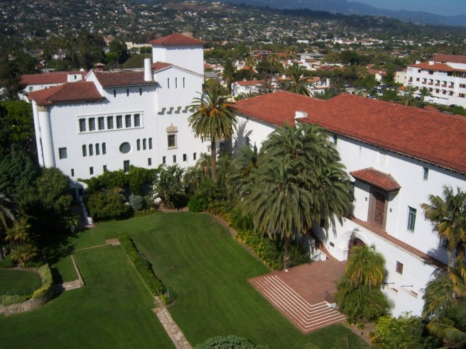
SANTA BARBARA
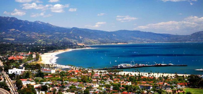
Santa Barbara is the county seat of Santa Barbara County and, with a 2010 population of 88,410, the second-most populous city in Santa Barbara County. It’s a popular tourist destination and home to five colleges and universities including the University of California, Santa Barbara, Santa Barbara City College, Westmont College, Antioch University, Santa Barbara, and the Brooks Institute of Photography.
Arts venues include the Arlington Theatre (built in 1931) which hosts the annual Santa Barbara International Film Festival, the Lobero Theatre (1873), the Granada Theatre (1924), and the outdoor Santa Barbara Bowl, where I saw Best Coast and Belle & Sebastian with friends a couple of years ago.
Events hosted by the city include the annual Old Spanish Days Fiesta, New Noise Music Conference and Festival, Santa Barbara French Festival, and the Summer Solstice Celebration. Other attractions include the Santa Barbara Museum of Art, the Santa Barbara Zoo, and the Neal Taylor Nature Center at Cachuma Lake.
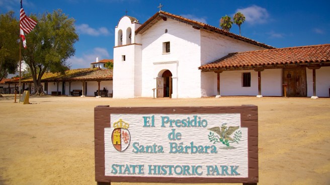
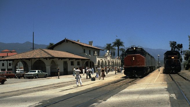
Historic attractions include Mission Santa Barbara (1786), De La Guerra Plaza, Covarrubias Adobe (1817), Rafael González House (1825), Hill-Carrillo Adobe (1825), Hastings Adobe (1854), Cold Spring Tavern (1865), Stearns Wharf (1872), St. Vincent Orphanage and School Building (1874), Santa Barbara’s Moreton Bay Fig Tree (planted in 1876), Joseph and Lucy Foster Sexton House (1880), Faith Mission (1889), Franceschi Park and House (1893), Southern Pacific Train Depot (1902), Andalucia Building (1911), Val Verde (1915), Allan Herschell 3-Abreast Carousel (1916), ruins of Knapp’s Castle (c. 1916), Acacia Lodge (1917), Virginia Hotel (1925), El Paseo Shopping Mall (1925), Santa Barbara County Courthouse (1926), Janssens-Orella-Birk Building (1927), US Post Office-Santa Barbara Main (1937), and Los Baños del Mar (1939).
SANTA BARBARA ISLAND
Santa Barbara Island is a 2.63 square kilometer, making it the smallest of the Channel Islands. Its highest peak is the 193 meter tall Signal Hill. Lacking a consistent source of fresh water or firewood, it’s never likely supported a human population although it is home to the largest breeding colony for Scripps’s Murrelet.
SANTA CRUZ ISLAND
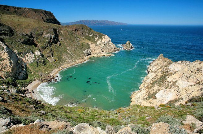
At 250 square kilometers, Santa Cruz Island is the largest island in all of California. It contains two mountain ranges in which the highest peak is the 740 meter tall Devils Peak. Remains of ten Chumash villages have been located on the island. It was was formerly the largest privately owned island off the continental US but was taken over in the 1990s and is now jointly protected by the Nature Conservancy and the National Park Service.
SANTA MARIA
Santa Maria is a city which as of 2010 had a population of 99,553, making it the most populous city in Santa Barbara County. Its name was recorded as Grangerville in 1875, then Central City, and after 1885, Santa Maria. It is known for the production of wine and Santa Maria-style barbecue sauce. It’s home to Allan Hancock College (which includes the Pacific Conservatory of the Performing Arts), the Chapel of San Ramon (1875), and the Julia Morgan-designed Minerva Club of Santa Maria (1894).
SANTA ROSA ISLAND
Santa Rosa Island, at 215 square kilometers, IS the second largest of the Channel Islands although it’s home to just two residents. The highest point is the 484 meter tall Vail Peak on Soledad Mountain. So far the remains of eight Chumash villages have been discovered. It was ranched for many years but wash purchased in 1986 and subsequently made part of Channel Islands National Park.
SANTA YNEZ
Santa Ynez is a CDP in the Santa Ynez Valley which as of 2010 had a population of 4,418.
SISQUOC
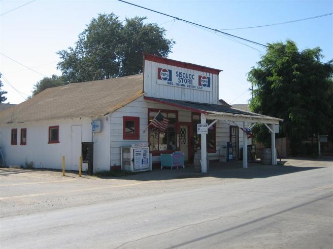
Sisquoc is a CDP on the southwestern edge of the floodplain of the Sisquoc River which as of 2010 had a population of 183. It’s home to a general store, the Sisquoc Store, and a fire station.
SOLVANG
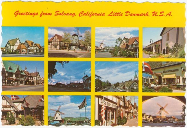
Solvang is a town in the Santa Ynez Valley which as of 2010 had a population of 5,245. It was founded by Danish-Americans in 1911 — “solvang” is Danish for “sunny field.” Solvang began to actively cater to tourists in the 1930s. The annual Danish Days were launched in 1936. In 1939, Danish Crown Prince Frederik and Princess Ingrid of Sweden visited the hamlet, then home to 400 people. In the 1940s, Ferdinand Sorensen and Earl Petersen began constructing new buildings in the Danish Provincial style and adding half-timbered facades to preexisting structures. It incorporated as a city in 1985. Today Solvang has statues of Hans Christian Andersen and the Little Mermaid, a Rundetårn, the Elverhøj Museum, the Hans Christian Andersen Museum, the Vintage Motorcycle Museum, the Solvang Wind Harp, and many shops and restaurants selling Danish kitsch, goods, and food.
SUMMERLAND

Summerland is a CDP which as of 2010 had a population of 1,448. It was founded in 1883 by spiritualist and real estate speculator H.L. Williams. In 1888 he began selling tracts to other Spiritualists. The Summerland Oil Field was discovered in the 1890s and Summerland became the site of the first offshore oil well.
SURF
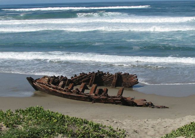
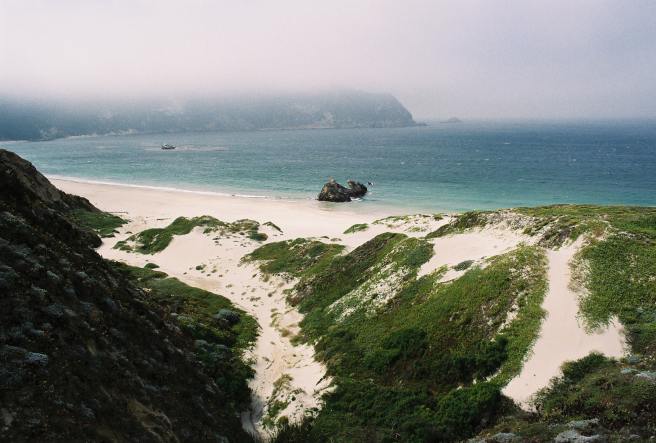
Surf is a coastal community which began as a stop on the Southern Pacific Railroad, who built a station there for its Coast Line in 1900. It’s home of Surf Beach and the remains of the Sibyl Marston, which shipwrecked near the coast in 1909.
TORO CANYON
Toro Canyon is a CDP which as of 2010 had a population of 1,508.
VANDENBERG AIR FORCE BASE
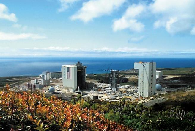
Vandenberg Air Force Base is a space and missile testing base named in honor of former Air Force Chief of Staff General Hoyt S. Vandenberg. Before it was an air force base it was an army base, Camp Cooke, established in 1941. As of 2010 it had a population of 3,338.
VANDENBERG VILLAGE
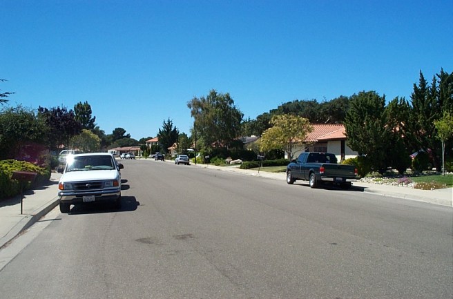
Vandenberg Village is a CDP which as of 2010 had a population of 6,497.
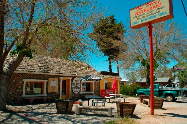
VENTUCOPA
Ventucopa is an unincorporated community in the southeastern Cuyama Valley.
*****
Eric Brightwell is an adventurer, writer, rambler, explorer, cartographer, and guerrilla gardener who is always seeking writing, speaking, traveling, and art opportunities — or salaried work. He is not interested in writing advertorials, clickbait, listicles, or other 21st century varieties of spam. Brightwell’s written work has appeared in Amoeblog, diaCRITICS, and KCET Departures. His work has been featured by the American Institute of Architects, the Architecture & Design Museum, the Craft & Folk Art Museum, Form Follows Function, Los Angeles County Store, Skid Row Housing Trust, and 1650 Gallery. Brightwell has been featured in the Los Angeles Times, Huffington Post, Los Angeles Magazine, LAist, Eastsider LA, Boing Boing, Los Angeles, I’m Yours, and on Notebook on Cities and Culture. He has been a guest speaker on KCRW‘s Which Way, LA? and at Emerson College. Art prints of his maps are available from 1650 Gallery and on other products from Cal31. He is currently writing a book about Los Angeles and you can follow him on Facebook, Instagram, and Twitter.
Click here to offer financial support and thank you!


69 thoughts on “California Fool’s Gold — A Santa Barbara County Primer”