

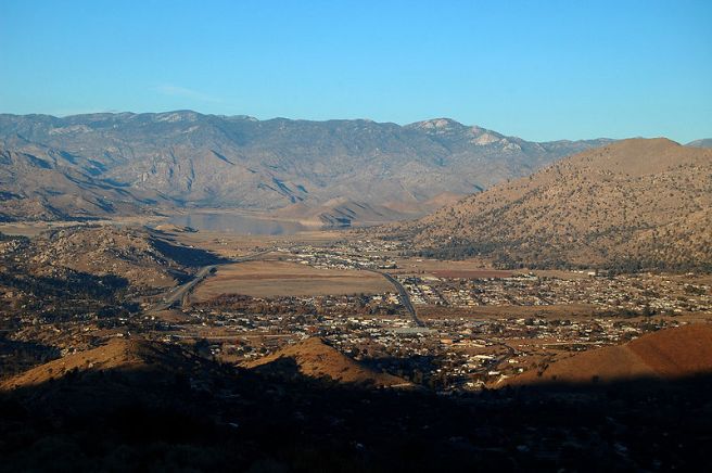
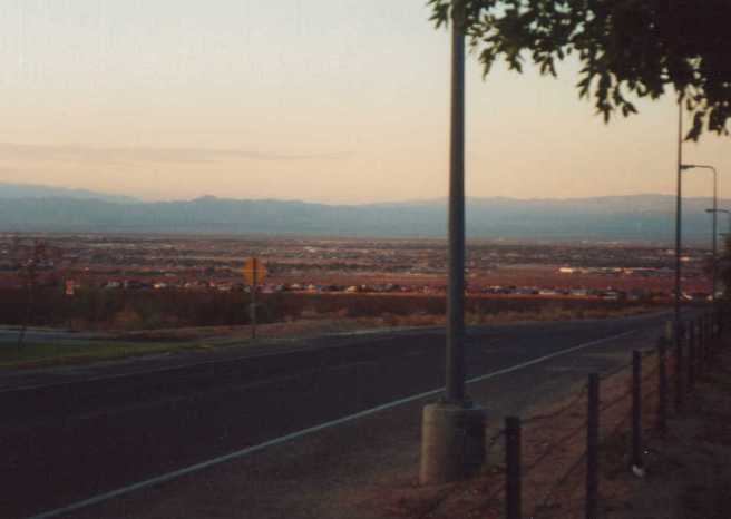
California‘s Kern County is located at the southern end of the Central Valley — a flat, expansive region that dominates the geography of central part of the state. At its widest point, the titular valley is about 100 kilometers wide. It’s roughly 720 kilometers long from south to north. In the northern portion are the cities of Fresno, Redding, and Sacramento. In Kern County the largest city is Bakersfield.
The Kern River Oil Field was discovered in 1899 and there are several oil-related historic sites. Kern County is the site of the biggest oil spill in American history, an event known as the Lakeview Gusher of 1910. There are still visible signs of the event near the town of Maricopa. Near McKittrick are the remains of California Standard Oil Well 1 as well as a series of natural asphalt lakes known as the McKittrick Tar Pits.
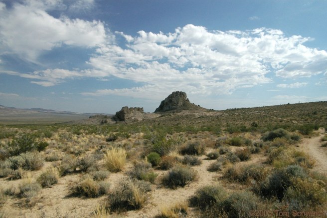
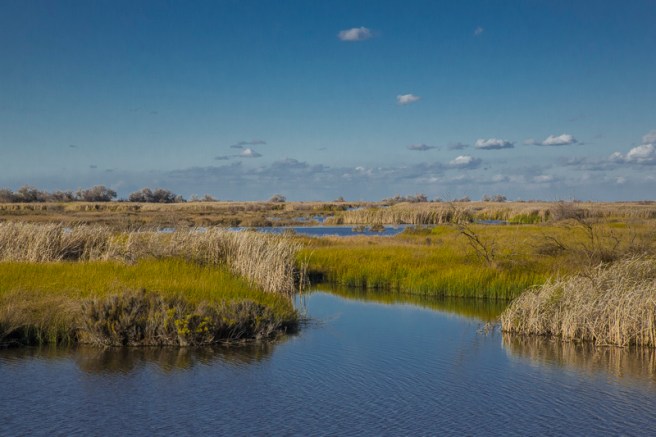
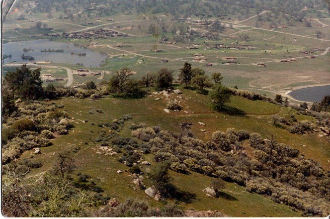
Other rural sites of interest include Rogers Dry Lake — a desert salt pan and site of the world’s largest compass rose; Robbers Roost/Bandit Rock, an unusual rock formation near Inyokern; and the Last Chance Canyon historic site (near Johannesburg); parts of Carrizo Plain National Monument (the largest single native grassland remaining in California), Giant Sequoia National Monument, Los Padres National Forest, and Sequoia National Forest. Kern County also contains Bitter Creek National Wildlife Refuge (known for its population of California Condors as well as other rare animal species like San Joaquin kit foxes), César E. Chávez National Monument, and Kern National Wildlife Refuge (located on the southern margin of what was once the largest freshwater wetland complex in the western United States and remains an important wintering habitat for waterfowl and water birds).
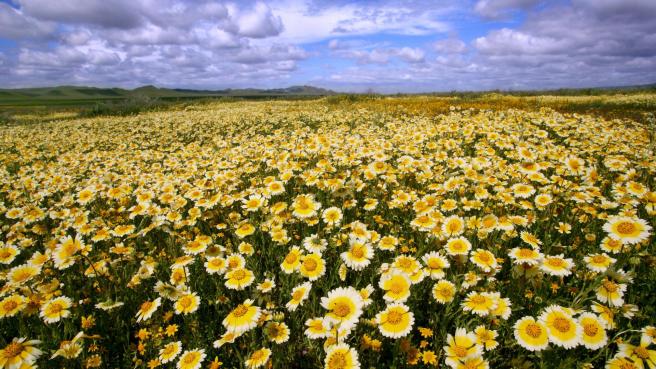
Although today the economy of the Central Valley is dominated by agricultural concerns, the Central Valley grassland was previously a biologically diverse grassland containing areas of desert grassland, prairie, savanna, riparian woodlands, marshland, seasonal vernal pools, and large lakes. The dominant grass of the valley was Purple needlegrass (Nassella pulchra) but today only 1% of the native grassland is original and intact. Other native flora include the California poppy (Eschscholzia californica), lupins, and Purple Owl’s Clover (Castilleja exserta). Remaining riparian woodlands are home to willows, western sycamore (Platanus racemosa), box elder (Acer negundo), Fremont cottonwood (Populus fremontii), and the endemic Valley oak (Quercus lobata).
Kern County is also home to large populations of the endemic Tule Elk, mule deer, San Joaquin kit foxes, California condors, western aquatic garter snakes, California ground squirrels, gophers, mice, hare, rabbits, giant kangaroo rats, blunt-nosed leopard lizards, Gilbert’s skinks, tri-colored blackbirds, western spadefoot toads, western horned lizards, and many invertebrates. Although the pronghorn was driven into local extinction, it was reintroduced in much smaller numbers in the 1980s. The California Grizzly which appears on the state flag was sadly driven to complete extinction. The last known grizzly in Kern was killed in 1918.
Modern Kern County was historically home to several Native American peoples including the Chumash; the Uto-Aztecan language-speaking Kawaiisu, Kitanemuk, Taaqtam, Tataviam, and Tübatulabal; and the Penutsian language-speaking Yokuts. All lived in the area for thousands of years before the first European, Commander Don Pedro Fages, arrived in the area in 1772. Even after the Spanish Conquest, however, few Europeans settled the area until after 1821, when Mexico acheived independence from Spain. Three years later, the Chumash rebelled against the Mexicans at the Battle of San Emigdio — a bit south of what’s now Bakersfield. They lost to the Mexican forces. The victorious Mexicans too would fall to conquerors, this time the United States, in 1848.
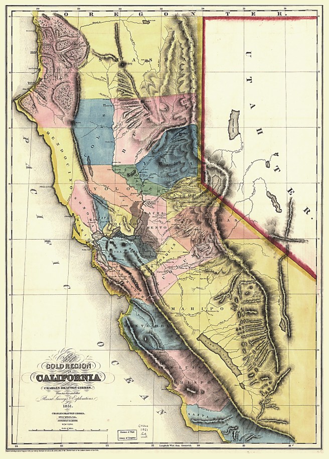
When California joined the union in 1850, what’s now Kern County was part of Mariposa County, then the largest such division in the state. In 1851, gold was discovered near the Kern River in the southern Sierra Nevadas. In 1865, oil was discovered in the valley. In 1866 Kern County was carved from it. Its name was derived from the Kern River, which had been named after cartographer Edward Kern but which was known to the Spanish and Mexicans as Rio Bravo de San Felipe.
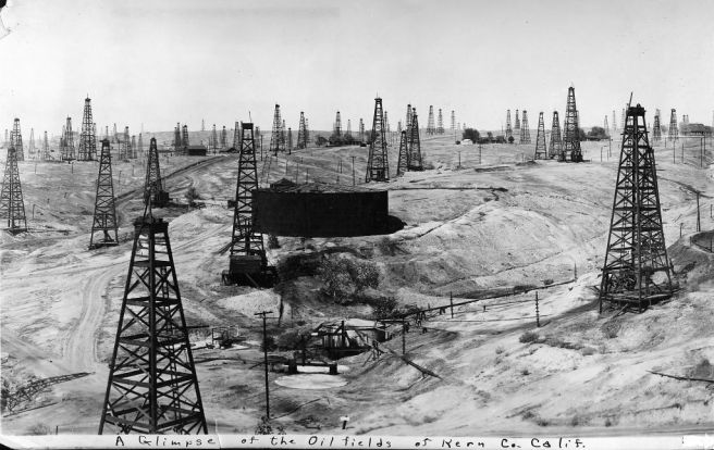
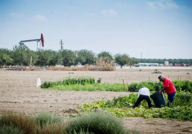
The drastic transformation of the land — which included the drainage of lakes and construction of canals — was mostly undertaken by Chinese laborers. In 1874, the county seat moved from Havilah to Bakersfield. The Kern River Oil Field turned out to be the fifth largest oil field in the US and the names of towns like Oil City, Oil Center (located in what’s now Bakersfield), and Oildale all reflect the commodity’s economic importance to the region. Today oil remains important to Kern County’s economy, as does the military industry, and agriculture.
In 2013, Kern County was home to an estimated 874,589 people. 82.9% were white (36.9% Anglo), 6.3% were black, 5.3% were Asian-Pacific Islander, 2.7% were Native American, 3% were of mixed race, and 24.3% were from other races. Latinos of any race comprised 50.9% of the population. The most common heritage is Mexican although there are significant populations of Salvadorans, Colombians, and Guatemalans as well.
*****
ARVIN
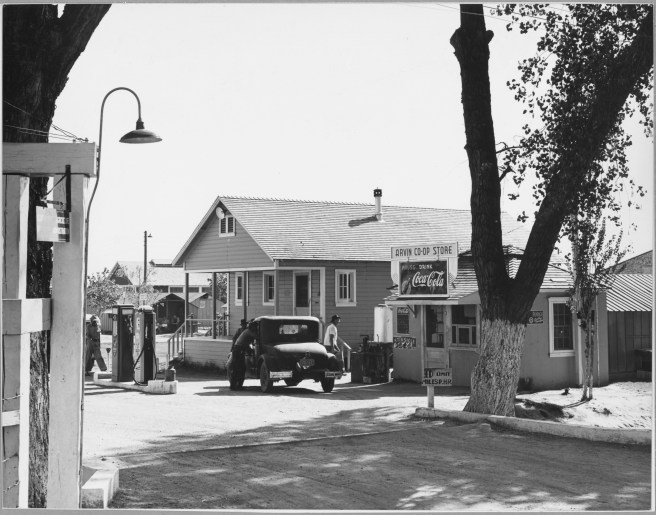
The town of Arvin was named after Arvin Richardson and won out over Bear Mountain and Walnut because the other two names were already in use. The first post office opened in 1914, in the living room of Birdie Heard who was not only the town’s postmaster but its head librarian as the library too was located in the Heard home until a Kern County library was built in 1927.
As of 2010, the town of Arvin had a population of 19,304. In 2007, it had the dubious distinction of being singled out by the EPA for having the highest level of smog in the US although Arvin Transit and Kern Transit offer alternatives to car dependency.
BAKERSFIELD
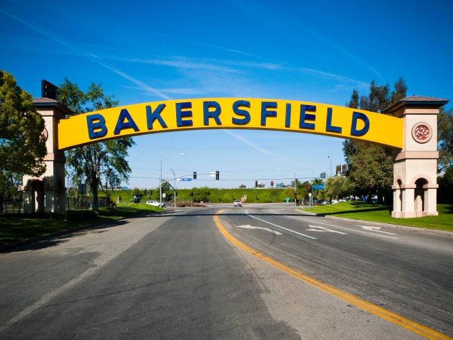
Bakersfield was known to early pioneers as a reedy, flood-prone, malarial marshland named Kern Island. The original settlement was established by German immigrant Christian Bohna in 1860 and washed away in 1862. Gold prospector Thomas Baker moved to the area in 1863 and his property came to be known to travelers lodging upon it as Baker’s Field. By 1870 it had a population of 600 and was the largest town in the county.
Bakersfield incorporated as a city in 1873 and the following year it was made the new county seat. Motivated primarily by their dislike of the town’s marshall, a cantankerous Kentuckian named Alexander Mills, Bakersfield was disincorporated in 1876 which meant that Mills no longer had a job. It was re-incorporated in 1898.

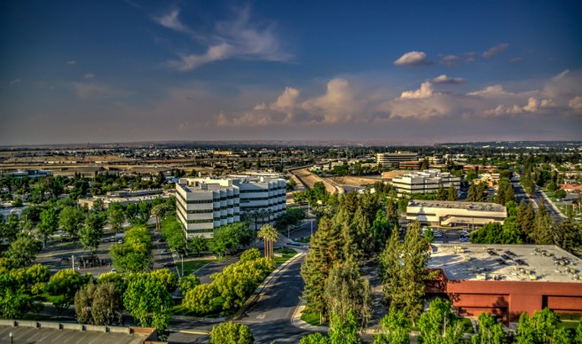
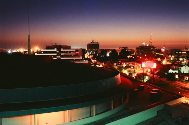
Today, with a population of roughly 363,630, Bakersfield remains the most populous city in Kern County and is the ninth most populous city in California. Most of Bakersfield’s early residents cam from Louisiana, Oklahoma, and Texas but a substantial number came from the Basque homeland on the Iberian Peninsula. Their continued presence is reflected by the existence of Basque restaurants like Benji’s, Narducci’s Café, Noriega’s, Pyrenees Café, and Wool Growers.
Bakersfield is also rightly celebrated for the “Bakersfield sound,” a twangy, rockin’ subgenre of country music, exemplified by Merle Haggard (a native of nearby Oildale), Tommy Collins, Wynn Stewart, Jean Shepard, Susan Raye, Lewis Talley, Speedy West, Dennis Payne, Freddie Hart, and the late Buck Owens, who opened the Buck Owens Crystal Palace in 1996.
Historic Bakersfield buildings include the Tevis Block (1893), the Kern Branch Beale Memorial Library (1900), the Jastro Building (1917), the Bakersfield Californian Building (1926), and First Baptist Church (1933). Other sites of possible interest include Buena Vista Museum of Natural History, Kern County Museum, California State University, Bakersfield, the Garces Memorial Traffic Circle (which includes on it John Palo-Kangas’s 1939 statue of Father Francisco Garcés), and the Colonel Thomas Baker Memorial (dedicated in 1944).
BEAR VALLEY SPRINGS
Bear Valley Springs is a census-designated place (CDP) in the Tehachapi Mountains. As of 2010 its population was 5,172. It’s a gated community, developed in 1970 and boasts equestrian trails, a 9-hole golf course, tennis courts, a shooting range, an archery range, camp grounds, and a gym.
BODFISH
Bodfish is a CDP named for George Homer Bodfish, who settled nearby in 1867. In 2010 it reported a population of 1,956. It’s home to the Silver City Ghost Town (a tourist attraction) and Dave’s Sports Bar.
BORON

Boron is a CDP which in 2010 reported a population of 2,253. It is named after the element, Boron and is home to the US Borax Boron Mine, California’s largest open-pit mine and the largest borax mine in the world (the borax deposit was first discovered in 1925). It’s also home to Domingo’s Mexican & Seafood Restaurant, 20 Mule Cafe, Vernon P Saxon Aerospace Museum, Boron Museum, Pioneer Park, and Pilot Truck Stop.
BUTTONWILLOW

Buttonwillow is a CDP in the San Joaquin Valley which in 2010 reported a population of 1,508. Although developed as Buena Vista in 1895, it became named Buttonwillow after a lone buttonbush, (Cephalanthus occidentalis) which was used as a meeting place by the aboriginal Yokuts and which is now California Historical Landmark No. 492.
CALIENTE
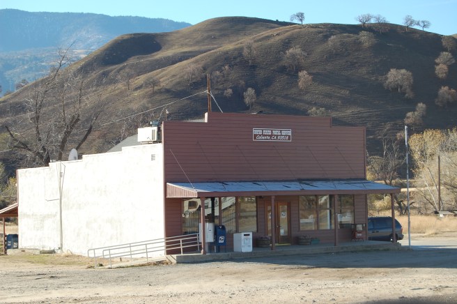
Caliente is an unincorporated community which in 2010 reported a population of 1,019. It was originally developed in the 1870s as Allens Camp, named after rancher Gabriel Allen. It was later known as Agua Caliente, after its hot springs, but that name was already in use and it was shortened to Caliente in 1875. It was served by Southern Pacific Railroad‘s Tehachapi Pass line, the Telegraph Stage Line, and the Cerro Gordo Freighting Co. which prompted the growth of the town. Edward Fitzgerald Beale established a home in this area about 1855 which is now registered as California Historical Landmark #757.
CALIFORNIA CITY
California City is an unincorporated, master-planned resort town from 1958 designed by real estate developer and sociology professor Nat Mendelsohn. It was incorporated in 1965 but remains largely undeveloped, criss-crossed with a huge, crumbling infrastructure. As of 201o it had a population of 14,120. One of its best known attractions is the abandoned Lake Shore Inn, built on the shores of a 11 hectare artificial lake.
CHEROKEE STRIP
Cherokee Strip is a CDP which in 2010 reported a population of 227.
CHINA LAKE ACRES
China Lake Acres is a CDP which in 2010 had a population of 1,761.
DELANO
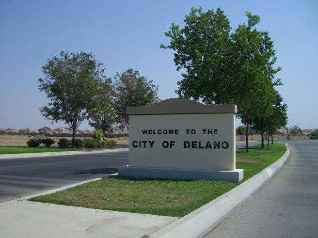
In 2010 Delano had a population of 53,819, making it the second largest city in Kern County. It’s hardly a metropolis, home to a handful of Chinese, Mexican, and pizza joints. It is an important center for grape growing, however, and was home of Forty Acres — the first headquarters of the United Farm Workers labor union. Today it’s also home to two state prisons, North Kern and Kern Valley.
DERBY ACRES
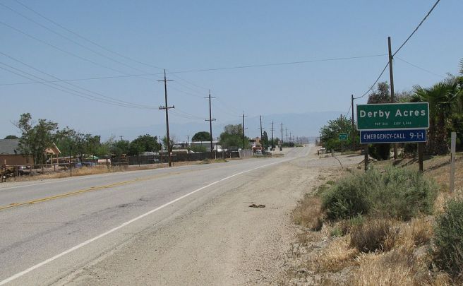
Derby Acres is a CDP founded in the 1930s and home, in 2010, to 322 people.
DUSTIN ACRES
Dustin Acres is a CDP which in 2010 had a population of 652.
EDMUNDSON ACRES
Edmundson Acres is a CDP which in 2010 had a population of 279.
EDWARDS AIR FORCE BASE
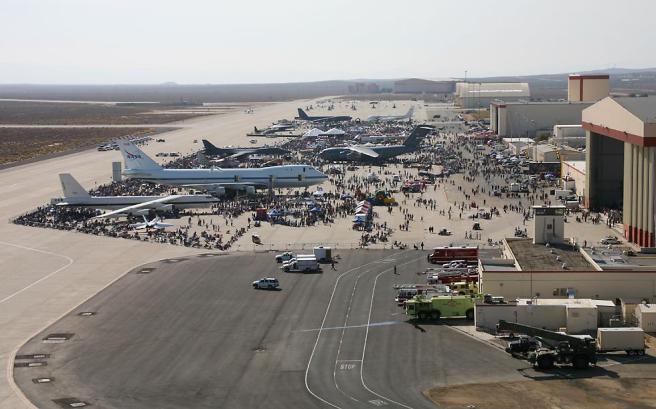
Edwards Air Force Base is home to the Air Force Test Center, the Air Force Materiel Command, the US Air Force Test Pilot School, and NASA‘s Armstrong Flight Research Center, next to which is painted the world’s largest compass rose. It was built in 1933 as Muroc Air Force Base. Several notable occurrences occurred there including Chuck Yeager‘s flight in the Bell X-1 which broke the sound barrier and the first landings of the Space Shuttle. As of 2010 it had a population of 2,063.
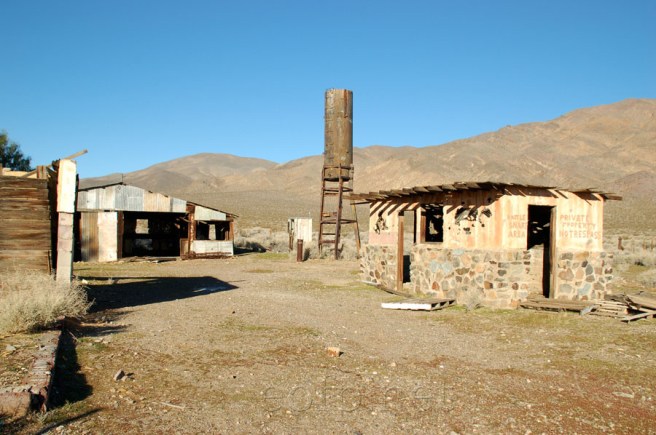
FELLOWS

Fellows is located atop the third largest oil field in the US, the Midway-Sunset Oil Field, to which it owes its existence. The oil field was discovered in 1909 and developement of the town, named after Sunset Western Railroad contractor Charles A. Fellows, followed. As of 2010 is the population of Fellows had dropped to 106.
FORD CITY
Ford City is a CDP which in 2010 had a population of 4,278. According to California’s Geographic Names: A Gazetteer of Historic and Modern Names of the State, its name came from the large number of Fords owned by the towns citizenry.
FORT TEJON

Fort Tejon was an army outpost located in the Tejon Pass and intermittently active from 1854 to 1861. From 1858 it was also used as a stagecoach station by the Butterfield Overland Mail as well as the US Camel Corps. It was again briefly re-occupied from 1863 to ’64 after which it was abandoned.
Today several of the historic buildings remain and the barracks and commanding officer’s quarters are open to visitors, part of the Fort Tejon Historic Park. The grounds also include the grave of Peter Lebecque, after whom nearby Lebec is named.
FRAZIER PARK
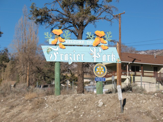
Frazier Park is an unincorporated town which in 2010 had a population of 2,691. It is one of the Mountain Communities of the Tejon Pass. It was founded in 1925 by Harry McBain, who named it after nearby Frazier Mountain.
FULLER ACRES
Fuller Acres (formerly, Hilltop) is a CDP which in 2010 had a population of 991.
GARLOCK
Garlock is a ghost town, apparently also known as Cow Wells, El Paso City, and Eugeneville. A post office was in operation from 1896 till 1904 and again from 1923 to 1926. The name Garlock was derived from mill owner Eugene Garlock. The town is registered as California Historical Landmark #671. It’s also home to a 1.3 kilometer long Burro Schmidt Tunnel, dug into the El Paso Mountains by William “Burro” H. Schmidt by 1902 and 1940 and profiled on Episode #509 of California’s Gold with Huell Howser.
GOLDEN HILLS
Golden Hills is a CDP in the Tehachapi Mountains which in 2010 had a population of 8,656
GREENACRES
Greenacres is a CDP which in 2010 had a population of 5,566. It was founded in 1930 as Green Acres.
GREENFIELD
Greenfield is a CDP which in 2010 had a population of 3,991. It was originally named Delkern, derived from the Kern Delta. There are a handful of Mexican restaurants there and a Chinese place, Peking Express.
HAVILAH
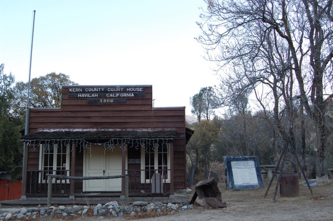
Havilah is an unincorporated town bordered to the east and west by the Sequoia National Forest. “Havilah” is a Biblical name meaning “that suffers pain” and is the land where “Saul smote the Amalekites.” It’s also mentioned in Genesis (γένεσις) as being rich in bdellium, gold, and onyx. Havilah was Kern County’s first county seat and served as such from 1866 until 1872, when it moved to Bakersfield.
INYOKERN
Inyokern is a CDP which in 2010 reported a population of 1,099. It was established first as railroad town along the Southern Pacific railroad Lone Pine Branch and known as Siding 16. With the establishment of a post office in 1913 it took a more traditional name, Magnolia. Unable to resist changing its name once again, it later became Inyokern, an ingenious combination of “Inyo” and “Kern.” It’s home to several steakhouses, burger joints, and the Indian Wells Brewing Company.
JOHANNESBURG
Johannesburg is a CDP in the Rand Mountains. From 1897 to 1933 it was a terminus of the Randsburg Railway. It was founded to support mining operation at Randsburg and named by miners who had previously worked in gold mines in South Africa. As of 2010 its population had shrunk to 172.
KEENE
The small village of Wells was established in the foothills of the Tehachapi Mountains. It’s name was later changed to Keene and in 2010 it reported a population of 431. Keene is home to the César E. Chávez National Monument, the headquarters of the United Farm Workers, and home to (and final resting place of) farm worker, labor leader, and civil rights activist César Chávez. It’s also home to the Keene Café.
KERNVILLE

The Gold Rush of 1858 led to the formation of a town first known as Rogersville. It was later renamed Williamsburg. After a saloon opened it became known as Whiskey Flat until 1864, when it was renamed Kernville.
In 1948, Kernville was moved to higher ground after construction began of the Isabella Dam. When the water level is low, the foundations of old Kernville are sometimes visible underneath the lake’s surface. The new Kernville has several lodges, cafés, diners, and is home to the Kern River Brewing Company. As of 2010 Kernville had a population of 1,395.
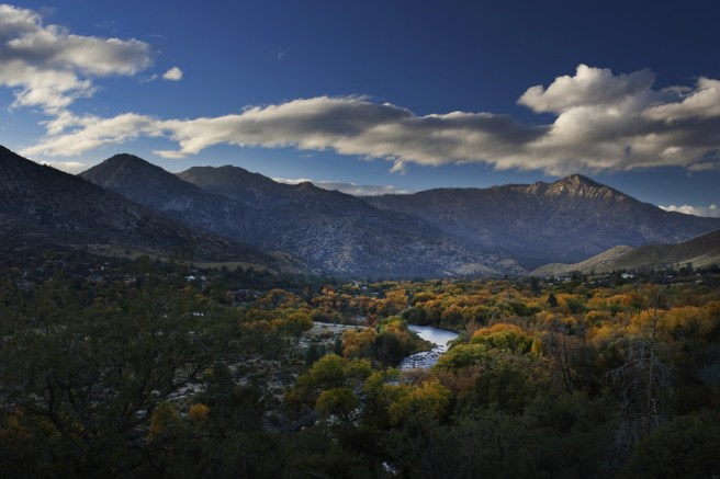
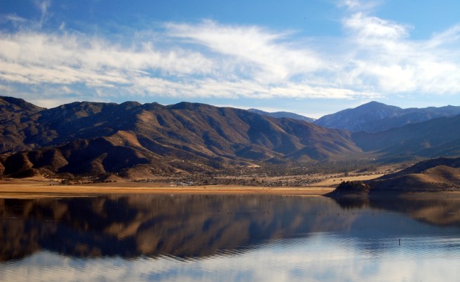
LAKE ISABELLA

Lake Isabella was founded simply as Isabella in 1893. It was named after Queen Isabella of Spain by the town’s founder, Steven Barton. The Lake was added in 1957, after the formation of the Lake Isabella reservoir which also necessitated the relocation of the town to higher ground. The area is popular with campers and kayakers. As of 2010 Lake Isabella had a population of 3,466.
LAKE OF THE WOODS
Lake of the Woods is a small village located in the Cuddy Canyon of the San Emigdio Mountains within Los Padres Forest. It was established in 1925 by Florence Cuddy. The reservoir after which it was named went dry in 1962, when the dam burst. As of 2010 the town had a population of 917.
LAMONT

Lamont is a town which in 2010 reported a population of 15,120. It was founded in 1923 and its population grew during the Great Depression. It’s home to several Mexican restaurants and hamburger joints.
LEBEC
Lebec is named in honor of Peter Lebecque, a French trapper killed by a California grizzly bear. An inscription carved into an oak tree read “PETER LEBECK / KILLED BY A X BEAR / OCTR 17 / 1837.” As of 2010, Lebec had a population of 1,468 people and 0 grizzly bears. Today Lebec is home to several motels and Mexican restaurants.
LORAINE
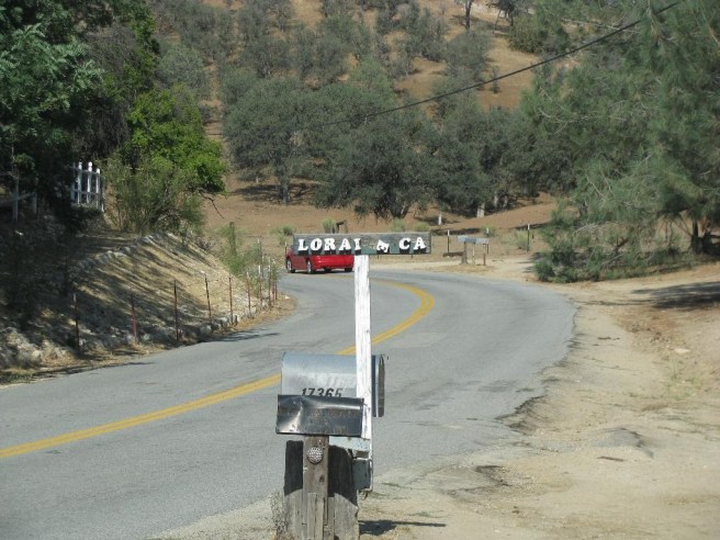
Loraine is a small village near the mouth of Indian Creek founded by miners from Alsace. It was previously named Paris, a post office bearing that name having opened in 1903. Its name was changed to Loraine in 1912. As of 2010 it had a population of 313.
LOST HILLS
Lost Hills (formerly, Lost Hill) is a small farm town which in 2010 reported a population of 2,412. An Interstate 5 rest stop is located less than 2 kilometers from the town and the area boasts many chain restaurants, gas stations, motels, and a popular taco truck, El Dollar Taqueria.
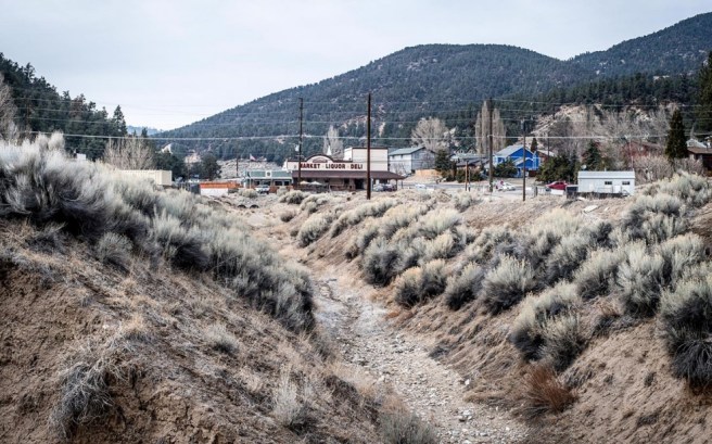
MARICOPA
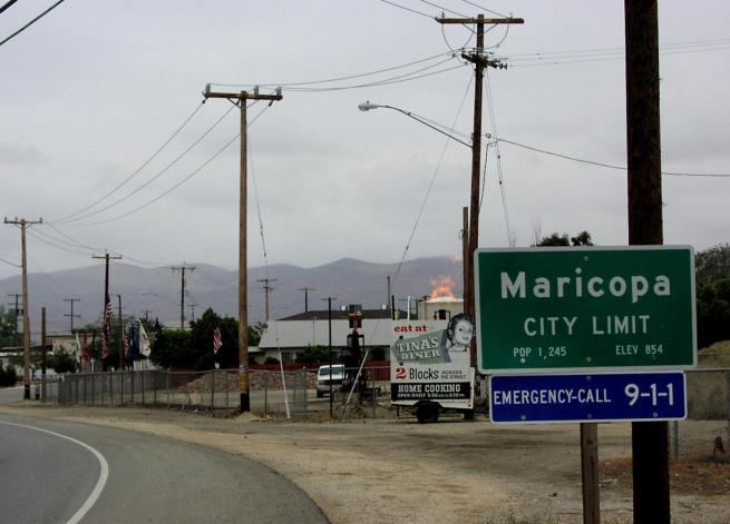
Maricopa is a small town located near the junction of Route 166 and Route 33, southeast of the Carrizo Plain. In 2010 it had a population of 1,154. To the northeast is the vast Midway-Sunset Oil Field.
MCFARLAND
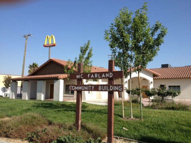
McFarland (formerly, Hunt and Lone Pine) is located within the San Joaquin Valley. As of 2015 it had a population of 14,037. It is named after its founder, J.B. McFarland. The first post office opened in 1908 and in incorporated in 1957. It was mentioned on an episode of MacGyver titled “Bitter Harvest.”
MCKITTRICK
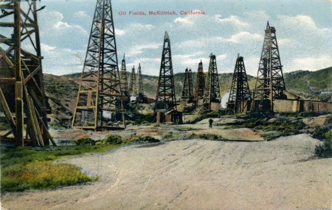
McKittrick is a CDP located near the McKittrick Tar Pits.The first post office opened in 1910 and the town, named after rancher Captain William McKittrick, incorporated in 1911.. In the town 2010 had a population of 115.
METTLER
Mettler is a CDP which in 2010 had a population of 136. The town was founded as Mettler Station in the 1940s by William H. Mettler and his two sons. On 30 September, 1955, James Dean was stopped by California Highway Patrol officer O.V. Hunter in Mettler Station for speeding less than two hours before the actor died in an automobile accident.
MEXICAN COLONY
Mexican Colony is a CDP which in 2010 had a population of 281. Approximately 81% of the population is Latino, mostly of Mexican origin.
MOJAVE
Mojave (formerly, Mohave) is a CDP located in the Antelope Valley at the southwestern edge of the Mojave Desert. As of 2010 the population was 4,238. Mojave began in 1875 as a construction camp along the Southern Pacific Railroad and was, from 1884 to 1889, the western terminus of the 266 kilometer twenty-mule team borax wagon route. It was later the headquarters for the construction of the Los Angeles Aqueduct. In 1935, the Mojave Airport was established to serve the local gold and silver mining industry.
MOUNTAIN MESA
Mountain Mesa is a CDP located along the south shore of Lake Isabella. As of 2010 it had a population of 777.
NORTH EDWARDS

North Edwards (formerly, Edgemont Acres and North Muroc) is a CDP named after the Edwards Air Force Base, of which it lies 12 kilometers northeast. As of 2010 it had a population of 1,058.
OIL CITY
Oil City is an unincorporated community located adjacent to the Kern River Oil Field.
OILDALE
Oildale is an unincorporated suburb of Bakersfield. As of 2010 it had a population of 32,684.
OLD WEST RANCH

Old West Ranch is a community near Tehachapi. Many of its residents live off-the-grid.
ONYX
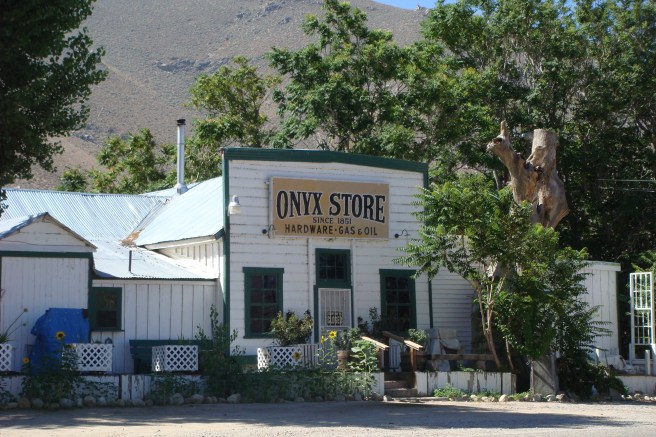
Onyx is a CDP which in 2010 had a population of 475. It was originally named Scodie, after William Scodie, who opened a store there in 1861. The Onyx Store opened even earlier, in 1851. The first post office opened in 1889. The ruins of Walker’s Pass Lodge are also in Onyx.
PINE MOUNTAIN CLUB
Pine Mountain Club is an unincorporated private community. It is one of the Mountain Communities of the Tejon Pass. As of 2010 it had a population of 2,315.
PUMPKIN CENTER
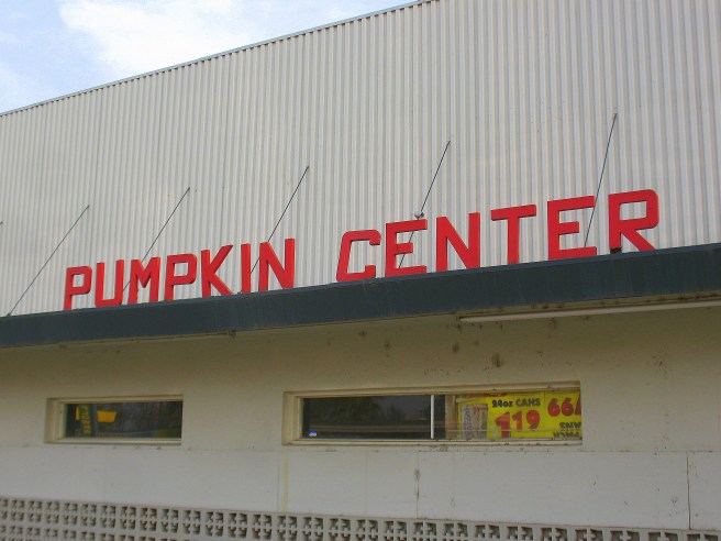
Pumpkin Center is unincorporated community. The first post office opened there in 1945. Despite its odd name it is one of three places in California to have been thus known. It’s celebrated in the David Allan Coe song, “Pumpkin Center Barn Dance.”
RANDSBURG
Randsburg is a CDP which in 2010 had a population of 77. It’s home to the ruins of Rand Mining District. It’s located in the Rand Mountains. It was founded as Rand Camp after gold was discovered in 1895. The first post office at Randsburg opened in 1896. South of Suez (1940) was filmed in there, as was the video for Dwight Yoakam‘s “Long White Cadillac.”
RIDGECREST
Ridgecrest is a city which in 2010 had a population of 27,616. Ridgecrest began in 1912 as a farming community called Crumville in 1912, named after local dairyemen James and Robert Crum. The first post office opened in 1941. It was incorporated as a city in 1963. It’s home to the The Maturango Museum, a museum devoted to the northern Mojave Desert’s history and culture.
ROSAMOND
Rosamond is a CDP located in the Antelope Valley. It was established as a stop on the Southern Pacific Railroad in 1877 and was named after a railroad official’s daughter.The Rosamond post office opened in 1885, closed in 1887, and re-opened in 1888. It was primarily a cattle town until gold was discovered in the 1890s. Today its known for being the home of the Exotic Feline Breeding Compound. As of 2010 it had a population of 18,150.
ROSEDALE
Rosedale is a CDP which in 2010 had a population of 14,058. Rosedale was founded in 1891 by English farmers. A post office opened in 1891… and closed in 1913.
SAND CANYON
Sand Canyon is an unincorporated community which somehow seems not to have even been included in the last census… or at least I can’t find any census data.
SHAFTER
Shafter is a city in which in 2010 had a population of 16,988. The town was founded as a Santa Fe Railroad loading dock, named after Spanish-American War veteran General William Rufus Shafter.The first post office opened in 1898. Shafter incorporated as a city in 1938. Historic attractions include Green Hotel (1913) and the Santa Fe Passenger and Freight Depot (1917), both listed on the National Register of Historic Places.
SMITH CORNER
Smith Corner is a CDP which in 2010 had a population of 524.
SOUTH TAFT
South Taft is a CDP which in 2010 had a population of 1,898.
SQUIRREL MOUNTAIN VALLEY
Squirrel Mountain Valley is a CDP in the southern Sierra Nevadas. As of 2010 it had a population of 547.
STALLION SPRINGS
Stallion Springs is a CDP in the Tehachapi Mountains. In 2010 it had a population of 2,488.
TAFT

Taft is a city in the foothills at the southwestern edge of the San Joaquin Valley. As of 2010 it had a population of 9,327. Taft began as Siding Number Two along the Sunset Railroad. In 1900 an attempt to designate it Moro was declined due to its similarity to Morro Bay. Instead, it was named Moron. After a fire burned most of Moron down it was renamed Taft after William Howard Taft. It’s home to the West Kern Oil Museum and the historic Works Progress Administration building, The Fort.
TAFT HEIGHTS
Taft Heights is a CDP which in 2010 had a population of 1,949. It was founded as Boust City, named in honor of oilman E.J. Boust.
TEHACHAPI
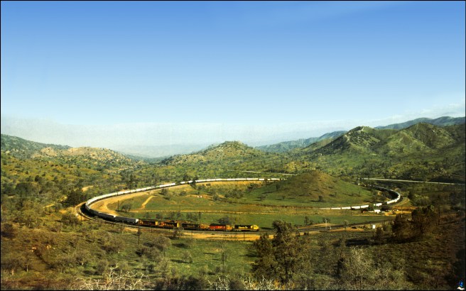
Tehachapi is a city which as of 2010 had a population of 14,414. Though small, Tehachapi is home to several attractions, including its Old Town, built in the 1860s. Homes of note include the Errea House, built between 1870 and 1875, and Donald B. Parkinson’s stone, Colonial Revival Courtlandt Gross House, built in 1942. The Tehachapi Depot Railroad Museum is located in a replica of the historic Tehachapi Depot, which burned down in 2008. The Tehachapi Loop is a 1.17 kilometer long spiral Union Pacific Railroad line through Tehachapi Pass of the Tehachapi Mountains.
TUPMAN
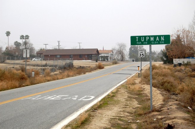
Tupman is a CDP which in 2010 had a reported population of 161. The town was founded in 1920 by the Standard Oil Company on land purchased from H.V. Tupman. The first post office opened in 1921.
TWIN PINES
Twin Pines is an historic mining town.
VALLEY ACRES
Valley Acres is a CDP which in 2010 had a population of 2010. It was founded in 1937.
WASCO
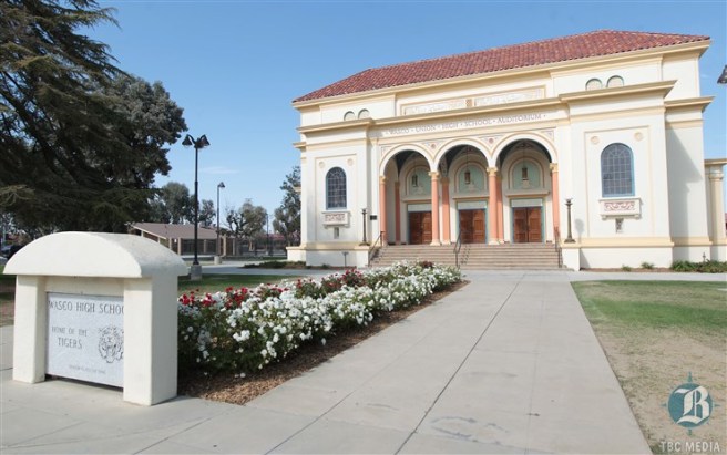
Wasco is a city which in 2010 had a population of 25,545. It was previously known as both Dewey and Deweyville, named after Admiral George Dewey, a veteran of the Spanish-American War. The first post office opened in 1899, the year before its name was changed to Wasco. Wasco is the site of the Fourth Home Extension Colony, founded in 1907, and teh The Wasco Union High School Auditorium is on the National Register of Historic Places.
WEEDPATCH
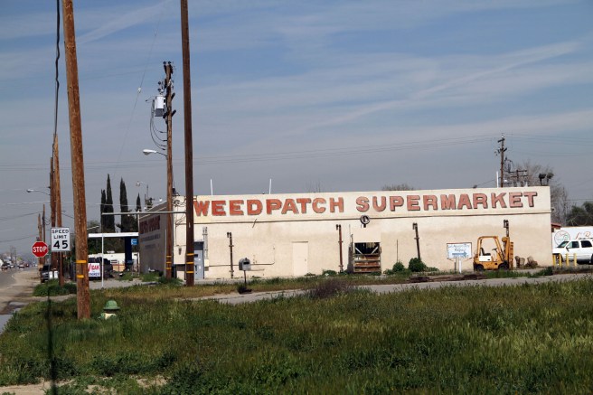
Weedpatch is an unincorporated community which as of 2010 had a population of 2,658. The area was known as Weed Patch as early as 1874 although the town wasn’t founded until 1922. It was also known as Alexander’s Corner, in honor of a local named Cal Alexander. Just south of town is Weedpatch is the site of the Arvin Federal Government Camp, known colloquially and in the novel The Grapes of Wrath as Weedpatch Camp.
WELDON
Weldon is a CDP located at the southeastern edge of Lake Isabella. As of 2010 it had a population of 2,642. The first post office opened in 1871. It’s named in honor of rancher William B. Weldon.
WILLOW SPRINGS
Willow Springs is an old mining town. The post office opened in 1909 and closed in 1918. The titular springs were utilized first by Native Americans and later but travelers along freight and stagecoach lines. Most of the buildings, now in ruins, were constructed by Ezra Hamilton around 1900 and the site is now registered as California Historical Landmark #103.
WOFFORD HEIGHTS

Wofford Heights is a CDP located on the western shore of Lake Isabella in the southern Sierra Nevadas which in 2010 had a population of 2,200. It was founded as a resort in 1948 by I.L. Wofford. The first post office opened in 1953.
Hopefully, these brief descriptions have piqued your interest in some of the communities of Kern County. Let me know which, if any, in the comments.

Eric Brightwell is an adventurer, essayist, rambler, explorer, cartographer, and guerrilla gardener who is always seeking paid writing, speaking, traveling, and art opportunities. He is not interested in generating advertorials, cranking out clickbait, or laboring away in a listicle mill “for exposure.”
Brightwell has written for Angels Walk LA, Amoeblog, Boom: A Journal of California, diaCRITICS, Hidden Los Angeles, and KCET Departures. His art has been featured by the American Institute of Architects, the Architecture & Design Museum, the Craft Contemporary, Form Follows Function, Los Angeles County Store, the book Sidewalking, Skid Row Housing Trust, and 1650 Gallery. Brightwell has been featured as subject in The Los Angeles Times, Huffington Post, Los Angeles Magazine, LAist, CurbedLA, Eastsider LA, Boing Boing, Los Angeles, I’m Yours, and on Notebook on Cities and Culture. He has been a guest speaker on KCRW‘s Which Way, LA?, at Emerson College, and the University of Southern California.
Brightwell is currently writing a book about Los Angeles and you can follow him on Ameba, Duolingo, Facebook, Goodreads, Instagram, Mubi, and Twitter.


One correction. The photo you have for Taft is in reality Boust City in 1911. For a brief time Boust City was called The City of Taft but when the investors didn’t pay its name reverted to Boust City. Boust City came to an end by about 1916 or 1917. Then in 1919 it became Taft Heights.
LikeLiked by 1 person
Thanks for catching that! I’ll update when I have a minute.
LikeLike
Do you have any idea of the origin or etymology of the unincorporated area called, “Cherokee Strip?” I noticed that there is a thin strip of houses that runs along the east side of CA SR 43, just below the Red Wagon Café. Any ideas about how that area arrived at it’s name?
LikeLiked by 1 person
Tom Roe and his wife (Mrs. Tom Roe) moved from Shafter to Bakersfield and purchased land in early Septemeber 1939. They subdivided it into lots and mostly rented to Okies. By December 1940, it was known as “Cherokee Strip.” The original Cherokee Strip was created in Oklahoma in 1835, in what was then Indian Territory. There was also a western film called “Cherokee Strip” that was released in October 1940 so it may’ve been on the Roes’ minds when they (or whomever) first came up with the name.
LikeLike