STRAIGHT BILLIN’ THROUGH THE EASTSIDE
In Los Angeles, usage of the term “Eastside” varies depending on the speaker. To most
Angelenos — especially
Latinos —
“The Eastside“ refers to a group of neighborhoods immediately east of the Los Angeles River:
Boyle Heights, Brooklyn Heights, City Terrace, East Los Angeles, El Sereno, Happy Valley, Hillside Village, Lincoln Heights, Rose Hills
, and
University Hills.
THE (HISTORICALLY) BLACK EASTSIDE
The other Eastside is in South LA. This Eastside was historically the main area that LA’s black residents were required to live until the middle of the 20th century. It should be noted that when people speak of this region — though they’re implicitly referring to the East Side of South Los Angeles — that reference to this area as “the Eastside” likely pre-dates the modern version of communties east of the river. Check out The Eastsiders, a documentary about South LA’s Eastside between 1920 and 1965.
South Los Angleles ‘s Eastside is neighbored by South Los Angeles’s Westside to the west; The Mideast Side, Downtown and the Eastside to the north; Southeast Los Angeles to the east and The Harbor to the south. In South Los Angeles, the dividing line between Eastside and Westside was traditionally Main Street, which is still the dividing line between east and west street addresses. After the construction of the 110, which runs parallel a few blocks west of Main, this more dramatic physical distinction became the dividing line between east and west.
THE GATEWAY CITIES
For much of the early part of the Los Angeles history, The Eastside (along with Southeast Los Angeles and The Harbor) were lumped together as “The Gateway Cities.” The region was a huge industrial region dominated by the Ports of Long Beach and Los Angeles in the southern end and many of the neighborhoods were built to house those involved in the warehouses and factories that popped up between the harbor and downtown.
LOS ANGELES UNDER SEGREGATION
 Gray areas showing black majority areas of Los Angeles in 1940
South LA’s Eastside was home to two of the oldest black neighborhoods,
South Central in the north and
Watts in the south. Under racially restrictive covenants, blacks were allowed to own property only within the area hemmed in by
Main, Slauson, Alameda and
Washington, in Watts and a few other smaller areas like
Oakwood in
Venice.
SOUTH CENTRAL UNDER SEGREGATION
In the 1940s, South Central gave rise to the
West Coast‘s main jazz center. Numerous jazz and blues clubs and other black cultural institutions gave rise to people referring to it and neighboring
Bronzeville to the north as
“The Harlem of the West.” Every year to this day, during the last weekend in
July,
The Central Avenue Jazz Festival is still held in South Central.
WATTS UNDER SEGREGATION
Five miles south, around the same time, Watts became predominantly black, largely as a result of the
Second Great Migration from the South during the same decade. Thousands of people came — largely from from
Louisiana, Mississippi, Arkansas and
Texas — to work in war-related industries. The large
Nickerson Gardens, Jordan Downs and
Imperial Courts housing projects were all built largely to house the newly arrived, working class immigrants as well as returning war veterans.
SHELLEY v. KRAMER
As a result of 1948’s Shelley v. Kraemer, the Supreme Court banned the enforcement of racist restrictive covenants. As a result, in Los Angeles, the black population of and surrounding both areas began to pour out of their overcrowded confines. Resentful racist white gangs like The Spook Hunters formed to terrorize blacks with the hope of keeping them out of Compton, Lynwood, Huntington Park and Downey.
 Gray areas showing black majority areas of Los Angeles in 1960
South Central was already home to several street gangs, including
The Magnificents,
The Purple Hearts, 31st Street and
28th Street, who were engaged primarily in turf battles, pimping, theft and small time robbery. However, to counter the violence of the Spook Hunters, new black protectionist gangs like
The Devil Hunters, The Slausons, The Businessmen, The Farmers and
The Gladiators formed and combat their racist rivals. By 1960 the Spook Hunters were defeated and the black populations of South Central and Watts overflowed and met in the middle before began spreading into till-then-white Compton far to the south (as well as
Midtown).
WATTS RIOTS & THE RISE OF GANGS
In 1965, tensions, many racial, exploded into the Watts Riots. As a result, many of South Los Angeles’ white residents moved away, most often to either Artesia, Bellfower, Norwalk or Paramount. In 1969, The Cripsformed (as the Baby Cribs) in South Los Angeles’ Eastside. Though initially inspired by black empowerment organizations like the Black Panthers and US, they quickly devolved into a violent street gang that mostly prayed on innocent black residents.In 1972, a group of gangs including the Pirus, Lueders Park Hustlers, LA Brims, the Denver Lanes andthe Bishops met and joined forces as The Bloods to counter the Crips’ power. Gang violence escalated in the 1970s but reached a new level of violence when crack hit the streets in 1983. Violence explodedt and as a result, many long-established black families began to move to areas they perceived as more desirable.
GANGSTA RAP AND THE CRACK WARS
Compton, which had till-then recently dominated South LA’s music scene with a vibrant homegrown
electro soon became known for
gangsta rap in the 1980s, involving some of the same players (e.g.
Arabian Princeand
Dr. Dre). South LA’s eastside produced
Compton’s Most Wanted, 2nd II None, DJ Quik and
NWA. Together they painted a nightmare vision of South Los Angeles as a Crack War battleground contested by well-armed and sociopathic Bloods and Crips.
BLACK FLIGHT & THE RISE OF LATINOS
Meanwhile, as much of the better off black population continued to move away, poor, newly arrived immigrants from
Mexico and
El Salvador began to fill the newly created void. By then, the South Central neighborhood was predominantly Latino although people were then accustomed to employing the name “South Central” as a racially-loaded catch-all for any black neighborhood south of the
10. Today, this mental colonialism is still evinced in the words of self-appointed hood experts who don’t even live in South Central yet nonetheless claim it, denying their own neighborhood’s equally unique and interesting histories in the process.
By the time of the Los Angeles Riots of 1992, which began in South LA’s Westside, the Eastside was mostly dominated by LA’s Latino majority, with only Compton and Watts still having predominantly black populations. After the riots of 1992, another wave of black families moved to more stable neighborhoods and today even Compton and Watts are mostly Latino cities.
THE EASTSIDE TODAY
Today South Los Angeles is one of LA’s least ethnically and racially diverse regions but I still think it’s an interesting place. Except for West Compton, every neighborhood is dominated by the Latino majority (primarily of Mexican and Salvadoran origin) of 76% overall. The minorities are 20% are black, 2.8% arewhite and .7% are Asian.Physically the region is a large, flat alluvial plane. The architecture, for the most part, is rather low-profile — dominated by bungalows and lowrise apartment buildings. From the elevated sections of the Metro Blue Line one can see for miles a skyline that is only occasionally punctuated by structures like the Watts Towers and the taller, but less iconic, Mount ZionTowers, the Compton Courthouse, and near the edge of Downtown: the LA Mart, Bob Hope Patriotic Hall, and 155 West Washington Boulevard.
and now onto the neighborhoods:
*****
BROADWAY SQUARE
First up, its position determined by the alphabet, is
Broadway Square. Broadway Square was established by the the Eighth District Empowerment Congress’s Naming Neighborhoods Project in 2008 but at least as many people know it by the more boring street-combo name, “
Broadway-Manchester.” It is unrecognized by the
Los Angeles Times, Wikipedia, Nabewise and
Wikimapia. The bedroom community is home to several fast food chains and the population is 59% Latino (mostly Mexican and Salvadoran), and 39% black.
CENTRAL-ALAMEDA
Central-Alameda is a largely industrial area south of Downtown. It was famously home of the The South Central Farm (South Central Community Garden), which was in operation between 1994 and 2006. It’s still home to the historic, Moorish Revival-style Lincoln Theatre, the Richard Neutra and Paul Revere Williams-designed Pueblo del Rio projects from 1941, and the oasis-like Augustus F. Hawkins Natural Park.
CENTURY COVE
Century Cove is another neighborhood established by the the Eighth District Empowerment Congress’s Naming Neighborhoods Project in 2008. The Watts-adjacent neighborhood’s residents are roughly 54% Latino (mostly Mexican and Salvadoran) and 44% Black. Presumably, the “Century” of the name refers to Century Boulevard.
CENTURY PALMS
The last of the three neighborhoods established by the the Eighth District Empowerment Congress’s Naming Neighborhoods Project is Century Palms. Though mostly residential, there are a large number of auto shops, churches and small markets. The population is roughly 59% Latino (mostly Mexican and Salvadoran) and 39% black.
COMPTON
Compton is an infamous city that is practically synonymous around the world with the South Los Angeles region of which it is part. Due largely to the mythologizing
NWA and their gangsta rap followers, Compton has also become a byword for urban squalor and gang violence even though (not to make anyone feel old) nearly a quarter of a century has passed since the release of
Straight Outta Compton. Naturally the city has changed a great deal in the time that saw
Ice Cube go from rapping about rape and murder to starring in
children’s movies. To read more about Compton,
click here.
EAST COMPTON
East Compton, also known as East Rancho Dominguez, is an unincorporated community surrounded by the city of Compton. In fact, Compton, which has in the past tried to annex East Compton but business and property owners in the area have successfully opposed their efforts. Today the population is 73% Latino (mostly Mexican and Salvadoran), 23% black.
FLORENCE
OK, rather confusingly (and not that atypical in a region where neighborhoods are so often nebulously) there are seemingly two adjacent neighborhoods which together form Florence. The Los Angeles one is a rather industrial area that’s home to many Mexican restaurants, metal works, furniture factories, mini-markets. The population is 70% Latino (mostly Mexican and Salvadoran) and 28% black.Florence is famous for its Crip history. Raymond Washington founded the gang (as the Baby Avenues) at Fremont High. When he was two years old, his family moved into their home near Wadsworth and E 76th Street. Florence is also where Washington was murdered in 1979, in front of an apartment building at6326 S. San Pedro St.
FLORENCE-FIRESTONE
The other half of Florence is an unincorporated community in Los Angeles County. Along with Graham to the south, the two are sometimes referred to as Florence-Firestone, after the intersection.
THE FURNITURE AND DECORATIVE ARTS DISTRICT
Signs for The Furniture & Decorative Arts District seem to include the entire neighborhoods of South Central, South Park, Florence, and Central-Alameda. I got my couch there at a place off Slauson so I can personally vouch for furniture being made there. There’s also a huge chair, pictured above.
GRAHAM
To the south of unincorporated Florence, sometimes lumped together as Florence-Firestone or Florence-Graham is the titular Graham. It’s also sometimes referred to as Firestone Park for a tiny park in its northeast. Larger parks include Colonel Leo H Washington Park and Will Rogers Memorial Park.
GREEN MEADOWS
Although the Los Angeles Times once published an article, “Asphalt Jungle or Green Meadows” which gently mocked the 8th District Empowerment Congress’s Neighborhood Naming Project, from what I’ve read, it seems Green Meadows is a pre-existing moniker that possibly dates back to the area’s pastoral past. Today it’s full of meat-dominated restaurants and baptist churches. The population is 54% Latino (mostly Mexican and Salvadoran) and 44% black. Despite it’s bucolic name, Green Meadows is the second most violent neighborhood in the Eastside after Watts.
HUNTINGTON PARK
Eastside’s Huntington Park was incorporated in 1906 as a streetcar suburb for workers in the rapidly expanding industries to the southeast of downtown Los Angeles. To this day, about 30% of its residents work at factories in nearby Vernon and Commerce. After the decline of American manufacturing in the area, many of the residents moved elsewhere too. The vacuum was filled almost entirely by two groups of Latinos: upwardly mobile families eager to leave the barrios of East Los Angeles, and recent Mexican and Salvadoran immigrants. Today the population is 95% Latino (mostly Mexican and Salvadoran) and 3% white.
LYNWOOD
Though all of South Los Angeles has a reputation for crime,
Lynwood is the second safest community in the region after sparsely-populated
West Compton. Incorporated in 1921, the city is named for
Mrs. Lynn Wood Sessions, wife of a local dairyman,
Charles Sessions. It’s the birthplace of actor/director
Kevin Costner as well as
“Weird Al” Yankovic, who released an album titled
Straight Outta Lynwood. The population is 82% Latino (mostly Mexican and Salvadoran), 13% black and 3% white. It’s home to the picturesque
Plaza Mexico, a celebrated cultural and shopping center.

In the 1930s and especially the ’40s,
South Central Avenue was the center of
West Coast Jazz. At the time, even superstars like
Duke Ellington who played around Los Angeles still had to stay in South Central. Although the most famous, the Dunbar, was located in South Park, there were numerous other jazz and blues clubs on South Central. After the restrictive housing codes were abolished, this
Harlem of the West dissipated as the population dispersed, jazz declined in popularity, and the neighborhood fell into disrepair.Nowadays South Central is 87% Latino (mostly Mexican and Salvadoran), 10% black, 1% white and 1% Asian. It’s one of the more urbanized areas of the Eastside and, depending on where one draws the dividing line between Downtown and South Central (e.g. the
10 Freeway or
W Washington Boulevard), its home to most of the iconic buildings in the region including
Allied Architects Association‘s
Bob Hope Patriotic Hall, the 13-story
LA Mart, and the 14-story
Art Deco 1
55 West Washington Boulevard building, built in 1927. To read more about it,
click here.

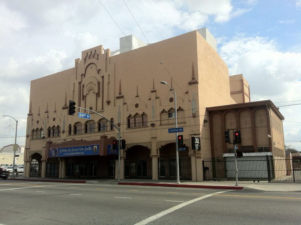
South Park is a neighborhood that lies directly south of South Central and is centered around a park of the same name. Before 1948 it was as far south as blacks were allowed to live (aside from Watts) with Slauson forming its southern border. Around 1952, the neighborhood saw the formation of The Slausons, a black gang which organized to protect blacks from attacks by racist whites hoping to keep them from moving south of Slauson. Most of the black population eventually moved elsewhere and today South Park is 79% Latino (mostly Mexican and Salvadoran), 19% black and 1% white.South Park is also fairly devoted to small-scale industries such as machine shops, auto shops, upholsterers, medical suppliers, etc, much like the Furniture and Decorative Arts District to the east. Notably, it is home to the tallest structure in the region, the 12-story Mount Zion Towers, built in 1971. It’s also home to the stunning, Rudolph Schindler-designed Bethlehem Baptist Church. It’s most famous building, however, is the famed Dunbar Hotel.
VERON
 The Villa Basque (image source: jericl)
Vernon has the smallest population of any incorporated city in California (although that might soon change). It’s motto is “Exclusively Industrial” (take that City of Industry!). The motto isn’t entirely true, Vernon has, after all, some 112 residents. It became industrial around 1919, when two slaughterhouses opened. Eventually it was home to 27 such on a blood-soaked strip of Vernon between Soto and Downey. Vernon is also home to La Villa Basque, a restaurant and beautiful relic of the 1960s (historically, aesthetically and culinarily) that has been used in Mad Men. Iniside it has an amazing Googie coffee shop, a martini lounge and a large dining room. Unfortunately, misguided efforts have been underway to “improve” it with disastrous consequences: loud, horrible music; a cheesy new name (Vivere) — courtesy owner and disgraced former Vernon mayor, Leonis Malberg.

In 1907, Watts was incorporated a its own city, named after Watts Station, then a major stop for the Pacific Electric Railway‘s Red Car line between Los Angeles and Long Beach. Most of the residents were white and Mexican traqueros who worked on the line.Watts became mostly black in the 1940s, when southern blacks settled there in search of industrial jobs. In 1965, it was the epicenter of the Watts Riots which saw part of the city burnt to the ground and nicknamed“Charcoal Alley.” It was plagued by gangs like the Watts Cirkle City Piru Bloods, Grape Street Watts Crips, Bounty Hunter Watts Bloods and PJ Watts Crips during the 1970s and ’80s which contributed to black flight. Today Watts is 62% Latino (mostly Mexican and Salvadoran) and 37% black. Although there have been attempts to turn around the neighborhood’s decline, it still suffers from the highest crime rate in the region.
It’s famously home to the Watts Towers, built by Italian immigrant construction worker Sabato Rodiabetween 1921 and 1954, probably one of LA’s five most recognized landmarks. Rodia himself named the structure “Nuestro Pueblo.” To read more about Watts, click here.
WEST COMPTON
West Compton is an unincorporated community west of Compton. Today, probably in part due to the negative popular associations with the Compton name, many refer to it as West Rancho Dominguez (a reference to Rancho Dominguez… a community which, unlike Compton, it does not lie directly west of). At the time of writing it’s the only remaining black majority neighborhood in South LA’s Eastside. The population is roughly 58% black, 36% Latino (mostly Mexican and Salvadoran), 2% Asian and 2% white. It also has the lowest crime rate.
WILLOWBROOK

Willowbrook‘s name comes from the willow-lined shallow brooks and springs that covered the area up through the 19th century. It was still largely rural until the 1980s. Today it is mostly developed although less than most of the region. The population is 53% Latino (mostly Mexican and Salvadoran), 44% black and 1% white. Willowbrook is locally notorious as the home of the troubled Martin Luther King Jr Harbor Hospital. It’s also home to the well-known Charles R. Drew University of Medicine and Science.
If you’d like to see any communities on South Los Angeles’s Eastside explored for a future edition of California Fool’s Gold, please let me know which ones in the comments. Thanks!

Eric Brightwell is an adventurer, essayist, rambler, explorer, cartographer, and guerrilla gardener who is always seeking paid writing, speaking, traveling, and art opportunities. He is not interested in generating advertorials, cranking out clickbait, or laboring away in a listicle mill “for exposure.”


76 thoughts on “California Fool’s Gold — A South Los Angeles Eastside Primer”