

San Bernardino County, along with Riverside County, comprise the Southern California region known as the Inland Empire. Before 1914 (the earliest recorded use of the term “Inland Empire”) the region was known as “The Orange Empire.” Both San Bernardino and Riverside counties are inland — the nearest point in San Bernardino County to the sea is about 43 kilometers — but today their empire-like character is less obvious than it was in the days when they were important citrus producers.

With orange production a thing of the past, what makes it the Inland Empire empire-like isn’t immediately obvious. It is a large area — San Bernardino is the largest country in the entire US, larger, in fact than nine entire states (and 71 sovereign countries). The Inland Empire also has a fairly large population, about 4.2 million people, but in my mind, dwarfed as it is by Los Angeles County (the most populous county in the US by a landslide), the Inland Empire feels less like its own empire than a dominion or protectorate of the adjacent Los Angeles Empire. Its proximity and mysteries are among the reasons that I, as an Angeleno, would like to further explore it and since I already wrote a Riverside Country Primer, here’s one for San Fernando which I hope will encourage readers to vote for the communities which they’d like me to explore.
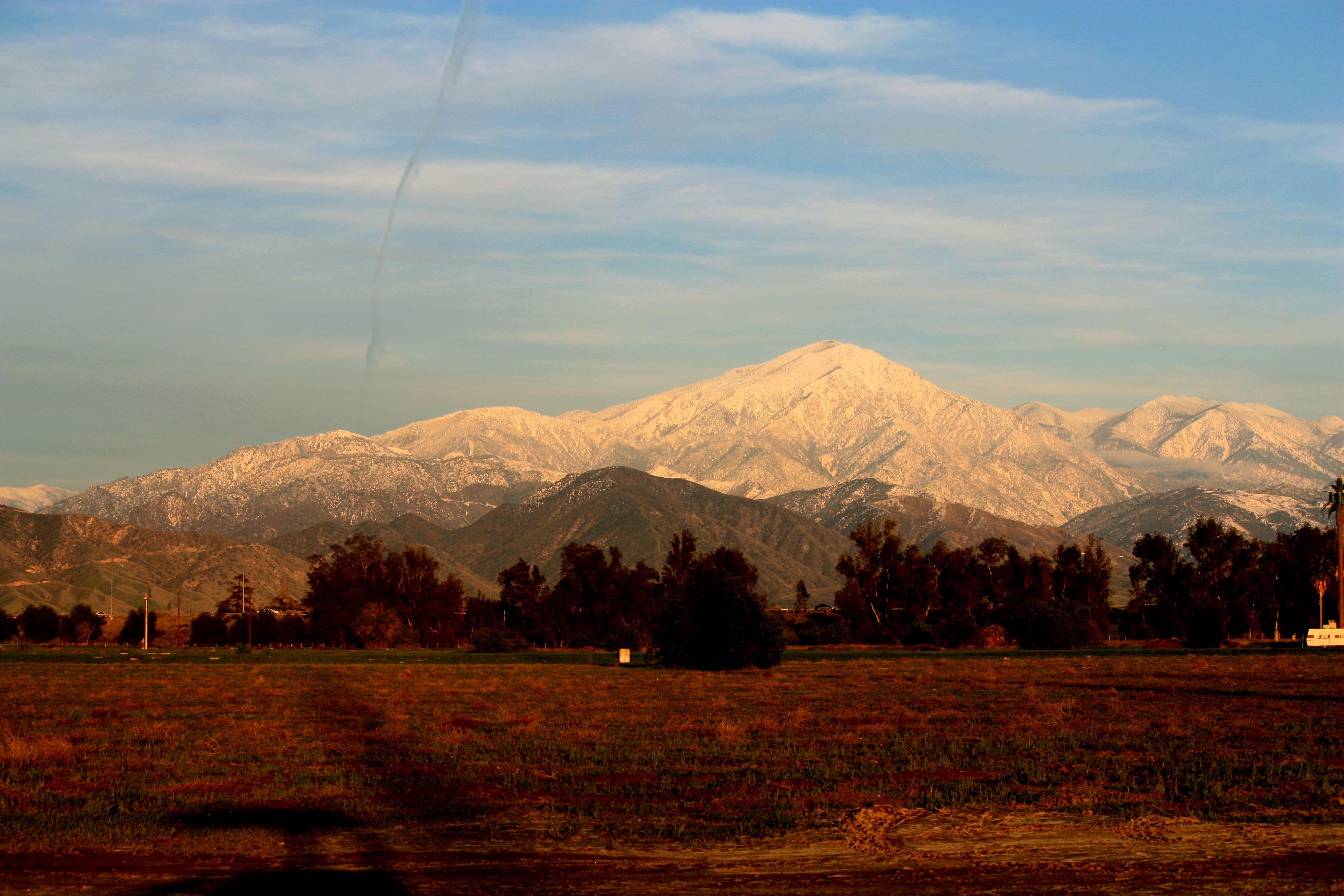
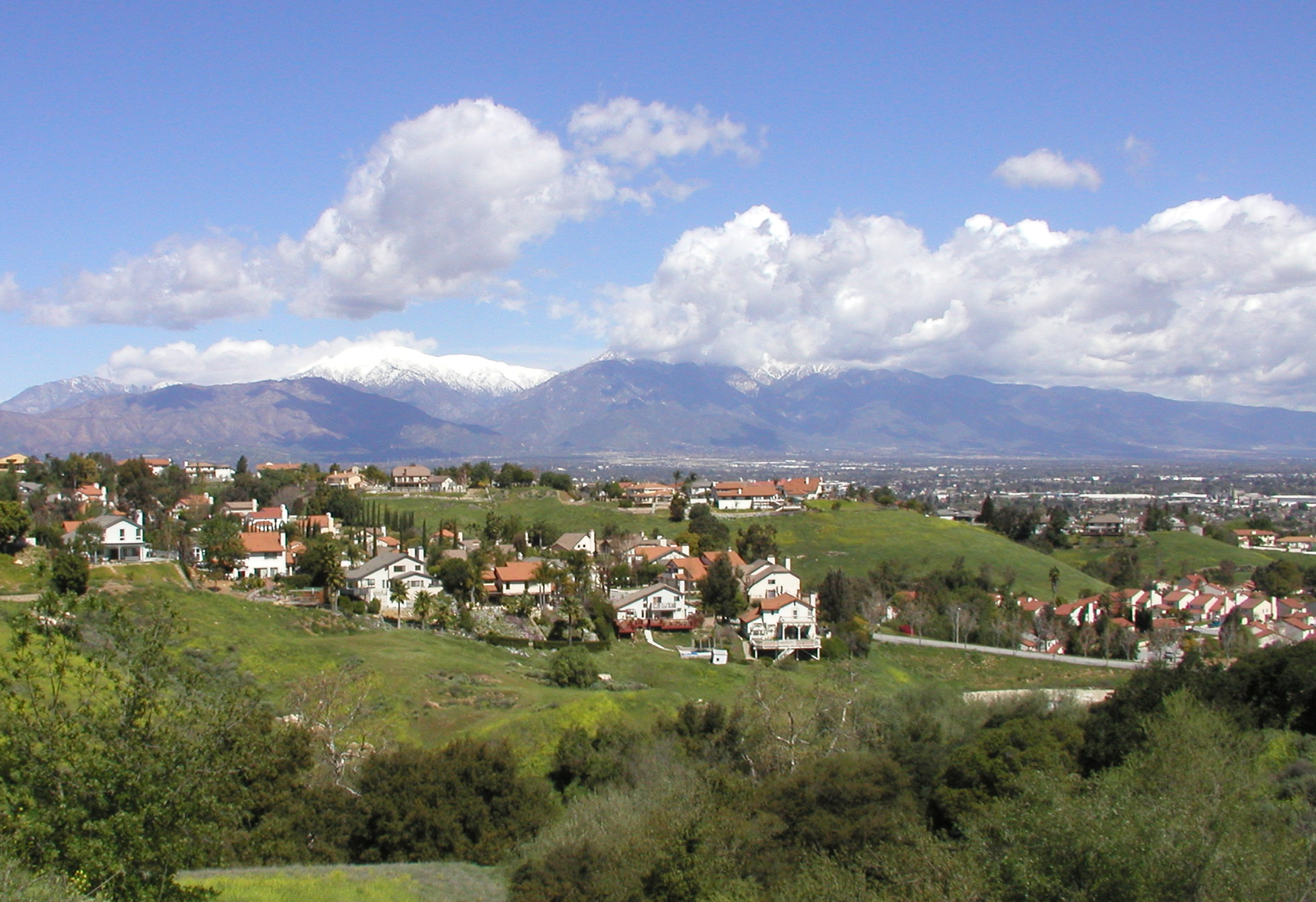
Naturally spacious San Bernardino County includes some pretty large attractions, including all of Mojave National Preserve; parts of Angeles National Forest, Death Valley National Park, Havasu National Wildlife Refuge, Joshua Tree National Park, and San Bernardino National Forest; and 35 National Wilderness Preservation System-designated wilderness areas (more than any other county in the US).

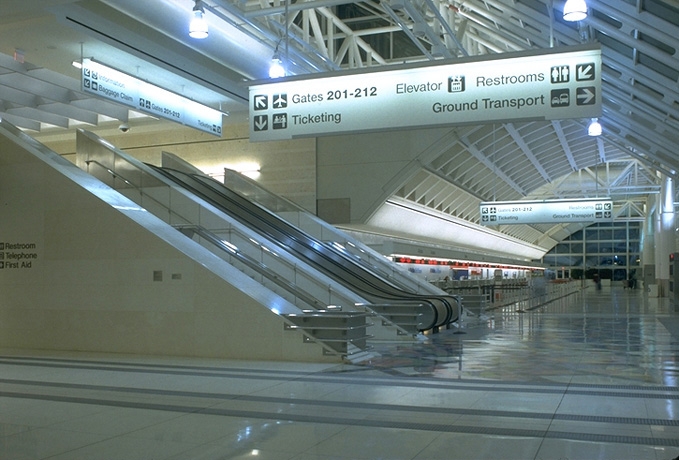
It’s hardly a busy international airport but Ontario International Airport is the county’s major hub of air travel. San Bernardino International Airport is, despite its name, currently operating as a general aviation and cargo airport but is being remodeled to serve as an international airport. Other general aviation airports include Apple Valley Airport, Baker Airport, Barstow-Daggett Airport, Big Bear City Airport, Cable Airport, Chino Airport, Hesperia Airport, Needles Airport, Redlands Municipal Airport, and Twentynine Palms Airport.

San Bernardino is also served by rail. Metrolink‘s Inland Empire-Orange County and San Bernardino lines serve several stations as do Amtrak‘s Southwest Chief and Sunset Limited lines. Future transit plans include a Metro Gold Line extension from the current terminus in Azusa to Ontario and further down the line, California High Speed Rail.
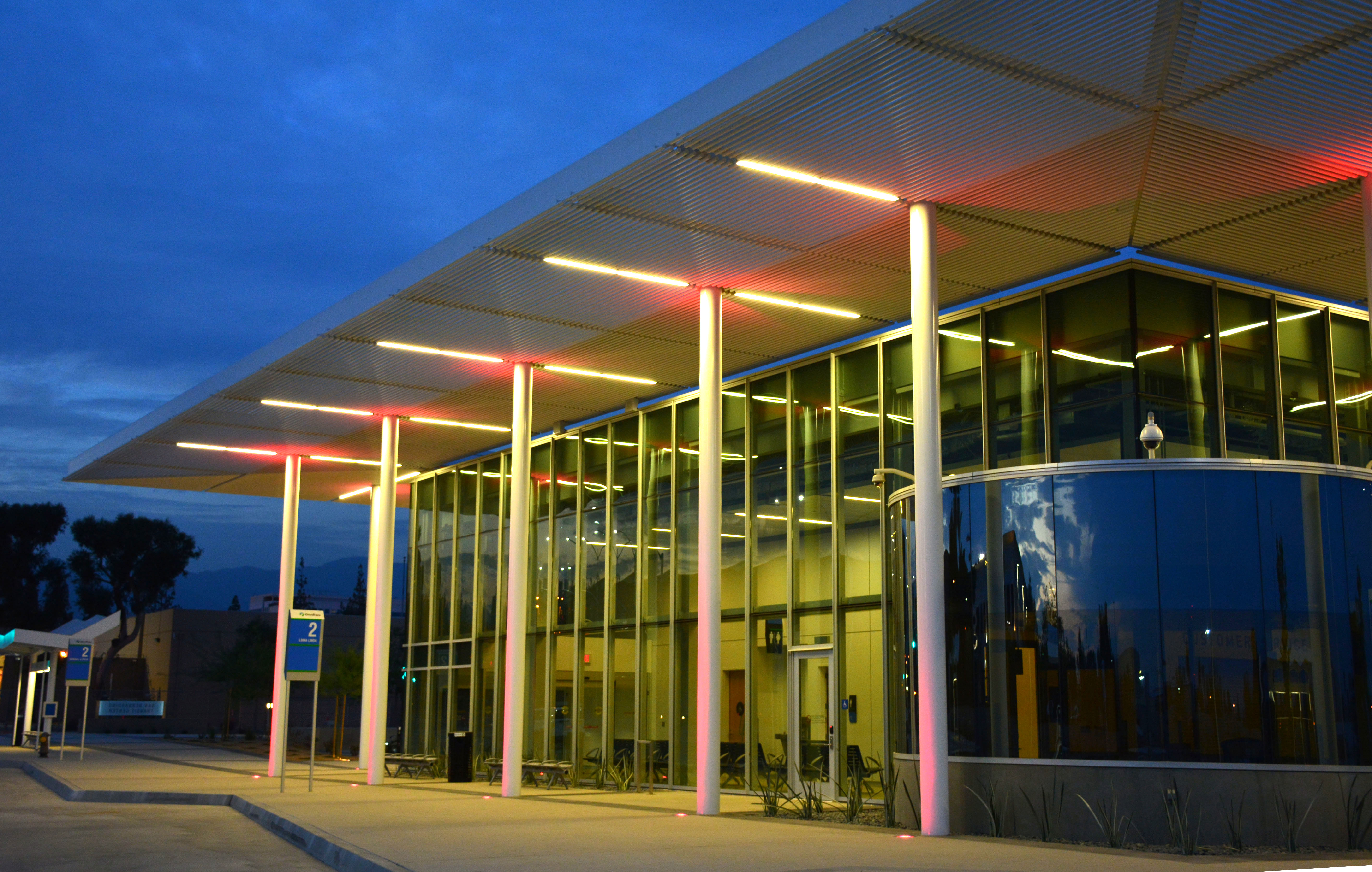
Regional bus providers include Omnitrans and San Bernardino Express bus lines as well as Barstow Area Transit, Morongo Basin Transit Authority, Foothill Transit, Twentynine Palms Limited, Mountain Area Regional Transit Authority, Needles Area Transit, Orange County Transit Authority, Riverside Transit Authority, Victor Valley Transit Authority, and Greyhound.
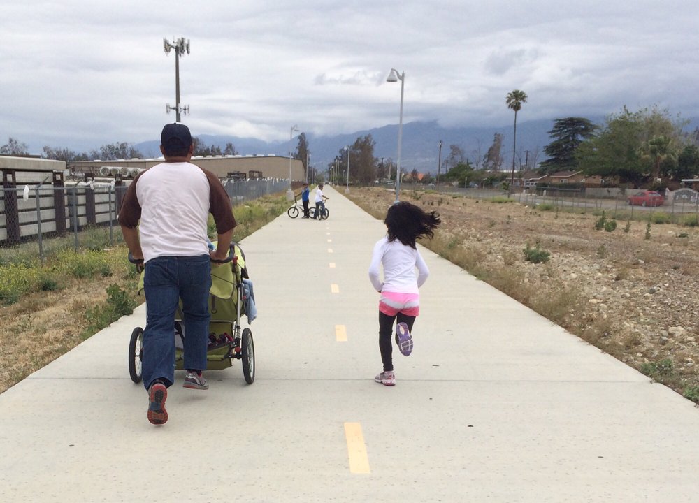
Cyclists and pedestrians can utilize the Santa Ana River Bicycle Path, which when complete will stretch 135 kilometers from Redlands to Huntington Beach. There’s also the 34-kilometer long Pacific Electric Inland Empire Trail connecting Rialto to Claremont (as well as the Santa Ana River Bicycle Path).

Cultural institutions of San Bernardino County include the Inland Empire Harmony Carousel Chorus, the Redlands Symphony, the San Bernardino Symphony, Theatrical Arts International, and the Victor Valley Symphony.
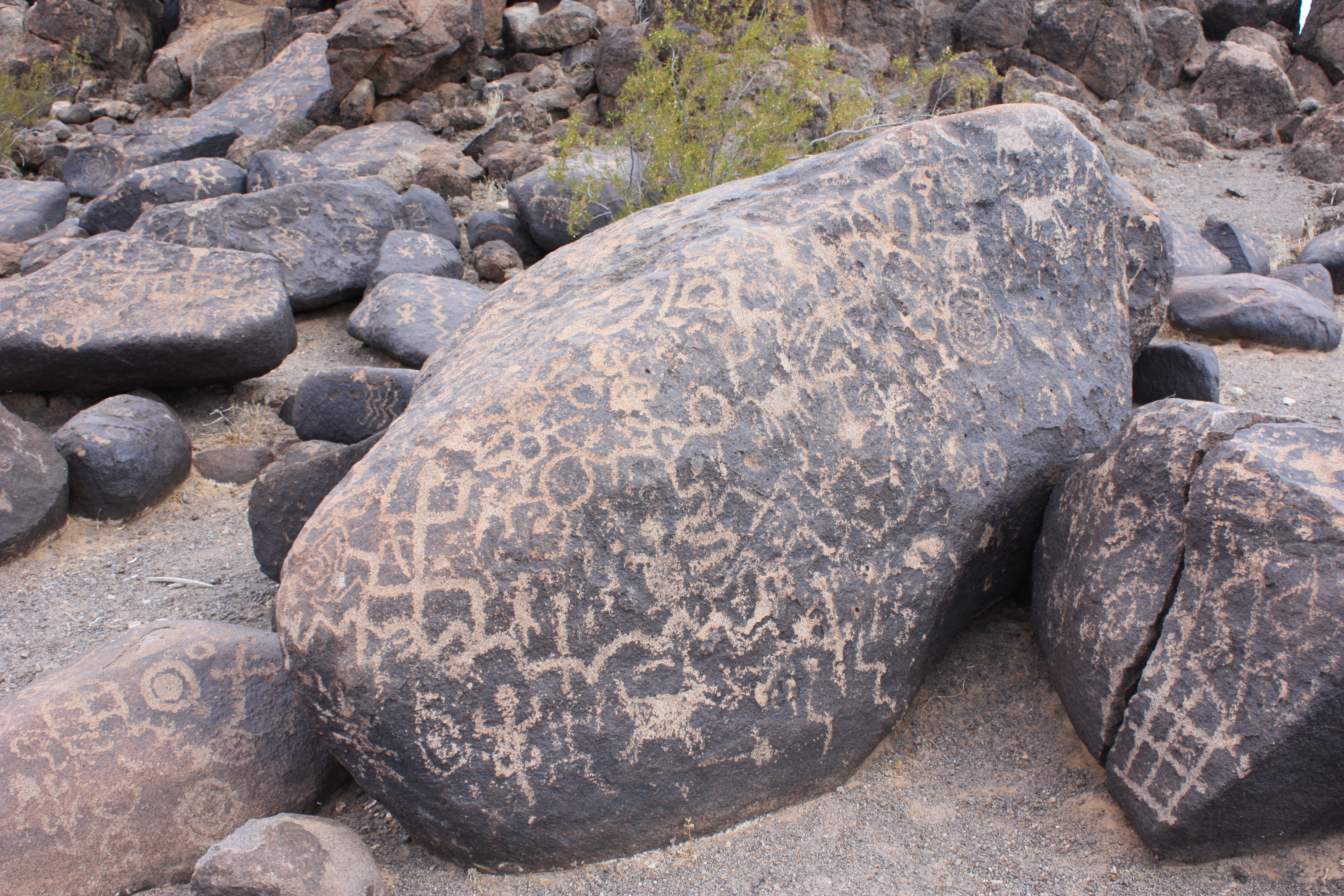
Before the Spanish Conquest, the Inland Empire was home to several Native American nations including the Chemehuevi, Iviatim, Kuupangaxwichem, Maarenga’yam, Payómkawichum, Paiute, Taaqtam, Vanyume, and Yuhaviatam. There are many Native American sites of archaeological note in San Bernardino County although the precise locations of many are restricted in order to protect them (mostly petroglyphs and pictographs) from vandals.
Sites open to visitors include Aiken’s Wash (near Baker); the Rodman Mountains Petroglyph Archaeological District (near Barstow); the Black Mountain Rock Art District (near Hinkley), Newberry Cave Site (near Newberry Springs); Calico Early Man Site (near Yermo); and Foxtrot Petroglyph Site (in Twentynine Palms).
Restricted sites include Archeological Site CA-SBR-140 (near Baker); Bitter Spring Archaeological Site 4-SBr-2659 and Fossil Canyon Petroglyph Site Archeological Site (near Barstow); Archeological Site No. D-4, Piute Pass Archeological District, and Topock Maze Archeological Site (near Needles); Archeological Sites CA-SBr-1008A, CA-SBr-1008AB, and CA-SBr-1008C (near Johannesburg); Archeological Site No. E-21 (near Parker); Squaw Spring Archeological District (near Red Mountain), and Archaeological Site CA SBR 3186 (near Helendale).

In 1810, Spanish from Mission San Gabriel Arcángel established a church at the village of Politania (or Apolitana). Father Francisco Dumetz named the church San Bernardino on 20 May after the feast day of St. Bernardino of Siena. In 1819, the Franciscans established the San Bernardino de Sena Estancia farm in what’s now Redlands.
Mexico achieved independence in 1821 and the mission lands were secularized and granted to Mexican citizens. Rancho Jurupa was established in 1838, Rancho Cucamonga and El Rincon in 1839, Rancho Santa Ana del Chino in 1841, Rancho San Bernardino in 1842, and Rancho Muscupiabe in 1844. The first Mexican pueblo established was Agua Mansa, settled by immigrants from New Mexico on land donated in 1841.
California was conquered by the Americans as a result of the Mexican-American War. California became a state in 1848 and the town of San Bernardino was founded by Mormons in 1851. San Bernardino County was formed in 1853 from Los Angeles County. A portion of the new county became part of Riverside County in 1893.
As of the 2010 census, San Bernardino County was home to 2,035,210. The population self-identified as roughly 31% non-Latino white, 9% black, 7% Asian, 5% mixed-race, and 1% Native American. 49% of the population are Latino of any race.
What follows is a brief introduction to the communities of San Bernardino County to pique your interest. Let me know in the comments which San Bernardino County communities you’d like me to explore for a future edition of California Fool’s Gold. Thanks!
ADELANTO
Adelanto (Spanish for “progress”) is located in the High Desert and as of 2010 had a population of 18,130. It was founded in 1915 by E. H. Richardson, inventor of the electric iron. Richardson sold his patent and used the profit to purchase land which subdivided. A post office opened in 1917 and a library followed in 1921, operating out of the office of a fruit company. It incorporated as a city in 1970 and the city’s police department was disbanded in 2001 due to massive corruption.
AMBOY
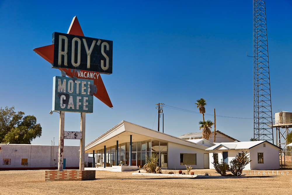
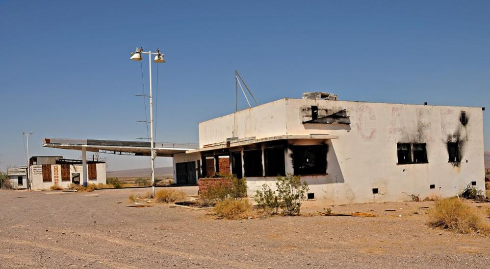
Amboy was once a major stop along Route 66 but went in to decline when Interstate 40 opened in 1973. As of 2014, it had a population of four. Amboy is still home to the iconic Roy’s Motel and Café, which opened in 1938. Nearby is the Amboy Crater and Lava Field, an extinct cinder cone volcano that rises above a 70 square kilometer lava field.
ANGELUS OAKS
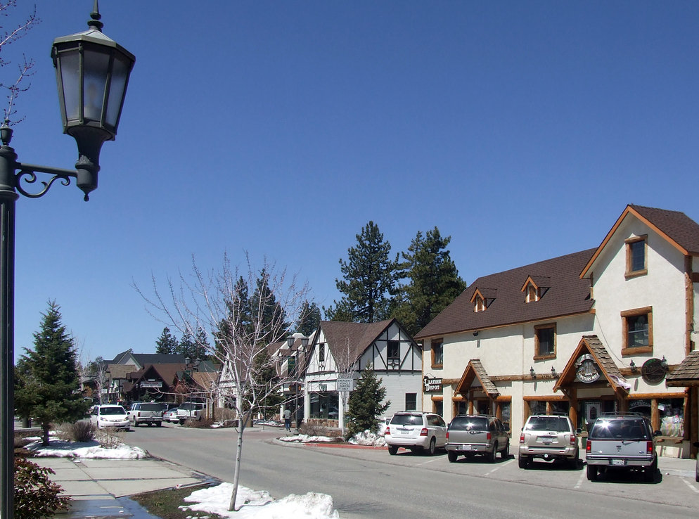
Angelus Oaks is an unincorporated community in the San Bernardino National Forest which, as of 2010, had a population of 190. In the 1970s, the nearby Seven Oaks post office closed and the Camp Angelus post office was renamed Angelus Oaks. Despite its size, it retains a general store, a gas station, a restaurant, a post office, a real estate office, a sheriff’s office, and two commercial lodges.
APPLE VALLEY
Apple Valley is a town located at the southern edge of the Mojave Desert in the Victor Valley. As of 2010, it reported a population of 69,135. The town was formerly home to Roy Rogers and Dale Evans, who established a museum there in 1967 (which moved, naturally, to Branson, Missouri but closed in 2009). State Route 18, which passes through it, is known as the “Happy Trails Highway.”
BAKER
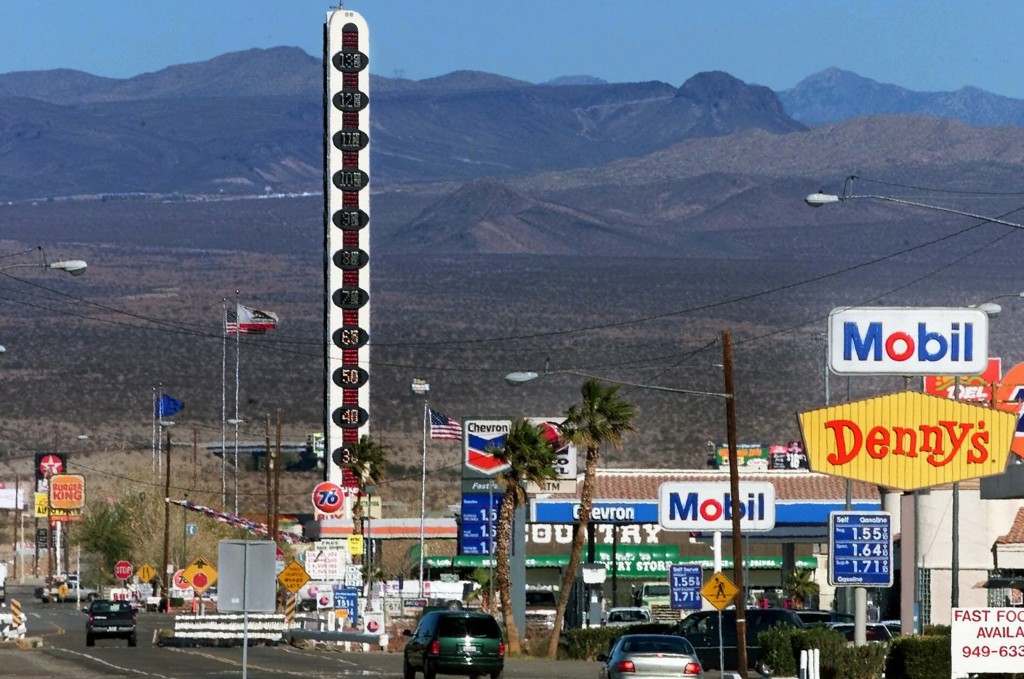
Baker is famously home of the world’s tallest thermometer (although technically it’s an electric sign displaying the temperature and not a thermometer). As of 2010, the census-designated place (CDP) reported a population of 735. It was founded in 1908 as a stop on the Tonopah and Tidewater Railroad and was named after Richard C. Baker, president of the T&T.
BALDWIN LAKE
Baldwin Lake is a CDP located in the San Bernardino Mountains on the shore of a shallow, intermittent, alkali lake of the same name. It is surrounded by the 63-hectare Baldwin Lake Ecological Reserve.
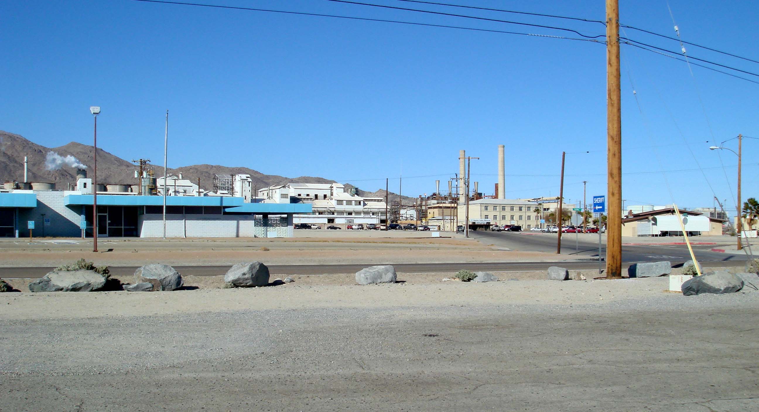
BARSTOW
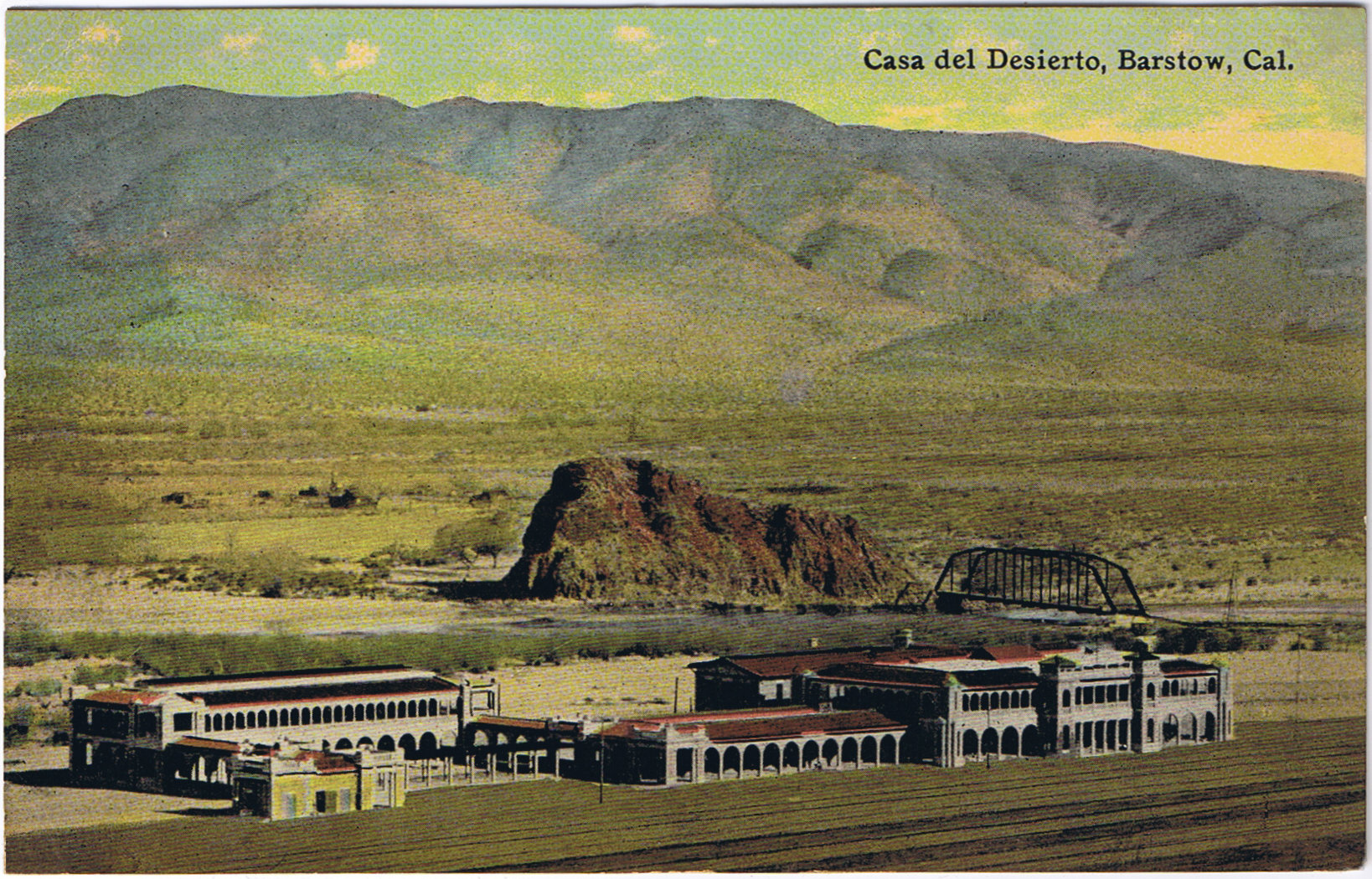
Barstow is home to a Harvey House Railroad Depot, a train station built in 1911 and currently a train station housing Barstow city offices and two museums (the Route 66 Mother Road Museum and the Western America Railroad Museum). In 2010 the population was 22,639. The town is named after William Barstow Strong, a president of the Atchison, Topeka and Santa Fe Railway. A series of murals created by Main Street Murals depict the town’s history. The largest meteorite found in California, the Old Woman meteorite, is housed in the Desert Discovery Center.
BIG BEAR CITY
Big Bear City, despite its name, is an unincorporated town and not a city. Also despite its name, hunters drove the titular California Grizzly Bears into extinction in the first decade of the 20th century. The town is located on Big Bear Lake‘s eastern shore, east of the city of Big Bear Lake. As of 2010, it had a population of 12,304.
BIG BEAR LAKE
Big Bear Lake is a resort town located on a large reservoir of the same name. As of 2010, it had a population of 5,019. Bear Valley Dam is considered an attraction, as is Old Bear Valley Dam — entirely submerged but usually visible through the water. The town is home to the Big Bear Discovery Center as well as the Planetarium, Projector, and Science Museum.
BIG RIVER
Big River is a CDP which in 2010 had a population of 1,327. The titular big river is the colorado river, which forms the town’s southeastern border. It is home to Big River Inn, Big River Market, Big River RV Park, Dock Restaurant, and Mediterranean Skewers.
BLOOMINGTON
Bloomington is CDP which in 2010 had a population of 23,851. Bloomington was originally developed as “Crestmore” in 1888 by the Semi-Tropic Land and Water Company. Today it’s home to Baker’s Drive Thru, Cenaduria La Gorda, China Express, Hong Kong Express, El Mesquite Restaurant, Farmer Boys, Goyo’s Tacos, J&A Bakery & Donuts, Juan Pollo, MGM Burgers, Mikel’s Donuts & Subs, Porky’s Pizza, and Tacos El Primo.
BLUEWATER
Bluewater is a CDP which in 2010 had a population of 172. The blue water refers to the Colorado River. Facing Bluewater, California, across the Colorado’s brown water, is Bluewater, Arizona.
CADIZ
Cadiz is an unincorporated community in just south of the Marble Mountains. The town was named in 1883 by Lewis Kingman, a locating engineer for the Atlantic and Pacific Railroad, and once boasted a railroad stop. A new stop will be constructed if the tourist train between Cadiz and Parker is completed as planned.
CEDAR GLEN
Cedar Glen is an unincorporated community which in 2000 had a population of 552. It’s home to the Cedar Glen Inn, Cedar Glen Malt Shop, and Jensen’s Foods.
CHINO

Chino was where I stayed when I first moved to California. On the television series The OC, the main character (Ryan Atwood) was a Chino tough who was adopted into the wealthy Cohen family in Newport Beach. The Chino Airport is home to Yanks Air Museum. Other Chino attractions include the historic Yorba and Slaughter Families Adobe (1853) and Moyse-Gray Building (1887).
CHINO HILLS
Chino Hills is a city which in 2010 had a population of 74,799. It borders Los Angeles, Orange, and Riverside counties. The hills after which it’s named include Chino Hills State Park and the town proper is where I ate for the first time at an El Pollo Loco (I ordered a BRC and a smokey black bean burrito).
COLTON
As of 2010, the city of Colton had a population of 52,154. It was founded in 1875 and incorporated in 1887. Colton is home to the Agua Mansa Pioneer Cemetery, the ruins of Camp Cady (established in 1860), and has a Carnegie Library.
CRAFTON
Crafton is an unincorporated community. It’s named after Myron H. Crafts, who established a small orange grove there in 1870. In 1882 he established the Crafton Land and Water Company and constructed the Crafton Reservoir.
CRESTLINE
Crestline is a CDP which in 2010 had a population of 10,770. Crestline is home to the Mozumdar Temple and Pillars of Christ, Heart Rock Falls, and Lake Gregory Regional Park. Local eateries and bars include Chef Cindy’s Cafe, Bear Claw Saloon, La Casita, Lake Gregory Coffee House, Pazzo’s Italian & Pizza, Roadhouse Pizza, Stockade, and Toni’s Kitchen Mexican Food.
DAGGETT

Daggett is an unincorporated community which as of 2000 had a population of 200.It was decided to name the city after then Lieutenant Governor of California, John Daggett, during the Spring of 1883. It’s home to the Daggett Pioneer Cemetery and Desert Springs Bar-N-Grill.
DECLEZVILLE
Declezville is an unincorporated community. It’s home to El Colima Mexican Grill, Nogales Burgers No 2, and My Little Video Store.
DEVORE (DEVORE HEIGHTS)
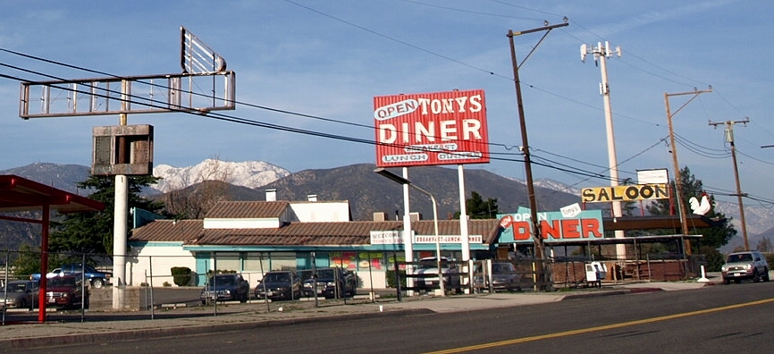
Devore (or Devore Heights) situated near the San Bernardino National Forest. It’s home to the largest amphitheater in North America, the San Manuel Amphitheater. It’s also home to Papa Tony’s Diner and Screaming Chicken Saloon.
EARP
Earp is an unincorporated community in the Sonoran Desert. It was founded as Drennan in 1910 and renamed Earp in 1929, after lawman Wyatt Earp, who had lived and mined in the area. Earp died at his Los Angeles residence but a fake grave stands in Earp.
FAWNSKIN
Fawnskin is an unincorporated community on the north shore of Big Bear Lake. Its post office was established in 1918. Before “Fawnskin” was settled on as a name, the community was at various times referred to as Bald Eagle Valley, Big Bear Village, Cline-Miller, Grout, and Oso Grande. Fawnskin was formerly a hub of activity, attracting various artists from the Los Angeles Area and served with a stagecoach stop, hotels, and restaurants. In 1924, the Woodland Theater at Fawnskin was founded by composer Fannie Charles Dillon. The town was featured in the 1958 film, Giant from the Unknown as well as the television episodes “Murder by the Book” (Columbo) and “The Case of the Violent Village” (Perry Mason).
Today, notable landmarks include the Pedersen Saw Mill, Big Bear Discovery Center, Old Miller School House Park, Dana Point Park, Don Conroy Memorial Park, the Lighthouse Camp and Landing, and the Hanna Flats and YMCA Camp Whittle. Popular events include a Doo Dah Parade and the Loggers’ Jubilee.
FONTANA
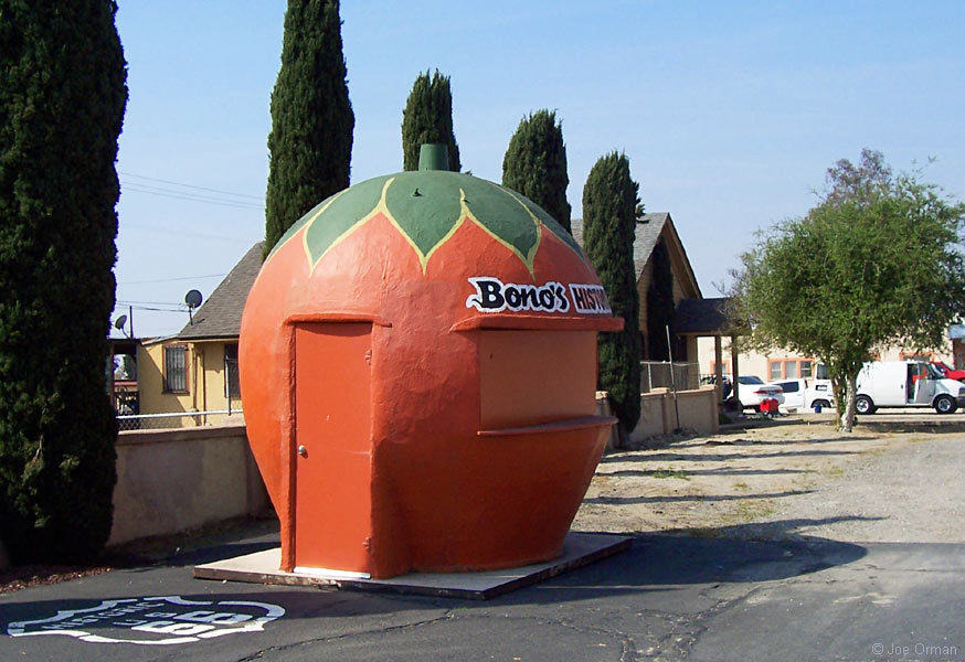
Fontana is the third-largest city in the Inland Empire and the second largest in San Bernardino County. Located on the grounds of the Mary Vagle Nature Center is the Fontana Pit and Groove Petroglyph Site. It’s also the home of the historic Fontana Farms Company Ranch House (built in 1906 and aka Pepper Street House). Fontana is home to a programmatic, two-meter tall Big Orange fruit stand (built in 1936) and an adjacent Streamline Moderne building (1943) that was previously home to Bono’s Restaurant and Deli, since relocated. The first time I visited Fontana I told my friend from Chino that the area reminded me of Kentucky, and it was then that he informed me of its nickname, Fontucky.
FOREST FALLS
Forest Falls is an unincorporated community located on the southern edge of the San Gorgonio Wilderness Area. As of 2010, it had a population of 1,102. It is also known for the waterfalls on Vivian and Falls creeks. It is less well known for — but nonetheless is home of — El Mexicano I and Elkhorn General Store.
FORT IRWIN

Fort Irwin is a CDP which as of 2010 had a population of 8,845. It is centered around the Fort Irwin National Training Center but is also home to the Goldstone Deep Space Communications Complex, part of NASA‘s Deep Space Network, Chopstick, Samuel Adam’s Grille, Shockwave, Strike Zone Bowling.
GOFFS
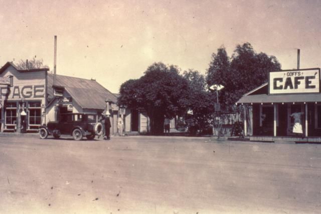
Goffs is an unincorporated community. Practically a ghost town today, it was once a railroad town and, until 1931, a stop along Route 66. From 1893 until 1902 it was known as Blake, after Isaac Blake, builder of the Nevada Southern Railway. It’s home to an abandoned general store (the town’s largest structure) and an historic schoolhouse built in 1914 which now houses a museum devoted to the area’s mining history.
GRAND TERRACE
Grand Terrace is a city which in 2010 had a population of 12,040. It’s located in a valley between Blue Mountain to the east and La Loma Hills to the west. It was incorporated in 1978. Earlier names include “East Riverside,” “South Colton,” and “Grand Terrace.”
HELENDALE
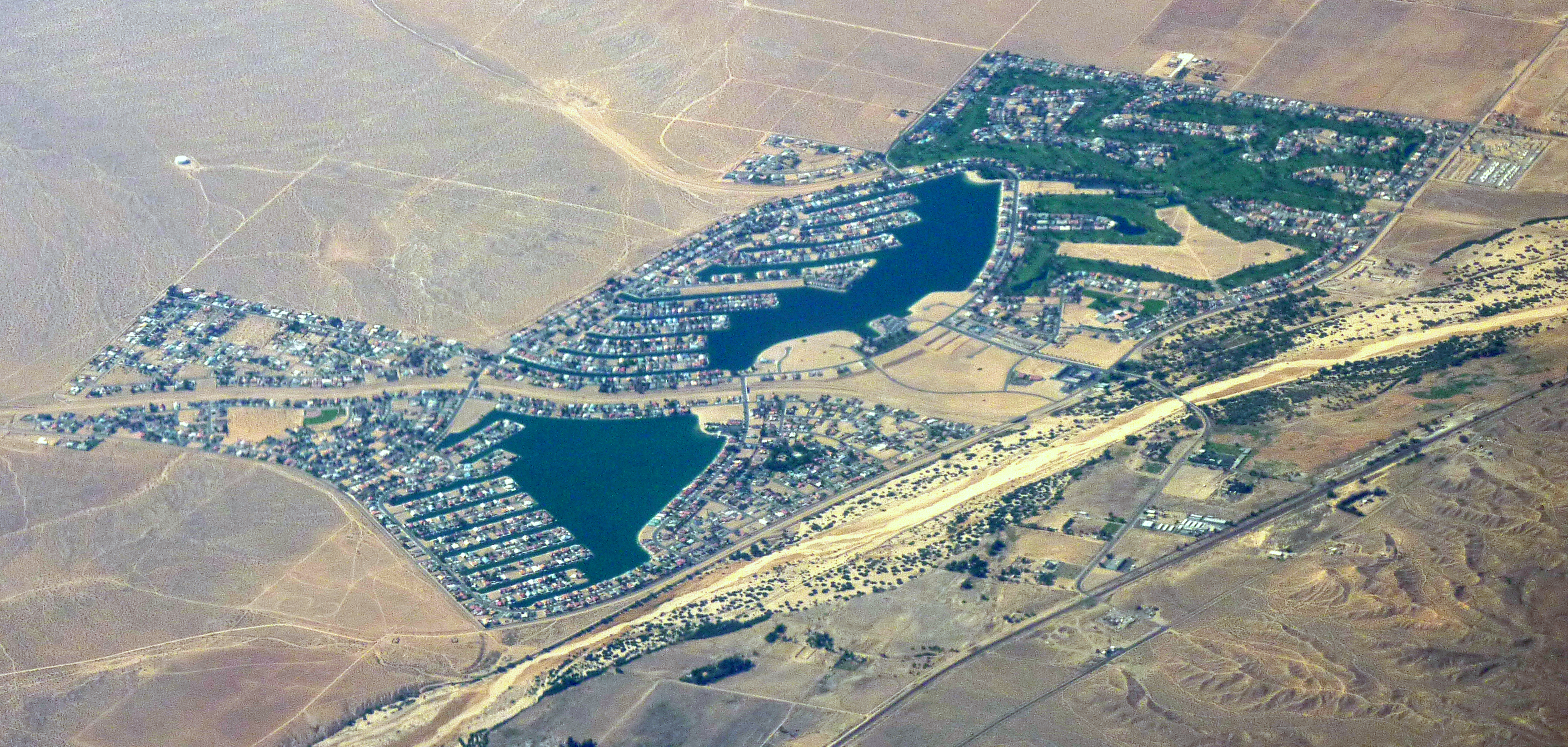
Helendale is a CDP located along historic Route 66 in the Victor Valley. The 2010 census reported that Helendale had a population of 5,623. The town was originally known as Point of Rocks but was renamed “Helen” after Helen A. Wells, daughter of railroad executive Arthur G. Wells. In 1918 the name was changed to Helendale. In 1969 construction began of two artificial lakes and the resort community of Silver Lakes opened in Helendale in the early 1970s and nowadays, Silver Lakes is sometimes used instead of Helendale to refer to the unincorporated community.
HESPERIA

Hesperia is a city in the Mojave Desert which as of 2010 had a population of 90,173. For a city of its size, Hesperia has surprisingly few attractions other than restaurants.
HIGHLAND
Highland is a city which in 2010 had a population of 53,104. It is twin cities with, Lachin, a town internationally controlled by the mostly unrecognized Nagorno-Karabakh Republic (who renamed it renamed it Berdzo). It is home to the 1900s-era Highland Historic District.
HINKLEY
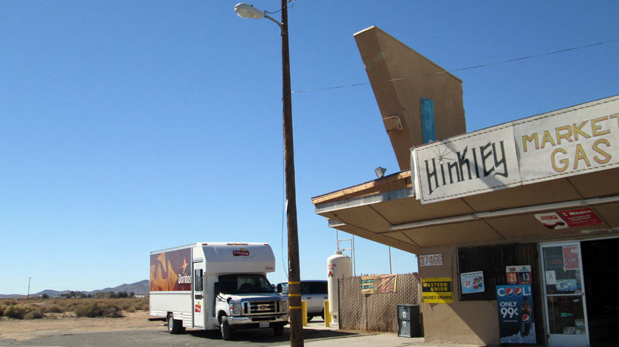
Hinkley is an unincorporated community in the Mojave Desert which in 2000 had a population of 1,915. Its claim to fame is for having the largest plume of cancer-causing chromium-6 in the world — which contaminated its water and was the inspiration of the film, Erin Brockovich. The only school in Hinkley closed in June 2013 and today there’s apparently almost no business or civic activity.
HODGE
Hodge is an unincorporated community located along historic Route 66. It was named after ranch owners Gilbert and Robert Hodge.
HOMESTEAD VALLEY
Homestead Valley is a CDP which in 2010 had a population of 3,032.
JOHNSON VALLEY
Johnson Valley is an unincorporated community located in the High Desert with a population of approximately 2,200.
JOSHUA TREE
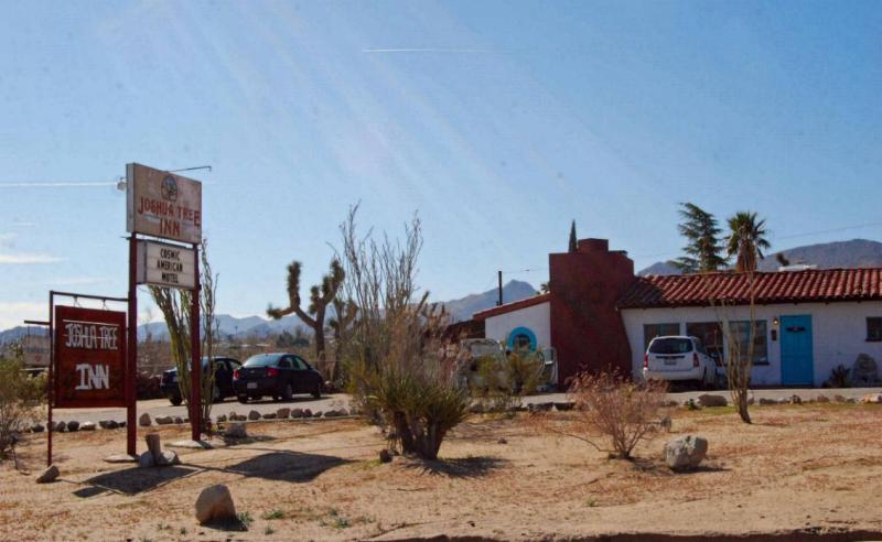
Joshua Tree is a CDP in the High Desert which in 2010 reported a population of 7,414. It’s home to several odd attractions, including the Krblin Jihn Kabin, Hicksville Trailer Palace, and the Noah Purifoy Outdoor Desert Art Museum. For country-rock fans, Room 8 of the Joshua Tree Inn is famously where Gram Parsons overdosed and died 19 September 19, 1973. Less famously, but worth noting, Room 11 is the Donovan Suite.
KRAMER JUNCTION

Kramer Junction (also known as “Four Corners”) is an unincorporated community in the Mojave Desert. In 2000 it reported a population of 2,231. Located just northwest are the Solar Energy Generating Systems sites SEGS III-VII.
LAKE ARROWHEAD
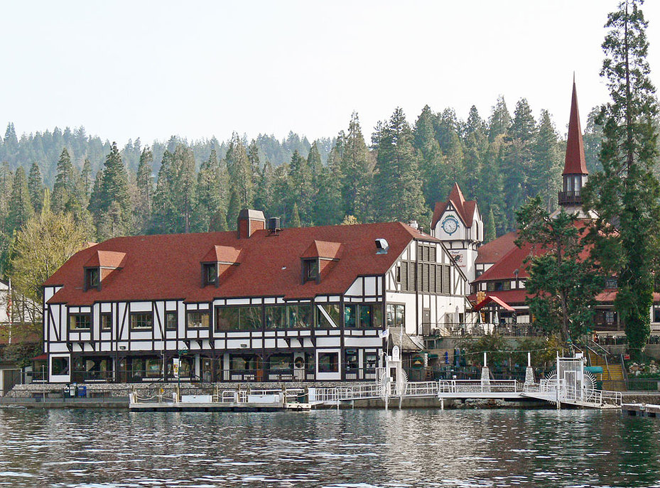
Lake Arrowhead is a CDP in the San Bernardino Mountains and situated along the shores of the Lake Arrowhead Reservoir. As of 2010 it had a population of 2,424. It was founded as “Little Bear Lake” but its name changed after it was purchased by the Arrowhead Lake Company. Local attractions include Shady Point (an historic home from 1930).
LANDERS
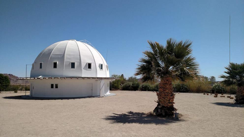
Landers is an unincorporated community in the Mojave Desert which as of 2012 had a population of 2,606. Just outside of town is Giant Rock, a large freestanding boulder which in the 1950s became a popular destination with UFO believers. The rock also inspired inventor and UFO contactee George Van Tassel to build the Integratron in 1959, a structure whose designer claimed it could rejuvenate visitors, create anti-gravity, and transport objects through time.
LENWOOD
Lenwood is a CDP which in 2010 had a population of 3,543. It’s home to Plata’s Mexican Food.
LOMA LINDA
Loma Linda is a city which in 2010 reported a population of 23,261. It incorporated in 1970. It’s well known as the home of Loma Linda University Church of Seventh-day Adventists, founded in 1905. Since many Seventh-day Adventists are vegetarians, the town boasts several popular vegetarian and vegetarian-friendly restaurants including A Dong Restaurant II, Angelo’s, Ayda Ethiopian Restaurant, Baker’s Drive Thru, Cafe Society, Cha-Cha’s Tacos, Clark’s Nutritional Centers, Firehouse Subs, Jeeva’s Kitchen, Loma Linda Market & Nutrition Center, LLU Dining Councilors Student Pavilion, Najwa’s Mediterranean Cuisine, Napoli Italian Restaurant, Oh Mai Pho!, Patio Pantry, Red Hot Kitchen, Sorrentino’s Italian Restaurant, Tess’ Place, Thai Bowl Cafe, and many more.
LUCERNE VALLEY
Lucerne Valley is a CDP located in the Mojave Desert which as of 2010 reported a population of 5,811. It is home to the Jack O’Landia roadside attraction which is something like a vacant theme park/folk art piece. It’s also home to China House, Rock’s Place, and Stallone’s Pizzeria.
LUDLOW
Ludlow is a small town along historic Route 66. The town started as a water stop for the Atlantic and Pacific Railroad in 1883 and grew into a mining town. Mining ceased in the 1940s and the town essentially became a ghost town in the 1960s although there are a few businesses there today.
LYTLE CREEK
Lytle Creek is a CDP located inside the San Bernardino National Forest. The population as of 2010 was 701. Mormons arrived in the valley in 1851 and named it “Lytle Creek” after their leader, Captain Andrew Lytle. Lytle Creek’s newspaper, The Canyon, has been published by volunteers at the Lytle Creek Community Center since 1948.
MENTONE

Mentone is a CDP which reported a population of 8,720. It’s named after It was named for Menton, France. It’s home to Arthurs Restaurant, Barnacles Sports Bar, The Beach House, Casa Maya, Diamond Jim’s Saloon, Frank’s Place, Garden Thai, Greenspot Market, Heska’s Sugar Shack, Jacinto Farms, Mill Creek Cattle Company, and Stafford Produce.
MONTCLAIR
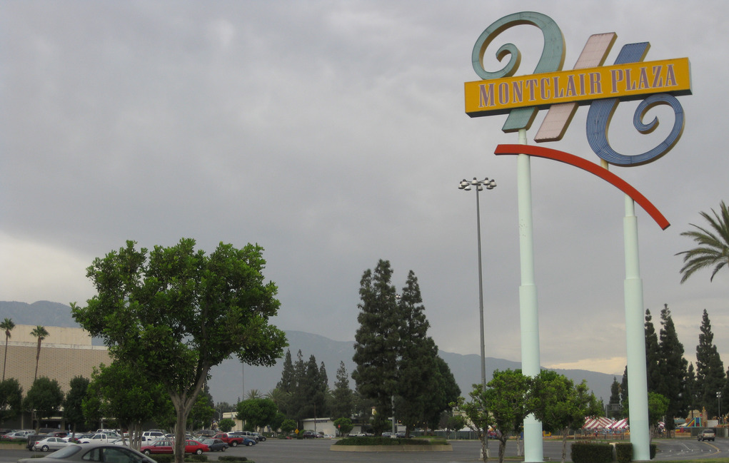
Montclair is a city which in 2010 had a population of 36,664. In the late 19th and early 20th centuries, there were several settlements in what’s now Montclair, including Marquette, Monte Vista, and Narod. Suburbanization increased after World War II and the city was incorporated as Monte Vista in 1956. However, due to there being a Monte Vista in Northern California, it was changed to Montclair (a play on the name of neighboring Claremont) in 1958. Local attractions include the Mission Tiki Drive In Theatre and the Russian Village District.
MORONGO VALLEY
Morongo Valley is a CDP on the western edge of the Mojave Desert which in 2010 had a population of 3,552. Attractions include the Big Morongo Canyon Preserve and Covington Park. Local establishments include Morongo Valley Cafe, Happy Cooker, Morongo Fruit Market, Rattlesnake Jake’s, Sand to Snow Monument Bar & Grill, and Willie Boy’s Saloon & Dance Hall.
MOUNT BALDY
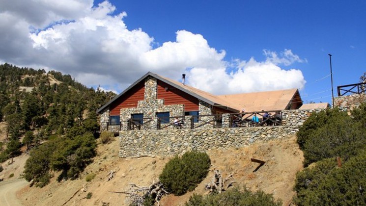
Mt. Baldy is an unincorporated community named after Mount San Antonio, the highest peak of the San Gabriel Mountains and colloquially known as “Mount Baldy.” It was established in 1906 as Camp Baynham n 1906 and its name changed to Camp Baldy in 1910. It became Mount Baldy in 1951. In addition to nearby hiking and ski trails, the community is also home to Top Of The Notch Restaurant.
MUSCOY
Muscoy is a CDP that had a population of 10,644 in 2010.
NEEDLES
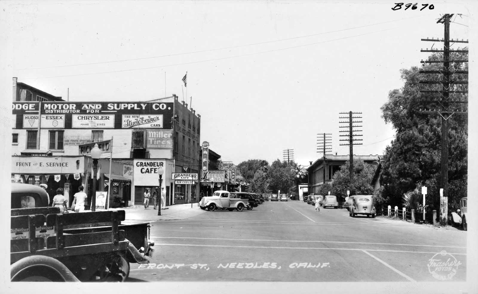
Needles is a city situated on the western banks of the Colorado River in the Mohave Valley. As of 2010, it had a population of 4,844. It’s name comes from “The Needles,”, a group of mountain peaks in the Mohave Mountains. In the comic strip Peanuts, it was the home of Snoopy‘s brother, Spike, who lived in a hollow saguaro cactus. Another notable lodging is El Garces Hotel, built in 1908 as a Harvey House.
NEWBERRY SPRINGS

Newberry Springs is an unincorporated community located at the foot of the Newberry Mountains. As of 2000, the population was 2,895. The springs after which the town is named also inspired the town’s first name, “Water.” Local establishments include The Barn and Kelly’s Market.
NIPTON
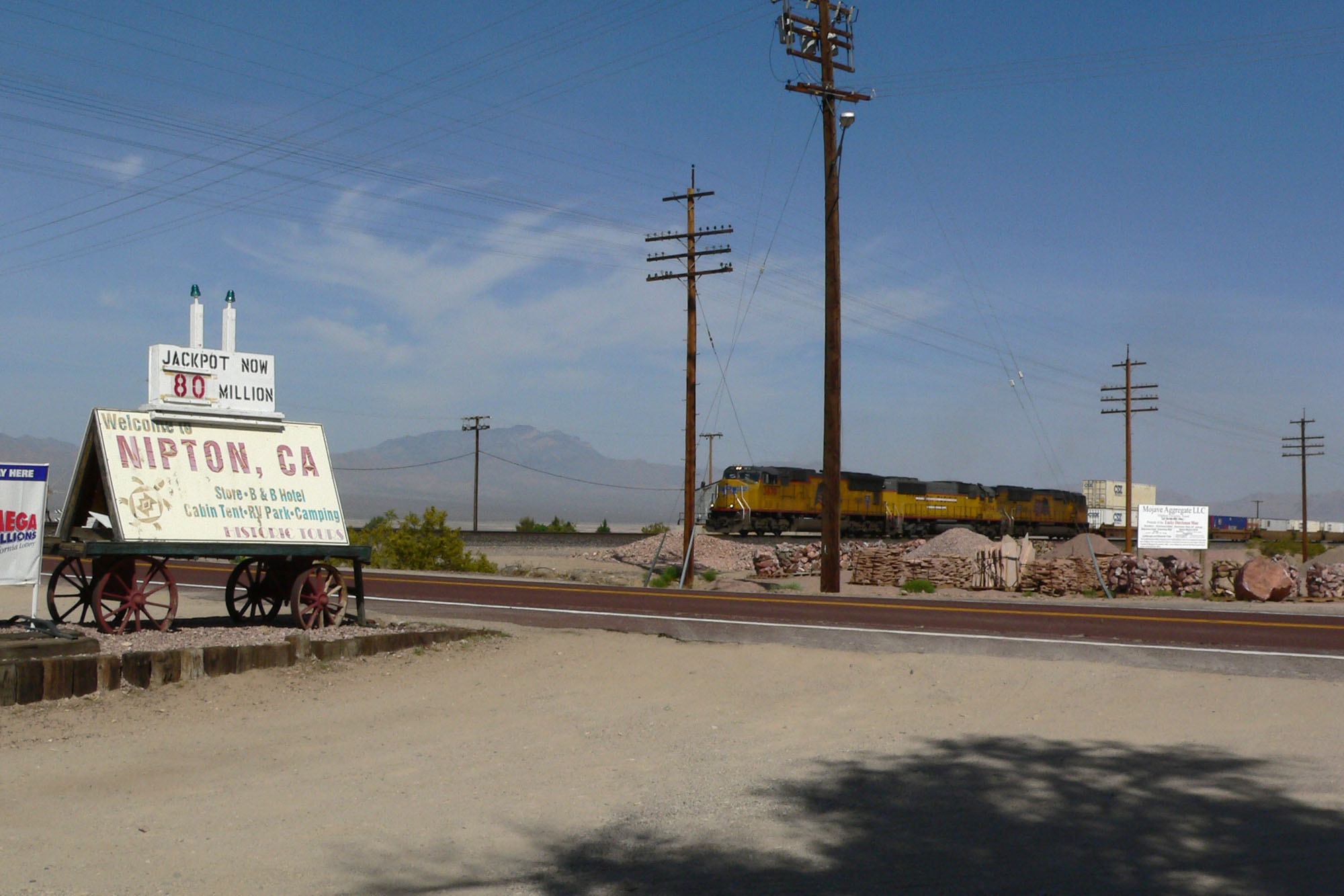
Nipton is an unincorporated community located on the northern edge of Mojave National Preserve. It has a population of 60. It was founded in 1905 as “Nippeno Camp.” It’s home to El Oasis Cafe and the Nipton Trading Post.
OAK GLEN
Oak Glen is a CDP situated between the San Bernardino Mountains and the Little San Bernardino Mountains. As of 2010, it had a population of 638. In the 1940s it acquired a reputation for its varieties of apples and apple products, sold at roadside stands. It’s home to Apple Annie’s, That Creative Cafe, Rileys at Los Rios Rancho, Trezo D’haiti Coffee, Mountain Town Wildlife Museum, The Wildlands Conservancy – Oak Glen Preserve, and Willowbrook Apple Farm.
OAK HILLS

Oak Hills is a CDP in the High Desert which in 2010 had a population of 8,879. Its most famous icon is the Summit Inn Restaurant, an iconic 1950s diner.
ONTARIO
Ontario is a city that lies just east of the Los Angeles county line. As of 2010, it had a population of 163,924. It is home to LA/Ontario International Airport. Its name comes from the Ontario Model Colony, established in 1882 by the Canadian engineer George Chaffey and his brothers William and Charles. It’s home of the historic Ontario State Bank Block (1887), Dr. Orville S. Ensign House (1893), and Frankish Building (1915).
ORO GRANDE
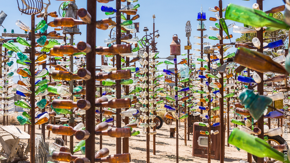
Oro Grande is an unincorporated community in the Mojave Desert on historic Route 66. As of 2010, it had a population of fewer than 1,000. It’s home of Elmer Long’s folk-art Bottle Tree Ranch as well as a pizzeria, Cross Eyed Cow Pizza.
PHELAN
Phelan is a CDP located in the Victor Valley. In 2010 the population was 14,304. Phelan was named after Senator James D. Phelan and his brother, John Thomas Phelan.
PIÑON HILLS
Piñon Hills is a CDP which as of 2010 had a population of 7,272. It’s home to Big Rock Inn, Casa Ortega, and Rick’s Roadside Cafe.
PIONEERTOWN
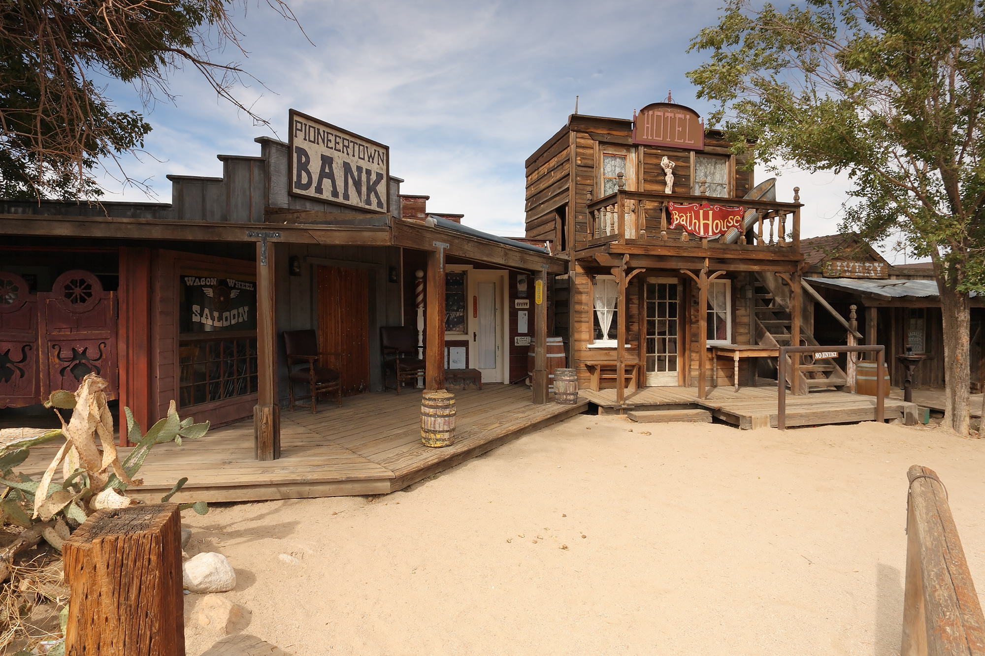
Pioneertown is an unincorporated community in the Morongo Basin which began as a live-in Old West motion-picture set, built in the 1940s. Roy Rogers, Dick Curtis, and Russell Hayden were among the original developers and investors. As of 2006, Pioneertown had a population of 350. Today it’s home to Pappy & Harriet’s Pioneertown Palace.
RANCHO CUCAMONGA
Rancho Cucamonga is a city forty which in 2010 had a population of 165,269. It incorporated in 1977, merging the pre-existing communities of Alta Loma, Cucamonga, and Etiwanda. It boasts a couple of historic buildings, including the John Rains House (1906) and the Pacific Electric Etiwanda Depot (1914). It’s also home to the Victoria Gardens Cultural Center.
RED MOUNTAIN
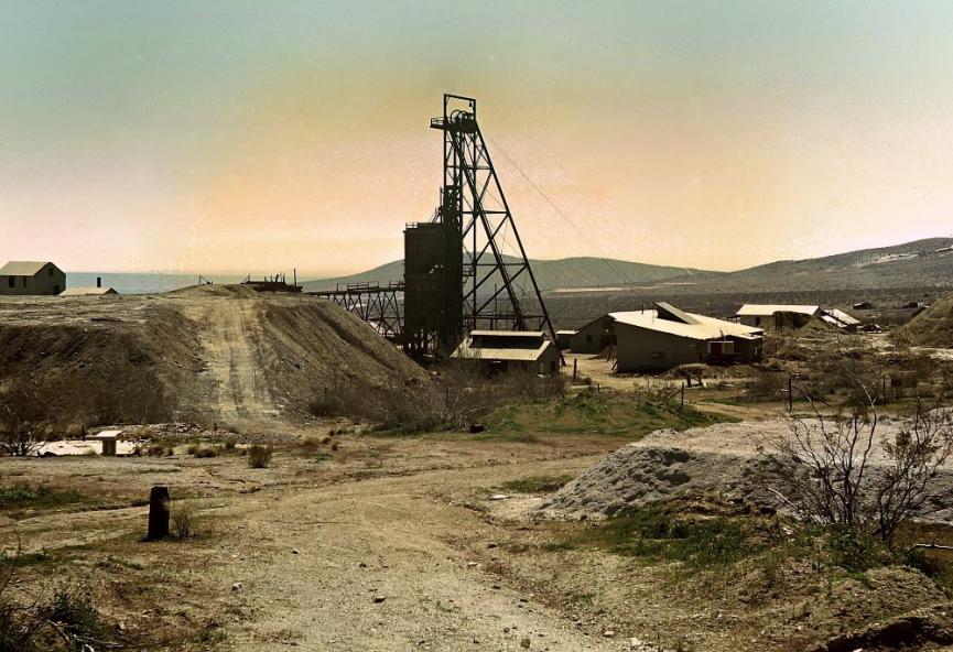
Red Mountain is mostly a ghost town, with an estimated remaining population of 130. It was founded as “Rand Camp” and later known as “Yellow Aster Mine.” Its first post office opened in 1896, when the population was roughly 1,500. Its population peaked at around 3,500 in 1899, the year the Orpheum Theatre was built. Today the theater, cabins, a church, and saloons remain, albeit long empty.
REDLANDS
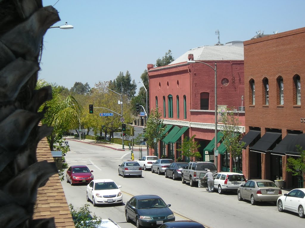
Redlands is a city which as of 2010 had a population of 68,747. It’s home to the historic A. K. Smiley Public Library, Greek Revival Barton Villa (1872), Beverly Ranch (Fisk-Burgess House), the ruins of Guachama Rancheria, Kimberly Crest House & Gardens, the Mill Creek Zanja, the Redlands Central Railway Company Car Barn, the Redlands Santa Fe Depot District, San Bernardino de Sena Estancia (founded in 1819), San Timoteo Canyon Schoolhouse, the Smiley Park Historic District, and the US Post Office—Redlands Main. It’s also home to the University of Redlands and the Richard Neutra-designed Auerbacher Home (1951).
RIALTO
Rialto is a city which in 2010 had a population of 99,171. It’s home to four major regional distribution centers: Staples, Toys “R” Us, Under Armour, and Target. It’s also home to Pyro Spectaculars, one of the largest American fireworks distributors. A 19th century adobe is the oldest building, located in Bud Bender Park. It’s most treasured historic building is First Christian Church of Rialto (1907), home to the Rialto Historical Society.
RICE
Rice, formerly named Blythe Junction, is a ghost town located in the Mojave Desert and former stop on the Santa Fe Railroad. Few signs of the former town remain — a former sign announcing the town disappeared and the abandoned service station stands in ruins. At some point, a custom-developed amongst travelers to hang pairs of shoes on a Tamarix shrub which has become known as “The Shoe Tree.”
RIMFOREST
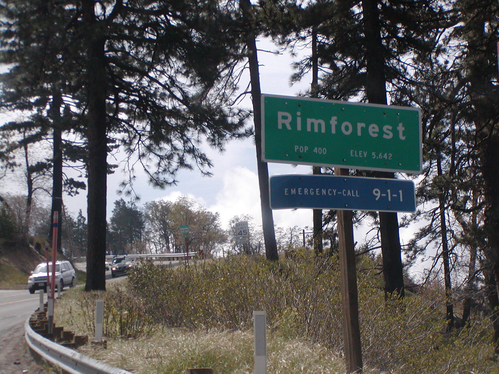
Rimforest is an unincorporated community in the San Bernardino Mountains. Its post office opened in 1949. It’s home to Angie’s Mexican Food and The Original Cottage Family Restaurant. It appears to have inspired a place of the same name on Ginger Brooks Takahashi‘s fantasy map, Welcome to Gayside.
RUNNING SPRINGS
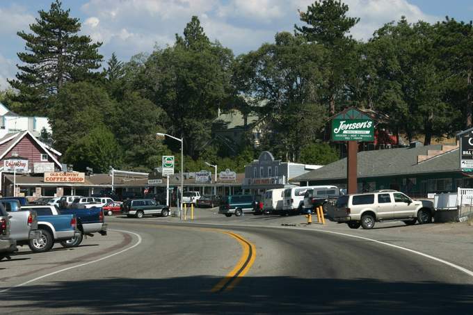
Running Springs is a CDP which in 2010 had a population of 4,862. It was originally known as Hunsaker Flats, named after a Mormon named Abraham Hunsaker. It’s home today to Fireside, Jensen’s Finest Foods, Neo’s Pizza House, Old Country Coffee Shop & Diner, Rocky’s Roadhouse, and Toto’s Mexican Restaurant.
SAN ANTONIO HEIGHTS
San Antonio Heights is a CDP which in 2010 had a population of 3,371. It’s most famous feature is an enormous holiday display, first lit in 1958. The house to which it was attached was destroyed in the 2003 Grand Prix Fire. A replacement was later erected on the property although copper wire thieves kept it from being lit in 2006.
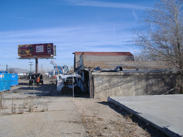
SAN BERNARDINO
San Bernardino is the second-largest city in the Inland Empire and the largest in San Bernardino County. Cultural and historical sites of interest include the Fox Theatre, Heritage House, San Bernardino Railroad and History Museum, Sturges Center for the Fine Arts, the unsanctioned McDonald’s Museum (at the site of the original McDonald’s), the Inland Empire Military Museum, the American Sports Museum, the WBC Legends of Boxing Museum, the California Theatre of the Performing Arts (built in 1928). The city annually hosts the nation’s largest car show, the Route 66 Rendezvous as well as the National Orange Show Festival.
The Robert V. Fullerton Museum of Art and the John M. Pfau Library are located on the campus of California State University, San Bernardino. Other colleges and universities include San Bernardino Valley College, National University San Bernardino, The Art Institute of California – Inland Empire, Argosy University-Inland Empire, Everest College, American Sports University, and UEI College.
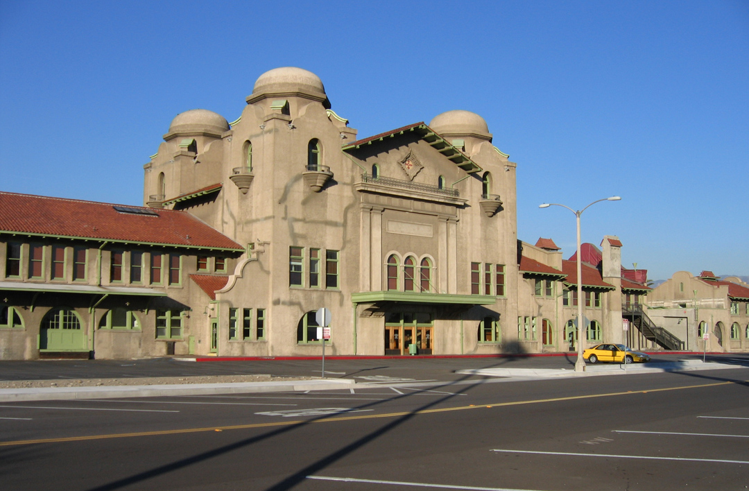
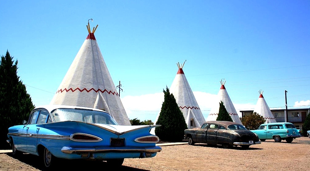
Other attractions include the Mission Revival style Atchison, Topeka and Santa Fe Railway Passenger and Freight Depot (1918), San Bernardino County Courthouse (1927), US Post Office-Downtown Station (1931), the grand Arrowhead Springs Hotel (1940), Wigwam Village No. 7 (a motel where the lodging quarters look like tipis), and the César Pelli-designed San Bernardino City Hall (1969).
SEARLES VALLEY
Searles Valley is a CDP in the Searles Valley of the Mojave Desert. It’s dominated by the Searles Valley Minerals plant, a raw materials mining and production facility which produces borax, boric acid, soda ash, salt cake, and salt. It is the site of the annual Gem-O-Rama, sponsored by the Searles Lake Gem & Mineral Society.
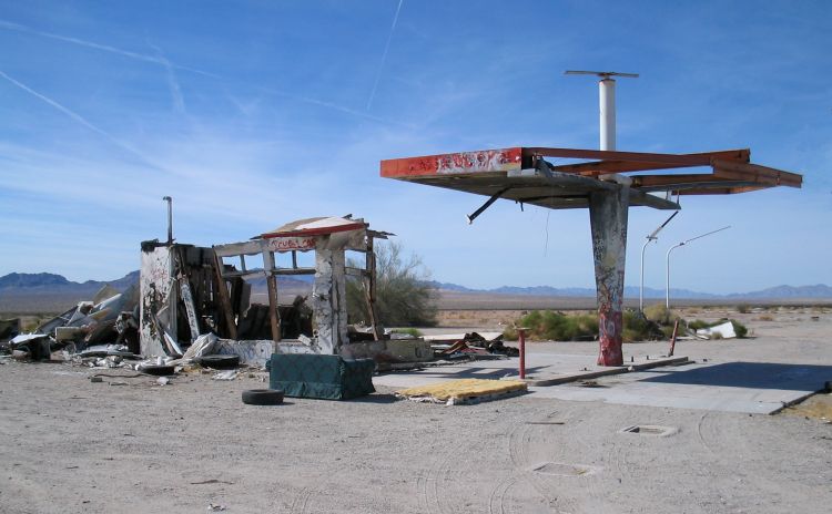
SIBERIA
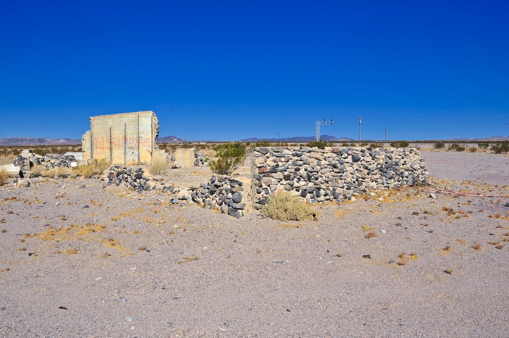
Siberia is a ghost town in the Mojave Desert which lies along historic Route 66. Siberia was a water stop and a rail siding for the Santa Fe Railroad. It was abandoned after the 1973 opening of Interstate 40, which bypassed it. Almost nothing remains today but the ruined foundation of a lone structure.
SKYFOREST

Skyforest is an unincorporated community. Its post office opened in 1928. It’s home to Hortencia’s Mexican Grill, Hungry Bear Deli, Bakery & Café, and Lou Eddie’s Pizza. It’s most well-known attraction is the kitschy Santa’s Village, which opened in 1955.
SPRING VALLEY LAKE

Spring Valley Lake is a CDP in the Victor Valley which in 2010 had a population of 8,220. It’s mostly comprised of large homes situated on the edge of an artificial lake — there are only two commercial buildings. Residents enjoy waterskiing, fishing, riding horses, golf — that sort of thing.
SUGARLOAF

Sugarloaf is a primarily residential unincorporated community which in 2010 had a population of 1,816. It’s named after a mountain, Sugarloaf, and not the Classic Rock band who wrote and performed “Green-Eyed Lady.” Before the invention of sugar cubes, refined sugar was sold by the loaf.
TRONA
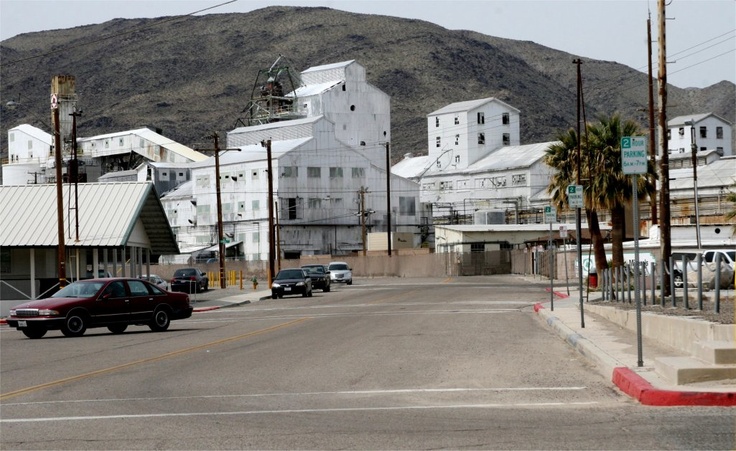
Trona is an unincorporated community located along the western edge of the dry lake bed of Searles Lake. The town’s name (which it shares with an adjacent community in Inyo County) is derived from the abundance of trisodium hydrogen dicarbonate dihydrate (aka sodium sesquicarbonate dihydrate or Na3(CO3)(HCO3)•2H2O), a non-marine evaporite mineral. Nearby are the Trona Pinnacles. Trona was established in 1913, as a self-contained mining company town. The economy is still dominated by soda ash processing and evaporative salt extraction.
TWENTYNINE PALMS

Twentynine Palms is a city named for the palms found there in 1852 by Colonel Henry Washington whilst surveying. A post office was established in 1927. As of 2010, it had a population of 25,048. Twentynine Palms is home to the ruins of the McHaney Gang’s Cow Camp (built in the 1880s), the ruins of cattle rustler Jim McHaney’s Desert Queen Mine (stolen from its original owner in the 1890s), Keys Desert Queen Ranch (1894), the ruins of J.D. Ryan’s adobe, Ryan House (1896), as well as Lost Horse Well, Barker Dam (built in 1900), the philosophical folk art musings of Samuelson’s Rocks, and Wall Street Mill (1933).
TWENTYNINE PALMS BASE
Twentynine Palms Base is located next to the town of Twentynine Palms. As of 2000, it had a population of 8,413. Its status as a CDP was discontinued prior to the 2010 census. From 1942 through 1945, the base was a naval auxiliary air station. In 1949, Marine Corps Base Camp Pendleton headquarters issued Post Order 343 creating the Marine Corps Training Center, Twentynine Palms.
TWIN PEAKS
Twin Peaks is an unincorporated community. Its post office opened in 1916. It’s also home to The Grill At the Antlers Inn. It’s also home to the Church of Scientology Technology Headquarters, a compound designed to survive a nuclear war with a shelter awaiting the imminent return of L. Ron Hubbard.
UPLAND

Upland is a city in which in 2010 had a population of 73,732. It incorporated in 1906 and was previously known as “North Ontario.” It’s home to the historic Upland Fire Department Museum and Cooper Regional History Museum, the Carnegie Upland Public Library, the Old San Antonio Hospital, a series of monumental statues from the 1920s called Madonna of the Trail, and the Romanesque Revival Ontario and San Antonio Heights Waiting Station (built in 1907).
VENUS
Venus is an unincorporated community. The Venus Deep Space Station, part of the Goldstone Deep Space Communications Complex, is located there.
VICTORVILLE

Victorville is a city located in the Victor Valley which as of 2010 had a population of 115,903. Its roots were in a way station established in 1858, by a Mexican-American War veteran named Aaron G. Lane. He named it Lane’s Crossing. Later it acquired a railroad siding named “Victor“, after the California Southern Railroad‘s general manager Jacob Nash Victor, and that evolved into a village of the same name. It incorporated as the city of Victorville in 1962. Victorville is home to the Route 66 Museum, the Old Victor School, and a Veteran’s Memorial. Perhaps the most stunning feature is the Southern California Logistics Airport, an airplane boneyard.
VIDAL

Vidal is an unincorporated community. In the 1960s, Vidal was home to Solar Lodge, a secret society (1965-1972) who owned the town’s businesses and were later involved in a child abuse case known colloquially as “The Boy in the Box.” Vidal is also home to the remains of World II-era Camp Iron Mountain and one of Wyatt Earp’s cottages.
VIDAL JUNCTION
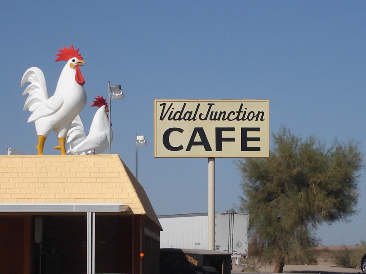
Vidal Junction is a small townsite in the Sonoran Desert. It’s home to Vidal Junction Mini-Mart & Gas Station, a trailer park, and a California agricultural inspection station.
WILD CROSSING
Wild Crossing is an unincorporated community located along the Union Pacific Railroad, east of the Mojave River.
WRIGHTWOOD
Wrightwood is a CDP in the San Gabriel Mountains which in 2010 had a population of 4,525. A ranch owned by Sumner Wright was subdivided into commercial lots in 1920s. It’s home to the Cinnamons Bakery, Evergreen Cafe & Racoon Saloon, Gamee Kitchen, Grizzly Cafe, Mile High Pizza, and The Village Grind.
YERMO
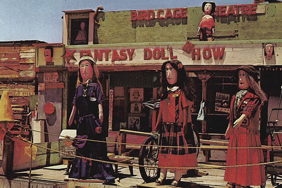
Yermo is a town in the Mojave Desert, just south of the Calico Mountains. In 2009, the town’s population was an estimated 1,750. The opening of Interstate 15 in 1968 brought about a decline in the town’s livelihood. For years after, however, it was famously home to the Possum Trot Doll Theater.
YUCAIPA
Yucaipa is a city that incorporated in 1989 and as of 2010 had a population of 51,367. Stater Bros. Markets was founded there in 1936 (but has since relocated its headquarters to San Bernardino). It’s still home to the much older Yucaipa Adobe, built in 1859.
YUCCA VALLEY
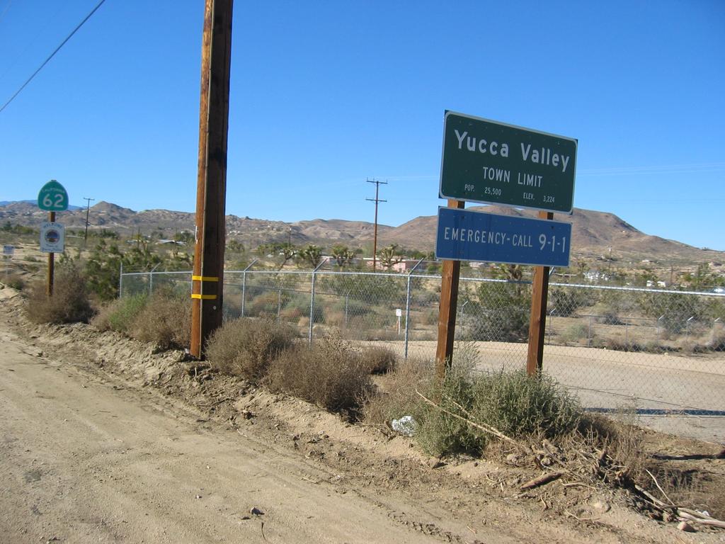
Yucca Valley is an incorporated town which in 2010 had a population of 20,700. Yucca Valley is home to the Desert Christ Park sculpture garden, erected in 1951), as well as Andrew Roger’s large sculpture, Rhythms of Life.
ZZYZX

Zzyzx, formerly Camp Soda and Soda Springs, is an unincorporated community within the Mojave National Preserve. It is the former site of the Zzyzx Mineral Springs and Health Spa, now the site of the Desert Studies Center. Lake Tuendae, originally part of the spa, is now a refuge habitat of the endangered Mohave tui chub. The name “Zzyzx” was given to the area in 1944 by Curtis Howe Springer, who wanted it to be the last word in the English language and founded a spa in the spa the same year. It remained in operation until 1974 when the government took over the land

Eric Brightwell is an adventurer, essayist, rambler, explorer, cartographer, and guerrilla gardener who is always seeking paid writing, speaking, traveling, and art opportunities. He is not interested in generating advertorials, cranking out clickbait, or laboring away in a listicle mill “for exposure.”
Brightwell has written for Angels Walk LA, Amoeblog, Boom: A Journal of California, diaCRITICS, Hidden Los Angeles, and KCET Departures. His art has been featured by the American Institute of Architects, the Architecture & Design Museum, the Craft Contemporary, Form Follows Function, Los Angeles County Store, the book Sidewalking, Skid Row Housing Trust, and 1650 Gallery. Brightwell has been featured as subject in The Los Angeles Times, Huffington Post, Los Angeles Magazine, LAist, CurbedLA, Eastsider LA, Boing Boing, Los Angeles, I’m Yours, and on Notebook on Cities and Culture. He has been a guest speaker on KCRW‘s Which Way, LA?, at Emerson College, and the University of Southern California.
Brightwell is currently writing a book about Los Angeles and you can follow him on Ameba, Duolingo, Facebook, Goodreads, Instagram, Mubi, and Twitter.


80 thoughts on “California Fool’s Gold — A San Bernardino County Primer”