

A few weeks ago, I was part of a transit discussion at Frank Radio called Alternate Paths (with Lisa Kwon, Maylin Tu, Julia Beach, Greg Ruben, and Hunter Baoengstrum — check it out!). Afterward, one of the attendees, a woman named Xochitl, asked whether I was ever going to do any more neighborhood explorations. I honestly didn’t realize at the time how long it had been — but apparently the last, Elysian Heights, was in December 2023! How is that possible?! Just a reminder — I’d love nothing more than to quit my day-job and to devote myself full time to exploring Southern California and beyond. If any sponsors or patrons wanna make that possible, please reach out — or just make an anonymous donation!
Anyway, after that I reached out to two of my friends, Mike and Jackie, to see if they’d like to explore any of the communities that have been requested by readers. It had been fairly hot so I was tipping the scale away from top-voted (and inland) Brea toward the beach community (and second-most top-voted) Playa del Rey. So Playa del Rey it was!
I first visited Los Angeles in 1998 and I have only been — as far as I know — to Playa del Rey four times now. To be honest, in the past I have confused Playa del Rey and Playa Vista… but I don’t actually know if I’ve ever been to the latter. The whole region seems like it was named with an exceedingly small set of refrigerator magnets. There’s also Marina del Rey and Del Rey. Of course, neighboring Westchester breaks that mold, as does neighboring El Segundo — one of the first communities I visited in Los Angeles because my road-trip/room-mate Seth‘s dad lived there. But back to the reyes. There’s also the Venice del Rey Tract (founded in 1905), Palisades del Rey (1921), and the Paseo del Rey, all of which got me wondering — is this a particular “rey”? The answer, it would seem, is no — it’s just meant to give it a touch of class — like Burger King. Finally, though, I will add that my confusion is compounded by the boss at my aforementioned day job using the term “playa” to refer to his store in Playa Vista, and to label packages bound for that store, “PV,” which I often accidentally refer to as Palos Verdes. Nothing to clear up the confusion, though, like visiting, exploring, and painting a map of a place.
The second time I spent a little time in Playa del Reay was in 2014, after the release of Her, local writers were salivating over its depiction of a future Los Angeles with rail to that same beach. To prove a point, I wrote a piece about all of the mass transit options to Los Angeles beaches, including Playa del Rey. Then, in 2021, Mike and I rode bikes from Torrance to Pacific Palisades and back and stopped at Playa Provisions for a bite.
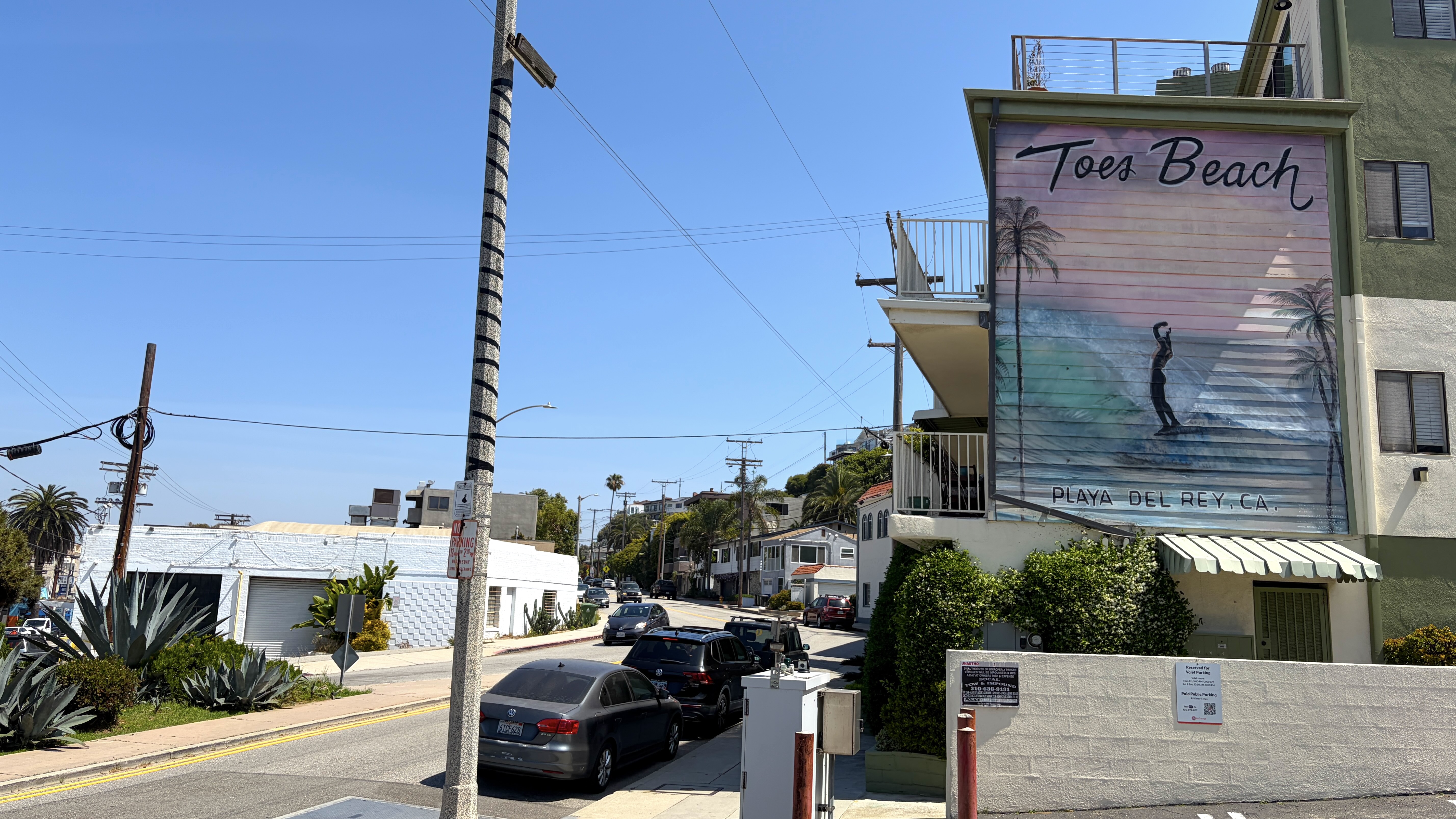
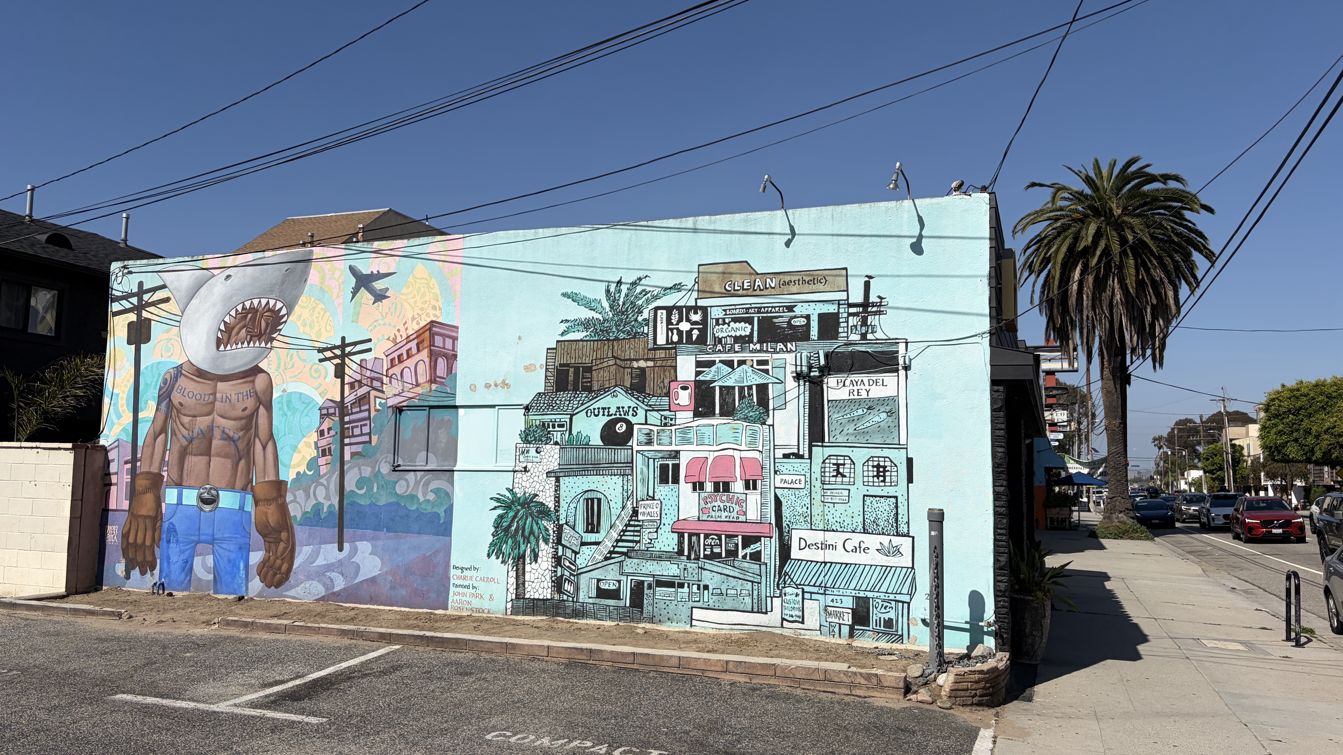
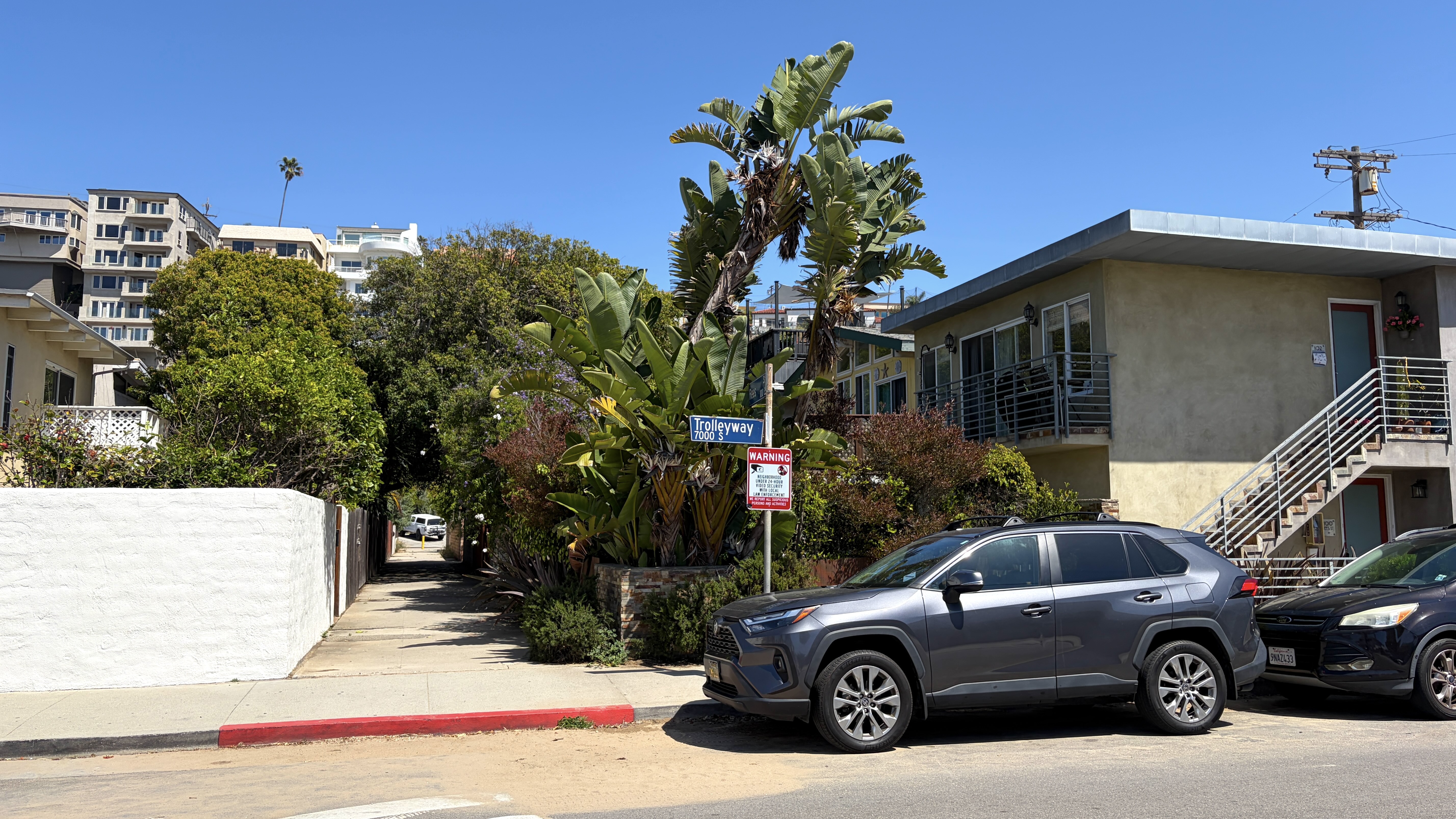
And then, on Tuesday, we decided to head over in Mike’s car. My preference would’ve been to take mass transit — but we got a late start and transit from Silver Lake to Playa del Rey is not great. It would’ve taken about two hours. So Mike drove and I gave him $20 for gas. Mike parked on Pershing Drive, beneath an apartment mural for Toes Beach and behind a landscaped traffic triangle with a “Playa del Rey” sign. There was a strong breeze and the smell of jasmine in the air, which fired up the Isley Brothers’ cover of “Summer Breeze” on my mental jukebox.
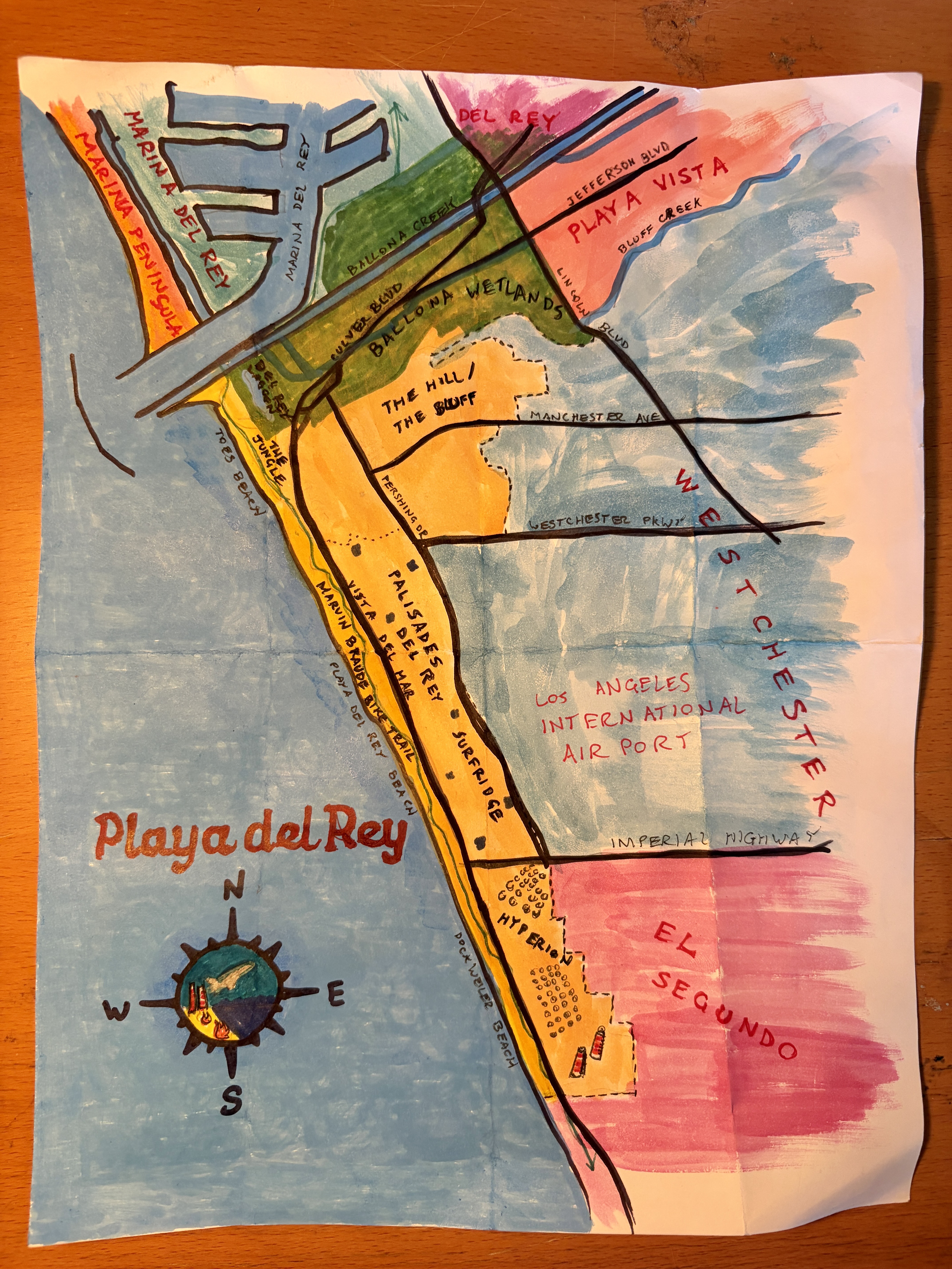
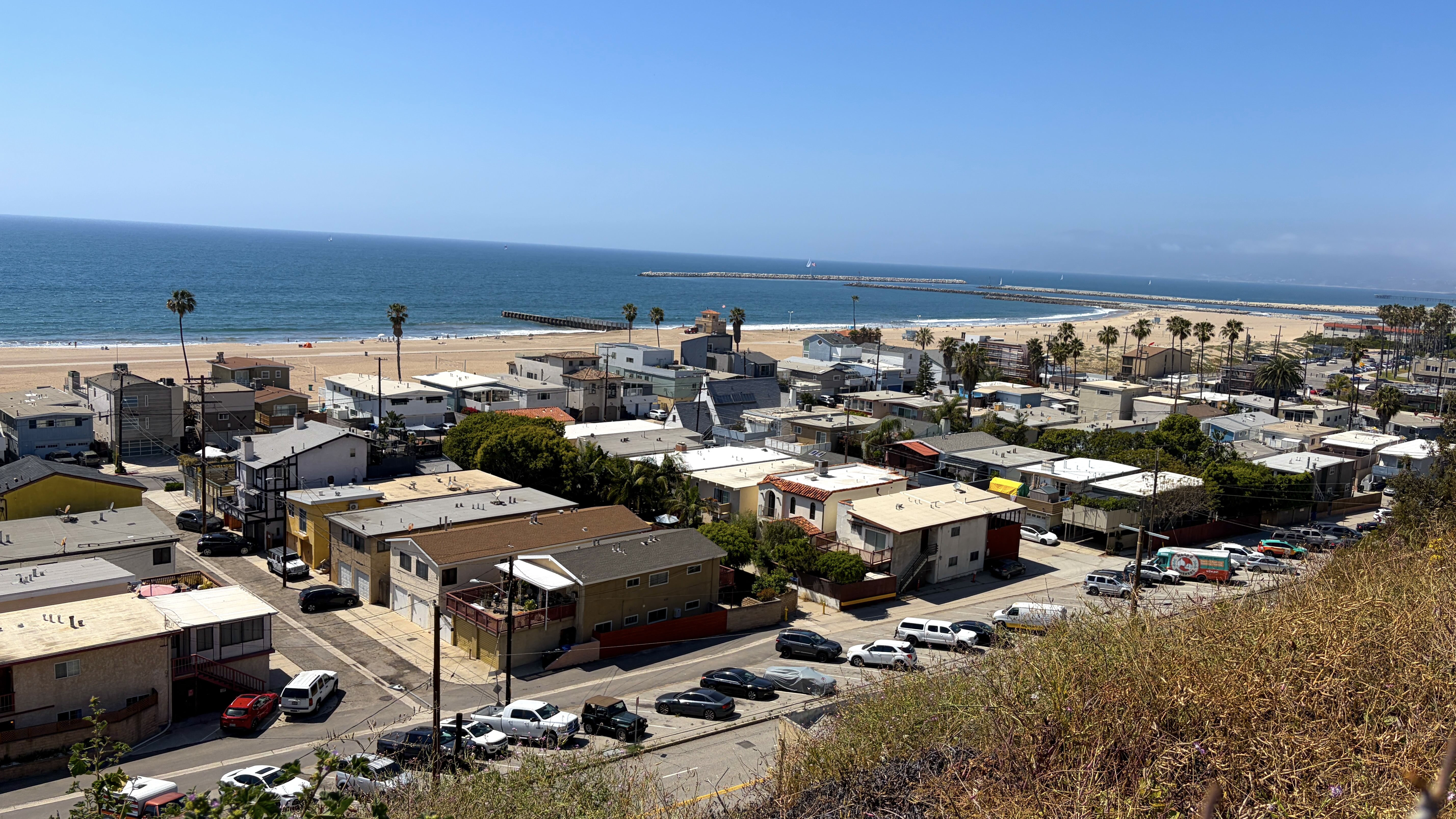
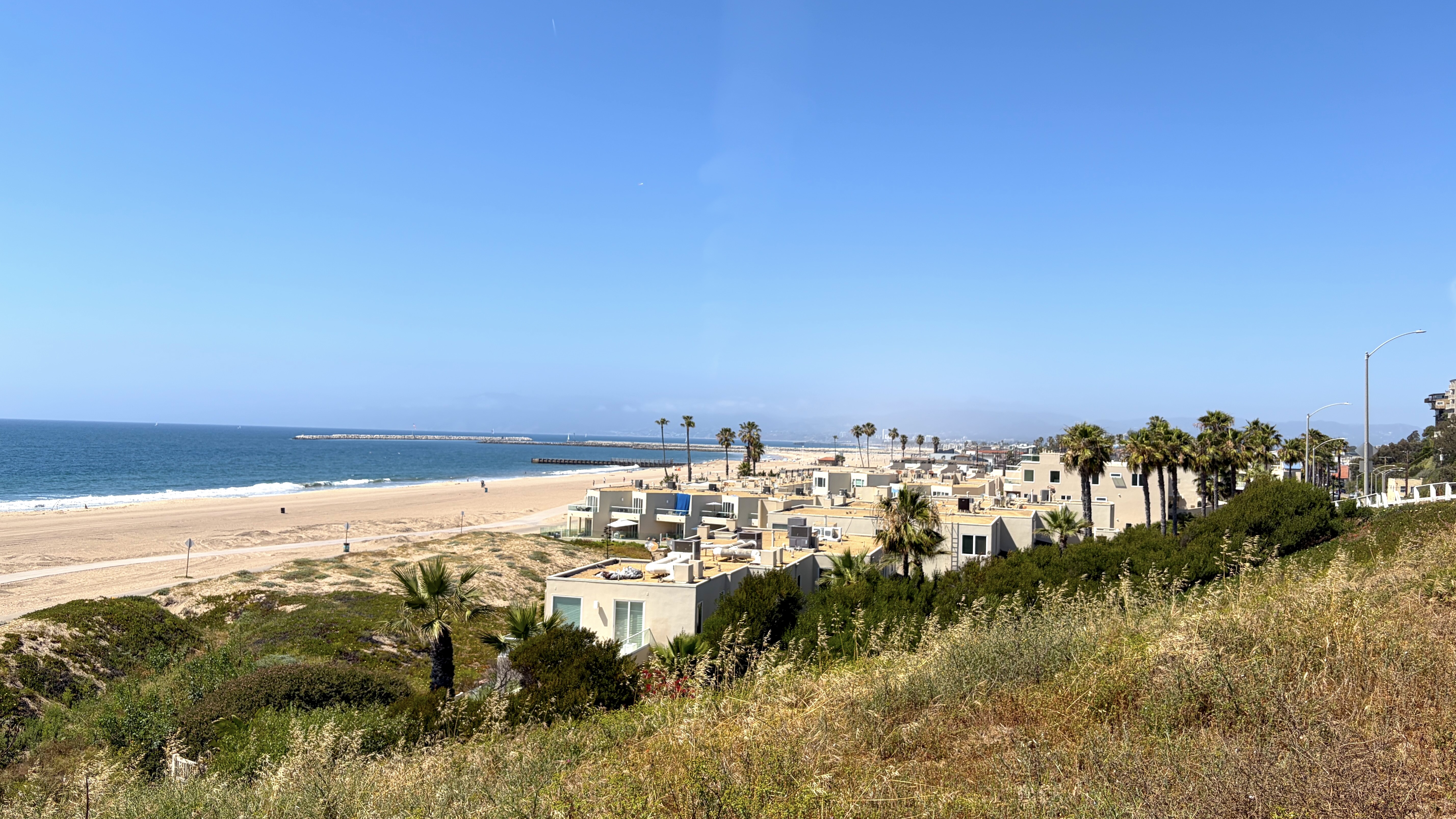
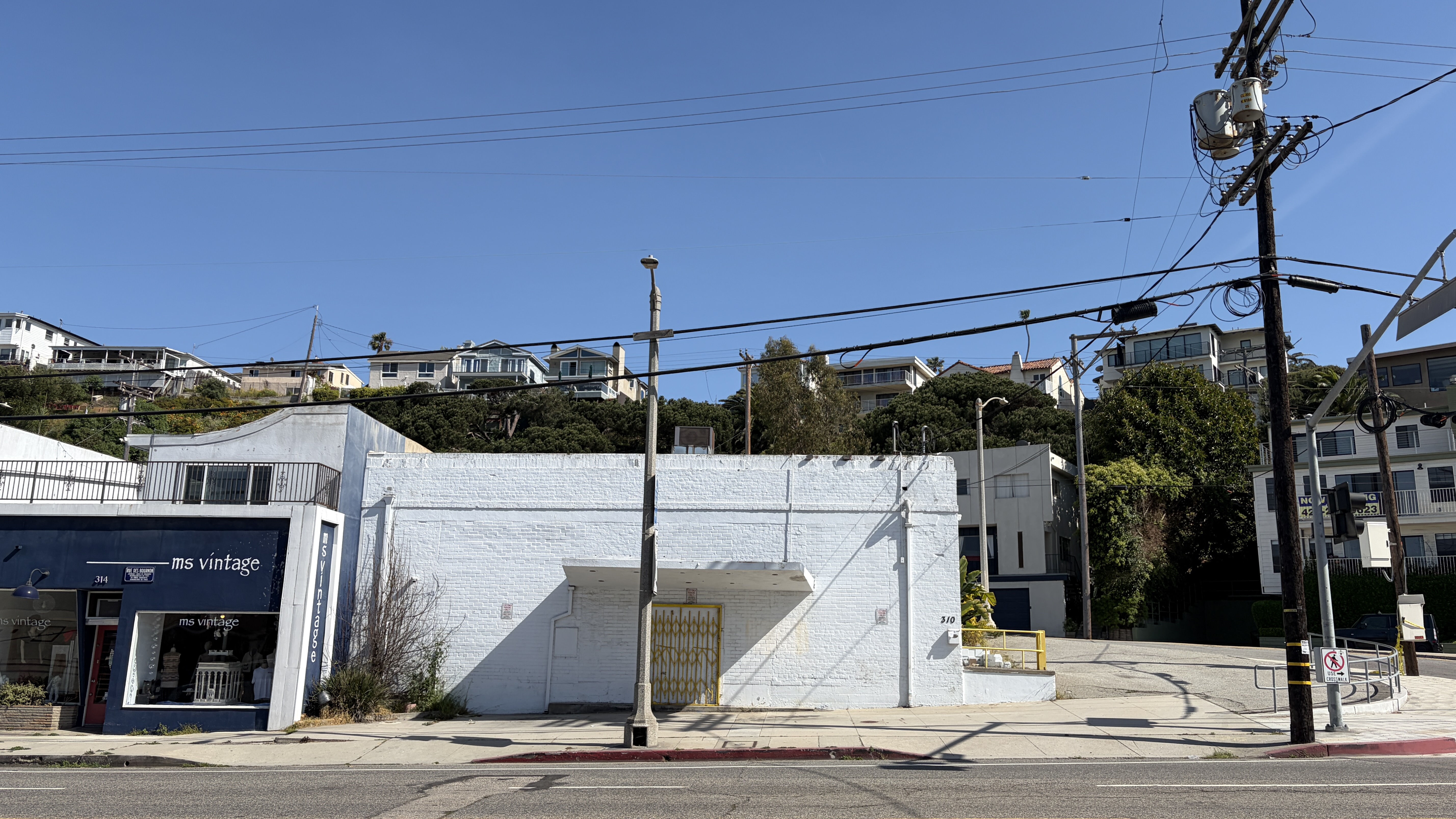
After we disembarked from Mike’s car, we stretched out legs by walking down to and along Culver Boulevard. In doing so I was reminded of what an island or village Playa del Rey feels like. To the north are the degraded but expansive Ballona Creek Wetlands. In the east are the steep bluffs of the Del Rey Hills and Los Angeles International Airport. To the south is the abandoned Surfridge neighborhood and, beyond that, the Hyperion Water Reclamation Plant. To the west, of course, is the Pacific Ocean and the northern Channel Islands. Nearly all of the businesses are along a less than half-mile (600 meter) stretch of Culver that takes maybe seven minutes to walk.
When I visited Playa del Rey in 2014, I arrived via Culver after walking along Lincoln Boulevard – truly one of the most terrifying experiences I’ve had in Los Angeles — far worse, in fact, than an attempted mugging or any encounters with the police. In places, that “boulevard” is ten lanes wide and motorists hurl their cars along it at freeway speeds. Of course there is no sidewalk. So anyone unfortunate to find themselves walking there must hack their way through overground weeds and piles of trash casually tossed from passing drivers as they cling to the low guardrail that separates life and death. Had I known about the Ballona Creek Bike Path connecting to Playa del Rey, across a bridge that used to connect Venice and Playa del Rey before the construction of the marina, I’d have walked that. Maybe some better waymarking or just, hear me out, a sidewalk, would’ve helped.
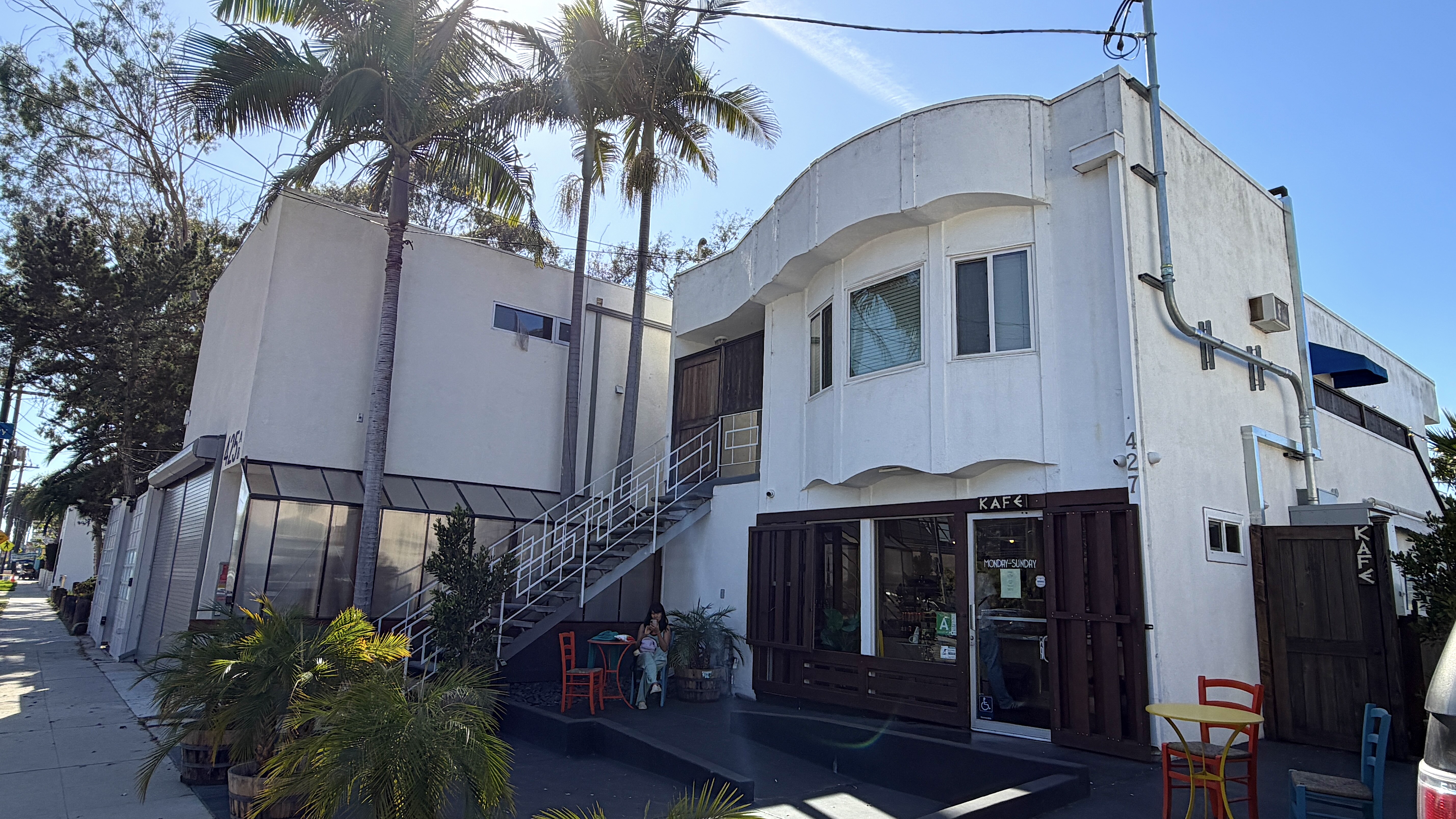
As we strolled along Culver, we decided to start our day with lunch. I spied the Shack, a swimsuit-friendly bar that opened back in 1972 but I thought maybe we’d end up there later. We also considered Tanner’s Coffee Co, which opened in 1999 – but we wanted something more substantial. Mo’s Place, Señor G’s, T.C. Organic, Sushi Beluga, and Bacari were all considered but vetoed by at least one member of our part.
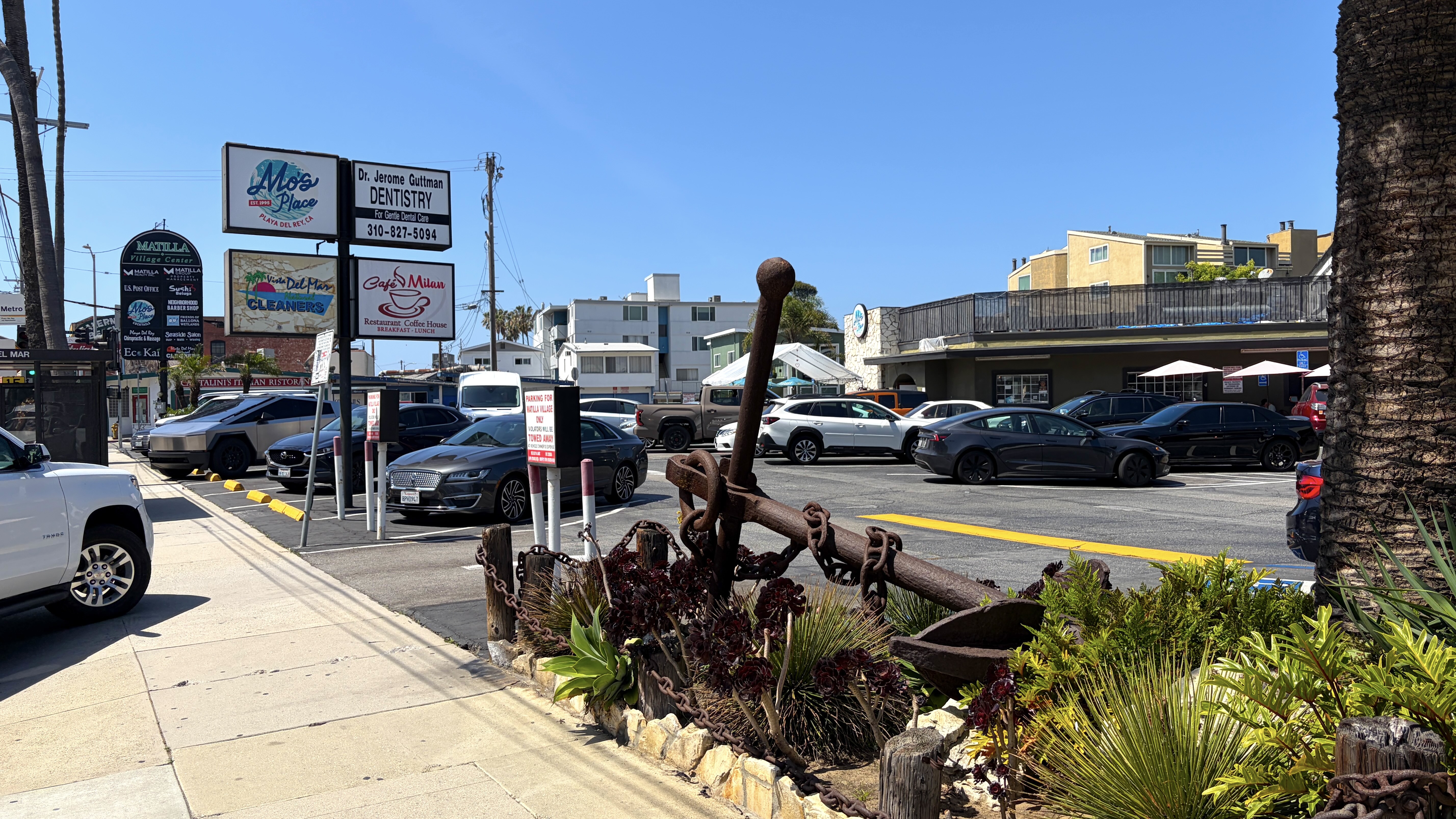
Beyond this tiny commercial strip, there are a smattering of other eateries along an even shorter stretch of Manchester Avenue, located “up the hill,” so we ultimately decided to return to Playa Provisions where I grabbed a sandwich and a pilsner.
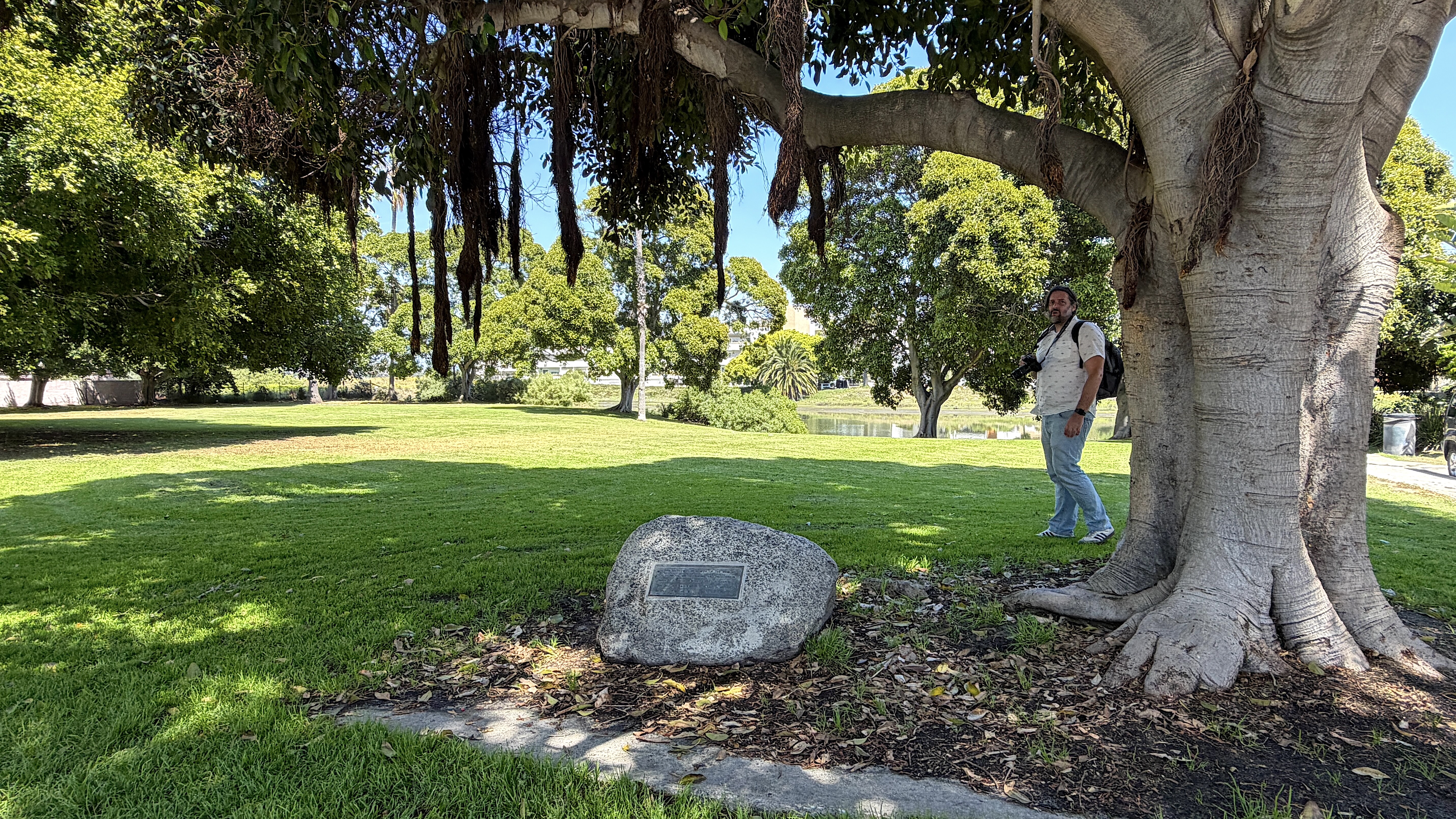
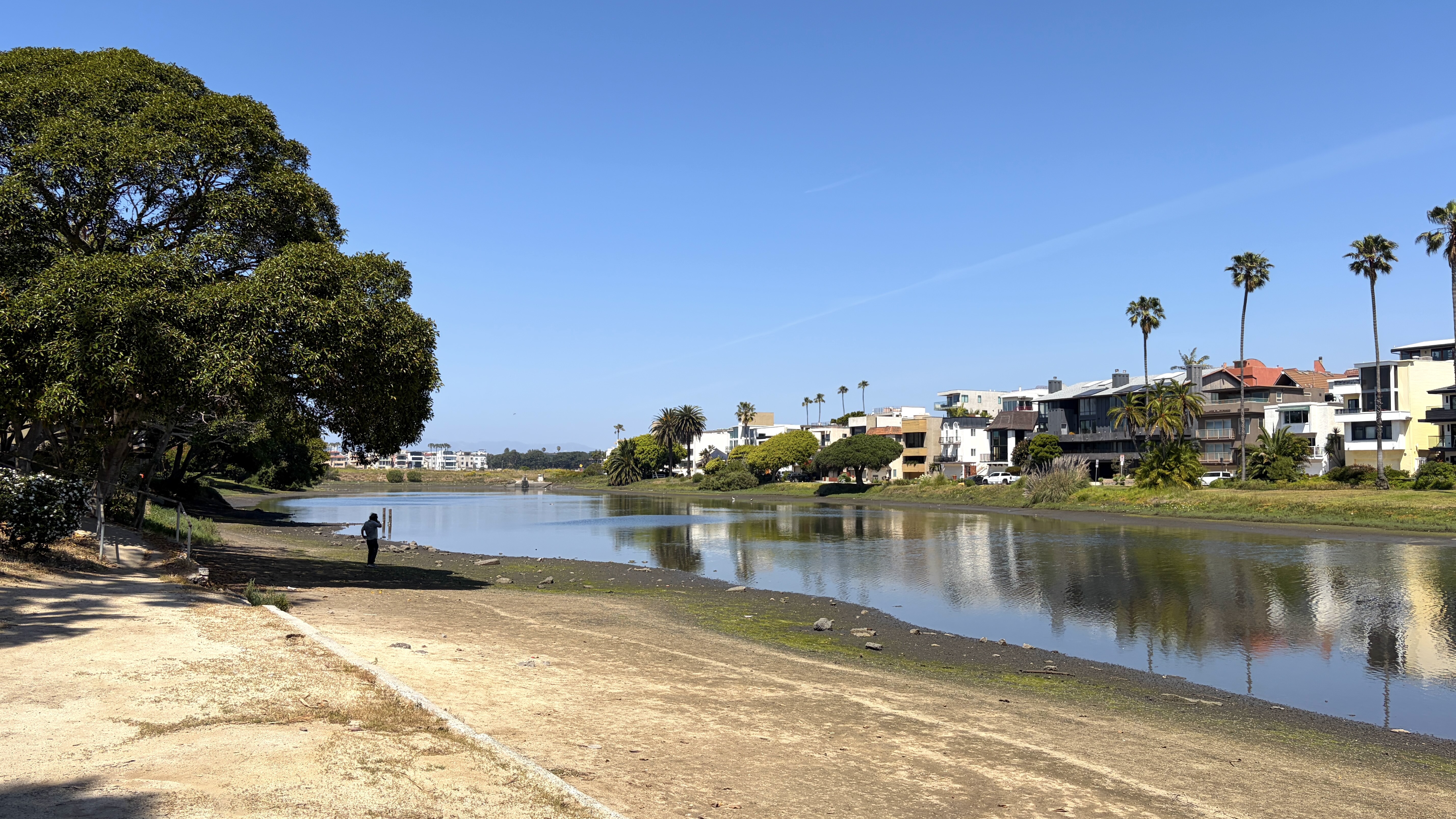
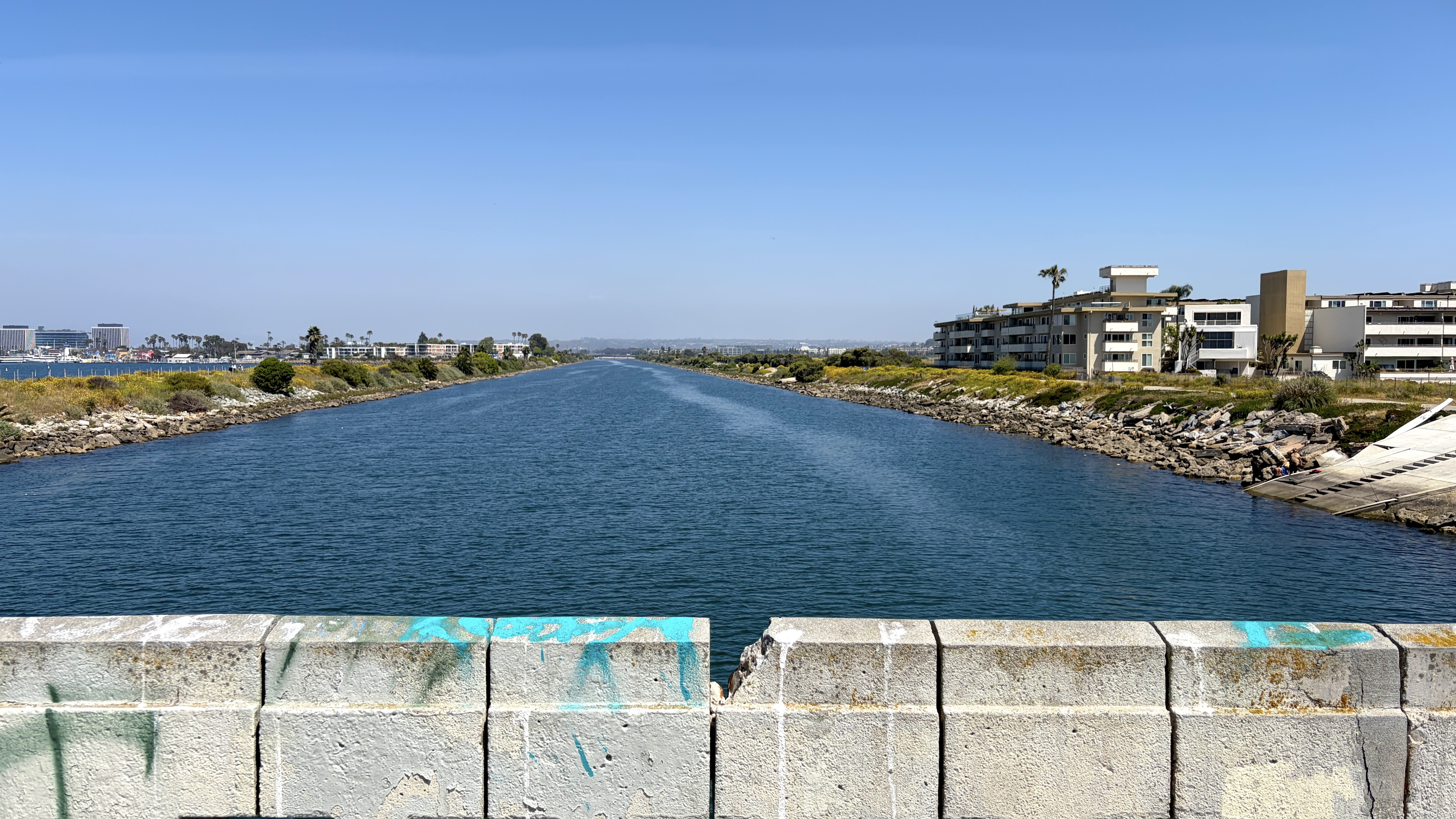
After that, we strolled over to the Del Rey Lagoon (aka “the Duck Pond”) in Del Rey Lagoon Park, over to Ballona Creek, and to Pacific Avenue. Pacific Avenue used to cross the creek to the Marina Peninsula neighborhood. That was the bridge used by the Los Angeles Pacific Railroad (LAP) — and later Pacific Electric Railway‘s (PE’s) — Venice-Del Rey Shuttle Line. That train connected Venice and Playa del Rey via a bridge over Ballona Creek from 1905 until 1936. The bridge there was demolished in 1950, increasing Playa del Rey’s isolation from its neighbors. We then walked through the quiet streets of this area, mostly developed with apartments and condominiums from the 1950s through the ’80s.
A BRIEF HISTORY OF THE AREA — THE CHUMASH ERA TO PRESENT DAY
The first people who arrived in the area were the ancestors of the Chumash, who established villages in the bluffs here some 7,500 years ago. Below the bluffs, as the ice caps melt during the end of an ice age, sea levels rose and the deep water bay was filled with sediment, creating a vast saltwater marsh that teemed with life, and thus, resources. The villagers used plant material waterproofed with tar to construct a village that, eventually, was their most populous on the mainland. Around 2000 years ago, however, the Chumash developed their revolutionary sea craft, the tomol, which they used to pivot from coastal foraging to deep sea hunting. Over time, their homelands — which at their peak stretched from Morro Bay to at least as far as Bolsa Chica — shrank and they abandoned some of their mainland villages.
THE TONGVA AND PWINUKIPAR
Around 3,500 years ago, the Tongva began migrating into the Los Angeles basin from the Sonoran Desert to the east. By roughly 1000 CE, they were the dominant people of the Ballona Wetlands, which they named Pwinukipar, meaning “it is filled with water.” At Pwinukipar, the Tongva established a complex of villages, including Sa’angna (“place of tar”) and Wa’atsngna (“place of mud”). They, too, possessed the technology to build sewn-plank canoes, which they called ti’at — probably acquired from the Chumash, with whom they established an intense economic interdependence and a generally peaceful coexistence.
NEW SPAIN
In October 1542, a new people arrived on the scene, the Spanish. On the 10th of that month, the expedition of Juan Rodríguez Cabrillo anchored off the coast of Pwinukipar and claimed everything he saw for Spain. In Juan Paez’s, Relación del descubrimiento que hizo Juan Rodríguez, Paez wrote that the Tongva rowed out from a village next to the sea in “muchas canoas muy buenas, que cabían en cada una doce o trece indios.” The Spanish thus referred to the village “el Pueblo de las Canoas” — named after the ti’at. Paez also noted that the pueblo’s inhabitants wore animal skins and ate a diet based around agave and raw fish. He added, though, that maize reportedly grew in a nearby valley. On 13 October, the Spanish sailed out of Pwinukipar, past Anyapax, into the Chumash heartland. After that, 227 years would pass without further contact between the two peoples.
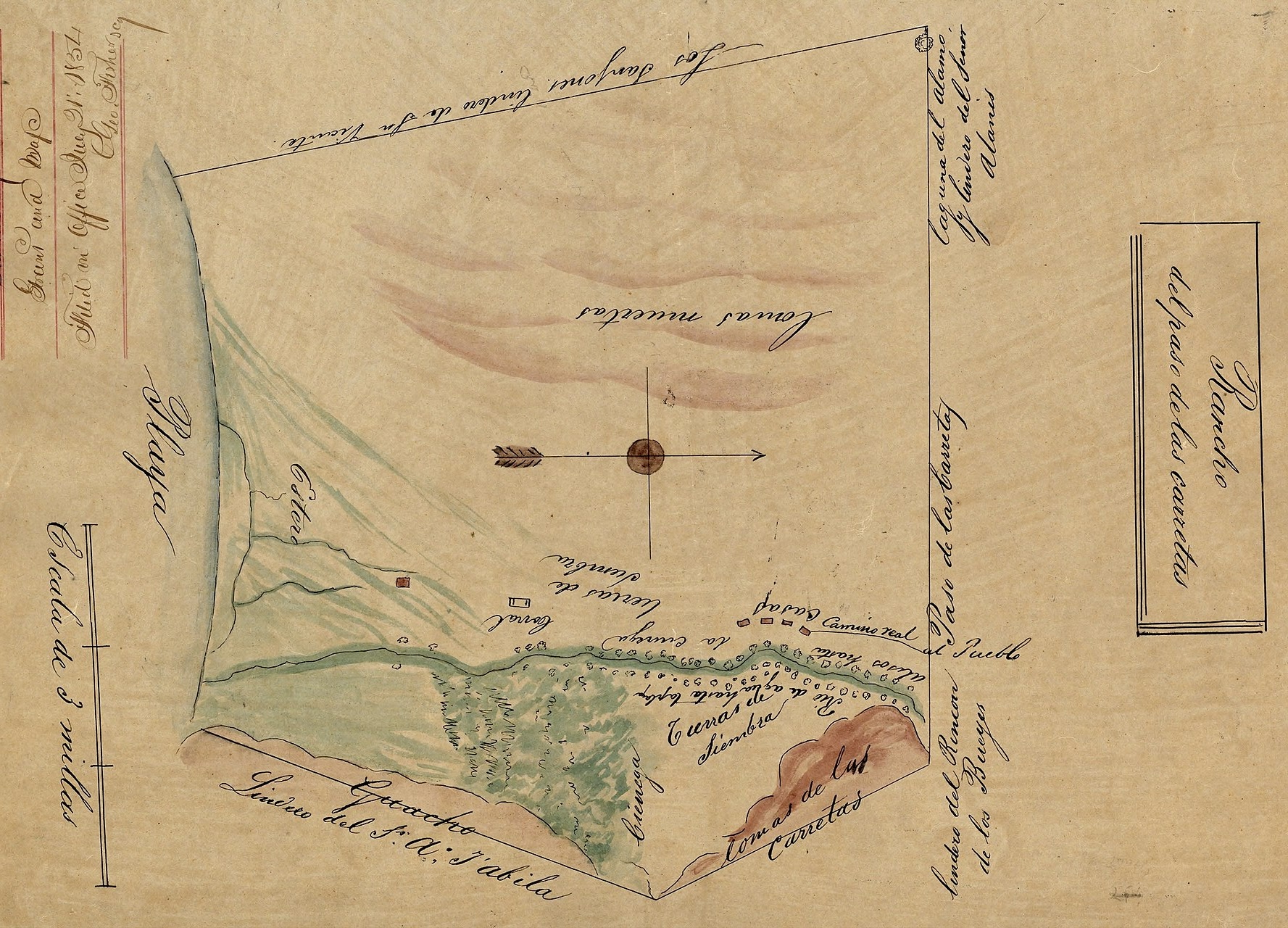
In 1769, the Spanish returned, this time with an overland expedition led by Catalan explorer Gaspar de Portolà i Rovira. Following the ancient Chumash road from the La Brea Tar Pits that led to the coast (now Wilshire Boulevard), the Spanish didn’t, that time, pass through Pwinukipar — but Catalan missionary Joan Crespí noted in his diaries the sight of smoke rising from coastal villages to the south. This trip marked the real beginning of Spain’s colonization of Alta California, which would lead to the decimation and subjugation of the Chumash, Tongva, and all the Natives unlucky enough to live within the narrow “mission strip.” The first mission in the area, Misión de San Gabriel Arcángel, was founded about 40 kilometers east in 1771. Records show that ninety residents of Wa’atsngna were baptized there. El Pueblo de Los Angeles was founded in 1781. In 1803, Jalisco-born Jose Pio Quinto Zuñiga and his Payómkawichum wife, Rufina Maria Allam, established Rancho de los Quintos in Pwinukipar and began grazing cattle and horses in the wetlands..
Mexico declared independence from Spain in 1810, which was followed by an eleven-year war for independence. In 1815, a massive flood washed away the original Plaza de Los Angeles and rerouted the Los Angeles River’s course from the San Pedro Bay to the wetlands here along the Santa Monica Bay. By 1819, two other families – the Machados and Talamantes – were also grazing cattle in and around the wetlands. Another massive flood, in 1825, returned the mouth of the Los Angeles River to the San Pedro Bay and the smaller waterway flowing along its former course was renamed Río de la Ballona. The source of the name is unclear. It’s possible that it is a reference to Baiona, the purported ancestral home of the Talamantes family. Another theory is that it’s a reference to whales, or “ballenas.” On maps, it was also often labeled Sanjón de Agua con Alisos or Sanjón Alisal. In 1839, Mexican Governor Juan Bautista Alvarado granted the 5630-hectare area around the wetlands as Rancho La Ballona-Paso de las Carretas. The four recipients of the grant were brothers Agustín and Ygnacio Machado, and father and son Felipe and Tomás Talamantes.
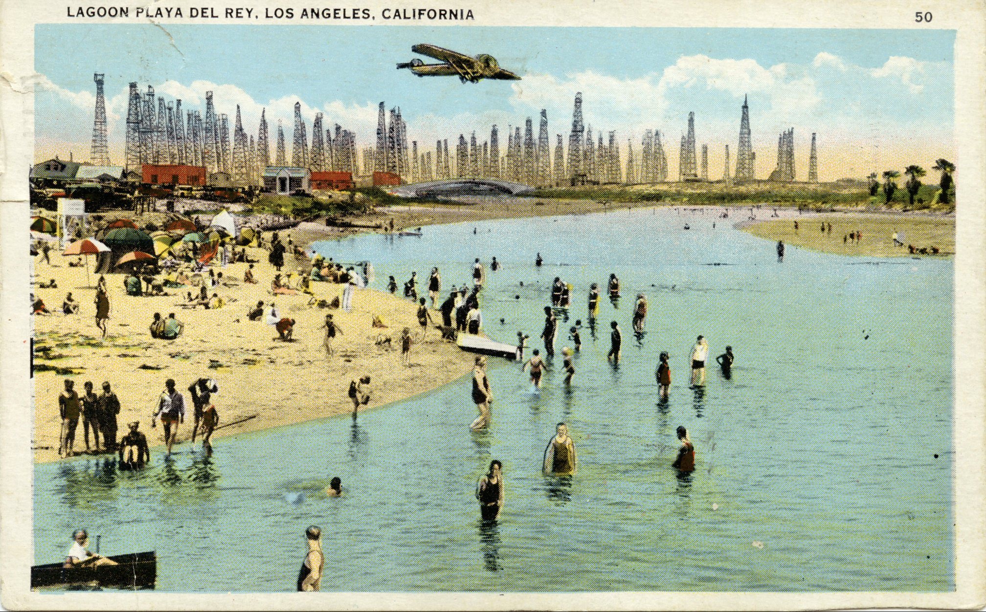
The US invaded Mexico in 1846. By ‘48, two-thirds of the latter had been conquered by the former. California became a state and the City of Los Angeles was incorporated in 1850. The nominal city, then home to 1,610, was located about fifteen kilometers east-by-northeast of Rancho La Ballona. Around 1868, a court decree divided Rancho La Ballona into 23 sections, with the heirs of the Machados receiving the largest allotment. In 1887, Moye Wicks and Louis Mesmer formed the Port Ballona Development Company. Backed by the Atchison, Topeka and Santa Fe Railway, the company spent roughly $300,000 (a bit over $10 million adjusted for inflation) to dredge the lagoon with the hope of establishing a major shipping port on the Santa Monica Bay. The dredged channels, though, were repeatedly filled with sand deposited by the ocean and, in 1888, the company gave up and pulled up stakes. In 1907, the rival, Southern Pacific Railroad-backed Port of Los Angeles would ultimately open in the San Pedro Bay, which today (combined with the neighboring Port of Long Beach) forms the busiest port complex outside of Asia.
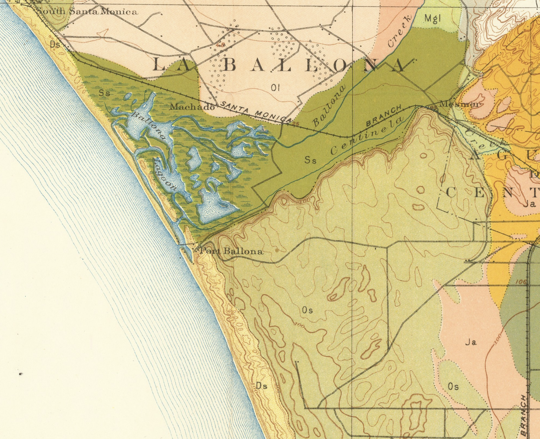
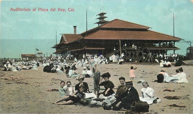
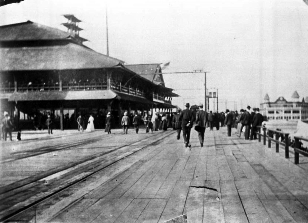
In 1902, Eli P. Clark, Henry P. Barbour, and Moses Sherman formed the Beach Land Company in order to transform the abandoned port project into a luxury resort. Toward that aim, they purchased 1,000 acres (404 hectares) of land around the wetlands. In June 1902, they established the Playa del Rey townsite. The streetcar suburb was connected to Los Angeles by LAP’s Redondo Beach via Playa del Rey Line, which began operation on 9 November 1902. The mass transit line ran along the route of Culver Boulevard (the parallel car path, added in 1904, was called Speedway and was renamed after Harry Culver in 1927) and what became Vista del Mar.
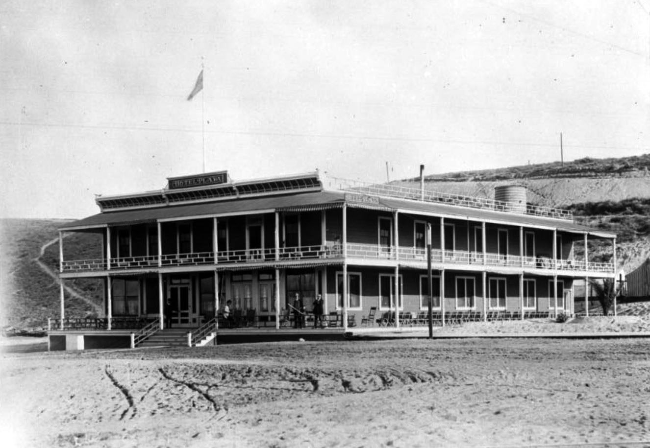
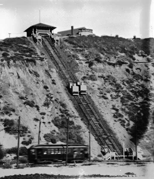
The centerpiece of the Playa del Rey resort was the 40-room Hotel Playa. Soon after opening in 1904 it was renamed the Hotel del Rey. The attached Playa del Rey Pavilion contained a dancefloor, restaurant, and bowling alley. The Playa del Rey Incline Railway was built to convey tourists between the pavilion above and the beach until it was abandoned around 1908 due to erosion and instability. Other resort attractions included a plunge and a boardwalk.
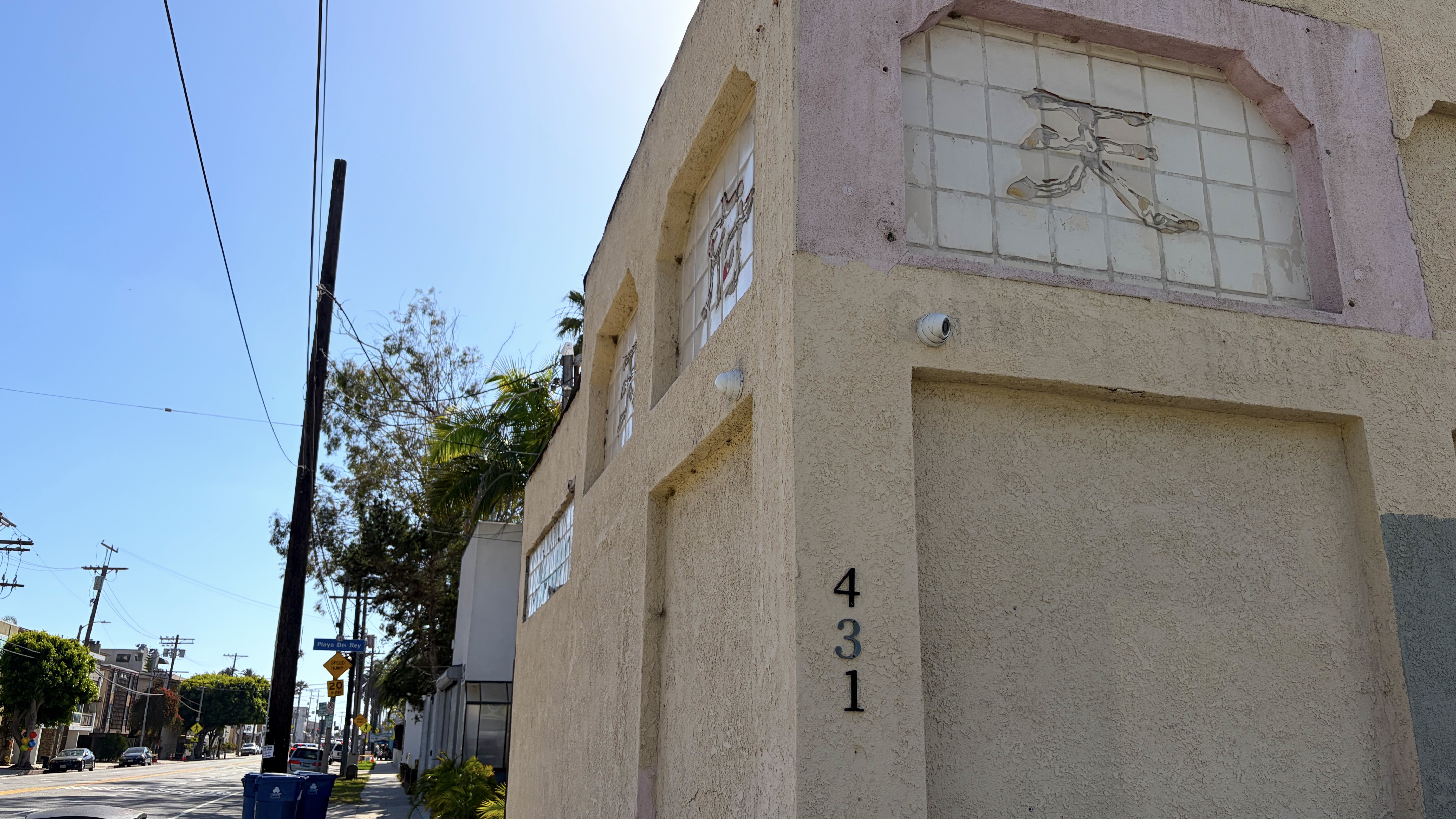
A few early structures were constructed, a handful of which still stand: 6501 Ocean Front Walk (1907), the Playa del Rey Commerce Building (179 Culver Boulevard, 1911), and the so-called Howard Hughes Guest Home (200 Montreal Street, 1912). Most of Playa del Rey’s built environment, however, was constructed in the 1950s. The hills east of Pershing Drive and south of Manchester Avenue, were mostly developed with low-rise condominiums between the 1960s and ‘80s. That area, although not developed until much later, was the first to have been annexed by Los Angeles — having become part of that city with the West Coast of Addition of 15 June 1917.
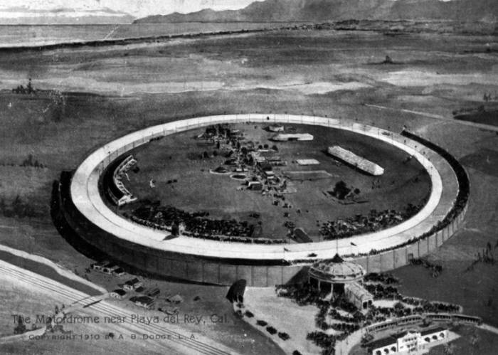
THE LOS ANGELES MOTORDOME
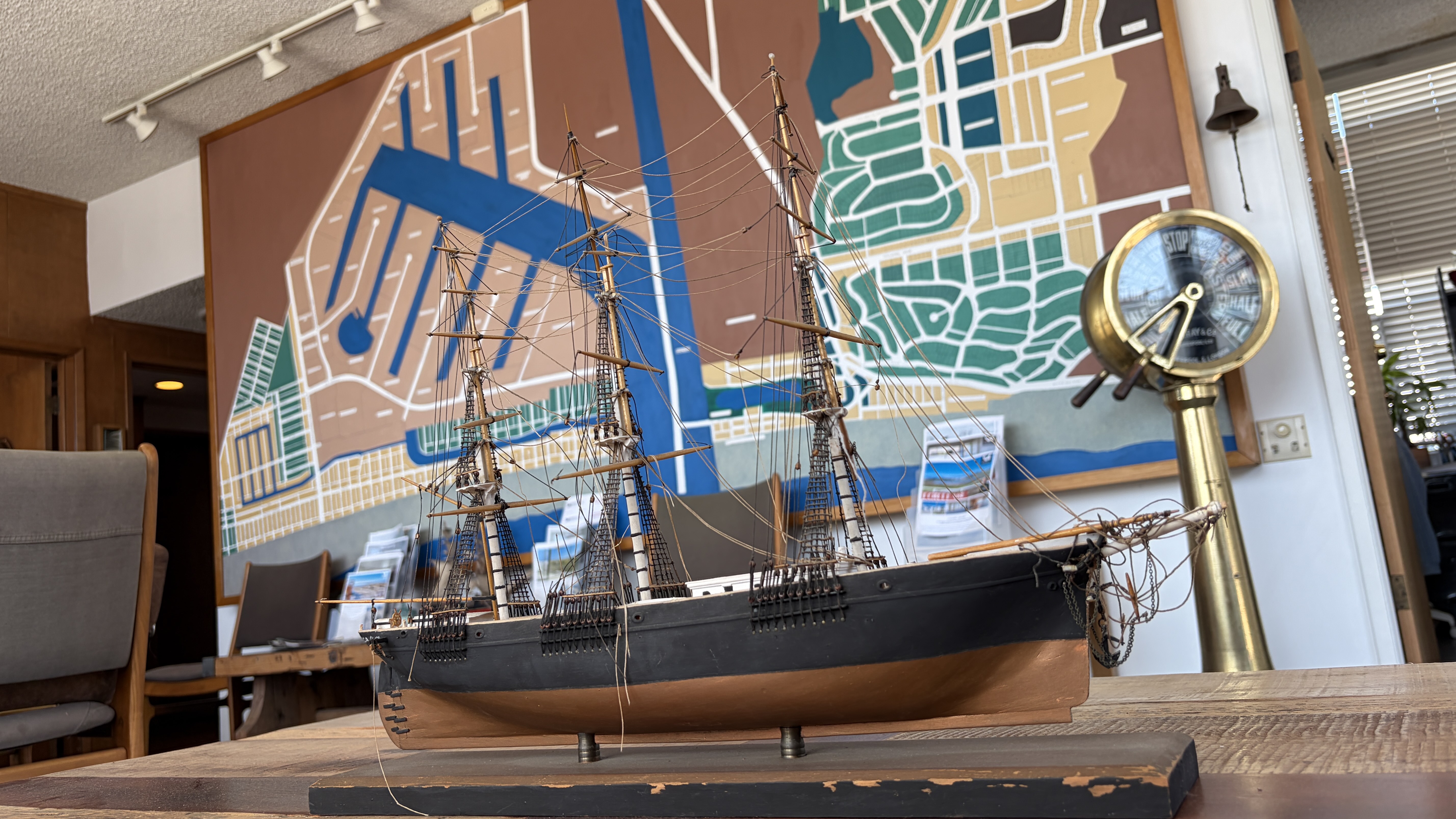
The second big attraction in Playa del Rey was a racetrack. The Los Angeles Motordrome opened on 8 April 1910. Nicknamed “the Boards” and “the Pie Pan,” it was the first circular wooden track built specifically for automobile and motorcycle racing. It was designed by a former champion bicyclist, velodrome designer, and British immigrant named John Shillington “Jack” Prince,. It was constructed near the intersection of Culver and Jefferson boulevards. Hugely popular, it proved, nevertheless, to be short-lived. On 11 August 1913, the 40,000-capacity venue was severely damaged by fire – blamed on vagrants who’d taken shelter beneath the elevated track. The venue was partly owned by PE, who after the fire, abandoned their rail spur to the venue. The structure, made of Oregon pine, was eventually mostly dismantled by salvagers or rotted and absorbed back into the earth.
HYPERION
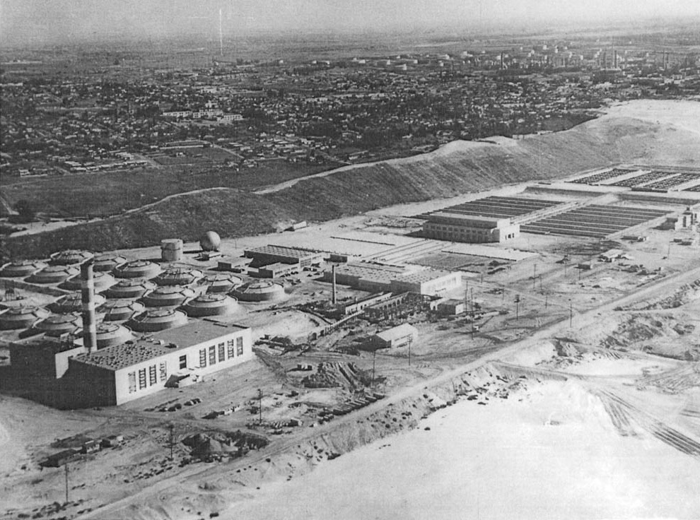
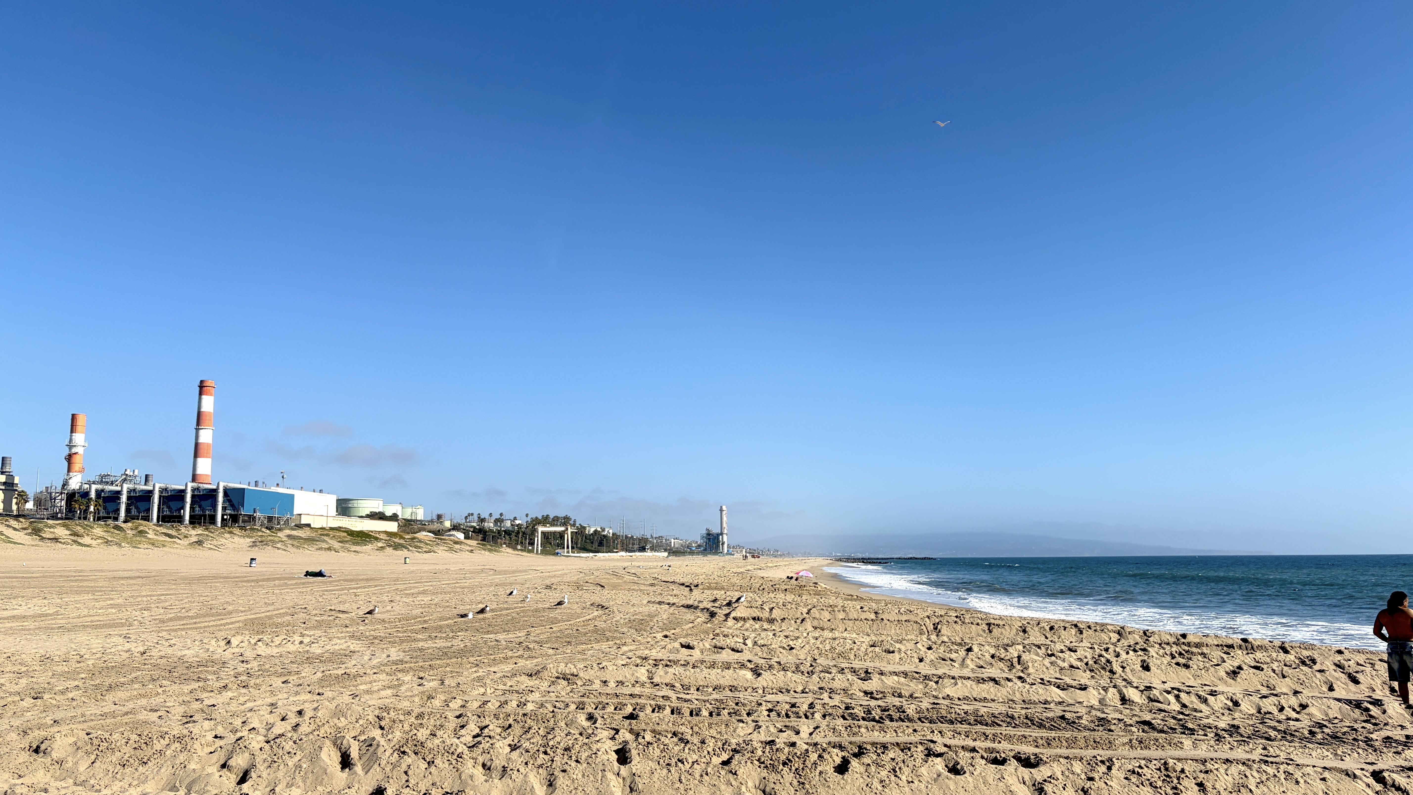
I have seen “Playa del Rey, California,” written in many places — make it seem as though it’s still a town. Playa del Rey was never incorporated as a city, though. It was, instead, dismantled and annexed by Los Angeles in sections, and then reassembled as a neighborhood. The southernmost edge of the neighborhood, the unhabited Dockweiler Beach area, was historically known as Hyperion. Hyperion came part of Los Angeles as part of the West Coast Addition of 15 June 1917. Today it’s dominated by the Hyperion Water Reclamation Plant which, from 1894 until 1925, was Los Angeles’s primary raw sewage outfall. The history of Los Angeles sewage is thoroughly recounted in Anna Sklar’s Brown Acres: An Intimate History of the Los Angeles Sewers (Angel City Press, 2008). In 1925, Los Angeles began treating the sewage before dumping it off the coast and the outfall was eventually extended further into the ocean. The beach there, originally the Venice-Hyperion Beach, was renamed after Isidore Bernard Dockweiler in 1955.
ANOTHER GREAT FIRE
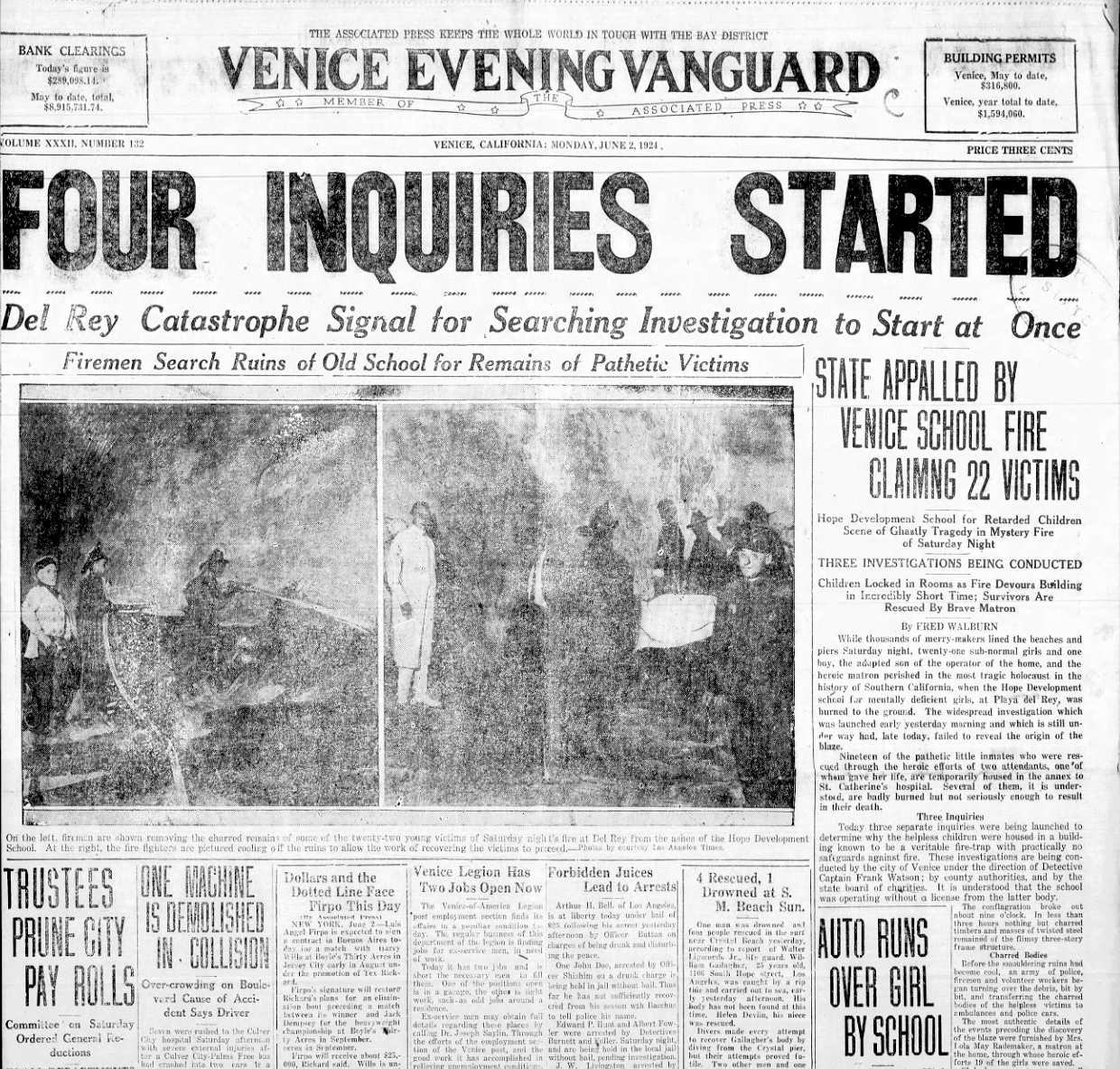
On 31 May 1924, Playa del Rey’s other remaining attraction was also destroyed by a conflagration. The old Hotel del Rey had, by then, been leased for years to Ione Conant. Conant operated the old hotel as a home for young women with developmental disabilities, the Hope Development School. One of the girls there, sixteen-year-old Josephine Barthelemy, started a fire that destroyed the hotel hoping that it would free her from its confines. The fire destroyed the hotel, pavillion, and 24 residents. Because of her mental state, she was deemed unsuitable for prosecution. After that, she disappeared from the public eye but regulations, reforms, and changes were adopted and implemented to make such disasters less likely. A memorial to the dead students was installed at Inglewood Park Cemetery.
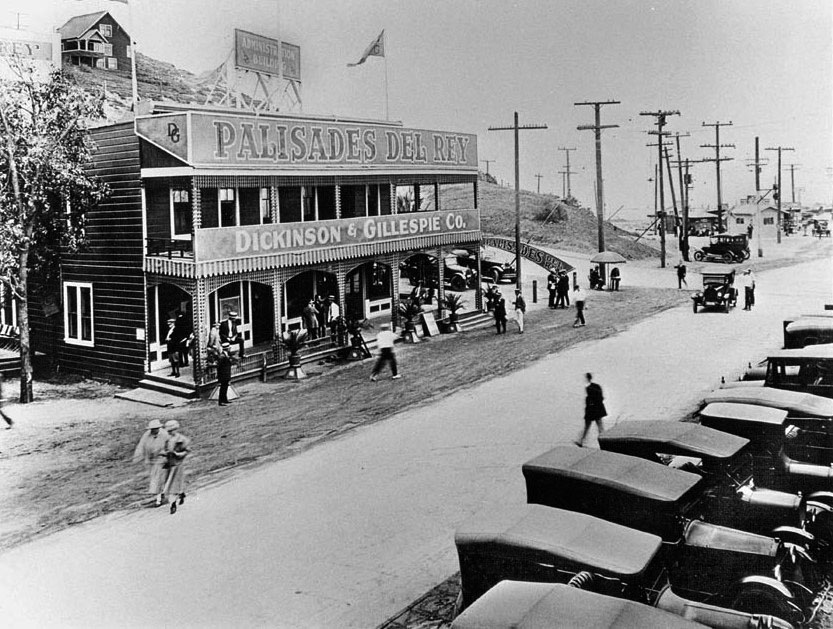
ANNEXATION, PALISADES DEL REY, AND SURFRIDGE
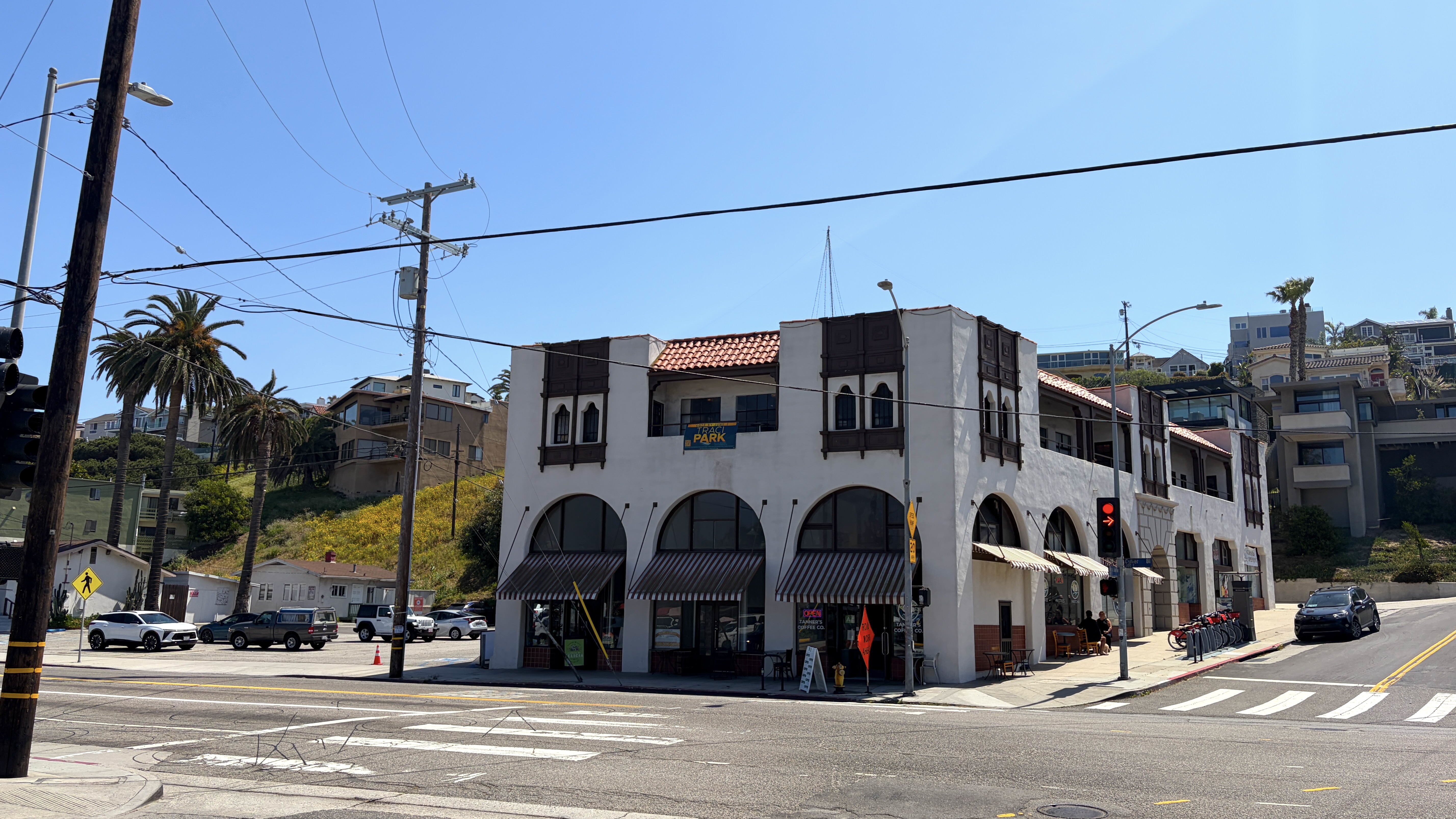
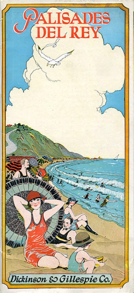
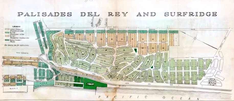
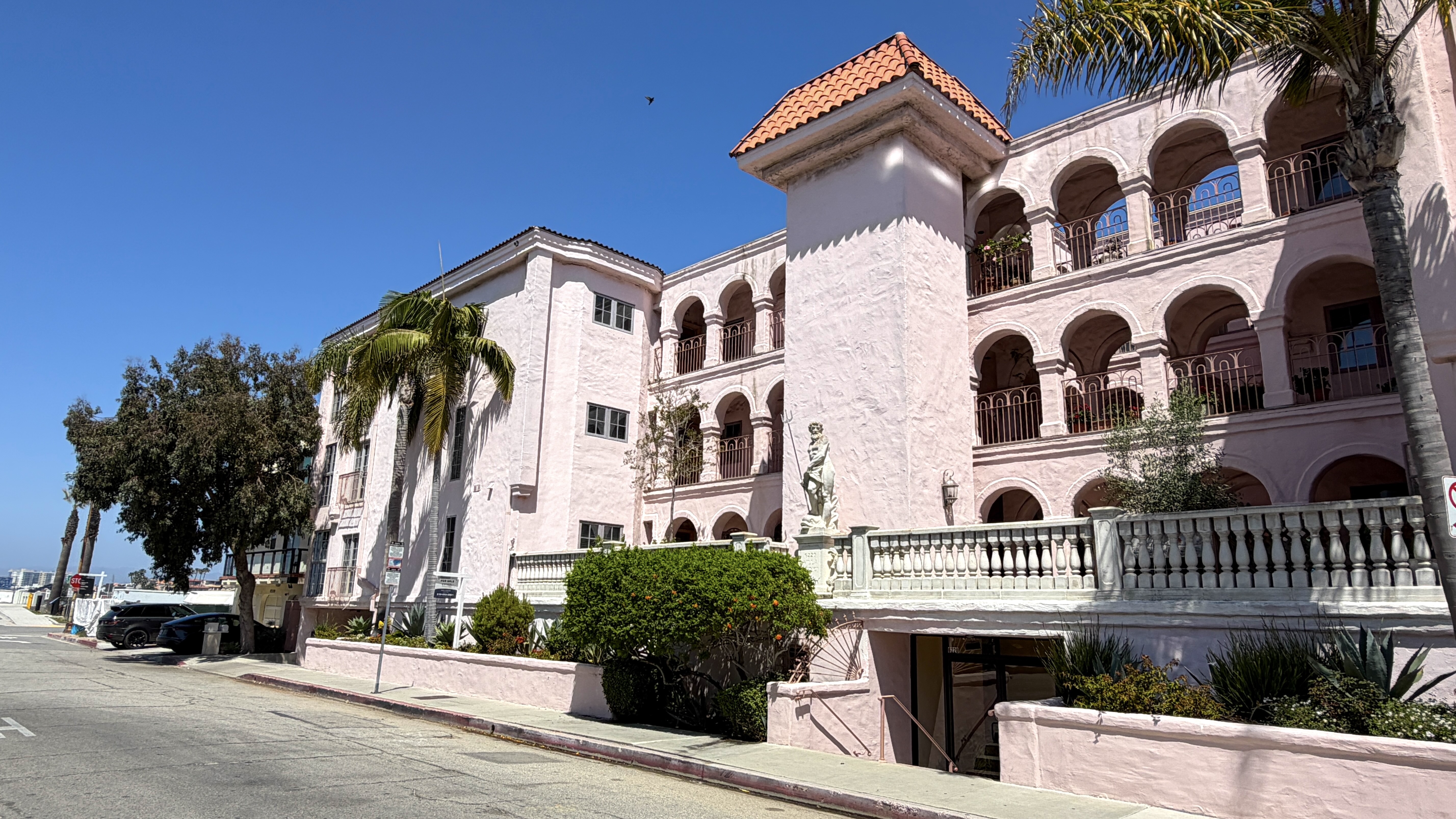
On 25 November 1925, the community west of Pershing Drive became part of Los Angeles as part of the Venice Consolidation. After the fire and annexation, the focus of development in Playa del Rey was shifted from resort maintenance to the construction of permanent residences. Most of the oldest homes in Playa del Rey were built in 1925. A neighboring subdivision, Surfridge, also opened in 1925 (following Palisades del Rey in 1921). Both were developments by Dickinson & Gillespie, a firm that officially relocated from Minneapolis to the remodeled Hotel Playa around 1924. Not to be confused with the Hotel Playa, this much smaller Hotel Playa was built in 1906 and was named after the larger Hotel Playa had been renamed Hotel del Rey. In 2009, this building, at 200 Culver Boulevard, was designated Los Angeles Historic-Cultural Monument No. 955.
SHIFTING TRANSIT GEARS — MINES FIELD AND BUSES
An airstrip known as Mines Field opened immediately east of Palisades del Rey and Surfridge on 1 October 1928. In 1930, it became Los Angeles Municipal Airport. That same year, PE cut rail service to Playa del Rey to just one daily trip in order to retain operating rights. Passenger rail service to Playa del Rey ended completely on May 12 1940 and was replaced by PE’s bus service, which was taken over by Metropolitan Coach Lines and, in turn, Los Angeles Metropolitan Transit Authority in 1958. Southern California Rapid Transit District (SCRTD) took over in 1964 and provided limited bus and shuttle service until 1993.
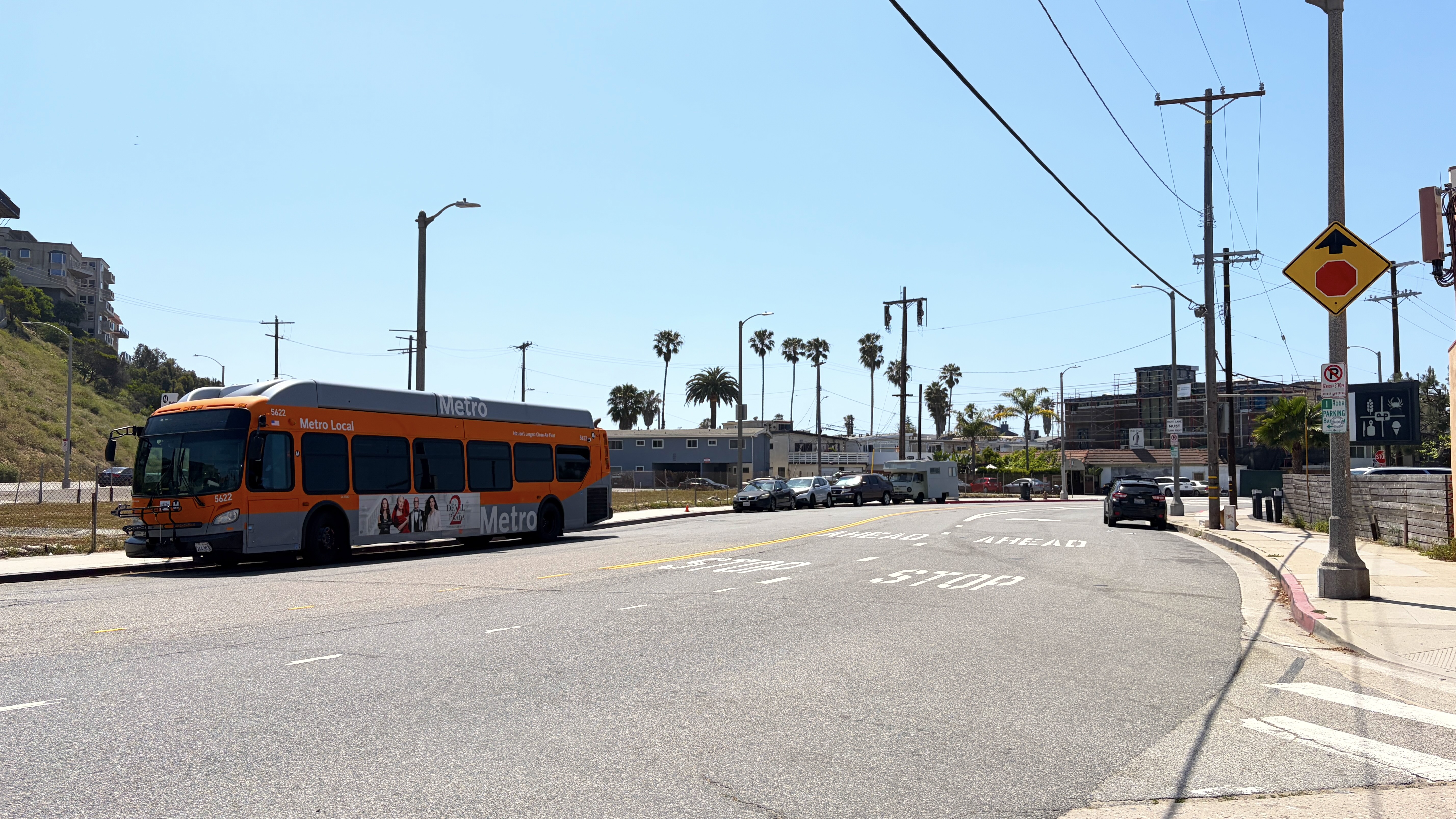
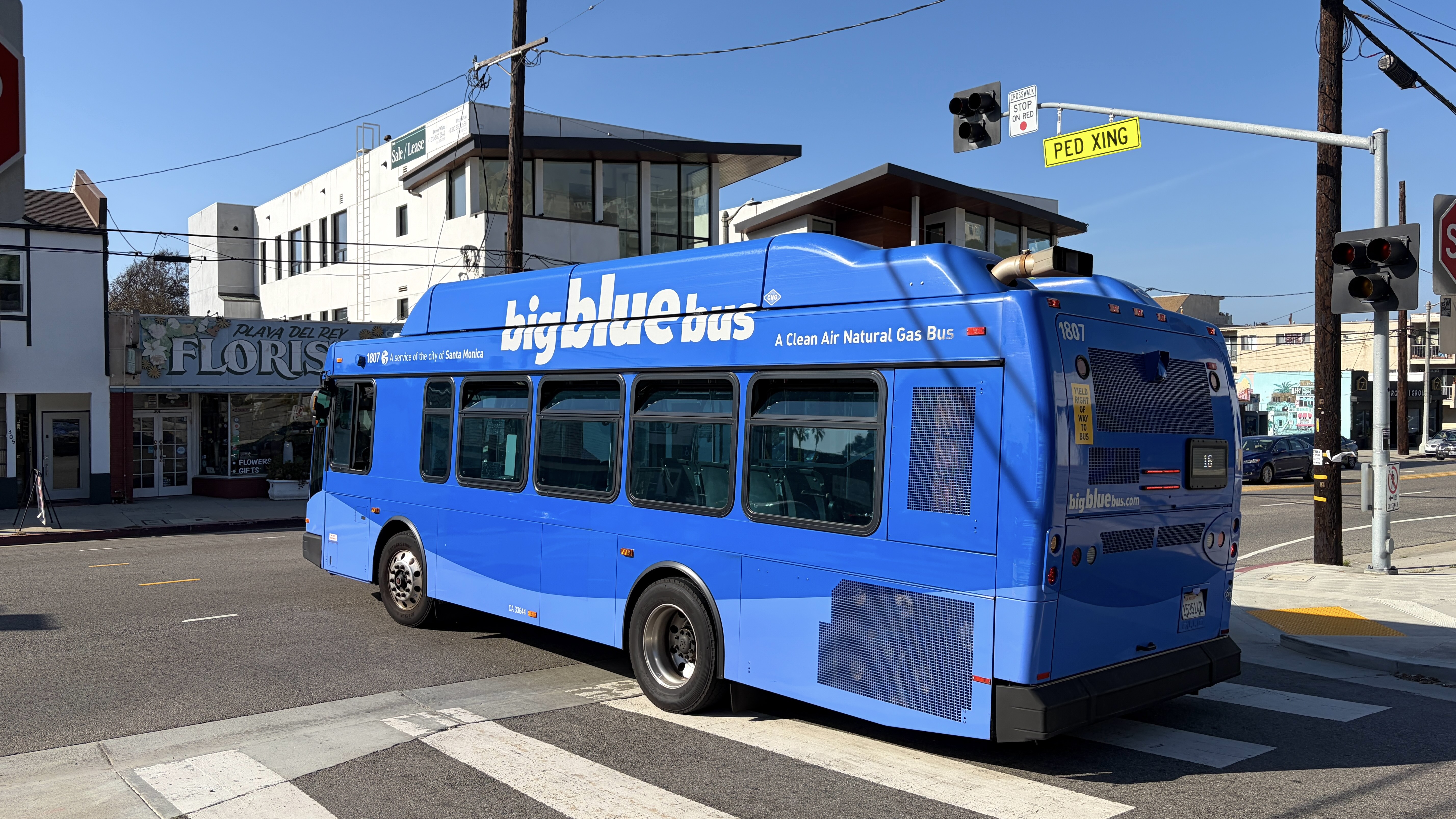
Today Playa del Rey is seriously underserved by mass transit. There is Metro‘s 115, which was extended to the neighborhood in the late 1980s, although “short-lined” buses still terminate at Sepulveda in Westchester — and weekend service is even less frequent. In 2023, Big Blue Bus‘s (BBB’s) 16 was only extended to the neighborhood in 2023 — but not on weekends, when most tourists presumably wish to visit.
THE JET AGE AND THE DESTRUCTION OF PALISADES DEL REY AND SURFRIDGE
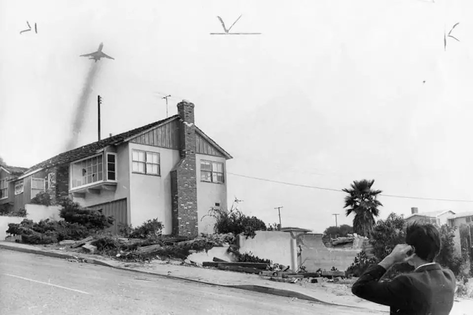
After further expansions, it became Los Angeles International Airport (LAWA) in 1949. On 25 January 1959, American Airlines launched its first transcontinental jet flight from there. At 8:45 that morning, a Boeing 707 named Flagship California departed for New York City, inaugurating the Jet Age. The Jet Age revolutionized the speed, scale, and accessibility of human movement; lowered operating costs making air travel accessible to middle class Americans; but also drastically increased noise and air pollution. The residents of Palisades del Rey and Surfridge had soot-covered front row seats. Many residents abandoned the neighborhood in the aftermath but a long legal battle began between the City, the Department of Airports, and the residents who refused to leave. Many homes were acquired through eminent domain in 1965 but there were holdouts. The last residents were gone by 1975. The vacated homes were demolished, leaving behind a sort of ghost town network of empty streets.
THE DEL REY CO-OPERATIVE MARKET
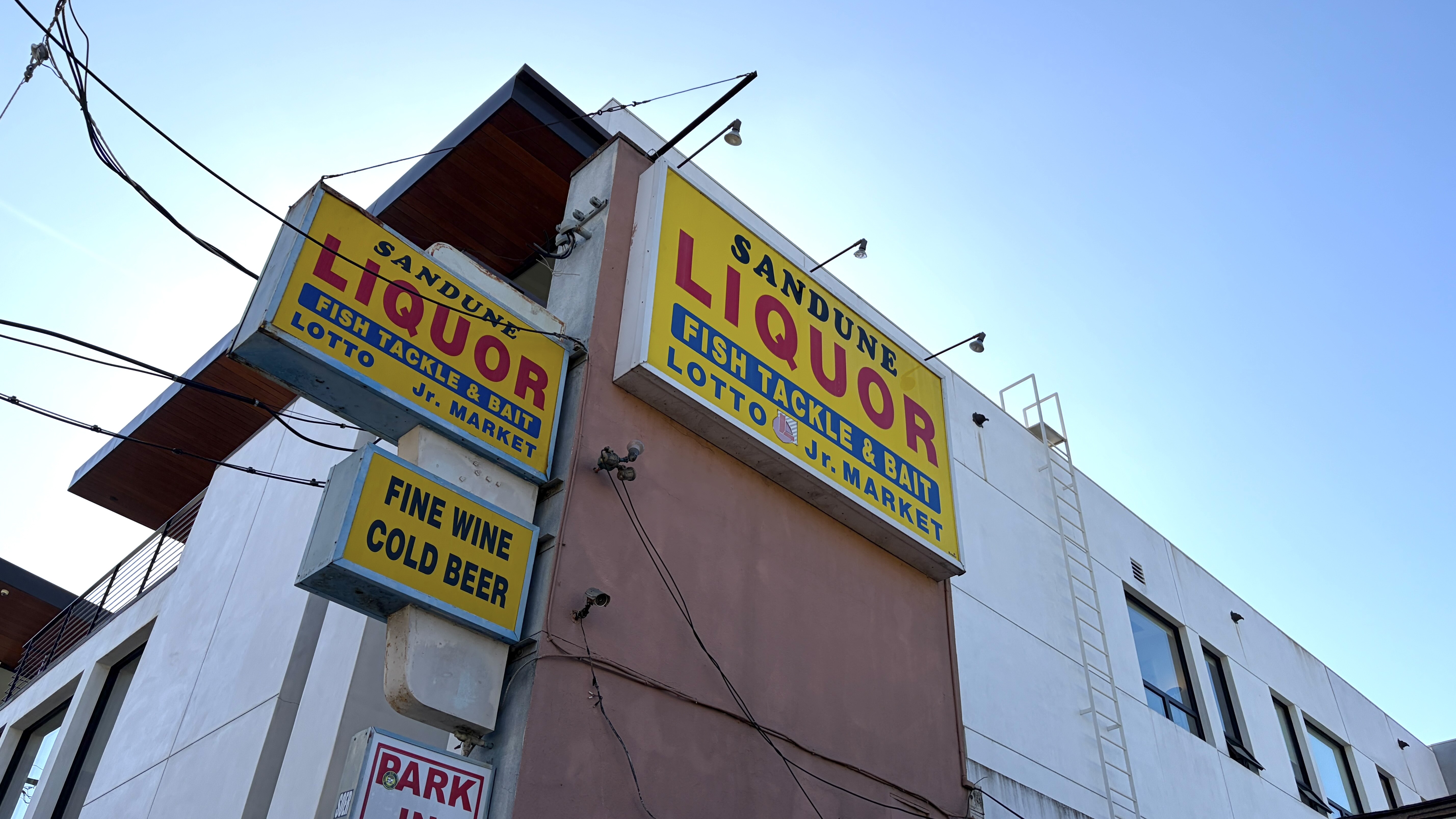
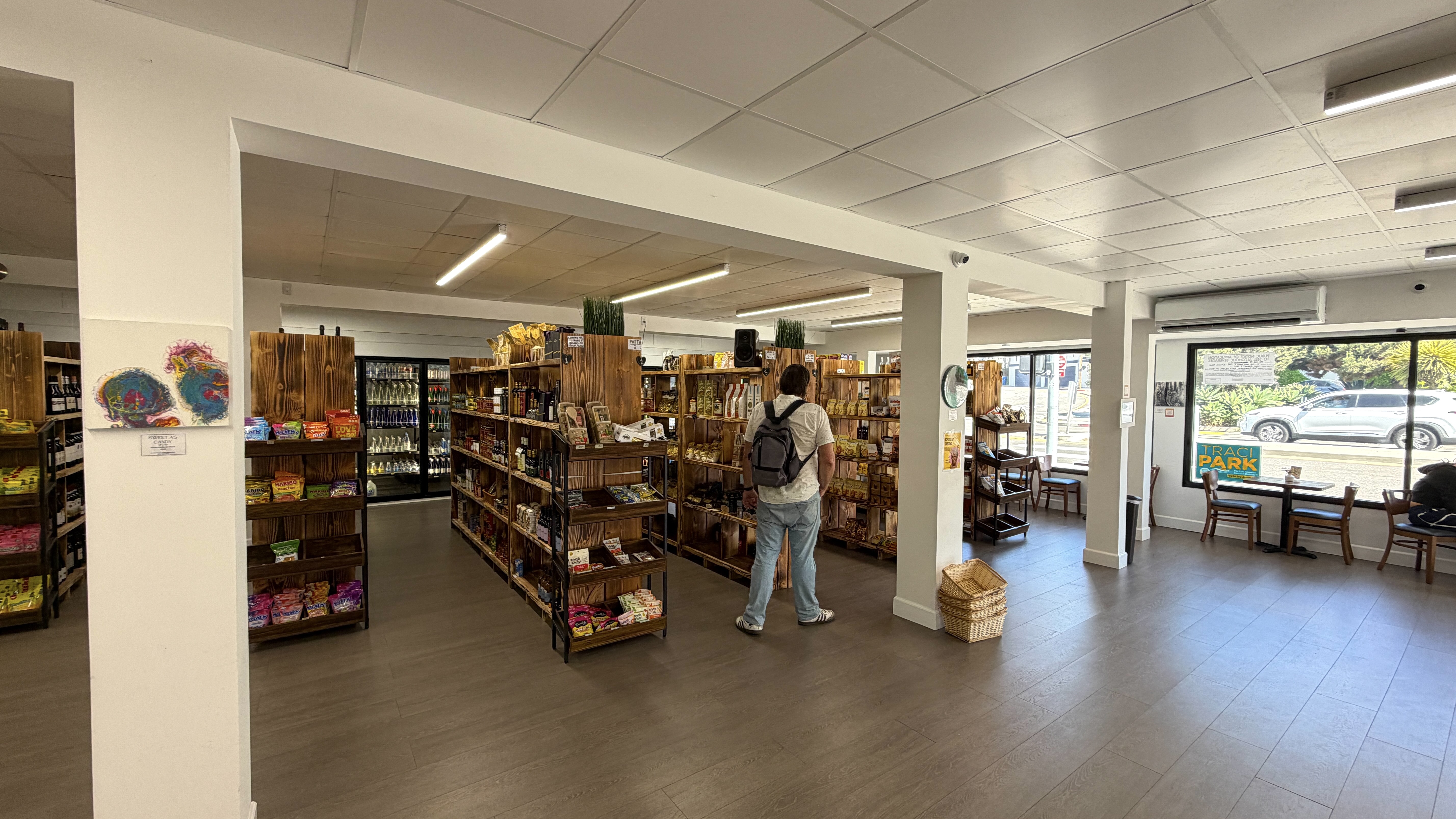
The Del Rey Co-Operative Market opened in the Playa del Rey Commerce Building in 1933. It closed in 1966, after which it was replaced by a bar called Chez del Rey. A bar is nice — but it’s not the same as a grocery store, which the closure of the co-op seems to have robbed the community of. Although focused on “fine wine & spirits,” Dale’s Jr. Market is probably the most varied. Although alcohol probably accounts for most of their sales, they’re stocked with toiletries, bottled condiments, and a small produce section. Howe Mart is similar, if even more convenience store in its orientation. Sandune Liquor Store – Jr. Market stocks liquor, essentials — and “fish tackle and bait.” Basically, if you can live off Michelob Ultra and Funyuns Flamin Flavored Hot Onion Rings — you’re all set. If you want artisanal cheeses, veggie meats, or produce other than the school lunch staples, you’ll probably have to drive or be driven out of the neighborhood, though — or ride a bus or cargo bike. I should mention, to, Local Market & Deli, which has a deli, lots of Italian snacks, noodles, sauces, &c. Jackie bought a bag of chips that she is now scouring the region to find at a spot closer to her place in the San Gabriel Valley.
AEROSPACE HUBURB
In 1940, almost a decade before Los Angeles Municipal Airport became Los Angeles International Airport, Howard Hughes began purchasing farmlands and wetlands near Playa del Rey. The Hughes Aircraft Company moved there in 1941. At the time of its completion, it’s runway was the longest in the world. In 1947 — the same year Los Angeles International Airport adopted the code, “LAX” — Hughes’s wooden Hughes H-4 Hercules (mockingly nicknamed the “Spruce Goose”) made a one mile test flight after having been disassembled and transported from Hughes Airport to Long Beach the previous year.
WELCOME TO THE JUNGLE
One of the most notable developments was Tract No. 8573 – better known, locally, as the Jungle. The Jungle is a residential area composed largely of apartments built in 1956 and ‘57. Relatively dense, it stands out along a coast where expensive uniplexes are the norm.
There are walk streets and tropical foliage and it feels to me more like Venice to the north than the Beach Cities to the south.. Apparently, in its early days, the Jungle was usually disparaged by its neighbors. By 1986, however, some residents there proudly wore T-shirts proclaiming defiantly “There is no life east of Vista del Mar.” Since 1978 has been an annual Jungle Clean-Up, these days organized by Friends of the Jungle (FOTJ).
Just south of the Jungle, from 1925-1978, home of another of Playa del Rey’s early attractions, the Westport Beach Club. Its Spanish Colonial Style clubhouse, designed by Stephen Goosson, included cabanas, a pool, and volleyball courts. It was destroyed by a fire in 1964. The club itself officially disbanded in 1978. What was left of the fire-damaged clubhouse was demolished in 1984 to make way for the construction of the Westport Beach Club Condominiums.
TOES BEACH & FIRE PITS
In the 1950s, Playa del Rey emerged as a popular surf spot. The north end of the beach became known as Toes Beach, or Toes Over Beach, named for the “toes over” surf maneuver.
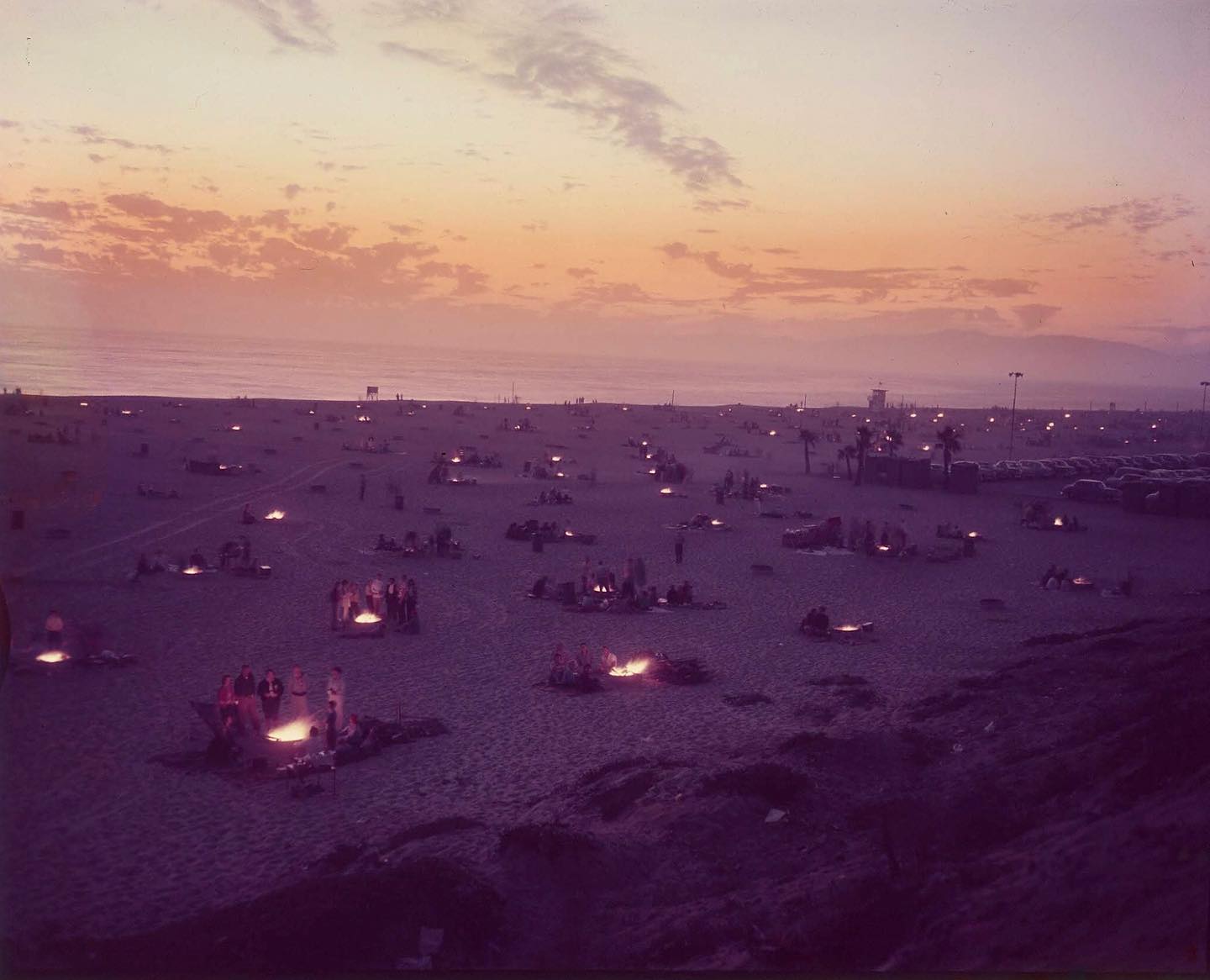
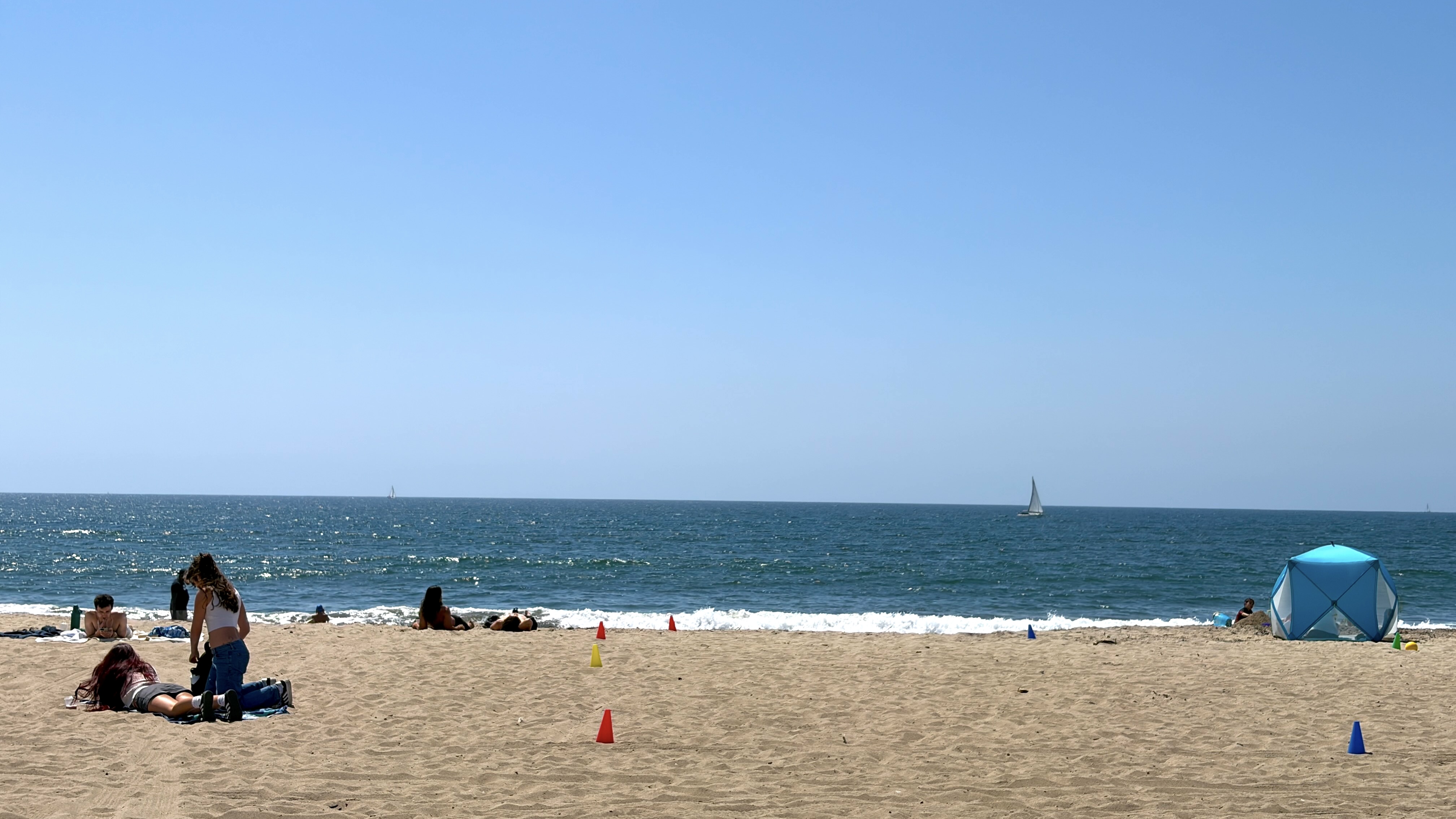
Photos from 1953 depict the neighborhood’s beach culture, which even then included beach bonfires. In 1990, concrete rings were built to create permanent fire pits and today Dockweiler Beach is the only beach in Los Angeles County where fires are still legally permitted. Use of the fire pits was banned during the COVID-19 lockdown, in a bit of counter-scientific overreaction, when beaches were closed despite the extreme unlikelihood of outdoor virus transmission.
Use of the fire pits was again banned in early 2025 as a result of air quality concerns during the out-of-control fires that burned across the region. While it might seem like the pollution from small fire pits would be less of a concern under the shadow of jets flying over and the smokestacks of the nearby Chevron El Segundo Refinery, those industrial giants are subject to regulations and produce different types of air pollution than wood fires, which an AQMD study suggested can be up to ten times more toxic to human lungs than “regular” fossil fuel pollution from cars and industrial sources. On the other hand, wood fires are good for the soul in way that car exhaust and smokestacks aren’t. Burning anything causes pollution, unfortunately, but if you need to scratch that firebug itch, there are less polluting products you can burn than traditional logs. Enviro-Log Firelogs (made from waxed, recycled cardboard), GrenHeat compressed sawdust bricks, and various brands of coffee logs will all give you flames and crackle with less pollution. And if you wish to grill, consider cleaner alternatives to traditional briquets like coconut shell charcoal, natural lump charcoal, and binchōtan.
THE BIRTH OF MARINA DEL REY & THE DEATH OF SURFING
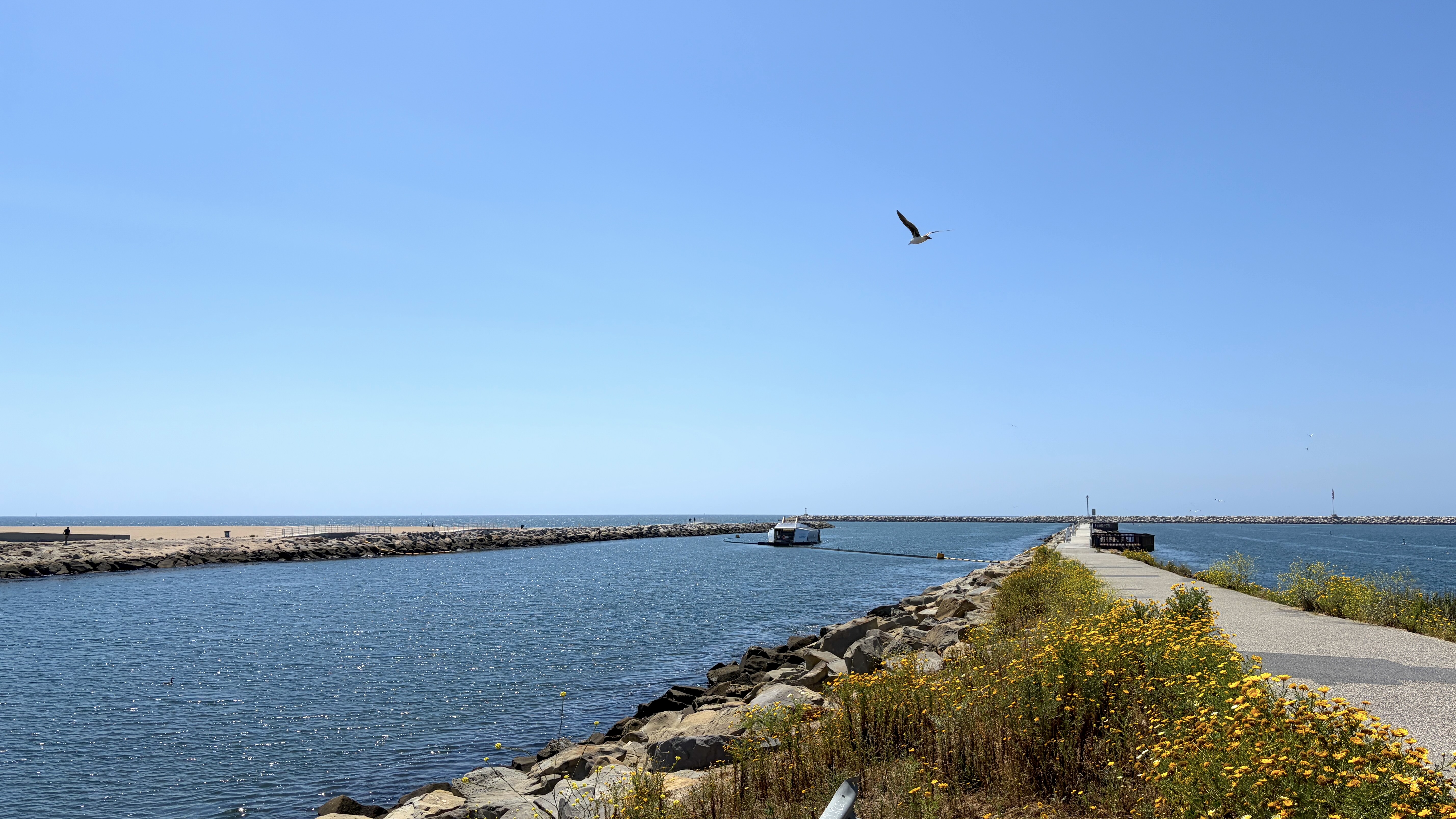
Although people still enjoy the beach and fires, the surfers have long since moved on. Surfing was snuffed out with the construction of a breakwater to protect Marina del Rey. The Los Angeles County Board of Supervisors authorized loans for the development of Marina del Rey in 1953. Beginning in 1957, developers dredged and destroyed 900 acres (364 hectares) of wetlands. Ocean currents continuously filled the newly created jetties with sediment until enough rocks had been transported from Santa Catalina Island (Pimu’ngna) to create a barrier, between 1963 and 1965 . There was, apparently, a return to surfing in 1969, when that year’s El Niño weather brought swells that overwhelmed the breakwater.
ITALIAN SURGE
I said earlier that you could, if means afford you, dine out for all of your meals in Playa del Rey. It would be helpful, though, if you like Italian food. The aformentioned Local Market & Deli has a decidedly Italian bent. Cafe Milan is nominally Italian but seems to have been founded by a Croatian and was popular former Yugoslavs. Caffe Pinguini, though, was opened by an immigrant from Rome, Tony Cotrufo in 1997. Bacari is a small, local chain of Venetian-inspired restaurants that opened its Playa del Rey location in 2014.
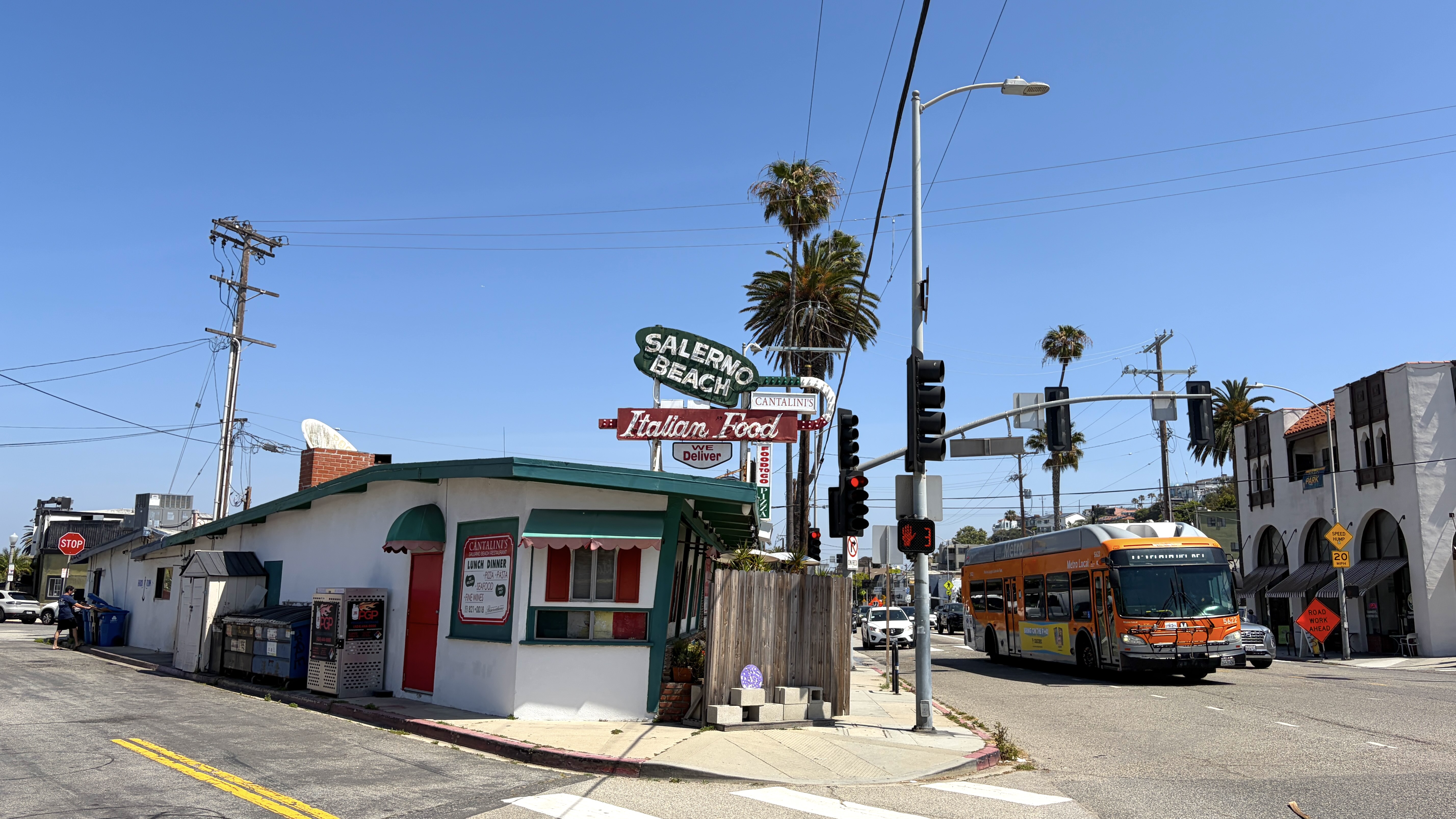
One of the first — probably the most storied, anyway — was Giovanni’s Salerno Beach, opened by Giovanni Cimino in 1962.Cimino was famous for singing as he served his supper in a dining room decked year ’round with Christmas decorations. In 1999, he sold the restaurant to Lisa Schwab, and it became Cantalini’s Salerno Beach. Cimino then retired to Salerno. There’s also Hank’s Pizza, which opened up the hill around 1969.
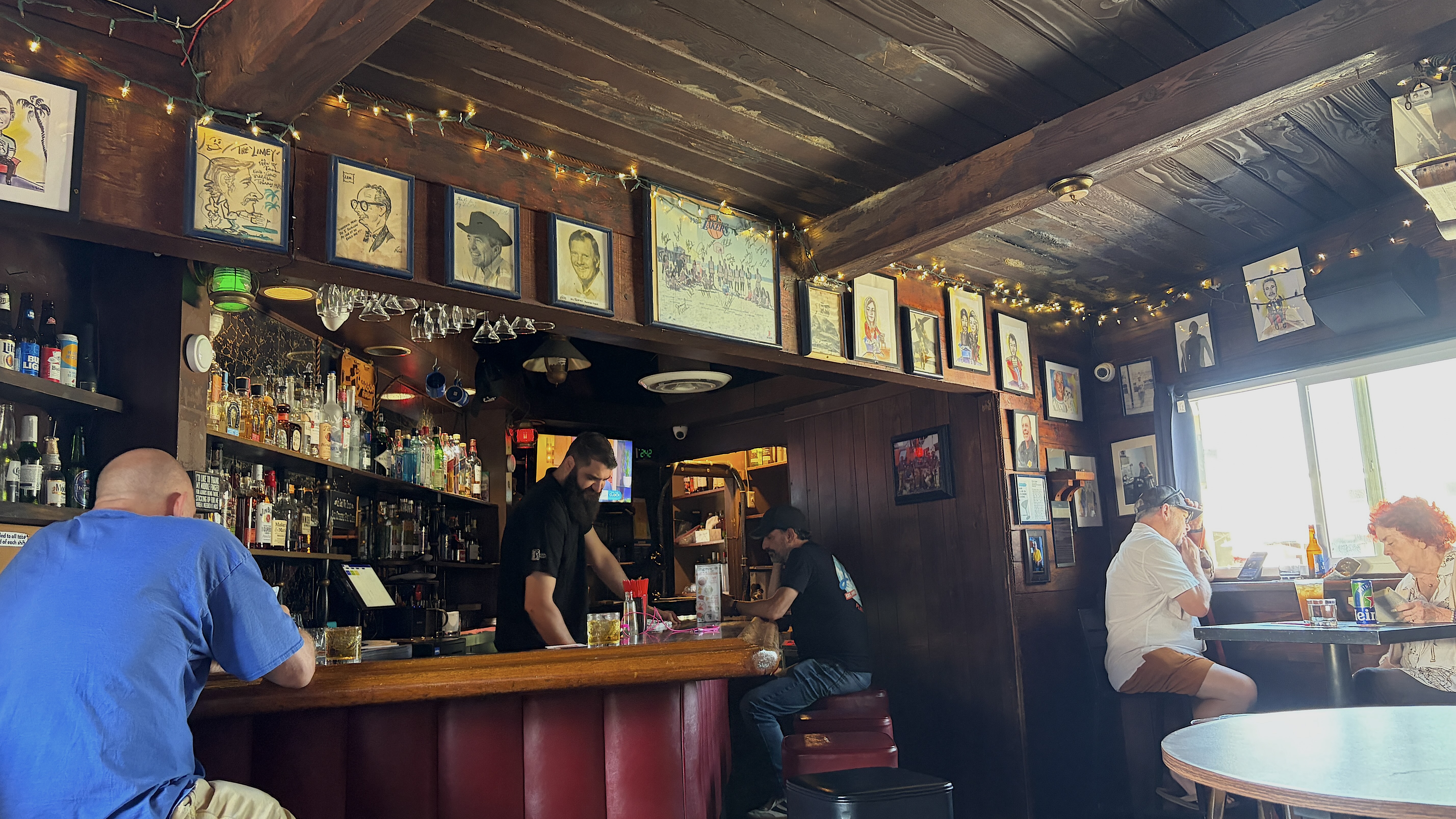
We did not eat any Italian during our visit — but we we did pop into the Harbor Room, which has a back door that opens into Salerno Beach and is pparently the smallest bar in Los Angeles County. With a reported capacity of either fourteen or twenty patrons, it’s larger than the average the yokocho bars you’d find in Japan — but apparently it’s the third-smallest bar in the US.
BIKE TRAILS
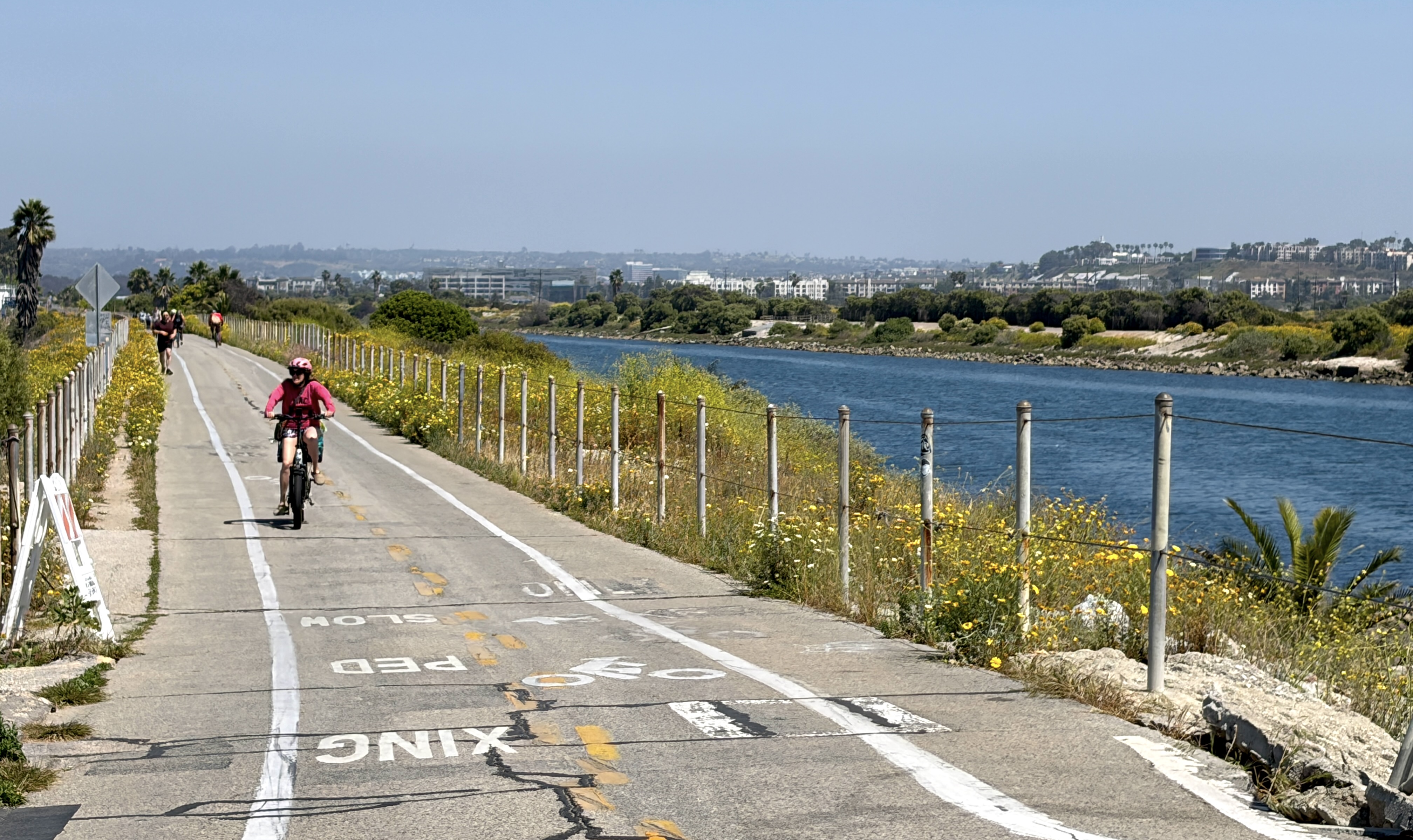
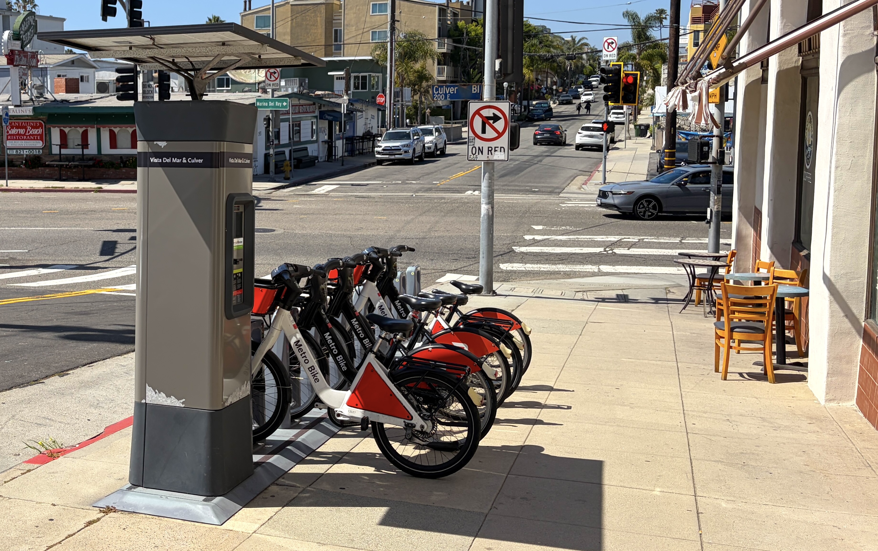
One way in, out, and around the neighborhood, of course, is by bicycle. There is another small market, Lil Bill’s Beach Side Market, located over by Dockweiler Their selection of vittles is even more limited — mostly soft drinks and chips — but they do also sell firewood and rent bikes. There are a couple of nice bike trails, too. The Ballona Creek Bike Path was officially opened in 1970, when a section of a maintenance path along Ballona Creek was opened.
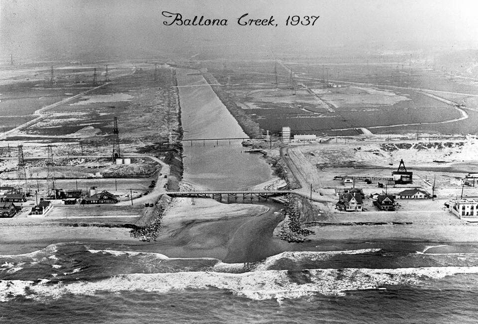
Ballona Creek was channelized by the US Army Corps of Engineers after a flood in 1938. Although plans to extend it toward Mid-City date back to the 1970s, its only as of October 2025 that a new $6.4 million extension project was approved to fulfill that vision.
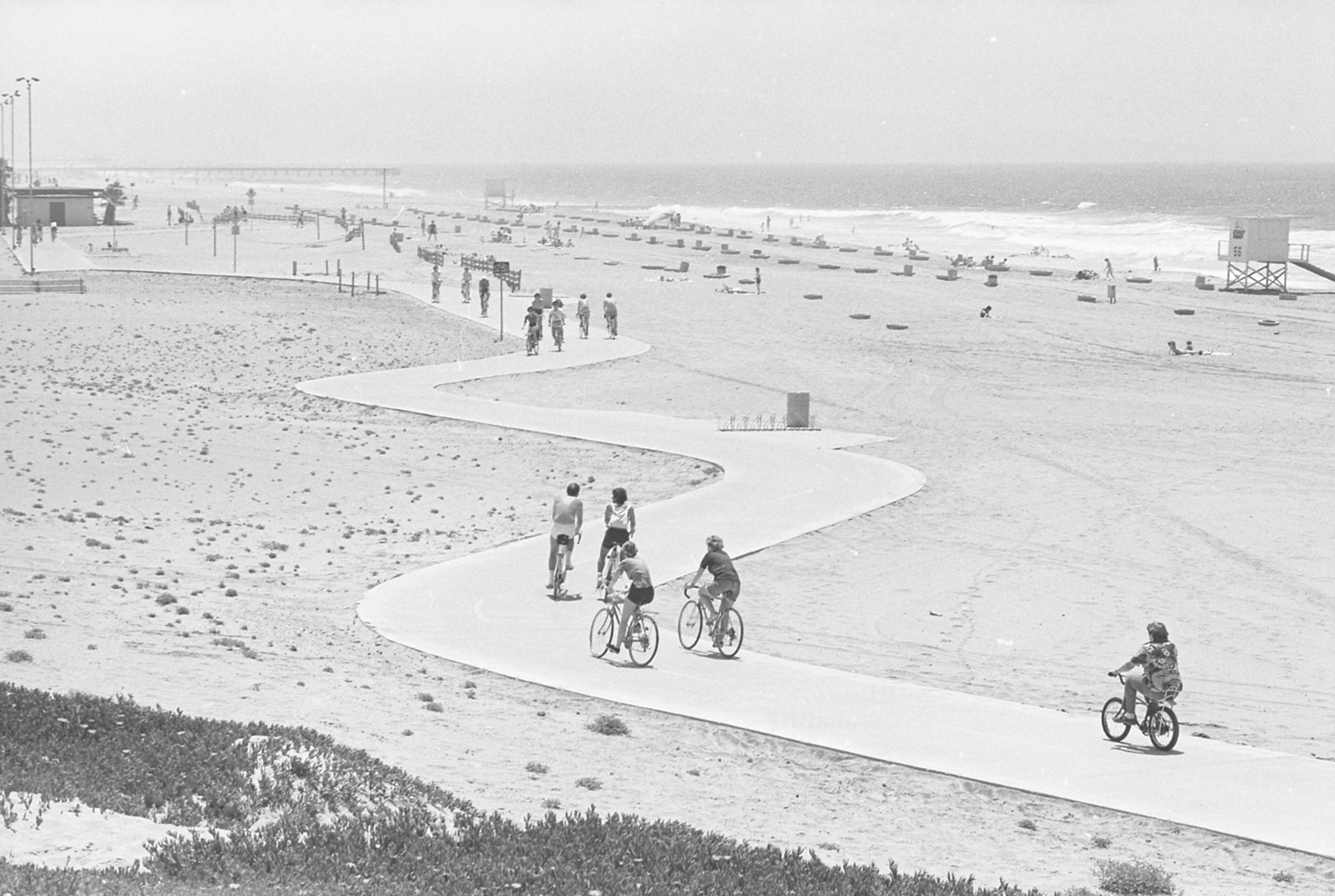
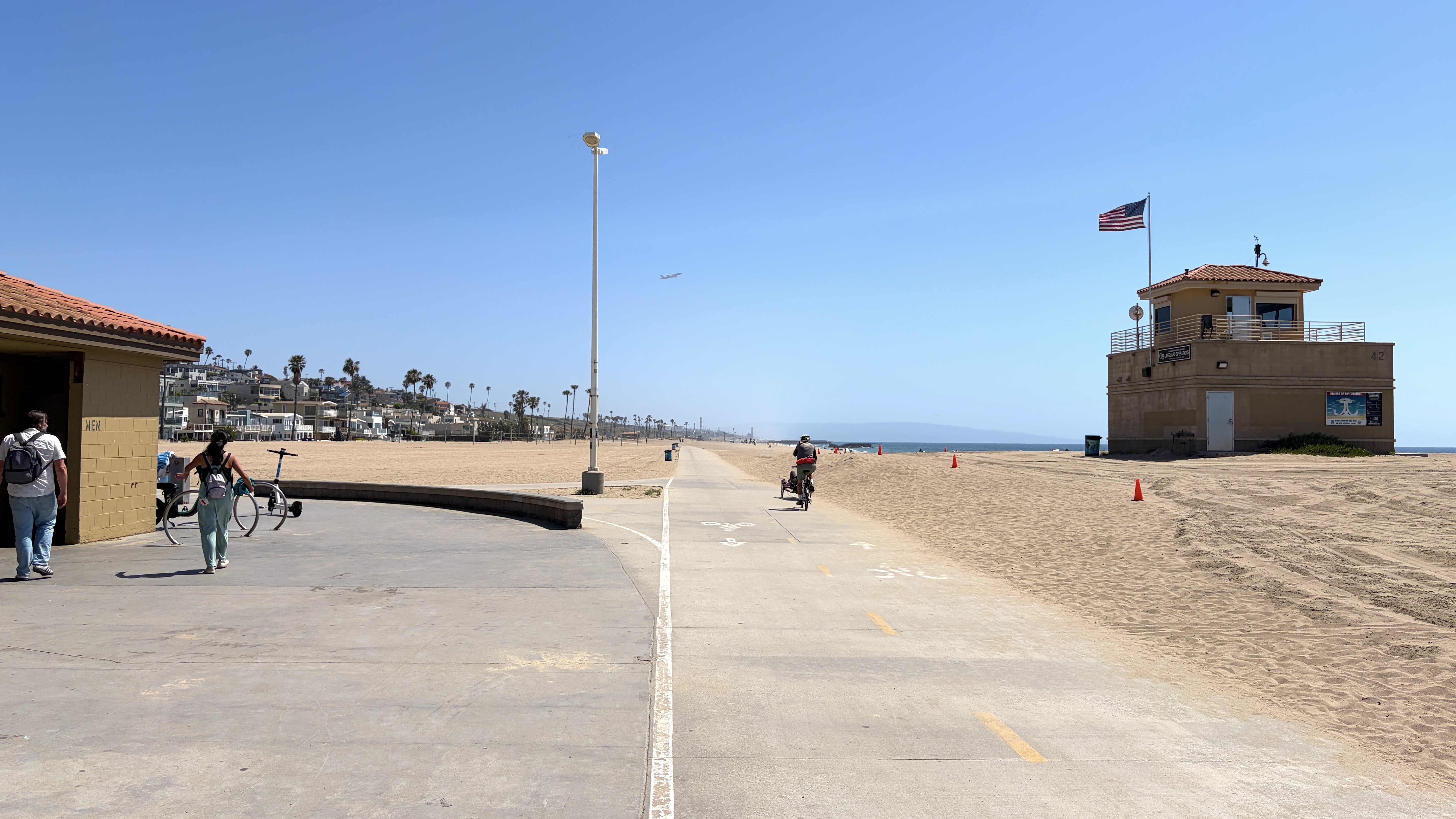
Another bike trail, the 22-mile long beachfront Beach Bike Path (or South Bay Bike Trail – aka the Strand), partially opened in 1974. It had first been proposed by City Councilman Marvin Braude in 1968 but was opposed by some beachfront homeowners who hated the idea of people cycling along a public beach. The final segment opened in 1989. It was officially renamed the Marvin Braude Bike Trail in 2006. It’s 35.9 km (22.3 mi) long, connecting Will Rogers State Beach in the north with Torrance County Beach in the south. Having ridden it, I can say that it’s pretty easy… flat and generally unbattered by offshore winds. The section around Marina del Rey is a little hairy, though, and takes you away, temporarily, from the beach.
THE EL SEGUNDO BLUE BUTTERFLY PRESERVE
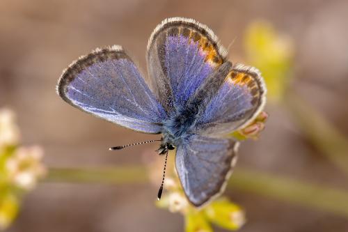
Up above the bike trail, in the former Palisades del Rey and Surfridge neighborhoods, is the LAX Dunes Preserve, created in 1986 as a wildlife preserve for the El Segundo Blue Butterfly (Euphilotes battoides allyni). The butterfly, found in that neighborhood and almost nowhere else, became the first insect ever listed as a federally endangered species in 1976. Nevertheless, Los Angeles World Airports initially proposed setting aside 92 acres for the butterfly and 200+ acres for a golf course. That idea was rejected by the California Coastal Commission. Meanwhile, the Bay Foundation and other groups began removing invasive iceplant and wild mustard (brought by the Spanish) and began replanting seaside buckwheat (Eriogonum parvifolium), the preferred plant of the endangered Lepidoptera. Groups like FOTJ have also planted buckwheat on nearby city-owned property and medians to support the butterfly’s flight path.
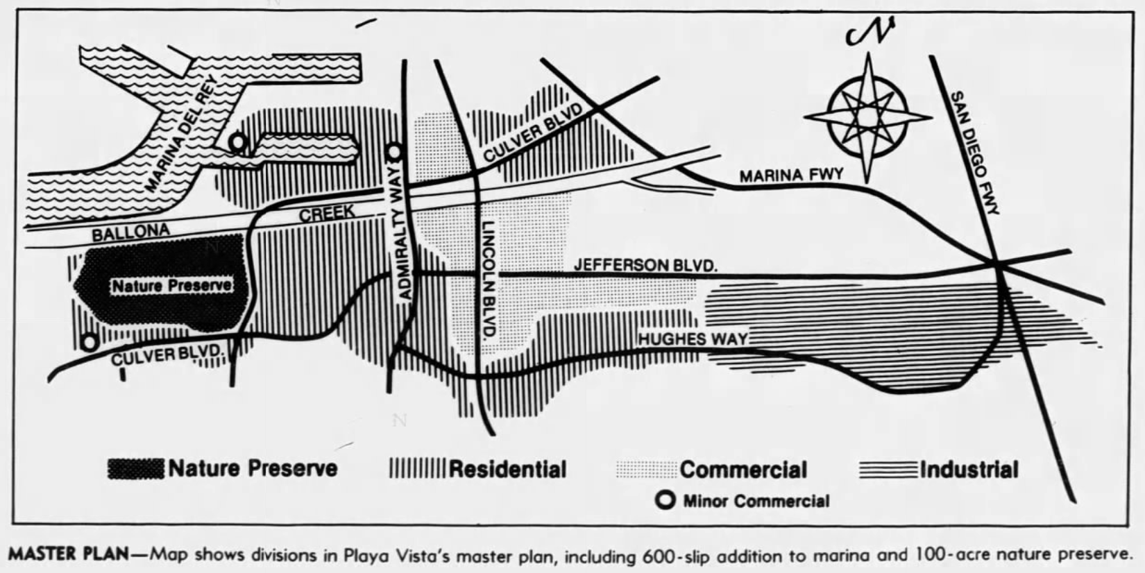
THE BATTLE FOR PLAYA VISTA
After Howard Hughes died in 1976, following years of isolation, self-neglect, malnutrition, and drug abuse — his heirs’ management company, Summa Corporation, moved to develop his vast land holdings into a $1 billion high-rise community immediately east of Playa del Rey. It was approved by the California Coastal Commission in 1984. It was immediately opposed by the then-newly formed Friends of Ballona Wetlands, which filed the first of dozens of lawsuits. Meanwhile, Summa evicted the Playa del Rey Stables, which had been a community fixture since 1910.
In 1987, local activist Ruth Galanter, who’d fought unsuccessfully to save the stables, defeated the incumbent City Councilmember, Pat Russell, who had supported the development. In 1989, facing intense legal and political pressure, Summa Corp sold the project to Maguire Thomas Partners, who began a decade-long process of downsizing and redesigning the master plan. The developers paid $10 million and promised to restore 345 acres (140 ha) of wetlands west of Lincoln in exchange for the end of opposition. Maguire Thomas split in 1996 and Playa Capital Company (an investment group, led by Goldman Sachs and Morgan Stanley), took over. The downsized development, Playa Vista, opened in 2002 and the California Department of Fish and Wildlife took over the preservation of 600 acres of wetlands.
THE BATTLE OVER BIKE LANES AND BIKELASH
In 2015, a sixteen-year-old girl, Naomi Probst, was struck by a motorist and killed whilst attempting to cross Vista Del Mar. Her family sued the city who settled for $9.5 million and adopted a mandate to improve safety. In 2017, the Los Angeles Department of Transportation (LADOT) re-designed the street’s traffic configuration with the goal of saving lives. On Pershing Drive, Jefferson Boulevard, Culver Boulevard, lanes were reconfigured from four general traffic lanes to two general traffic lanes and two protected bicycle lanes — a so-called “street buffet” that added a transit option where before there had been none. On Vista del Mar, parallel car storage on both sides of the road was replaced with diagonal parking on just one. LADOT intended for the pilot to last one year but the backlash was fierce and immediate. Motorist were outraged by the slower speeds they were forced to drive. Many business owners shared anectodal experience of reduced business. The Manhattan Beach-based Keep L.A. Moving, which coalesced to oppose the anti-traffic death Vision Zero, sued the city. Mike Bonin, the area’s city councilman, was slapped with a recall effort, despite his having won 71% of the vote in the election. Bonin defeated the recall effort — and a subsequent one — but opted not to run for a third term in order to focus on his family and his mental health. The pilot program ended prematurely, after just five months — during which time zero traffic fatalities were recorded. Since the street buffet was removed, nine people have died in Playa del Rey traffic fatalities, most recently 29-year-old Cecilia Milbourne.
As a former business owner, it’s easy for me to sympathize with the struggle to attract customers conditioned to driving everywhere. At the same time, in the two years that I had my business, I also witnessed a speeding driver hit two cyclists in a single U-turn, administered first aid to a driver hit by a red-light-running motorist as he crossed in a crosswalk, and had a driver crash through my wall before backing out and fleeing the scene. Safety, to me, is more important than commerce although I just can’t accept that there’s not a way to have both — or that we’re just too stupid as a people and city to make work what has worked in so many other cities. On the other hand, decades of pathological car-dependency can’t be undone overnight — or in five months — or, perhaps, by the addition of a few bike lanes. At the end of the day — most Angelenos want to drive less but feel like they have no real choice — and most of us — even the car-dependent — hate that. Pedestrians don’t feel safe walking because of cars, cyclists don’t feel safe cycling because of cars, buses are slow because of cars, and even drivers complain about the fact that there are too many cars. They are stuck in traffic and they are the traffic.
Playa del Rey’s residential and commercial area quarter is very small — just .825 square miles (2 square kilometers). It is easy to walk for most able-bodied people. In our exploration, Mike, Jackie and I walked 3.25 miles (5 kilometers). About 55% of Playa del Rey residents, however, commute outside the neighborhood for work. And we drove in and out of the neighborhood because mass transit options were so limited and infrequent. There was a Metro bikeshare station, but unless you’re just recreationally riding along the very nice bike trails, many of the neighborhood’s streets are hilly, lack amenities, or seem extremely hostile. Even though walking was usually pleasant, we experienced a few aggressive, distracted, and antisocial motorists. At one crosswalk, a man honked angrily at a woman who apparently didn’t know what a flashing red light meant – something an estimated 60-90% of local drivers are ignorant of. She was also on her phone. As we crossed the crosswalk, a truck sped past us anyway. We found respite from the hostility on side-streets but, when we scaled the slope from the beach to Vista del Mar, found that there was no sidewalk along either side. With no obvious way to return to the business area, we climbed Vista del Mar Lane. We didn’t feel unsafe there, but as a residential street, there was no way for us to spend our money at local establishments.
THE SCATES RESIDENCE
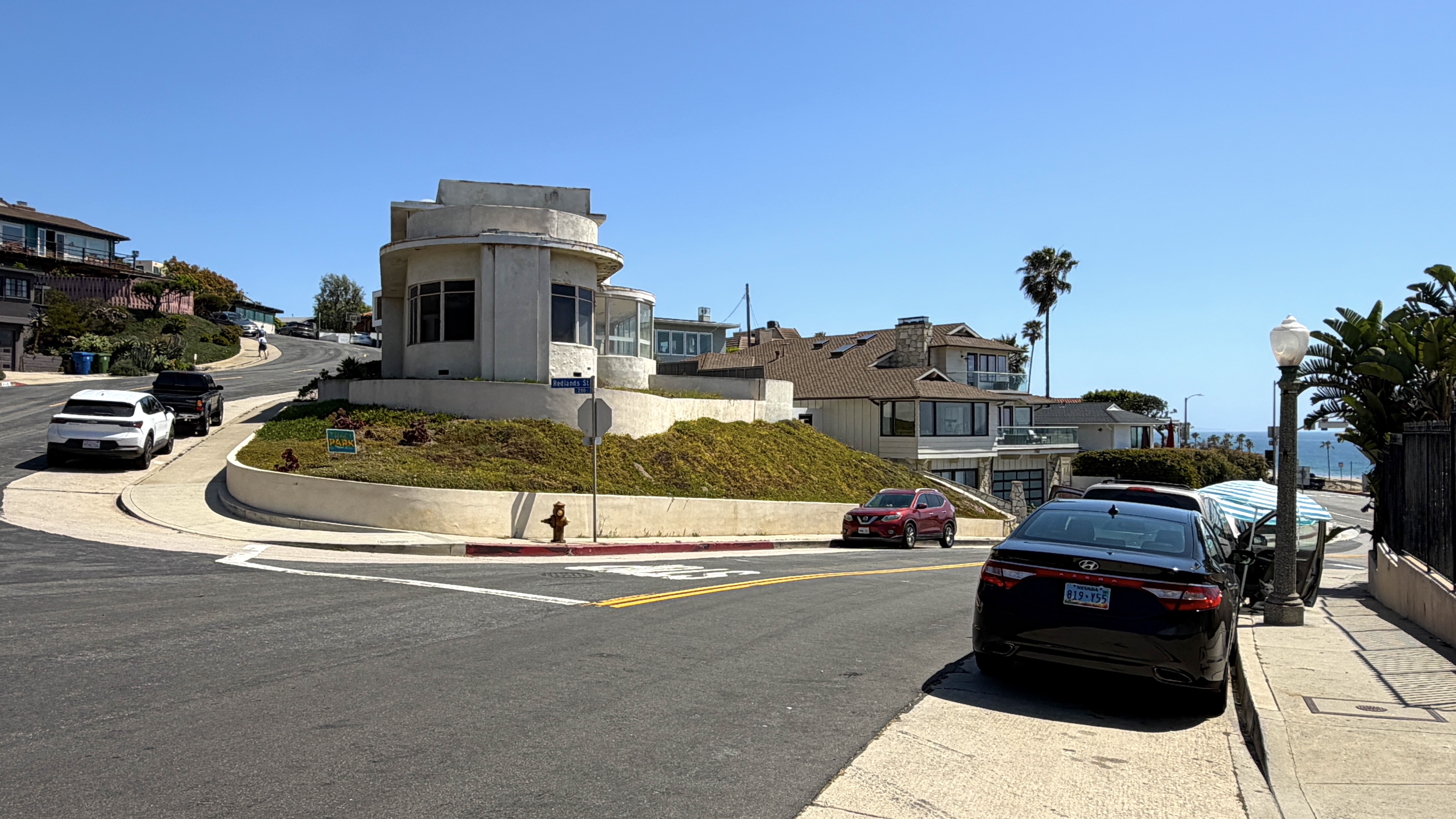
Instead, we looked at houses, the most interesting of which, to my mind, was a care-deprived Streamline Moderne at the corner of Redlands Street and Vista del Mar Lane. A bit of research revealed that it had been built in 1941 for two Arkansas-born socialites and owner-operators of Culver City’s Scates Women’s Apparel, William and Nell Scates. Mrs. Scates also hosted the Culver City Woman’s Club, who met in the home. Bill died in 1956. Nell died in 1960. Their home was then owned by Dr. Bruce Little, whose 35-foot-long cabin cruiser was stolen from Marina del Rey and found wrecked and partially submerged, off Point Fermin in 1964.
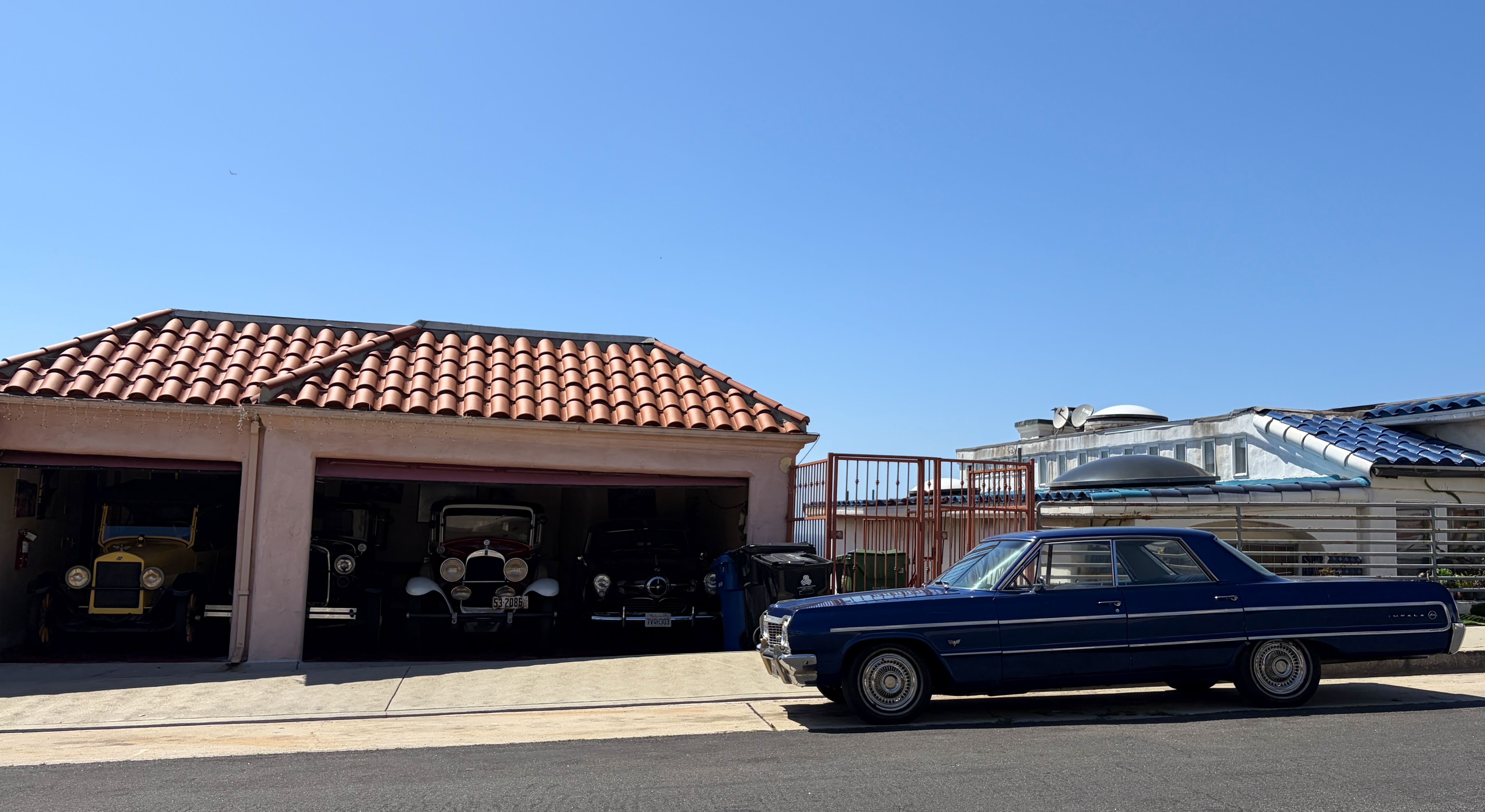
Strolling up the hill, we saw few obvious signs of life. A group of teenagers dressed like emo rappers strolled down Manchester, stopping to pose moodily for pictures meant to convey the depth of their inner torture. A dog living in a vehicle barked and lunged at me whilst its own gently admonished it with no result. There were some sloppily painted placas from the Slauson Locos clique of Culver City 13 painted on the street near a house with raised garage doors revealing a small fleet of beautiful antique cars. We spied a cat in a yard and many signs for Traci Park, the councilperson who was elected to represent the area after Bonin with 52% of the vote. Judging solely by yard signs, you’d think she was running uncontested this time. Her challenger, though, Faizah Malik, has garnered the endorsement of groups like Abundant Housing LA, Streets For All, and many others. Park recently posted a video of her driving down Pershing (apparently filming herself with a phone whilst behind the wheel) in order to preview a temporary lane closure and to invite community feedback, which was politely offered with all of the civility you’d expect from Facebook‘s chronically online boomers.
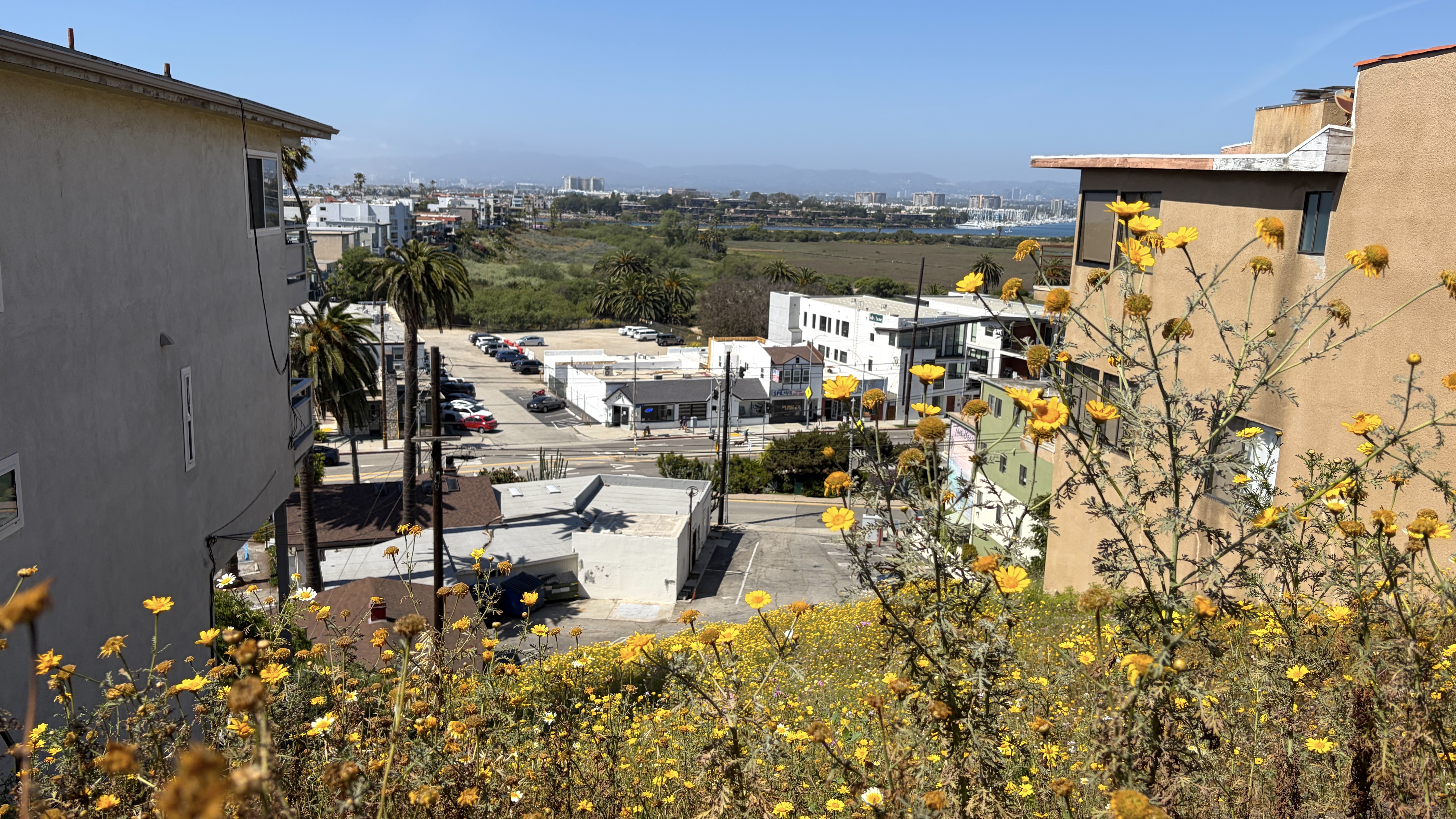
The best part of the walk was from atop a vacant lot, where we could take in the wetlands below.
PETROS CAFE & TITMOUSE PARK
Once we descended back to the bottom of the hill, Mike shared his desire for a coffee. We headed east, past the Prince O’ Whales, where a couple expressed disappointment that it was closed. Having checked their hours, I told them that it would open in about fifteen minutes. Meanwhile, my crew walked on to Ioannina-born Petros Benekos’s Petros Kafe, where Mike and I each got a coffee.
I walked to the end of Culver, to where it basically becomes a freeway through the wetlands. There was an abandoned building — formerly home to Szechwan Palace Restaurant — which apparently closed on account of the loss of business that afflicted many Chinese establishments when our Dear Leader began repeatedly referring to COVID-19 as “the China Virus.”
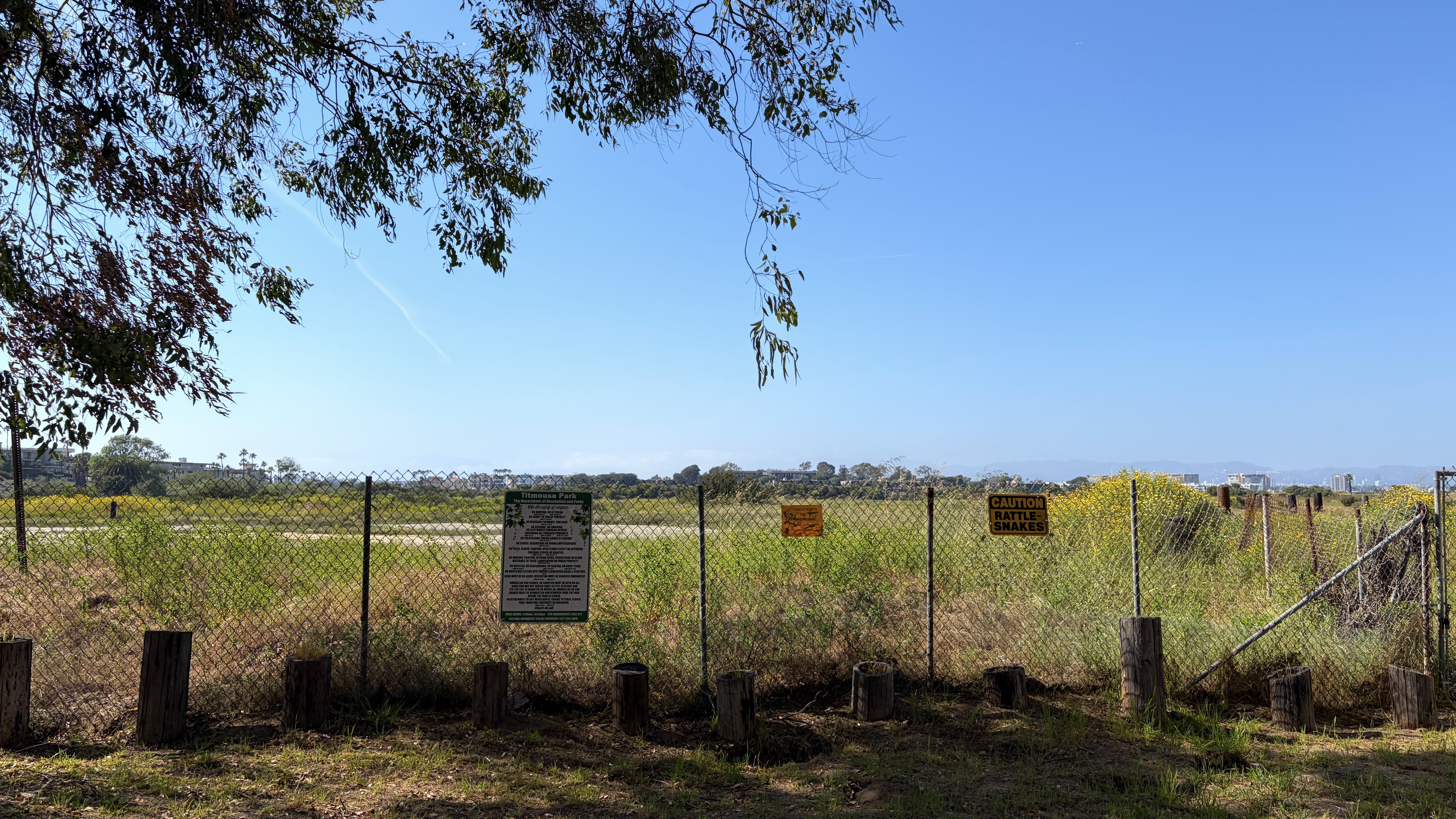
Afterward, armed with an iced black coffee, I headed over to tiny Titmouse Park. It was relaxing although signs warned us of rattlesnakes… which, in my experience, sound a bit like the rustle of eucalyptus leaves we listened to at the park. Although there are Oak Titmice (Baeolophus inornatus) in Los Angeles, the park’s name may have been coined by as a joke by someone easily amused and in possession of a sophomoric sense of humor. California Silvery Legless Lizard (Anniella pulchra), are more common visitors to the park but we didn’t see any. Still, anything’s an improvement on a patch of iceplant, which is what that tiny plot had been until 1988, when they were mercifully rempoved by members of the Playa del Rey Junior Women’s Club.
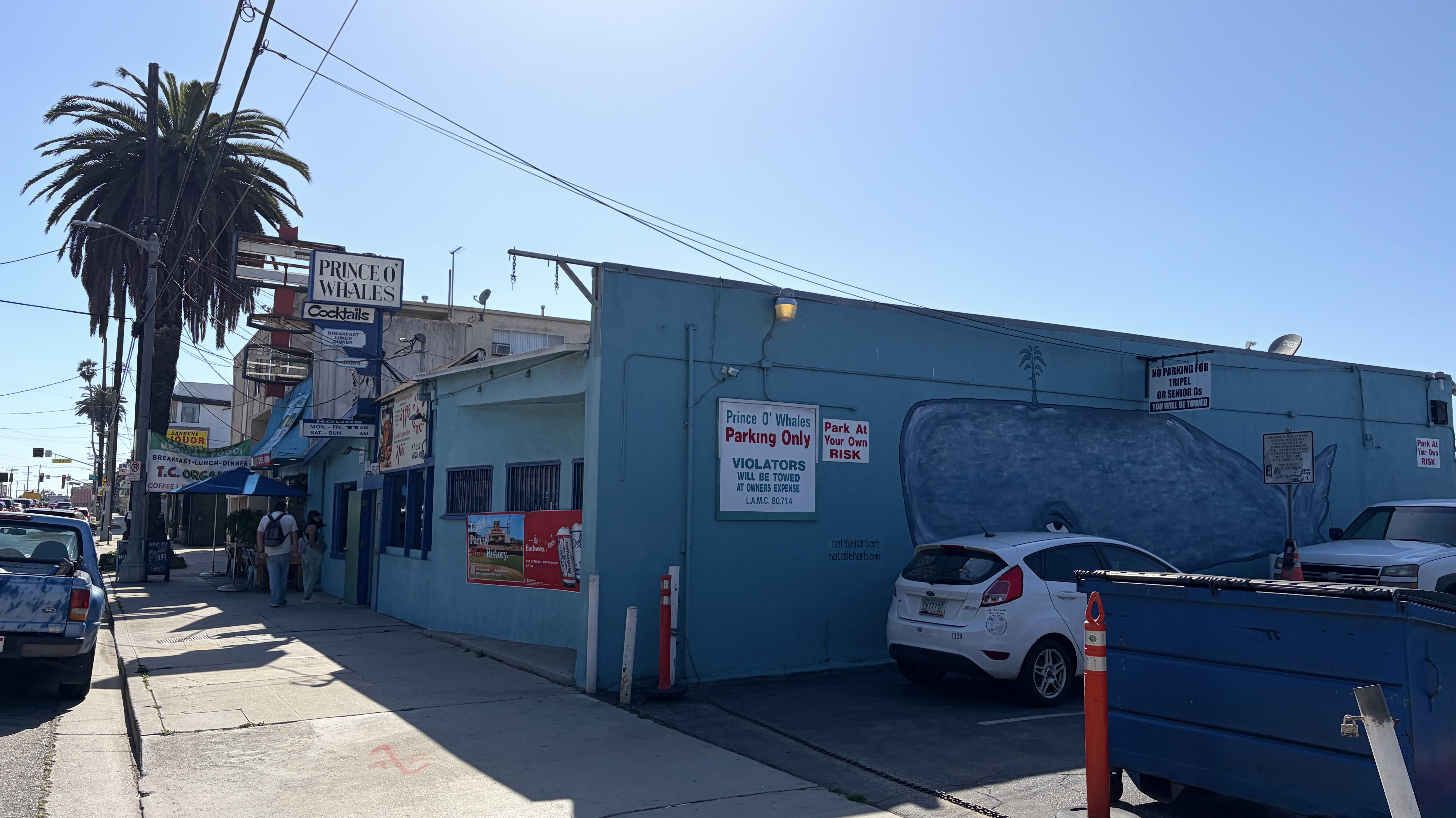
BOWSPIRIT/PRINCE O’WHALES
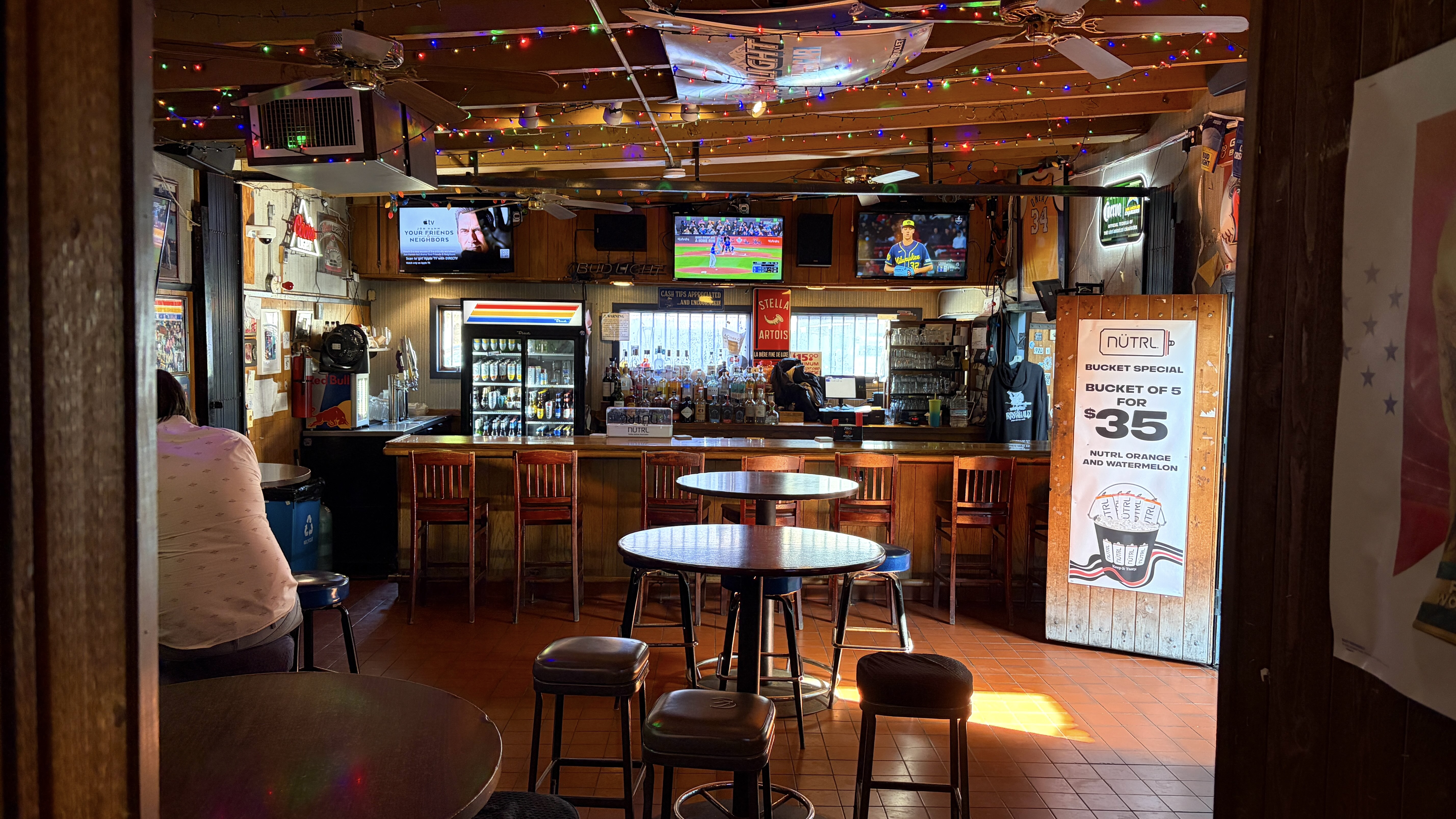
After finishing our coffees — but not our desire to explore — we headed over to the Prince O’Whales. The bar originally opened as The Bowsprit in 1955 — named after the wooden spar (the bowsprit of a ship) that still hangs over the bar today. It was renamed Prince O’Whales in the summer of 1972 when Steve Mayer took over. Apparently its also widely known as “P.O.W.” and “Pee-Oh-Dubs.” I enjoyed a $6 gin and tonic and as we started to head out I suggested we check out the patio, which turned out to be where all of the patrons were — and a ping pong table. There, Jackie and I narrow defeated Mike in a game of cutthroat before moving on.
DOCKWEILER
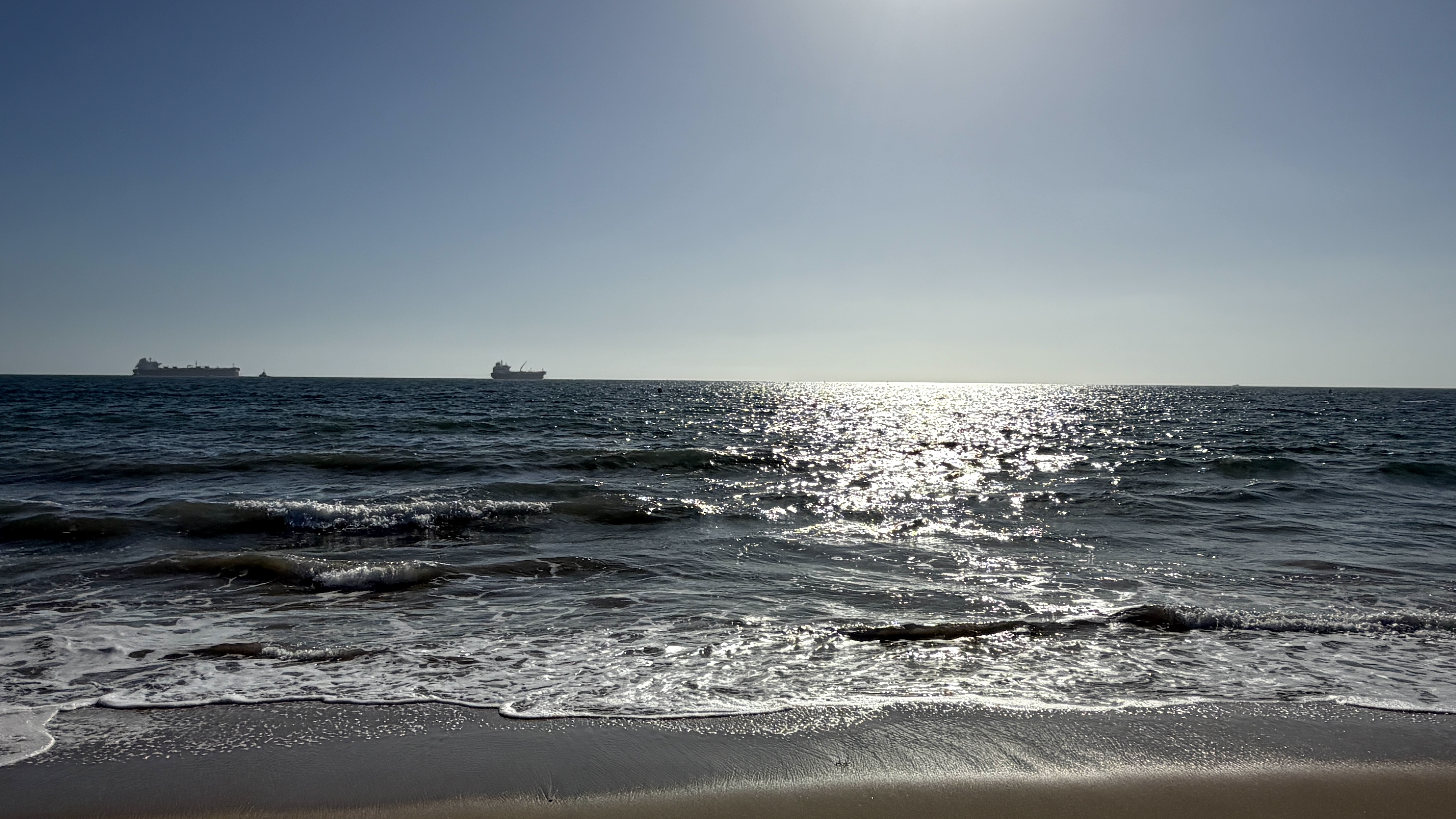
For our final stop, Mike drove us to Dockweiler State Beach. Mike pointed to a battered, partly wooden structure that I wrongly guessed was the ruin of a pier. It turned out to be the “one mile pipeline” that used to discharge sewage from the city to a point one mile offshore.Behind us was the Hyperion Water Reclamation Plant, which should’ve been a hint as to its function but, next to the Chevron El Segundo Refinery, all I could think was what a great place they’d make for a martial arts fight — not sludge digestion, sewage aeration, or fluid catalytic cracking. Offshore from the refinery, meanwhile, were a pair of oil tankers. One, the Seaways Yellowstone, was heading (according to MarineTraffic) to Long Beach. After resting for a bit, we hopped back in the car for the long and unrewarding slog back to our homes. I requested Righeira‘s “Vamos a la Playa.” Jackie requested “Everyday is Like Sunday,” which Mike honored.
As with all of my California Fool’s Gold explorations, I’d love nothing more than to be able to spend 48 hours in a community, giving myself an opportunity to explore on one day and then re-visit my favorite spots the next. Seems like there are acouple of places one might comfortably stay in Playa del Rey — Green Ginger Guest House and the Inn At Playa Del Rey. If I had another day in Playa del Rey, I’d have surely spent much of it swimming in the ocean. I know most people complain that the water’s too cold here but, in my opinion, it’s not too cold if it’s not frozen. Staying here would’ve saved us for another day from the slog back across town. One doesn’t have to dream that big to imagine a world in which the buses are upgrade to BRT lines that terminate, as they do today, at the triangle bounded by Culver, Vista del Mar, and Pacific Avenue… but instead of containing a vacant lot is home to a six-story hotel with a market and transit-center on the ground floor and a green roof on top.
If you’d like for a Southern California community to be considered as a destination for California Fool’s Gold, let me know which one(s) in the comments. Next stop – Sawtelle!
Support Eric Brightwell on Patreon

Eric Brightwell is an adventurer, essayist, rambler, explorer, cartographer, and guerrilla gardener who is always open to paid writing, speaking, traveling, and art opportunities. He is not interested in generating advertorials, cranking out clickbait, or laboring away in a listicle mill “for exposure.”
Brightwell has written for Angels Walk LA, Amoeblog, Boom: A Journal of California, diaCRITICS, Hey Freelancer!, Hidden Los Angeles, and KCET Departures. His art has been featured by the American Institute of Architects, the Architecture & Design Museum, the Craft Contemporary, Form Follows Function, the Los Angeles County Store, Sidewalking: Coming to Terms With Los Angeles, Skid Row Housing Trust, the 1650 Gallery, and Abundant Housing LA.
Brightwell has been featured as subject and/or guest in The Los Angeles Times, VICE, Huffington Post, Los Angeles Magazine, LAist, CurbedLA, LA Times 404, Marketplace, Office Hours Live, L.A. Untangled, Spectrum News, Eastsider LA, Boing Boing, Los Angeles, I’m Yours, Notebook on Cities and Culture, the Silver Lake History Collective, KCRW‘s Which Way, LA?, All Valley Everything, Hear in LA, KPCC‘s How to LA, at Emerson College, and at the University of Southern California. He is the co-host of the podcast, Nobody Drives in LA.
Brightwell has written a haiku-inspired guidebook, Los Angeles Neighborhoods — From Academy Hill to Zamperini Field and All Points Between; and a self-guided walking tour of Silver Lake covering architecture, history, and culture, titled Silver Lake Walks. If you’re an interested literary agent or publisher, please out. You may also follow on Bluesky, Duolingo, Facebook, Goodreads, iNaturalist, Instagram, Letterboxd, Medium, Mubi, Substack, Threads, and TikTok.


