

IS BUSTIN’ A CAP REALLY FUNDAMENTAL — SOUTH CENTRAL
South Central means different things to different people. To some, it refers to a vast, amorphous collection of neighborhoods and cities between the Santa Monica Bay and the San Gabriel River, north of the San Pedro Bay, and south of the 10 Freeway. To others it’s less of a geographical space than a metaphor — that’s surely the sense in which Ice Cube used it to refer to Compton — which is, of course, its own city and thus not any part of “L.A.”
A widely-accepted story tells that the South Central brand became so loaded with negative connotations of gang violence and riots that a neologism, South Los Angeles, was supposedly devised to “officially” replace it. But South Los Angeles is a geographic concept that goes back at least to 1903. “South Central” was in use at least as early as 1929, when it was coined to refer to the then-mostly-black neighborhood that arose just south of Downtown along South Central Avenue (hence the name) that is now sometimes referred to as “Historic South Central.”
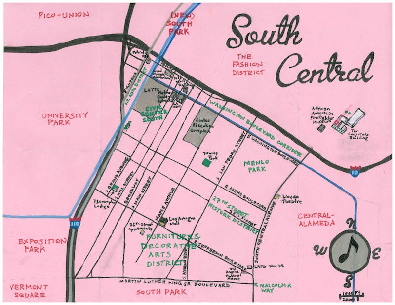
As stated above, South Central is located immediately south of Downtown Los Angeles. Its other neighbors are Central-Alameda to the east (which, historically, was almost always considered to be part of South Central), South Park to the south (the original, more than a century old South Park – not the part of Downtown which has only attempted to co-opt that name in the last decade), Vermont Square to the southeast, Exposition Park and University Park to the west, and Pico-Union to the northwest. On an alternately cool and balmy January day (yesterday in fact) I set about exploring the neighborhood with frequent traveling companion Tim Shimbles (aka DJ Modernbrit).
ANCIENT HISTORY OF THE AREA
The area of Los Angeles that’s now home to South Central was inhabited for at least 13,000 years, perhaps originally by the ancestors of the Chumash. Some 3,500 years ago the ancestors of the Tongva arrived in the area from the Sonoran Desert to the east and either displaced or combined with the indigenous population. The Tongva established many villages throughout the Los Angeles area, including Yaangna and Apachiangna (spellings vary of both) very near modern South Central.
SPANISH & MEXICAN ERAS
Spaniard Gaspar de Portola led an overland expedition in 1769 that set the stage for the subsequent Spanish Conquest. The Spanish first established a mission in the Whittier Narrows region in 1771 and in 1776 moved their mission to its present location in San Gabriel, about eighteen kilometers to South Central’s northeast. In 1781 the Spanish founded El Pueblo de Nuestra Señora la Reina de los Angeles. It was granted four leagues of land, the southern border of which corresponds to modern Exposition Boulevard.
Mexico gained independence from Spain in 1821. Mexico’s reign proved short, however, ended in 1848 by defeat at the hands of the US. California became a state two years later and Los Angeles was incorporated.
AMERICAN ERA
In Mexico, slavery had been abolished for decades by the time that the US took over Alta California. Furthermore, more than half of Los Angeles’s founders were recorded to have had measurable African ancestry. Slavery was only abolished in the US in 1865. Three years later, Los Angeles expanded its borders for the first time, annexing 766 acres to its south and moving the southern border to 39th.
PALM DRIVE
In the 1860s, General Charles A. Longstreet (not James Longstreet, as some sources claim) bought forty acres of land off of Adams and Figueroa and planted palm trees along his driveway. Longstreet died in 1877 and by 1900, Longstreet’s mansion was in use as an osteopathic hospital.
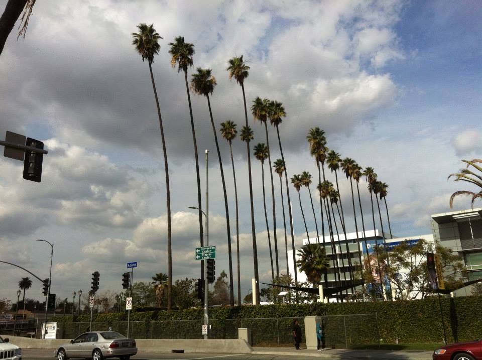
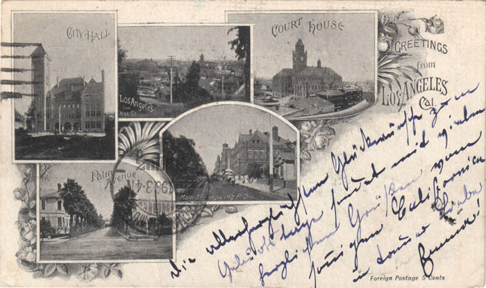
The palm-lined drive became variously referred to as the Avenue of Palms, Palm Avenue, and Palm Drive. In 1911, the still-extant Los Angeles Orthopaedic Hospital was established there as Orthopaedic Hospital. A postcard from 1900 depicts them alongside old City Hall, Main Street, the old Courthouse, and the view of the city from Hill Street as that era’s postcard iconic equivalents of the Walk of Fame, an Angelyne billboard, the Hollywood sign, Rodeo Drive and some be-thonged posteriors on Venice Beach. Amazingly, at least some of the trees still stand, towering above their surroundings.
BLACK LOS ANGELES IN THE 1890s
By 1890, Los Angeles’s population was 50,395. Much of the city’s then small black population (only about 2,000) had relocated from places like Atlanta, New Orleans, Shreveport, and Texas. Most of the black population back then was centered in the area along 2nd Street between Los Angeles Street and Spring Street in what’s now the Old Bank District. South Los Angeles, at that time, was still largely rural and agricultural.
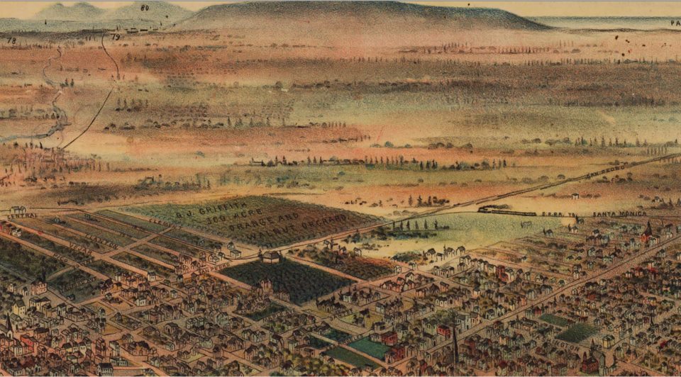
A map from 1891 depicts a couple of farms (including G.J. Griffith’s 100 Acre Orange and Walnut Orchard) and the Southern Pacific Railroad. By the century’s end, Los Angeles would annex Garvanza, Highland Park, West Adams, and University Park; and again move Los Angeles’s border south to Slauson and the Southern Pacific rail that then ran parallel to it.
GRIDER & DOW’S ADAMS STREET TRACT
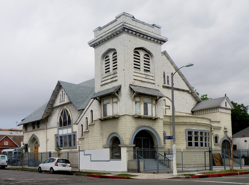
In 2009, the 27th Street Historic District (centered on the intersection of East 27th Street and Paloma Avenue) was added to the National Register of Historic Places. The district contains numerous Queen Anne style (and some Colonial Revival and Transitional Craftsman) homes dating back to 1895 when it was developed as Grider & Dow’s Adams Street Tract. The Romanesque Haven Methodist Episcopal Church (now known as the Crouch Memorial Church of God and Christ) was built in 1895 (and completed in 1896) as well. Unfortunately, it was mostly destroyed by fire in 2013.
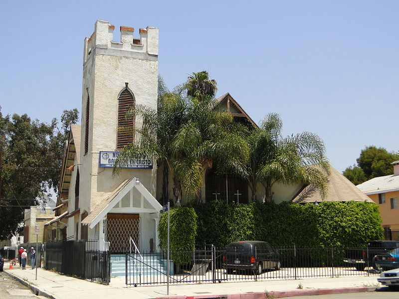
The Gothic Revival-style Salem Congregational Church (now known as Nueva Iglesia Bautista en Cristo) was constructed in 1906. The original inhabitants of the neighborhood were mostly white Protestants. Reflecting an early population shift, Haven Methodist Episcopal became the Armenian Gethsemane Congregational Church in 1917. In the 1920s much of the southerly migrating black population arrived in the area although the church remained an Armenian congregation until 1944.
MENLO PARK
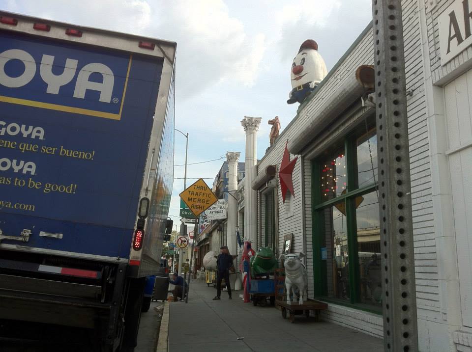
One of the first major residential developments in South Central was Menlo Park, subdivided in 1896. Its borders are Washington on the north, Central on the east, Adams on the south, and San Pedro on the west. I was rather surprised to see a sign posted recognizing the area on a corner shared with LADOT signs also designating the area the Furniture & Decorative Arts District as well as South Los Angeles. I’m not sure if they were removed or whether I just didn’t notice them during my visit, but I didn’t see any of the “Historic South Central” signs that at least formerly announced the neighborhood’s presence.
OTHER TRACTS
Other tracts in the area were many. In addition to the Adams Street Tract, Leroy Grider‘s company also developed the Orangedale Tract and the Central Avenue Tract. I’m not going to list every tract in the area but here are a few: the Abbot Kinney Tract, the Boettcher Tract, Damon and Millard’s Subdivision of the Shaw Tract, the Ford Tract, Friend’s Subdivision, the Hege Tract, the Jenkins Tract, John Weber’s Subdivision, the Maskell Tract, McCartney’s Washington Garden, Shafer & Lanterman’s Resubdivision of the Dimmick Tract, and Shafer & Lanterman’s Stephenson’s Subdivision of the Montague Tract.
36TH STREET APARTMENTS
One of the first homes built in the area (Potter’s Woodlawn Tract, to be exact) was later converted into multi-family housing known as 36th Street Apartments. It recently was awarded a Los Angeles Conservancy Preservation Award.
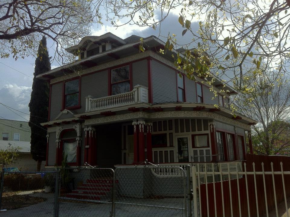
The entire, nice and shady block is home to some pretty handsome homes and, because my computer was dead and I hadn’t written down the address, I didn’t take a picture of the structure (located at 157 E. 36th Street) – but I did snap a picture of this stunner across the street.
THE BLACK POPULATION COMES TO SOUTH CENTRAL
In 1903, the black population of Los Angeles nearly doubled when Southern Pacific brought in 2,000 black rail workers to break a strike by Mexican-American workers. In 1906, the South Park Tract was subdivided (Avalon Boulevard was then known as South Park Avenue). By that time, Skid Row had already developed along 5th Street (hence its nickname, “The Nickel”) and the black population of the city leapfrogged past the area, settling primarily along South Central Avenue, near the newish Southern Pacific Railroad station. Originally centered around 6th Street and South Central, it soon began moving south, soon stretching from 8th Street to around 20th Street.
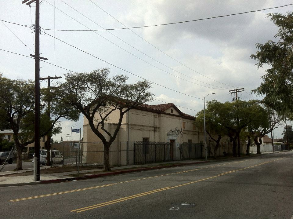
Tim and I started our walk in this area, now the southeastern corner of Los Angeles. Even maps of downtown that attempt to define the neighborhoods within it usually leave the southeastern corner blank – presumably both because it’s reckoned to be of little interest to visitors and because its constantly shifting character and overlap resist fixed designations. Within a few blocks, we walked through areas that felt like extensions of the Flower District, the Fashion District, the Electronics District, the Piñata District, and the Produce District before reaching our first stop, the old Fire Station #30, now a museum.
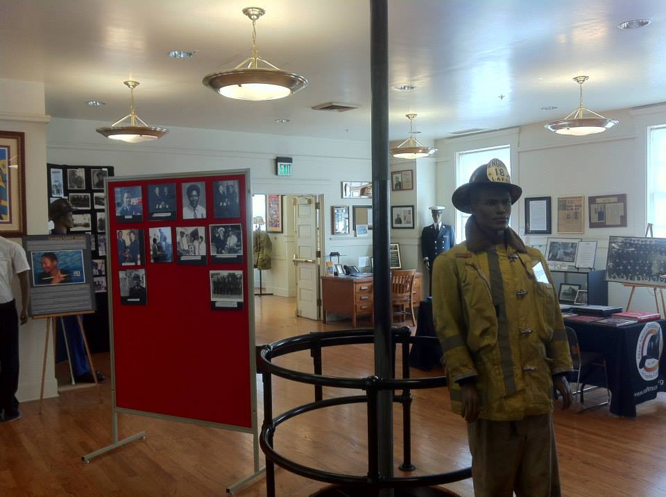
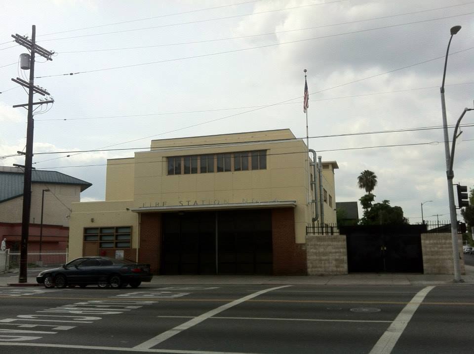
THE AFRICAN-AMERICAN FIREFIGHTER MUSEUM
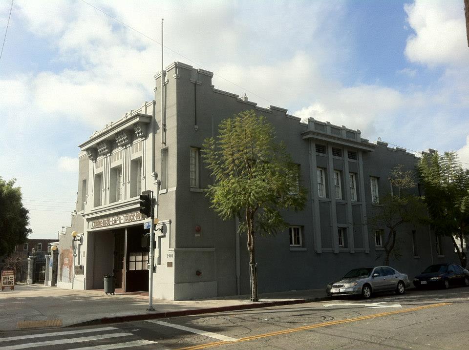
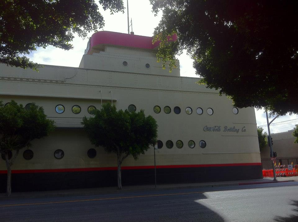
After stopping to admire and take pictures of Robert V. Derrah‘s Streamline Moderne-style Coca-Cola Building – constructed in 1939 – we crossed the street to the African-American Firefighter Museum. There we met volunteer Jimmy Smith, a Monterey Hills resident who’s worked at the museum for about a year. He gave us a tour and filled us in on a great deal of history.
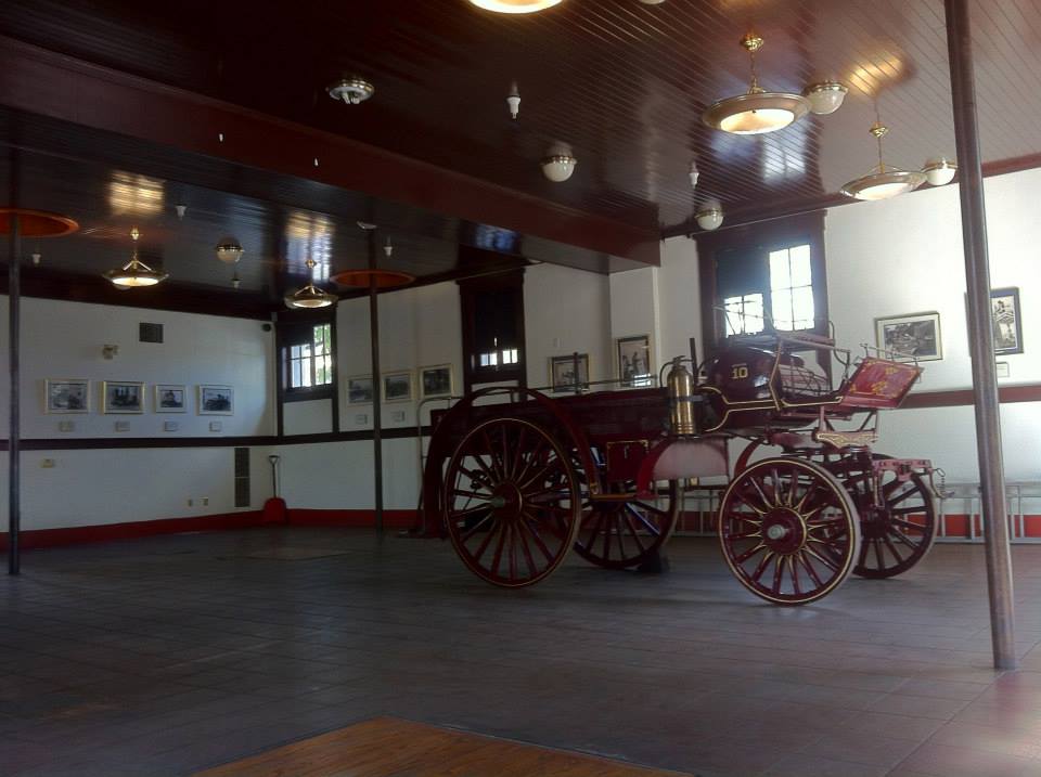
The Prairie School-style building, designed by James Backus, was constructed in 1913. The city’s first black firefighter, Sam Haskins, was hired in 1892 and died in the line of duty in 1895. By 1924 it was decided that the fire department should be segregated and Fire Station #30 became the first of two all-black fire stations. Change came slowly and after the department began in 1955, black firefighters faced shocking acts of hostility. The fire station, which ended operations in the 1980s, became a museum in 1997. Today it also hosts all sorts of events and is home to a large archival collection, including two DVDs: Engine Company X and Engine Company X 2.
THE BLACK BELT
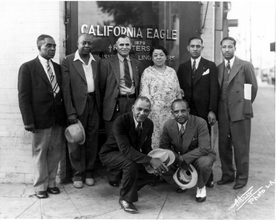
The black-owned newspaper, the California Eagle, was established in 1879. By 1915 they were operating out of a location at Central and 8th Street and were referring to the Central Avenue Corridor as the city’s “black belt” on account of both the residences and businesses that then dominated the area.
In 1915, Atlanta-born Nollie B. Murray, the so-called “King of the Bootblacks” turned his attention from his shoeshine empire to a new business venture, Murray Pocket Billiard Emporium and Cigar Stand, which opened near the intersection of Central and 9th Street. In 1916, Texas-born Sidney Dones founded the Sidney P. Dones Company at Central and 10th Street which provided legal and real estate services to black clients.
The South Central neighborhood extended west to Main street, where Dreamland Rink, an ice-skating rink that employed and catered to blacks, opened in 1906. Well-known residents who moved to the area before the close of the 1910s included Jelly Roll Morton, Kid Ory, and “Ragtime” Billy Tucker. Sadly, today (aside from the firefighter museum) there are few if any vestiges of this era to be found north of the 10 Freeway.
BLACK THEATER DISTRICT
South Central was also home to many early black movie theaters. Before Broadway could boast of having the largest concentration of picture palaces in the world (a claim still true today), Main Street was Los Angeles’s primary theater district.
Rather than suffer the indignity of watching often-racist depictions of themselves in segregated movie theaters, a network of black theaters began operating in South Central which offered, in many cases, so-called race films – black films made by and for black audiences. In the 1910s there was the Elite Theatre, the Gayety Theatre, the Globe Theatre (later renamed the Florence Mills Theatre after a black performer who died in 1927 at the age of 31), the Photoplay Theatre (later renamed the Washington Theatre), the Rosebud Theatre, the Star Theatre, and the Woodlawn Theatre (later renamed the Pictorial Theatre and even later, the Barbara Theater).
THE BLACK EASTSIDE
Although comparatively unaffected by the Great Migration that saw many black Americans move from the South to the cities of the Midwest and Northeast, through a series of small, steady migrations, Los Angeles’s black population surpassed 15,000 in 1920.
Although there were exceptions (such as Oakwood and parts of Mid-City), the boundaries of Los Angles’s black ghetto were practically, if not officially (that I’m aware of) formalized as an area roughly bounded Washington to the north, Alameda to the east, Slauson to the south, and Main to the west – in other words South Central, Central-Alameda, and South Park – together which formed the bulk of the Black Eastside, or simply, the Eastside (not to be confused with the Eastside region comprised of the communities located east of the Los Angeles River including Boyle Heights, East Los Angeles, El Sereno, Lincoln Heights, &c).
GRAND OLYMPIC AUDITORIUM
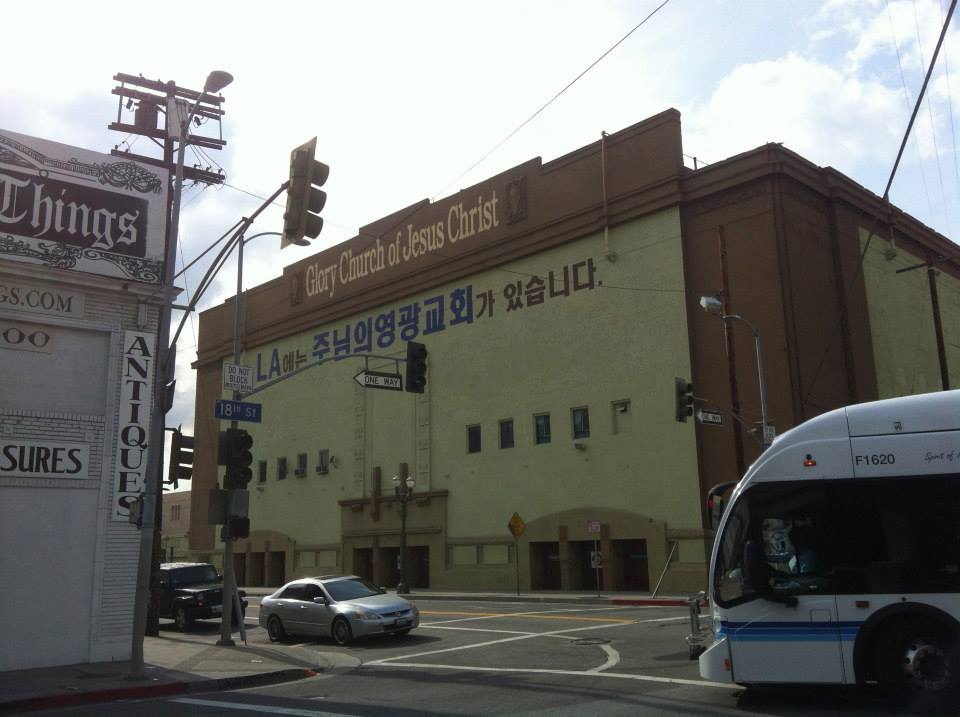
Grand Olympic Auditorium was built in 1924 for the 1932 Olympic games. Boxing, weightlifting, and wrestling events all took place there. With a capacity of 15,300, it was at the time the largest indoor venue in the country. Nowadays it’s home to a Korean church, the Glory Church of Jesus Christ.
PATRIOTIC HALL
Allied Architects designed the ten-story Patriotic Hall in 1925. It was originally designed to serve veterans of the wars against Native Americans, the Spanish American War, and World War I. Somewhat ironically then, I saw Tom Hayden speak at an anti-war rally there after the US invaded Iraq in search of phantom WMDs. A year later it was rededicated Bob Hope Patriotic Hall.
FRANK WIGGINS TRADE SCHOOL
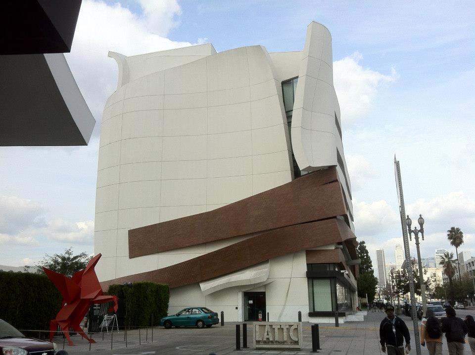
Los Angeles Trade Technical College (aka L.A. Trade-Tech aka LATTC) began in 1925 as Frank Wiggins Trade School. Although I’d never really noticed them before exploring it, some of the buildings on campus do appear to date from that era. In fact, it’s the oldest of the nine campuses of the Los Angeles Community College District, which it became part of in 1969. It should be noted for visitors that it includes the Campus Bookstore and a cafe, the Garden Room.
28 TH STREET YMCA
The great Paul Revere Williams, the first black member of the American Institute of Architects, designed the 28th Street YMCA which was constructed in 1926. One of its most important features was the swimming pool since Los Angeles’s swimming pools were segregated until 1931. In 2012 the historic Y reopened as the 28th Street Apartments. In 2013 it won a Preservation Award from the Los Angeles Conservancy.
SECOND BAPTIST CHURCH
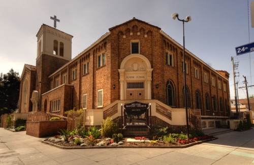
The Lombardy Romanesque Revival Second Baptist Church was also designed by Paul Williams (in collaboration with Norman Marsh) and built in 1926. It was designated a Los Angeles Historic-Cultural Monument in 1978 and added to the National Register of Historic Places in 2009. Well-known speakers at the church include Alice Dunbar Nelson, Malcolm X, Martin Luther King, Jr., and W. E. B. Du Bois.
THE INTERNATIONAL MART
The International Mart, at 155 West Washington Boulevard, is an Art Deco skyscraper constructed in 1927. It’s also sometimes referred to as the Mode O’Day Building, or simply 155 West Washington Boulevard. At fourteen stories, it’s probably the tallest building in the neighborhood. It currently has a pretty bold color scheme.
UNITED LODGE OF THEOSOPHISTS
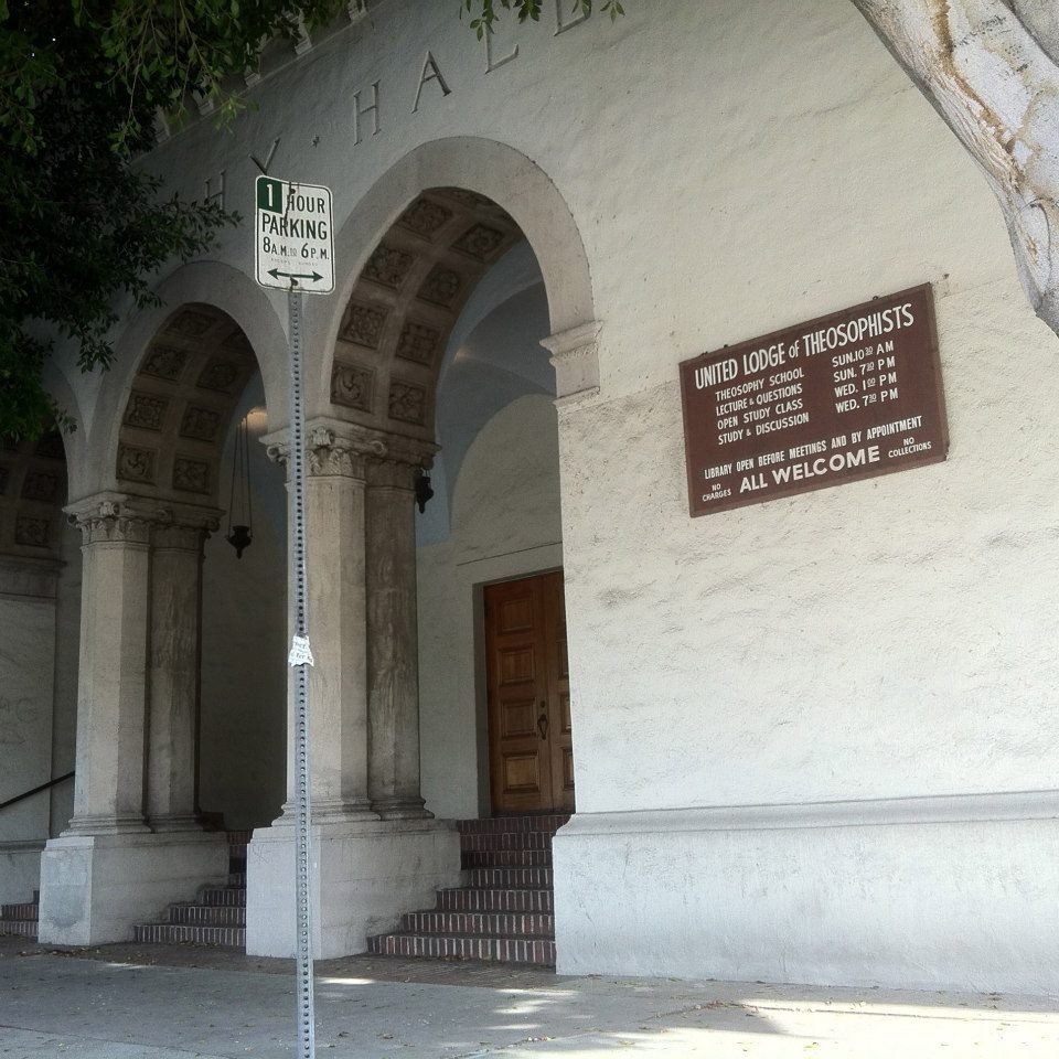
The United Lodge of Theosophists, at 245 West 33rd Street, was built in 1927. Includes a bookstore and library that are open before lectures and by appointment – which we didn’t have. Because of the large trees in front of it, it’s rather difficult to get a good view of the building’s facade. Theosophy, for those unfamiliar, is a 19th-century spiritual movement, like the Hermetic Order of the Golden Dawn or the Semi Tropic Spiritualists, only unlike them, still active.
SOUTH CENTRAL JAZZ
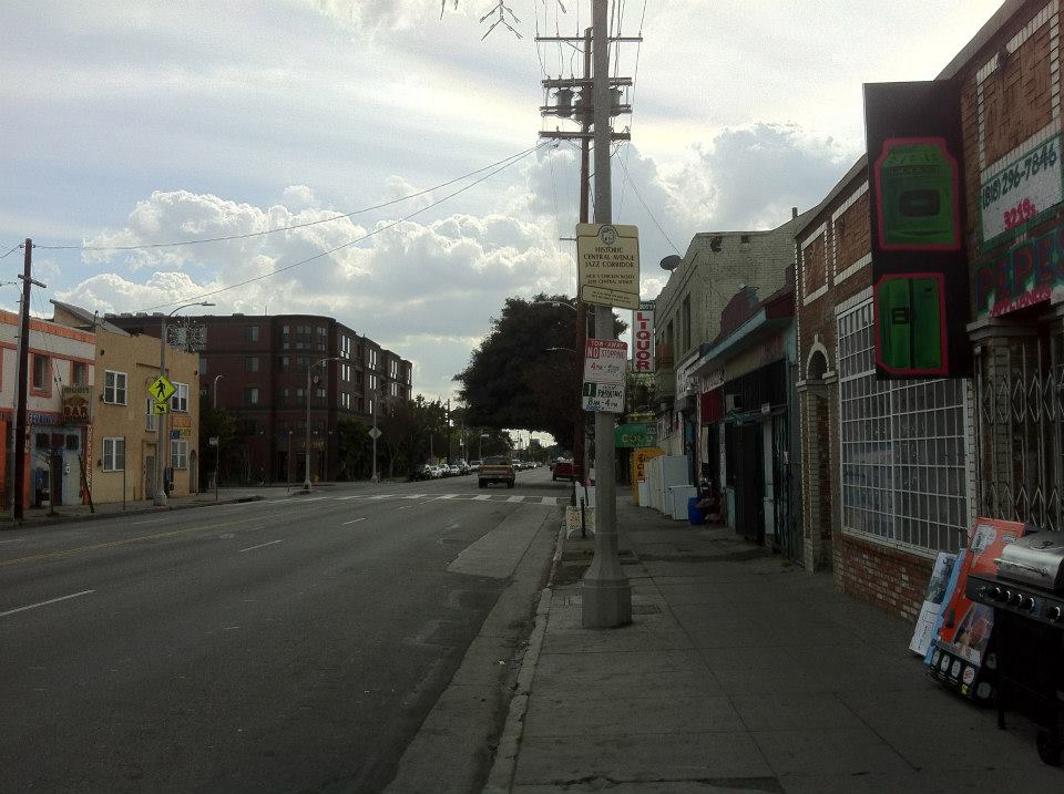
South Central’s most celebrated era was the 1930s and ’40s, when it acquired another nickname, “Harlem of the West,” on account of its central importance to West Coast Jazz. Venues from the era included Elks Hall (3416 S. Central) and Jack Johnson’s Chicken Basket (aka Jack’s Basket Room) (3219 S Central). Nearby but further in South Park was The Showboat and Club Alabam (at the Dunbar). In Central-Alameda was the Dolphins of Hollywood record store and radio station. Other area venues (whose addresses I don’t know) include Alex Lovejoy’s, Johnny Cornish’s Double V, Stuff Crouch’s Backstage, and the Turban Room. To this day, the Central Avenue Jazz Festival is held annually in front of the Dunbar.
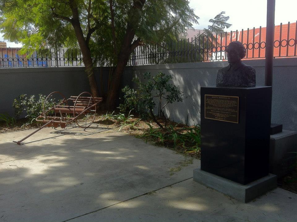
ANGELUS FUNERAL HOME
Yet another Paul Williams-designed building in South Central is the former location of the Angelus Funeral Home. It was built in 1936 and still stands, albeit not in the best condition, at 101 East Jefferson Boulevard. It was neither the first nor last home of Angeles Funeral Home, which was founded in 1922 and moved to its current location in Baldwin Hills on Crenshaw Boulevard in 1951. It was added to the National Register of Historic Places in 2009.
SECOND GREAT MIGRATION AND INTEGRATION
Whereas the first Great Migration had mostly involved migration from the south to the north, the so-called Second Great Migration that began in the 1940s involved large numbers of black southerners from Arkansas, Dallas, Houston, New Orleans, and Mississippi to the West – in particular Long Beach, Los Angeles, and Oakland. The increasingly crowded segregated ghetto was finally given breathing room in 1948, when the US Supreme Court ruled that the enforcement of racist housing covenants was unconstitutional and at least on paper black Angelenos were finally free to move where they may.
FIRE STATION #14
Los Angeles’s other segregated fire station was built in 1949 to replace an older firehouse. The International style firehouse was designed by Earl T. Heitschmidt and was added to the National Register of Historic Places in 2009. Unlike the African American Firefighter Museum, it remains in use as a fire station today.
OUTWARD MIGRATION
In the 1950s, the black populations of Mid-City, South Central, and Watts expanded and grew together to form a single contiguous region. The black population also began to move into South Los Angeles’s Westside, which since its annexation in 1906 until the Supreme Court ruling was mostly off-limits to blacks. By the end of the decade, Los Angeles had a larger black population than any city in the South. As the population spread from beyond the South Central neighborhood, so to did the usage of the South Central name and its application to areas far beyond its original vicinity. Whether it was employed as distinction-ignoring, coded shorthand or a term of endearment for all black Los Angeles neighborhoods south of the 10, it became commonplace even after most of those neighborhoods to which it came to refer became predominantly Latino.
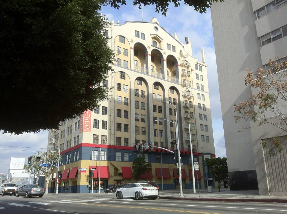
L.A. MART
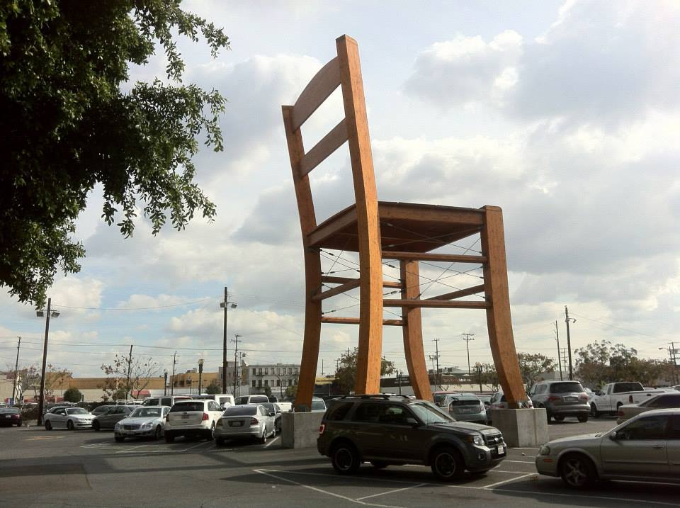
The twelve-story L.A. Mart was built in 1958 by the Los Angeles Home Furniture Manufacturers Association. It’s a combination design center, office building, and collection of showrooms. Back when I ran a men’s shop, I used to come down there every once in a while and my first piece for KCET was an account of walking from there to my apartment in Silver Lake. In the parking lot, there’s a rather tall wooden chair. Does anyone know who the artist is?
THE MUNICIPAL TRAFFIC COURT BUILDING
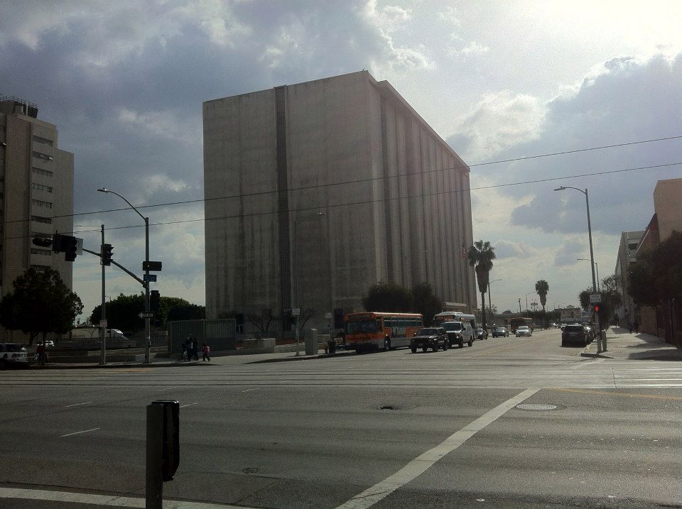
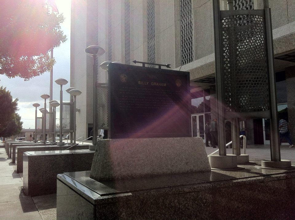
The Brutalist Municipal Traffic Court Building/Metropolitan Courthouse is located at 1945 S Hill St. It was designed by William Allen & Associates and constructed in 1970. It appeared as the Bay City Police Headquarters in the Todd Phillips film, Starsky & Hutch (2004). It also appeared in a 1977 episode of CHiPs and Marilyn Manson‘s video for “The Dope Show.” There’s also a plaque in front marking the 1949 location of Billy Graham‘s “Canvas Cathedral.”
AFTER THE WATTS RIOTS – THE BLACK EASTSIDE TURNS BROWN
It seems that for many, the Watts Uprising of 1965 (despite Watts’ somewhat considerable distance from South Central by eight kilometers) marked the end of an era. Black flight to the comparatively newer, more monied, and suburban westside of South Los Angeles accelerated.
In the 1970s, Latino immigration from Mexico and Central America increased and many settled in South Los Angles’s Eastside, which grew more impoverished as union industry jobs vanished or relocated. The US’s exacerbation of violence in several Latin American conflicts resulted in more Latino immigration to the neighborhood. In the 1980s, South Central became predominantly Latino. In the years that followed, so too would most of South Los Angeles. Today the population of South Central is roughly 91% Latino, 6% black, 1% Asian, and less than 1% white.
SOUTH CENTRAL TODAY
In roughly six hours of exploring, I saw no signs that would suggest gentrification, despite South Central’s proximity to Downtown. Perhaps the reputation of the neighborhood still frightens off interurban explorers, foodies, flippers, beardos, hipsterjugend, and the funny mustache mob. Nevertheless, crime is down and South Central is currently ranked 27th in violent crime out of all Los Angeles neighborhoods. Despite all of the reasons one might visit a neighborhood, the one other white guy that we encountered in our exploration grinned and asked me “checkin’ out the hood?” with what I assumed was an unattractive, self-satisfied cynicism. I suppose that there are busloads of wide-eyed tourists whose voyeuristic interest is in exploring the reality of Ganglandia but we had better things to do so we kept moving south.
GETTING THERE AND GETTING AROUND
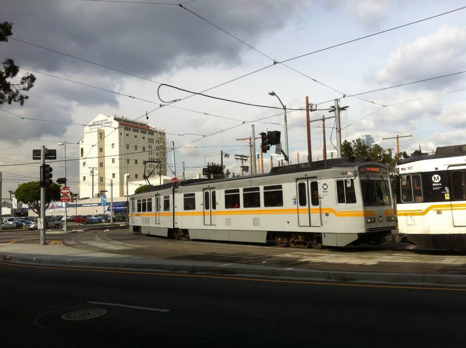
If you do decide to visit South Central, either merely to “check out the hood” or for less unsavory reasons, it’s thankfully well-served by public transit. Metro has got it pretty well covered with stops on the Blue, Expo, and Silver Lines as well as the 4, 10, 14, 35, 37, 38, 40, 45, 48, 51, 52, 55, 81, 102, 105, 200, 202, 352, 355, 442, 450, 460, 603, 701, 705, and 721 bus lines. It’s also served by LADOT‘s DASH King-East, Pico-Union/Echo Park, Southeast, several Downtown lines, and Commuter Express. Montebello Bus Lines, OCTA (Orange County Transit) and Torrance Transit also serve the area.
STAYING THERE
Staying overnight in South Central might prove a bit more difficult. There are lodging houses, or at least nominally motels, although most look from the outside to be pretty shady. For the record, there’s the Astro Motel, Casitas Motel, Eastsider Motel, Grace Apartment Hotel, Hayes Motel, and likely others. There are a few places advertised on Airbnb that look decent – none of which refer to the neighborhood as South Los Angeles or South Central, choosing instead (perhaps understandably) to refer instead to their proximity to USC and/or Downtown.
MUSIC OF SOUTH CENTRAL
Even following the decline of the Central Avenue Jazz scene, there’s undoubtedly been music made by South Central residents. I certainly heard plenty although in several cases it was blasting so loudly that I could only tell that it was music from the rattle metal and plastic of the cars from which it often emanated.
Although born in Chicago, Quincy Jones has a neighborhood school named after him, Quincy Jones Elementary School – which opened in 2010. There’s an underground music venue called Project Infest, which occupies a warehouse space at Maple and 32nd. Nearer to USC there’s a Classical KUSC station on Hope.
I wasn’t able to uncover any musical talents actually born in the neighborhood but if you know of any or are one yourself, please let me know in the comments and I’ll add your information.
SOUTH CENTRAL MOVIES
All of the neighborhood’s movie theaters seem to have been destroyed. In addition to the earlier silent movie theaters, there were also formerly the Allena Theatre and the Wesley Little Theatre. On the other side of Central Avenue (meaning I’ll cover it more thoroughly if/when I get around to exploring Central-Alameda) is the Lincoln Theatre, a Moorish, Exotic Revival style venue that was designed by John Paxton Perrine and built between 1926 and ’27. It was designated Los Angeles Historic-Cultural Monument in 2003 (#744) and added to the National Register of Historic Places in the same year. In addition to movies, it also featured live theater, talent shows, vaudeville acts, and music performances from some very big names including Billie Holiday, Duke Ellington, Esther Philips, Johnny Otis, Lionel Hampton, and The Nat King Cole Trio among others.
The neighborhood is home to a movie studio – AZ Productions and Studio. That organization was founded in 2005 by Ali and Zeus Zamani. As a duo, they’ve currently produced over 150 music videos, commercials, and films including Battlefield America, The Helpers, Maul Dogs, 616: Paranormal Incident, and many others.
Additionally, it’s home to the Film & Theatre Arts Charter.
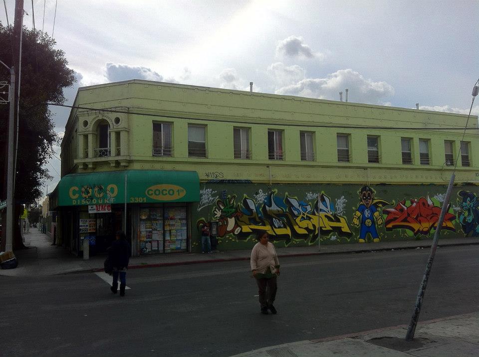
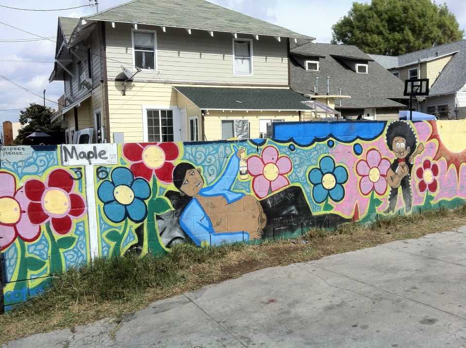
SOUTH CENTRAL ART SCENE
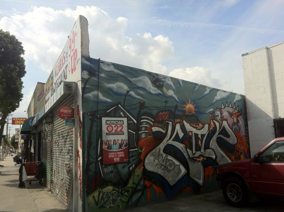
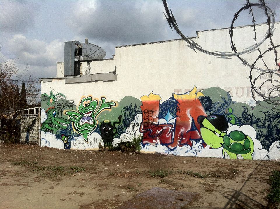
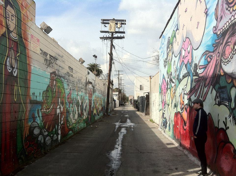
The most visible manifestation of arts in South Central is the huge amount of wall space devoted to graffiti and murals. There’s also a lot of folk commercial art in the form of signage and those murals that grace the exteriors of many Latino markets that depict a sample of products sold within.
South Central is also home to Frida Kahlo High School, named after the famous painter from Coyoacán. The area is also home to The Institute For Art And Olfaction.
SOUTH CENTRAL EATS
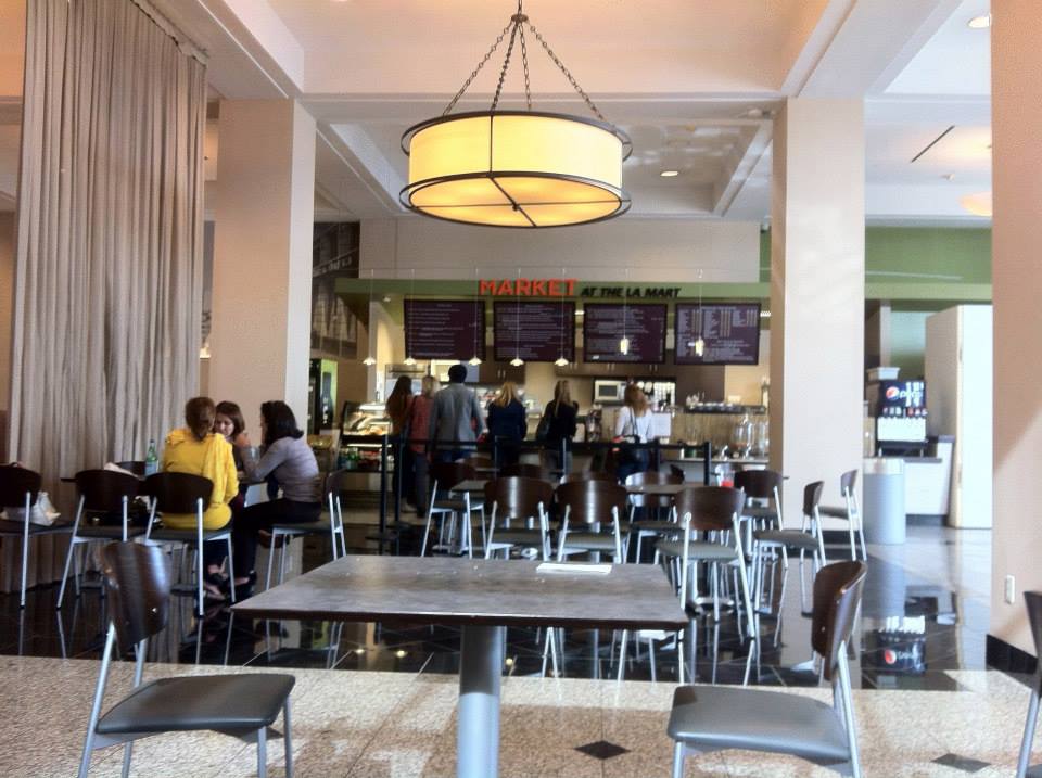
When Tim expressed the desire to get something to eat, I jokingly suggested Market at the LA Mart. I had wanted to try Azla, an Ethiopian restaurant recently opened by a friend’s family but Tim surprised me by persistently repeating his desire to eat at Market (which is fine for what it is — just perhaps not terribly adventurous) so we did.
Other restaurants, including a few that are probably better than Market at the LA Mart (there’s a King Taco, after all), include AA Chinese Express, Alberto’s, Angel’s Burgers No 1, Antojitos Hondurenos, Arellano Bulmaro, Armenia Restaurante, Birrieria Baldomero, Birrieria El Chivito, Black & White,Burger Plaza Grill, Carolina’s Restaurant, Chichen Itza, Chinatown Express, Chinatown Fast Food,Chinese Express, Chinese Food Bowl, Chon Mariscos Restaurant, Circle A Food Express, Costa Del SolRestaurant, Dog Gone It, El Chivito Birrieria, El Cihaulteco, El Gallo Giro, El Guanaco Pupuseria Y Restaurant, El Palmar, El Ranchito, El Santiagueno, El Tarasco Cafe, 5 K’s Mexican Grill, Food Haus Café, Gayle’s Famous Burgers, Golazo Restaurant, Greenwich Village Pizza, Guido’s Pizza & Pasta, Hong Kong Express, J&J Wok Chinese Fast Food, Juana La Cubana, La Chiquita Bakery, La Doña Mariscos, La Fogata, La Riviera Estilo Nayarit, Lindo Oaxaca, Los Compadres Restaurante, Los Gueritos, Los Mandilones, Los Morelianos, Manzanillo Colima, Maria’s Restaurant, Mariscos Los Korales, Mariscos Teca, Mr. Taco, No 1 Teriyaki, Original Bill’s Taco House, Pescaderia Puerto Penasco, Salad Farm, San Andres Restaurant, Simon’s Burgers, Tacos Doña Guera, Solecito Mexican Food & Deli, Tacos El Gordo A Todo Vapor, Tacos El Porvenir, Tamales Costeños, Tam’s Burger, Taqueria D F, Taqueria Tepeque, Taqueria Vista Hermosa, Thai Corner Food Express,Tijuana Restaurant Mexican Grill, Tony’s Burgers, Torta Movil, and URBNMRKT.
If you’re more interested in drinks (coffee, tea, alcohol, or otherwise), there’s Kenny’s Coffee, La Chiquita Bar, Mal’s Cafe, Oaxacalifornia Juice Bar and Ice Cream, and Seree’s Coffee Shop. Mal’s Cafe sounds like a good bet from the reviews — offering as it does both popcorn and live music.
SOUTH CENTRAL MARKETS
Although many are perhaps little more than convenience stores or liquor markets, there are a lot of markets in the neighborhood, including Adair Market, Adams Ranch Market, Bembi’s Market, Buddy’s Liquor, Central Liquor Market, El Charrito Market, Chayo Market, El Principio Market 2, Eudora, Feregrino’s Mini Market, Fuentes Market, Happy Market, Jessie’s Market, La Estrella Market, LA Meat Market, La Reina Market, Louie’s Liquor Market, Mac 7 Mini SuperMarket, Main Street Market, Maple Market, Marces Market, Martinez Mini Market, Maximo Market, Mercado La Paloma, Mother’s Nutritional Center, New San Pedro Market, Numero Uno Market, Ofelia’s Mini Market, Prince Liquor Market #8, Rancho Meat Market, Reyes Mini Market, Ron’s Market, Rosita’s Mini Market, 30th Street Market, Susy Mini Market, Tikal Market, Unified Markets, Victoria Market, Village Market Place, Wall Market, Y & Y Market, and Youngs Market.
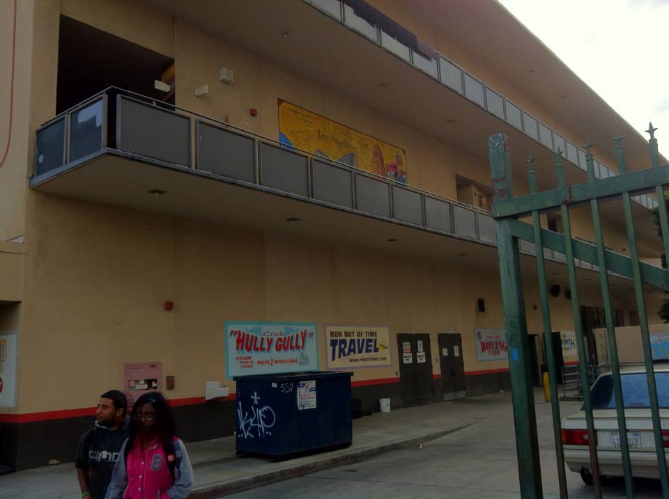
SOUTH CENTRAL NIGHTLIFE
If you love the nightlife, in addition to the aforementioned live music venue, there’s also a strip club called Déja Vu Showgirls and a gay club called La Victoria Coco Bongo – both located on Main Street. If you’d like to rent out your own space, there’s Salon Acapulco Banquet Hall Salon de Fiestas. There’s a sign on the second floor above a quick loan place that says Tropical Club but I’m not sure what sort of venue it is, or even whether it’s a venue at all.
OTHER STUFF TO DO
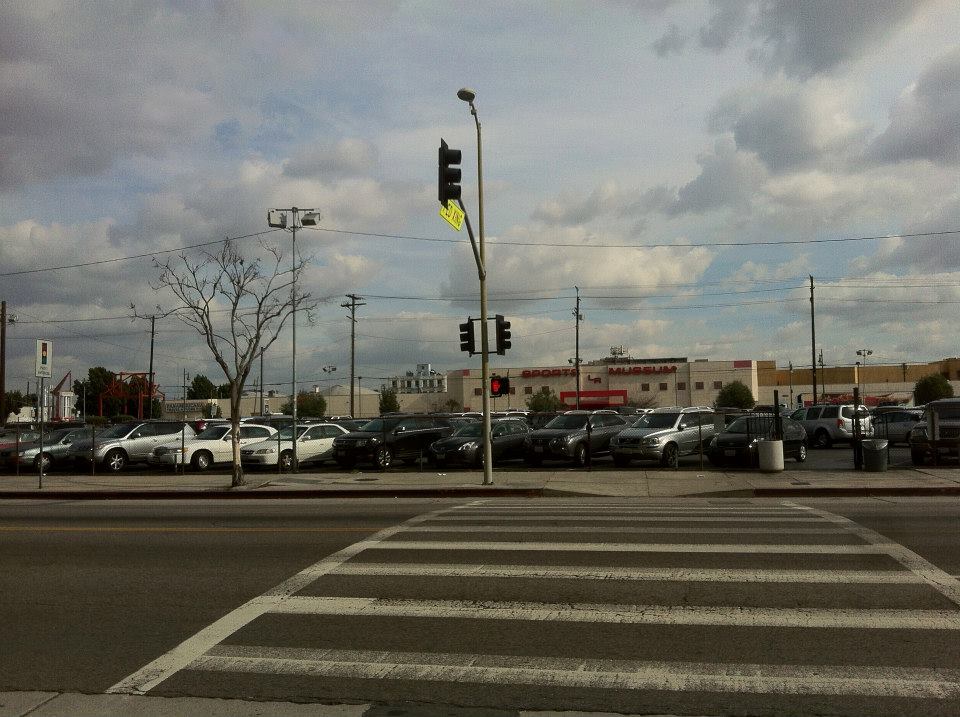
The Sports Museum of Los Angeles is Gary Cypres‘s private museum and is open by invitation only (although the website allows you to contact him and, I suppose, ask for one). Open to the public but I don’t believe in yearlong operation is Scare LA, a Halloween haunted house.
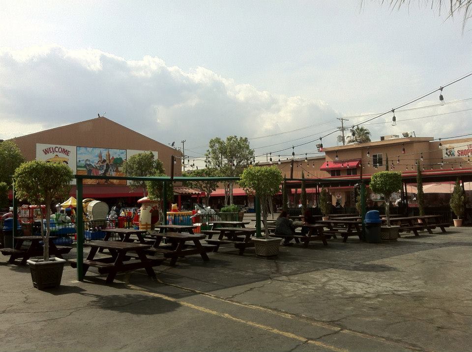
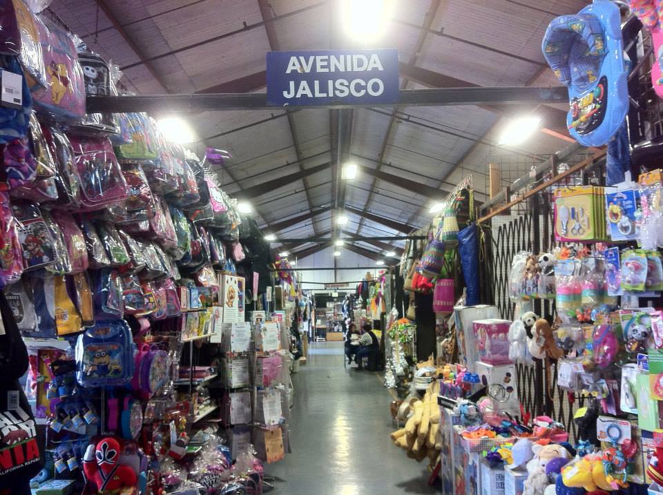
More appealing to me than both of those is the Los Amigos Mall. Los Amigos Mall is an indoor/outdoor swap meet. It’s not nearly as big as a lot that you find in the city but it makes up for its small size with an arcade, a CD store (selling mostly Mexican and other Latino music), many food options, and a stage, Estrellas de los Amigos, that hosts live music on Sundays.
Unfortunately, one thing that South Central doesn’t have a lot of is park space. There’s only Trinity Park, which includes a gymnasium/auditorium, basketball courts, and a playground. Exposition Park is within walking distance and home to a lot of area attractions such as the California African American Museum, the California Science Center, the Natural History Museum, and more.
NON-PROFITS/COMMUNITY SERVICES
Services provided for or within South Central are provided by organizations including Adobe Community Housing, Benando Breakthrough Support Mission, Hope Harbor, St. Francis Center, and Urgent Care LA.
SOUTH CENTRAL SOCIETIES
South Central, along with part of Central-Alameda, is represented in the Neighborhood Council system by the South Central Neighborhood Council. Not that long ago I some of the Eastside Boys and I’m sure there are other social clubs too.
FURTHER READING
Other books worth checking out for those interested in the neighborhood and its history included Douglas Flamming‘s Bound for Freedom: Black Los Angeles in Jim Crow America (2006) and Karin L. Stanford‘s African Americans in Los Angeles (2010). In 1997, Erin J. Aubry wrote a nice piece for the Los Angeles Times called “The Legacy of the Eastside Boys.” There’s a good documentary out there covering the era from 1920 till 1965 called The Eastsiders.
Support Eric Brightwell on Patreon

Eric Brightwell is an adventurer, essayist, rambler, explorer, cartographer, and guerrilla gardener who is always seeking paid writing, speaking, traveling, and art opportunities. He is not interested in generating advertorials, cranking out clickbait, or laboring away in a listicle mill “for exposure.”
Brightwell has written for Angels Walk LA, Amoeblog, Boom: A Journal of California, diaCRITICS, Hidden Los Angeles, and KCET Departures. His art has been featured by the American Institute of Architects, the Architecture & Design Museum, the Craft Contemporary, Form Follows Function, Los Angeles County Store, the book Sidewalking, Skid Row Housing Trust, and 1650 Gallery.
Brightwell has been featured as subject in The Los Angeles Times, VICE, Huffington Post, Los Angeles Magazine, LAist, CurbedLA, Eastsider LA, Boing Boing, Los Angeles, I’m Yours, and on Notebook on Cities and Culture.
Brightwell has been a guest speaker on KCRW‘s Which Way, LA?, at Emerson College, and the University of Southern California.
Brightwell is currently writing a book about Los Angeles.
You can follow him on Ameba, Duolingo, Facebook, Goodreads, iNaturalist, Instagram, Mastodon, Medium, Mubi, the StoryGraph, and Twitter.


The majority of the people now in South Central, haven’t a clue.
LikeLike