

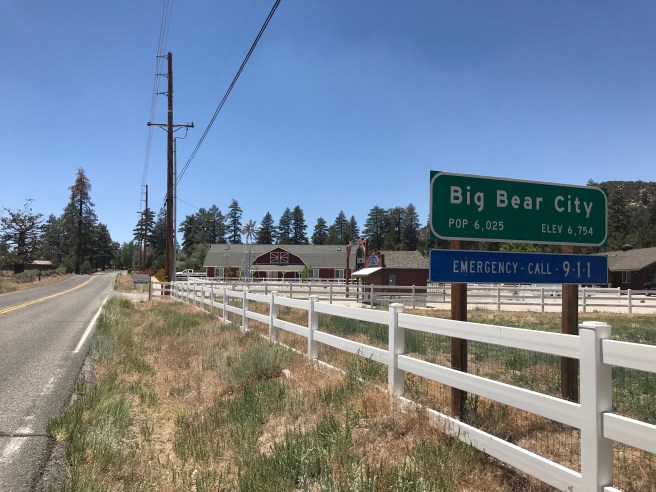
After eleven years of exploring Los Angeles County, and eight of exploring Orange County, I finally explored elsewhere in Southern California for California Fool’s Gold a week ago, when I visited the small San Bernardino County town of Big Bear City with my friend, Mike. We first stopped at Running Springs for a bathroom break. In that town, I expressed to a man my view that the weather was pleasantly cool and he correctly surmised that I was “from down the hill.”
I usually choose what community to explore based upon readers’ votes and I created a poll for San Bernardino County communities in 2015. Big Bear City was actually tied for second place, as of this exploration, with San Bernardino and Rancho Cucamonga. The first place position is right now held by Calexico. Calexico, however, is 364 kilometers from my house and thus not exactly ideal for a quick day trip and Mike, being the one with the car, decided of the communities in second place, he’d most like to explore Big Bear City, so it was to Big Bear City that we went.
I often speculate (although I have no real way of knowing) why readers vote for the communities which they vote for. After having visited Big Bear City, I can’t help but wonder whether or not those who cast votes for it really wanted me to visit Big Bear Lake. Not that Big Bear City is without charm but, somewhat confusingly, it is Big Bear Lake which is the incorporated city along the shores of Big Bear Lake whereas Big Big City is, despite its name, an unincorporated community and thus not a city in any sense except perhaps the aspirational.
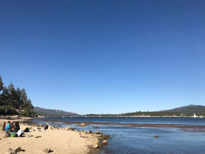
To add to the confusion, Big Bear Lake (the lake after which both the city and unincorporated town with “city” in the name are named) is actually a reservoir, and not a lake proper. As there are no tributaries or means of mechanical replenishment, it is fed entirely by snowfall and rain. At its deepest point, it has a depth of 22 meters.
Before there was a Big Bear Lake, Big Bear Valley was home to a wetland. A single arch granite dam was built by the Bear Valley Irrigation Company in 1884, which created a reservoir for the purpose of irrigating the citrus orchards around Redlands. The water provided proved insufficient and in 1912, a multiple arch dam was constructed a bit downstream from the original dam by the Bear Valley Mutual Water Company, which increased the reservoir’s capacity.
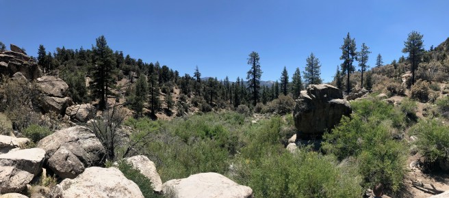
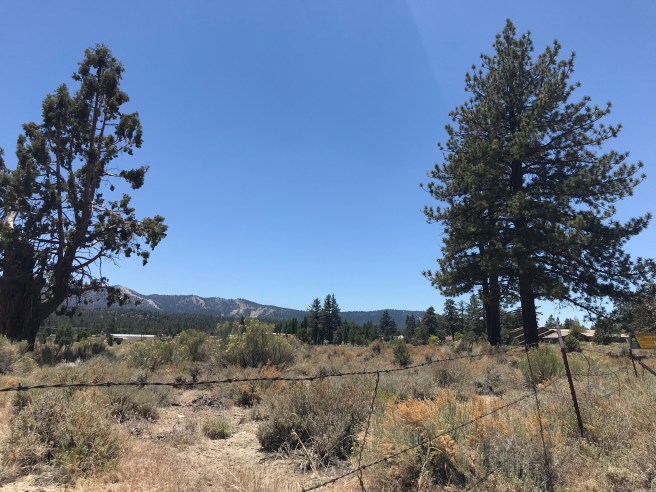
The “Big Bear” name refers to the grizzlies which were prevalent there for thousands of years but, thanks to hunting, driven into local extinction in 1906. Non-human animals which still live in the area include black bears, chipmunk, coyotes, gray foxes, mountain lions, mule deer, raccoons, squirrels, and skunks. Whilst hiking, I did spy a chipmunk but for the most part, non-avian wildlife proved elusive. The area remains heavily wooded, though, and Coulter, Jeffrey, knobcone, lodgepole, piñon, ponderosa, and sugar pines were abundant.
The first humans to live in the area referred to themselves as the Yuhaviatam, which translates to “people of the pines.” The Yuhaviatam are currently believed to have migrated to the area as long as 2,000 years ago. The Yuhaviatam established winter villages at lower, warmer elevations and summer villages at higher elevations, where they largely lived off acorns, herbs, juniper berries, mesquite beans, pinyon nuts, screw-beans, tubers, and game. Grinding rocks can still be seen in Big Bear City, which the Yuhaviatam refered to as “Hatauva” (“eye of God”) and regarded as the source of their creation. The Yuhaviatam referred to their territory as Yuhaviat (“place of the pines”) and the first Europeans to pass through may’ve been the Spanish during Francisco Garcés‘s expedition of 1774-1776. The Spanish simply referred to the Yuhaviatam as “serranos,” meaning “mountain people.”
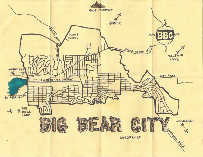
Upon arriving in Big Bear City, Mike first drove us into Maple Ridge, a McMansion subdivision on Maple Hill. As with most planned communities, there was nearly nothing of interest although nearby is Sugarloaf Park, Big Bear High School, and Baldwin Lane Elementary. It’s also next to Big Bear Cemetery (aka Gold Mountain Memorial Park), in which the human remains of about 568 folks are interred. It appeared to be closed, though, and is apparently abandoned except by the descendants and relatives of those buried there. According to the Big Bear Grizzly, it hasn’t had a licensed manager for many years. However, if Hollywood is right about anything, building a McMansion development next to an abandoned burial ground is always a recipe for fun.
After that, we headed to something marked on Wikimapia as “flume tunnel.” There was no description of the site but it was tagged “place with historical importance.” A bit of quick research suggests it is a 90-meter long water tunnel cut through a hill in 1875 by Chinese laborers who’d previously worked on the Transcontinental Railroad in order to provide water to process ore from the Lucky Baldwin Mine/Gold Mountain Mine and to power a stamp mill’s steam engine. A shaft was dug through the hill so that water could flow via a wooden flume roughly 8 kilometers downhill to the mill.
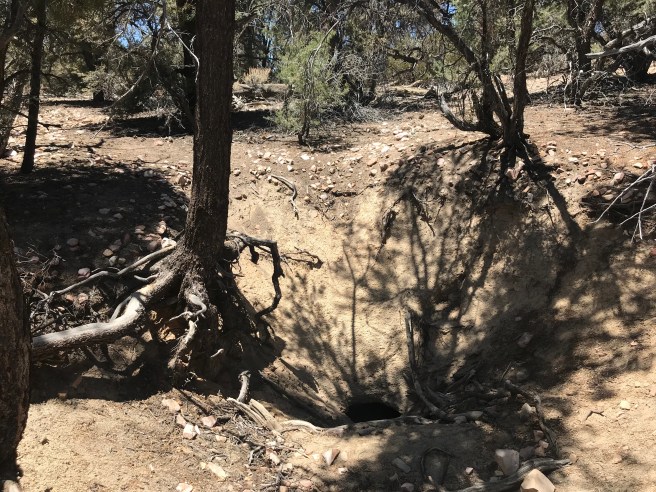
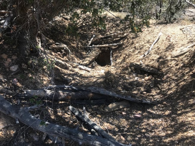
The flume tunnel’s location was eventually forgotten but in 1990 was rediscovered by Wilbur Roller. In 1991, it was visited by the Big Bear Valley Historical Society, the members of which entered the tunnel. Using my tracking skills, I was able to get us pretty close to the central shaft but ultimately it was GPS coordinates which pinpointed its location and that of the tunnel’s west entrance. Sadly for would-be spelunkers, the tunnel is now filled in with dirt and rubble. According to a geocacher known as “Rimor,” 23 meters north of the east tunnel entrance is a wikiup built of Ironwood branches supposedly built by the Chinese laborers but Mike was wary of spending all day huting for filled-in tunnel entrances and 19th-century brush shelters so we hiked back to his car (this time relying entirely on my sense of direction).
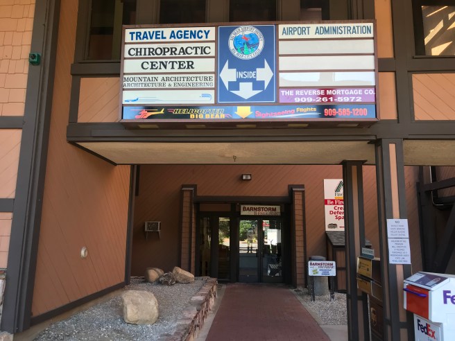
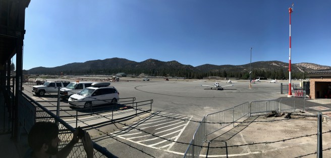
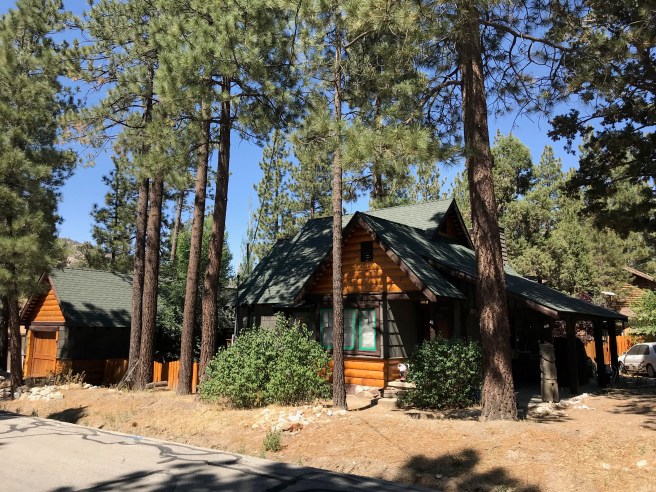
Today, Big Bear City is small and walkable although when we visited, we saw very few pedestrians and quite a few automobiles. The region which includes Big Bear Lake, Crestline, Highland, Lake Arrowhead, Lake Erwin, Moonridge, Running Springs, San Bernardino, and Victorville is also served by Mountain Transit — although we saw no buses during our visit. The town is also physically dominated by a general aviation airport — Big Bear City Airport — which currently offers only private air services and from which we saw no aircraft arriving or departing.
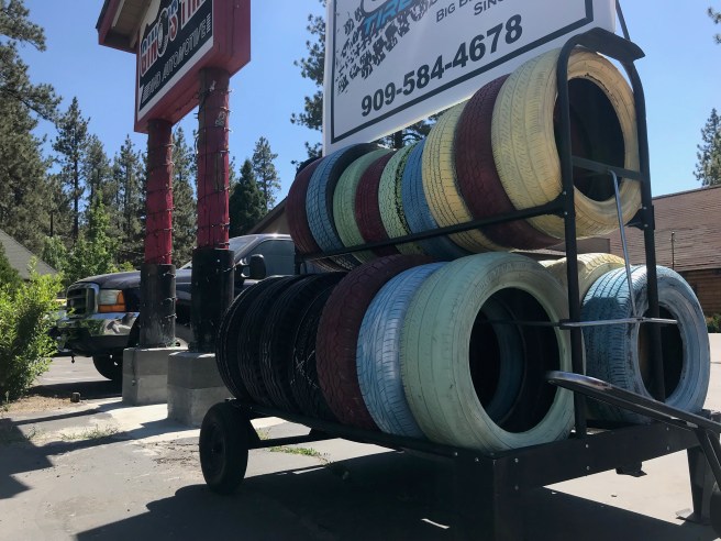
Big Bear City’s primary thoroughfare is Big Bear Boulevard, which at the town’s eastern extremity splits into Shay Road and Greenspot Boulevard. The length of the cross-town thoroughfare is about four short kilometers but as we walked it, the only other pedestrian we saw was a young woman we both, rightly or wrongly, assumed was a teenaged runaway. For such an apparently car-dependent small town, the main thoroughfare seemed to be dominated by various automobile service stations, all of which seemed to be doing good business. Otherwise, most of the businesses seemed to be thrift stores like Big Bear Valley Humming Bird, Doves Nest Thrift Store, and Senior Citizens Thrift Store, several of which we visited but at none of which did either of us find anything particularly of use. Although pine cones were laying on the ground everywhere, one of the thrift stores was offering a reused potato bag full of them for the low price of two dollars.
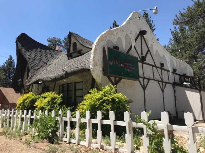
It’s easy to imagine living in a small town without ever finding a reason to visit either a car shop or thrift store but I don’t know anyone who never fancies dining out and Big Bear City is home, not surprisingly, to a few restaurants, including the Barnstorm Restaurant (inside the airport), BJ’s Restaurant and Sandwich Shop, Broadway Cafe, Cocina de Mexico, Lumber Jack Cafe, No Name Pizza, and Thelma’s. Based entirely upon is whimsical storybook style architecture, complete with fake crumbling plaster and needlessly (for much of the year, anyway), fake snow-covered roof, I suggested a restaurant located behind a tulip-motif white picket fence. According to public records, it was built in 1979 although I personally suspect its a couple decades older than that. It proved to be empty, though, its most recent tenant having apparently been a French restaurant called Madlon’s.
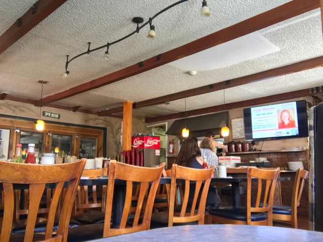
After recovering from my disappointment, we headed to the appealingly-named Thelma’s, which proved adequate if, to be honest, not especially memorable aside from the historic photos of the town and Big Bear dam being constructed which provided most of the decorations — and the television set which seemed to broadcast a public access channel community calendar throughout our meal.
After our meal, we passed through the abandoned, bleak Big Bear City Park & Playground. Although for some reason permanently closed, a shirtless man was playing with his dog in a vaguely post-apocalyptic scene. Signs for a museum led us across the barren playscape.
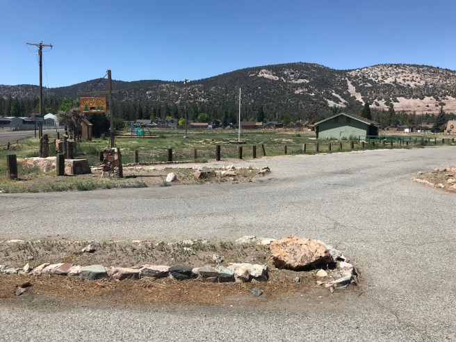
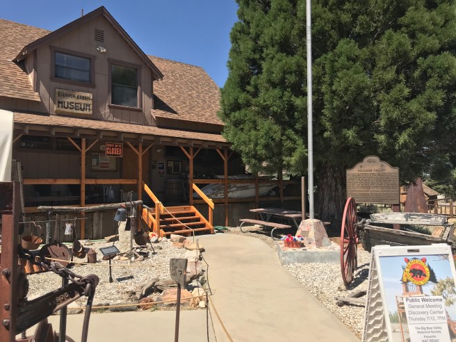
We tried to visit Big Bear Valley Historical Society’s Big Bear Valley Historical Museum (aka the Eleanor Abbot Bear Valley Historical Museum or simply the Eleanor Abbot Museum) but it also proved to be closed as it’s only open on Wednesdays, Saturdays, and Sundays from 10:00-16:00 and unfortunately for us we were there on a Monday.
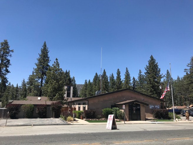
Other establishments include Big Bear Fire Department Station 282, Big Bear Foursquare Church, Big Bear Psychic, Community Market, Cornerstone Christian Church, and Liquor Junction.
There used to the Pan Hot Springs Hotel and the Peter Pan Woodland Club, both built in the mid-1920s.
The Pan Hot Springs Hotel, built circa 1926, was located on a natural hot spring and its two swimming pools were filled with hot mineral water from them. The Pan Hot Springs Hotel burned to the ground in 1933 and never re-opened, although the hotel’s swimming pools remained in use until the 1990s when they were closed due to earthquake damage.

The lavish and exclusive Peter Pan Woodland Club, built in 1925, is widely credited as having been responsible for the existence of Big Bear City, located as it is a bit east and inland from the popular reservoir. It included on its grounds a cinema, a golf course, a model train, a swimming pool, and tennis courts. It burned to the ground on 18 June 1948.
After spending a few hours exploring the town of Big Bear City, we walked along the shore of Big Bear Lake before heading home. Till next time!
FURTHER READING
To vote for any communities you’d like to see covered in California Fool’s Gold, name them in the comments. If you’d like a bit of inspiration, there are primers for:
- Imperial County
- Kern County
- Los Angeles County
- Angeles Forest
- the Antelope Valley
- the Channel Islands
- Downtown
- the Eastside
- the Harbor
- Hollywood
- Mideast Los Angeles
- Midtown
- Northeast Los Angeles
- Northwest Los Angeles
- the Pomona Valley
- the San Fernando Valley
- the San Gabriel Valley
- the Santa Monica Mountains
- the South Bay
- South Los Angeles’s Eastside
- South Los Angeles’s Westside
- Southeast Los Angeles
- the Verdugos
- the Westside
- Orange County
- Riverside County
- San Bernardino County
- San Diego County
- San Luis Obispo County
- Santa Barbara County
- Ventura County


Man you disnt even go to the village and try to look for the underground tunnel system that we have up here the first one was idk when but it had connected the bar and a old whore house dudes would use it so their wofes wpuldnt catch them cheatingannyou didmt even really dig into our history otherwise your report wpuldnt haveade our towm look like a lame ass town but good looks anyways
LikeLike