

INTRODUCTION
Normally when I write an account of one of my explorations, it’s after I’ve concluded it. Sometimes I work on them for months and when I can’t stand thinking about it anymore, I just publish it and figure I’ll correct the typos later. However, I began exploring and writing about Valley Boulevard more than a year ago and finally it dawned on me that — through the magic of the internet — I could just publish what I’ve got and update it as I continue exploring. It’s not a book, after all… so what you’re reading (should you continue past this introduction) is a work in progress… unless I’ve made it all the way to Pomona. As of December 2017, I’m less than halfway there, walking it with a walk-loving dog named Dooley when I find myself charged with her care.
Map of Valley Boulevard — in progress
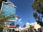
Although it extends beyond it, Valley Boulevard is the main thoroughfare of the San Gabriel Valley. Its name is interesting to me because, although Los Angeles County includes within it many valleys, in colloquial use, “Valley,” when otherwise unqualified, in nearly every case to refer to the San Fernando Valley. Although “the Valley,” is much more interesting than most give it credit for, the San Gabriel Valley is even more so.
Valley Boulevard runs about 45 kilometers from its western terminus in Lincoln Heights to its eastern one in Pomona, where it turns into Holt Boulevard. Over in Fontana, it once again becomes Valley Boulevard and remains so until Colton, where it ends at Sperry Drive. Colton is located in the San Bernardino Valley, not the San Gabriel, and for all intents and purposes, it’s a different Valley Boulevard. I’m sure, for that matter, that there are many Valley Boulevards in the English-speaking world, and if I ever do explore that one or any other, it will be for a separate entry.
In the latter half of the 2000s, I was in a relationship with a Valley Girl, albeit a San Gabriel Valley Girl. She initially lived at her family’s home in Avocado Heights. I lived in Silver Lake, some 32 kilometers to the west. When I’d bicycle over to her neighborhood — just her neck of the woods — Valley was my preferred route. Other routes were shorter but involved riding up and down hills. They were also, to my mind, less interesting as I prefer to ride down roads that tell a sort of story about Los Angeles.
My relationship with the San Gabriel Valley Girl ended but, having fallen in love with the San Gabriel Valley when I first visited Los Angeles in 1998, I still find myself traveling up and down Valley Boulevard semi-regularly. As much as I like it, though, there are things about it which I find rather aggravating. Unlike most great streets, for example, Valley Boulevard does not especially lend itself, flatness aside, to walking. Nor is it as well served by mass transit as a vibrant street in the world’s richest nation might be expected to be.
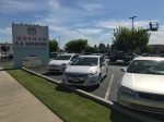
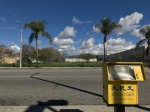
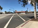
Although wide enough to accommodate them for its entire length, not one block has a bike lane, nor is there even a single sharrow. There are sections where pretty trees grow from the median, but the sidewalks are almost completely unprotected from the sun by either trees or tall buildings. Unsurprisingly, few pedestrians walk along Valley and those that do often wear visors and/or carry parasols. The acreage devoted to vast parking lots is staggering and mixed-use buildings are only just beginning to rise up.
There’s a strong likelihood that Valley’s route was walked first by animals, later by humans, and eventually, cars but in the 21st century, Valley Boulevard, like the San Gabriel Valley itself, still feels like a relic of the car-dependent mid-20th century. Although wide enough to accommodate light rail or at least a streetcar, as far as I know, none has ever traveled any part of it. Today the western half is served by Metro‘s 76 Line and sections of the route east of El Monte are served by various lines of Foothill Transit.
LINCOLN HEIGHTS


Valley Boulevard begins in the Eastside neighborhood of Lincoln Heights. It is not that neighborhood’s main street — nor, for that matter, is Main Street — which terminates at an intersection with Valley. Lincoln Heights’ main street is Broadway, another great street which begins there and ends nearly 30 kilometers south in the Harbor District city of Carson.
Today the population of Lincoln Heights, like all of the Eastside, is predominantly Mexican-American with a sizable Chinese-American majority, most of whom are Hoa from Vietnam and their descendants. Historically, however, Lincoln Heights was home to a sizable population of German-Americans and later (and more famously) Italian-Americans. As the San Gabriel Valley to the east suburbanized, many of the Italians, by then largely assimilated, moved into it. Mrs. Cubbison’s Bakery & Bread is perhaps the only obvious reminder of the Germans’ presence, many of whom were bakers. There are few more reminders that there was once a Little Italy, though, including Lanza Brothers Market, the San Antonio Winery, and the Italian Renaissance-style Federal Bank Building which has since 1993 been the incongruously fancy-looking home of an El Pollo Loco.
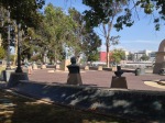
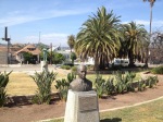
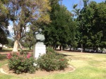
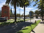
Lincoln Park was created in 1881, as East Los Angeles Park. Lincoln Heights was known as East Los Angeles until 1917. In 1901, East Los Angeles Park was renamed Eastlake Park, highlighting its relationship to the neighborhood of Westlake‘s titular Westlake Park — renamed MacArthur Park in 1942. Next to, but separate from Lincoln Park, is El Parque de Mexico. The small park is home to many sculptures commemorating Mexican historical figures but is unfortunately somewhat isolated by busy streets — although that could easily be solved if the last block of Main were closed to cars and some bollards or planters installed.
BOYLE HEIGHTS


For a short stretch, Valley Boulevard forms the northern border of the Boyle Heights neighborhood. As with Lincoln Heights, however, Valley is not one of the neighborhood’s main thoroughfares. 1st Avenue, on the other side of the 10 Freeway, is the neighborhood’s high street. This northernmost section of the neighborhood is dominated by the ever-expanding campus of theLAC+USC Medical Center and a pocket of aging industrial buildings adjacent a freight train line.
Boyle Heights was, thanks to housing discrimination, historically home to a diverse population of non-Protestant Croats, Japanese, Jews, Mexicans, Russians, Serbs, and others. As with their Italian neighbors to the north, many spread into the western end of the San Gabriel Valley as it developed. As of 2010, the population of Boyle Heights was 94% Mexican, making it the least ethnically diverse neighborhood in the entire city. Because of gentrification, that seems to be changing — although the diversity now is more a result of colonization from wealthy non-Latinos rather than housing discrimination.
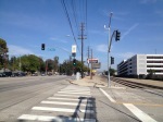
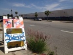
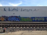
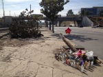
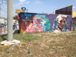
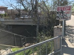
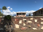
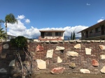
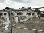
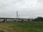
Although the railroad adjacent warehouses have a certain aesthetic appeal, they’re set back from the boulevard, on the other side of the tracks. Within five years, all of those aging buildings will probably be turned into food halls, but for now, it’s a pretty desolate stretch of Valley with no sidewalk along the south side of the boulevard, nor much of anything but litter and detritus. It’s definitely my least favorite stretch to ride a bicycle, as it’s needlessly wide and cars thus tend to drive at unsafe speeds. As I walked along I noticed a broken wall which a car appeared to have crashed into, and a memorial, where someone else seemed to have collided with a pole.
HILLSIDE VILLAGE


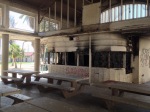
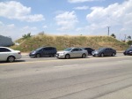
Heading east one passes along the southern edge of Hillside Village, a small neighborhood located on the former site of the New Ascot Speedway. From 1924-1936, roughly 24 race car drivers perished on the course. In 1936, two more died in what had by then been renamed the Ascot Motor Speedway and it closed. Eight months later the grandstands of the abandoned raceway burned to the ground and a few years later, Hillside Village sprang up.
Hillside Village is mostly residential, comprised of small homes and lawn ornaments dating from the 1940s. Although it was formerly promoted as “the Beverly Hills of the Eastside,” it’s one of those many neighborhoods which reminds me more of the neighborhood where The Wonder Years was set than it does that Westside oasis of nouveau riche tackiness.
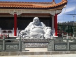
In a building that originally housed Roscoe Moss Company(now located across the street) is Ming Ya Buddhist Temple. There’s also Cha Cha Chili (a Korean-Mexican fusion restaurant), and a non-descript shopping center which is the neighborhood’s de facto “downtown” and is home to the aesthetically nondescript but highly regarded restaurant, King Torta. Before that, it was home to the neighborhood’s de facto town hall — Hillside Village Market.
EL SERENO


Most would argue that Hillside Village and, to the east, University Hills, are both part of the greater El Sereno neighborhood. Valley passes along both neighborhoods but a short stretch between is inarguably El Sereno and nothing else. This section is bisected by Eastern Avenue, appropriately named as El Sereno extends further east than any other neighborhood in the city of Los Angeles.
UNIVERSITY HILLS


The area surrounding the 71-hectare campus of California State University, Los Angeles (CalState LA) is known as University Hills. The school, which originally shared a campus in East Hollywood with Los Angeles City College, was formerly known as Los Angeles State College. In 1955 it moved to its present location. Although I’ve still yet to attend an event there, The Harriet and Charles Luckman Fine Arts Complex includes two theaters and an art gallery, and someday soon I hope to catch a performance there.
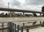
Walking along Valley, though, you don’t notice any of that, really, as that portion of the neighborhood is dominated by the presence of freight train line which gives the immediate surroundings their distinct character. This side of the hill, however, does boast the Heidleman Stairway, which at 234 steps is the tallest public stairway in Los Angeles. Separating University Hills from Alhambra is the abrupt end of the 710 Freeway, an interstate freeway which will likely be recognized as a misguided mistake and dismantled or turned into something else before its extended north into the wealthier, and thus more politically powerful, communities along its planned route.
ALHAMBRA


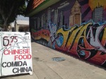
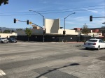
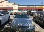
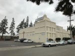
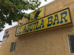
As Valley Boulevard crosses into the city of Alhambra, it finally enters the San Gabriel Valley. The motto of Alhambra is, appropriately then, “the Gateway to San Gabriel Valley.” Many are the times I’ve entered Alhambra from the west and noticed both a seeming improvement in air quality and a definite improvement in its scent. The majority of Alhambra’s population is Chinese. The majority of inhabitants were also born abroad, mostly in either China or Vietnam. In addition to the various regional Chinese cuisines, Alhambra is home Burmese, Indonesian, Japanese, Korean, Taiwanese, Thai, Vietnamese, and formerly a Malaysian restaurant — all of which have made it a frequent culinary destination for me.
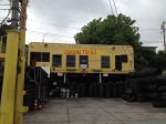
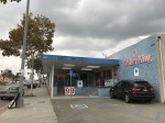
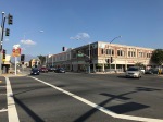
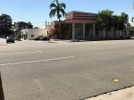
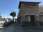
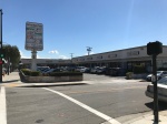
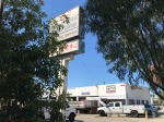
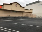
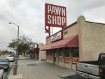
Alhambra, though, is a fairly large suburb — spread across 34 square kilometers. In this instance, its Main Street is its Main Street, and the central business district is centered around the intersection of Main and Garfield Avenue. The section of Valley Boulevard in Alhambra isn’t especially interesting, as it’s dominated by auto maintenance shops and chain restaurants. In fact, I once found myself replacing a flat tire there and, with no apparently better options, ate lunch at a Shakey’s Pizza Parlor.
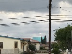
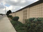
This section of Valley, in fact, is amongst its most unforgivably shade-deprived and not surprisingly, it’s rare to encounter anyone else using the sun-blasted sidewalks. Looking around, I spied a couple of interesting structures far in the distance. The first, the Pyrenees Castle, was designed by John Walker Smart and built in 1927 for a French-American shepherd named Sylvester Dupuy. Many years later, it was where Phil Spector lived and infamously murdered actress Lana Clarkson.
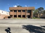
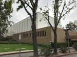
The other building, the Sears, Roebuck and Company, Pacific Coast Territory Administrative Office building, can be seen from nearly any part of Alhambra — in a situation which unfailingly reminds me of experimental filmmaker John Smith‘s, The Black Tower. The Late Modern office building was designed by A. C. Martin & Associates and built in 1971. It’s only thirteen stories but far taller than any other buildings in the vicinity. Additionally, each floor has two panes of glass, giving it the appearance of a building twice its height. Locally known as the “Big Blue Cube,” it’s since 1987 been home to the Department of Public Works.
One of the last buildings of note that one passes before leaving Alhambra is the 168 Market. I’m assuming that its name is a bit of Chinese numerology. 168 sounds a bit like “路發,” meaning “fortune all the way.” The market and shopping center originally opened as Crawford’s Corner, around 1965. The architectural theme was inspired by New Orleans and the gazebo used to feature life Dixieland bands.
SAN GABRIEL


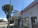
Riding a bicycle, one of the indicators that the Valley Boulevard explorer has left Alhambra and entered San Gabriel (in addition to the signs notifying one of this fact), is that the quality of the road worsens and I believe that it was in San Gabriel where I took my only spill on my bicycle that didn’t involve a car.
There’s no obvious change in the quality of the sidewalk, though. The Asian demographic of San Gabriel, however, is even more pronounced than Alhambra’s. Upon reading this on my tricorder, I decided to pay more attention to the demographics of pedestrians along Valley. By the time I crossed the suburb, I counted zero non-Latino white folks, who as of the last census accounted for 11.4% of the population. As with Alhambra, most Asians in San Gabriel are of Chinese ethnicity. For this reason, I’ve heard locals jokingly (and with pride, I think), refer to San Gabriel as “Chan Gabriel.” It’s worth noting, though, that more than twice as many of San Gabriel’s foreign-born, though ethnically Chinese, come not from China but from Vietnam. If they were ethnically Vietnamese, I wonder, would they refer to it as “Tran Gabriel?”
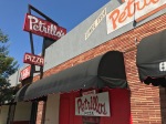
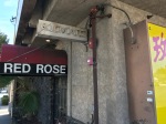
Along Valley is Petrillo’s Pizza Restaurant, another reminder of the Italian exodus from the Eastside into the western San Gabriel Valley. Two blocks east is another, a location of the local Italian market chain, Claro’s. There are now six locations, but the San Gabriel one was the first, opened by Joe Claro in 1948. Brothers-in-law Carl Petrillo and Norbert Lighthouse (one wonders why they didn’t name it Lighthouse’s Pizza) opened Petrillo’s in 1954. A few years later they opened a second location in Glendora.
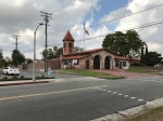
To the north, Main Street becomes Las Tunas Drive once it enters San Gabriel. Valley still doesn’t feel like the main street, though, as the titular San Gabriel Mission is located north, on Mission Boulevard, and the area around that, which is home to San Gabriel’s civic buildings, is known as its city center.
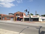
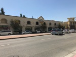
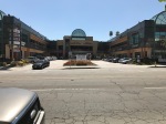
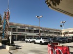
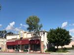
The area along Valley, however, does feel less marginal in San Gabriel than it does in Alhambra, and it feels more vibrant and walkable — in part because of a concentration of shopping centers. I doubt there are many urbanists whose idea of walkability includes clusters of malls, but however unlikely, Hilton Plaza, Life Plaza Center, Prospect Plaza, Swiss Plaza, and San Gabriel Square (even though car-oriented and situated behind parking lots or on top of garages) cumulatively suggest something like a suburban “city” center.
ROSEMEAD


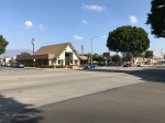
As we entered Rosemead, I (and presumably Dooley) noted the scent of hot cooking oil which hung in the air. I couldn’t place the source of the odor but my guess would be that it was from one or more of the restaurants in the vicinity. There were several in the vicinity, mostly Chinese and Vietnamese. There are still quite a few Mexican restaurants too, although the Latino demographic has declined somewhat dramatically as the Asian has increased. As with other suburbs of the western San Gabriel Valley, there are still a few Italian establishments. There are also several longstanding hamburger joints. Although hamburgers certainly remain popular, I associate them with the mid-20th century and the burger stands, like the other restaurants which line Valley Boulevard in Rosemead, tell a story about the suburb’s changing demographics.
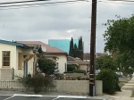
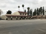
The development of Rosemead also tells a story. Like San Gabriel to the west, most of the area around Valley was developed in the 1920s and ’40s. However, in Rosemead, development continued at a larger scale into the 1950s. There’s a slightly different character to the Rosemead businesses and residences along Valley. Many of the buildings are separated from one another by narrow alleys which lead to rear parking lots. There seem to be more residences along the boulevard too — including a 1920s tetraplex, a mobile home court, and several attached homes.
From what I can tell, though, there are no mixed-use buildings with residences placed above businesses yet and when I used to find myself killing time outside TBT Hiep Thanh Car CareCenter or picking up đồ chua at Lee’s, I frequently had a palpable sense that I was standing in some linear, remote town which developed along Route 66 and not in the middle of urbanizing valley.
Speaking of Lee’s, the Rosemead location was not where I was introduced to the bánh mì chain, but it was, I believe, where I first patronized a Bánh Mì Chè Cali. Although my favorite bánh mì place was in San Gabriel (RIP Mr. Baguette), there is a real concentration of them in Rosemead and in a 2008 piece, Jonathan Gold referred to “Rosemead’s bánh mì district,” which as far as I know sadly remains an unofficial designation.
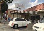
Most of the admittedly few restaurants I’ve dined at in Rosemead are either Vietnamese or Chinese. However, I’ve probably eaten at none more than Di Pilla’s, an institution since 1967. It’s the sort of Italian place that people probably describe as “red sauce” or “checkered tablecloth” and authenticity-obsessed foodies probably sneer at condescendingly. It’s the sort of place where the decor alone would induce (provided cameras were rolling) Gordon Ramsay to furrow his furrowed brow and express performative amazement with a couple of expletives. I quite like it, it goes without saying then.
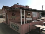
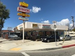
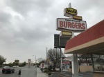
There are other restaurants and liquor stores that I appreciate from their exterior only for their architecture, decor, signage, &c. Those include El Sason (located inside a roughly trapezoidal building constructed in the 1930s or ’40s) Valley Super Burgers (located in a stand built in 1961), Jim’s Famous Quarterpound Burger (the building of which at the very least was constructed the same year), Kev’s Liquor Store (located inside a building constructed in 1953) and Mission Valley Liquor (built in 1963).
Today Rosemead has a majority Asian population — mostly Chinese, Vietnamese, and Hoa. Walking through the suburb I only heard Spanish spoken once and the only English I heard came from a couple of women who greeted me with a “hi” and “hello” as we crossed paths. Most of Rosemead’s residents are foreign-born, as well, with most having moved here from Vietnam. Rosemead is where Hoa immigrant David Tran founded his Huy Fong empire before moving to Irwindale. Rosemead is home to Saigon Times, the newspaper which was founded there in 1987. When I was researching Little Saigon, in heavily Asian North Orange County, I remember reading that as community members there lobbied for recognition, there was around the same time another group of developers hoping to establish a Little Saigon in the San Gabriel Valley. The article didn’t specify where they’d set their sites but I’ve always assumed that it was in Rosemead.
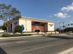
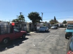
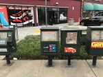
As with the preceding suburbs, I took special note of the strip malls and shopping centers which — along with their soul-killing parking lots — define much of the streetscape. I started to notice a trend in San Gabriel Valley and especially Rosemead business names: Gold World Plaza (across the street, actually, in San Gabriel), Golden Bull Noodle, Golden Heart Medical, Golden Soup, Golden Sun, Golden Valley Plaza (not to be confused with Alhambra’s Golden Valley Center), &c. There’s a motel called Valley Hotel which has a sign depicting two interlocked, golden “G”s. I assume that they stand for “golden gold” or something like that. Other plazas and pod malls along Rosemead’s stretch of Valley include Empire Commercial Center, Lucky Plaza, Minh Square, Mission Valley Center, New Valley Plaza, Orchid Plaza, Rio Hondo Plaza, Rose Valley Center, Universal Plaza, Universal Square Shopping Center, Valley Gateway, and Valley Hart Plaza.
There’s an appendage of El Monte which is all but indistinguishable to the casual observer from surrounding Rosemead which contains a couple of institutions which, though not technically in Rosemead, I will mention here. One is Signarama, which I mention because it occupies an interesting building constructed in 1958 that I assume was once a coffee shop. It’s also worth noting that the signs of both of its next-door neighbors include broken neon and missing letters. Someone from Signarama might want to do a bit of outreach. There’s also the sprawling campus of the Gill Corporation, most of the buildings of which were constructed in 1959 and ’60. I’m not sufficiently curious about Gill to figure out what it is they do, but whatever it is, they include on their fenced-off, manicured lawn a very impressive sign in the form of a massive, rotating globe proudly festooned with the Gill name.
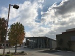
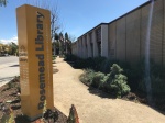
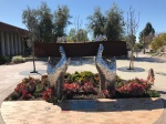
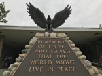
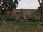
Other buildings that caught my eye include Great Wall Supermarket, located inside a faux Craftsman built in 1966. The more typically-mid ’60s Rosemead City Hall (built in 1967) and the adjacent library includes on its grounds a rose garden, a memorial to 9/11 titled “Reflect,” and a Vietnam War memorial. There’s also a somewhat striking Bank of America, built in 1971 and an equally Pacific Western Bank from 1984 which is adorned with fake owls presumably strategically placed to convince pigeons to excrete elsewhere. There were more fake birds at the Los Angeles County Fire Dept. Station 42 — this time vultures — which along with red lights and a tombstone suggested that someone forgot to take down the Halloween decorations or is really into preparedness. Behind the fire station’s fake tombstone (are fire station’s ever buried, really?) are the real graves of settlers interred in Savannah Memorial Park since it is believed, the 1840s. One piece of architecture which probably inspires no one but me is Stor Mor Self Storage & Parking Facility, a boldly banal storage facility built in 1978 which incorporates elements of New Formalism into its Smog Check Revival style.
As with the preceding suburbs, most of Rosemead’s commuters resort to using automobiles to get around. The website Walkscore awards Rosemead a walk score of 61 out of one hundred, 8 points lower than the walk score of San Gabriel and Alhambra. The same site gives Rosemead a transit score of 40 out of 100, which incidentally is as pathetic as the president’s approval rating. Metro’s Silver Line and Metrolink‘s San Bernardino Line both pass through the middle of the suburb without stopping. I did see several Metro buses, however, and the bus stops were generally more substantial than most of those in other parts of the route so far. I also spied a Gary Express shuttle, a wonderfully-named private shuttle service that transports San Gabriel Valley gamblers to and from a dozen or so casinos.
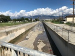
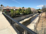
There are seemingly opportunities for improvement of commuter and recreational bicycle infrastructure too. Rosemead is trisected by the Alhambra Wash and Rubio Wash. Much of its eastern border with El Monte is formed by Eaton Wash. Of the three, I was struck by how easy it would be to line the latter one with bicycle trails. Eaton Wash is lined along both banks’ maintenance roads and the only obstacles inhibiting would-be cyclists and pedestrians are the fences, litter, and laws against trespassing. I guess there were efforts to develop an Eaton Wash Corridor Trail which emerged around 2010 but they don’t appear to have gone anywhere from what I could tell. Still, it’s tempting to imagine a leisurely ride from Eaton Canyon Falls above Altadena to the confluence of the wash with the Rio Hondo, in El Monte, where it would link with the Rio Hondo Bike Path. As it is, there’s currently only one designated bicycle lane in the strangely underdeveloped suburb, tucked away in the town’s northeast on a quiet residential street where it’s not really needed.
EL MONTE


In a way, El Monte is the center of the San Gabriel Valley. I’m speaking geographically, generally, although technically the exact geographic center of the San Gabriel Valley is one of Irwindale’s gravel pits, located a few hundred meters outside of El Monte’s northeast corner. Come to think of it, that’s probably the sort of fact that the Irwindale Tourist Board, assuming that there is one, shouldn’t ignore. Whilst not the geographic center, then, I suppose one could at least make the argument that El Monte is the cultural center of sorts — although that view probably would’ve found more support if the El Monte Legion Stadium, Nashville West, and Gay’s Lion Farm were still in operation.
El Monte is not without present-day distinctions, to be sure. For one, it’s the tenth most populous city in Los Angeles County; in the San Gabriel Valley it’s second in size only to Pasadena — which, although located far from the geographic center, most, I suspect, would probably nominate as the region’s cultural center. El Monte is also the most densely-populated city in the San Gabriel Valley — although strangely, perhaps, anyone who walks across through it along Valley probably notices more parking lots than anything else which give it the sense of being on the edge of something, rather than the center.
Those parking lots and the general car-centric focus of this suburb helped make it, in the past, my least favorite section of valley to cycle through— and having now walked it I can safely say almost no expense has been spent to make it pleasant to walk along either. Perhaps the overall feeling of bleakness was increased by the overcast skies, but whatever the case may be, it proved to be a fairly bleak walk. In order to enjoy myself, then, I decided not to fight the bleakness but rather to embrace it.
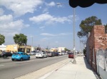
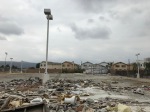
El Monte is also the poorest city in the San Gabriel Valley, with roughly one in four residents living under the poverty line. There are a lot of motels along Valley and more bail bonds places than you can shake a stick at. There was a (and I’m not easily shocked) a shocking amount of litter and filth along the sidewalk — including a large amount of excrement of apparently human origin. At one point we spied a dead animal, its carcass crawling with flies. I couldn’t identify its species, rotted as it was and apparently passed over numerous times by an apparently disinterested groundskeeper. Perhaps I might’ve not noticed all of the massive turds, maggot-eaten corpses, and styrofoam containers lined with half-eaten beans and bones had I not been accompanied as I was by a dog who insists on stopping to smell everything –especially if it’s disgusting — but there was undeniably a larger amount of garbage sullying the sidewalk and verge than in any previous neighborhood.
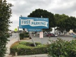
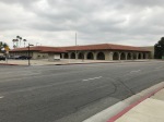
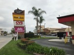
Dooley and I walked through three revealingly named, pedestrian-unfriendly neighborhoods: Northwest Industrial, the Auto District, and 5 Points (named after an intersection of five roads). El Monte does have a walkable and an attractive, mid-20th-century, but there’s a feeling right now that its best days are behind it… or perhaps ahead of it. Downtown, what there is of it, is centered along a street running parallel to Valley Boulevard known as Valley Mall. Physically, Downtown El Monte is not without charm and reminds me a little bit of Downtown Pomona. After all, both downtowns have Metrolink stations, are small and walkable, and have a mid-20th century aesthetic. Pomona, though, has live music venues like the Glass House and the Fox Theater, breweries, pubs, art galleries, cafes, and a moderately diverse restaurant scene. Downtown El Monte, on the other hand, has almost exclusively (and not regionally diverse) Mexican restaurants, T-Mobile and Sprint shops, a whole lot of free parking, and not much else. A Los Angeles Times journalist described it as “a humble promenade of discount and check-cashing stores, Mexican restaurants, hair salons and an El Pollo Loco.”
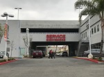
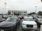
There’s a sense, it seems, that El Monte is down on its luck. In 2009, in fact, The Los Angeles Times published an article titled “El Monte is down on its luck.” A large part of that sense, I maintain, is owed to El Monte’s unshakeable embrace of the private automobile and all things catering it. Several signs are gigantic — ridiculously so for the pedestrian or cyclist — but necessarily so for the speeding motorist. According to the aforementioned Los Angeles Times article, “auto sales provided 60% of El Monte’s revenue.” The same reporter also noted that “in the last nine months, three of the city’s eight largest car dealerships have closed. The rest struggle. The city’s tax revenues have plummeted.” Nonetheless, nine years later El Monte prioritizes the automobile and Valley Boulevard is dominated by car dealerships, driving schools, drive-thrus, smog checks, car washes, muffler shops, collision repair, &c. One of the dealerships has been demolished and slated for redevelopment with a multi/mixed-use facility — absolutely ideal for people willing to live 160 meters from the freeway.
Not that there weren’t pedestrians or transit riders, though. I spied quite a few Metro, Foothill Transit, and El Monte “Trolleys” (buses). The El Monte Bus Station is a major transit hub although a few years ago when it first opened, I attempted to leave it on foot (the signs are confusing and many exits are for cars only). I was yelled at by a police officer using his PA system (although I couldn’t understand what he was saying). When I asked a Metro employee for help, he suggested the way I’d just attempted and I told him about the angry cop. When he asked what I was trying to do and I explained that I was trying to walk around El Monte he insisted that people don’t really do that. Apparently, they all just board another bus or hop into a car.
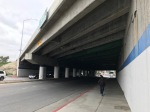
There are a fair amount of trees lining the sidewalks of El Monte — which is more than can be said of some of the preceding neighborhoods — and definitely makes walking a bit more pleasant. In 2012, in fact, the Arbor Day Foundation awarded it the title “tree city USA.” That said, the 10 Freeway bisects El Monte and walking along Valley Boulevard, it’s the first freeway under which I passed. Not long after — at the suburb’s eastern edge — is the 605 Freeway. The predominant smell in El Monte was, for the first time on my walk along Valley, not one of food but rather one of car exhaust. It’s really saying something when the odors emanating from a Shakey’s, a Starbucks, and a place called Donut Capital provide respite from fossil fumes. After crossing the city my nose was congested, my throat was sore, and my head ached.
There is not just smog in the air, though, but change. El Monte is, for now, still mostly Latino, the vast majority of whom have ancestral roots in Mexico. There are smaller numbers of Salvadorans, Guatemalans, and other Latinos. El Monte became majority Latino in the 1970s when Latino both immigrants from Latin America and Eastside transplants migrated there in large numbers. In the past 20 years, though, the percentage of Latinos has shrunk as the percentage of Asian-Americans has grown.
Like many arguably under-performing communities, El Monte has attracted the attention of immigrant business people and foreign investors. Cathay Bank moved into El Monte before I moved to Los Angeles. A bunch of townhouses arose east of the bus, train, and trolley station around 2005. Some more townhomes, part of a development called Union Walk, were springing up near the post office as we passed through. The Hilton Garden was the city’s first proper hotel. Here as elsewhere, small ranch homes are being replaced with tacky McMansions. According to the Los Angeles Times, 85% of the B-5 (a federal program that offers visas and a pathway to permanent residency to immigrants who invest at least $1 million in a U.S. business that creates at least 10 jobs) investor visas are applied for by Chinese.
As of 2010, about 25% of El Monte’s population was Asian-American — a 6.57% increase over the previous decade. It will be interesting to see how much more Asian it’s become by the 2020 census. Nearly two-thirds of El Monte’s Asians have Chinese origins and the other third, Vietnamese. Like it’s mid-valley neighbors — Baldwin Park and West Covina — El Monte forms a sort of barrier and bridge between the Asian communities of the west valley (Alhambra, Arcadia, East San Gabriel, Monterey Park, San Gabriel, San Marino, South San Gabriel, Rosemead, and Temple City) and those to the east (Diamond Bar, Hacienda Heights, Ramona, Rowland Heights, and Walnut).
TO BE CONTINUED…
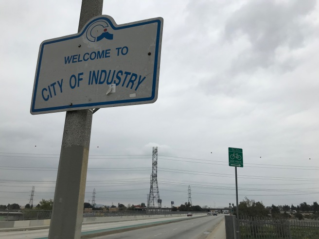
Still to come… Industry, Avocado Heights, La Puente, South San Jose Hills, Walnut, and Pomona
FURTHER READING
“How Valley Boulevard’s Restaurants Built L.A.’s New Chinatown“ by Clarissa Wei (2015)

Eric Brightwell is an adventurer, essayist, rambler, explorer, cartographer, and guerrilla gardener who is always seeking paid writing, speaking, traveling, and art opportunities. He is not interested in generating advertorials, cranking out clickbait, or laboring away in a listicle mill “for exposure.”
Brightwell has written for Angels Walk LA, Amoeblog, Boom: A Journal of California, diaCRITICS, Hidden Los Angeles, and KCET Departures. His art has been featured by the American Institute of Architects, the Architecture & Design Museum, the Craft Contemporary, Form Follows Function, Los Angeles County Store, the book Sidewalking, Skid Row Housing Trust, and 1650 Gallery. Brightwell has been featured as subject in TheLos Angeles Times, Huffington Post, Los Angeles Magazine, LAist, CurbedLA, Eastsider LA, Boing Boing, Los Angeles, I’m Yours, and on Notebook on Cities and Culture. He has been a guest speaker on KCRW‘s Which Way, LA?, at Emerson College, and the University of Southern California.
Brightwell is currently writing a book about Los Angeles and you can follow him on Ameba, Duolingo, Facebook, Goodreads, Instagram, Mubi, and Twitter.

Hi I used to live in Pomona and I’m fairly certain that Valley Blvd. turns into Holt Blvd. in the city of Pomona, not Ontario as stated in your email blast that I received today. Great idea about reporting on this very long west-east route.
LikeLike
Thanks for catching that. You’re absolutely correct — and my own map shows that… and means I won’t have to walk _quite_ as far.
LikeLike