

AS I LOOK BACK ON MY EDUCATION — UNIVERSITY HILLS
In the fall of 2012 I had a stint house-sitting in El Sereno and I spent much of that time exploring said neighborhood with a dog named Dooley. This past fall I again returned to the Eastside and Dooley I again resumed our epic walks. This time around we explored Arroyo View Estates, City Terrace, East Los Angeles, El Sereno, Garvanza, Happy Valley, Hermon, Highland Park, Hillside Village, Lincoln Heights, Montecito Heights, Monterey Hills, Rose Hill, and one warm, sunny morning, University Hills.
(University Hills is home to Los Angeles’s longest public stairway — the 234 step “Heidleman Stairway”).
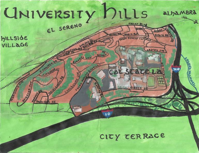
University Hills is a small neighborhood in Los Angeles’s Eastside. University Hills is, like Hillside Village, often (perhaps even usually) considered to be a district of the greater El Sereno neighborhood by some and a separate entity by others. To its west is Hillside Village, to its south are East Los Angeles and City Terrace, to the southeast is Monterey Park, and to the east is Alhambra.
EARLY HISTORY OF THE AREA
The earliest known inhabitants of the area that’s now the Los Angeles area arrived some 13,000 years ago. About 10,000 years later the ancestors of the Tongva arrived from the Sonoran Desert, ultimately establishing the village of Otsungna, meaning “The Place of Roses,” near the banks of a stream later named Arroyo Rosa de Castilla.
The Tongva’s reign ended shortly after Catalonian Gaspar Portolà i Rovira,‘s overland expedition passed through the area in 1769, an event which set the stage for Spanish conquest. In 1771, the conquerors constructed Mission San Gabriel Arcángel — first in Whittier Narrows. In 1776 the mission was moved to its present location in San Gabriel, seven kilometers to the northeast of what’s now University Hills. A few years later, in 1781, El Pueblo de Nuestra Señora la Reina de los Ángeles de Porciúncula was founded eight kilometers to the west.
The area that now comprises University Hills was located in lands owned and controlled by the mission until Mexico gained independence in 1821 and the missions’ holdings were later subsequently secularized. In 1831, the land containing what’s now University Hills was granted to Juan Ballesteros by Governor Manuel Victoria. Ballesteros named his ranch, Rancho Rosa de Castilla. Mexico’s rule would prove even shorter than Spain’s and ended in 1848 when California was conquered by the US. In 1850, California entered the union and Los Angeles incorporated as a city.
In 1850 the rancho was acquired by Anacleto Lestrade. In 1852, the title passed to a Basque couple, Jean-Baptiste Batz and his wife, Catalina Hegui. The family patriarch passed away in 1859 but it wasn’t until 1876 that Catalina acquired the title to the land and purchased surrounding areas. After her death in 1882, the land was inherited by six of the eight Batz children. Their adobe, built in 1776 and gradually expanded upon over the years, was destroyed by a fire in 1908.
UNION PACIFIC RAILROAD
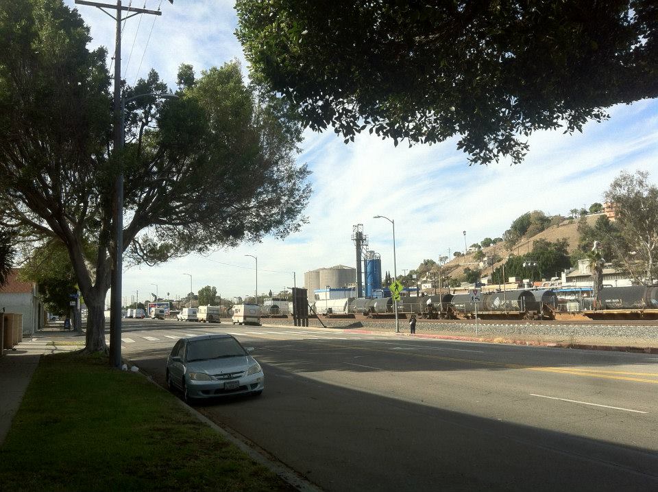
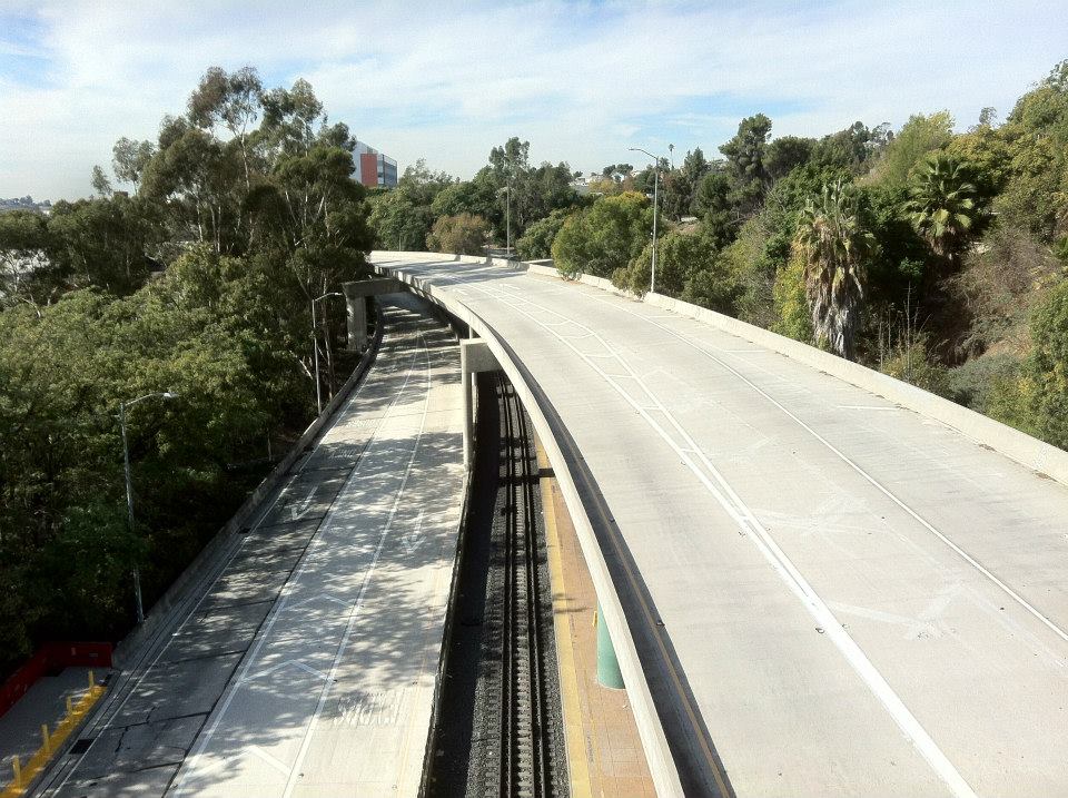
The northwestern border of the University Hills is generally formed by a Union Pacific freight train line, acquired from Southern Pacific in 1996. Southern Pacific was the first transcontinental railway to reach Los Angeles, back in 1876. I don’t believe (but I’m not sure) that this section of the rail was part of the original route connecting the city to San Francisco (since it seems to be heading in the wrong direction) although I believe that I read somewhere that it was installed no later than the 1880s. Back then the train also carried passengers to Los Angeles and in 1885, when the Atchison, Topeka and Santa Fe Railroad broke their rival’s monopoly, a rate war saw trips from Kansas City, Missouri temporarily drop to just $1 per passenger.
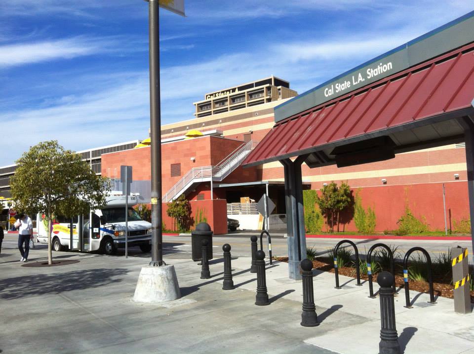
By 1888, the San Gabriel Rapid Transit Railroad passed through the area, linking Monrovia with Los Angeles. The local stop was listed simply as “Batz.” Portions of the railway were incorporated into the Pacific Electric Railway, which traveled along the route of the modern Metrolink line to San Bernardino. The train carried passengers from 1914 until 1941 and ceased to run freight in 1950. The tracks continued to be used by Southern Pacific and Amtrak until 1990, when the line was sold to LACTC (the Los Angeles County Transportation Commission), which established Metrolink in 1992. Cal State LA Station opened in 1994.
GRIDER & HAMILTON’S FLORAL PARK
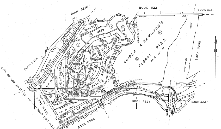
By 1906 or so, a small part of the area that’s now University Hills was subdivided as Grider & Hamilton’s Floral Park, who promoted their tract in the Los Angeles Herald with an ad that read, “Acres and Half-acres. Whole acres for the price of town lots just beyond beautiful Eastlake park. Close In. Wait for it. It will pay you to do so.” Grider was Leroy M. Grider, a real estate developer who’d moved to Los Angeles in 1857 and started his first company, L. M. Grider & Co., in 1886.
Grider was described by some as being the first developer to sell neighborhood’s via the “excursion method,” which saw him ferry potential homeowners via streetcar to then-new “toonervilles” where they would additionally be plied with free BBQ. Grider also served on City Council but after retiring from both politics and real estate, opened a pet store called Birdland.
Turn of the century Pacific Electric Railway Railway maps show the neighborhood stop no longer listed as “Batz” and then simply listed as Floral Park. The surrounding area was annexed in 1915 as the Bairdstown Addition — taking its name from a nearby community to the north. In 1917 the area was officially re-named El Sereno.
Development of the area took off in the 1920s. In the 1930s and ’40s, much of Los Angeles’s population of Italian Americans moved east from Little Italy (much of which became Chinatown), settling in the Eastside and the neighboring western-most communities of the San Gabriel Valley. After that, the demographic became increasingly Latino. Today the population today is roughly 65% Latino of any race, 14% Asian, 14% white, and 5% black but most of the neighborhood is dominated by the campus and transient population of California State University, Los Angeles.
CAL STATE LA
Groundbreaking for the Los Angeles State College of Applied Arts and Sciences‘ new campus took place in 1955. Around the same time, Arroyo Rosa de Castilla began to be covered and diverted into culverts until it was almost entirely covered by the 1960s. (Readers: Is Arroyo Rosa de Castilla the same thing as Luguna Channel?) In 1964 the school name changed to California State College at Los Angeles.
METROPOLITAN HILLS -> UNIVERSITY HILLS
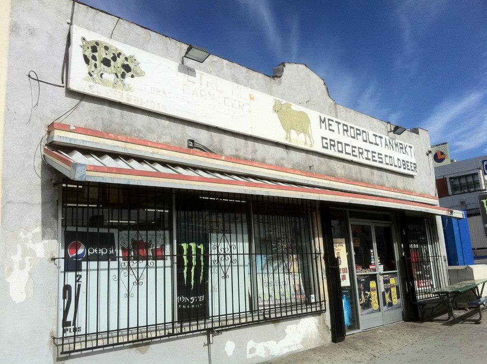
At some point the area apparently came to be known colloquially as Metropolitan Hills or Metro Hills. At least by the 1970s there was a local gang, Metro 13, who still claim the area as their turf. Along Eastern Avenue (technically within East Los Angeles but thanks to the 10 Freeway more perhaps more aligned with University Hills), there are a couple of businesses — Metro Barber Shop and Metropolitan Market — that reflect the pre-University Hills identity. From 1951 until 1964, Los Angeles Metropolitan Transit Authorityexisted, having taken over some of the old Red Car and Yellow Car lines. Perhaps Metro Hills is a reference to that old agency (sometimes referred to as Metro I to differentiate from the modern Los Angeles County Metropolitan Transportation Authority aka LACMTA aka MTA aka Metro II).
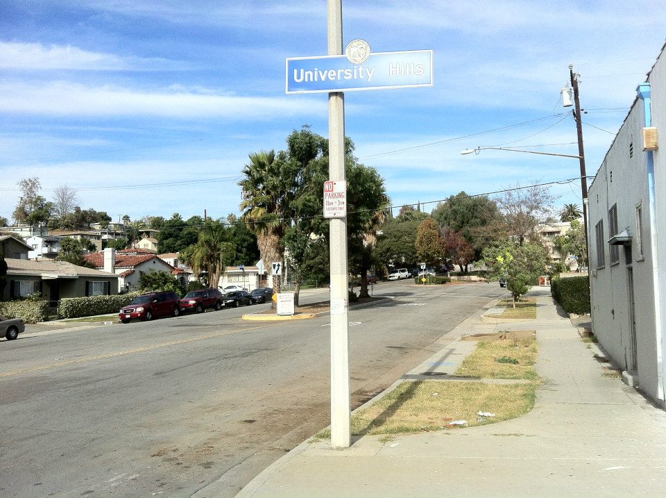
Whatever the case may be, around 1995 the University Hills Community Association formed in the neighborhood. Back in 1972, California State College was awarded university status and was renamed California State University, Los Angeles so the “university” in “University Hills” almost certainly referred to that. In 2004, the LADOT installed the now familiar blue neighborhood signs. Presumably the impetus to create a new neighborhood identity is usually founded in the desire to disassociate with the perceived negative connotations of the neighborhood that one has historically been part of. There are several things about these efforts that I find rather amusing. Namely, changing the name of where one lives doesn’t actually change where one lives. Also, in most cases no one has many concrete associations with the old neighborhood name that the new neighborhood is trying to disassociate itself from. In other words, tell people that you live in University Hills because you don’t want to be painted with the same brush as folks in El Sereno and most people in Los Angeles will have no idea what El Sereno is — much less a negative opinion of it. On the other hand — it’s been designated University Hills now for more than a decade so fighting against its autonomy seems like an equally silly waste of time. Best perhaps just to accept that it is what it is and move on… unlike the 710.
HALTING THE 710
Construction of what is today known as the 710 began in the 1930s and was envisioned as a highway designed to connect Long Beach to Pasadena. For decades it crept north, in the process expanding from a highway into an interstate as well as displacing many residents and dividing communities. By the 1960s it terminated at the edge of El Sereno/Metro Hills at Valley Boulevard. In the 1990s, a group of activists (including The Mothers of East Los Angeles, the El Sereno Neighborhood Action Committee, the El Sereno Organizing Committee, and the NAACP) mobilized to prevent the 710 from progressing further north and since 1997 it was terminated at the northeast corner of University Hills on the edge of Alhambra.
GETTING THERE AND GETTING AROUND
The southern edge of the neighborhood is roughly formed by the 10 Freeway (again, as referenced earlier, Cal State LA’s Diagnostic Center/Forensic Science Center and everything west of that and south of Drucker and Worth Streets are located within East Los Angeles). The 10 includes the El Monte Busway, used by Metro‘s Silver Line and Foothill Transit‘s Silver Streak.
Cal State LA Station is a fairly major transit hub that in addition to being served by the aforementioned lines is also utilized by Metrolink‘s San Bernardino Line, Alhambra Community Transit, East LA Sol, and Monterey Park Spirit Bus. The neighborhood is also served by Metro’s 71, 76, 256, and 487/489 lines.
MUSIC OF UNIVERSITY HILLS
I heard and saw signs of music throughout University Hills as Dooley and I explored the neighborhood. As we walked through the campus, one scowling man in a taqiyah “bumped” smooth jazz from a boom box. An elderly couple pushing a stroller played traditional Chinese music from an unseen source — and the baby in the stroller waved at us (well, probably just Dooley). As we walked by student housing I could hear what sounded like a shower running and reggae. A flyer on Valley advertised an upcoming banda concert. I saw one young guy wearing an S.O.D. T-shirt and another one for Metallica‘s “Creeping Death.” However, although I’m sure that there are musicians from University Hills, but I’m not aware of them — so if you are one or know one, let me know in the comments, please.
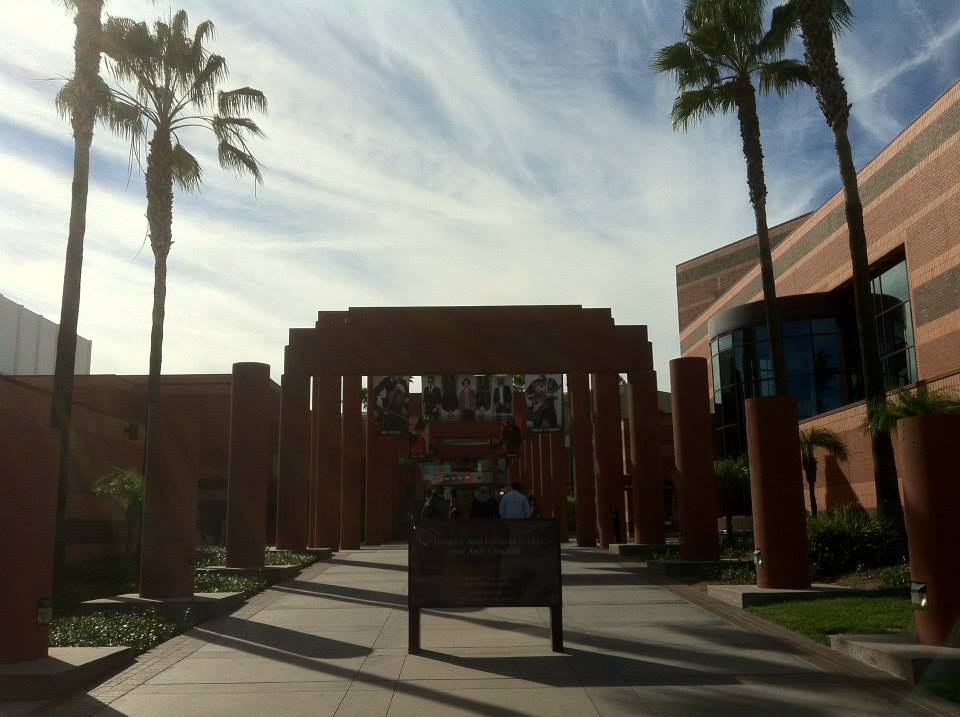
The most recognized hub for music performance in University Hills is The Luckman Fine Arts Complex, which opened in 1994 and provides a nice balance to the smaller, more-locally focused arts spaces and backyard parties found in the Eastside by brining in the sort of international talents you might not otherwise expect to see perform an in-store at Amoeba or at Royce Hall in Westwood. The venerable venue has hosted the likes of Barbara Morrison, CocoRosie, the Idan Raichel Project, India.Arie, Jane Birkin, Lila Downs, Rodriguez, Sinéad O’Connor, Tinariwen, Rokia Traoré, Yemeni Blues and many more. On the local tip, Luckman is also home to home of the Luckman Jazz-Orchestra.
There’s also a recital hall on the Cal State LA campus. When I was in college, I used to regularly enjoy attending free recitals and I imagine that if I lived closer to Cal State, I’d do the same there. It’s really a quite pleasant, free diversion!
UNIVERSITY HILLS ART SCENE
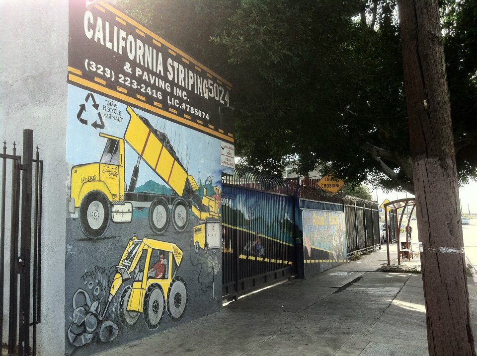
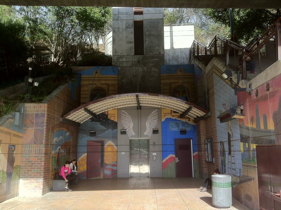
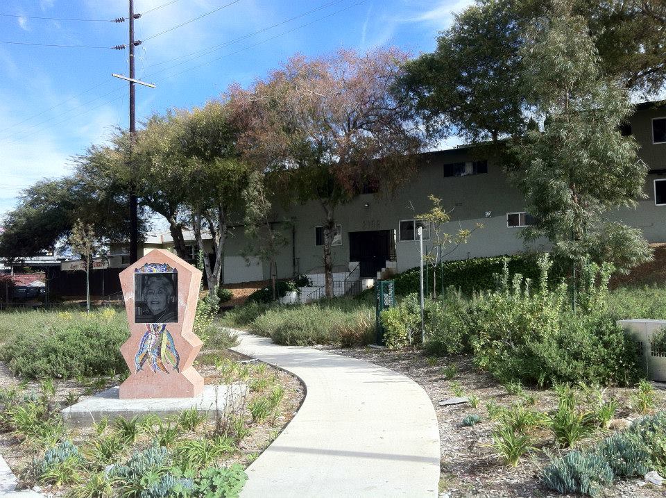
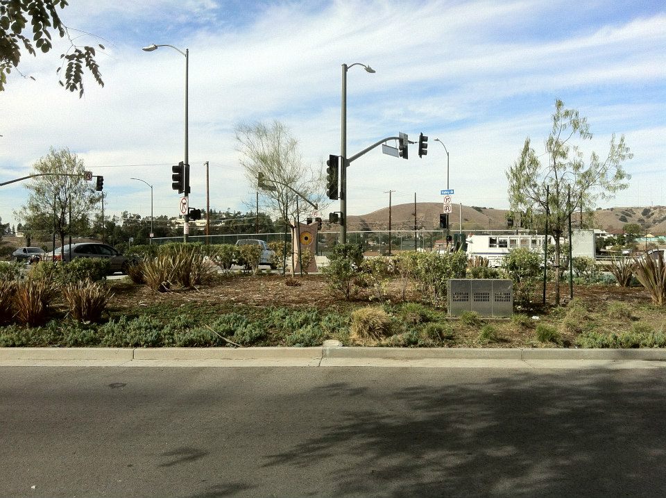
University Hills boasts quite a bit of art in the form of murals, commercial art, public art, graffiti, and arts spaces. For one, there’s a public art piece, José Antonio Aguirre‘s A Luminaries Journey, located around Valley Boulevard Bridge honoring significant figures in Chicano history which extends into El Sereno and Hillside Village.
All around the railroad there’s predictably, quite a lot of graffiti, much of it more far impressive than mere tags — although if anyone thinks that those are art, they’re there too. Los Angeles County High School for the Arts (aka Arts High aka LACHSA) is a tuition-free, public, visual and performing arts high school founded in 1984 on the Cal State LA Campus but now located just north of it. There’s a documentary about LACHSA called Fame High.
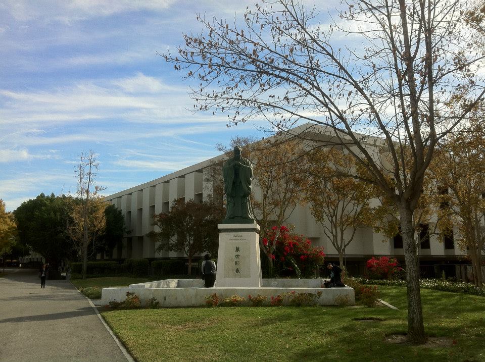
Cal State’s Street of the Arts has a statue of Confucius that was a gift from the government of Taiwan.Guillermo “Bill” Granizo‘s Olympic Fantasy mural is the most visible piece of art on campus and supposedly the largest tile mural ever created by a single artist.
Additionally, the University’s Fine Arts Gallery in the Fine Arts Building showcases works by students and faculty from the Department of Art. The Luckman Gallery exhibits works by both international and local artists. To read more about the campus art scene, click here.
UNIVERSITY HILLS EATS
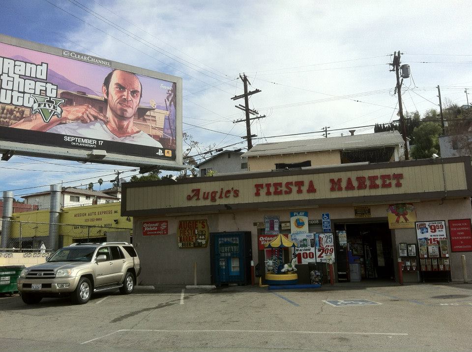
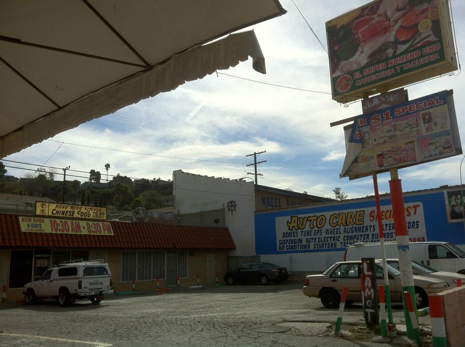
Hong Kong Kitchen and El Super Numero Uno
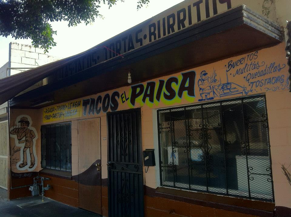
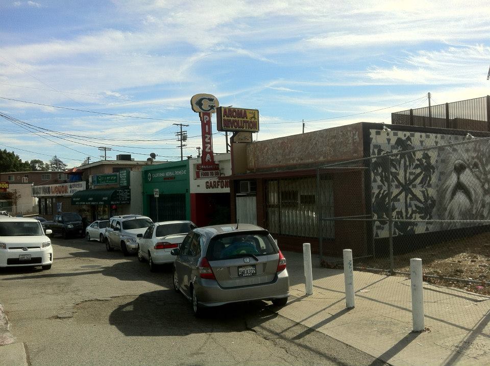
There are only a handful of eateries and markets in University Hills: Augie’s Fiesta Market, Chris’s Pit Stop, Dolcini Caffe Espresso, the Jonathan Gold–touted El Super Numero Uno, Fiesta Market,Garfono’s Pizza, Hong Kong Kitchen, Johny’s Kitchen, Rice Garden, The Original Taco Room, Tacos el Paisa, University Club, and Valley Foods Liquor.
UNIVERSITY HILLS AREA PARKS
There are currently no public parks in University Hills. Across the railroad tracks there’s a small, new park — El Sereno Arroyo Playground. There are also larger parks nearby in Alhambra, City Terrace, El Sereno, and Monterey Park. I suppose the small triangle at the intersection of Valley Boulevard and Marianna Avenue and adjacent area could be thought of as a cluster of very tiny parks although there’s barely enough space to lay down within them. There are also two, large open spaces in University Hills that seem like ideal, potential locations for parks. One is the open space north of the 710 Freeway. The other is a large space next to Marianna Avenue that affords a nice view of Downtown Los Angeles and is apparently used for little beyond furniture dumping and gravel piling.
I’m not sure exactly what the rules are concerning public use but on Cal State LA’s campus there’s the Jesse Owens Stadium (or Jesse Owens Track and Field). The football and track stadium opened in 1958. The sports ground also includes a soccer/football field, a baseball diamond, tennis courts, swimming pools and probably more. Also on campus is the Batz Rose Garden, dedicated in 1982 and named in honor of the aforementioned Batz family who formerly lived in the area.
UNIVERSITY HILLS THEATER
Throughout the Eastside there are small art/community/cultural spaces, most of which draw primarily from within their communities for talent. In El Sereno, for example, there’s Summercamp’s ProjectProject and EastSide Café Echospace. In the University Hills section there’s Off the Tracks Theater & Gallery. Below is a video showing a preview of their performance, Pato, muerte y tulipán.
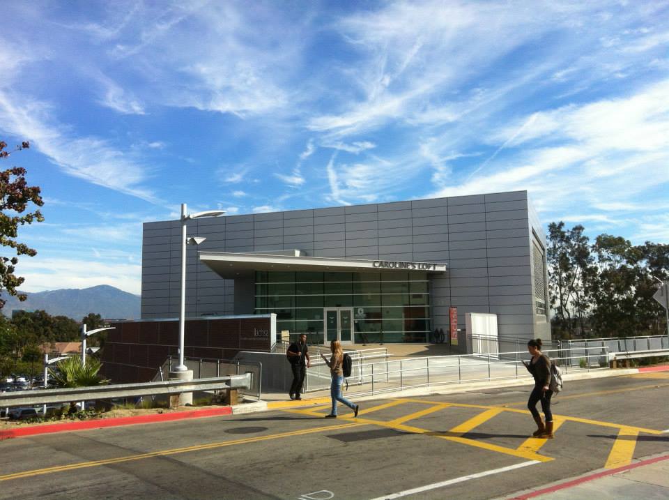
There’s also Caroline’s LOFT(named after LACHSA founder and arts benefactor, Caroline Ahmanson), the main performance space for LACHSA. Cal State LA is home to the Luckman Theatre, and the Luckman Intimate Theatre.
UNIVERSITY HILLS BOOKS
Bibliophiles in University Hills will find books for sale at the University Book Store and books for loaning out at the University Library.
To vote for any communities you’d like to see covered in California Fool’s Gold, name them in the comments.
Support Eric Brightwell on Patreon

Eric Brightwell is an adventurer, essayist, rambler, explorer, cartographer, and guerrilla gardener who is always seeking paid writing, speaking, traveling, and art opportunities. He is not interested in generating advertorials, cranking out clickbait, or laboring away in a listicle mill “for exposure.”
Brightwell has written for Angels Walk LA, Amoeblog, Boom: A Journal of California, diaCRITICS, Hidden Los Angeles, and KCET Departures. His art has been featured by the American Institute of Architects, the Architecture & Design Museum, the Craft Contemporary, Form Follows Function, Los Angeles County Store, the book Sidewalking, Skid Row Housing Trust, and 1650 Gallery.
Brightwell has been featured as subject in The Los Angeles Times, VICE, Huffington Post, Los Angeles Magazine, LAist, CurbedLA, Eastsider LA, Boing Boing, Los Angeles, I’m Yours, and on Notebook on Cities and Culture.
Brightwell has been a guest speaker on KCRW‘s Which Way, LA?, at Emerson College, and the University of Southern California.
Brightwell is currently writing a book about Los Angeles.
You can follow him on Ameba, Duolingo, Facebook, Goodreads, iNaturalist, Instagram, Mastodon, Medium, Mubi, the StoryGraph, and Twitter.


Great piece, really teaches me about my neighborhood. Thanks!
LikeLiked by 1 person
Very nice story on University Hills. I’ve lived in University Hills since starting at Cal State in 1969, so 56 years. It WAS El Sereno to me most of that time. I was a music major, so to me it’s always been a neighborhood of music…mostly mine (ha!) I used to have bands over and record music in the house in the 70’s (and would get a call late at night from a neighbor to stop!) But I can go out in the afternoon, and hear the sounds of my neighbor across the street practicing trumpet (and he gets to hear my saxophone sometimes.)
There were two things that changed when the neighborhood became University Hills. First it became permit-only parking on all the streets, and 2nd, because of that, isolation. What once was a busy neighborhood, mostly because CSULA students would park on the street, then walk up to campus. now? Nothing. No one. You may see a car drive down the street a couple times a day (it’s a mistake, as it’s a dead end), but no one parks, other than neighbors. I’m NOT a fan of permit only parking, nor keeping out the University students.
I do remember those stairs, because I live at the bottom of the hill, which meant walking up those stairs at least once a day…sometimes carrying a baritone saxophone! Just hatted them! When I moved in, there was no hill that there is now, my street went directly up to Hellman. So it was not only those 234 stairs, I had to hike up the hill 1/4 mile just to get to them!
For the most part, University Hills is a very stable neighborhood, very few children, mostly older folks, and many who, like me, have lived in the neighborhood for decades, in my neighborhood, most residents have been there more than 30 years..
LikeLiked by 1 person