

BLOW SOME MY WAY — CHESTERFIELD SQUARE

Chesterfield Square is without a doubt, one of Los Angeles’s most obscure neighborhoods. The obscurity is somewhat surprising given the neighborhood’s longstanding and dubious distinction of having the city’s and county’s highest violent crime rate pretty much month-after-month, year-after-year. As a matter of fact, though, most of Los Angeles’s most crime-ridden neighborhoods are rather obscure. Ironically, communities with reputations for high crime rates are rarely as dangerous as they’re assumed to be. Compton, South Central, and Watts, for example, aren’t even in the top ten.
Although I don’t in any way wish to minimize the seriousness of crime, both visitors and residents of the neighborhood are more likely to be felled by heart disease, cancer, an accident, suicide, or even a recklessly driven automobile than they are by violent criminals — especially those who are not or don’t appear to be affiliated with a gang. Furthermore, citywide violent crime rates for Los Angeles are the lowest they’ve been since 1966. It may be rough by Los Angeles standards but it’s hardly San Pedro Sula. In other words, nothing bad is going to happen to you.
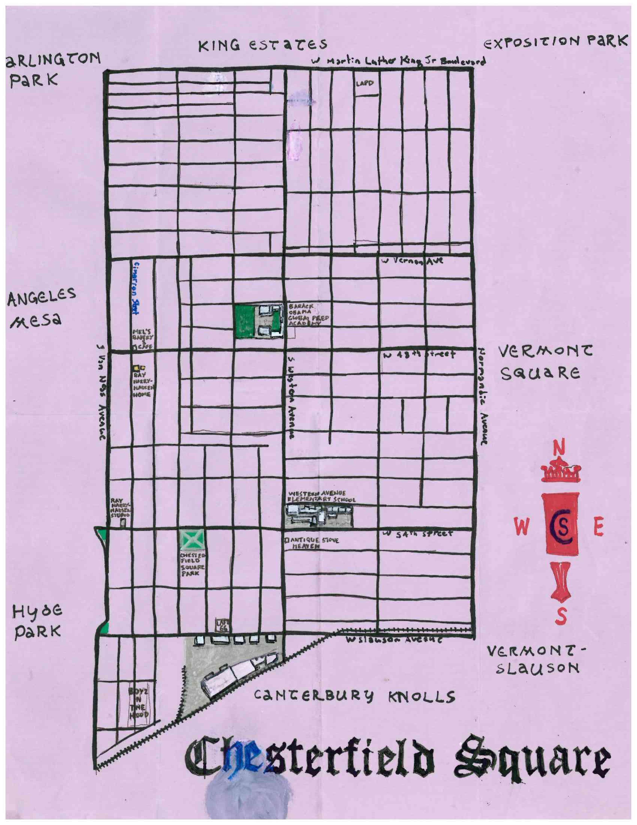
Chesterfield Square is a neighborhood located in South Los Angeles’s Westside. It is neighbored by King Estates to the north, Exposition Park to the northeast, Vermont Square to the east, Vermont-Slauson to the southeast, Canterbury Knolls to the south, Hyde Park to the southwest, Angeles Mesa to the west, and Arlington Park to the northwest. The population of Chesterfield Square is currently about 59% black (mostly of Angelenos of unspecified West African and Belizian origin), 37% Latino of any race (mostly of Mexican or Salvadoran origin), 2% white, and 1% Asian.
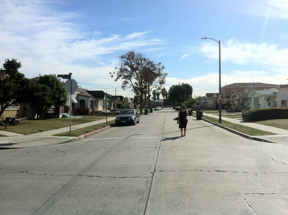
Last week I headed to the neighborhood with filmmaker Diana Roark on what turned out to be a decidedly relaxed and slightly warm autumn day, the kind of day with enough heat to magnify the mingling scents of food cooking, weed smoking, and rose gardens. Given the time and day of our exploration, most residents of the neighborhood were likely at work or in school but we did encounter people hanging out in parks, on corners, in lawns, and on porches – most all of whom were politely friendly and some of whom shared stories that helped inform this piece. If any of them are reading this, thanks for your kindness, stories, and opinions. I hope you enjoy.
If you’d like to see another community be the subject of a California Fool’s Gold piece, let me know which one(s) in the comments. Thanks!
EARLY HISTORY OF THE AREA
The human history of Chesterfield Square begins at least 13,000 years ago, when the Paleoamerican ancestors of the Chumash arrived in Southern California. Around 3,500 ago, the ancestors of the Tongva arrived in present day Los Angeles County and found, after centuries of droughts, a Los Angeles Basin that had mostly — except for coastal areas and the Channel Islands — been de-populated by the Chumash. By 500 CE, the Tongva occupied some 10,000 km² of land, including most of southern half of Los Angeles County.
SPANISH ERA
Spain, first visited Southern California in 1542 and declared, without setting foot on it, that all of California belonged to them. Sustained contact with the Tongva and other Native American nations only began in 1771, after the construction of Mission San Gabriel Arcángel some 27 kilometers east, in the Whittier Narrows. After sunjagating the Chumash, Tongva, and others; the Spanish divided most of the land into ranches administered by the missions. The lands that now comprise Chesterfield Square were part of an area of public lands, though, that were located between the Pueblo de Los Angeles and ranchos to the west.
MEXICAN AND EARLY AMERICAN ERA
After eleven years of war revolutionary war, Mexico gained independence from Spain in 1821. In 1846, when Mexico was just 25 years old, the US invaded and by 1848 had conquered California. The state was admitted to the Union in 1850. Los Angeles County was one of the original counties and then included parts of what are now Kern, San Bernardino, Riverside, and Orange Counties.
SHOESTRING STRIP ANNEXATION
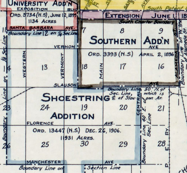
On 26 December 1906, the Shoestring Addition added 48 square kilometers to Los Angeles’s southwest, including a narrow shoestring-like strip of land that extended over to the San Pedro Bay towns of San Pedro and Wilmington. When they were annexed by Los Angeles in 1909, Los Angeles’s 128-year-long period of being a land-locked city ended.
BEGINNING OF CHESTERFIELD SQUARE
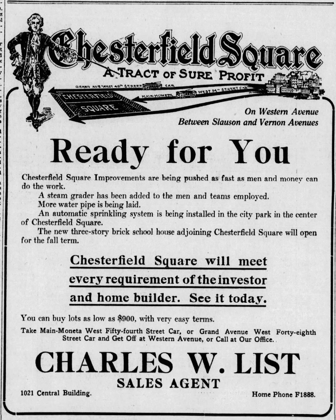
In 1912, two brothers – Charles List and R.D. List – entered the picture. R.D. List was a South Pasadena-based notary public and real estate speculator and he and Charles bought and subdivided a development that they named Chesterfield Square. I haven’t found what inspired their choice of name. Was it the Earl of Chesterfield? Chesterfield cigarettes, couches, or overcoats? Chesterfield County, Virginia? Maybe they just liked the way that it sounded. (UPDATE: A 1912 advertisement for the subdivision, pictured above, depicts a man in knee breeches who I can only assume is the Earl of Chesterfield).
In 1912 the streets of the tract were paved and the Los Angeles Railway’s Division 5 car-house was built nearby, on the southwest corner of the intersection of South Van Ness Avenue and West 54th Street. The station’s yellow cars ran down 54th, 48th, Santa Barbara (now Martin Luther King Jr Boulevard) and stretches of other streets in the neighborhood.
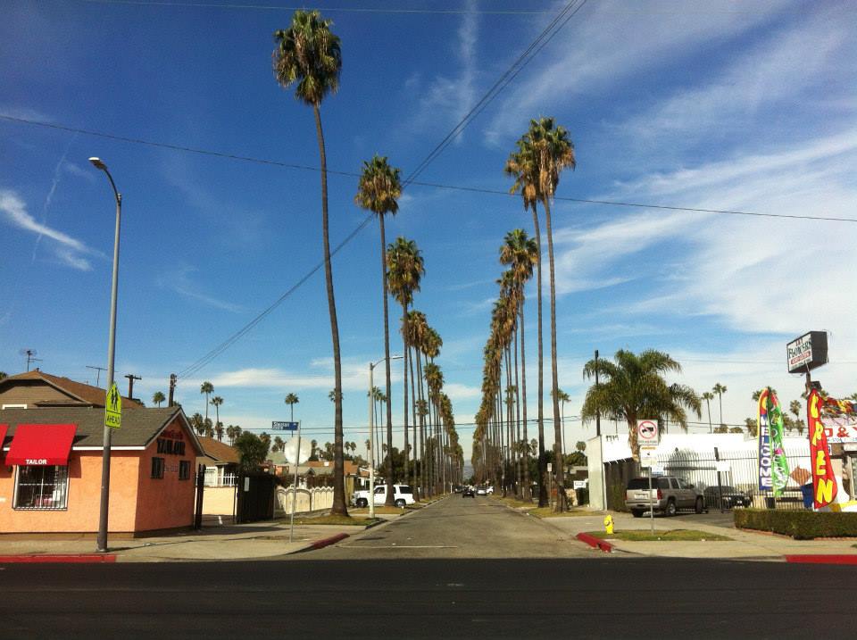
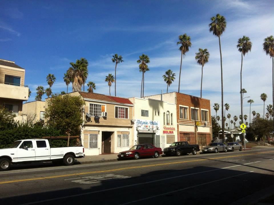
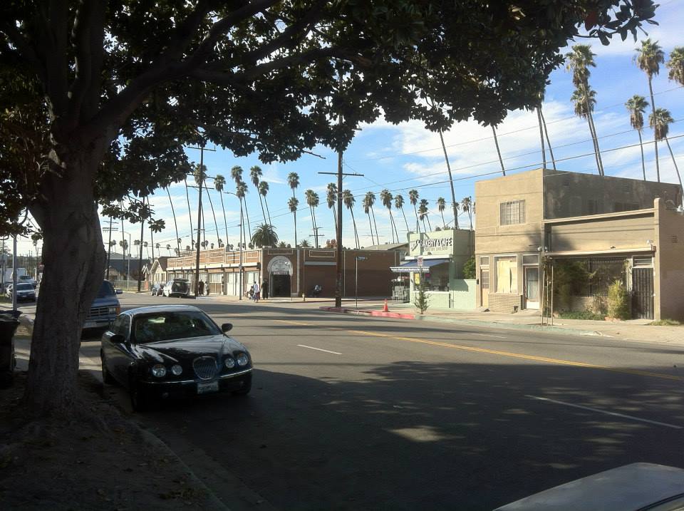
Many of the neighborhood’s streets are still lined with towering, spindly Washingtonia robusta palm trees planted in those years.
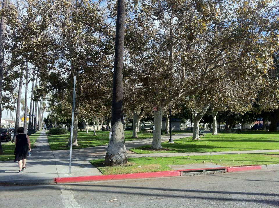
Chesterfield Square was also home to (and is still home to) Chesterfield Square Park, a small but pretty, formal park with axial walkways, mature sycamores, and a walk street – Concordia Walk – along its southern edge. There are two other pocket parks, or “parklets,” in Chesterfield Square, located at the intersection of 54th Street and South Van Ness Avenue, and Slauson Avenue and S Van Ness Avenue.
HARBOR SUBDIVISION
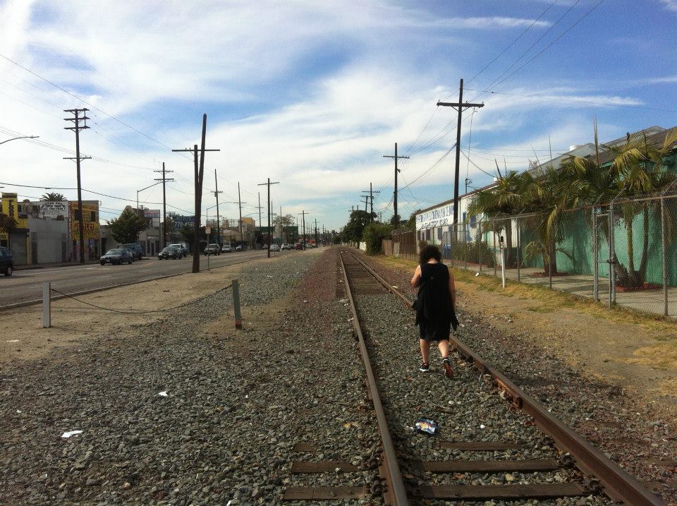
Chesterfield Square’s location was placed just north of the Atchison, Topeka, and Santa Fe Railroad’s (ATSF) Harbor Subdivision line, which at that time connected Downtown Los Angeles to a port in Redondo Beach. In the 1920s, to capitalize on the oil boom, it was extended to Torrance, Wilmington, and Long Beach. Although mostly used by freight trains, it also served as a passenger rail. The Harbor Subdivision was the ATSF Railroad’s (and its successor, the Burlington Northern Santa Fe Railroad’s) primary route between the Harbor and Downtown until the 2002 opening of the more direct Alameda Corridor to the east.
GROWTH OF CHESTERFIELD SQUARE
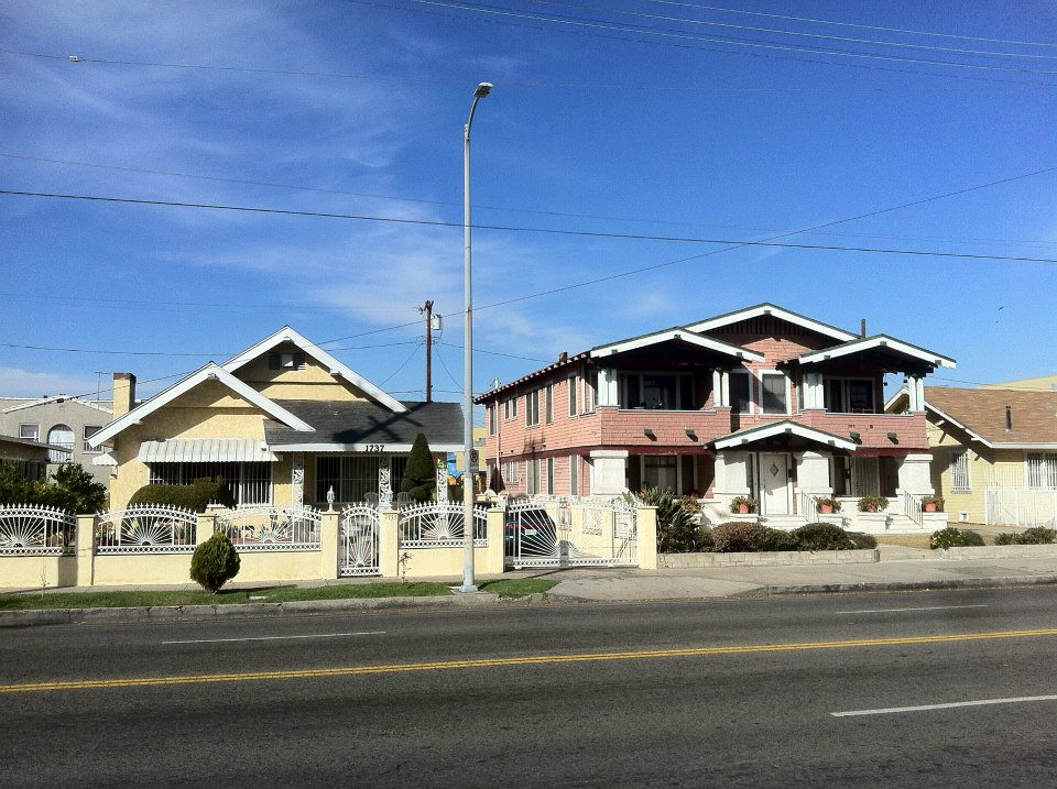
A 1923 advertisement in the Los Angeles Times offered homeowners the chance to buy a “swell, new modern bungalow, built of the best materials” with “better improvements than in Wilshire District, at half the price.” Sales of homes in Chesterfield Square really took off in the 1910s and ’20s– fueled by the real estate and oil booms. Its was mostly built out by the end of the decade and today the neighborhood is still comprised mostly of homes built in the popular styles of that era including Spanish Colonial Revival and California Craftsman homes, evidently chosen from pattern books (in many cases a street containing several homes of almost identical design distinguished by slight, ornamental variations).
THE CARLTON THEATRE
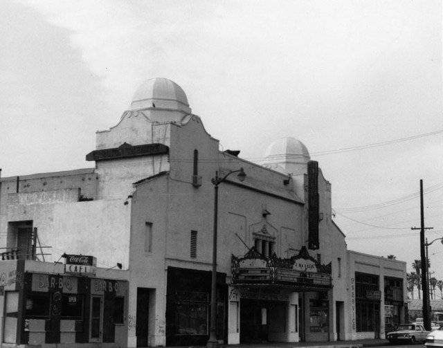
The neighborhood picture palace; the 1,200 Fox-owned Carlton Theatre, was formerly located at 5409 South Western Avenue. It was around at least as early as 1924, when it announced the addition of a children’s matinee in the paper. Although the Tim Burton film Ed Wood depicted the premiere of Plan 9 From Outer Space taking place at the Pantages in Hollywood, it in fact first screened in Chesterfield Square’s Carlton Theatre. Before the 1950s ended, the theater was re-purposed as a church. The building was demolished by 1972 and today the lot is still empty.
RAY HARRYHAUSEN
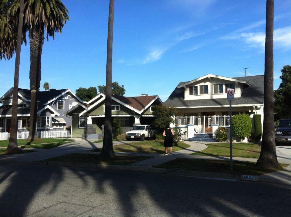
In the 1930s, inspired by the work of Willis O’Brien (the man who was responsible for animating King Kong), a teenaged Chesterfield Square resident named Ray Harryhausen began experimenting with stop motion animation in the garage of his home at 4822 Cimarron Street. When we stopped by the house, the owner was sitting on his porch. Diana talked to him about Harryhausen having lived there, which he was unaware of.
In 1956, Ray Harryhausen began renting a space and operating an effects studio near the intersection of Cimarron and 54th Street. It was there that he created the visual effects for 20 Million Miles to Earth (1957) and The 7th Voyage of Sinbad (1958). In 1960 he moved to London and for many years was the biggest name in movie effects. He passed away on 7 May 2013.
WAR YEARS
In the 1940s, World War II helped transform Los Angeles into an important manufacturing center. To meet the demands of the war industry, thousands of working-class Southerners moved to the working class neighborhoods of South Los Angeles. Though white immigrants were able to live just about anywhere that they could afford to, blacks were confined to roughly 5% of the city’s area, mostly to the neighborhoods of Watts and South Central.
END OF RACIST HOUSING COVENANTS
In 1947, an incident in Missouri brought the case of Shelley v. Kraemer to the US Supreme Court. The lead counsel for the defendants was a black lawyer from Silver Lake, Loren Miller. As a result, racially restrictive covenants were found to be unconstitutional. Homeowner associations, developers and white gangs would still pursue various methods to keep black Angelenos from moving into “their” communities, however, including zoning restrictions against multi-tenant residences, drive-by shootings, cross burnings, harassment, and physical attacks. Despite all that, black Angelenos quickly spread west of South Central into the Crenshaw district, including Chesterfield Square.
LEON T. GARR
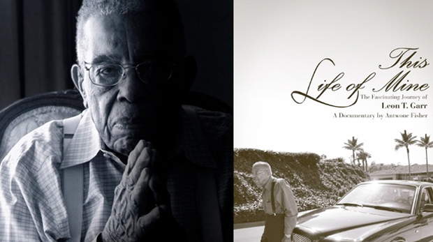
One black resident who came to South Los Angeles and who also came to prominence was Leon T. Garr. Garr was born in 1914, in Ruston, Louisiana and moved to Los Angeles in the early 1940s after having served in World War II. After co-founding Coast Construction in 1958 he launched Garr Construction in 1963. In 1991 he transformed a failed savings and loan into Founders National Bank. Along the way he proved himself to be a major force in South Los Angeles and today several Chesterfield Square locations give evidence of his philanthropy including the Garr Child Care Learning Institute, the Garr Academy of Math and Entrepreneurial Studies School, the Leon & Mattie Garr Foundation, and the Garr Banquet Hall. In 2012, Antwone Fisher directed the biographical documentary, This Life of Mine: The Leon T. Garr Story, about Garr. On 23 March he celebrated his 99th birthday.
THE BIRTH OF BLACK CLUBS
Black clubs, in many ways the precursors to modern gangs, began to emerge partly to counter the harassment of black Angelenos at the hands of white gangs. The largest black club on South Los Angeles’s Westside was The Gladiators, whose turf was centered around the intersection of 54th and Vermont, just beyond the borders of Chesterfield Square. As whites increasingly left the region, interracial violence was increasingly replaced by intra-racial violence – primarily between the many clubs of South Angeles’s historically black and poorer Eastside and the clubs of the upwardly mobile black Westside. Though there was violence, it wasn’t even close to the level that arose in later decades. Fights over girls, American football rivalries, and class resentment were rarely deadly and in 1960 there were only six gang-related deaths in the entire city of Los Angeles.
CHESTERFIELD SQUARE BECOMES A BLACK NEIGHBORHOOD
By 1960, the previously separate black populations of South Central, Watts, the black Westside and Mid-City had merged to form one large, contiguous black majority region. “South Central,” named after the neighborhood which had flourished along South Central Avenue, became increasingly accepted as shorthand for any and all black communities throughout South Los Angeles and the name “Chesterfield Square” began to vanish from the public consciousness
Nuance and distinction between communities of South Los Angeles began to reassert itself in 1965 when residents in Watts launched a violent uprising in the wake of perceived racism on the part of the LAPD. In the wake of the unrest, which resulted in 34 deaths, the population of upwardly mobile blacks in South Los Angeles increasingly left the Eastside for the Westside, including Chesterfield Square.
THE END OF THE CIVIL RIGHTS ERA & THE BEGINNING OF GANG ERA
The second half of the 1960s saw several key moments in Civil Rights history. In 1965, Malcolm X was murdered. Martin Luther King Jr was murdered in 1968. Although it might sound like a conspiracy theory, it is a matter of fact that the FBI deliberately created conflict between the preeminent Black Nationalist organizations of the day with their anti-dissident COINTELPRO program, hoping that they’d wipe each other out. They were certainly involved in the 1968 assassination of the Panthers’ Fred Hampton and the following year, a fight between the Panthers and US over at the UCLA campus in Westwood turned deadly.
In the wake of the disintegrating Black Nationalist movement, teenage groups like the Baby Avenues (later known as The Crips) and, in the Chesterfield Square vicinity, the LA Brims both coalesced in 1969. Like other clubs at the time such as Compton’s Pirus or the Black P. Stones in Mid-City, they initially all dabbled at least superficially with Black Nationalism before quickly devolving into criminal gangs.
GOOD FRED
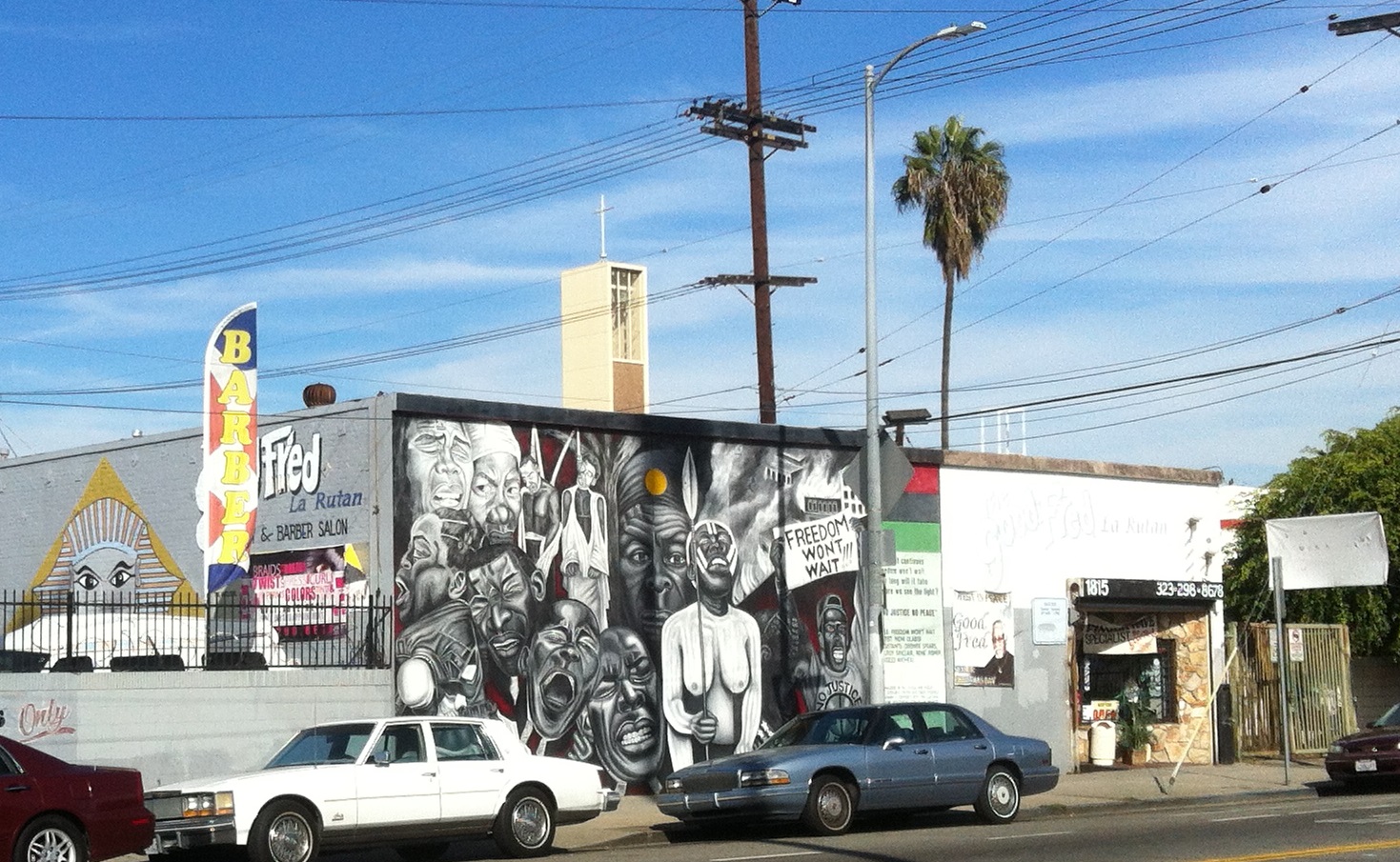
Frederic Douglas “Good Fred” Ellis was born on 21 April 1946 in Detroit. In 1954 he joined the Air Force and served with the 49th Air Squad until 1958. While in the military he acquired the nickname, “Good Fred.” He graduated from barber college in 1961 and opened his first hair salon, LaRutan (“natural” backwards), in Chesterfield Square on Western Avenue in 1968. In 1971 bought a larger location on 54th Street and began manufacturing The Good Fred Oil, designed specifically for black hair and celebrated in a jazz song of the same name by Dawn Norfleet. La Rutan’s patrons included Bobby Womack, Clifton Powell, Nina Simone, Richard Pryor, and others. More importantly, though, Fred was a philanthropist and positive force in the community, contributing to a variety of local causes. He passed away in 2011.
GROWTH OF THE LATINO POPULATION
In the 1970s, much of South Los Angeles’s industry dried up or relocated. The factories that remained increasingly turned to newly-arrived immigrants from Mexico rather than the heavily-unionized black labor force. In the 1980s, as the US became involved in several Central American wars, refugees from that region began to flee to Los Angeles, often settling in South Los Angeles, eventually helping Latinos form the dominant ethnicity of South Los Angeles’s Eastside. On the other side of the 110, the Latino population grew and continues to grow but the region remains primarily black. In fact, in 2013 every black majority neighborhood of Los Angeles is located (with the exception of West Compton) in South Los Angeles’s Westside.
ANTIQUE STOVE HEAVEN
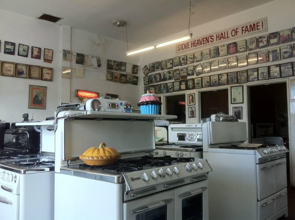
Antique Stove Heaven opened circa 1978. Around 1988 they moved to their current location on Western. Their stoves have been featured in films including Devil in a Blue Dress, Driving Miss Daisy, Eraser, Hunger Games, and Nixon. They’ve been featured on the TV shows The Christopher Lowell Show, Hot in Cleveland, The Lynette Jennings Home Show, and Weeds as well as commercials for Blue Cross, Campbell’s Soup, Carl’s Jr., Jack in the Box, Kraft Cheese, Oreo Cookies, and Sunny Delight. Diana and I popped in and were shown around the facility. The stoves really are beautiful and I found myself wondering if, underneath the layers of black, my own 1960s stove might actually be a thing of beauty. After looking at it again, I, unfortunately, don’t think so.
THE 1980s – A TIME OF CRISIS
The 1980s were trying times – especially for working class communities. The HIV/AIDS epidemic began around 1981 – the same year the federal budget for mental health was slashed and psychiatric patients were essentially dumped onto the streets. At the same time, the Central American Refugee Crisis worsened considerably when the US increasingly funded right-wing death squads in El Salvador, Guatemala, Honduras, and Nicaragua. Crack hit the streets around 1984 and every year from 1985 to 1992 Los Angeles’s homicide rate increased. In 1979, the Westside Crips (founded in 1971) had splintered into the rival Gangster Crips and Neighborhood Crips. In the 1980s, after more splintering, Chesterfield Park became bore witness to the development of and became home to the Rollin’ 40s Neighborhood Crips, the Rollin’ 50s Neighborhood Crips, and the Rollin’ 60s Neighborhood Crips – all of which include smaller sets – as well as the 51 Trouble Gangster Crips, the Westside 54 Van Ness Gangster Brims and no doubt others.
54th STREET MASSACRE
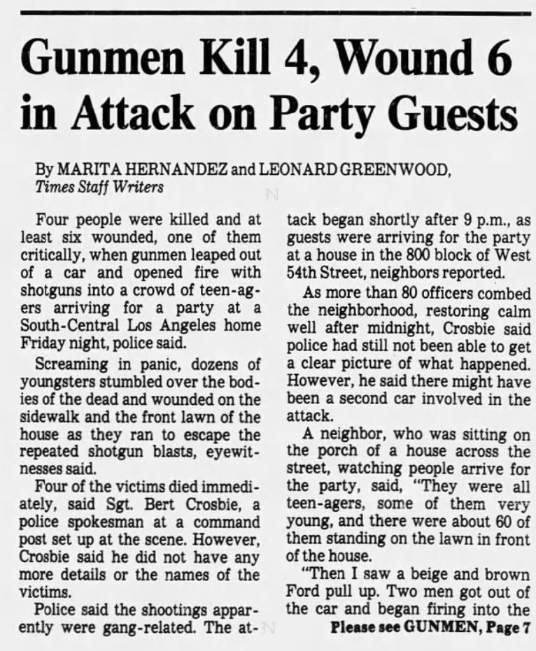
One of the single worst instances of gang violence that Los Angeles has witnessed in modern times was the 54th Street Massacre which took place in Vermont Square in 1984. Back then, Westside Van Ness Gangster and Chesterfield Square resident Keith Tyrone “Ase Capone” Fudge’s car was allegedly stolen at gunpoint by Percy “Buddha” Brewer, of the Westside 52 Hoover Gangster Crips. On the night of 12 October, Fudge, Harold “Freaky Friday” Hall, and Fred “Fat Freddie” Knight allegedly rolled up and blindly fired 15 to 20 shots into the crowd gathered at a party at a residence on 54th Street. (Knight was acquitted after several years in prison). When the smoke cleared Brewer lay dead, but also Shannon Cannon, Darryl Coleman, Phillip Westbrook, and Diane Rasberry. All of the victims and assailants involved were teenagers at the time, some as young as fourteen years old.
GRIM SLEEPER
At least as early as 1985, Lonnie David Franklin, Jr. is believed to have begun his reign as one of the country’s longest active serial killers, nicknamed “The Grim Sleeper.” His nickname is a reference to the fact that he’s believed to have taken a 14-year break from murder after one of his attempted victims survived an attack in 1988 and he perhaps got spooked. He is believed to have begun killing again in 2002. His last known murder victim before the hiatus was of Alicia “Monique” Alexander, then 18, whose body was found in an alley near the 1700 block of West 43rd Place on 11 September 1988 in Chesterfield Square after she’d left her home to walk to a convenience store.
MARTIN LUTHER KING JR – KINGDOM DAY PARADE
All was not grim and gray in the 1980s, however. Santa Barbara was renamed Martin Luther King Jr Boulevard in 1983. That same year President Reagan signed a law declaring Martin Luther King, Jr Day a national holiday. In 1986, the first Kingdom Day Parade was organized by Celes King III and Larry E. Grant. Now an annual tradition, the Kingdom Day Parade passes through King Estates, Chesterfield Square, Leimert Park, Arlington Park, and Angeles Mesa. It’s probably the best known cultural event that takes place in the neighborhood. Grant passed away in 2012 at 86 years of age but the parade rolls on.
BOYZ N THE HOOD
From 1 October to 28 November 1990, a film crew shot Boyz N the Hood in Chesterfield Square. The exterior of the Furious Styles character’s home is he home at 5918 Cimarron Street. Brandi’s house is 5906 Cimarron Street and the Baker home is at 5911 Cimarron. It was directed by John Singleton who at 23 was the youngest person ever nominated for a Best Director Oscar. Although it was preceded by 1988’s Colors, Boyz N the Hood and Menace II Society came to be seen as the quintessential examples of the “Hood film.”
THE LOS ANGELES RIOTS
The 1980s saw the highest level of Korean immigration to the US. Although most initially moved to Koreatown, designated along Olympic Boulevard in Midtown in 1980, many opened or took over businesses in South Los Angeles. On 16 March 1991, then-15-year-old Latasha Harlins was killed in Vermont Vista by Soon Ja Du, a Korean-American shopkeeper. That same month black motorist Rodney King was severely beaten by five white LAPD officers in the San Fernando Valley‘s Lake View Terrace neighborhood in an event that was secretly caught on tape. In the first case, Du was given probation, community service and fined $500. In the King case, three of the four LAPD officers involved were acquitted of all charges.
The results of the two trials are usually pointed to as the catalysts of the Los Angeles Riots which erupted just down the street from Chesterfield Square but quickly spread to it and far beyond. Over 60 people ultimately died in the uprising including 27-year-old Franklin Benavidez, who was shot and killed after fleeing from a Chesterfield Square gas station that officers claimed he’d attempted to rob. The officers, who fired at least ten rounds, also struck 19-year-old Victor Muñoz, claiming he’d brandished a handgun although it later turned out to be a beer can. Muñoz was hospitalized for two weeks and disputed the officers’ account.
Today Chesterfield Square — though it still suffers from violent crime, poor schools, and other ills — seems like a comparatively peaceful place (during the day at least). Fans of Craftsman architecture; Central American food, Mexican food, or Soul Food; or anyone simple desiring to experience the totality of their hometown should definitely check it out.
CHESTERFIELD SQUARE EATS
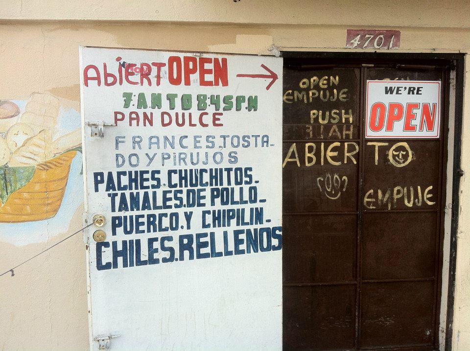
There are several eateries in Chesterfield Square including BBQ Express, El Arca Bakery & Restaurant, Flor Blanca Pupuseria Restaurante, Guatemalteca La Fiesta, Las Delicias, Master Burger, Natural Soul Food Non Profit Café, New Orleans Fish Market, Panaderia Mi Guatemala, and Sonsonate Grill.
Diana and I stopped into Mel’s Bakery & Café, a soul food place established seven years ago on West 48th Street initially just intending to get something to drink but the delicious aromas proved impossible to resist and Diana grabbed some of the mac ‘n’ cheese which I tried and found to be absolutely fantastic. The small eatery has a nice, relaxed vibe and customers came and went exchanging greetings and small talk that made it evident that everyone present was acquainted and friendly with one another. Across the street, at Spirit of Health Longlife Adult Day Health Care Center, a woman exchanged pleasantries and expressed her love for Mel’s.
I couldn’t be sure whether or not there was really a bar there but supposedly a joint called Foxy’s in this rundown but not unattractive building. According to a Foursquare tip, “3-7 pm on Thursday. Domestic beers $1.75.” I didn’t see any signage outside.
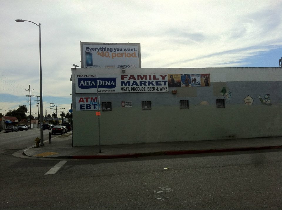
There are a few small markets in the neighborhood including A&W Market, Family Market, Sinai Mini Market, 2 & 1 Liquor Store, and West-Vern Liquor. The neighborhood’s sole supermarket is a 4 For Less, part of a national grocery store chain owned by Kroger.
MUSIC AND MOVIE SHOPS
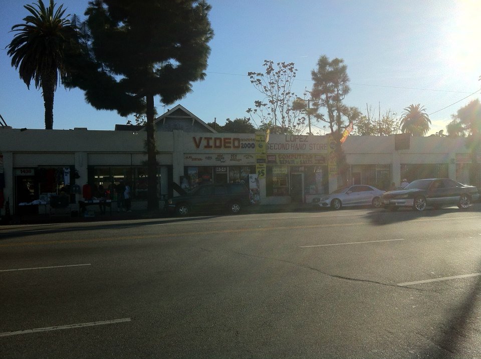
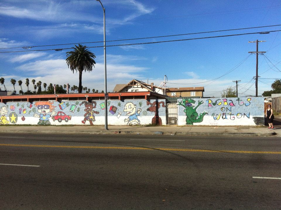
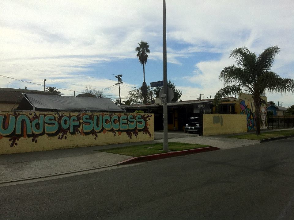
The only place that I saw selling DVDs was Video 2000 at 1434 Martin Luther King Jr Blvd. Looking online and in the yellow pages I couldn’t even find a listing for it, however, it looked from the posters in the windows like its stock was mostly mainstream American movies. There’s also a mural titled Rugrats on Wilton.Sounds of Success.
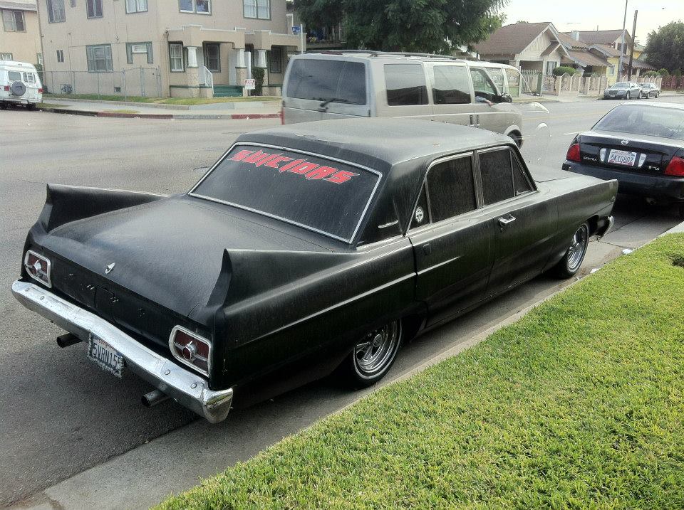
I didn’t see any music stores nor did my research turn up any. There was music coming from many sources however and the old school gangsta rap of a previous generation seemed to be particularly popular. The only artist I could instantly recognize was that of Eazy-E. There was also an eye-catching purple lowrider bumping The Dramatics’ wistful classic “Hot Pants in the Summertime.” I’m sure that there are some musicians in the neighborhood. I saw a kid practicing guitar in a garage. Please let me know who they are.
CHURCHES
In addition to the many beautiful Craftsman homes in the neighborhood, there are several churches, some of which are quite lovely. 54th Street Seventh Day Adventist Church is probably one of the oldest around as it was likely built in the earliest days of the neighborhood’s development. From the outside it rather resemblesLiberty Baptist Church, another beautiful church in the neighborhood that was built in 1914.
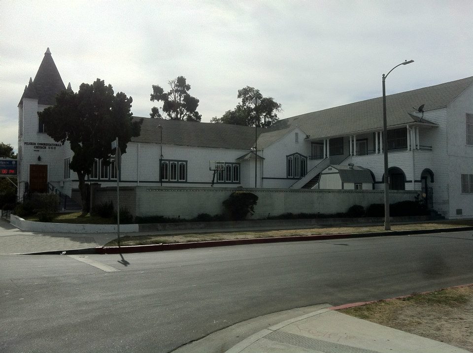
I’m also not sure of the construction year of the Pilgrim Congregational Church although the distinct, wood-shingled structure looks fairly aged.
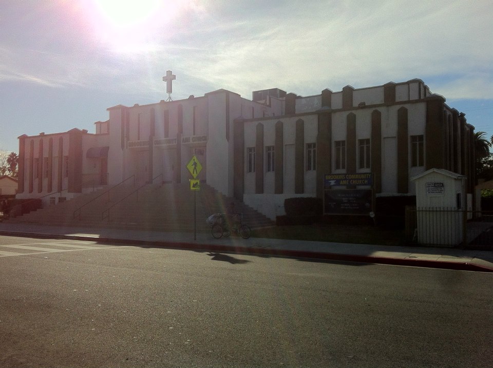
Brookins Community AME caught my eye with its distinctly Deco exterior. Online research gives various construction dates for buildings on the property including 1908 and 1930. A plaque in front of the church states that Kansas-born Bishop Hamel Hartford Brookins was instrumental in quelling the Watts Uprising and that in 1977 he founded the Brookins Community AME Church.
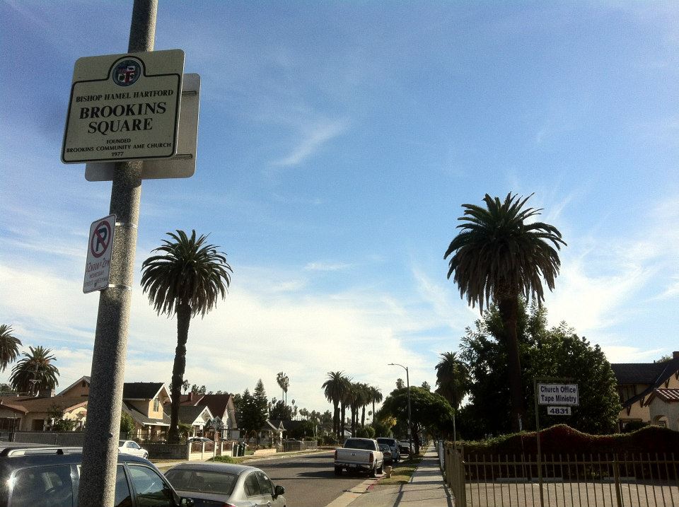
In 2008 the intersection of 49th Street and Gramercy Place was designated Bishop Hamel Hartford Brookins Square and it happens to be one of the most charming areas of the neighborhood.
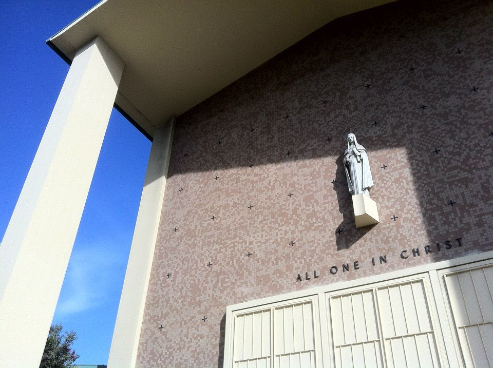
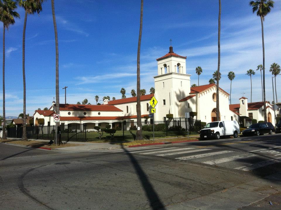
A mid-century stunner is St. Brigid’s Church, which in 1955 was awarded an Award of Merit From the American Institute of Architects and also of The National Catholic Institutional Distinctive Design Award.
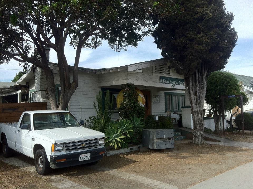
Some of the more humble churches include Church of the Nazarene, Embajada de Dios Church, Greater New Jerusalem Baptist, a Jehovah’s Witness Kingdom Hall, a Religious Society of Friends meeting house, St. James Community Baptist Church, St. Matthew Baptist Church, and Word of God Baptist Church.
GETTING THERE AND AROUND
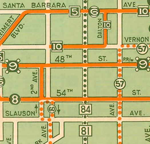
Though the Yellow Cars are long gone, Chesterfield Square is still well-served by public transit. There are several Metro lines including 40, 102, 105, 108, 206, 207, 209, 358 and the rapid 705 and 757 lines. LA DOT’s DASH Chesterfield Square and Leimert Park lines also serve the neighborhood. You could also pick up a new ride at Primo’s Bike Shop or Morgan’s Mini Bikes and Go-Karts.
If you prefer riding trains, Chesterfield Square isn’t too far from the Expo Line, the Expo/Western Station of which is located half a mile (less than a kilometer) north of the neighborhood. When the Crenshaw Line opens, it’s Leimert Park Station will be located less than a mile west of the neighborhood.
STAYING IN CHESTERFIELD SQUARE
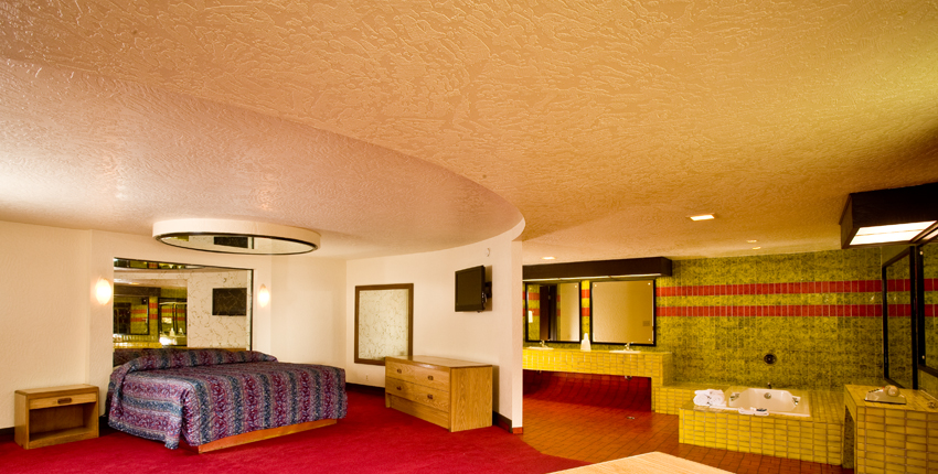
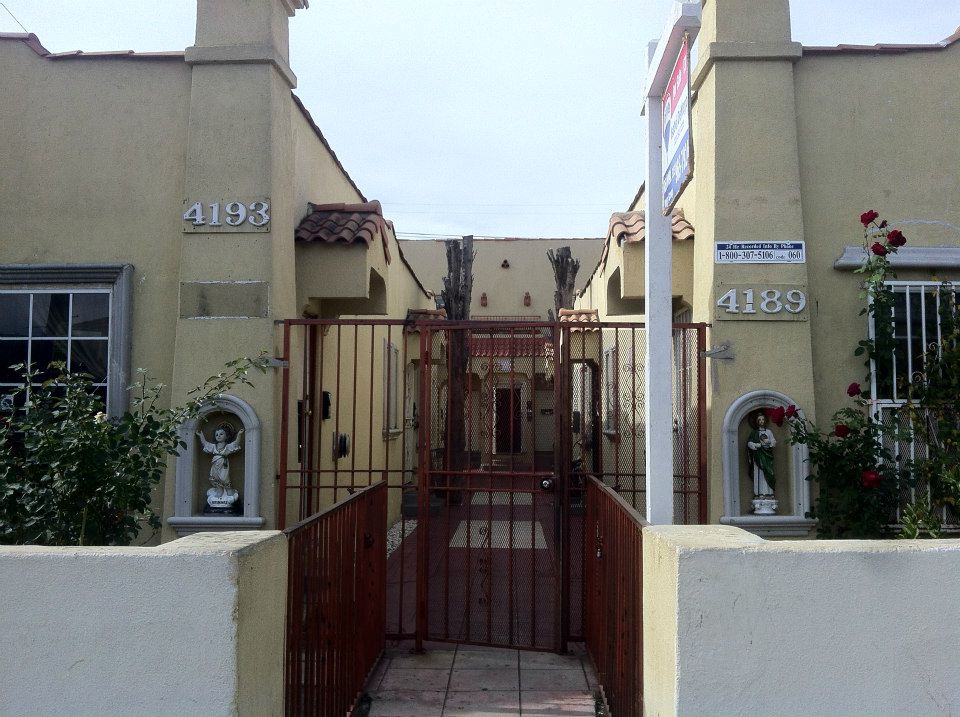
There are several places to stay in the neighborhood including America’s Best Value Inn & Suites-Los Angeles Downtown-S.W., Bronco Motel, Harvard Motor Inn, Mustang Motel, Santa Barbara Motel, and The Snooty Fox Motor Inn. The sign for the Snooty Fox is great. It depicts the titular mascot with his nose turned up holding a cane and wearing a bow tie, monocle, and derby. Be forewarned: most of them are the sorts of places that charge by the hour and several of them have rooms with mirrored ceilings.
SOCIAL SERVICES
There are several social services in the neighborhood serving people in the neighborhood. Chicago’s CORE (Congress of Racial Equality) established CORE-CA in the Chesterfield Square in 1989. Other neighborhood services include Changing Steps Treatment Center, Clean & Free, Infinity House Transitional Living for Men and Women, and Testimonial Community Love Center.
I sincerely hope that you’ll check out Chesterfield Square and the rest of South Los Angeles’s Westside as its one of the most interesting but overlooked areas of Los Angeles.
Support Eric Brightwell on Patreon

Eric Brightwell is an adventurer, essayist, rambler, explorer, cartographer, and guerrilla gardener who is always seeking paid writing, speaking, traveling, and art opportunities. He is not interested in generating advertorials, cranking out clickbait, or laboring away in a listicle mill “for exposure.”
Brightwell has written for Angels Walk LA, Amoeblog, Boom: A Journal of California, diaCRITICS, Hidden Los Angeles, and KCET Departures. His art has been featured by the American Institute of Architects, the Architecture & Design Museum, the Craft Contemporary, Form Follows Function, Los Angeles County Store, the book Sidewalking, Skid Row Housing Trust, and the 1650 Gallery.
Brightwell has been featured as subject and/or guest in The Los Angeles Times, VICE, Huffington Post, Los Angeles Magazine, LAist, CurbedLA, Office Hours Live, Spectrum News, Eastsider LA, Boing Boing, Los Angeles, I’m Yours, Notebook on Cities and Culture, KCRW‘s Which Way, LA?, at Emerson College, and the University of Southern California.
Brightwell is currently writing a book about Los Angeles.
You can follow him on Ameba, Duolingo, Facebook, Goodreads, iNaturalist, Instagram, Mastodon, Medium, Mubi, the StoryGraph, and Twitter.


9 thoughts on “California Fool’s Gold — Exploring Chesterfield Square”