

 Los Angeles is often characterized as a city in which one simply cannot exist without a car. And yet, as the millions of Angelenos who bicycle, take public transit, or walk will tell you, driving a car is no way to get to know the city. Since Los Angeles County is even larger than the island of Jamaica, walking everywhere would be a time-consuming endeavor but there are highly walkable areas located throughout the nation’s most populous — and most densely-populated — metropolitan area and in the series Urban Rambles, I will explore them.
Though the efforts of conservationists to revitalize the Los Angeles River probably began back before it was even channelized, the buzz around its reconnection with the city through which it passes seems to be growing exponentially in recent years. Numerous small parks and sections of bike paths have sprung up along its banks and kayaks and canoes have helped changed the way the river is viewed.
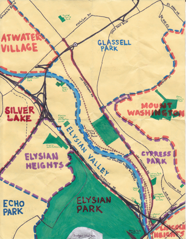
Much has already been written about the reawakening of the public’s riparian consciousness. I imagine that the many riverside communities will be uniquely affected by the coming changes, and with that in mind, I set out to explore a stretch of San Fernando Road near the Glendale Narrows and found several attractions that might appeal to people from beyond the neighborhoods as well.
San Fernando Road runs about 40 kilometers, connecting the Eastside neighborhood of Lincoln Heights in the south with the northernmost neighborhood in the city, Sylmar, in the San Fernando Valley. I only walked a short (about 4.5 kilometer) section — between Figueroa Street and Fletcher Drive — that passes through the Northeast Los Angeles neighborhoods of Cypress Park and Glassell Park: two east bank communities nestled in a valley flanked by Mount Washington to the east and the Elysian Hills to the west.
The area has a rich history as a transit hub. Between 1920 and 1958 the Los Angeles Railway‘s E (later 5) Line ran up the nearby tree-lined Cypress Avenue, connecting the distant communities of Eagle Rock and Hawthorne. In 1958 Los Angeles Metro Transit Authority took over operations until the rail was decommissioned in 1963. Even closer, on Avenue 28, is the MTA Bus Yard SGV-3. It first opened in 1907 as a rail yard for Division 3 of the Los Angeles Railway. In 1945, Los Angeles Transit Lines‘ motorcoaches (buses) began sharing the yard. Today it’s the oldest bus yard still in use in the city.
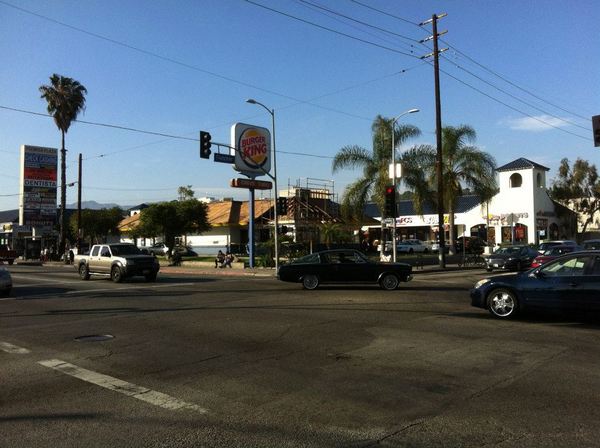
In the early 20th century, the neighborhoods between Lincoln Heights and Glendale were often referred to as “toonervilles.” Toonerville Folks was a popular comic strip, the adventures of which followed centered around the so-called Toonerville Trolley. Inter-urban streetcars (like the Yellow, Green, and Red Cars, locally) came to be associated with outlying residential developments, and many suburbs around the country came to be nicknamed toonervilles and their local lines, toonerville trolleys. Today the trolleys are long gone (although the name is held onto by a local gang) and this stretch of San Fernando Road is instead served by the Metro‘s 90 and 91 lines, as well as the 794 rapid line.
That’s not to say that the area is without rail though. Running parallel and just west of San Fernando are the train tracks currently used by Metrolink‘s Antelope Valley and Ventura County commuter train lines, as well as Amtrak‘s Pacific Surfliner. Just south of the starting point is Metro’s Lincoln Heights/Cypress Park Gold Line light rail station. The Gold Line currently connects East Los Angeles to Pasadena; construction is underway to extend it first to Azusa and ultimately to the distant Inland Empire.
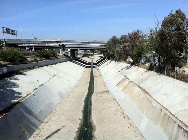
Near the southern end of San Fernando Road is the confluence of the Los Angeles River and Arroyo Seco. Arroyo Seco is a 40-kilometer-long river whose headwaters are near Mount Wilson. A stretch of the Arroyo Seco is lined with a trail, the Arroyo Seco Bike Path, which currently ends upstream in South Pasadena Nature Park. The Los Angeles River’s headwaters are in the Simi Hills and Santa Susana Mountains, and the Los Angeles River bike path currently exists in unconnected sections. This one that begins near the confluence extends north to the Bette Davis Picnic Area in Glendale.
Just southeast of the angle formed by the confluence of these two rivers is the northwest corner of Lincoln Heights. If you live near this part of town and have ever had your car towed, you’re probably familiar with the LAPD’s dusty Northeast Los Angeles OPG Yard. Other sites of note in the area include the old Lincoln Heights Jail (home to the Bilingual Foundation for the Arts theater company), Lacy Street Studios, Saint Vincent De Paul Thrift Store, and a building whose sign reads “Ca i ornia Nigth Club.”
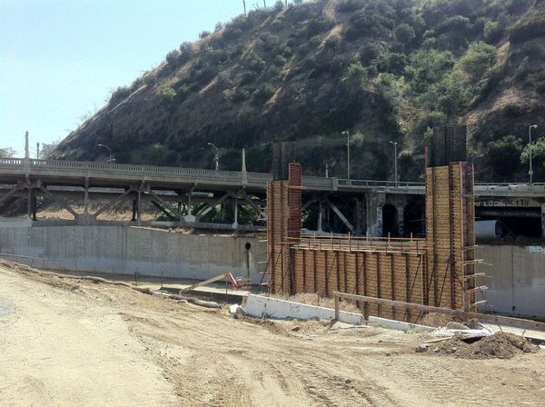
Just north of the confluence of the rivers (as well as the confluence of the 5 and 110 freeways) is the Riverside-Figueroa Bridge. Though attractive and historic (it’s Los Angeles City Historic Cultural Landmark No. 908), it’s being destroyed and replaced with a new bridge, currently under construction. This work is apparently being done with absolutely no thought given to the bridge’s pedestrian traffic, and to cross it I had to wait for a break in traffic before jogging in the street, ultimately hopping a barrier onto a closed sidewalk. It was either that or walk an eight-kilometer detour through Elysian Park, through Solano Canyon, across the North Broadway Bridge/Buena Vista Viaduct and back.
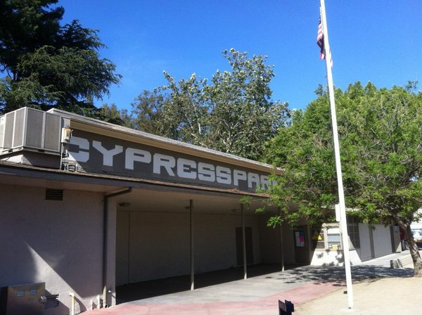
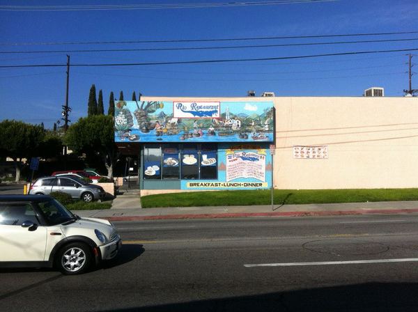
Cypress Park is a mostly Mexican-American neighborhood with a sizable Chinese-American minority. It’s historically important — and I’m not being facetious — for fans of delicious, local restaurant chains, as the birthplace of three great local chains: King Taco, El Atacor, and Yum Yum Donuts. Nearby and parallel, Cypress Avenue is home to a library, La Especial (which has a large mural of Tejana singer, Selena), and a couple of other restaurants and bars.
Between Cypress and San Fernando, on Avenue 28, are more bars (El Recreo Room and Footsies) and the Los Angeles Railway Huron Substation. It’s the city’s second-oldest surviving substation, built in 1906 from a design by Edward S. Cobb, and formerly housed equipment that powered the aforementioned Yellow Cars. Today it’s Historic Cultural Monument #404, and primarily used as a filming location, event space, and wedding venue.

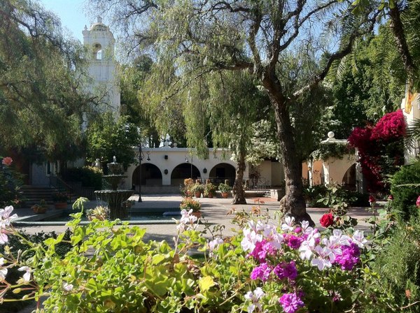
Just west of the substation, near the intersection of Avenue 26 and San Fernando Road is the Los Angeles River Center and Gardens. The buildings (which house the offices of several non-profits) were originally operated by Lawry’s, who opened their California Center in 1953 expanded it in 1961, and ultimately closed it in 1992.
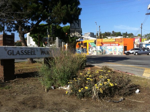
Continuing north (northwest, really) one enters the neighborhood of Glassell Park. As with Cypress Park, many of the neighborhood’s residents are Mexican-American, although Glassell Park’s largest minority are Filipinos. The east side of the road is dominated by small, aging factories of obscure usage. The west side of the street is home to much larger and varied features.
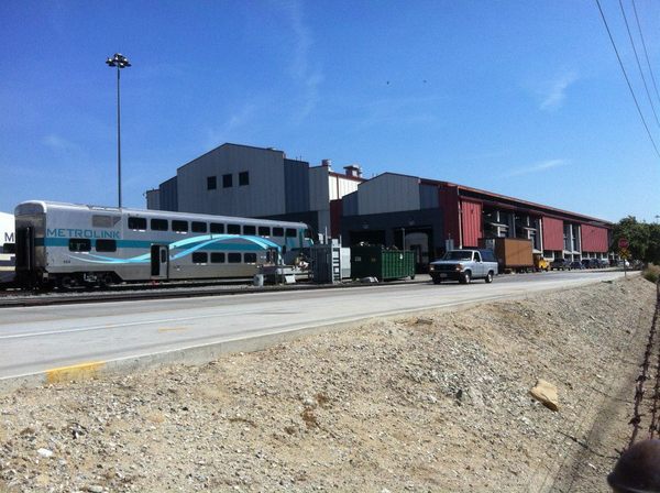
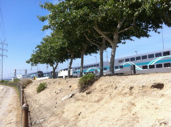
The first large operation one encounters on San Fernando Road in Glassell Park is Metrolink Central Maintenance Facility (CMF). Not to be confused with the Metro (which operates Los Angeles County’s largest bus and interurban rail lines), Metrolink is the commuter rail service that serves Los Angeles County and five other Southern California counties.
The facility is located on the former site of a huge pigeon farm that the flooding Los Angeles River washed away in 1914. The area was later home to — and best known for being — Southern Pacific‘s Taylor Yard. The CMF was constructed in 1992 when the system began operation and is one of Metrolink’s three maintenance facilities.
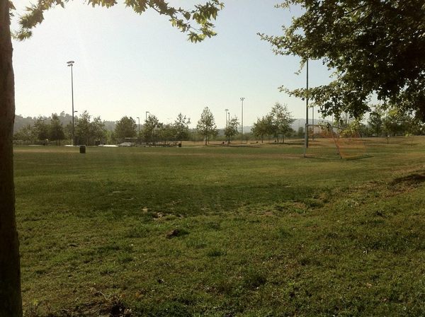
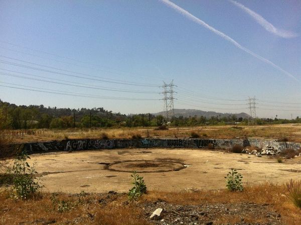
Just north of the CMF is El Río de Los Angeles State Park, which opened on part of the abandoned Taylor Yard in 2007. The grounds include sports fields and restored wetlands. Just north of the park are the large Sonia Sotomayor Learning Academies, a campus that includes three LAUSD pilot schools and two independent charter schools. Just south of the park is a parcel that’s currently being developed for affordable, train-yard-adjacent housing. The parcel behind the park remains undeveloped.
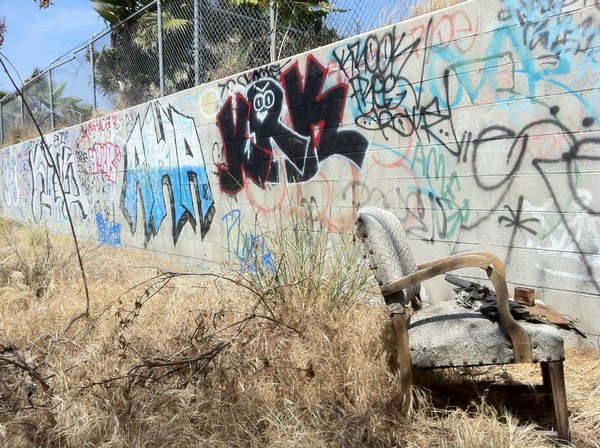
Taylor Yard ended most operations in 1985, but the demolition of last buildings standing didn’t happen until 2009. Just as Dogtown’s River Station finally transformed from an abandoned brownfield into Los Angeles State Historic Park, Taylor Yard is part of a planned transformation into a large park, although unlike “The Cornfield,” most of the former Taylor Yard is still covered with rubble, rusted metal, broken glass, tagged ruins and probably some invisible but pretty serious toxins.
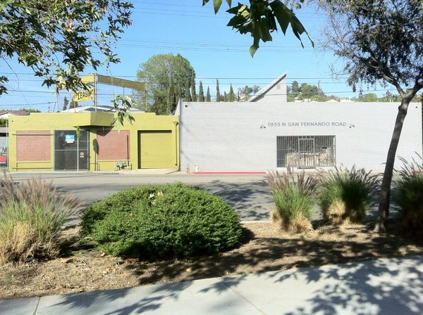
Across from the park is a stretch of San Fernando characterized by small buildings, most of the windows and doors of which have been bricked up. From the outside, there’s little indication of whether or not they’re in use beyond the presence or absence of “for lease” signs.
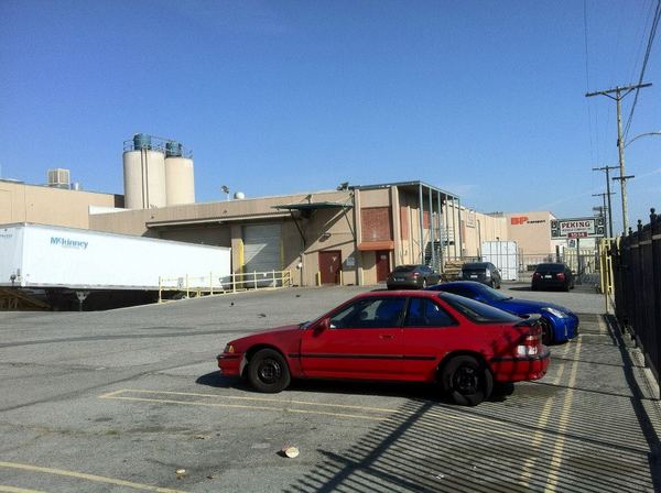
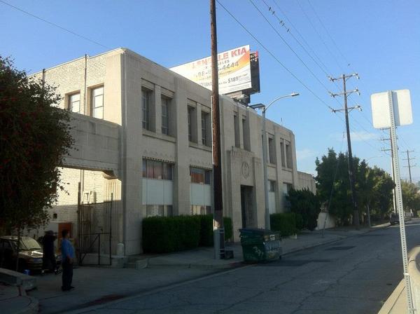
A few, like the Peking Noodle Factory, are obviously in use (since 1924). Others, like the former Hemphill Diesel Engineering School (established in 1933), have been used in the past but seem abandoned — at least from the outside. The building retains a beautiful Art Deco frieze portraying diesel-fuelled machinery, even though it’s perhaps better known for having been, starting in 1945, a Capitol Records pressing plant. Since that operation left in the 1970s, the building was used at least once as an art space.
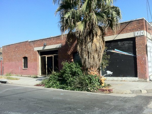
In fact, on both sides of the river, many of the old factories seem to buzz with artist activity rather than light industry and on the day of my walk, I also stumbled upon Concord, the doors of which were open at the time and to which I thus paid a visit.
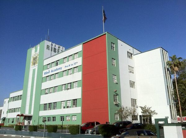
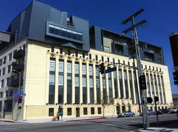
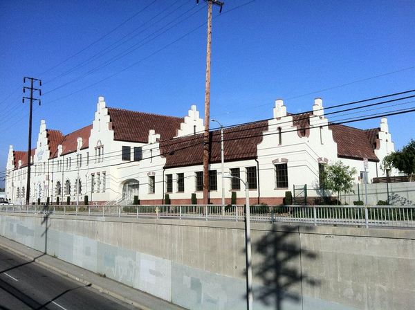
One of the largest re-purposed factories in the neighborhood is the building used since 1992 by Ribét Academy College Preparatory. Constructed in 1923, it was originally the home of the Theme Hosiery Factory. It was first converted into a school in 1960 when the Los Angeles Archdiocese took over and turned it into an all-boys high school.
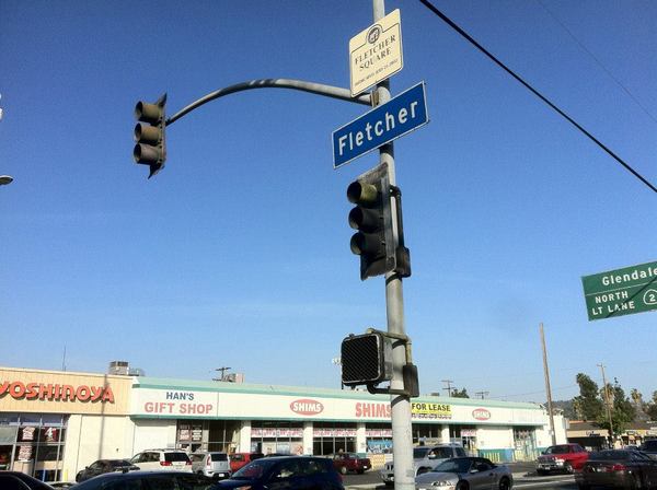
The intersection of Fletcher and San Fernando was officially designated “Fletcher Square” less than a year ago, in July 2012. The first official city square was Pershing Square, dedicated in 1918. It wasn’t until 1975 that the second city square was designated — Fletcher Bowron Square in the Civic Center section of downtown. Since then the speed of square dedication has increased rapidly. Fletcher Square is the 94th such square.
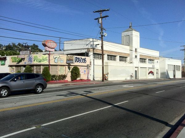
I’m not entirely sure what the supposed purpose of these markers is, but believe that I heard or read somewhere that they’re meant to instill pride in residents within their vicinity. In Fletcher Square’s case, there’s already a strip mall named “Premier Plaza” which boasts an assemblage of international fast food chains. There are also locally-established eateries like Downey-based La Pizza Loca, Hollywood-based Los Burritos, Compton-based Egg Roll King, one of many unrelated places called ABC Donuts and Lupita’s Tamales — there’s another place called Lupita’s in Cypress Park.
Just up the street, beginning at Tyburn Street is the Glendale neighborhood of Tropico. It was its own town until it was annexed by its neighbor to the north in 1918. Now no longer part of the city of Los Angeles, its absence from the Northeast Los Angeles profile stretches like a large bite mark, from Eagle Rock in the East to Atwater Village in the west.
Just west of the Metrolink tracks and north of the 2 Freeway is the Atwater Village neighborhood. Its western edge is the Los Angeles River. There are a couple of nearby buildings of interest. The flashier and more celebrated is the old Van de Kamp Bakery, designed by J. Edward Hopkins to resemble a Dutch 16th century farmhouse. It was built in 1930 and closed in 1990. In 1992 it was designated an Historic-Cultural Monument, and it’s now a location of LACCD satellite location known as the LACCD Van de Kamp International Education and Workforce Development Innovation Center.
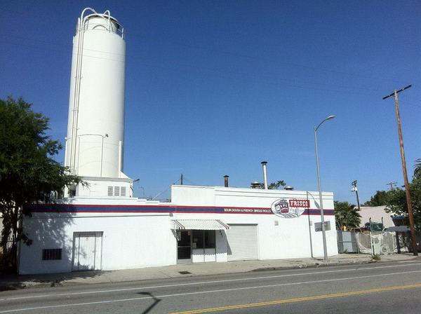
The area is still home to several other bakeries, including Kermanig Bakery (since 1949), La Morenita Bakery (since 1953), Frisco Baking Co (since 1954 and to San Franciscans’ likely disbelief and horror, was despite it’s name established by actual San Francisco natives).
Across the street from the old Van de Kamp Bakery is another striking building from the same era. The Valley Dairy Company building was built in 1931, and It’s currently home of JM Carden Sprinkler Co., who have been manufacturing fire sprinkler systems since 1953.
After that, it’s back across the river for me. While I certainly hope that people and pigeons will never again be imperiled by its temperamental alluvial terror, I can barely wait to see it navigate its new course as public space — one hopefully characterized by recreation, nature, and culture.

Eric Brightwell is an adventurer, essayist, rambler, explorer, cartographer, and guerrilla gardener who is always seeking paid writing, speaking, traveling, and art opportunities. He is not interested in generating advertorials, cranking out clickbait, or laboring away in a listicle mill “for exposure.”
Brightwell has written for Angels Walk LA, Amoeblog, Boom: A Journal of California, diaCRITICS, Hidden Los Angeles, and KCET Departures. His art has been featured by the American Institute of Architects, the Architecture & Design Museum, the Craft Contemporary, Form Follows Function, Los Angeles County Store, the book Sidewalking, Skid Row Housing Trust, and 1650 Gallery. Brightwell has been featured as subject in The Los Angeles Times, Huffington Post, Los Angeles Magazine, LAist, CurbedLA, Eastsider LA, Boing Boing, Los Angeles, I’m Yours, and on Notebook on Cities and Culture. He has been a guest speaker on KCRW‘s Which Way, LA?, at Emerson College, and the University of Southern California.
Brightwell is currently writing a book about Los Angeles and you can follow him on Ameba, Duolingo, Facebook, Goodreads, Instagram, Mubi, and Twitter.


I live in Lincoln Heights! Would I be able to find an elaborated version of this info? What came of your exploration of the Santa Fe Railroad’s Taylor Yard?
LikeLike