

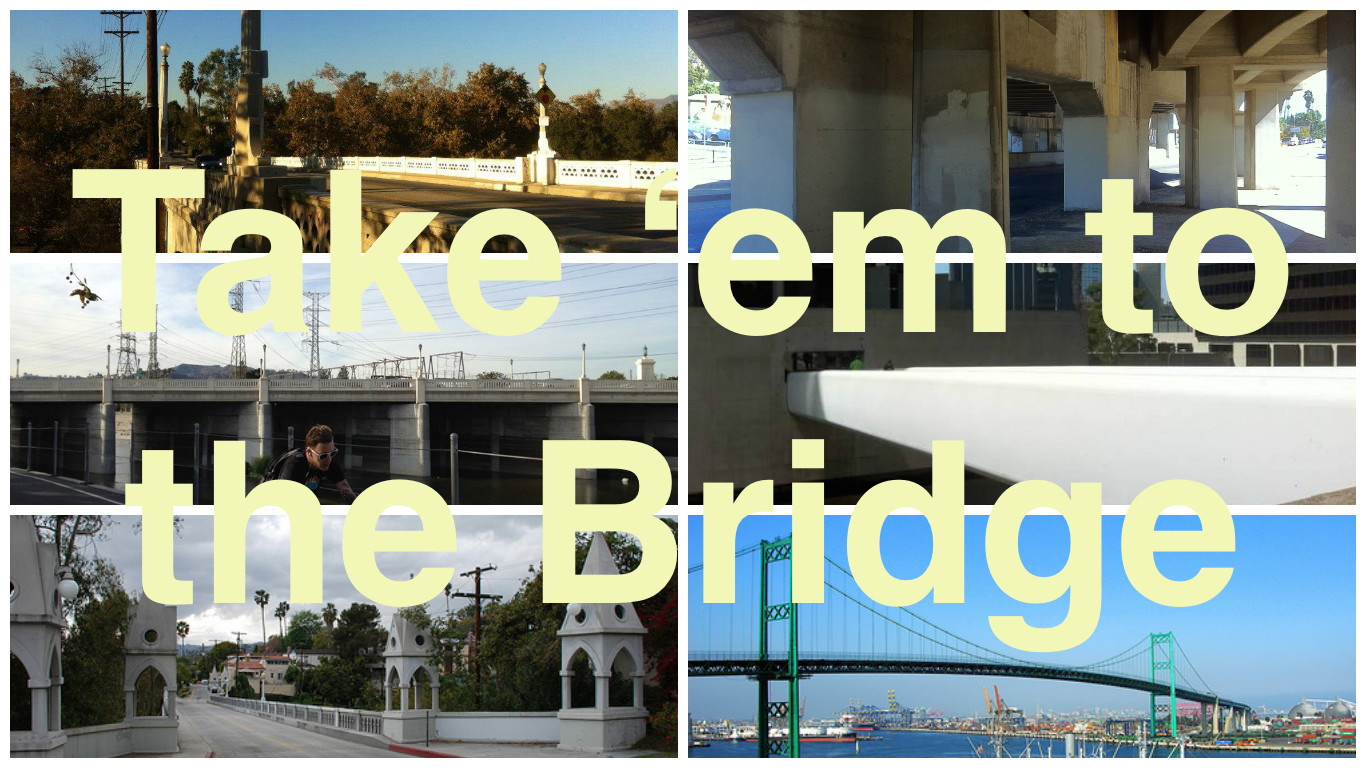
There are hundreds of bridges in Los Angeles County. They cross rivers, creeks, ravines, roads, train tracks, and other obstacles. If there’s a bridge you’d like to see me visit for this series, Take ’em to the Bridge, contact me to let me know or leave a comment.Trip, trap, trip, trap!
*****
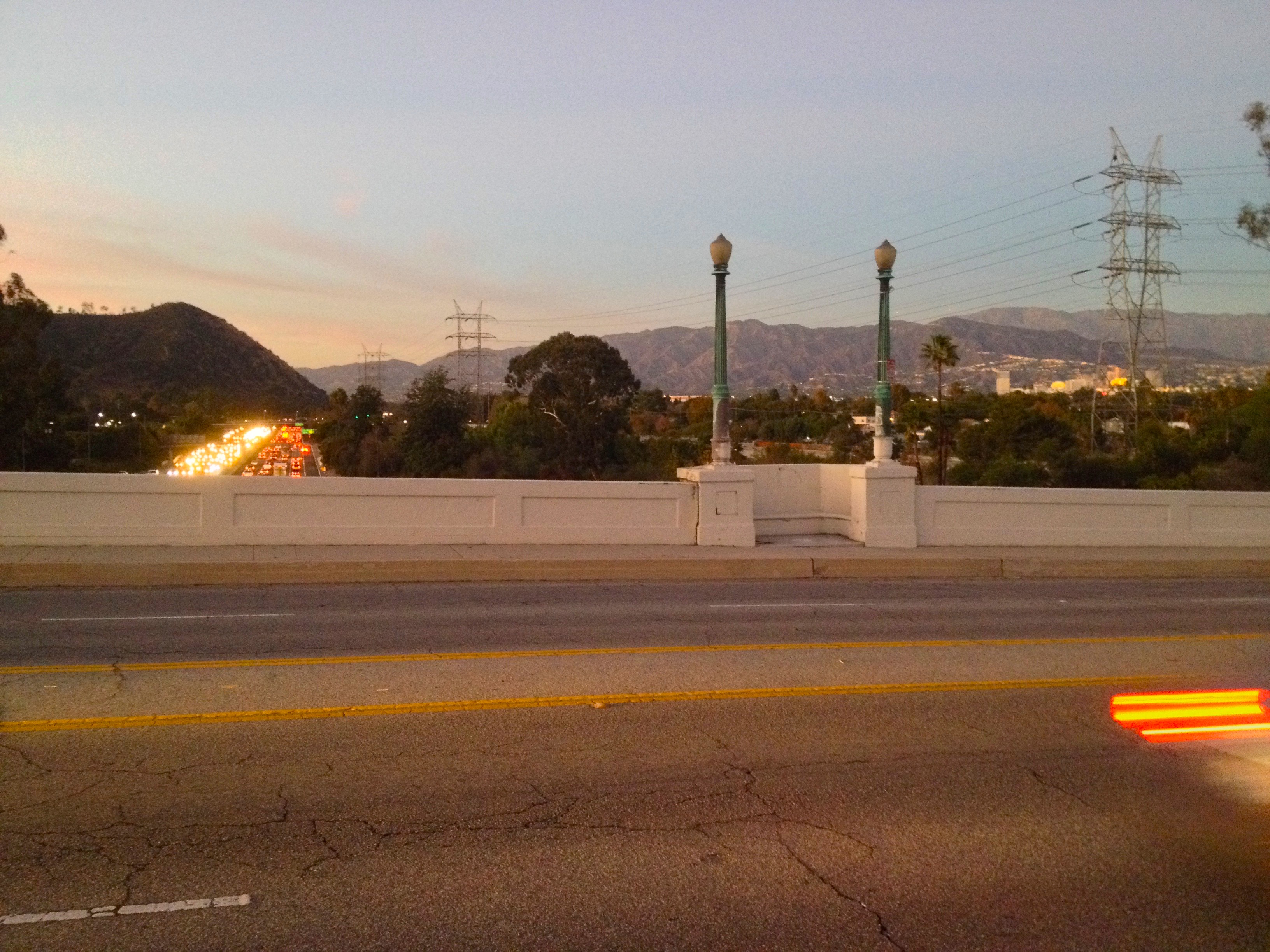
The Victory Memorial Bridge (aka Glendale-Hyperion Bridge) is an iconic bridge which spans the Los Angeles River. Ideally, it would offer a pleasant between Atwater Village in Northeast Los Angeles (NELA) and Los Feliz and Silver Lake in Mideast Los Angeles (MELA). Sadly, in its current state, it feels less like a complex of bridges than a complex of on and off-ramps for the Golden State Freeway. It’s due for a seismic retrofit and reconfiguration but whether it will be restored to a pedestrian and cyclist-friendly state or further sacrificed on the altar of car-dependency remains to be seen.
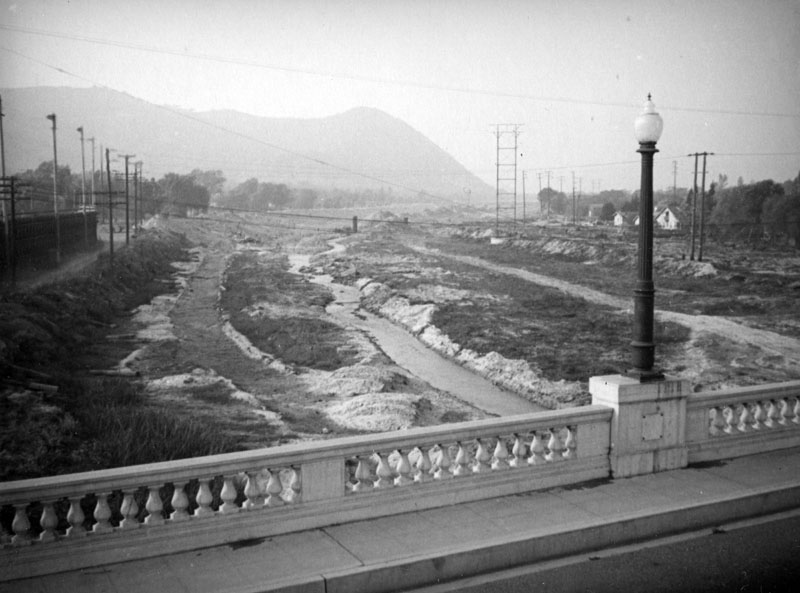
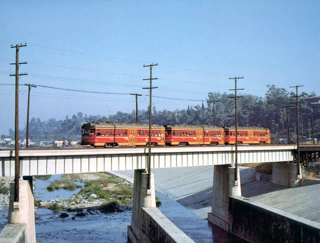
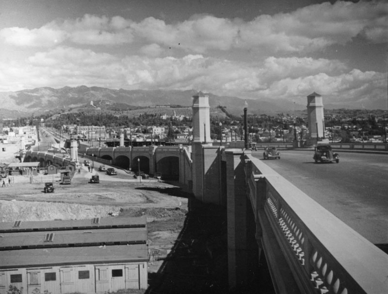
Before the construction of the Glendale-Hyperion Bridge and further downstream, the Fletcher Drive Bridge, Northeast Los Angeles and Glendale were somewhat isolated from Los Angeles proper. In 1904, the Los Angeles Interurban Electric Railway Company began running streetcars from Downtown Los Angeles to Downtown Glendale. In 1908, under new ownership by the Pacific Electric Railway, its route was extended to Downtown Burbank and was re-named the Glendale-Burbank Line. Around 1910, a wooden bridge was built at the present location of the Glendale-Hyperion Bridge.
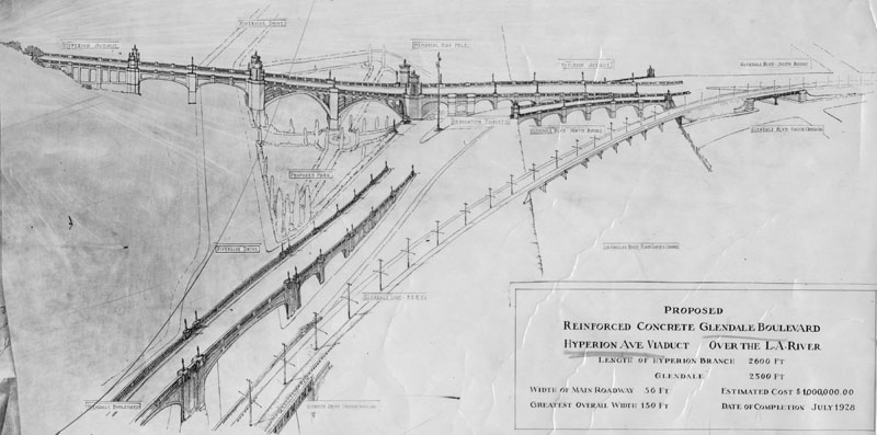
As a result of disastrous floods in 1914, the Los Angeles County Flood Control District was formed in 1915. Taxpayers approved bond issues in 1917 and 1924 to build dams to control flooding although they rejected funding the construction of recommended infrastructure downstream. A flood in 1927 destroyed the wooden bridge and city engineer Merrill Butler was commissioned to design a sturdier replacement.
Butler had previously designed and built the Fletcher Drive Bridge, which opened in 1927. Butler’s new bridge was named Victory Memorial Bridge and was scheduled to open on Decoration Day (later officially renamed Memorial Day) of 1928. Its design was part of the “city beautiful movement,” a belief that design and monumental construction projects could elevate the lives of city-dwellers.
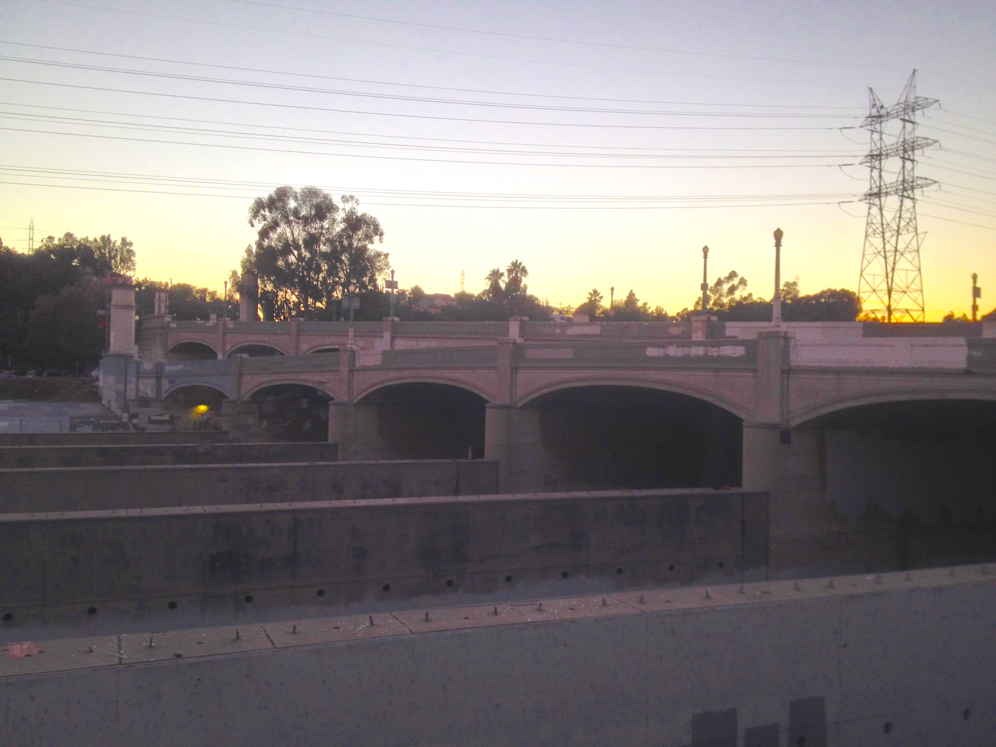
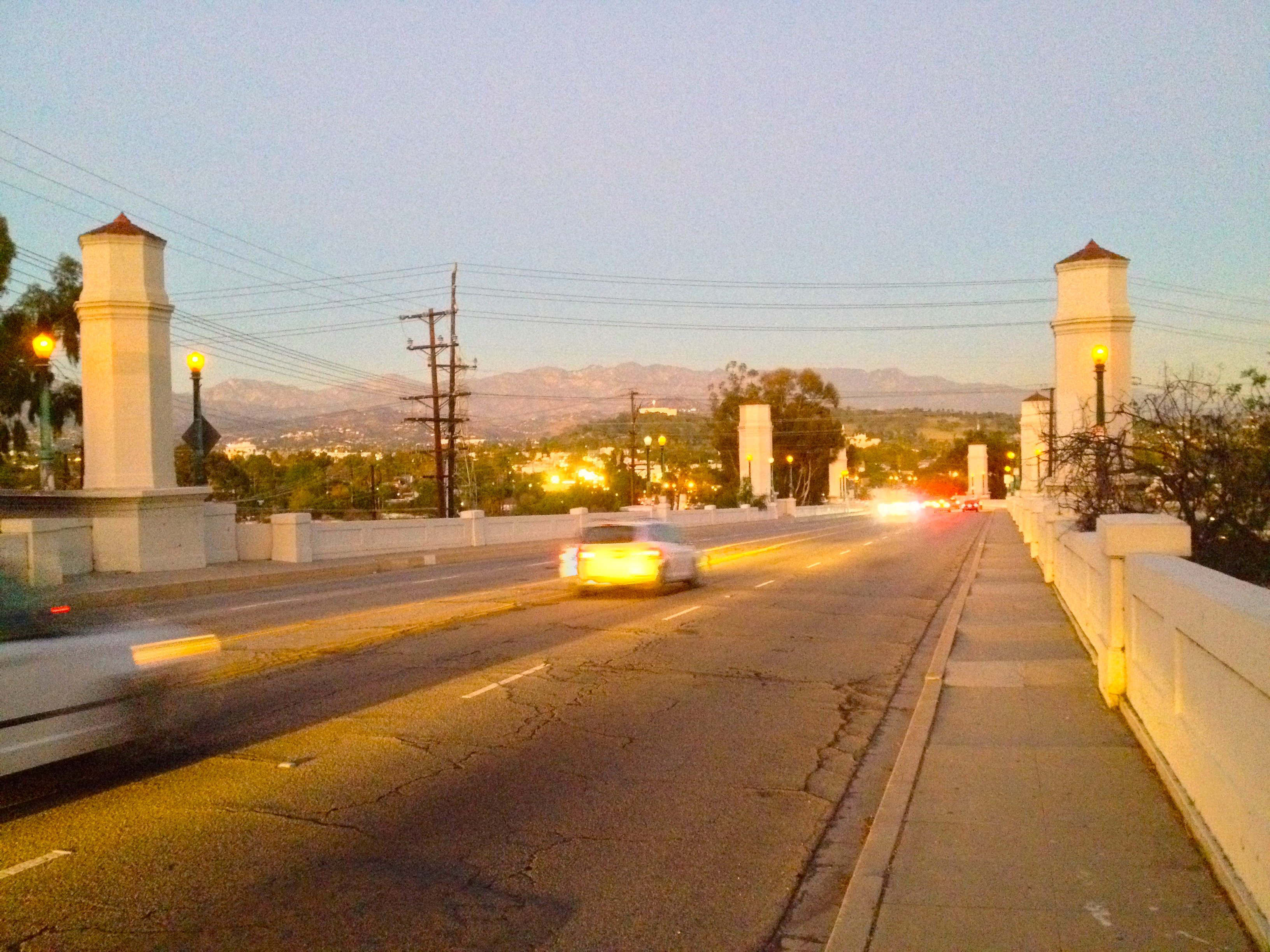
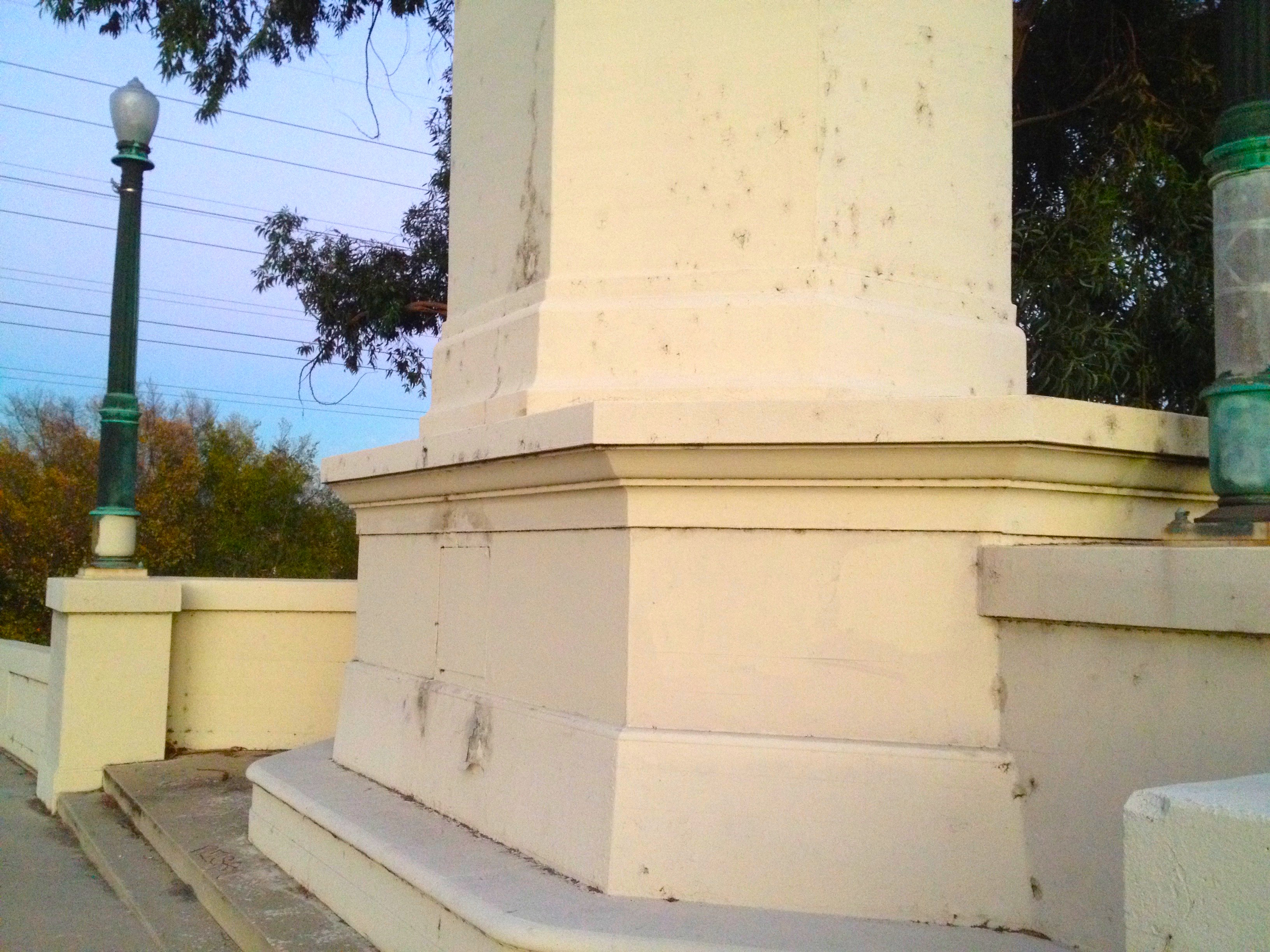
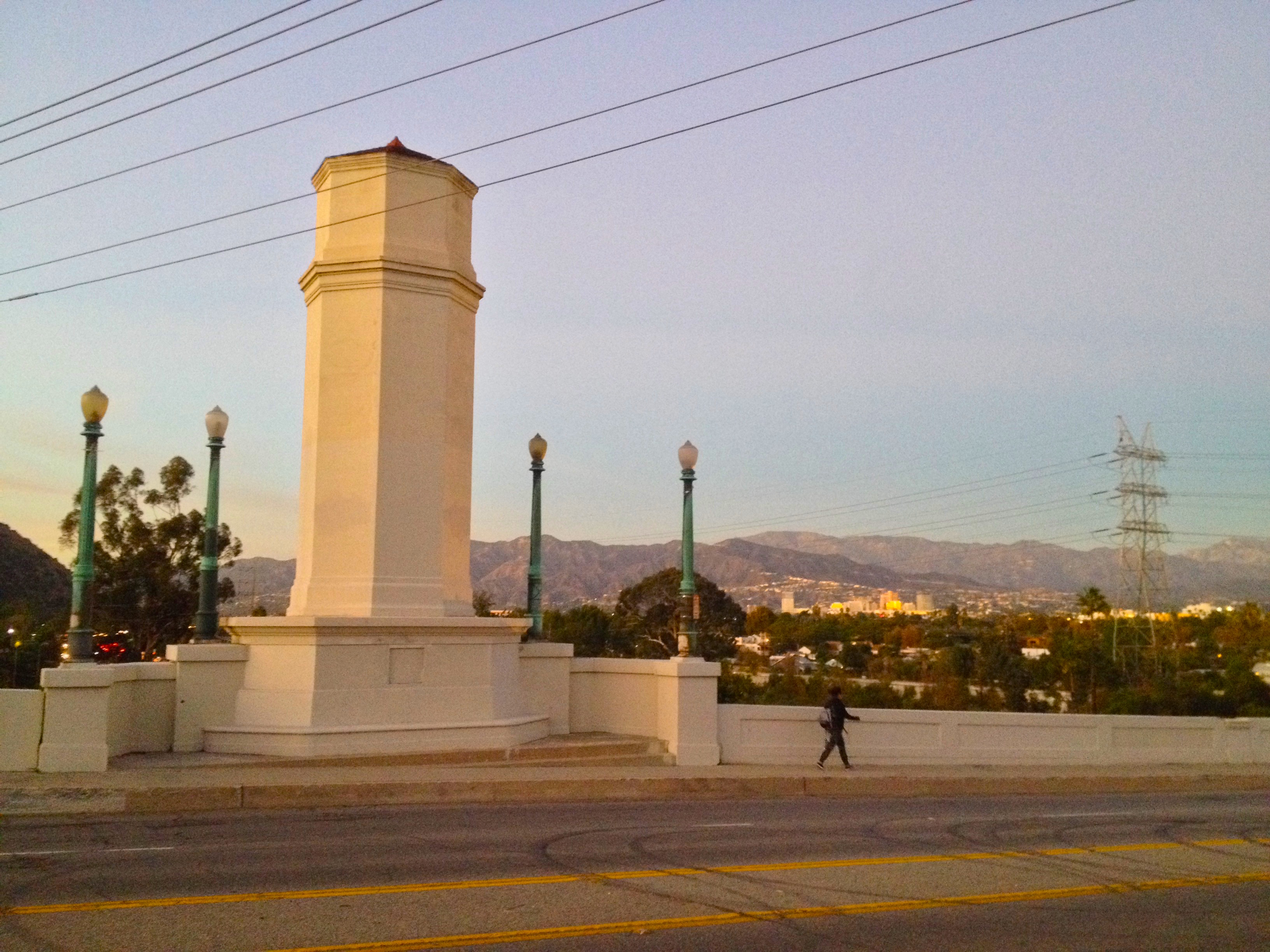
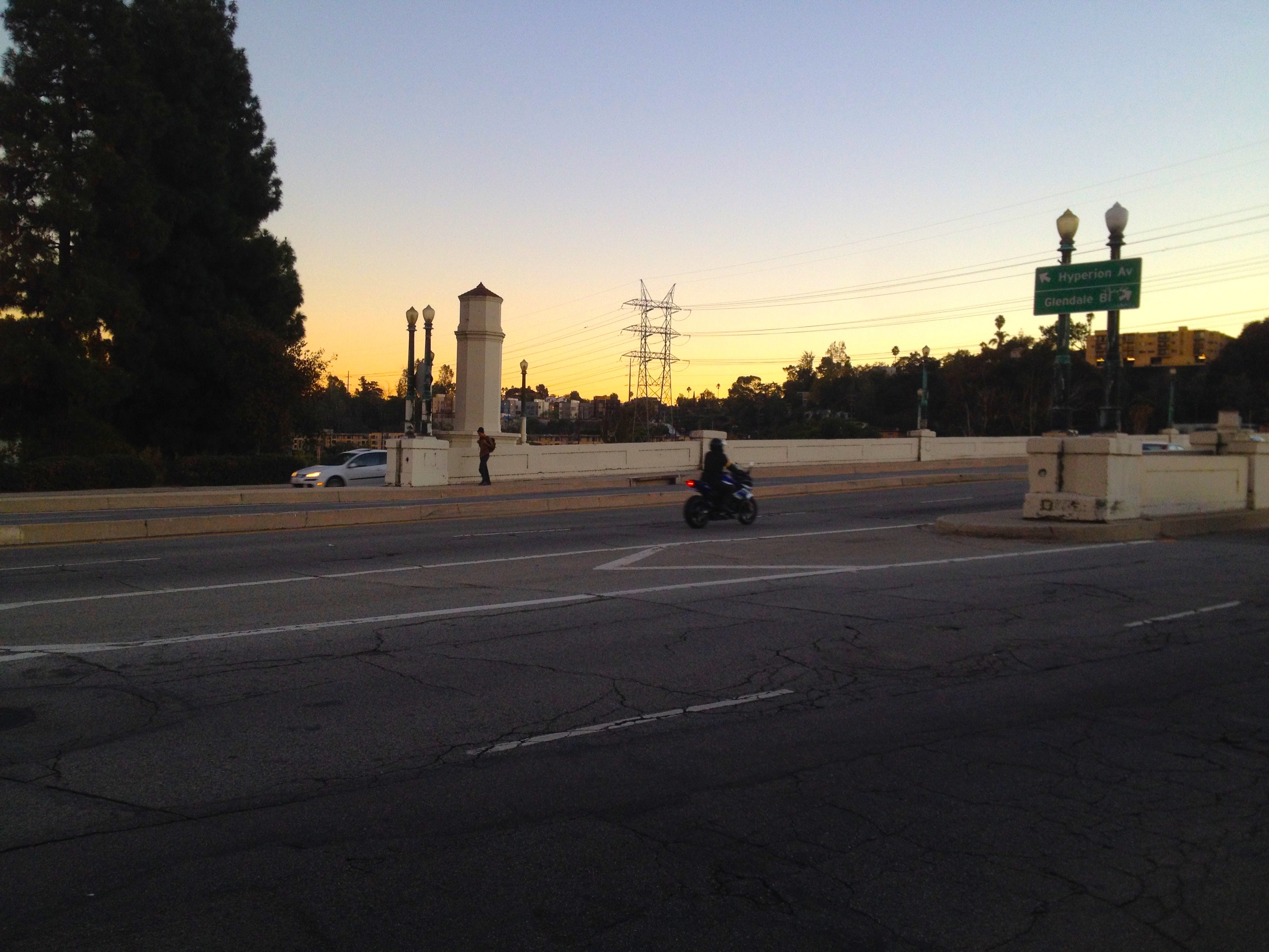
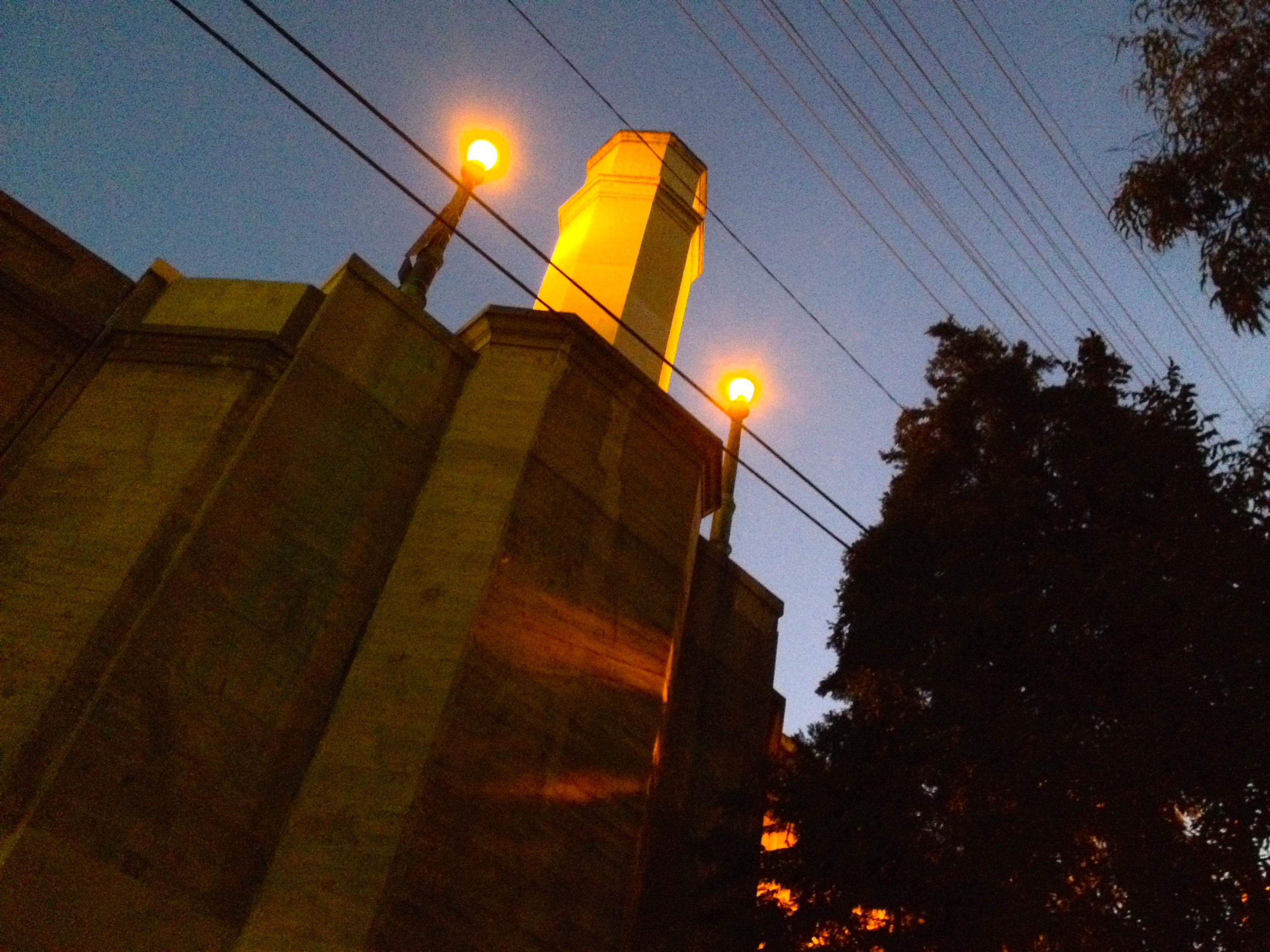
Construction of the Victory-Memorial Bridge used 27,000 cubic meters of concrete and 2700 metric tons of steel. It cost $2,000,000 to build. The bridge has a closed spandrel concrete deck design and has thirteen sweeping arches. Its large hexagonal posts were meant to distinguish it from other bridges. Northbound Pacific Electric red cars traveled along an adjacent crossing before heading up the center of wide Glendale Boulevard.
Construction of the bridge began on 27 March 1927. Decoration Day 1928 passed and the bridge was still under construction. Already people were referring to it as the Glendale-Hyperion Bridge. It was finally completed in February 1929, almost a year behind schedule. It was officially dedicated on 30 May 1930.
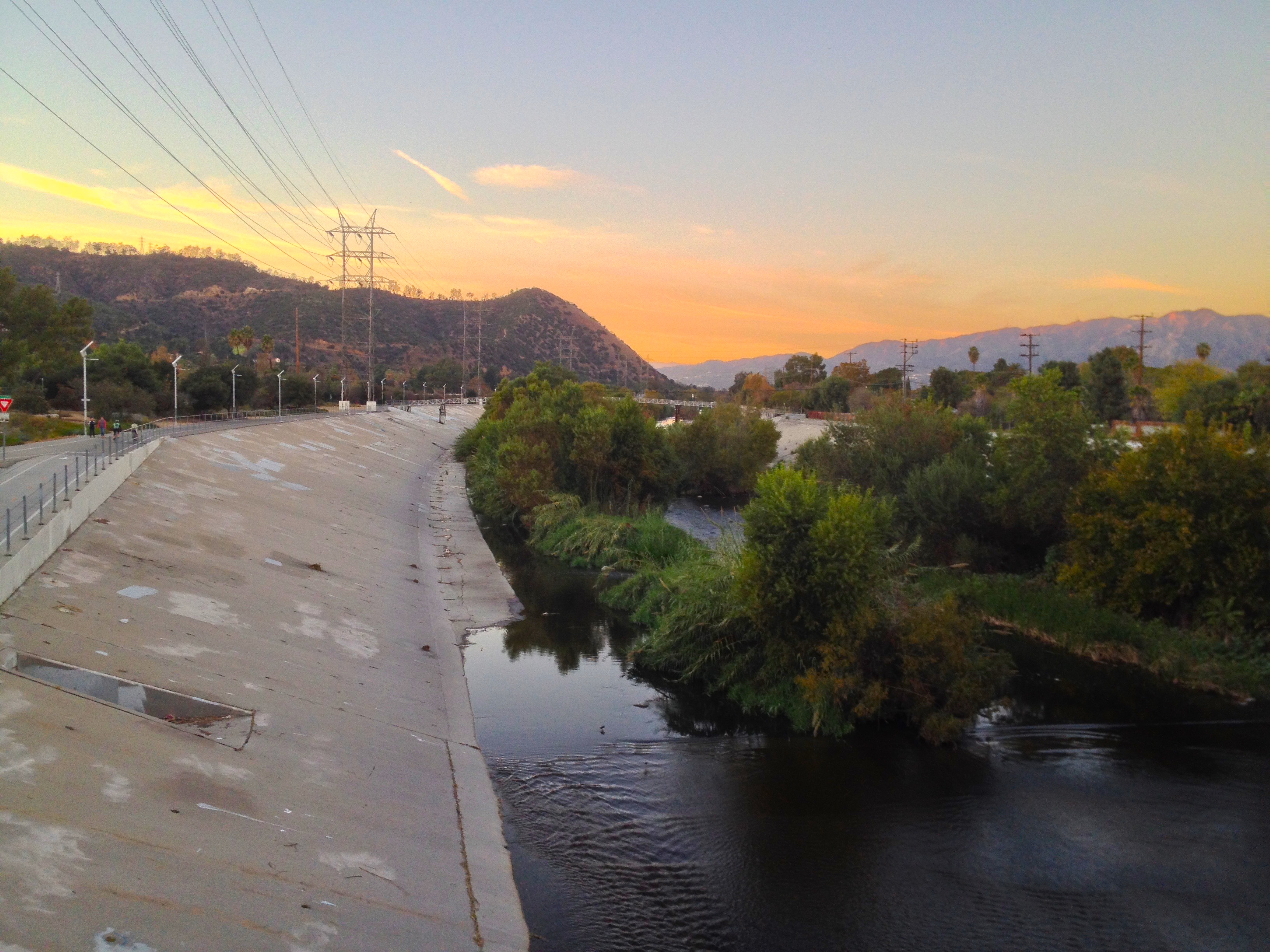
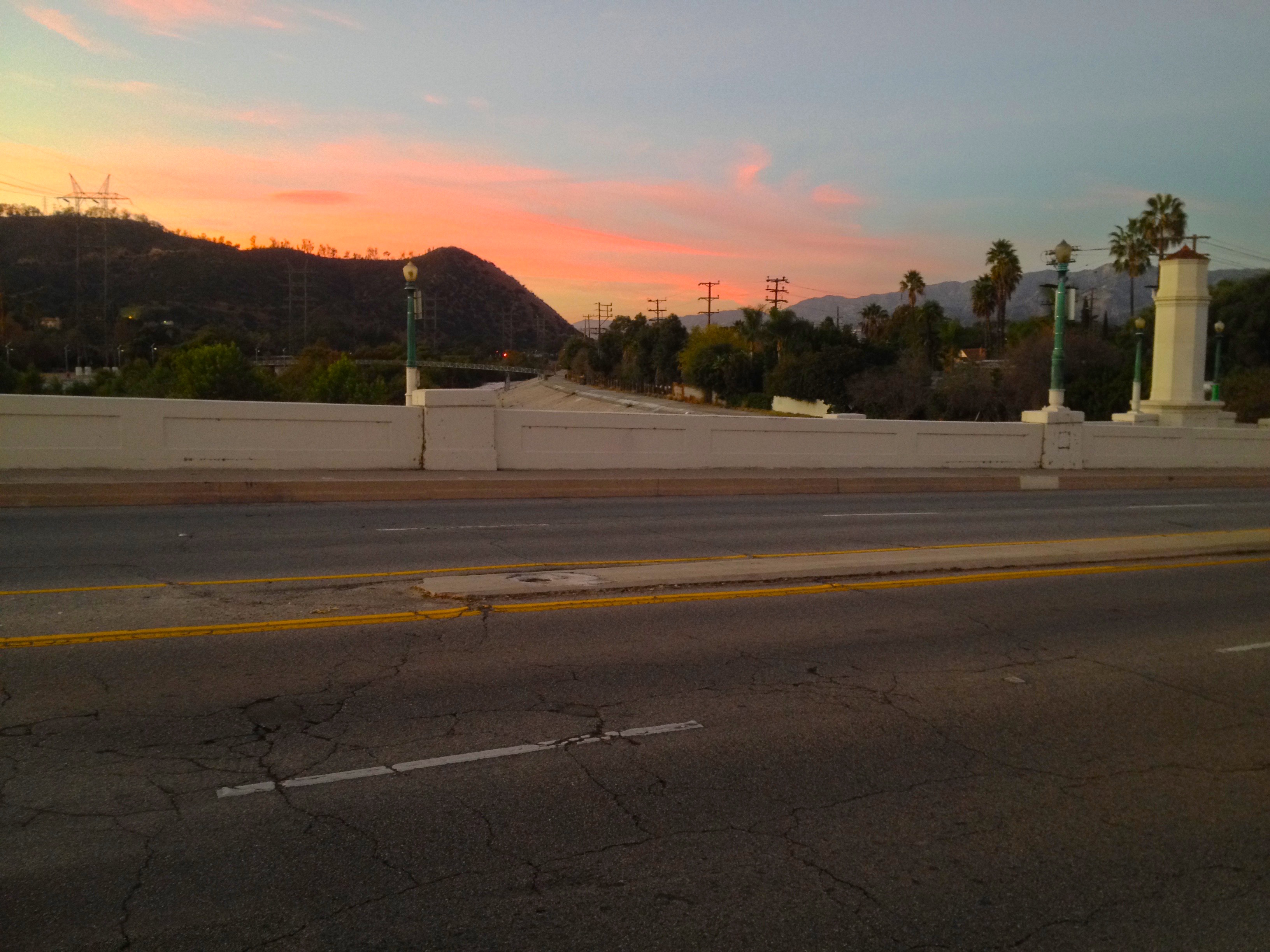
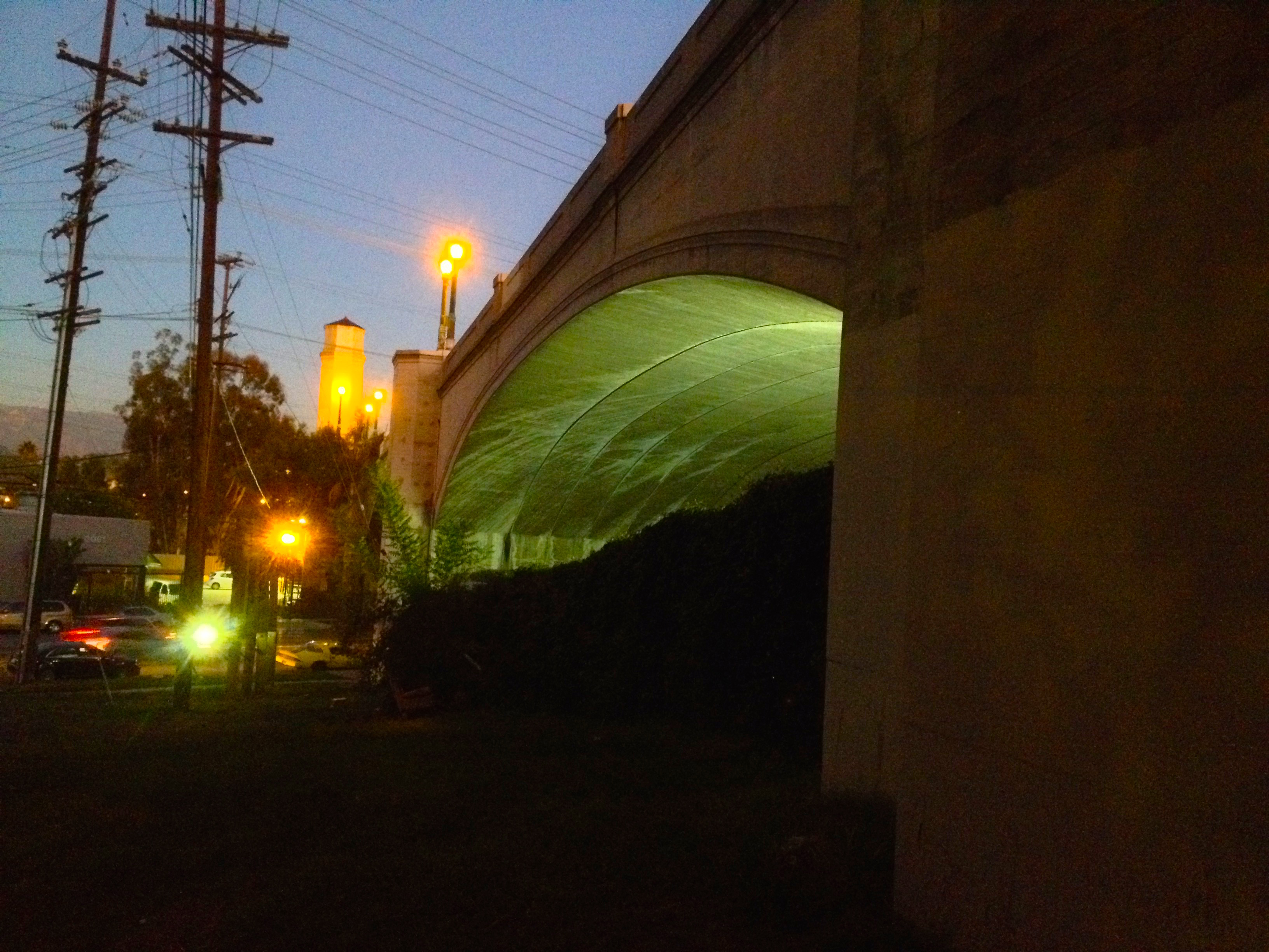
More disastrous floods in the 1930s prompted a request for federal assistance and as a result, the Army Corps of Engineers channelized most of the Los Angeles River. Due to upwelling ground-water in the Glendale Narrows, however, the bottom of the river under the Glendale-Hyperion Bridge remains unpaved and as a result, retains a comparatively wild character. Unlike the fully concretized sections, the soft-bottom portion hosts several species of wildlife, including American coots, American white pelicans, black phoebes, black-necked stilts, cinnamon teals, double-crested cormorants, great blue herons, great egrets, greater yellowlegs, killdeers, mallards, northern shovelers, red-winged blackbirds, rock pigeons, snowy egrets, spotted sandpipers, and the non-native Muscovy duck. It’s also a common site to see a local nicknamed the “Atwater Bird Man” tossing out food for them.
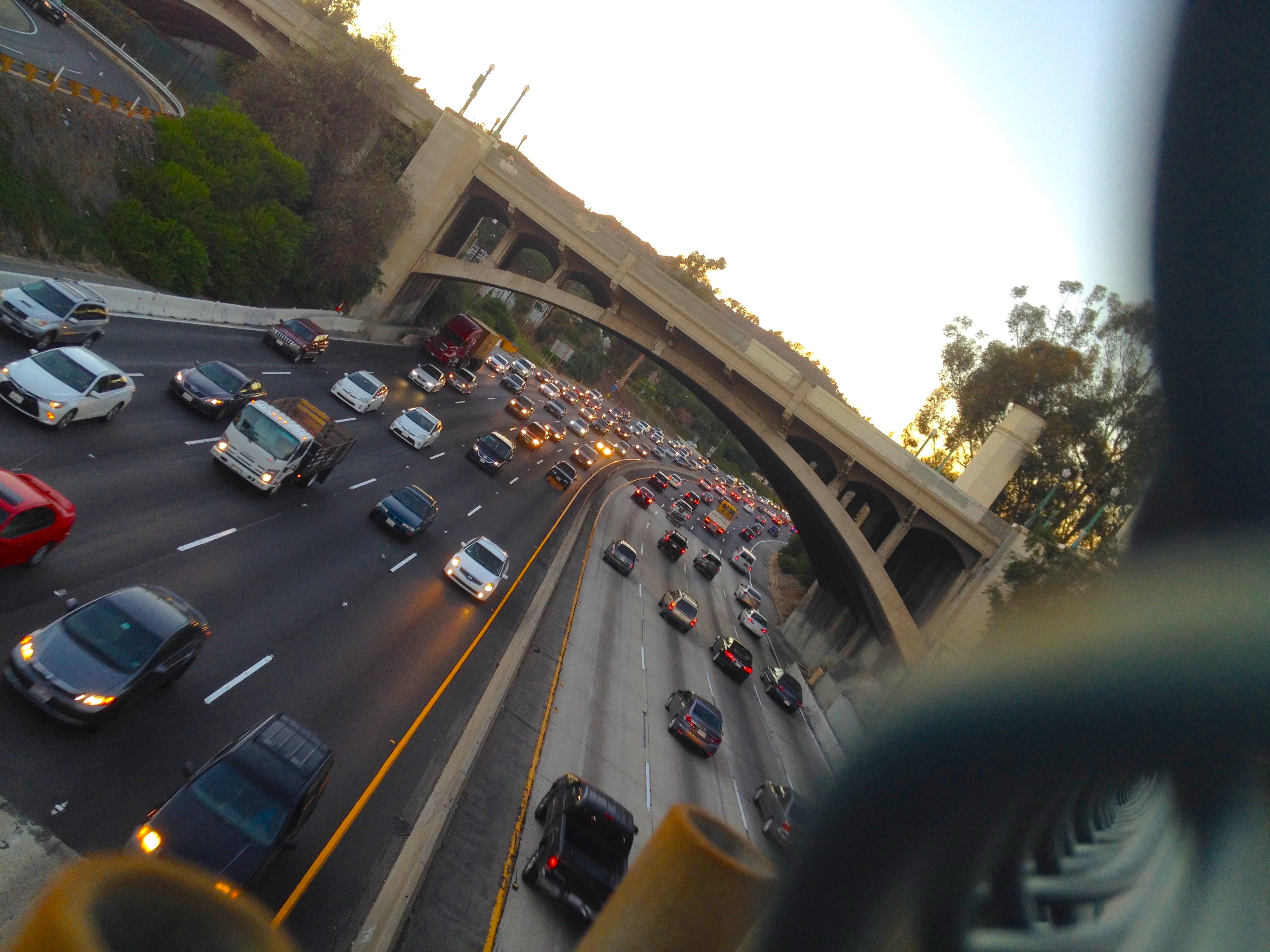
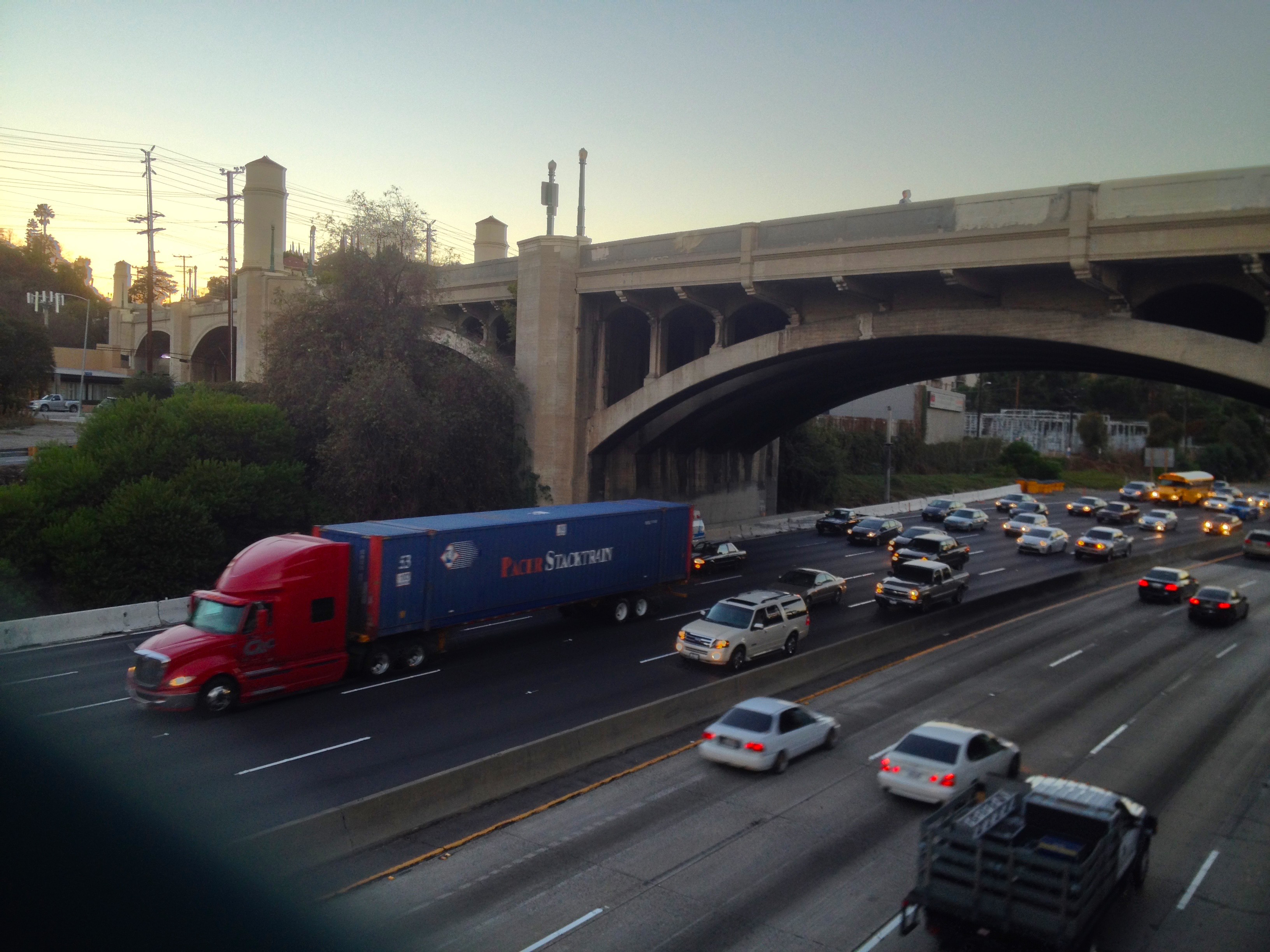
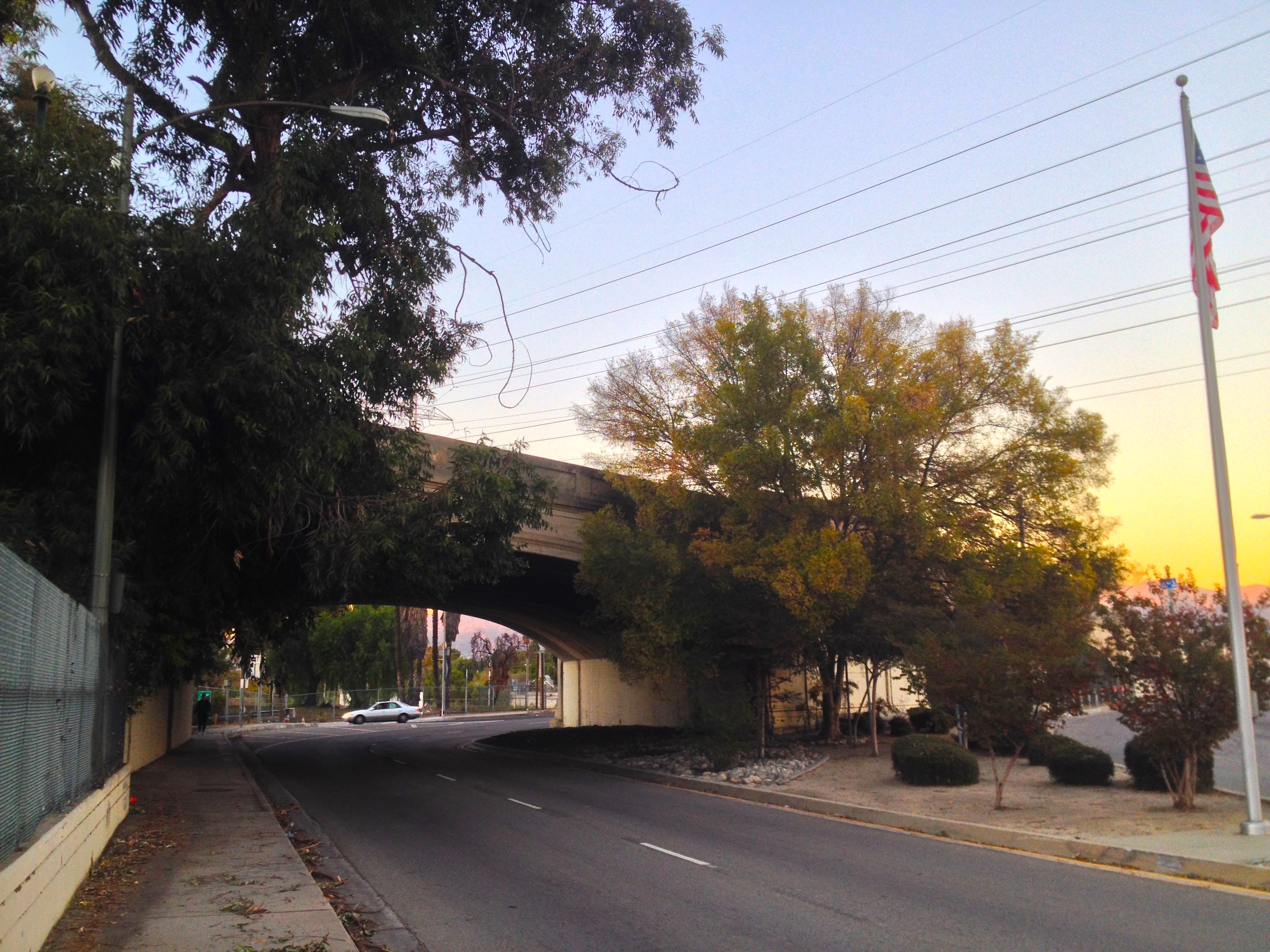
Even more destructive to the aesthetics and character of the area than the channelization of the river was the construction of the Golden State Freeway, which now runs along the river and passes under the bridge. Construction of the freeway was first proposed by the California Highway Commission in 1953 and the Interstate Highway System was authorized in 1956. While a nation-wide interstate highway system was a brilliant infrastructure improvement, construction of interstate freeways within cities was far more destructive than any historic floods had been.
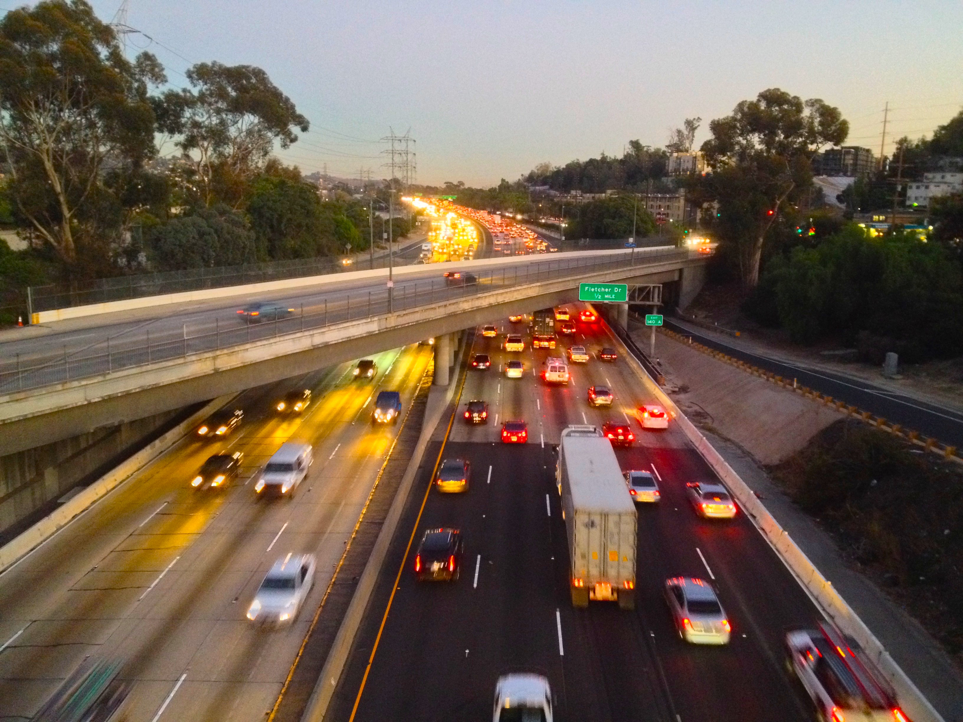
Understandably, the planned construction the Golden State Freeway was met with widespread protests but proponents of freeways won out and huge sections of working class Boyle Heights, Frogtown, and Hollenbeck Heights were irrevocably scarred. Thousands of residents were displaced as homes and businesses were destroyed and air quality would never be the same. At first the freeway was six lanes wide, enough to sever Griffith Park from the river. Since then it’s expanded, worsening instead of fixing traffic, and adding pollution to its surroundings.
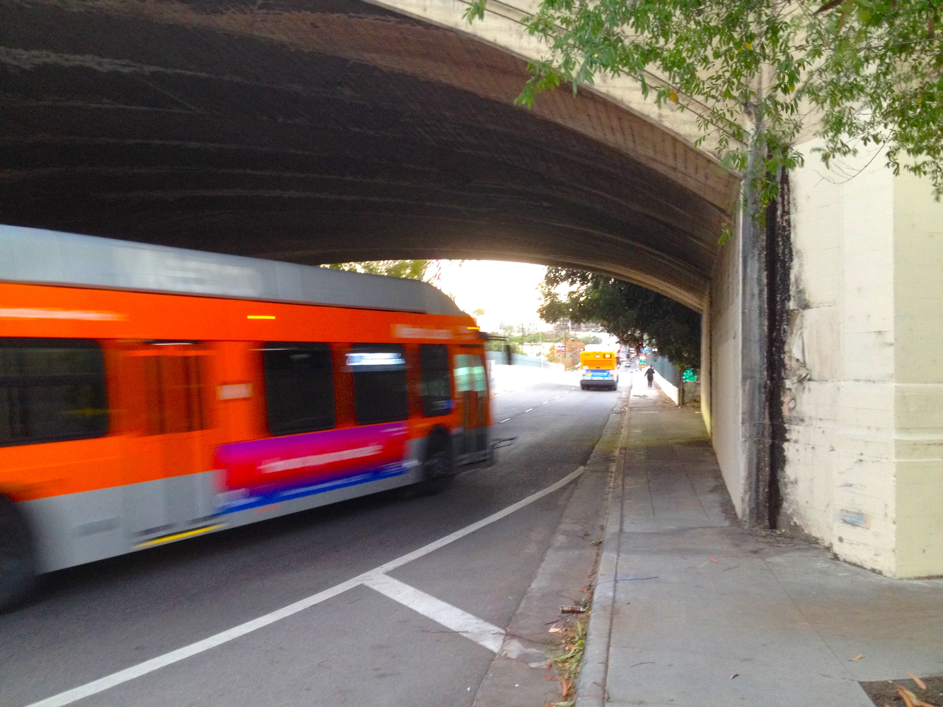
The Glendale-Burbank Line was decommissioned in 1955 and the last red cars crossed the bridge. The Los Angeles Metropolitan Transit Authority, formed in 1951, replaced it and other rail lines with buses. In the 1988 film, Who Framed Roger Rabbit (based largely on the General Motors streetcar conspiracy), the final scene takes place on the Glendale-Hyperion Bridge. Today the red car bridge supports remain but the bridge itself is traversed by Metro’s 92 and 201 lines. The park through which the train formerly passed is known as Red Car Park.
The phenomenon known as “latent demand” or “induced demand” was first illustrated in the 1960s. In essence, it illustrates that adding traffic lanes, rather than alleviating traffic, actually worsens it by attracting more traffic. Caltrans, the agency responsible for these costly “improvements,” even admits this (“California’s DOT Admits That More Roads Mean More Traffic”).
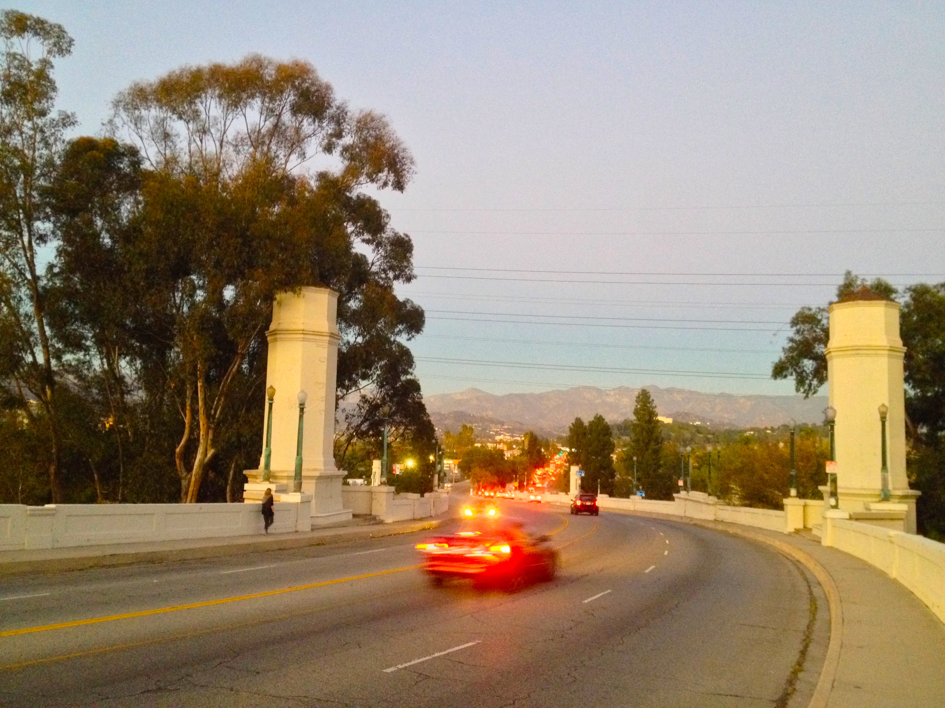
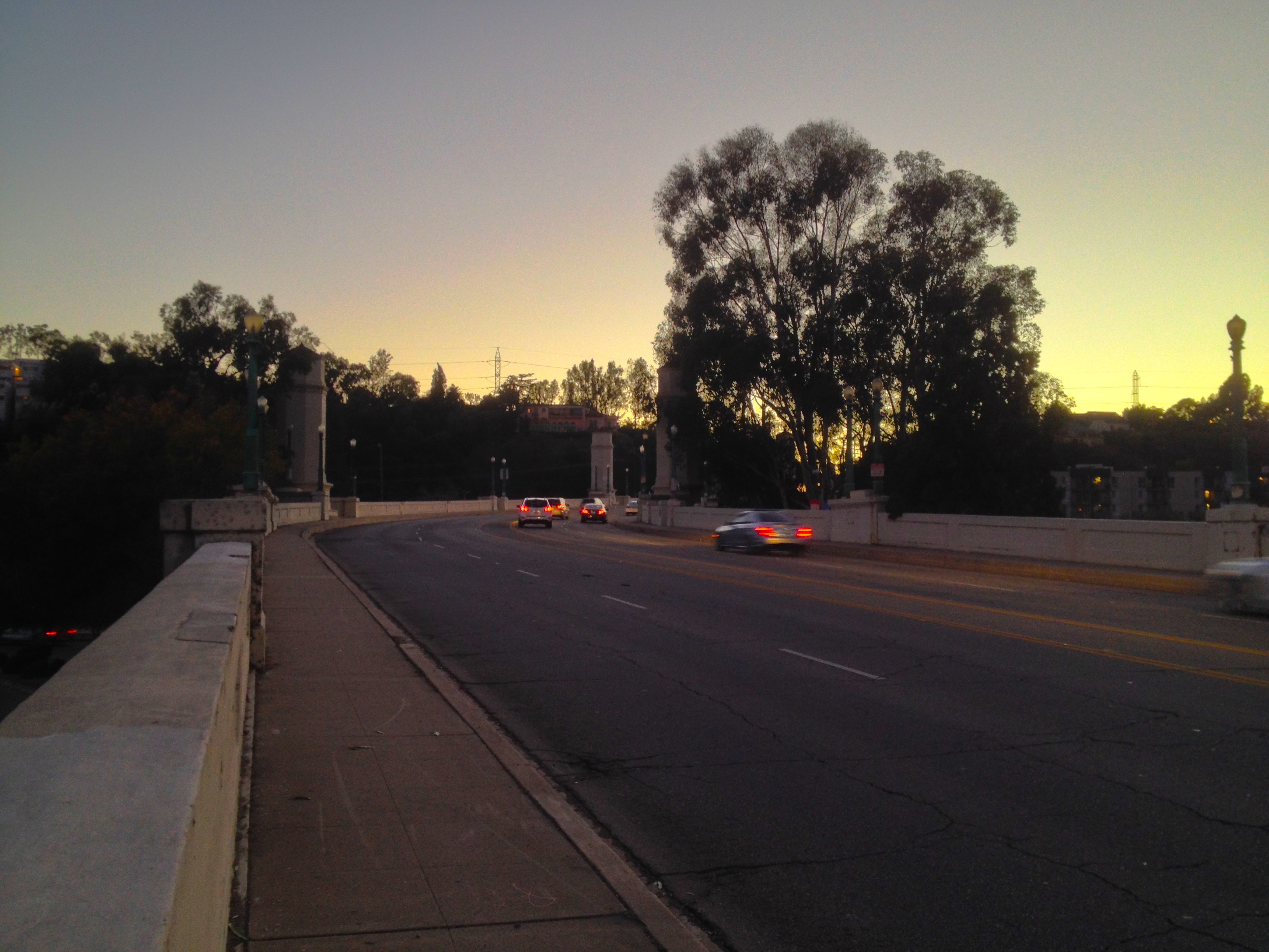
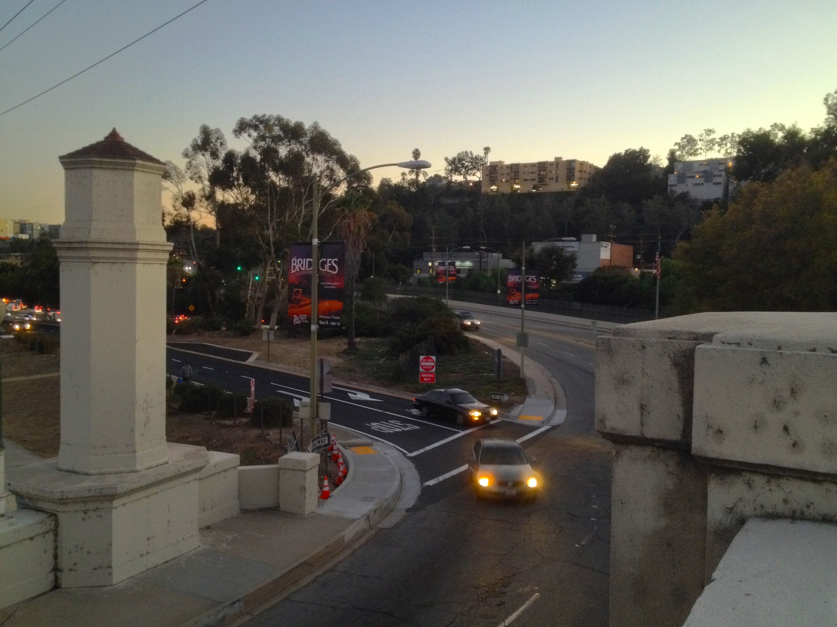
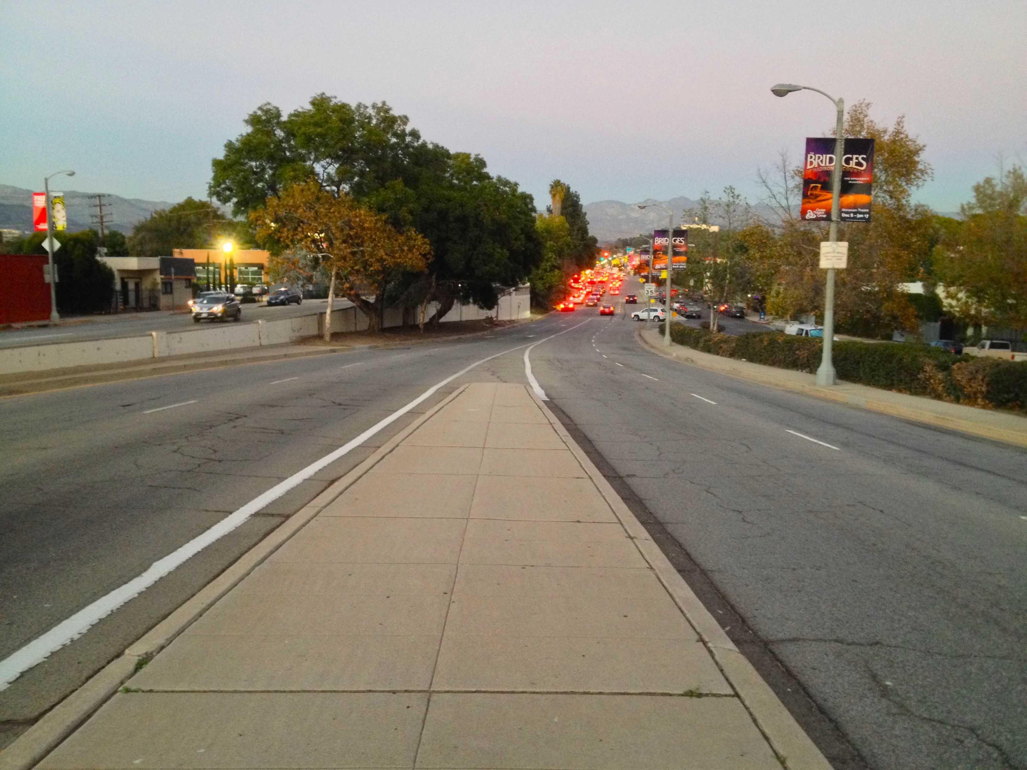
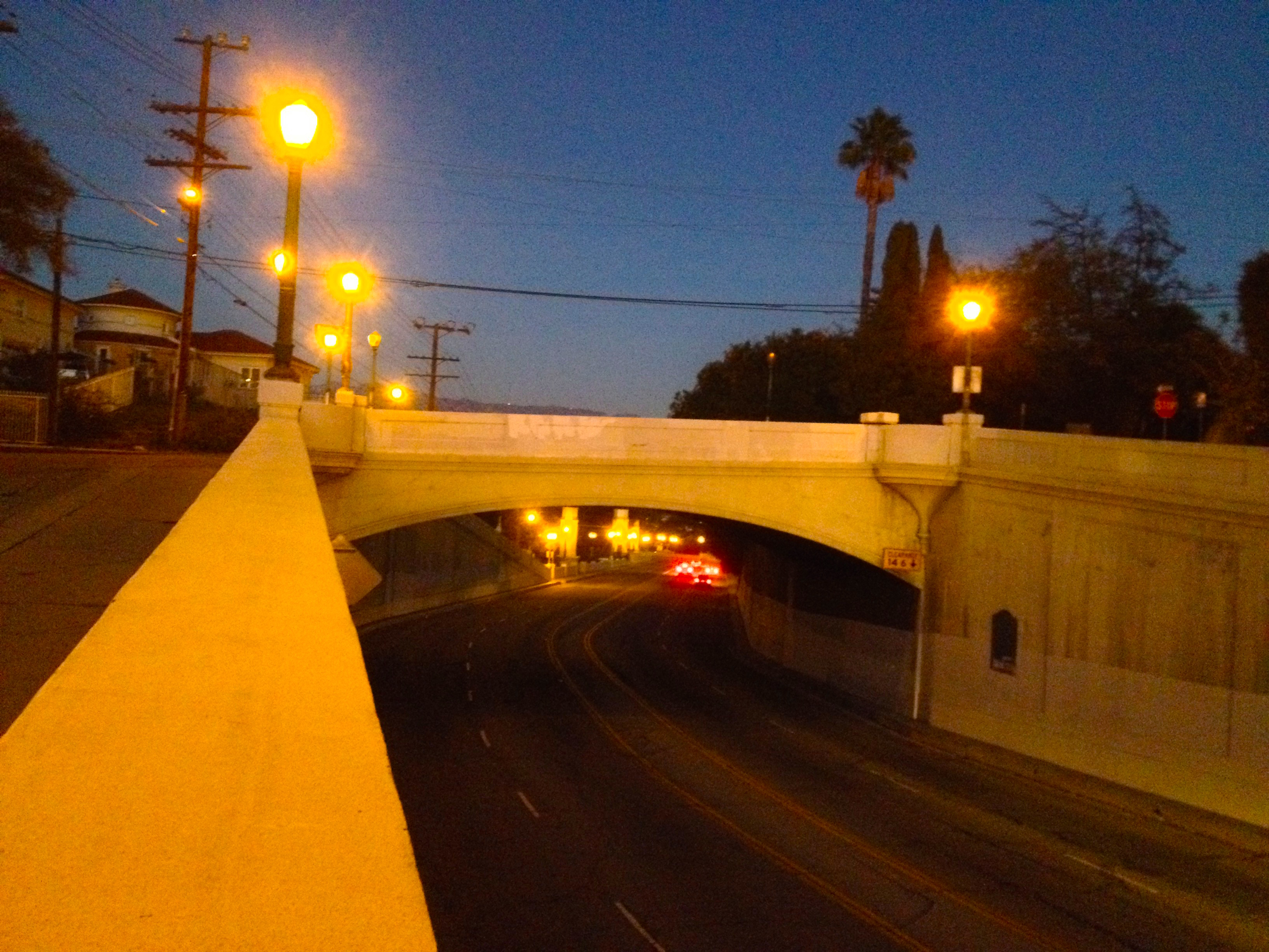
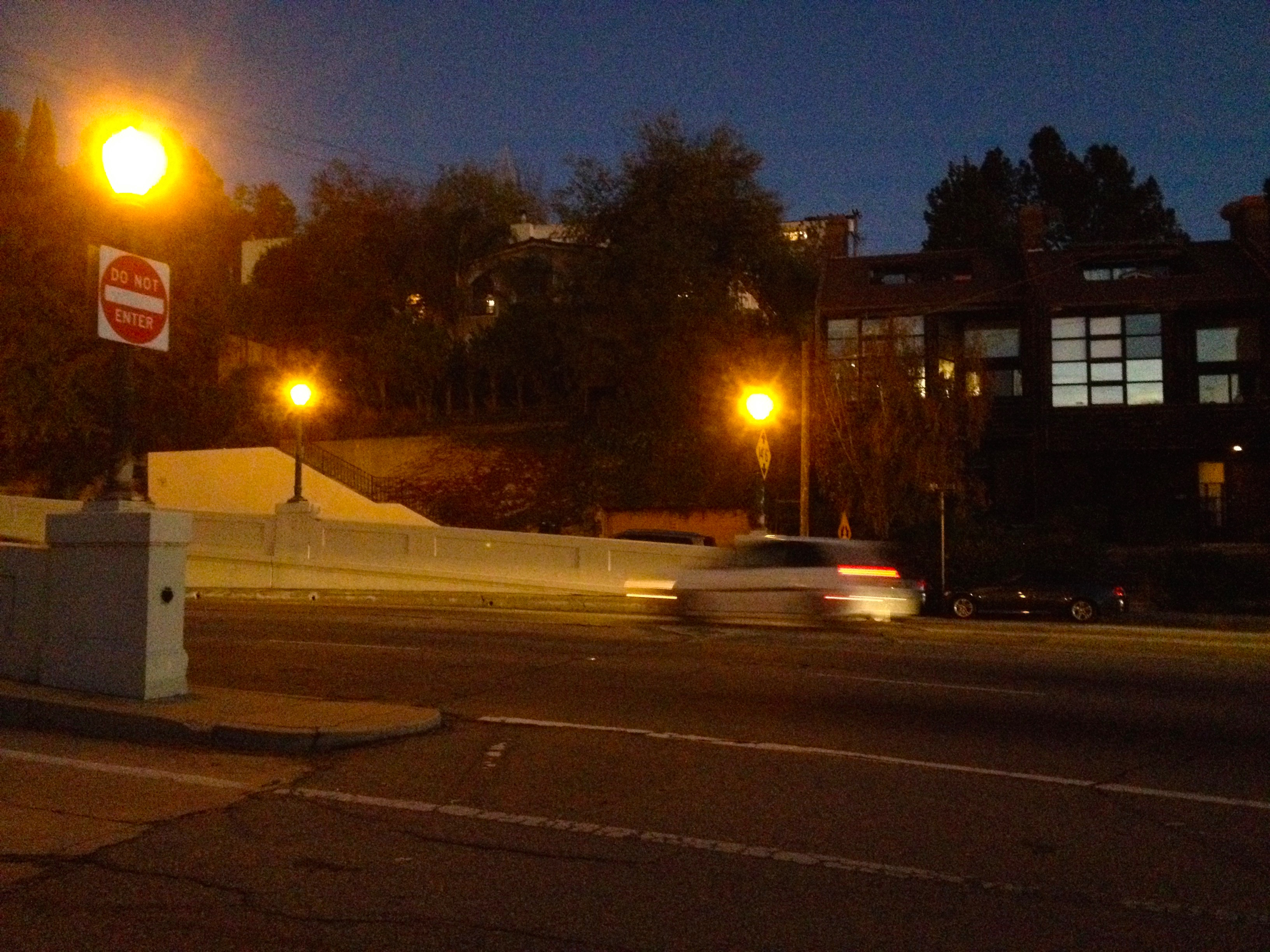
Atop the bridge, even during rush hour (when I visited the bridge and took these pictures), cars regularly fly over the bridge at 50 mph (80 kmh) (despite signs warning them not to exceed 30). There are benches next to the hexagonal posts and at other areas but I’ve never seen anyone rest at them or stop to enjoy the view. Calming traffic to a reasonable speed might make doing so more enticing.
A large portion of the eastbound automobile traffic barely enter Atwater Village before making a U-turn and speeding month the 5 (Golden State Freeway). In the island where everyone does a 180, homeless people have carved wooden busts and placed a “coin-toss” bucket for bored motorists sitting at the light.
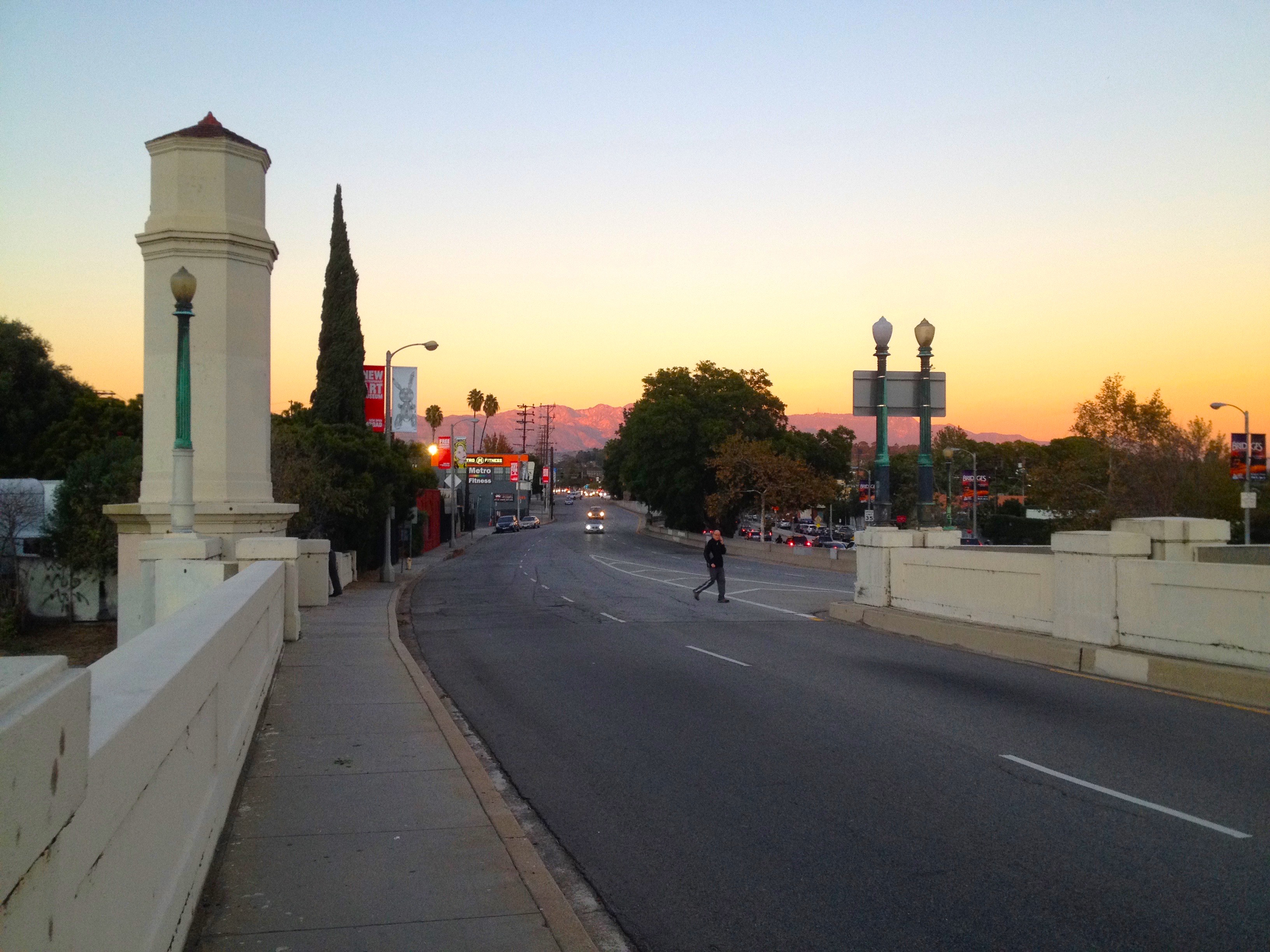
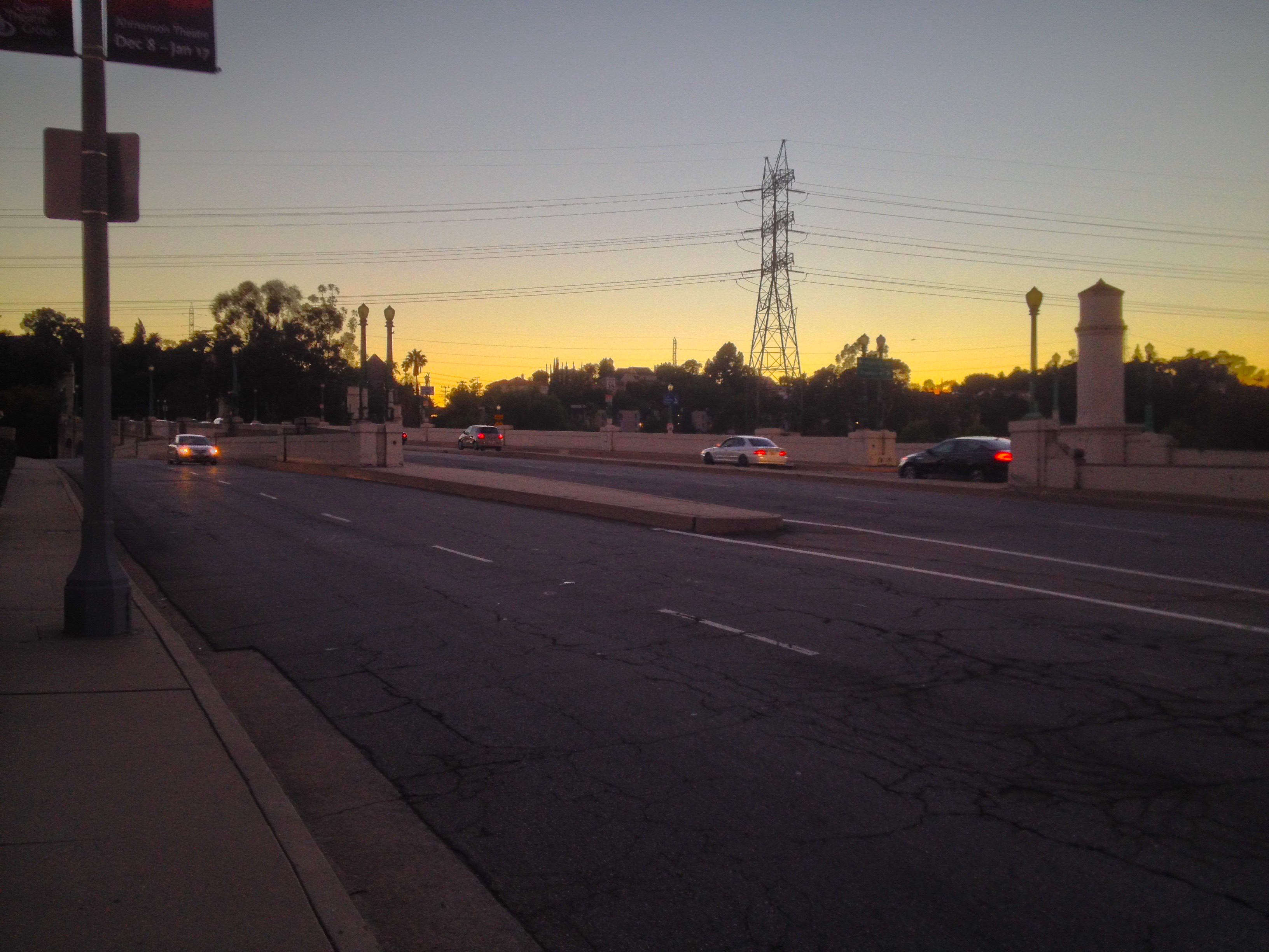
Sidewalks seem to have been shaved away to sacrifice more space for cars and the first time I crossed the bridge on foot was the third most terrifying experience I’ve had in Los Angeles. When a houseguest visiting from Scotland called me to say that he feared he’d mistakenly wandered onto a bridge which pedestrians weren’t meant to be on and needed my help, I knew exactly where he was.
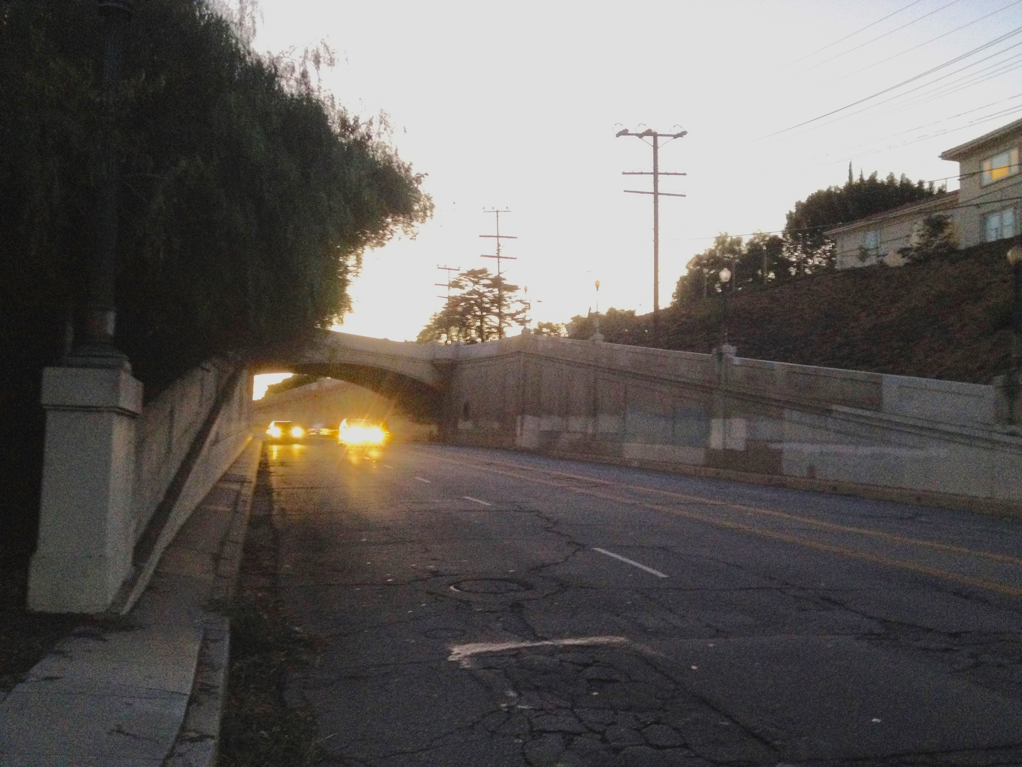
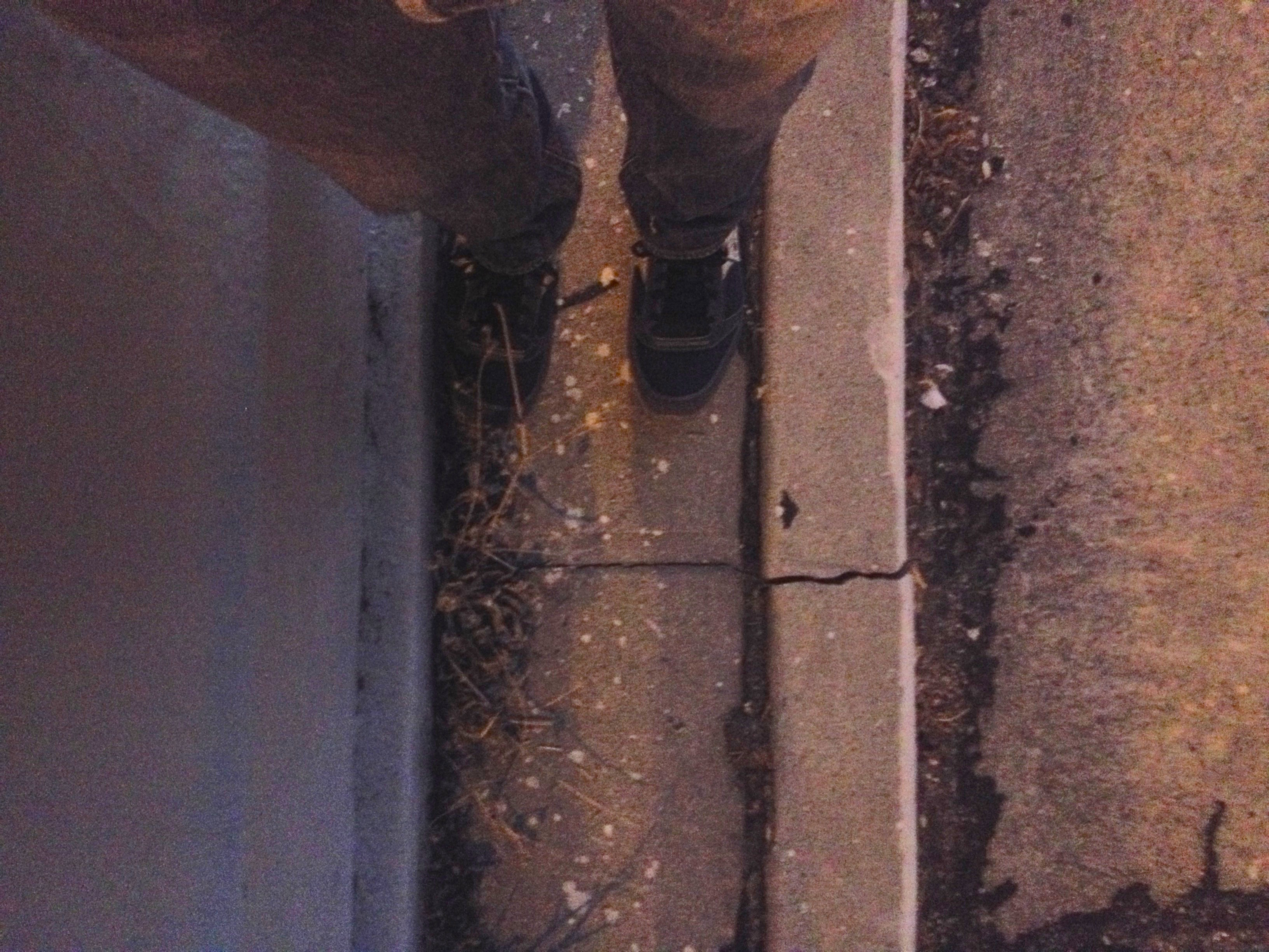
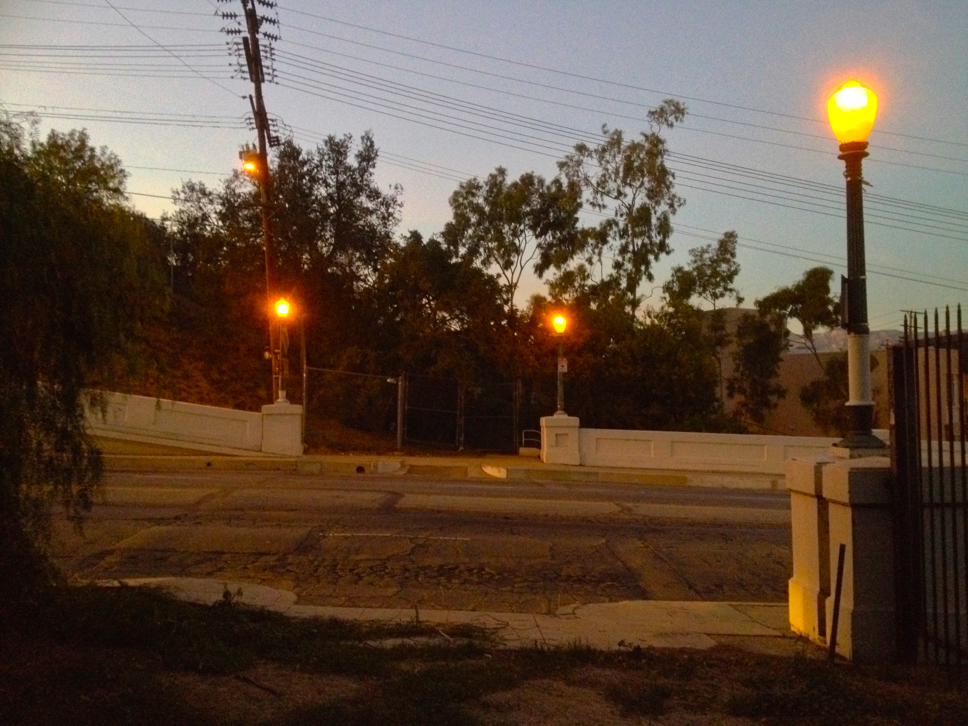
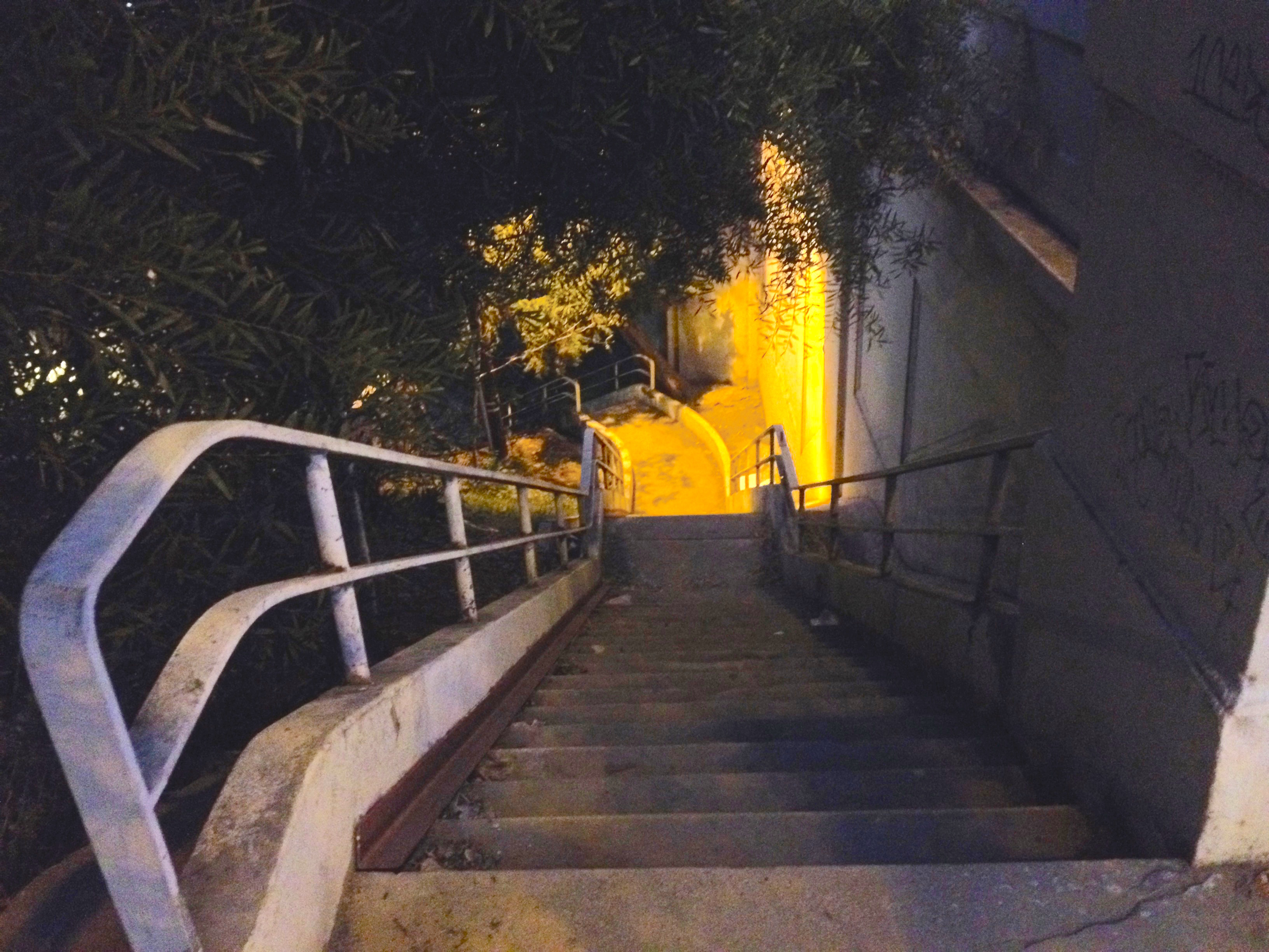
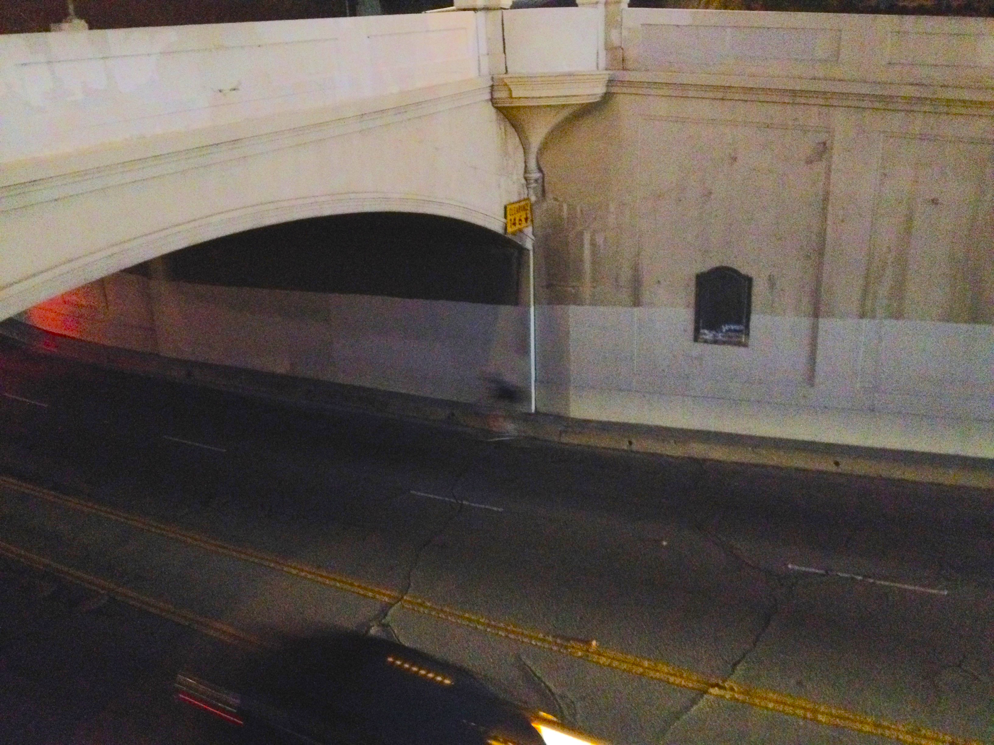
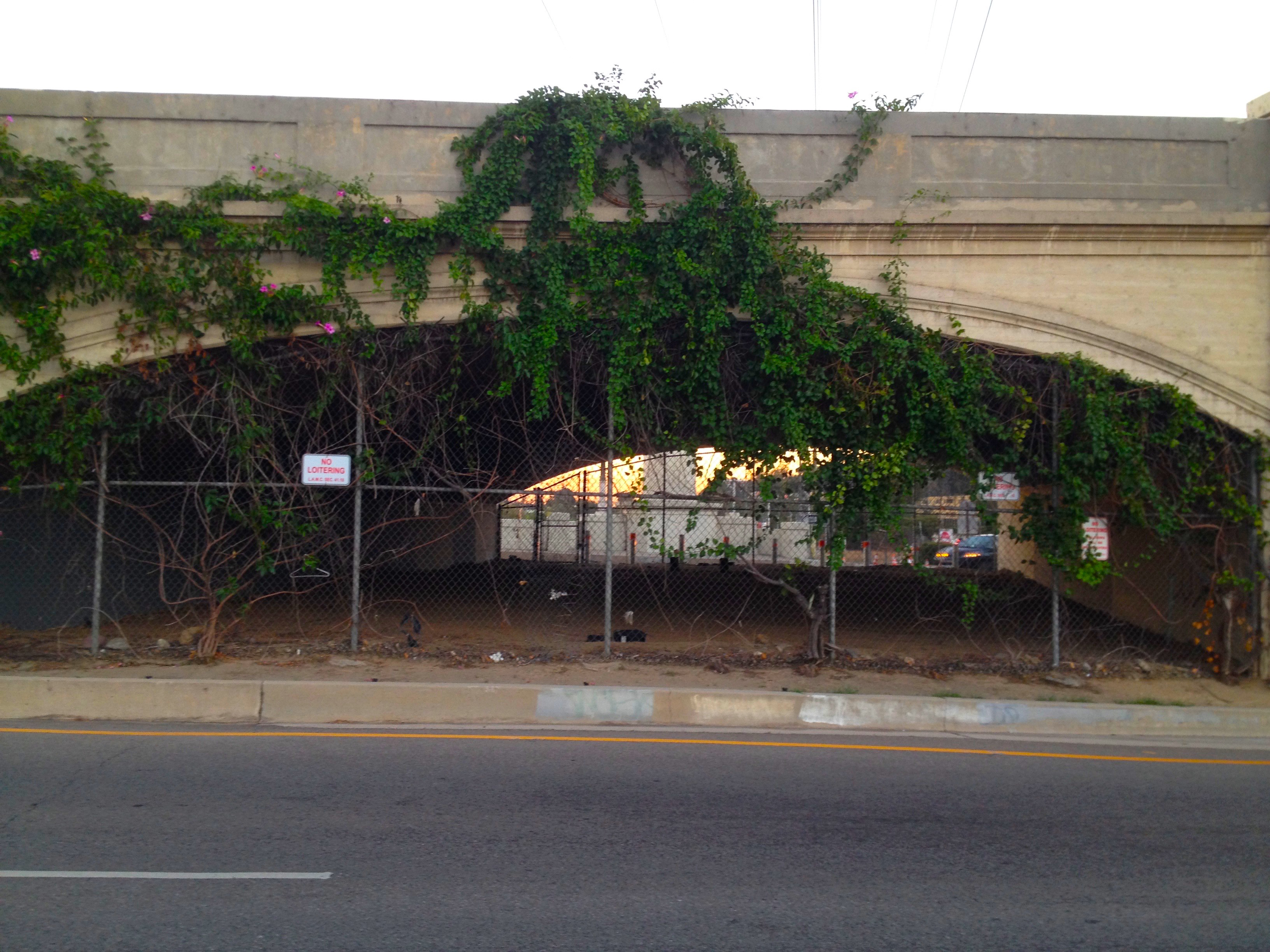
What sidewalks remain dead-end in the middle of speeding traffic, without the benefit of crosswalks. There is at least one crosswalk, although it is unmarked and its existence is only evident from the dips in the curb. To cross it I had to wait quite a while for a break in speeding traffic and then run and pray that I didn’t stumble. For anyone unable to run the wait could conceivably go on forever. On the other side is a dark staircase which reeks of urine.
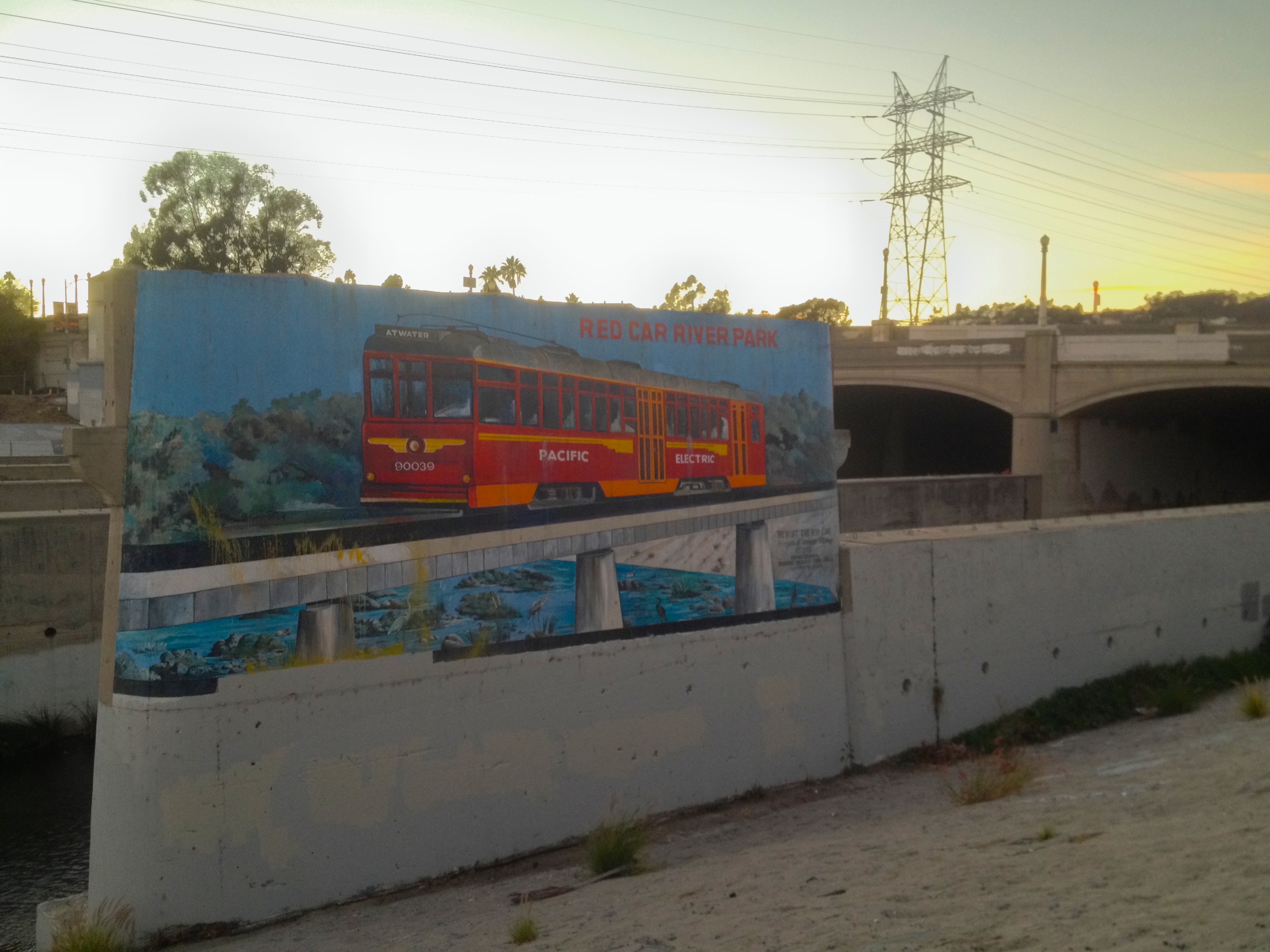
Although harrowing to cross, it’s still a fundamentally beautiful piece of engineering and architecture. On 20 October 1976, it was designated Los Angeles Historic-Cultural Monuments No. 164. Large parts of the bridge are covered with both murals and graffiti. The biggest mural is Revisit the Red Car, painted by Rafael Escamilla in 2004 with assistance from Roxanne Salazar and Tom Hinds.
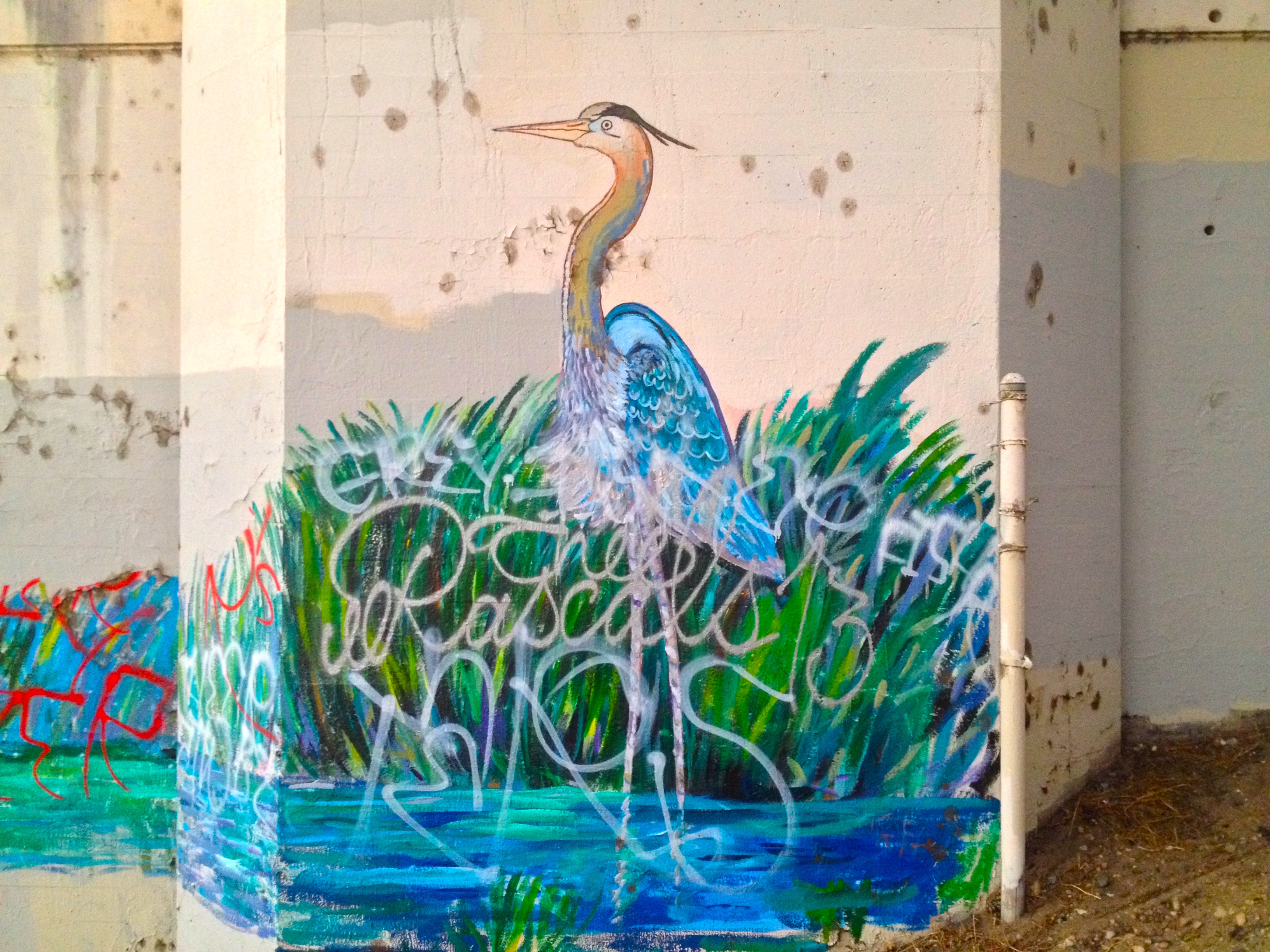
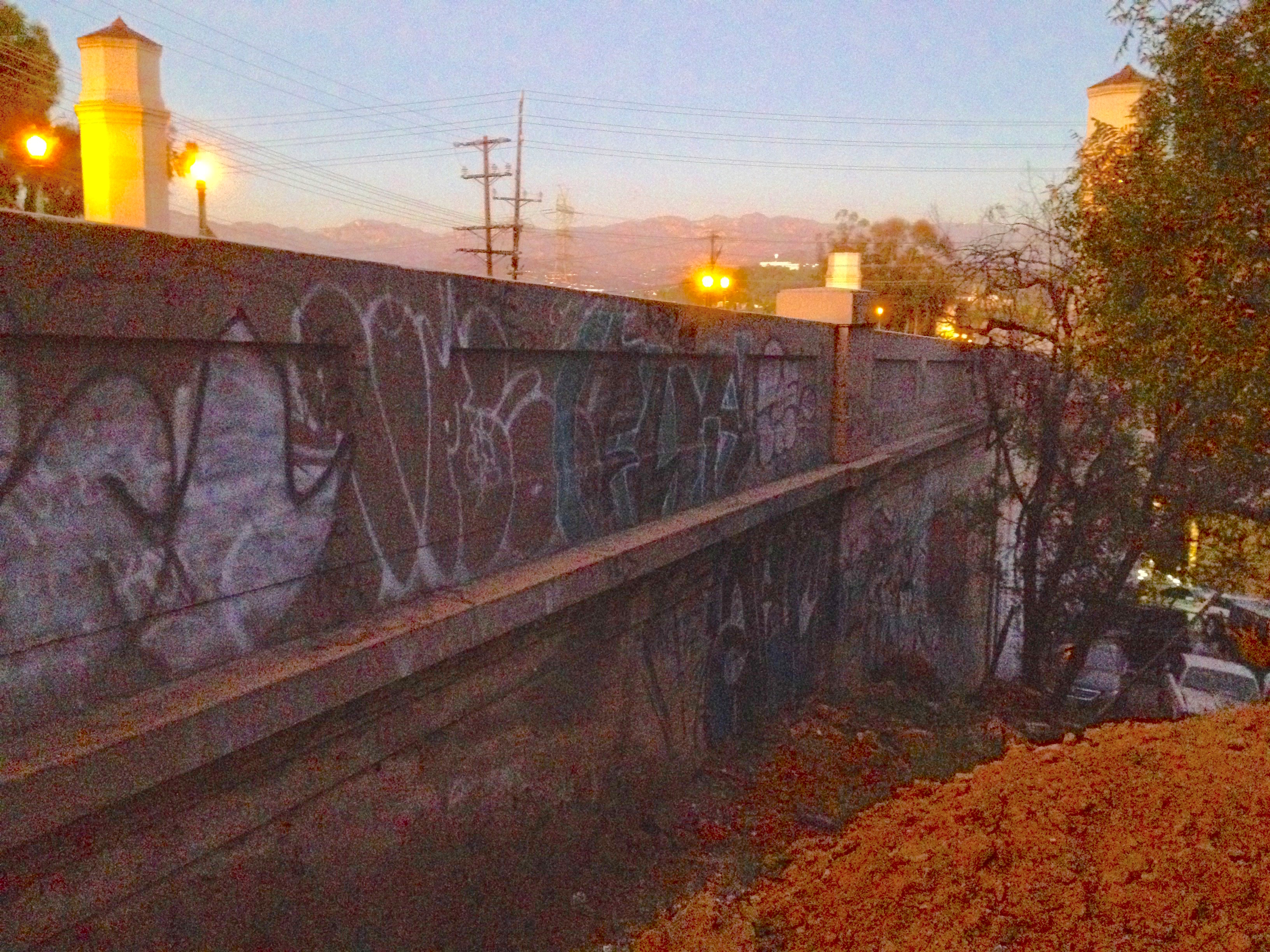
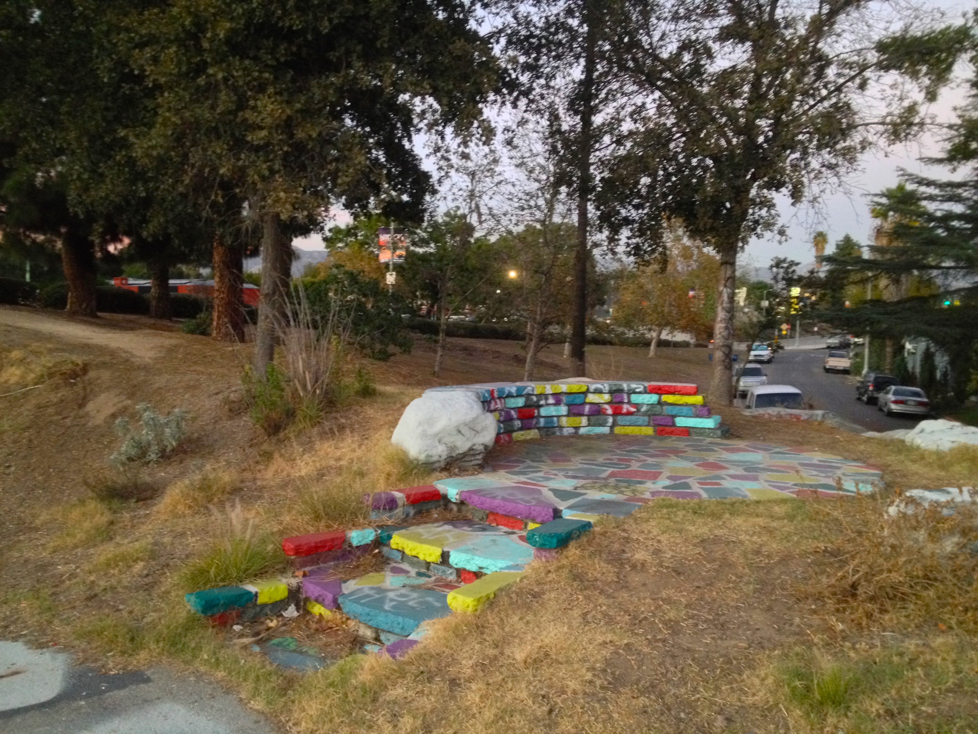
A lot of the graffiti is courtesy taggers and members of the gang, Thee Rascals 13 (TRS), who claim the Atwater side of the bridge as part of their turf. Thee Rascals formed in the 1970s as The Atwater Boys and their ranks include several cliques, including Without Sleep (WOS) and the Los Angeles River Drunks (LARD).
In 2008, Heather Wylie, then a project manager at the Ventura field office of the Army Corps of Engineers kayaked with about twelve others down a stretch of the Los Angeles River and as a result was disciplined and resigned. However, having successfully demonstrated the river’s navigability, the US Environmental Protection Agency declared the Los Angeles River a “traditional navigable water.” In May of 2013, the Los Angeles River Expeditions and the Los Angeles Kayak Club pressured government officials created the Los Angeles River Pilot Recreation Zone, a four-kilometer zone where kayaking was allowed. It was a success and kayaking continues in the Los Angeles River Recreation Zone.
The Los Angeles River Bicycle Path was added to the west bank of the Los Angeles River in (I believe) 2000. Fifteen years later its broken sections have yet to be connected. The section which runs under the Glendale-Hyperion Bridge is twelve kilometers long and runs from the edge of Downtown Los Angeles to Burbank. Someday it will run the entire length of the 82-kilometer river.
In 2012, a small-scale replica of the Glendale-Hyperion Bridge opened at Disneyland California Adventure Park in Anaheim. It replaced a bridge modeled after another California icon, San Francisco’s Golden Gate Bridge.
Closer to the actual bridge, Sunnynook River Park opened in June 2013, part of a growing network of parks and parklets along the river. Its construction was co-financed by Caltrans and the Santa Monica Mountains Conservancy, who removed poison oak and weeds and planted fifty native trees.
In December of 2013, thieves stole an over three-meter tall historic bronze lamp post. I can’t help but wonder if bronze, an alloy consisting primarily of copper, would be less valuable to copper thieves if we stopped minting pennies, which as of 2014 cost 1.7 cents to make and are accepted in zero vending machines. Even if the penny’s discontinuation has no effect on the demand for copper, it’s a useless coin. I realize I’m getting off topic but consider this, when the half-cent coin was discontinued in 1857 it was worth more than the dime is today but its discontinuation left no lasting scars.
The roots of the Glendale-Hyperion Bridge’s scheduled retrofit and redesign stretch back to 1994, when increased funding was made available for such bridge projects. The Glendale-Hyperion Bridge, technically a six bridge complex, is, therefore, eligible for six times the funding of a regular bridge. At the center of the debate over the Glendale-Hyperion Bridge is the issue of accessibility. One camp has encouraged adding bicycle lanes and sidewalks which comply with the disabilities act.
In the other corner is Los Angeles City Council. The same politicians who voted unanimously to support the Los Angeles Mobility 2035 Plan unanimously voted for a re-design which actually removes sidewalk from the bridge so that motorists can continue to drive at unsafe speeds well above the posted speed limit. They cite the fact that at present relatively few pedestrians and bicyclists cross the bridge. The funny thing about latent demand is that it works not just for cars but other modes of transportation. Build more sidewalks and more people will walk. Build bicycle lanes and more people will opt to bicycle. Run the 201 after 8:14 and more people will ride it. Better yet, restore train service along the old route instead of creating a segregated bicycle and pedestrian path. Or just hang a sign on the entrances to the bridge (named to honor war dead but colloquially known as “death bridge” for other reasons) stating “Cross at your own risk.”
FURTHER READING
Sahra Sulaiman: “Advocates Push for a More Livable ‘Death Bridge’: The Glendale-Hyperion Bridge Saga Continues“
Big Orange Landmarks: No. 164 – Glendale-Hyperion Bridge
Bridge Hunter: Hyperion Bridge
Carmen Tse: “Glendale-Hyperion Bridge Redesign Is Bad News For Pedestrians“
Joe Linton: “Who Do We Blame for the Next Death on the Glendale-Hyperion Bridge?”
Eric Brightwell is an adventurer, writer, rambler, explorer, cartographer, and guerrilla gardener who is always seeking writing, speaking, traveling, and art opportunities — or salaried work. He is not interested in writing advertorials, clickbait, listicles, or other 21st century varieties of spam. Brightwell’s written work has appeared in Amoeblog, diaCRITICS, and KCET Departures. His work has been featured by the American Institute of Architects, the Architecture & Design Museum, the Craft & Folk Art Museum, Form Follows Function, Los Angeles County Store, Skid Row Housing Trust, and 1650 Gallery. Brightwell has been featured in the Los Angeles Times, Huffington Post, Los Angeles Magazine, LAist, Eastsider LA, Boing Boing, Los Angeles, I’m Yours, and on Notebook on Cities and Culture. He has been a guest speaker on KCRW‘s Which Way, LA? and at Emerson College. Art prints of his maps are available from 1650 Gallery and on other products from Cal31. He is currently writing a book about Los Angeles and you can follow him on Facebook, Instagram, and Twitter.
Click here to offer financial support and thank you!


6 thoughts on “Take ‘em to the Bridge — Visiting the Victory Memorial Bridge (aka the Glendale-Hyperion Bridge)”