

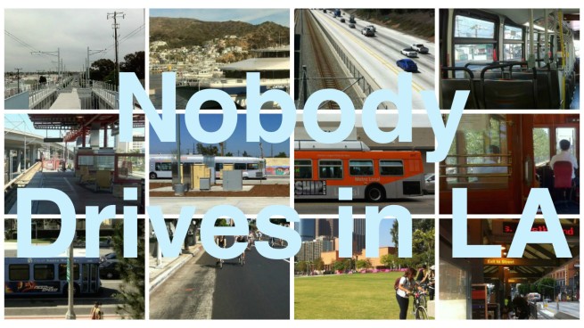
With bicycles, buses, ferries, planes, rideshares, sidewalks, subways, taxis, and trains at Angelenos’ disposal, why would any sane person choose car-dependency? Nobody Drives in LA celebrates sense and sensibility in transportation.
*****
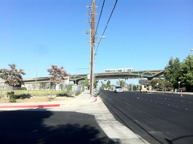
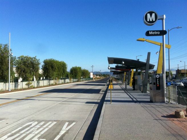
The Metro Orange Line extension opened on the 30th of June, less than two weeks after the opening of the final two stations (Culver City and Farmdale) of Phase 1 of the Expo Line. Whereas the Expo Line‘s opening elicited considerable fanfare and excitement — with a good deal of media coverage — the celebrations surrounding the opening of the Orange Line Extension seemed to be, at least to me, more muted.
My gut tells me that the Orange Line doesn’t evoke the same excitement as openings of other Metro lines because it, like the Silver Line, is a Metro Liner busway, and not a subway or light rail line. Public buses, with the possible exception of the film Speed, are generally viewed as the least glamorous choice among modes of public transportation. The Metro Liners are no mere buses, however.
The Metro looked to Curitiba, Brazil (how’s that for glamor?) for inspiration in its launching of the Metro Liners. In 1999, a group including then-Mayor Richard Riordan, County Supervisor Zev Yaroslavsky, and Metro‘s chief planning officer Martha Welborne traveled there to experience its renowned mass transit system and was inspired to follow its lead. There is a certain irony in how the nation with by far the largest economy is playing catch-up with a nation usually (although not without protestation) considered to be a developing nation. As podcaster Colin Marshall noted about his own excitement with the opening of new lines, “Isn’t this like celebrating that 38% of the city has water and power rather than 33%?”
The buses are longer, sleeker, faster, and travel down dedicated busways rather than adding to and suffering from the crushing misery that often characterizes traffic on public streets. It’s cheaper to operate than light rail, and allows for the possibility of conversion in the future. Additionally, the stations feel more like train stops than bus stops, with art and turnstiles in place of heavily-tagged poster displays, or worse, simply a metal sign with the appropriate bus numbers and a QR code.
Another reason I suspect that the Orange Line Extension is deemed less newsworthy is because the Orange Line is an exclusively San Fernando Valley line. Although Angelenos are often put in the position of defending their hometown against incomprehensible accusations that it’s a cultural desert, it nonetheless remains a popular pastime among these same people to write off regions of their city in the same spirit of ignorance. However unfairly, the San Fernando Valley is probably the most disdained region of all.
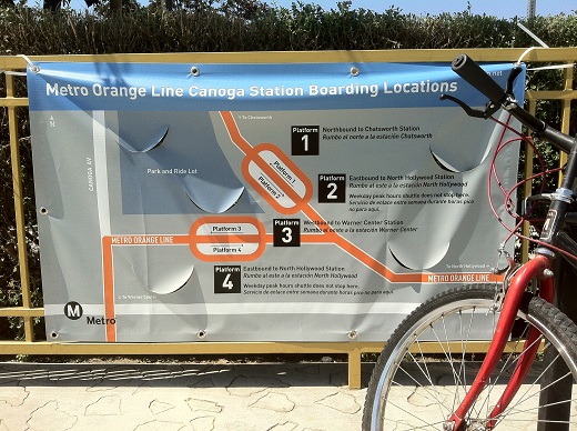
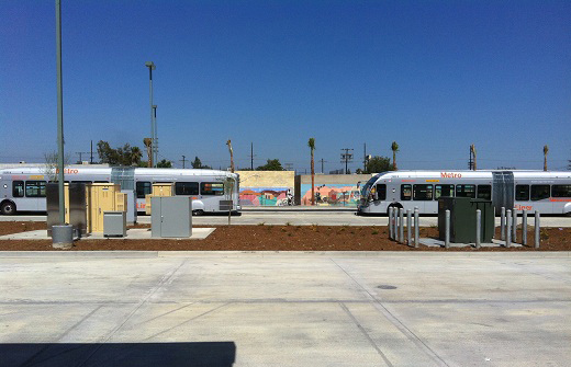
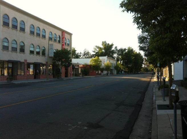
Having no problem with the Valley or buses, I was excited by the opening Orange Line Extension, and I decided to explore the areas around the stops, much as I did the Expo Line shortly after it opened. After traversing the Valley, the Orange Line Extension splits from the pre-existing Orange Line (which terminates in Warner Center) at the Canoga Station. I rode the extension line all the way to Chatsworth before disembarking.
CHATSWORTH STATION
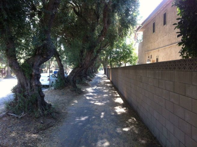
The area around the Chatsworth station feels like the crossroad that it has been for tens of thousands of years. Before humans even arrived, animals used the Santa Susana Pass to commute between the Simi Valley and the San Fernando. For thousands of years the Tataviam, Chumash, and Tongva people, whose lands intersected in the area, traded with one another in the Santa Susana Mountains above the neighborhood. Their long-established trail was later used by the Spanish, the Mexicans, and finally, the Americans.
In 1861, the Old Santa Susana Stage Road opened, linking the Los Angeles Basin to Ventura County, San Francisco, and beyond. In 1876, the first train arrived in Los Angeles. Back then there were about 11,000 Angelenos — a figure that’s incidentally less than half the average daily ridership of the Orange Line today.
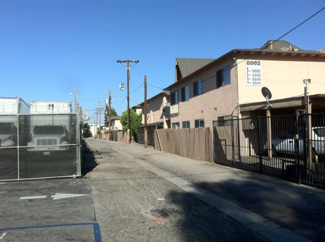
The town of Chatsworth Park was established in 1888, but remained overwhelmingly rural for several decades. In the 1960s it became largely suburban, and today its complexion is varied, including small industrial areas, sleepy residential suburbs, multi-unit residential areas, parks, ranches, and strip malls.
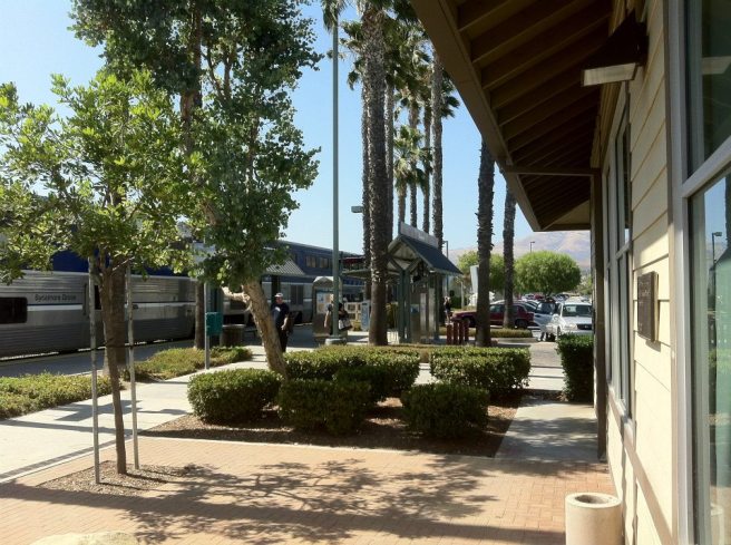
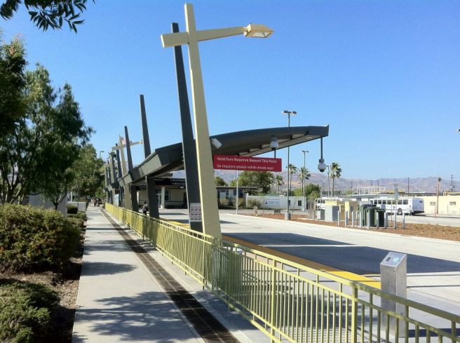
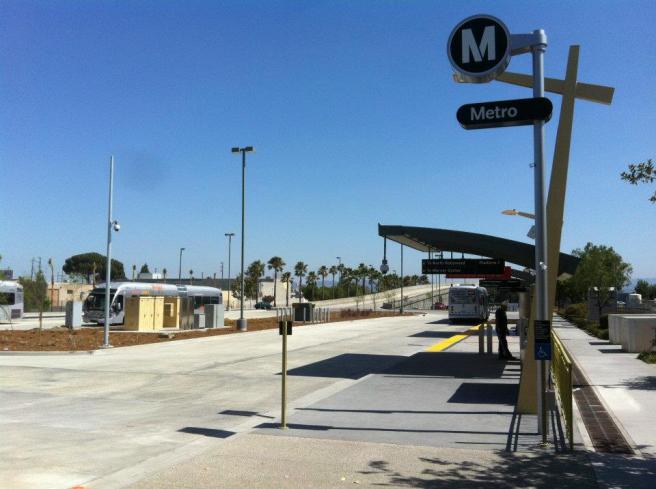
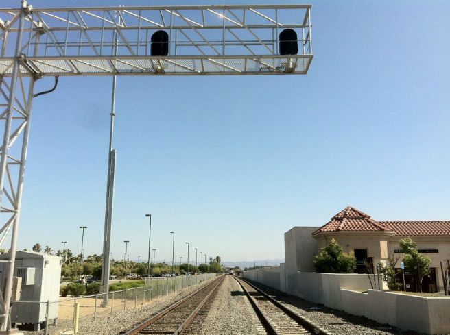
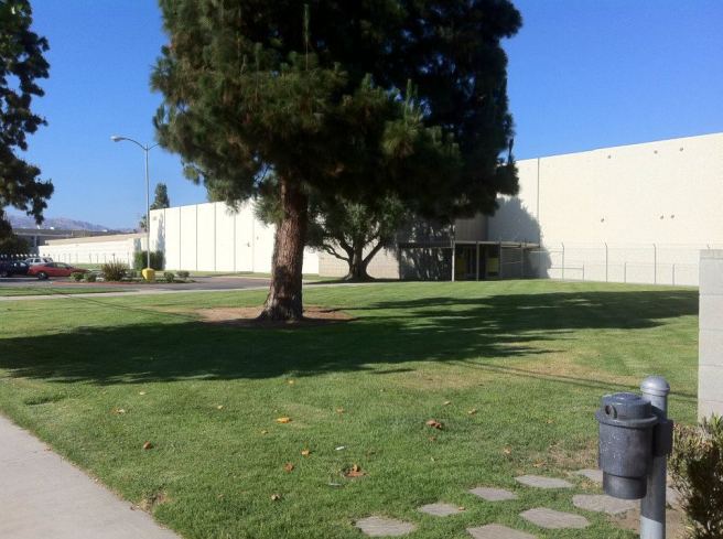
The Chatsworth Station not only serves the Metro Orange Line, but also Amtrak‘s Pacific Surfliner (San Diego and San Luis Obispo) and Metrolink‘s Ventura County Line (East Ventura to Los Angeles’s Union Station). It feels very much on the edge of the city, where Los Angeles finally stops and the Wild West seems to begin.
The Santa Susana Mountains and, in particular, Stoney Point Park give the impression of being on the set of an old western. Not coincidentally, the area has been featured in many film and television westerns. There’s a tranquility to the rustling of leaves that is only interrupted by the noise of arriving and departing trains.
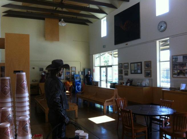
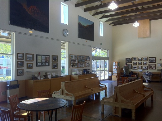
The station itself is small and surprisingly quiet — like an outpost on the way to somewhere else rather than a large commuter hub, although there are museum-like displays on the Chumash, Rocketdyne Santa Susan Field Lab, a statue (Joey Ballin‘s “Chatsworth Cowboy“), and a small coffee shop.
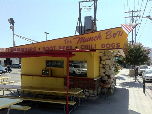
To the north, Devonshire Street boasts a diverse selection of cuisines and businesses. I stopped for a root beer float at the Munch Box, a Marcel Dumas-designed fast food stand built in 1956 and designated Historic-Cultural Monument No. 750 in 2003. The young woman working behind the counter suggested other places to check out while a man and his two daughters said grace over their fast food.
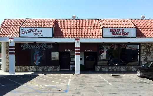
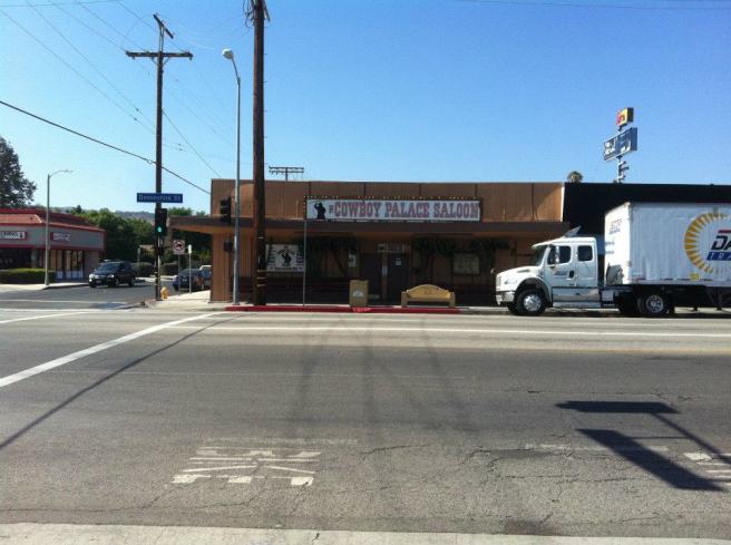
Further west I discovered a collection of vice-oriented businesses. Bully’s Billiards is owned by the same folks who run Candy Cat One, a topless bar next door. Sharing the same strip mall is The Social Lounge — a hookah bar. Across from an odd, curio shop called Pop’s Attic is The Cowboy Palace Saloon, which bills itself as “The Last Real Honky Tonk.” A big rig was parked in front and there’s a hitching post round back. It’s been featured in numerous television episodes, films and music videos. The building dates back to the 1920s, but the present incarnation as a country bar dates back to the early 1980s.
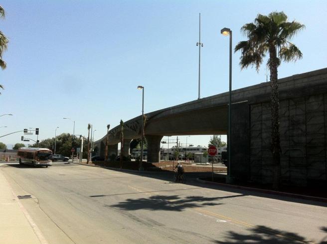
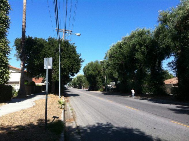
West of the station, Topanga Canyon Boulevard rumbles with traffic. There’s not much to see aside from cookie cutter apartment complexes, condominiums and traffic until one arrives at Lassen Street. There, L.A. Historic-Cultural Monument #49 (76 Mature Olive Trees) stands, a row of 49 (some have died) olive trees planted in the late 19th century. Heading west toward the hills the rural character turns up and the smell of horses grows strong.
NORDHOFF STATION
Heading south, the next stop is Nordhoff Station in Canoga Park. Like its neighbor to the north, the area is a mix of light industry, strip malls and quiet residential areas. Canoga Park began as Owensmouth, a name chosen to disingenuously suggest a proximity to the Owens River which, at its closest point, flows about 32 kilometers away. Despite its name, it remained a dry, dusty place, and the Owensmouth Gazette chastised its small population for pronouncing the name “with a little too much mouth,” and added, “For a little self-pride…and for the dignity of the town, let us practice up by putting the accent where it belongs, then we will pronounce it as though it were spelled ‘Owensmth.'”
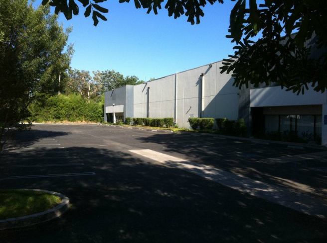
Just east of the station is the Moog Chatsworth Operations building. I hoped and assumed it was in some way connected to Moog Music, the company founded by the late, great synthesizer pioneer, Robert Moog; it turns out Moog Incorporated manufactures motion control products for aircraft, spacecraft, missiles and other machines. To the south are the headquarters of Wicked Pictures — a leader in the commercialized sex industry that manufactures adult films. Somehow it all makes sense.
At the corner of Nordhoff and De Soto Avenue is the Lamplighter, a family restaurant established in 1977, though it feels much older. It’s reminiscent of restaurants like Bob’s Big Boy, Norm’s, and Shoney’s — from the first half of the 20th century. It hosts karaoke on Saturdays, although there’s a very real chance that participants will have to compete against “The Olde Lamplighter,” who claims to be the “Karaoke King of Canoga Park.”
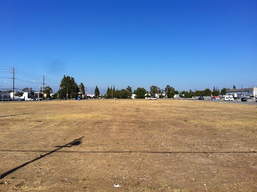
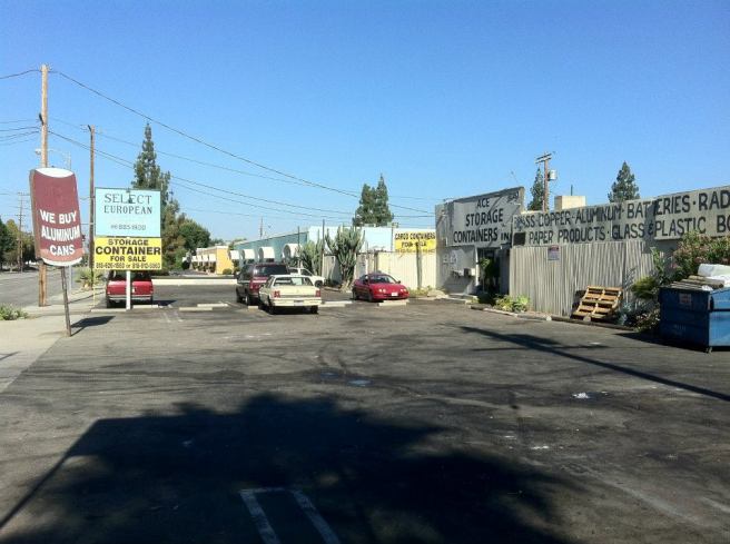
Across the street is a large vacant lot that was seasonally used as the site of the Fright Fair Halloween event and Rob & Cathy’s Christmas tree lot. It currently is a large, sunbaked and barren patch of nothing. To the south is a large facility built in 1959 to house Atomics International — a company that developed nuclear technology. For many years now it has been Rocketdyne Propulsion & Power‘s De Soto complex, where rocket engines are built.
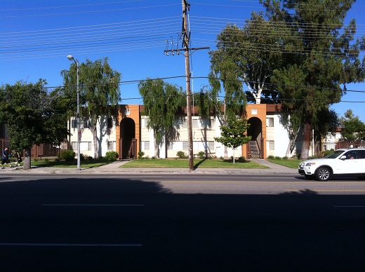
In suburbs without tourist attractions, it seems as though an effort was often made to exoticize apartment complexes. The developers of De Soto Gardens, built in 1969, seem to have been inspired by Moorish Architecture. More impressive is Canoga Island Village across the street, a nearly one hectare Polynesian-inspired complex built in 1963 as part of the Tiki craze. According to charliemanson.com, members of “The Family” used to live there when a number of them also lived across the street at a home dubbed “The Yellow Submarine,” which stood at 21019 Gresham Street.
ROSCOE STATION
The Roscoe Station is located at the intersection of Canoga Avenue and Roscoe Boulevard in Canoga Park. In addition to the usual assortment of chain restaurants, heading west down Roscoe involves passing through large car dealerships. Nearby are bars, an upholstery business and a strip club; legend has it that if one listens hard enough, one can almost hear the sound of neckties being loosened.
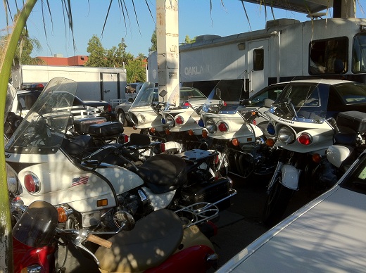
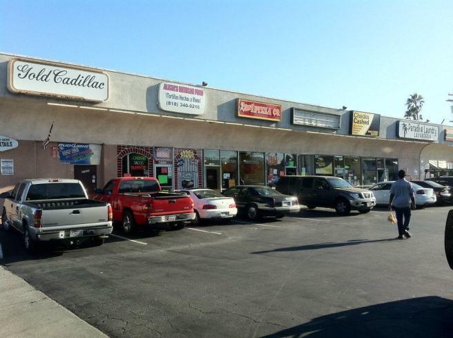
The auto theme continues at a shopping center at the corner of Remmet, which is home to the Gold Cadillac Bar and Hollywood Motors, specializing in police cars and motorcycles and other government vehicles. Most of the vehicles were formerly the property of the LAPD.
Turning the corner and heading north on Canoga, I stopped into Papa Mac’s Liquor to grab a drink and some Tylenol for a heat-induced headache — I’m not used to Valley temperatures. The man behind the counter rang me up without interrupting his phone conversation whilst the Bengali version of Who Wants to be a Millionaire? played in the background on a small television. Heading back to the station I passed Xposed Gentleman’s Club and its neighbor, an upholstery place.
SHERMAN WAY STATION
The final stop before reconnecting with the pre-existing Orange Line is the Sherman Way stop. Maybe it was the time of day, but where the areas around the previous stops had been fairly quiet, the neighborhood around this one stop was teeming with activity.
The section of Sherman Way between Canoga Avenue and Topanga Canyon Avenue is colloquially known as the Sherman Corridor, and marks the busy heart of Canoga Park’s business district. Installed in the sidewalk is The Walk of Hearts, which unlike the Walk of Fame, honors educators instead of celebrities.
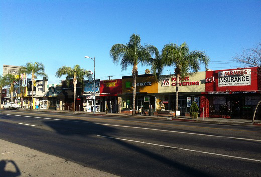
Where Sherman Way bustles with commercial activity, the side streets bustle with residential. Canoga Park Alabama tags are impossible to ignore, as they’re painted everywhere. The gang began as a farmworkers’ group in the 1931 before evolving into a car club, and ultimately transforming into its current incarnation. The sidewalks and streets were full of children riding scooters and bikes. Nearly every available patch of grass, including the strips between fast food restaurant drive-thrus and sidewalks, seemed to be occupied by people eating cemitas, smoking, and just hanging out.
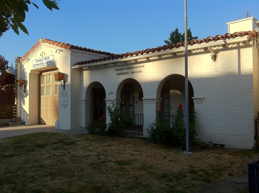
On Owensmouth (which no one pronounces “owensmth”) is the Canoga-Owensmouth Historical Society, housed in the former Canoga Park Fire Station #72. The station was built in 1931 and vacated in 1978 due to earthquake damage. It’s since been refurbished and re-purposed as the home of the historical center, as well as a museum and community center.
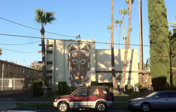
On Variel Avenue sits another vestige of Tiki culture in the Valley. The Polynesia apartment complex was built in 1962 by Max Resnick and was deemed photogenic and significant enough at the time to feature in a print ad for General Electric air conditioners. Sadly, the tiki totems were removed long ago. But at least the large tiki mask mural remains and is impossible to ignore.
After exploring the area around the Sherman Corridor, I hopped back on the Orange Line, which I rode to the Red Line and headed home. I thought about the charm of the busway. A fellow passenger struggled to explainto his friend on the phone that there was nothing wrong with him or his car, even though he was taking the bus. I made mental notes to check out the bike lane, the Sepulveda Basin Wildlife Preserve, Paladino’s, and other gems of the Valley on future excursions. The project was completed ahead of schedule and $61.6 million under cost, money which may go to extending the line to Burbank. If that happens I will ride it.
*****
Eric Brightwell is an adventurer, writer, rambler, explorer, cartographer, and guerrilla gardener who is always seeking writing, speaking, traveling, and art opportunities — or salaried work. He is not interested in writing advertorials, clickbait, listicles, or other 21st century variations of spam. Brightwell’s written work has appeared in Amoeblog, diaCRITICS, and KCET Departures. His work has been featured by the American Institute of Architects, the Architecture & Design Museum, the Craft & Folk Art Museum, Form Follows Function, Los Angeles County Store, Skid Row Housing Trust, and 1650 Gallery. Brightwell has been featured in the Los Angeles Times, Huffington Post, Los Angeles Magazine, LAist, Eastsider LA, Boing Boing, Los Angeles, I’m Yours, and on Notebook on Cities and Culture. He has been a guest speaker on KCRW‘s Which Way, LA? and at Emerson College. Art prints of his maps are available from 1650 Gallery and on other products from Cal31. He is currently writing a book about Los Angeles and you can follow him on Facebook, Instagram, and Twitter.
Click here to offer financial support and thank you!

