

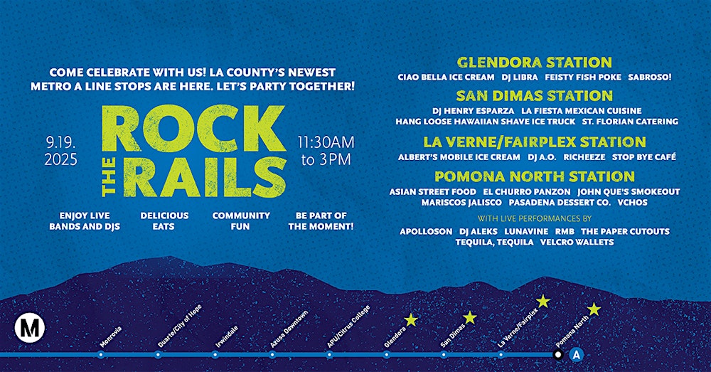
On 19 September 2025, Metro‘s A Line Extension to Pomona opened to the public. That day, there was an event called Rock the Rails which offered free music, free rides, and free food at the new stations. I decided to check it out and made an event for a “group ride.” I was joined by Colin, Jackie, Jeffrey, Shane, and Sunita,
It’s notable, for the length-fixated, that the Metro A Line was already the longest light rail line in the world. Now it’s even longer — 92.7 kilometers. There are 48 stops in the Harbor District, South Los Angeles’s Eastside, Downtown Los Angeles, Northeast Los Angeles, the San Gabriel Valley, and now, the Pomona Valley.
The Metro A Line began operation as the Blue Line back on 14 July 1990. The initial segment operated along the historic Pacific Electric Railway’s (PE) Long Beach Line — which, incidentally, was the last of PE’s lines in operation, having ended its run on 9 April 1961. After PE, the last Los Angeles Railway (LARy) line ended service in 1963, which was followed by a 27-year period in which Los Angeles was served by no mass rail transit. If you’re a pedant who insists on counting Angels Flight Railway, which ended service at its original location in 1969, the rail-free gap was 21 years long. Either way — it’s strange because Metro and Metrolink still feel pretty new to me even though they’ve been around for much longer than that gap — 35 and 32 years, respectively.
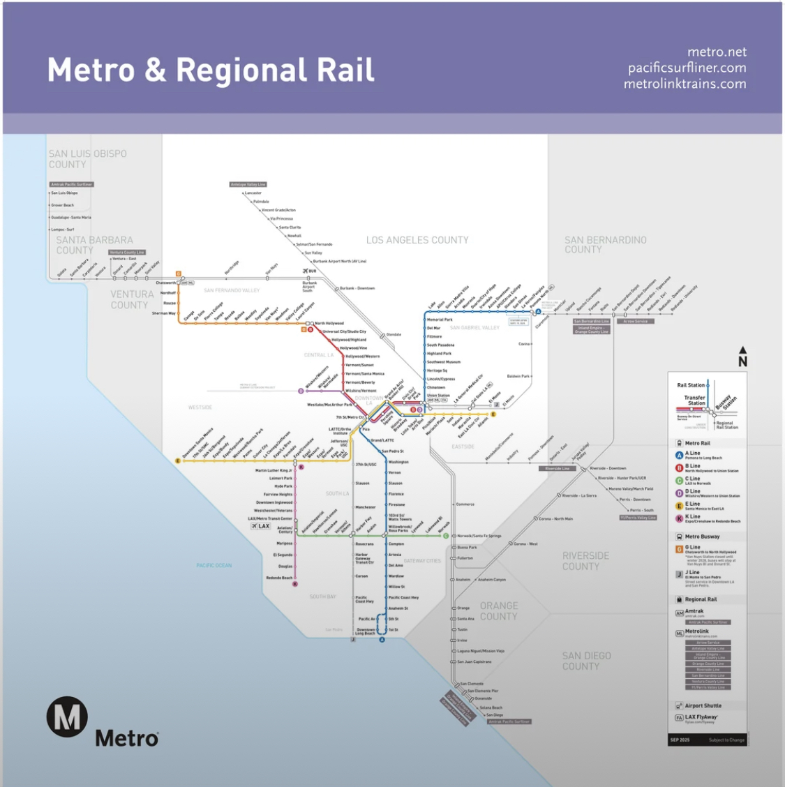
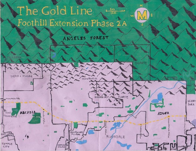
The northern section of the A Line, from Union Station through the San Gabriel Valley, follows the former right-of-way of the Atchison, Topeka and Santa Fe Railway‘s Pasadena Subdivision. Part of the line is still used by Burlington Northern and Santa Fe Railway (BNSF), This section was originally built in 1885. It was used by Amtrak until 1994. In 2003, it opened as part of the Gold Line. The extension to Azusa opened in 2016. I walked the route and explored its surroundings back in 2013 – in what was probably the longest walk I’ve undertaken within Los Angeles. It was renamed the L Line in 2020.
Metro decided to assign trains letters instead of colors in November 2018. It is something, seven years later, that still irks many Metro train riders — who ask why — but never seem to look for an answer. — so allow me to provide it. Or, if you’ve moved on, feel free to skip this aside.
<begin rant>
The changes was implemented to improve accessibility and address long-term expansion challenges. Conventionally, in the West, there are just seven colors of the rainbow. There are already eight Metro rail and BRT lines. Someday there will be many more. Whilst you might long to ride the Raw Umber Line, most of us would have no idea what that would mean. And how do you translate that? The first day I rode the Expo Line, I struggled to explain to a Korean woman with apparently almost no English comprehension that that line — assigned a light blue color — was not the line to Long Beach — which had a blue color two and shared portions of the same route and stations. She had meant to go to Long Beach and was in Culver City. I could remember the word, “푸른,” but didn’t know “파란색” — and neither did any of the Metro staff. Most Angelenos speak a language other than English and the percentage of non-English speakers amongst Metro users is almost certainly higher than the population at large.. In many languages, there’s not a distinct concept for blue, green, or purple. About one in twelve men has some sort of colorblindness, too — and on top of that, blue, red, and yellow tend to fade in the sun. Finally, why should light rail, heavy rail, and BRT be singled out when they, like our numbered Metro bus lines that no one complains about, are both part of the same system. It’s partly because those lines are singled out that many people who exclusively take the train forget that Metro also operates 116 lines that are assigned numbers.
So get over it — OK? What’s so bad about letters?
On the other hand, the lettering system is, in a word, inconsistent. The letters were assigned chronologically — based on their opening dates — which is great for the hardcore train historians but meaningless to everyone else. On top of that, Metro skipped “F Line” because “F” could scandalize a Puritan because several “bad words” start with that letter. Let me assure you, every letter of the alphabet can connote a bad word — or something inappropriate. Try me. Of course, “H” and “I” had to be skipped because people might look at a rail map and think that the entire line is a hospital or information booth, somehow. Wouldn’t someone that hopeless possibly thing that A Line means “Alternate” or “Airport:”? Would it surprise you to learn that plenty of cities operate F, H, and I lines without apparent issue.
If we accept that Metro will expand in the future, surely every letter of the alphabet will be in use sooner or later… and if not, a double letter should clear things up, right? If you see “HH Line” and think that it’s a linear hospital, you/re probably not long for this world.
I thought that it would’ve been a lot more intutive to rename the train lines after the colors they’d been assigned. The Red Line would’ve become the R Line. The Blue Line would’ve become the B Line. The Orange Line would’ve become the O Line because — you get it! And so, sort of, did Metro. After all, the Expo Line became the E Line instead of the G Line, which is what it would’ve been had Metro consistently applied its own naming convention — but Metro realized, with the Expo/E Line, that that made more sense asking riders to remember in what order they opened. What’s more, What’s done is done, however, and I remember that the Blue Line became the A Line not because it opened before the Green and Red lines… but because it’s the asul/azure/azzurro/azul.line.
After the Regional Connector was completed, the northern part of the A Line (then the L Line — which was then retired), was reconfigured so that instead of connecting Azusa to East Los Angeles, it connected Azusa to Long Beach – which is what made it the longest light rail line in the world – overtaking Belgium‘s Coastal Tram.
<end rant>
A ceremonial groundbreaking for the A Line Extension took place in December 2017 but actual construction of the A Line Extension (Phase 2B), from Azusa to Pomona (initially to Claremont), didn’t begin until July 2020. Construction was completed (to Pomona) in January 2025 and testing then began.
APU/CITRUS COLLEGE STATION
Our group convened at Union Station. I realized that I hadn’t specified where in Union Station and clarifying where, exactly, meant updating information on BlueSky, Discord, Eventbrite, Instagram, Reddit, Slack, Threads, and Lord knows where else. Luckily, Colin correctly intuited that I meant the waiting room, near the main entrance — and Traxx Bar — where we met at the first Nobody Drives in LA meet-up. I spied Jackie, who’s always hard to miss, walking past us in a pink turtle neck with a green vest. We headed to the platform where we spied Sunita and Shane — who I correctly assumed was one of us because he was wearing both blue and gold. They’d already met up with Jeffrey — an irrepressible train enthusiast whose excitement could, by all appearances, not be contained.
Our ride ended at APU/Citrus College Station — formerly known as Azusa/Citrus Station.
Don’t even get me started on station names — although int this case, I think that the new name is an improvement. To be brief, community identity and nearby attractions are more meaningful, to me, than street intersections — or the fact that they’re renamed faster than their station signs are updated. Consider, if you will, Imperial Station, which was renamed Imperial/Wilmington Station, and then renamed again, this time Willowbrook/Rosa Parks Station. Not to take anything aways from Rosa Parks — but what, if any, connection does she have have to Willowbrook? When staying in Los Angeles, she stayed with family in View Park, not Willowbrook — a community with which she had no obvious connection The station, meanwhile, is the only one in Willowbrook… so how about Willowbrook Station for a name?
POMONA-NORTH STATION
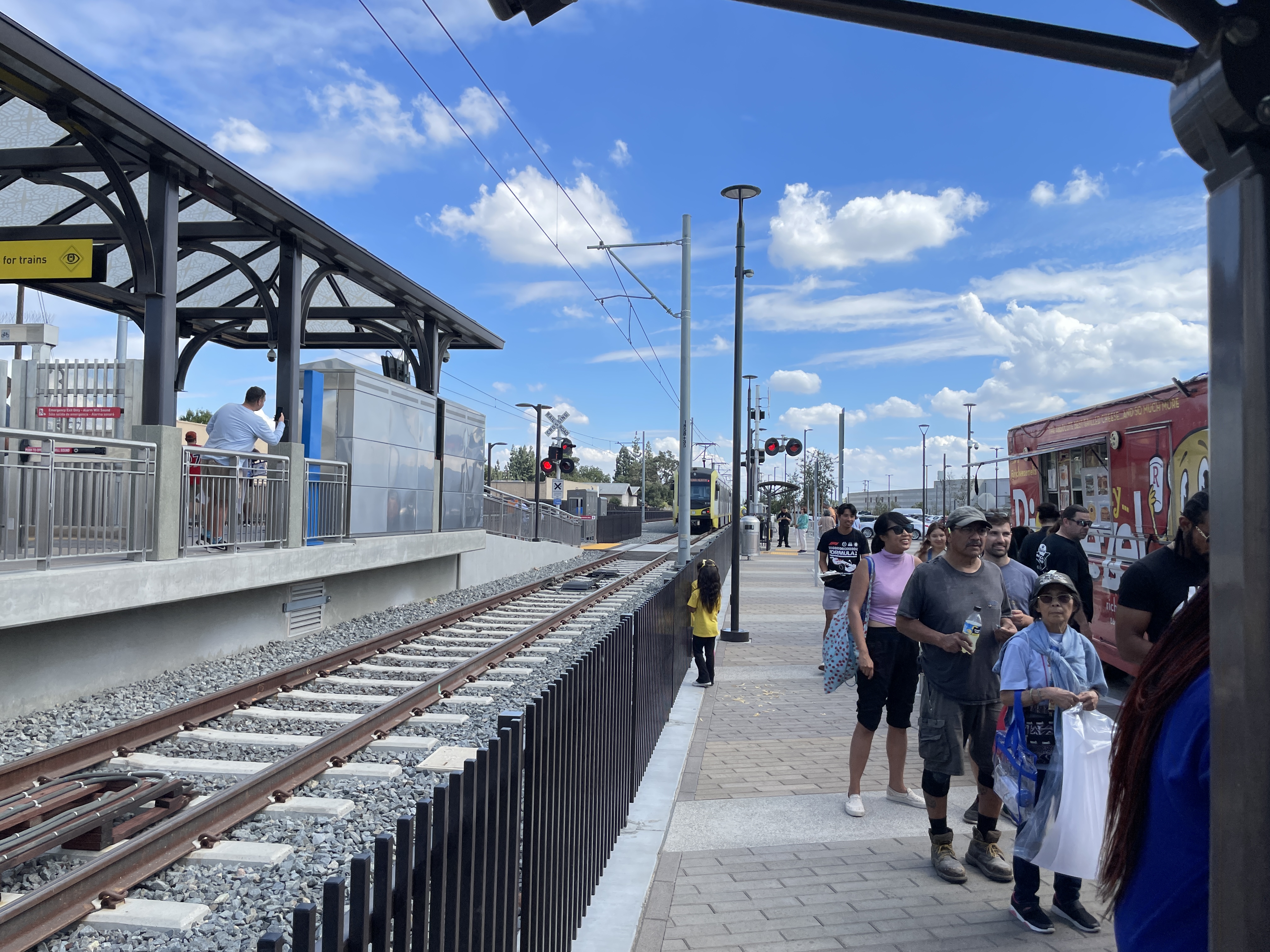
We started by riding all the way out to Pomona-North Station. To be honest, there’s not a lot in the area for visitors — yet. Right now, the surroundings are dominated by a couple of trailer parks (Copacabana Mobile Home Community and Valley Rancho Mobile Park), a retirement home (Serenity Villas Apartments) and various warehouses and small factories. It’s easy to imagine that changing, though, as the new station will make it even more of a transit hub. It’s already served by Foothill Transit’s 291 and 492 lines; Metrolink’s San Bernardino Line; and BNSF freight trains.
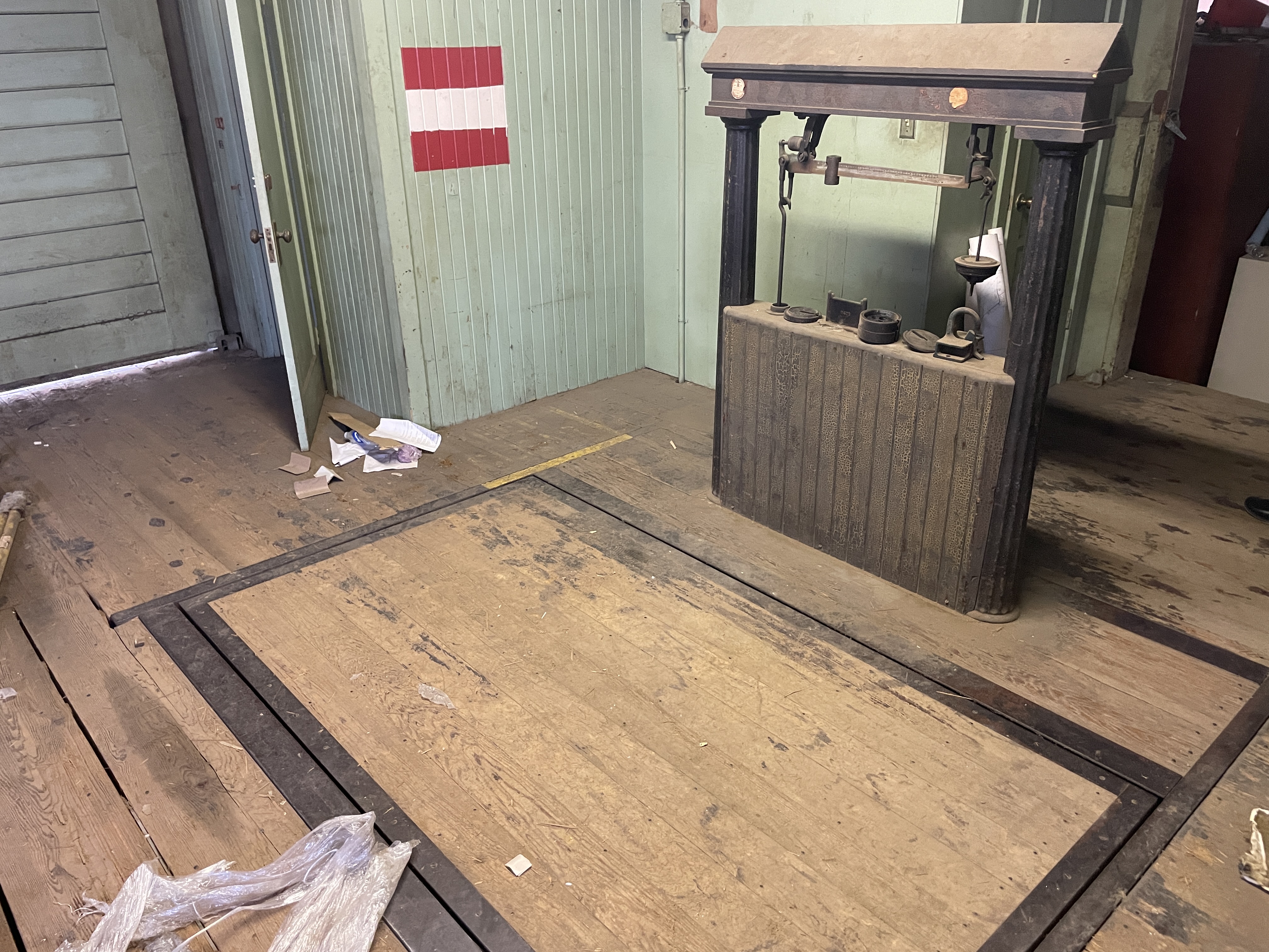
After disembarking, I headed over to the old AT&SF station, built in 1940. A brick and glass passenger area was added in 1966 and was used by Amtrak’s Southwest Chief from 1971 until 1994, when it was rerouted to San Bernardino Station.. It wasn’t clear how it will be used now but it was being used, on this day, by Metro employees for their lunch breaks. As far as myself, I’d planned on eating at and around all of the stations. I spied and briefly chatted with Streetsblog Los Angeles‘s Joe Linton, who’d been there for a while and was heading home.
I spied a pupusa truck — Vchos Pupuseria Moderna. It was so hot and muggy, I thought pupusas would be too much — but I spied plantain empanadas and thought that that might be a good start to my day. The closer I got, though, them stronger the urge to eat a pupusa became. When I opened my box, there were two — pl;us beans and cheese. I wolfed them down. The rest of the group huddled in the shade of our table and we chatted with a seventeen-year-old who’d come all the way from Inglewood.
Jeffrey, I think, stayed behind to take more pictures of trains. The rest of us hopped on the train and headed west.
LA VERNE/FAIRPLEX STATION
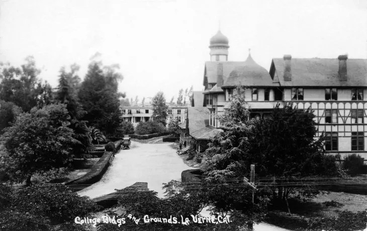
Our next stop was La Verne/Fairplex Station. Northwest of the station is Old Town La Verne As “old towns” go, it’s not particularly old. Most of the buildings date, at the oldest, back to the 1920s — although a handful were built in the first decade of the 20th century. La Verne was founded in 1887 as Lordsburg and next to Old Town is the campus of the University of La Verne, founded in 1891 as Lordsburg College. Although a private school, the University of La Verne does offer various public-facing cultural events, including a Cherry Blossom Festival, Cinco de Mayo, lecture series, art exhibitions, concert series, &c – the sorts of things that make proximity and accessibility to university and college campuses such valuable community assets.
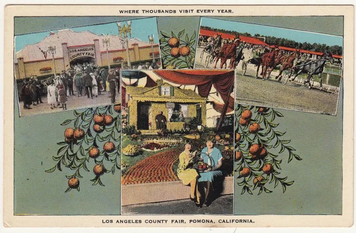
South of the station is the Fairplex, formerly known as the Los Angeles County Fairgrounds. It was hosted the Los Angeles County Fair since 1922. I haven’t been, I don’t think, since 1999 or 2000 – although I’m more likely to return now that there’s a train station. Beats two hours and two transfers by bus – or an hour of staring at brake lights on the freeway – but then anything beats that.
West of the fairgrounds is Brackett Field, a small public airport. dating back to the 1930s. Its presence, along with the new train station (which is also served by Foothill Transit’s 197, 291, and 492 lines would seem to make this something of a multi-modal transit hub — especially once a pedestrian bridge over the Metrolink tracks and Arrow Highway is built to connect the station to the Fairplex.
As it stands, though, there isn’t that much of interest to the casual visitor just yet. I looked across the hostile highway toward an automotive center and window tinting place and turned the opposite direction. I strolled down 1st Street past some anonymous light industrial buildings before turning back and redeeming a dessert ticket for ice cream. I reckoned I’d use one of the porta potties before hopping on the next train but they were, for whatever reason, locked — Heaven forbid a station visitor using them for their intended purpose! For the same reason, there are no restrooms at the brand new station.
We hopped on the train and continued our “Journey to the West.”
SAN DIMAS STATION
We disembarked at San Dimas — which has Throne restrooms. But we also wanted to rest and I especially wanted to visit the Rail Side Cafe. The cafe was founded by Montrealer mother and son, Josée Normand and Jordan Nachbaur back in 2014. .The tracks may’ve been near but passenger rail must’ve felt very far off in the distance. It’d been 63 years since PE’s Monrovia–Glendora Line had passed through the area and 51 since ATSF’s train’s Pasadena Subdivision trains. Eleven years would pass before the arrival of Metro. Inside, the decor, though, was all trains everywhere — even on our table. We relished the chance to sit in the air-conditioned business and to use the facilities. I was still stuffed from the pupusas but had an iced coffee. Shane, meanwhile, performed a disappearing trick on a surprisingly large salad.
Whoever wrote the Wikipedia entry on the station said that Frank G. Bonelli Regional Park and Raging Waters are “within walking distance.” Both are technically — but then what isn’t for the phsyically able and sufficiently mad? That said, a walk to either would take roughly an hour so I doubt too many will be making that connection on foot. On bicycle, perhaps. In the station’s immediate vicinity are some shops and eateries along sycamore-lined San Dimas Avenue. There’s Freedom Park, with its Eddie Martinez Jr-designed San Dimas Veterans Monument. North of the station are several buildings given an Old West-makeover in the 1970s. I pointed to one and Jackie offhandedly remarked that it probably housed a CVS. She turned out to be correct. There’s also a Wild West Starbucks and a frontier Subway — plus some non-chain options.
Across the street is the Frontier Village Shopping Center, built in 1962. In the 1970s, when it was given its Old West re-design, a charming wooden sidewalk was installed. Hitching posts were added. A covered wagon was permanently parked on Bonita Avenue. Not everyone loved the kitschy aesthetic — which was actually required by zoning and all new construction had to be approved by a design board. Trouble was, some felt, San Dimas’s roots weren’t really in the Old West. Although it was founded as La Cienega Mud Springs in 1887, it was named after Dismas (the penitent thief whose given name appears in the Gospel of Nicodemus) and incorporated as San Dimas in 1960 — not 1860. Not everyone was happy. The development of San Dimas really took in the early 20th century around the citrus energy and the town was nicknamed “Queen of the Citrus Belt.” The last packing house, though, closed in 1963. The San Dimas Historical Society and others decried — not without reason — that the Old West theme was inauthentic. On the other hand, isn’t inauthenticity pretty much the most authentically Southern California thing there is? If I were in charge, I’d have gone even further — demanding that the new Metro station be modeld after the fictional Cattle Corner Station in Once Upon a Time in the West and that any fare gates be disguised as swinging wooden doors — and abolishing modern cars from within the city.
In 2012, some businesses began removing their Old West facades and the old boardwalk was ripped out and replaced with concrete in 2017. New zoning and planning guidelines meant to encourage transit-oriented development were adopted in 2024.’
The station is also served by Foothill Transit’s 295 and 492 lines. The old Atchison, Topeka and Santa Fe Railway, located west of the new station, houses the Pacific Railroad Society Museum — but we skipped it this time because some people needed to get back and all of our energy was being sapped by the humidity and heat. I think we all agreed, though, that this was the most charming station and I assume that all of us will return at some point. The museum is at the top of my list, naturally. It’s operated by the Pacific Railroad Society, which was founded in 1936 as the Railroad Boosters. It acquired its current name in 1949 and moved into the old station (the Art Deco-style depot built in 1934 to replace the original 1889 station that burned down) in 1995. After passenger rail service ended and prior to the society moving in, the old station was used as a senior center and as offices for the local Chamber of Commerce.
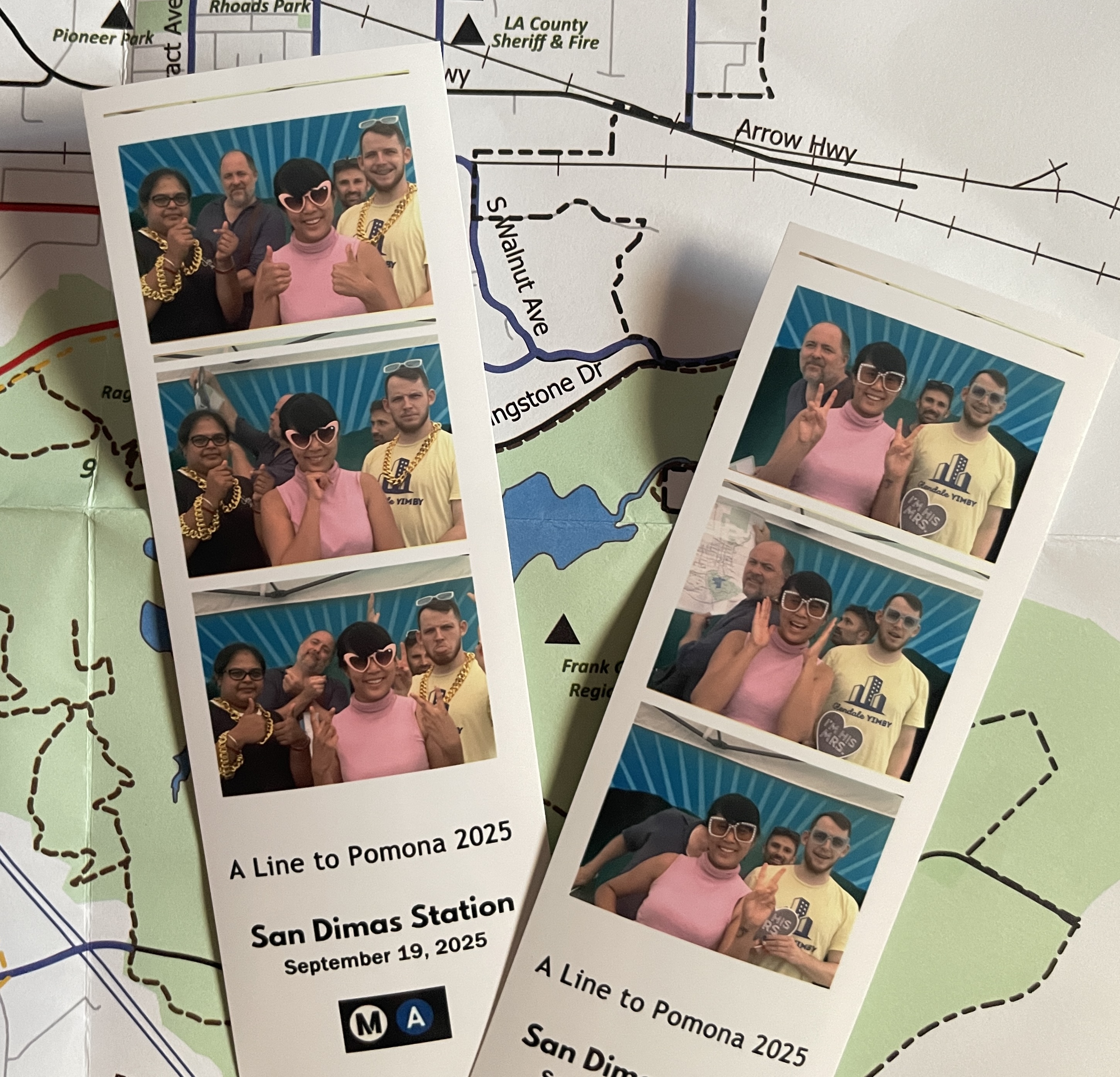
We took some pictures at a photo both and headed back to the station platform.
GLENDORA STATION
Our train soared over the sprawling but mostly empty asphalt seas surrounding various box stores as well as the Glendora Auto Center to which Jeffrey had earlier in the day extended a middle finger. After passing this bleak suburban decay, the train passes over San Dimas Wash and skirts the eastern end of the largely undeveloped South Hills — a chain that, though small, rises dramatically above its suburban surroundings and which has always appealed to me.
As we neared Glendora Station, we quickly conducted a voice vote, and it turned out that none of us had it in us to explore the station’s vicinity. I do like the Glendora Library, which is fairly close by, and we could appreciate, from the train, Michael Hillman‘s station art, “Glendora Home: A Slice of Sunshine.” Shane, who leads Glendale YIMBY, was particularly enthralled by a newly built mixed-use community that replaced an demolished historic car storage area paved way back in 1972. I mentioned the Glendora Farmers & Artisans Market (which seems, possibly, to be on an extended hiatus) and Glendora Village — but the main attractions in Glendale, to me, are Donut Man and Rubel Castle The former is about a 25 minute walk from the station – possibly something I’d undertake for the peach donut but it’s strawberry season, now. A ride on Foothill Transit’s 188 Line would shorten the commute to about ten minutes. A leisurely stroll up to Rubel Castle would take closer to 45 minutes. That side trip might make more sense on a bicycle, which would only take about ten minutes. The station is also served by Foothill Transit’s 284 Line and the Glendora Transit Shuttle, but nothing could budge us from our seats.
CLAREMONT TO THE FUTURE!
I’ll definitely ride the Gold Line before 2031, when it’s scheduled to reach Claremont. I might want to ride on that day but, at the same time, you can already get to Claremont from Union Station via Metrolink’s San Bernardino Line — something my co-host, Kyle, and I did on another transit adventure.
Originally, the A Line was planned to extend beyond Claremont to neighboring Montclair. The Montclair extension, though, was recently dealt a blow when the San Bernardino County Transportation Authority (SBCTA) withdrew funding for the portion into San Bernardino County. To my mind — that’s a totally acceptable outcome. Montclair Station is already served by the San Bernardino Line. What’s the point of a light rail line mirroring a regional rail line? Are there train riders for whom Metrolink trains are simply too fast? If SBTCA wants to build a light rail or BRT network, I’m all for that — but perhaps they should focus on connecting currently underserved population centers like Apple Valley, Hesrperia, Twentynine Palms, Victorville, or Yucca Valley with regional rail or BRT than extending a parallel light rail line across two counties. Maybe an Omnitrans connection between Metrolink’s Riverside and San Bernardino lines might make more sense, to connect more riders to Rancho Cucamonga Station, which would offer a connection with the Sunset Limited and will soon serve as the terminus of the Brightline West.
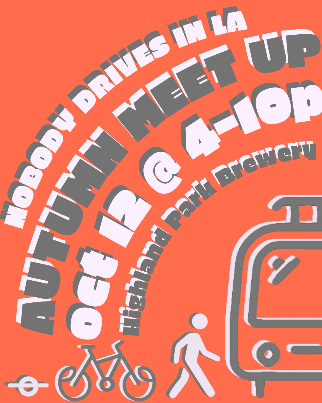
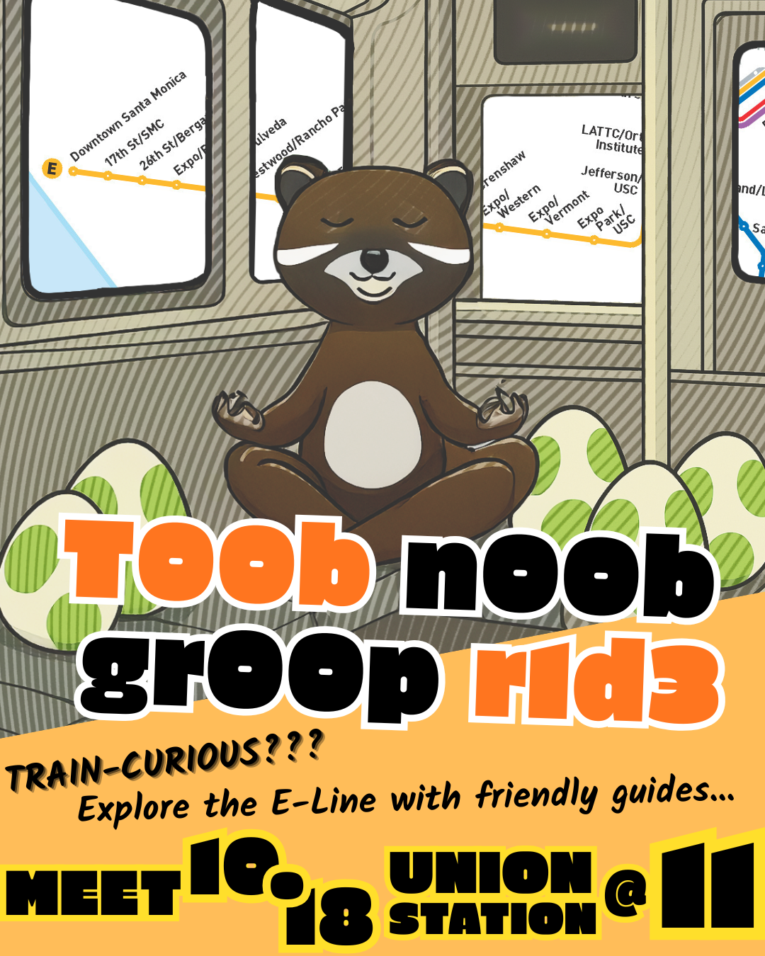
In Los Angeles County, in the meantime, I’ll be looking forward to the opening of the D Line extensions, the LAX Automated People Mover, Metrolink’s extension to Santa Barbara, the North Hollywood to Pasadena BRT, Vermont Transit Corridor BRT, K Line Extensions (south and north), Southeast Gateway Line, East San Fernando Valley Light Rail, Sepulveda Pass Subway, E Line Extension — as should you. And you should also, if able and interested, check out Nobody Drives in LA‘s upcoming LA Comic-Con panel (LA Transit in Pop Culture) Autumn Meet-Up, and Tube Noob Group Ride!
Support Eric Brightwell on Patreon

Eric Brightwell is an adventurer, essayist, rambler, explorer, cartographer, and guerrilla gardener who is always seeking paid writing, speaking, traveling, and art opportunities. He is not interested in generating advertorials, cranking out clickbait, or laboring away in a listicle mill “for exposure.”
Brightwell has written for Angels Walk LA, Amoeblog, Boom: A Journal of California, diaCRITICS, Hey Freelancer!, Hidden Los Angeles, and KCET Departures. His art has been featured by the American Institute of Architects, the Architecture & Design Museum, the Craft Contemporary, Form Follows Function, the Los Angeles County Store, Sidewalking: Coming to Terms With Los Angeles, Skid Row Housing Trust, the 1650 Gallery, and Abundant Housing LA.
Brightwell has been featured as subject and/or guest in The Los Angeles Times, VICE, Huffington Post, Los Angeles Magazine, LAist, CurbedLA, LA Times 404, Marketplace, Office Hours Live, L.A. Untangled, Spectrum News, Eastsider LA, Boing Boing, Los Angeles, I’m Yours, Notebook on Cities and Culture, the Silver Lake History Collective, KCRW‘s Which Way, LA?, All Valley Everything, Hear in LA, KPCC‘s How to LA, at Emerson College, and at the University of Southern California. He is the co-host of the podcast, Nobody Drives in LA.
Brightwell has written a haiku-inspired guidebook, Los Angeles Neighborhoods — From Academy Hill to Zamperini Field and All Points Between, that he hopes to have published. If you’re a literary agent or publisher, please contact him.
You can follow him on:
Bluesky, Duolingo, Facebook, Goodreads, iNaturalist, Instagram, Letterboxd, Medium, Mubi, Threads, and TikTok.


