

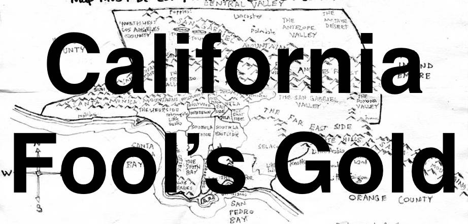
I was recently contacted by Dave Stoelk from Spectrum News. He originally wanted to do a segment on the Silver Lake Croquet League for his segment, “That’s So L.A.” After talking for a few minutes, though, he thought it might be fun to instead do a segment about my maps that I make, as Pendersleigh & Sons Cartography, for my online series, California Fool’s Gold. We were discussing possible neighborhoods on the phone when a woman walked by, recognized me, and asked if I was still making maps. I told her that I was and explained that we were looking to explore an as-yet-undecided, walkable neighborhood, the small scale of which would allow me to include lots of local businesses and features. She suggested “that neighborhood around Hoover.” I thought it was a great idea, and so, we decided to head over to Dayton Heights — or Madison — or J. Flats — or Virgil Village — or Silver Lake — or East Hollywood… depending on who you ask.
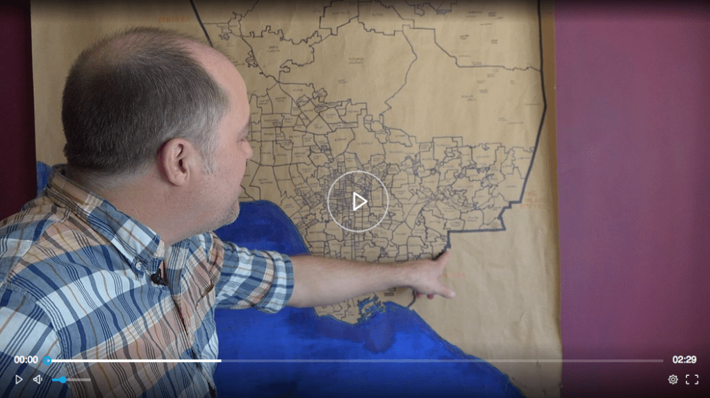
Here’s a link to the Spectrum story. I’ll embed the video if I figure out how!
Dave came over to Pendersleigh and interviewed me a bit as he checked out the maps. Next, we headed over to Dayton Heights. He parked at Bellevue Park, a former reservoir that was converted into a beloved park, seemingly without controversy. A group of men was gathered in the parking lot, listening to Frank Sinatra. Across the street, we encountered a woman and her dog outside of Marathon Apartments, a large complex where tenants are seemingly required to own at least one large dog and the elevators smell, well, doggy. I’d never noticed the pool before though. No one was in it. I wondered if it was only for dogs. From there we wandered down to Hoover and explored the charming commercial strip that I think of as Downtown Dayton Heights. First, a bit of history on the area, though.
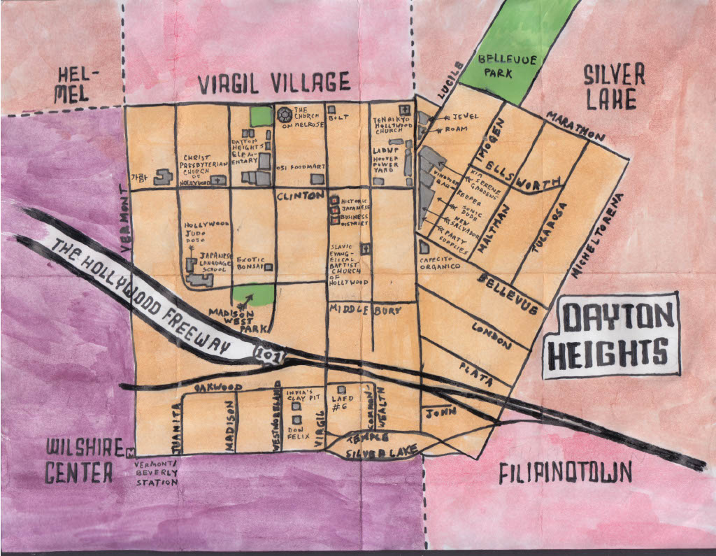
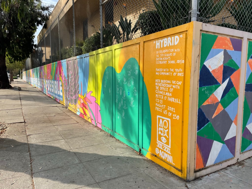
Pendersliegh & Sons Cartography‘s official watercolor and oil paint map of Dayton Heights, available on art prints of several sizes (soon) as well as a wide variety of merchandise
EARLY HISTORY
The first humans arrived in our region at least 13,000 years ago. These Paleoamericans were likely the ancestors of the Chumash, whose territory, at its greatest extent, sprawled all the way from Morro Bay to the Bolsa Chica Wetlands and across all of the Channel Islands. Some 3,500 years ago or so, the Tongva and other Uto-Aztecan language-speaking peoples migrated into the Los Angeles Basin from the Sonoran Desert to the east. The Spanish arrived from the south in 1542, claiming all that they saw for their empire. The Spanish founded El Pueblo de Nuestra Señora la Reina de Los Ángeles de Porciuncula in 1781. The pueblo’s shape was a square — for square leagues in size. The western border of the pueblo later became Hoover Street, named after John Leonce Hoover, a Swiss doctor who moved to Los Angeles in the 1840s and who died in 1862.
The streets of the Spanish pueblo were laid out on a diagonal grid. The streets around it were laid out, for the most part, on a Jeffersonian grid that was oriented along cardinal directions. Hoover remained Los Angeles’s western edge until 1896, when the Western Addition pushed it, at least south of Beverly Boulevard, to half a block west of Arlington Avenue.
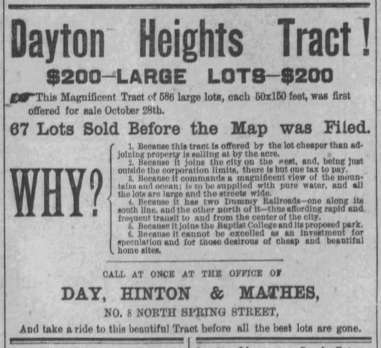
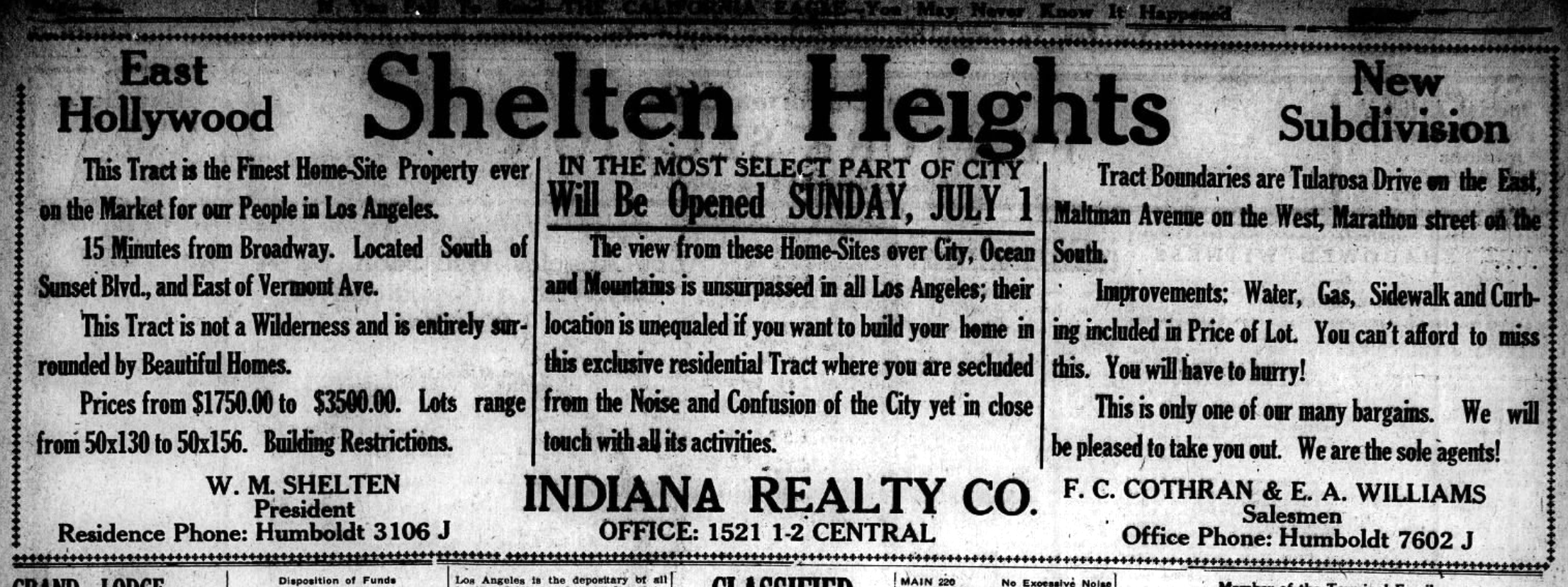
The Dayton Heights Tract was subdivided in 1887 and placed on the market that November, the year of Los Angeles’s first big land boom. Hoover, still the city’s western border, formed the eastern border of Dayton Heights. The Lincolnian Heights and Bellevue Temple tracts opened after, across the border in the city of Los Angeles. Those names, however, never caught on as community names and both came to be characterized as part of the Dayton Heights community and eventually, Silver Lake. On 26 October 1909, Los Angeles annexed the town of Colgrove, which moved the city’s western border to Vermont Avenue.
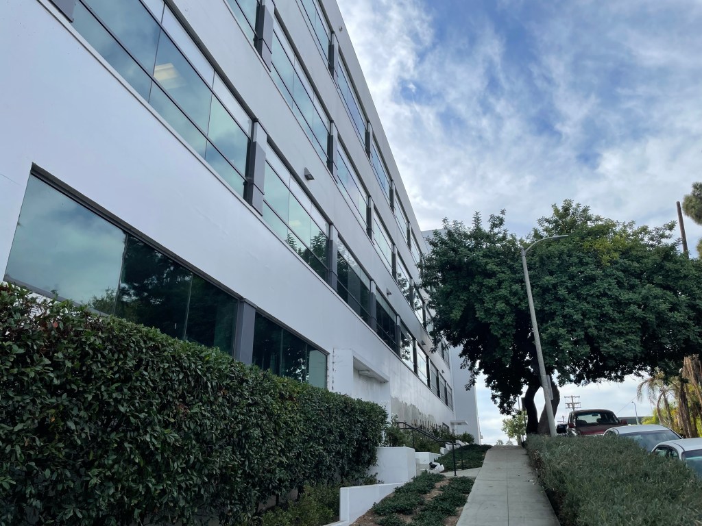
Developers of Dayton Heights made several claims — some dubious. The titular “Heights” are not very high. The extent of the elevation range is about seven meters. An early advertisement also claimed, “There are beautiful views of the ocean, mountain and valley, elegant resident sites on mounts, in orange groves, and vineyards…” I could barely make out the Hollywood Hills on the horizon from most points. I wasn’t sure what Valley I was meant to see. As for the ocean, I doubt whether anyone could see it from atop the tallest structure in the neighborhood, which is probably the four-story West Coast University – Center for Graduate Studies. The orange groves and vineyards are, of course, long gone.
GETTING THERE AND GETTING AROUND
One of Dayton Heights’s chief selling points was its location along the Cahuenga Valley Line, a steam-powered train that began operation the same year that the tract opened. Around 1895, it was acquired by Sherman & Clark. It was later electrified and taken over by Pacific Electric Railway (PE), which operated it until 1915. Dayton Heights was also served by two Los Angeles Railway (LARy) lines. The L Line, which traveled along Hoover, Clinton, and Virgil streets; operated until 1940. The V Line, which traveled along Vermont, operated until 1963. Even though the trains are gone, their routes are closely mirrored by Metro bus lines. The Cahuenga Valley train route is now the 14 Line. The L Line is now the 10 Line. The V Line is now the 204 Line. There’s also a subway station at the neighborhood’s southwestern corner, Vermont/Beverly Station, which is utilized by the B Line. There are currently zero dedicated bicycle lanes in the neighborhood but it is flat and small and thus pretty walkable — and walking is how I chose to explore it.
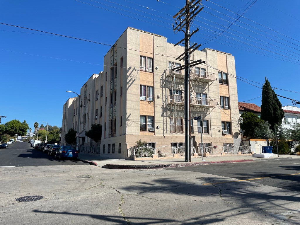
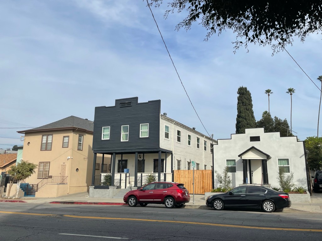
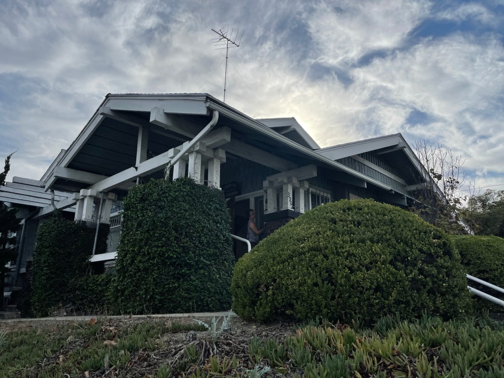
One of the buildings that caught my eye was an Art Deco apartment building, constructed in 1930. Three stories tall and home to 30 units, it was built before the implementation of parking minimums and its residents. In other words, transit-oriented developments with zero parking spots are sort of what the all-important “neighborhood character” is about.
THE ALBRIGHTS
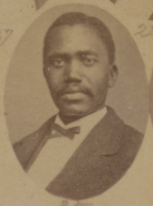
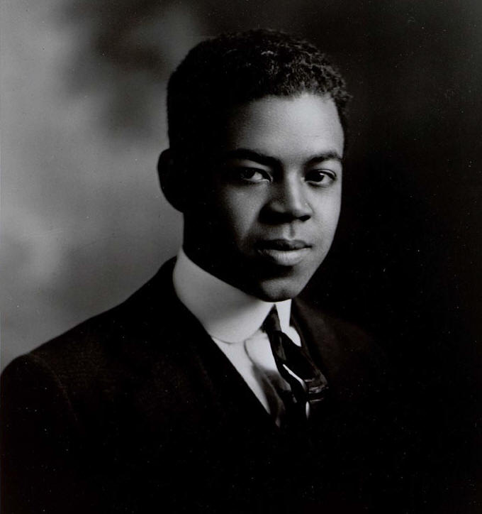
One of the early prominent residents of Dayton Heights was George Washington Albright, who’d served as a Mississippi state senator for four years and who had been born into slavery in that state in 1846. His senate career began in 1873 when he defeated Ku Klux Kan member, E. H. Crump, for the seat. In 1892, he and his white wife, Josephine Hardy, moved into a Dayton Heights home on Westmoreland Avenue. George operated a mill there, farmed, and planted an orchard. The Albrights petitioned the city to open a school, which opened as the Dayton Heights School in 1910. Both of the Albrights were themselves, teachers.
DAYTON HEIGHTS REXALL DRUGS
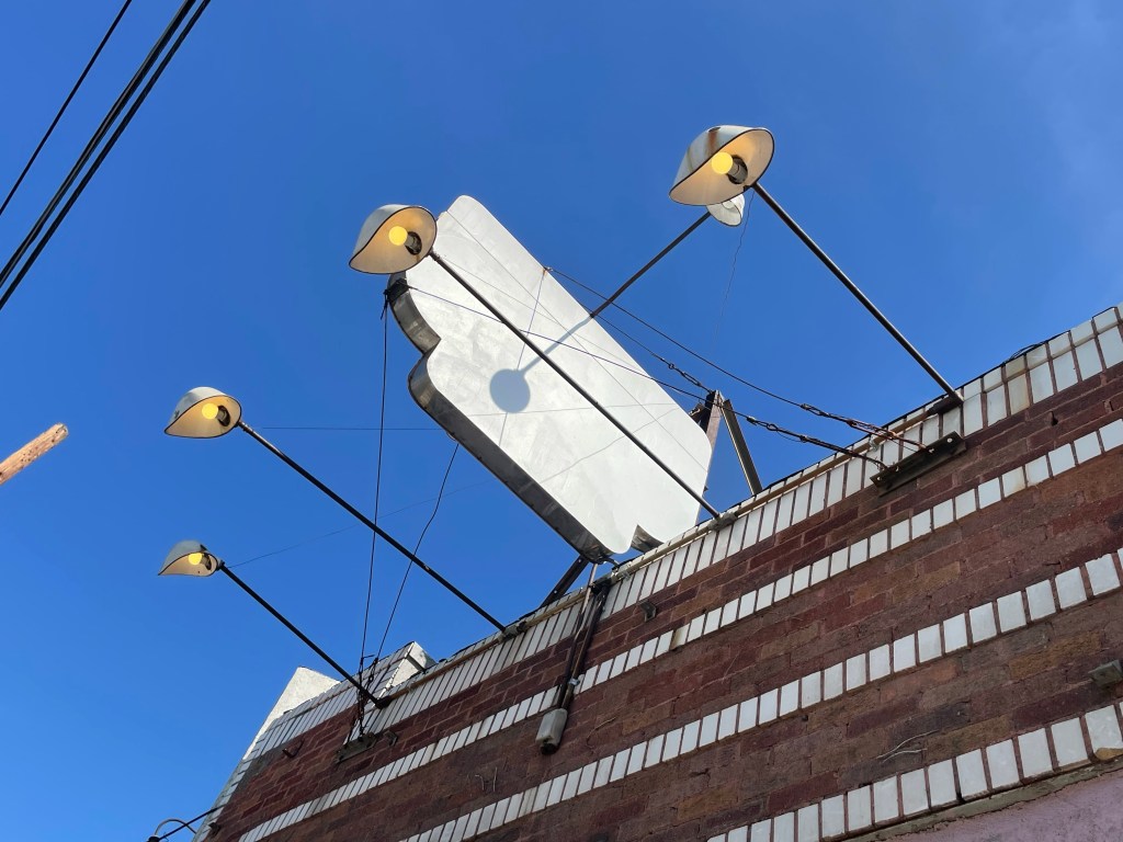
Aside from Dayton Heights Elementary (and the Dayton Heights Early Education Center), the only other place I saw “Dayton Heights” was on an old sign installed over a vacant business at 622 North Hoover. The letters had been painted over but were stamped into the metal sign and thus were still discernable. I had to strain my eyes to make them out. They spelled out “Dayton Heights Rexall Drugs.” Rexall, for those who don’t know, was a chain of corner drugstores that existed from 1920 until 1977. The building was constructed in 1925 on the Lincolnian Heights Tract. It was originally a café. In the 1930s and ’40s, it was home to a beauty salon. It was home to Dayton Heights Pharmacy by 1957.
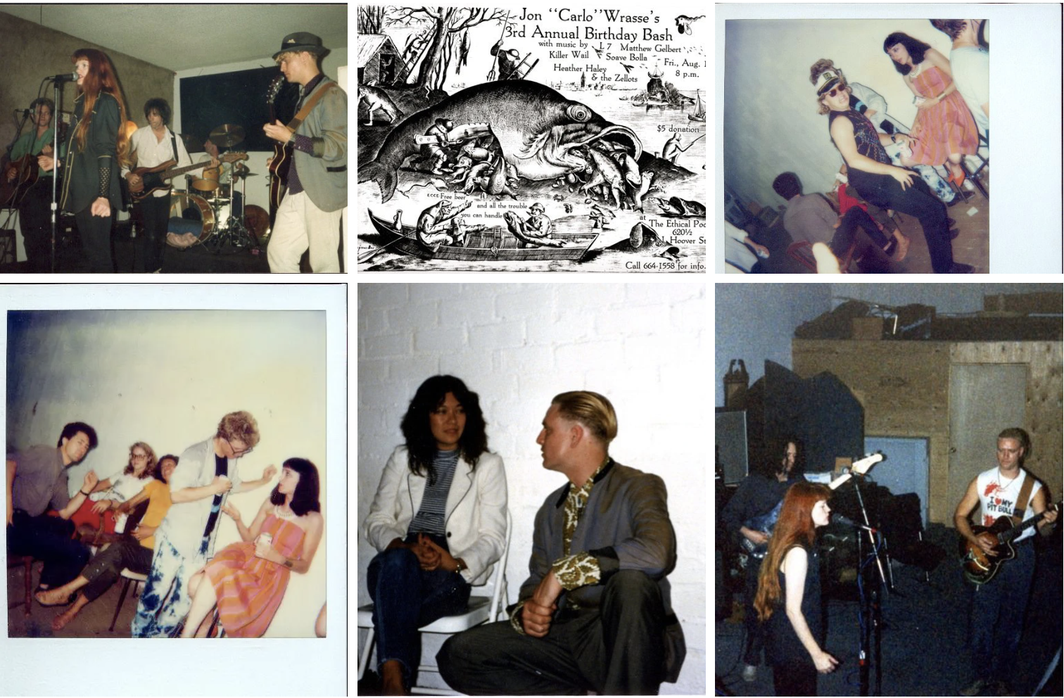
By the 1980s, it was a small live music venue and rehearsal space called Ethical Pool, that may’ve been operated by Carlo John Wrasse and Heather Haley. It seems to have been the nexus of a local rock scene. None of the performers who played there are household names but included the likes of Candy Kane, Crowbar, Greg Burk, Heather Haley & the Zellots, Killer Wail, Mathew Gelbert, Milo Bender, the Mindreaders, Sacred Antennae, Snake Farm, Soave Bolla, and Tupelo Joe. Apparently, Donita Sparks and Suzie Gardner, both of L7, performed there and until recently, I know that Sparks still lived just a couple of blocks away.
DOWNTOWN DAYTON HEIGHTS
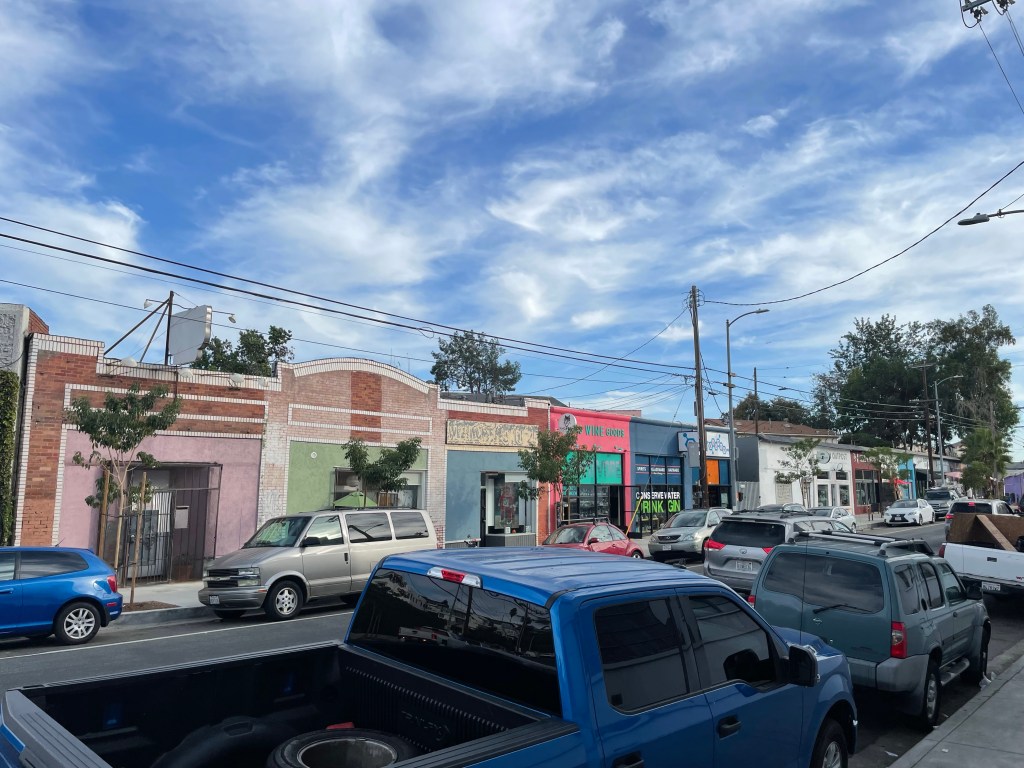
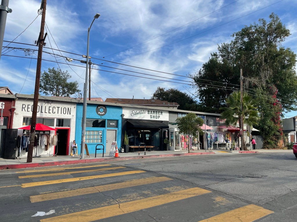
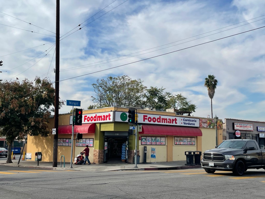
This short stretch of commercial buildings is essentially Downtown Dayton Heights… or Dayton Heights Village (if you’re into the whole villagification thing). Almost all of the commercial buildings on the east side of the street popped up around the route of LARy streetcar line in the 1920s and over the years have supported a variety of businesses.
In the 1920s, there was (another) beauty salon and a grocer. In the 1930s, there was Clinton Pharmacy. In the 1940s, there was a Safeway, where manager Frank Fischer was held up by gunmen in 1944. In the 1950s, there was Leo’s Courtesy Shoe Service and Kuykendalls (a store that sold stoves and other appliances).
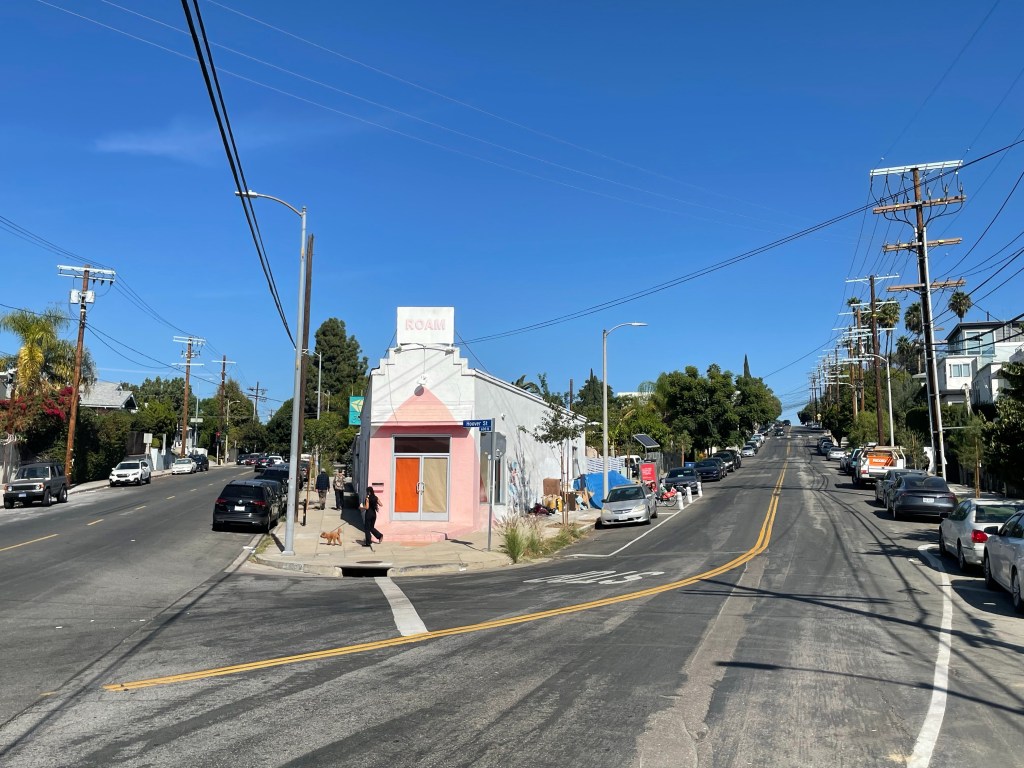
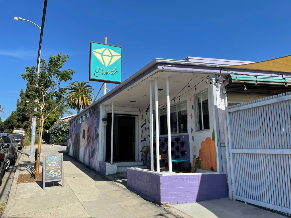
I can’t remember what all of the businesses were when I moved to Los Angeles in 1999 but, by then, they catered primarily to a Latino clientele. Two of them, Party Supplies (which has much more than just party supplies) and New Salvador Travel Agency, have been there since that era. A woman who’d lived on the block for 50 years reminded me that there’d been a laundromat. In recent years, as rents climbed on Sunset Boulevard, businesses like Bar Keeper and perhaps others relocated to Hoover. A punk club became a pot shop and is now Roam, a yoga studio. A vegetarian restaurant, Jewel, opened next door in 2018. There’s also Maeday Outpost, Wag n’ Swag, Recollection, Sonic Dude, Silverlake Barber Shop, and Kim Serene Gardens. At the latter, I chatted with owner Kim Anderson for a while about the changing identity of the neighborhood.
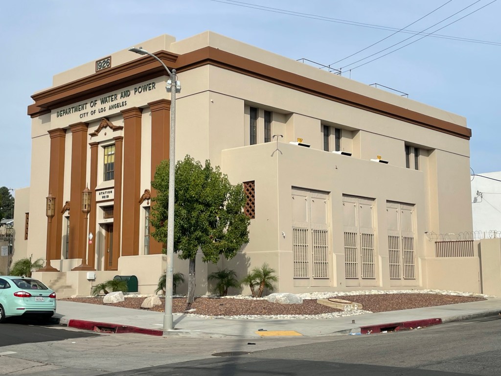
LADWP HOOVER POWER YARD
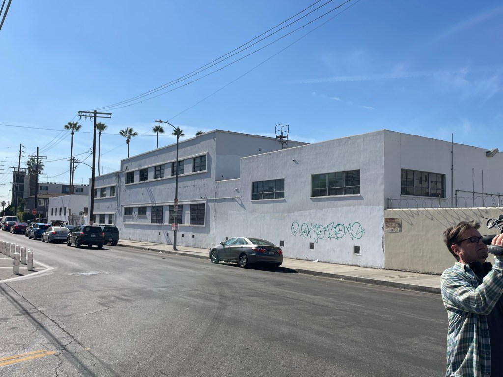
Across the street from these low-slung commercial buildings is the beautiful LADWP Hoover Street Yard. The dominant building is a Bauhausian building that looks to me like something Paul Revere Williams might’ve had a hand in the design of. It’s not long for this world, though, it seems. LADWP’s Streetlight Maintenance Department moved out of the facility in 2018 and it was announced that these buildings, with the exception of the 1920s distributing station, are going to be demolished and replaced with more modern facilities.
DAYTON HEIGHTS IMPROVEMENT ASSOCIATION
According to the most recent census data, the population of the Dayton Heights tract self-identified as 62% Latino of any race, 18% Asian, 12% non-Latino white, 6% multiple races, and 2% black. It has long been a highly diverse neighborhood — and yet, in 1923, some residents demonstrated appalling anti-blackness. One year earlier, “Little Celestine Shambrey” and “two little girls of the other race” were allowed to represent the Dayton Heights School at the Junior Orchestra Concert held at Philharmonic Auditorium. In 1923, though, the Dayton Heights Improvement Association banded together to dash the hopes of a group of black Angelenos who wanted to move there. Their members banded together to buy property in order to stop them.The Los Angeles Times reported, “Residents of Dayton Heights,’ by a community movement, have stopped an invasion of that territory by negroes, Mrs. B. A. Burgess, president of the Dayton Heights Improvement Association announced yesterday.”
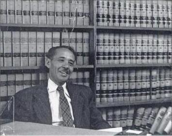
The “improvement association” dashed the hopes of one group but the neighborhood nevertheless grew less white. In 1940, black architect James Homer Garrott designed and built a home for himself, his mother, Fannie, and his brother Curtis, at 653 Micheltorena — as well as a residence at 647 Micheltorena for black civil rights attorney and judge Loren Miller. Miller, in 1948, was chief counsel before the court in the decision that led to the outlawing of racist housing covenants, Shelley v. Kraemer.
J. FLATS
The demographics of Dayton Heights began to change well before racially restrictive convents were ruled unconstitutional. In fact, such a significant enough shift occurred in Dayton Heights that it acquired a new nickname, J. Flats — short for “Japanese Flats.” One of the things that tickles me about this nickname is that it unconsciously refutes the pretentious “heights” of the fairly flat neighborhood. I also wonder whether or not it was coined by Japanese residents. By the early 1920s, Los Angeles boasted the largest population of Japanese outside of Japan and several Japanese enclaves existed beyond the well-known Little Tokyo, including Furasato, Soteru, and Uemachi — but all of those had names that were more recognizably Japanese in origin.
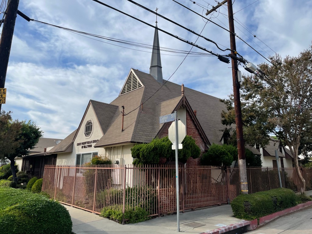
Former Japanese sites of note in Dayton Heights included the Japanese Presbyterian Church (now the Christ Presbyterian Church), the Shiraro Photo Studio (there were many Japanese Angelenos who took to art photography), the Obayashi Employment Agency, the Mary Yone Akita Residence, and the Ozawa Boarding House.
I spoke with a woman who’d lived in the neighborhood for decades and asked if she’d heard of the “J. Flats” designation. “Of course!,” she replied and mentioned Fujiya Grocery, which only became Osi Market in 2012 when owners June Tami and Wayne Kohatsu retired. It had been Fujiya, by then, for eighty years — having been founded by the Hoshizaki family in 1932. The Hoshizakis spent World War II in the Heart Mountain concentration camp. After they were released, they opened a nursery nearby. The California and Virgil Nursery became the Kingdom Hall Of Jehovah’s Witnesses, which it remains today.
Having visited the neighborhood many times in the past, I was surprised to discover that there are still Japanese institutions in the neighborhood that I’d not before noticed. There’s still the Hollywood Japanese Cultural Institute, which was founded in 1947 as the Hollywood Japanese Community Center. It was formerly used by the Hollywood Gakuen and Hollywood Buddhist Church.
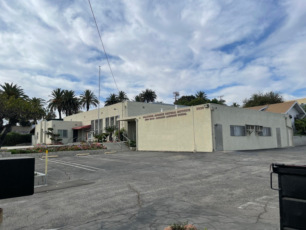
The Hollywood Judo Dojo was established nearby and moved to a new building on the campus of the cultural institute in 1977. At the opposite corner of the neighborhood, there’s the Tenrikyo Hollywood Church which I’ve passed hundreds of times and never noticed.
I even came across a private home in which a bonsai operation is located, Exotic Bonsai. The front gate was open but I didn’t see anyone and, since I hadn’t called in advance, I didn’t venture inside. I can’t say, definitely, whether or not the owner(s) are Japanese or whether or not they were trained by Japanese bonsai gardeners but I found its existence intriguing.
DAYTON HEIGHTS EATS & DRINKS
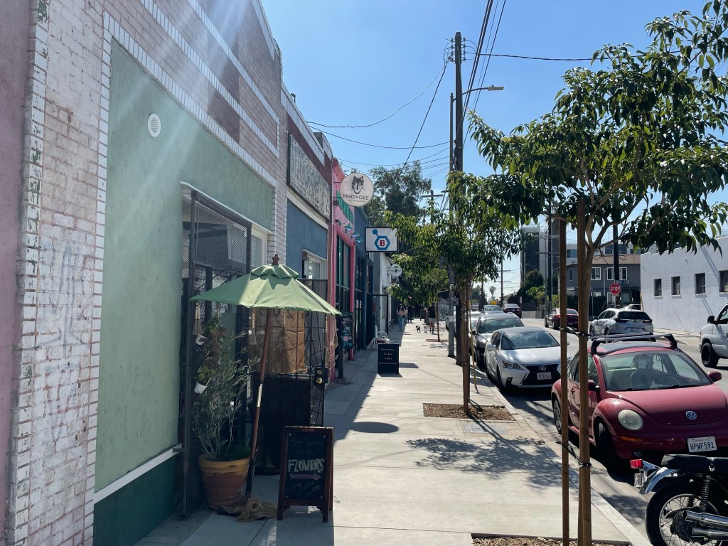
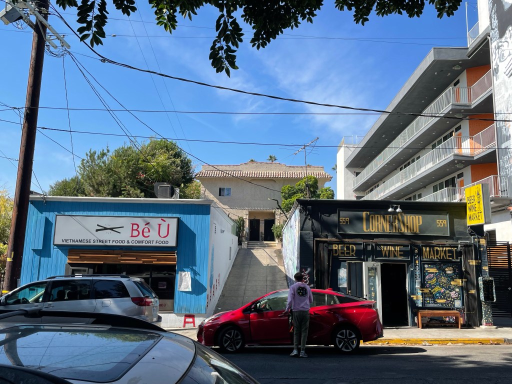
There are several restaurants and cafes in the neighborhood. Angel Orozco and John Sofio opened Cafecito Organico in 2004 in a striking building constructed in 1920. Across the street to the north, a woman was selling fresh fruit from her cart. She told me that she’d lived in the neighborhood for twenty years. Across the street to the west, in what look like former garages for the duplex behind them, are a Vietnamese restaurant, Bé Ù, and next to it a wine and beer shop, Corner Shop.
Vinovore, another wine shop, is located about a block north. South of the Hollywood Freeway, it really feels like a different neighborhood, but there’s a Peruvian restaurant, Don Felix, at which I struggled to find vegetarian options in the past, and next to it, India’s Clay Pot.
I came across the mysterious Garam, which felt like a secret clubhouse. The appealingly derelict building is almost hidden from view and entering the parking lot felt like trespassing. A fence around the sides contains broken equipment and litter. A fenced-off staircase leads to a walled-off entrance.
Bolt Virgil Village, not actually located in Virgil Village, is located where a beloved restaurant, Cha Cha Cha, flourished for many years — and where I celebrated one of my birthdays with friends and sangria. Dave and I ate lunch at Jewel. I had a breakfast burrito and cider. He had carrot lox toast.
MISCELLANEOUS DAYTON HEIGHTS
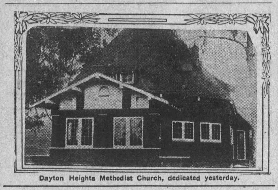
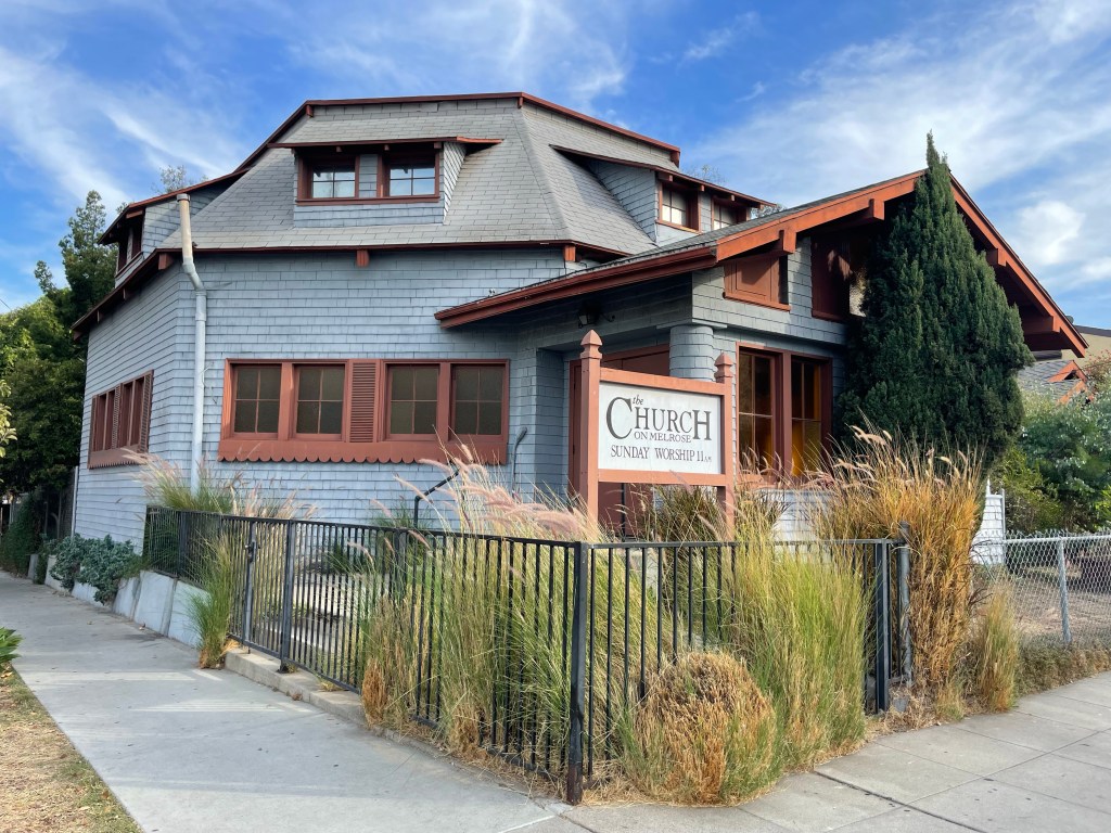
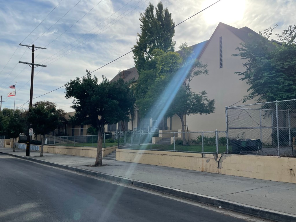
Other features of the neighborhood I came across included the Church on Melrose, housed inside a charming, small, hexagonal church dedicated on 1 April 1906 for the Dayton Heights Methodist Church.
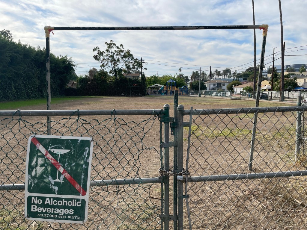
There’s also Madison West Park, which sounds like the name of an insufferable influencer, but is actually a small, somewhat barren soccer field, playground, and picnic area beneath a freeway way. The Hollywood Freeway is itself a major feature of the neighborhood.
HOLLYWOOD FREEWAY
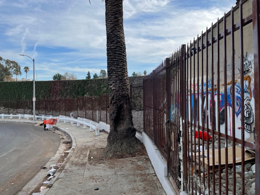
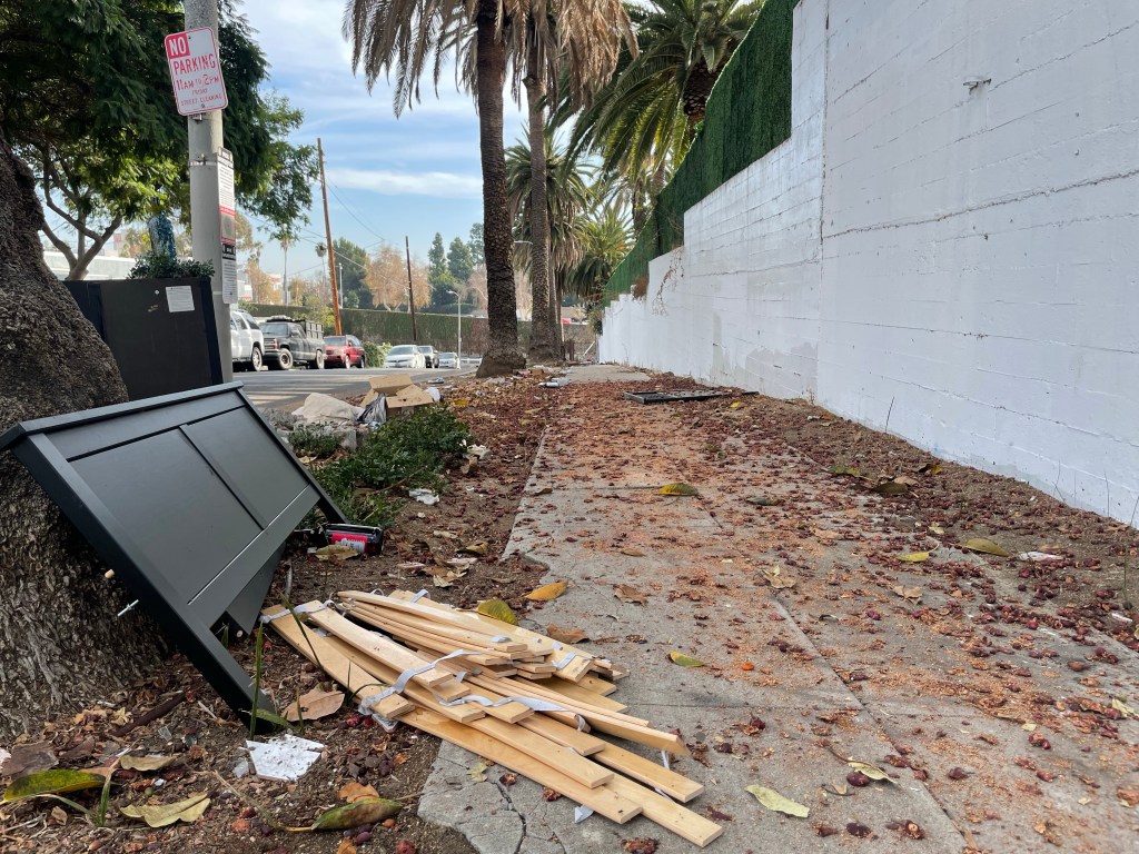
The 101 Hollywood Freeway sliced through the neighborhood, cleaving it in two, in 1954. Freeways are deleterious to neighborhood integrity and I doubt that it’s a coincidence that Dayton Heights began to vanish from the Angeleno lexicon at almost the exact same time as homes were demolished and residents displaced to allow for its construction. Those who could afford to move away, in many cases, surely did. Its existence means noise, exhaust, brake dust, and microplastics fill the air and soil around it. Its sound barriers are canvases for taggers and the landscaped area around it is filled with litter. Commonwealth, Juanita, Madison, and Westmoreland are all sliced in two; leaving Hoover and Virgil as the only streets that connect the northern part of the neighborhood to the southern. Both freeway underpasses are home to seemingly permanent homeless encampments, as is Oakwood Street. Hearteningly, their numbers have shrunk since the opening of large transitional housing structures.
Finally — what are your memories of Dayton Heights? Please share in the comments. And let me know there which communities you’d like me to explore and map next. Thanks!
Support Eric Brightwell on Patreon

Eric Brightwell is an adventurer, essayist, rambler, explorer, cartographer, and guerrilla gardener who is always seeking paid writing, speaking, traveling, and art opportunities. He is not interested in generating advertorials, cranking out clickbait, or laboring away in a listicle mill “for exposure.”
Brightwell has written for Angels Walk LA, Amoeblog, Boom: A Journal of California, diaCRITICS, Hidden Los Angeles, and KCET Departures. His art has been featured by the American Institute of Architects, the Architecture & Design Museum, the Craft Contemporary, Form Follows Function, Los Angeles County Store, the book Sidewalking, Skid Row Housing Trust, and 1650 Gallery.
Brightwell has been featured as subject in The Los Angeles Times, VICE, Huffington Post, Los Angeles Magazine, LAist, CurbedLA, Spectrum News, Eastsider LA, Boing Boing, Los Angeles, I’m Yours, and on Notebook on Cities and Culture.
Brightwell has been a guest speaker on KCRW‘s Which Way, LA?, at Emerson College, and the University of Southern California.
Brightwell is currently writing a book about Los Angeles.
You can follow him on Ameba, Duolingo, Facebook, Goodreads, iNaturalist, Instagram, Mastodon, Medium, Mubi, the StoryGraph, and Twitter.


The University at the corner of Clinton and Vermont was previously a Jewish Community center, and before that I believe it was the estate of the Laemmle family, who owned a chain of movie theaters.
LikeLiked by 1 person
Oh wow! I think that the Laemmle theaters are still owned by the Laemmles (Robert Laemmle and his son Greg Laemmle).
LikeLike