

INTRODUCTION
Readers are apparently loving these area code/valley posts. Last year’s 818/San Fernando Valley Day post was my most-read piece in 2021. That unexpected response inspired me to write this year’s 626/San Gabriel Valley Day post, which — two month’s after its publication — has already climbed to 2022’s number two spot. To be honest, I’d probably write these posts even if no one was reading them because I love geography and holidays. So naturally, I thought, why not do declare 9 September to be 909/Pomona Valley Day and write a post?
POMONA VALLEY AND THE 909 AREA CODE

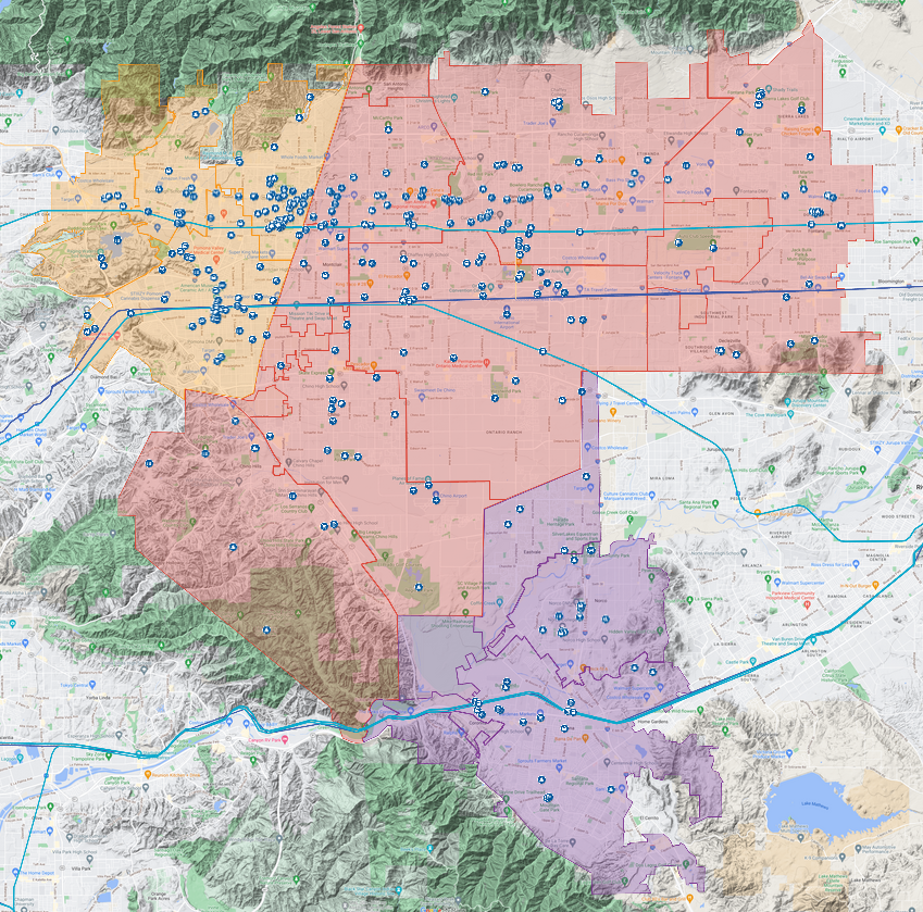
Unlike 626 Day and 818 Day, 909 Day works whether you write the date format month/day (most Americans) or day/month (pretty much everyone else on the planet). And why not write a post, so that readers will be ready to celebrate. Area codes were created to facilitate making phone calls without the assistance of a human operator, and not to correspond exactly to geographical regions for people who want to create holidays and thus, the communities served by the 909 area code don’t correspond exactly to those located in the Pomona Valley. The 909 extends far beyond the Pomona Valley, into the San Bernardino Mountains, where it serves Big Bear City before it transitions into the 760 area code. On the other hand, municipalities often don’t fit squarely into larger regions. Chino, Chino Hills, Claremont, Corona, Coronita, Fontana, La Verne, Ontario, Pomona, San Antonio Heights, and Upland all fit pretty squarely into the Pomona Valley and the foothills that define its edges. San Dimas, though, is located at the gateway between the Pomona and San Gabriel valleys, but is more culturally lined, I think, with the San Gabriel Valley. I’ve included here, then, a few San Dimas attractions located in the Pomona Valley side.
MY HISTORY IN THE POMONA VALLEY
When I first moved to California in 199, it was in the Pomona Valley that I stayed — specifically, Chino. It was there that I first saw an ad for El Pollo Loco with Paul Rodriguez and a chihuahua — a dig at Taco Bell‘s “Yo quiero Taco Bell” ads. I learned that El Pollo Loco was a fast found chain founded in Mexico, which was new to me. I immediately headed over to a location in Chino Hills where I ordered a Smokey Black Bean and BRC burrito, tried each of the salsas, and enjoyed my meal inside an otherwise empty dining room. I suppose most of the business was in the drive-thru. Now, I’m not going to say that El Pollo Loco is great — although if you want to visit an historic location, the first American one still operates just north of MacArthur Park on Alvarado. I’m not going to sneer at El Pollo Loco either, though. Besides, this was one of my first tastes of fast food with actual origins in Iowa. In Iowa City, where I’d gone to college, Mexican cuisine was represented by the strawberry Marguerita-type Mexican restaurant, Carlos O’Kelly’s, and the fast food from Taco Bell and Taco John’s — all of which were founded by US-born Anglos.
I’d driven from Iowa City with what I could fit into a beige Ford Taurus given to me by my grandmother, who preferred walking and cycling to driving. It had very few miles on it but was already on its second transmission. I was staying with a friend I’d made in college at his childhood home in Chino. His sister was in a recovery program and had been given the nickname “Green Acres” because she was from Chino. Her baby daddy was doing time at the California Institution for Men. Their toddler son rap-sang Limp Bizkit songs. My friend’s highschool sweetheart lived in Ontario or Upland — I can’t remember which — because she told people she was from Claremont. A mutual friend of all of ours, a Comanche nicknamed CPM, was from Pomona — and he invited himself on a date with me and a young Colombian from Chino Hills. CPM had a Mexican friend who was supposedly close to Morrissey and fronted a “romo” band called Pussywhip 2000. CPM was permanently stoned and in his absent-mindedness, drove us from the Los Angeles County Fair (held at Pomona’s Fairplex), with his ever-present cap still on the roof of his car. When he realized he was without it, we spied a street sweeper. I suggested he cut his losses and move on by he insisted that the driver let him retrieve it from the machine’s disgusting, trash-filled, watery reservoir, which he did. I remember that CPM’s parents loved to go to the Pomona Valley Mining Company, perched above the Pomona Valley. Our Chino friend’s mom, a Scilician, preferred the Claremont Buca di Beppo — which we ate at on her birthday in another restaurant chain first for me. I could instantly see what the fuss about Claremont was… or at least the walkable “the Village,” and nearby college campuses. I remember buying the VHS of Nick Cave and the Bad Seeds — The Videos, from the Rhino Records store. Although I usually can’t pick it up in Silver Lake, 88.7 KSPC is still my favorite local college station (sorry KXLU, KUSC, KJAZ, KCRW, and KPCC).
That said, during the few weeks that I lived in the Pomona Valley, I didn’t actually spend that much time there or explore much. Almost every day I’d drive over the San Jose Hills, across the San Gabriel Valley and Los Angeles Basin all the way to Santa Monica, on the Pacific Coast. Several of our college friends then lived in a truly grimy apartment in the Pico neighborhood. Another lived nearby, in a much less grimy home. From there, I would be shown the sites of the Westside, Hollywood, Midtown, and Mideast Los Angeles. Another friend from college lived in Monterey Park. I was fascinated by the San Gabriel Valley. We visited my friend’s dad in the South Bay who warned us not to go east of the 405. I added it to my list of boundaries we were cautioned against crossing. Don’t go east of the 405, don’t go south of the 10, and don’t go east of the Los Angeles River. Ignoring them all, I explored the Eastside a bit on my own after the brakes on my Taurus went out in Boyle Heights on the long drive back and thought it was magical. Another time I missed my exit and ended up in Fullerton and so saw a bit of North Orange County.
Suburban Chino felt both connected to Los Angeles but also acutely isolated. When I asked my friend’s mom how often she went to Los Angeles, she also boasted that she hadn’t been there in six years. When I asked whether she was friendly with her neighbors, at least, she said no and slagged them off for being Democrats and thus, idiots. Behind the backyard wall of the Chino home, there were sheep grazing quietly. The television was on constantly, drowning out the silence. I was amused, shocked, and appalled by how bad the local news was. One particularly offensive bit of fluff followed a reporter as he and a Marylin Monroe impersonator tried to determine which hotel had the beds with the best mattresses. Another hot “local” story was about the popularity of remote control airplanes in Iowa and Illinois’s Quad Cities! The only thing on television that I thought was any good was everything done by Huell Howser. It was far more exciting than car chases — it was a-MAY-zing!
After about a month, my Chino friend found an apartment in Silver Lake where I still live. With time and distance, I’ve grown more interested in the Pomona Valley — which is so often unfairly lumped in with the larger and higher profile San Gabriel Valley. I explored Claremont for California Fool’s Gold with a co-worker who told me he’d once DJed at a party in La Verne thrown by David Koresh. I headed out to interview Robert Martinez for my friend’s series, Angeleno Stories. I headed out to the Glass House to see Jesus & Mary Chain and St. Etienne (not on the same bill), located conveniently close to Pomona Station. I took my partner to Claremont Village on a date. We had Italian (at Aruffo’s, no Buca di Bepo). At Rhino, I picked up a vinyl copy of Wheatstraw Suite by Missouri’s Bluegrass rockers, The Dillards. I’ve since learned that Rhino picked up and moved to Claremont’s neighbor and nomenclatural mirror, Montclair. Before the move it was located conveniently near Claremont Station. Now it’s located in a larger building conveniently near Montclair Transit Center.
HISTORY OF THE POMONA VALLEY
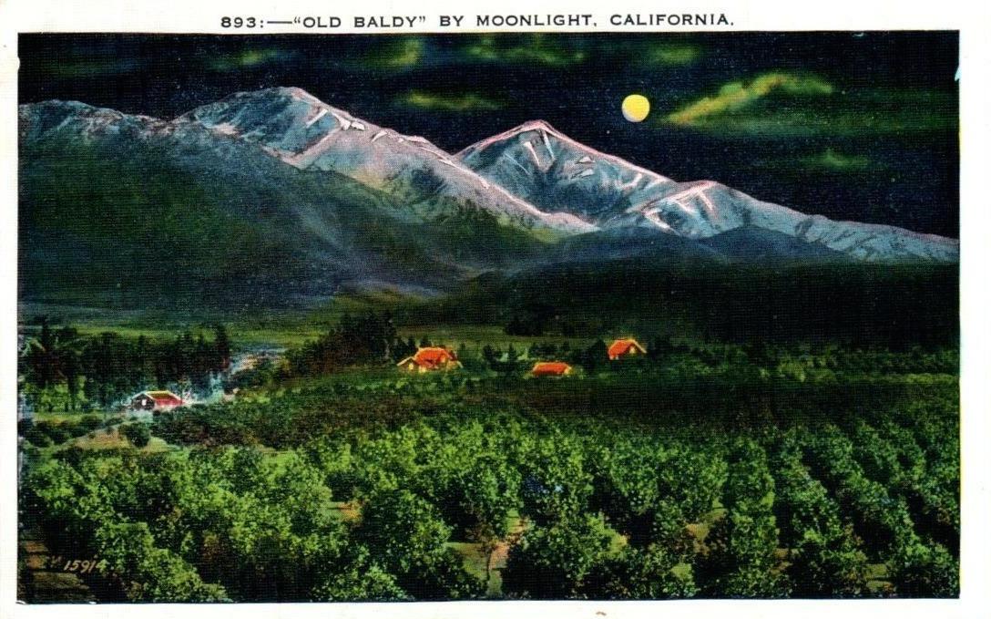
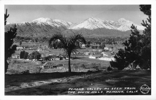
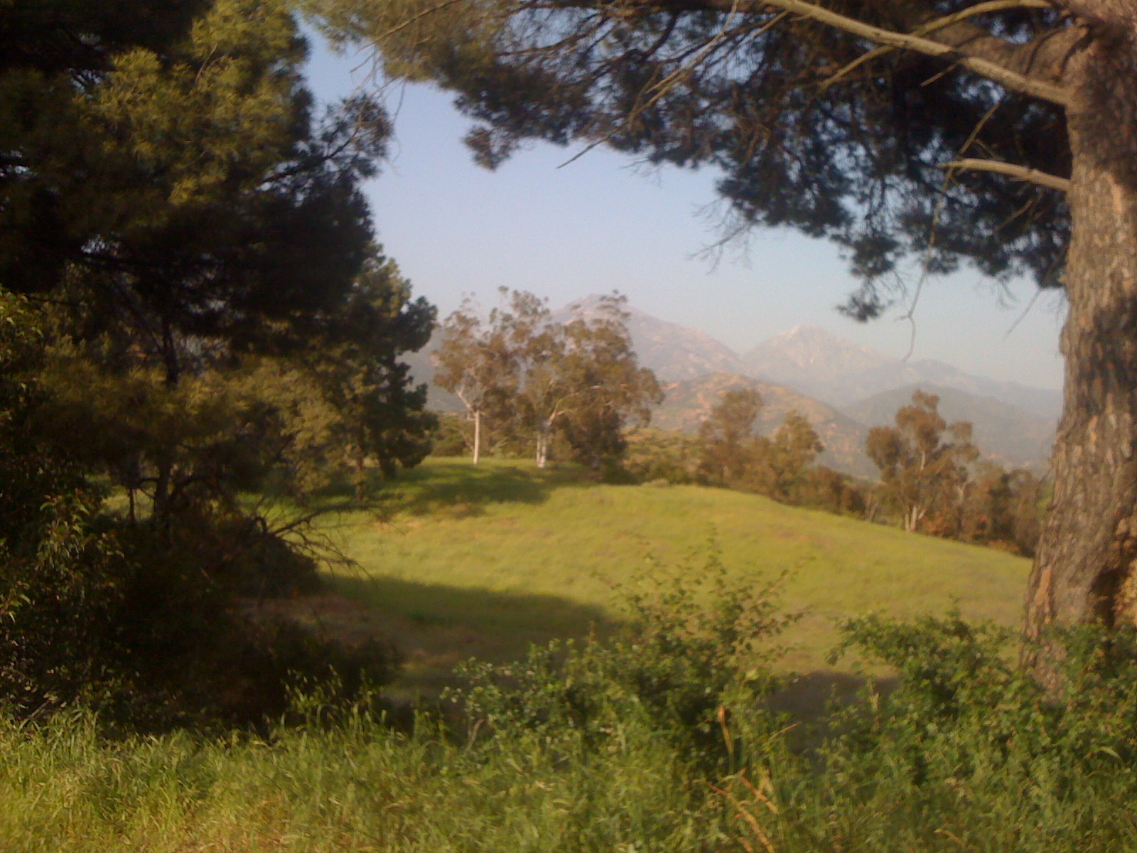
The Pomona Valley is an alluvial valley formed by the Santa Ana River and its tributaries, which include Chino Creek, San Antonio Creek, and San Jose Creek. It is hemmed in by the San Gabriel Mountains to the north, the San Jose Hills to the west, the Puente Hills (known locally as the Whittier Hills and Chino Hills) to the southwest, the Jurupa Hills and other small hills to the southeast, and the Cajon Pass to the east. To the north looms the tallest of the San Gabriel Mountains, 3,068-meter-tall Mount San Antonio, nicknamed Mount Baldy for its prominent tree-less and often snow-covered dome. To the west is the San Gabriel Valley — home to an estimated two million people. To the east are the two largest cities in the Inland Empire and the county seats of their respective counties, San Bernardino and Riverside. Together, they’re home to more than half a million. The entire Pomona Valley is home to about 1.25 million people.
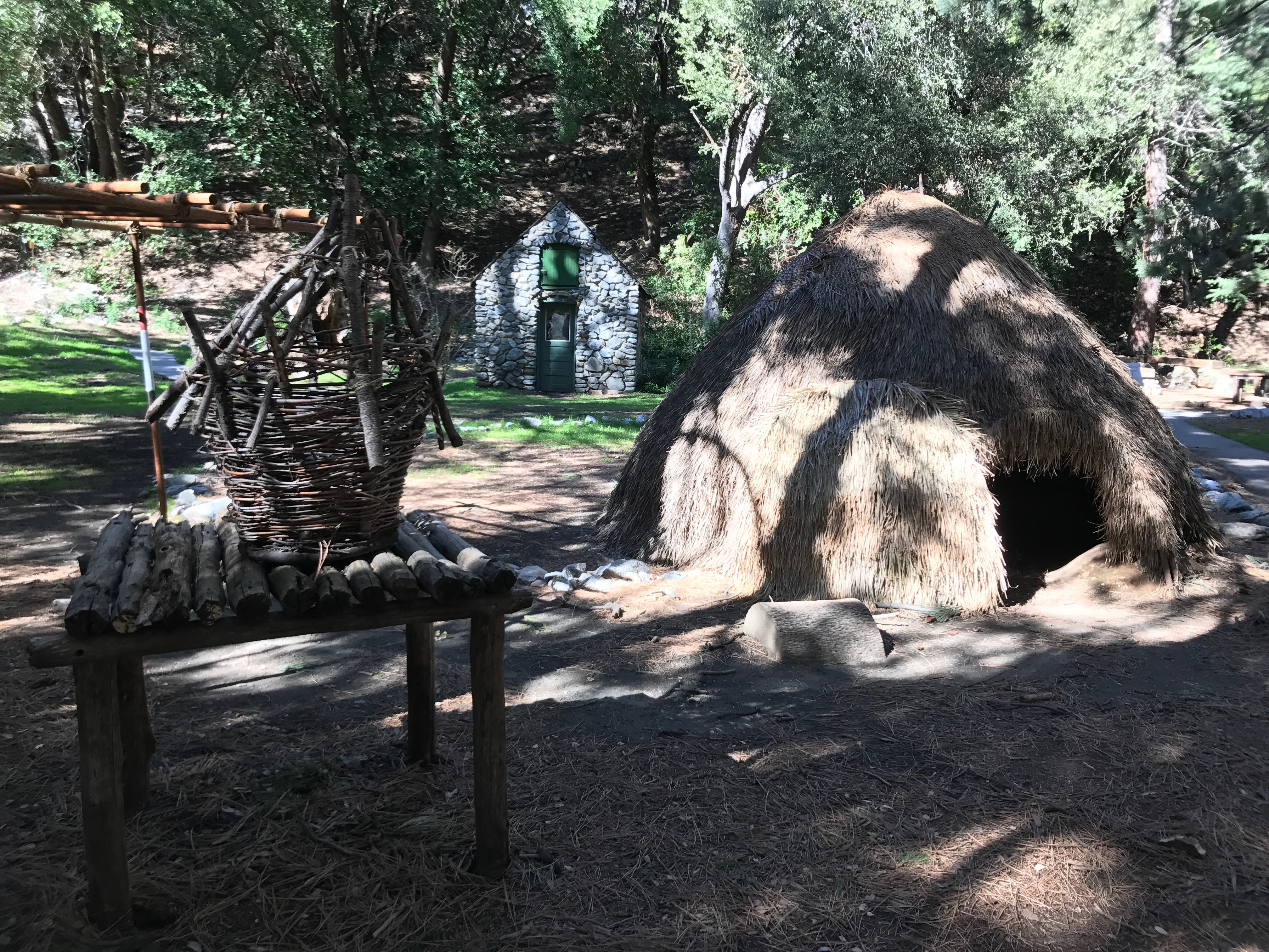
Historically, the Pomona Valley was covered with chaparral shrublands, coastal sage scrubland, grasslands, and oak woodlands. The first human inhabitants were the Taaqtam and Tongva — two Takic language-speaking peoples who migrated to the region from the Sonoran Desert to the east. Their villages in the area included Kukamongna, near Red Hill, and Wapijangna, in modern-day Chino.
Although the Spanish claimed all of California for their empire in 1542, they didn’t really trouble the inland people of the Pomona Valley and lands to the east that much until 1771, when they established a mission in the Whittier Narrows between the San Gabriel Valley and what’s now Southeast Los Angeles. The Spanish referred to the Tongva as “Gabrielinos,” after their Misión de San Gabriel Arcángel. They referred to the Taaqtam, who lived in the mountains above, as “Serranos,” meaning “highlanders.”

The San Bernardino de Sena Estancia, a ranch outpost of Misión de San Gabriel Arcángel, was founded in what’s now Redlands in 1819, nine years after Mexico declared independence from Spain. Mexico’s independence was recognized in 1821. Mexican ranchers raised cattle and sheep and grew beans, maize, and wheat. In 1848, the US invaded Mexico and conquered a third of the country, including all of California. Los Angeles, Mariposa, and San Diego counties were founded on 18 February 1850. On 26 April 1853, San Bernardino County was carved out of all three. Riverside County was carved on 9 May 1893 from San Bernardino and San Diego counties. Earlier that year, on 1 March 1, the California Assembly voted 54–14 to create a new county in the Pomona Valley called San Antonio County and with Pomona as its county seat. It was rejected by the California Senate, however, and today the Pomona Valley remains divided between Los Angeles, Riverside, and San Bernardino counties.
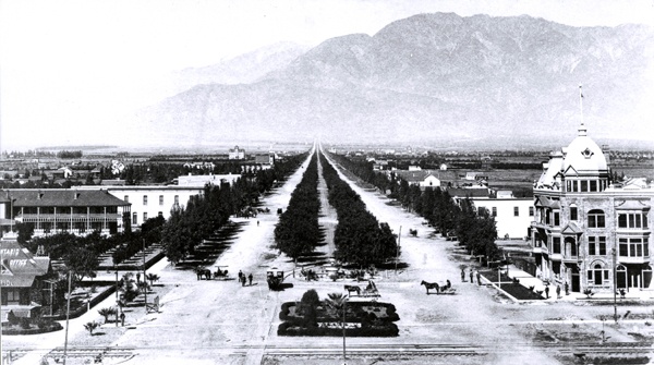
The first Southern Pacific trains arrived from San Franciso to Los Angeles in 1876. In 1887, the first Atchison, Topeka, and Santa Fe passenger trains rolled into Los Angeles. Competition between the two agencies drove down train fares. Ranchos transformed into townships and new towns were built from scratch along railroad lines, accommodating a flood of migrants from the East and Middle West. The Pomona Valley community of Ontario was founded in 1882. Corona was incorporated in 1886. The communities of Chino, Claremont, La Verne, and Pomona were all founded in 1887.
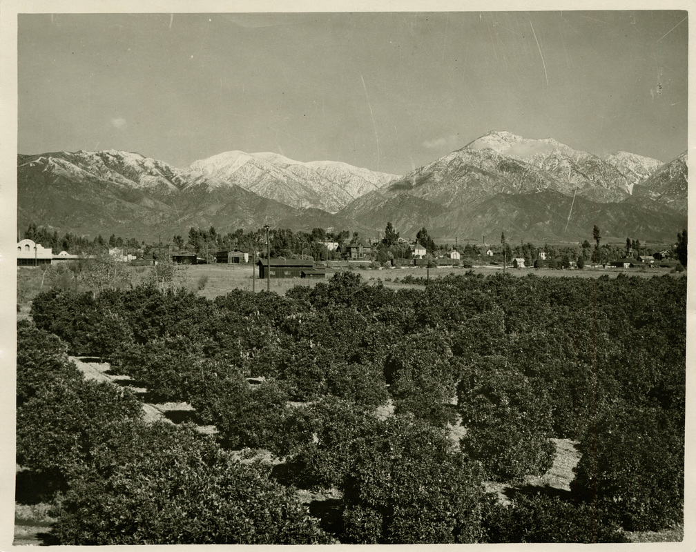
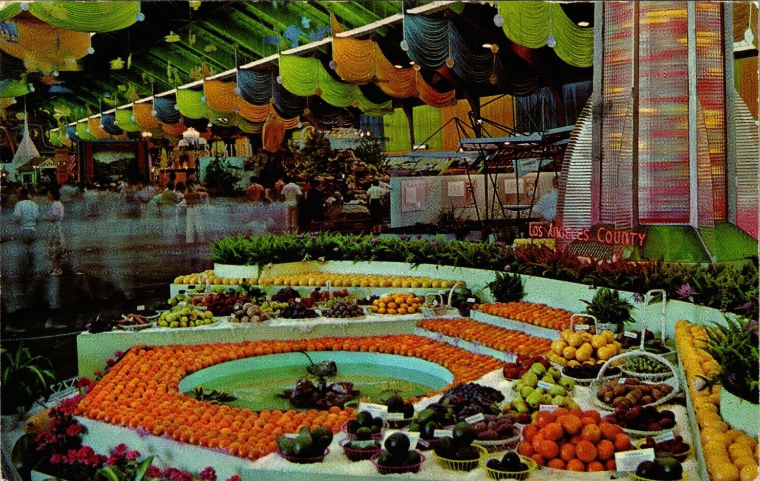
Citrus replaced earlier crops and Pomona arose as a primary center of a vast Orange Empire. Corona was known as the “Lemon Capital of the World.” Dairy cows, grapes, peaches, strawberries, sugar beets, sweet corn, tomatoes, walnuts, and wheat dominated elsewhere in the valley. In the 1940s and ’50s, groves of orderly rows of orange trees were replaced with orderly rows of cookie-cutter uniplexes. When Los Angeles began downzoning from a residential capacity of ten million to just four million, the resulting economic segregation pushed people onto the streets or into far-flung suburbs like those in the Pomona Valley, where a middle-class person might still find an affordable home. Today, Fontana is the most populous city in the Pomona Valley and the fourteenth most populous in Southern California.
POMONA VALLEY ARTS
There have at least a handful of depictions of the Pomona Valley in radio, film, and television, it seems. A running gag on the long-running radio program, The Jack Benny Program, featured Mel Blanc announcing “Train leaving on track five for Anaheim, Azusa, and Cucamonga!” There was an episode of I Love Lucy in which the main characters went to Pomona on a day trip to “the country.” Steven Spielberg‘s film, 1941, was partly set in Pomona. Rancho Cucamonga was the setting of the film, Next Friday, and the television show, Workaholics. And, although it was rarely depicted on the show, The OC, it was centered around fish-out-of-water character Ryan Atwood, who was transplanted from the mean streets of Chino to posh Newport Beach.
There have been a few notable film and television actors from the Pomona Valley, including Bill Fagerbakke, Charlene Yi, and Michael Parks (all from Fontana), Robert Graettinger (from Ontario); and Jessica Alba and Rik Van Nutter (from Pomona). Art director and production designer Henry Bumpstead was also from Ontario. Comedian and comedy writer Larry Willmore is from Pomona.
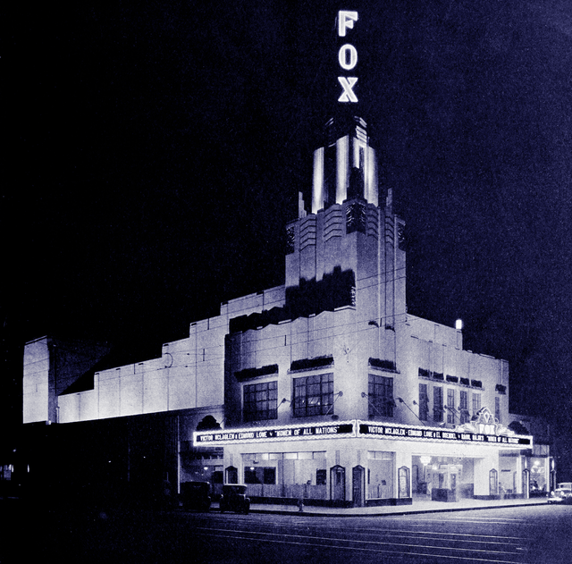
The Pomona Valley formerly boasted some beautiful cinemas, perhaps none lovelier than the Clifford A. Balch and Floyd E. Stanbery-designed Fox Theater Pomona, built in 1931 in an Egyptian-inspired Art Deco style. Unlike most of the region’s historic cinemas, The Fox Pomona Theater still features films along with other forms of entertainment. The region’s best cinema, though, in terms of programming, is the Laemmle Claremont 5. There, filmgoers are treated to a mix of independent films, classics, foreign films, and even the occasional superhero franchise entry. Most Octobers, the Pomona Valley hosts the 909 Film Festival.
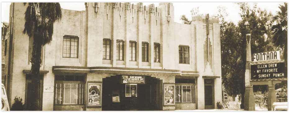
The Pomona Valley is home to numerous community and preparatory theater companies, all of which I’ve attempted to include on the map. One of the most beautiful theaters is one of those former cinemas — the Center Stage Theatre in Fontana. The Art Deco building was built as the Fontana Theatre and designed by Carl H. Boller in 1837. Playwright Roger Rueff was born in Upland. And finally, Ophelia’s Jump Productions annually produce their Midsummer Shakespeare Festival at Pomona College every July.
Musical acts from the Pomona Valley included emo bands A Static Lullaby and A Thorn for Every Heart (both from Chino Hills); Raja Kumari (from Claremont); Hit-Boy and Travis Barker (both from Fontana); Joey Scarbury and T Lopez (both from Ontario); Litefoot (from Upland); and Above the Law, Ben Harper, Buckethead, Jeanne Black, Kokane, Ray Collins, Rozz Williams (Christian Death, Premature Ejaculation, and Shadow Project), and Tom Waits (all from Pomona). Pomona Valley is less commonly referenced in song, although you can probably guess which suburb is the subject of both Frank Zappa‘s “Cucamonga” and the Grateful Dead‘s “Pride of Cucamonga.”
Charles and Dorothy Chase established Folk Music Center Store and Museum in Claremont in 1958 and it annually hosts a spring music festival. The Fender Musical Instruments Corporation, although founded in Fullerton, has relocated to Corona. I already mentioned my love for Rhino Records, founded in Westwood in 1973, and KSPC, which first went on air on 12 February 1956.
There are many restaurants in the region, all of which I’ve attempted to include on the map. It’s worth singling out a couple of the Pomona Valley’s artists, though. Sam Maloof was a woodworker and furniture designer born in Chino in 1916. After completing his schooling at Ontario’s Chaffey High School, he after completing high school, Maloof worked in the art department of the Vortox Manufacturing Company in Claremont. After World War II, Maloof came to Claremont to work for Millard Sheets. Maloof and his wife, Alfreda Ward, moved into a house in Ontario before they relocated to Alta Loma, where he died in 2009. Some of his work can be seen at the Los Angeles County Museum of Art (LACMA) on the Miralce Mile.

Millard Sheets, too, was a native of the Pomona Valley. Millard Sheets was born in Pomona in 1907. He was an artist, architectural designer, and teacher. His beautiful mosaics are on buildings throughout Metro Los Angeles, in particular on former locations of Home Savings of America. His art can also be viewed at LACMA. He also designed the celebrated Pomona Mall, built in 1962, which features many of his mosaics and sculptures. In 1977, more than half of the pedestrian plaza was surrendered to automobiles. The remainder is preserved on the campus of the Western University of Health Sciences. Sheets died in 1989.
I’ve tried to include any and all libraries and independent books stores on the map. There are also several Pomona Valley authors worth mentioning. David Foster Wallace was born in Claremont. Mike Davis, who co-authored the last book I finished, was born in Fontana. And finally, there’s Ontario-born Charles Phoenix, for whom the description, “Author” is inadequate. His Wikipedia page also describes him as a chef, historian, and pop culture humorist. I first became aware of him through his retro slide shows.
POMONA VALLEY FOOD
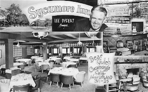
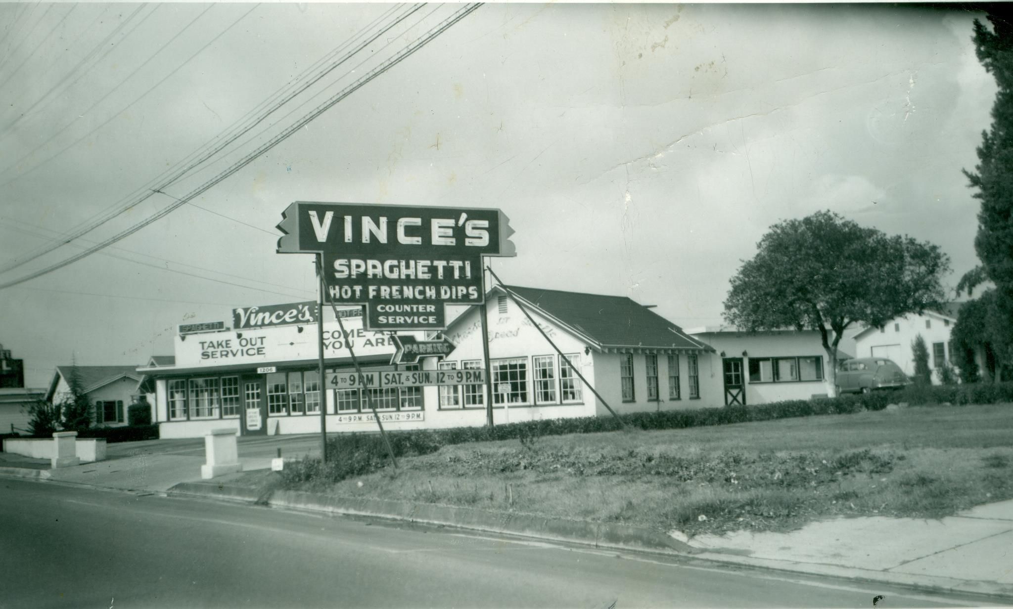
There are far too many restaurants either to list or include all on the map. I’ve included a few that are highly regarded, although I haven’t eaten at any of them. I do love old restaurants, however, regardless of the quality of their food (although good food is better than bad). Sometimes there’s nothing for me to eat since I don’t eat animals, as was the case when I went with friends to Centro Basco years ago. I just love the atmosphere and architecture of older restaurants. In the Pomona Valley, those include The Sycamore Inn (since 1939 in Rancho Cucamonga), Centro Basco (since 1940 in Chino), Vince’s Spaghetti (since 1946 in Ontario), the Magic Lamp Inn (since 1955 in Rancho Cucamonga), Cock-A-Doodle Restaurant (since 1957 in Chino), La Paloma Mexican Restaurant (since 1966 in La Verne), Cask ‘n Cleaver (since 1967 in Rancho Cucamonga), Pinnacle Peak Steakhouse (since 1967 in San Dimas), and Spires (since 1982 Ontario).
I haven’t included any restaurant chains on the map, despite my adventure at El Pollo Loco decades ago. I have included a few worthwhile grocery store chains, though. Cardenas, a Latino supermarket, was founded and is based in Ontario. And the Icee Company, although founded in La Vergne (not a typo — it’s in Tennessee), is included because it’s also headquartered in Ontario. The Pomona Valley also hosts several food festivals, including Claremont Village’s annual Pie Day Festival (held on 14 March) and the Upland Lemon Festival (held in April).
TRANSIT
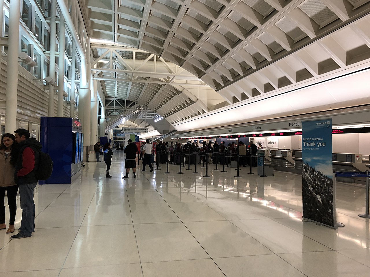
The Pomona Valley is served by multiple mass transit agencies. There are three Metrolink lines: the 91/Perris Valley Line, the Riverside Line, and the San Bernardino Line. Longer distance travel is available via Amtrak, FlixBus, and Greyhound. Local transit agencies include Foothill Transit, Metro, and Omnitrans. The Pomona Valley hosts several small, regional airports as well as the Ontario International Airport, which began as an airstrip, Latimer Field, in 1923.
Active transit options include bicycling, hore rising, and walking. There are networks of bicycle lanes across the region and at least one major bike trail, the Pacific Electric Inland Empire Bike Trail, a roughly 30-kilometer (20-mile), paved bicycle trail that utilizes an old Pacific Electric Railway right-of-way. There are several equestrian communities and Norco, in particular, is known for its horse trails. Aside from the region’s small downtowns, most of the Pomona Valley is not especially walkable. There are numerous trails, though, for recreational hikers.
The Pomona Valley also has a long history of inactive/micro transit. The frequent presence of a brown smear of smog speaks to the popularity of and dependence on private automobiles and motorcycles. The most notorious motorcycle gang, the Hells Angels Motorcycle Club, was founded in Fontana in 1948. There are also numerous car-and-truck-centric roadways including the 10, 15, 53, 57, 60, 66, 71, 83, 91, 142, and 210 — many of which are nominally interstate freeways but that, in fact, are mostly inter-suburban. When not on an actual road trip, my preferred way to view cars is at speedways and automotive museums — not blasting noise and belching exhaust at cyclists, horses, and pedestrians or getting in the way of buses. If you too like those, there are numerous racetracks, collections, and go-kart tracks included on the map.
How are you celebrating 909 Day/Pomona Valley Day?
Support Eric Brightwell on Patreon

Eric Brightwell is an adventurer, essayist, rambler, explorer, cartographer, and guerrilla gardener who is always seeking paid writing, speaking, traveling, and art opportunities. He is not interested in generating advertorials, cranking out clickbait, or laboring away in a listicle mill “for exposure.”
Brightwell has written for Angels Walk LA, Amoeblog, Boom: A Journal of California, diaCRITICS, Hidden Los Angeles, and KCET Departures. His art has been featured by the American Institute of Architects, the Architecture & Design Museum, the Craft Contemporary, Form Follows Function, Los Angeles County Store, the book Sidewalking, Skid Row Housing Trust, and 1650 Gallery.
Brightwell has been featured as subject in The Los Angeles Times, VICE, Huffington Post, Los Angeles Magazine, LAist, CurbedLA, Eastsider LA, Boing Boing, Los Angeles, I’m Yours, and on Notebook on Cities and Culture.
Brightwell has been a guest speaker on KCRW‘s Which Way, LA?, at Emerson College, and the University of Southern California.
Brightwell is currently writing a book about Los Angeles.
You can follow him on Ameba, Duolingo, Facebook, Goodreads, iNaturalist, Instagram, Mastodon, Medium, Mubi, the StoryGraph, and Twitter.


