

MY ADOBE HACIENDA NESTED IN THE WESTERN HILLS — HACIENDA HEIGHTS

This blog entry is about the community of Hacienda Heights, which rocketed to the top (becoming the most voted for neighborhood yet) following efforts by the City of Hacienda Heights on Facebook. Initially I was looking forward to meeting some locals to play tour guide but by the time I came they weren’t able. No worries, however, as I brought along Hacienda Heights native Brandi Shaver and recurring companion Will Fleming. To get in the mood I set the CARDIS‘s radio controls to KAZN, a Mandarin station broadcast out of Pasadena.

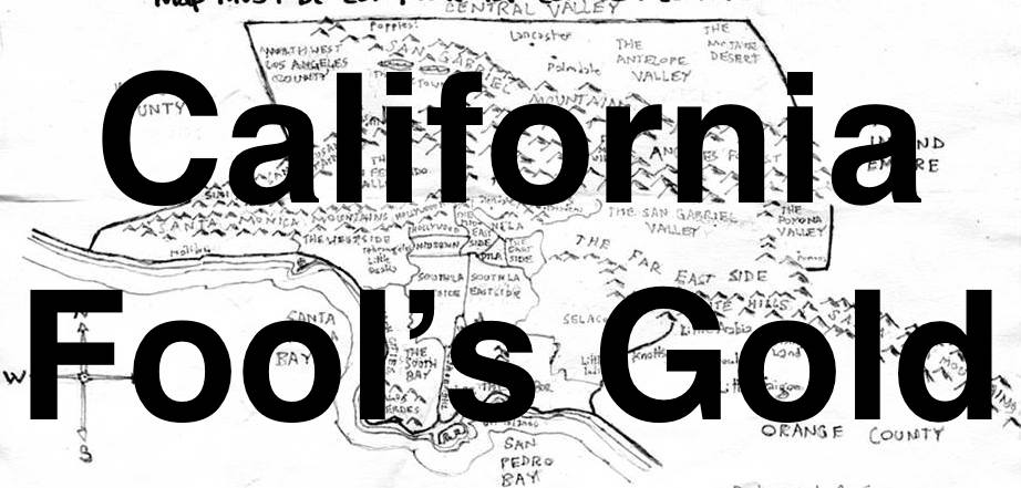
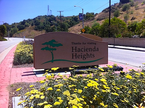
Hacienda Heights is a San Gabriel Valley community located on the northern face of the Puente Hills and the floor of La Puente Valley. The highest point in the Heights is Workman Hill. Hacienda Heights is neighbored to the south by the Southeast Los Angeles communities of Whittier and La Habra Heights. To the west is North Whittier. North are Avocado Heights and the City of Industry. To the east is Rowland Heights which, along with Hacienda Heights, are sometimes collectively referred to as “The Heights.”

Like its neighbor, Rowland Heights, Hacienda Heights is primarily a residential neighborhood, with wealthier residents residing in the hills, and more modest homes and businesses in the flats of the north.The CARDIS arrived in the morning and under cloudy skies and the group was greeted by the purplicious sight of copious jacaranda trees.
Prior to the Spanish Conquest, the Puente Valley (between the Puente Hills and South San Jose Hills to the north) was inhabited by the Tongva, who named the area “Awing’na,” meaning “abiding place.” The Spanish founded the nearby San Gabriel Mission in 1771 and the indigenous people were subjugated. Their land in what’s now Hacienda Heights was used for ranching and grazing to support the mission.

John Rowland 
Rancho La Puente 
William Workman
After Mexico gained independence in 1822, the missions were secularized and the former Spanish holdings were sold and granted to private parties. Two such parties were John Rowland and his partner William Workman. In November 1841 they arrived in a wagon train from Taos with a group of settlers from Missouri and New Mexico. In the early part of the following year, the two applied for a land grant from governor Juan B. Alvarado. For $1,000 and promising to employ Tongva, they obtained the 49,000 acre Rancho La Puente. They used the land to for cattle ranching, wheat production and wine and brandy distillation. The two partners amicably split their holdings in 1852.
Rowland prospered as did Workman for a time. However, Workman lost almost everything following the 1875 failure of the poorly managed Temple-Workman Bank he’d founded with his son-in-law, Francis Pliny Fisk Temple. Elias J. “Lucky” Baldwin issued a loan which allowed the bank to re-open but with conditions that were almost impossible to meet. The bank again failed in 1876 and a despondent Workman shot himself in the head at his home on May 17 of the same year.
After the competing Southern Pacific and Santa Fe Railroads arrived in the area, Lucky Baldwin began subdividing his possession although La Puente Valley remained primarily agricultural until the 20th century. Four years after Baldwin’s death, his daughter Anita Baldwin sold 1,826 acres to developers Edwin Hart and Jed Torrance who established the community of North Whittier Heights.
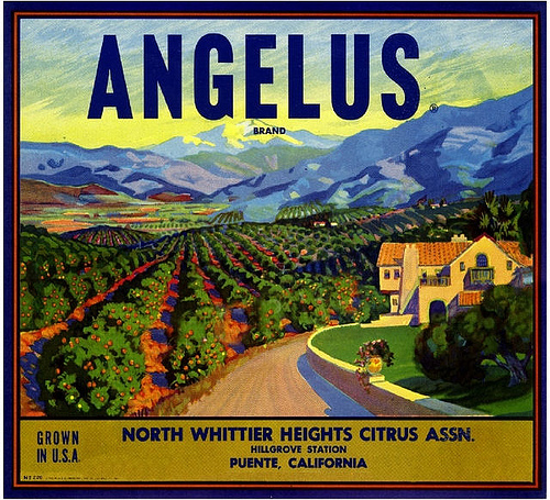
Cattle and sheep ranching largely gave way to avocado, citrus and walnut groves and North Whittier Heights became well-known for its walnuts. The North Whittier Heights Citrus Association and opened a packing plant near Ninth and Clark avenues and the small community that grew up in the area became known as Hillgrove.
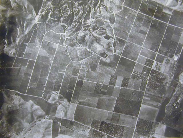
La Puente Valley in 1935 
Hacienda Heights in 1965
As with so much of Southern California, North Whittier Heights grew into a large suburb of Los Angeles after World War II, with massive scale housing especially occurring in 1957. In 1961, the residents of North Whittier Heights successfully petitioned to change their town’s name to Hacienda Heights (which, if you think about it, is kind of a silly name, no?) A master development plan was drawn up and over the next two decades the community saw a lot of housing construction. Several times citizens attempted to incorporate but, being primarily a bedroom community, its usually felt that the proposed city’s sales tax base is too small to support a city. [EDIT: Exhibit Homes, Inc. held the grand opening of the Hacienda Heights Tract on 17 December 1954. The six styles of homes were designed by Daniel L. Dworsky. Perhaps the citizens of North Whittier Heights petitioned to become part of Hacienda Heights.]
For most of 20th Century, Hacienda Heights was primarily home to Anglo Angelenos. In the 1980s, Latinos, many from the Eastside and Midtown, began moving to the hilly suburb. By 1990, the Latino population was dominant and, up till the early 1990s, Hacienda Heights was regularly referred to as “The Chicano Beverly Hills.” [EDIT: The nickname “Mexican Beverly Hills” began to be applied to Hacienda Heights at least as early as the mid-1970s].
In the 1990s and the decades since the area has seen another dramatic demographic shift with the arrival of many Taiwanese-Americans. Although there were Asian-Americans in the San Gabriel Valley for decades, real growth began in the late 1970s, when realtor Frederic Hsieh began promoting Monterey Park as the “Chinese Beverly Hills” in Hong Kong and Taiwan.
In the years that followed, many Chinese businesspeople and their families moved to the area. By the mid-1980s, people were commonly referring to Monterey Park as Little Taipei. As more and more Chinese mainlanders and Hoa arrived, many wealthy and by-then-established Taiwanese-American families began to relocate to classy communities like Arcadia and San Marino; nearby communities like Temple City; and less-developed communities like Walnut, Rowland Heights, and Hacienda Heights — communities whose rolling hills practically begged to be covered by McMansions.
Nowadays the community is mostly Latino and Asian-American – 46% Latino (mostly Mexican) of any race, 37% Asian (mostly Taiwanese and Chinese) and 5% non-Latino white.
Four Sea Restaurant 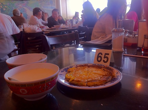
Breakfast
One of (if not the) main draws of Hacienda Heights is the food. Every year the community and Rowland Heights get together to host Taste of the Heights at Pathfinder Park. On the day of our visit we arrived in the morning and stopped at Four Sea Restaurant for a delicious breakfast of fried onion cake with egg, a rice roll with pickled vegetables and veggie pork, fried leek pockets and steaming hot soy milk.
Other well-represented cuisines include Chinese, Japanese, Korean, and Mexican and are represented by Akasaka Restaurant, Boiling Point (smelly Tofu!), Boston Cafe, California Stonegrill, Casa Blanca Mexican Restaurant, Casa De Tacos, Casa Jimenez Mexican, China Gate, China Mandarin Restaurant, China Star, China Wok Fast Food, Cindy’s Kitchen, Cindy Liu Deli, Da Bok Tofu Restaurant, Daikokuya, Deerfield Restaurant, Donut King, Dumpling Master Restaurant, E Mei Shan Chinese Restaurant, Earthen Restaurants, El Curtido, Flame Broiler, Foo Foo Tei, Fruity Deli-cious, Garden Fresh Vegetarian Food, Hacienda Grill, Hacienda Village Meat & Italian Deli, In-N-Out Burger, JJ Bakery, John’s Kitchen, Katana Sushi and Ramen, Little Sheep Mongolian Hot Pot & Grill, Los Frijolitos, Malan Han Noodle, Montanos, Nini Bakery, Oh! Crab, Osaka Seafood Buffet, Ostioneria Colima, Pak Kai Market / Deli, Pauline’s Chinese Kitchen, Run Taco Run, Senor Baja, Seoul Korea Restaurant, Shin Sen Gumi, Sokaku Sushi, Soo Ra Sang Korean BBQ, Sushi Umi, Taipan Kitchen, Taipei Ning Gi Hot Pot Restaurant, Taiwan Deli, Tamaya, Tasty Noodle House, Tiramisu Cafe, Tokyo Lobby Restaurant, Tony’s Pizza & Pasta, Whimsical Frozen Yogurt Gelato, World’s Best Pizza, and Yunnan Garden.
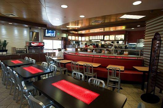
Oh, and although I normally forgo mentioning international restaurant chains, Hacienda Heights is home to the first (only?) Feng Shui McDonald’s.
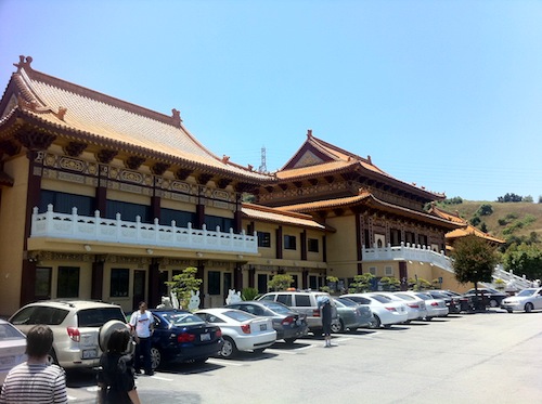
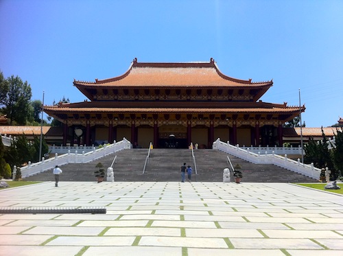
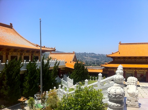
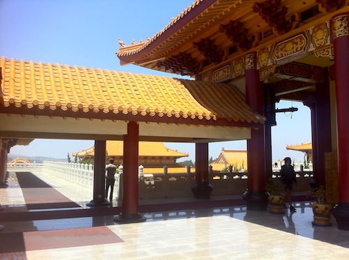
Rivaling or perhaps even surpassing Hacienda Heights’ eateries as a draw is the largest Buddhist temple complex in the Western Hemisphere, Hsi Lai Temple, which opened in 1988. It was founded by Venerable Master Hsing Yun, the 48th Patriarch of the Lin-chi line of Ch’an. He is also the founder of the Fo Guang Shan Buddhist Order whose headquarters are in Kaohsiung, Taiwan.

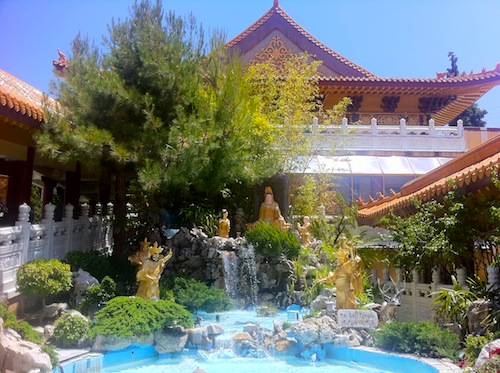
The large Temple includes many sites of interest including the Bodhisattva Hall, the Arhat Garden, the Avalokitesvara Garden, the large Founder’s Statue, the Main Shrine, the Requiem Pagoda, Meditation Hall, Translation and Publishing Center, Fo Guang Yuan Hsi Lai Art Gallery (where they sell Buddhist DVDs and CDs), the Tea Room and the Dining Hall.
Although not especially hungry we decided to eat again in keeping with Taiwanese customs. Since Humanistic Buddhists believe that food and drink should be consumed as vehicles for nourishment and nothing else, it’s pretty bland. In fact, garlic and spices are seen as obstacles to achieving a pure and clear mind. It definitely was decently prepared and could even possibly serves as a culinary bridge to the East for bland-food-favoring Middlewesterners.
Events Hsi Lai hosts many of the events and observances in Hacienda Heights, including the Buddhist Sangha, Buddha’s Birthday and Dharma Day. The St. John Vianney Church hosts the annual Early California Days. There’s also and annual Fourth of July celebration. Schabarum Park (which mostly lies in Rowland Heights) hosts annual summer concerts.
The largest landfill in the United States, the 2.8 km2 Puente Hills Landfill, is partially located within Hacienda Heights. It was featured in the Penn and Teller series Bullshit! as part of their campaign against recycling. It also appeared in an episode of MegaStructures called “Garbage Mountain.” Up to 13,200 tons of refuse are in by up to 1,600 trucks daily. The landfill rises up to a height of 150 meters but will close in 2013.
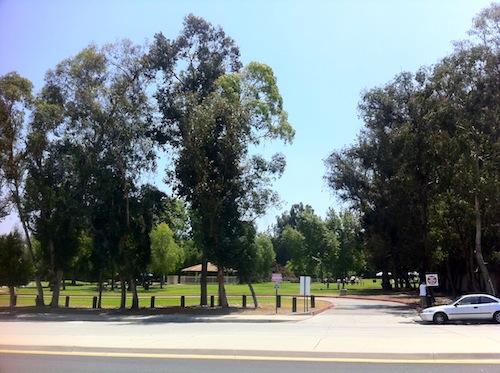
The biogas generated by the trash’s decomposition produces enough electricity to service approximately 70,000 area homes and is sold to Southern California Edison. The Puente Hills Landfill Native Habitat Preservation Authority is a Joint Powers Authority with a Board of Directors consisting of the City of Whittier, County of Los Angeles, Sanitation Districts of Los Angeles County, and the Hacienda Heights Improvement Association. The Habitat Authority acquires, restores, and manages open space in the Puente Hills, with the primary purpose of protecting biological diversity. They also offer hikes and educational programs.Other Parks of Hacienda Heights include the smaller Los Robles Park, Hacienda La Puente Park, Manzanita Park, Thomas Burton Park, County Wood Park, Pepperbrook Park and a small corner of Arroyo Pescadero Park.
Turnbull Canyon, which passes through North Whittier and connects Hacienda Heights to Whittier, is a source of many local legends involving Satanic Cults, extraterrestrials, the KKK, a witch house, a hanging tree, murderous psychopaths, ghosts, an abandoned insane asylum and more. Some of the kookier stories involve X-Files style government cover-ups. It was supposedly known to the Tongva as Hutukng’na, meaning “dark place.” Not surprisingly, its a popular destination for thrill-seeking teenagers out for kicks and killers looking for a dumpsite.
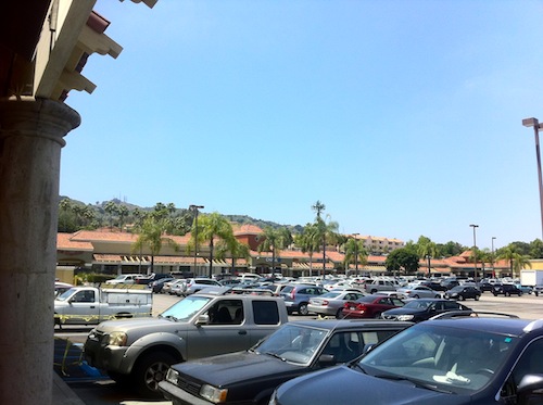
Bixby Plaza 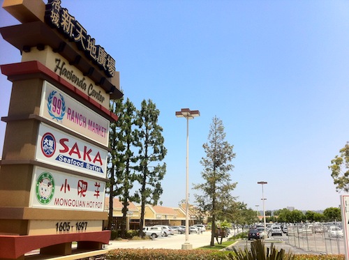
Hacienda Center 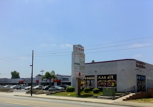
Plaza Stimson
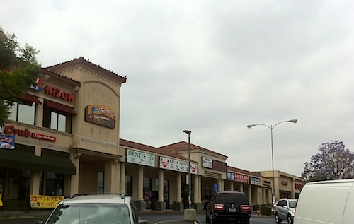
There are several shopping centers in Hacienda Heights like Gale Square Shopping Center, Plaza Stimson and Bixby Plaza but, to be honest, they’re not the sorts of malls I see people going to just to hang out (well, not young ones. I remember going to a red egg party at Saka Seafood Buffet at the Hacienda Center years ago.

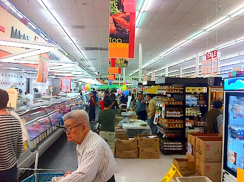
Revisiting it we popped into the local 99 Ranch Market to find that another observance was underway, the Shanghai Food Festival. There were numerous free samples being given out including lotion, golden kiwis, red bean ice cream, seaweed salad, Asian pears and more.
In addition to the television episodes filmed at the landfill, Hacienda Heights was featured in an eponymous English language novela. It’s also the birthplace of The Spectacular Spider-man‘s Joshua Keaton and Caprice Bourret of The Surreal Life. It’s also the birthplace of Brooklyn-based filmmaker/musician/photographer Tiffany Huang. Oh yeah, incontinence spokesperson Stacy Ann “Fergie” Ferguson is from there. Also, in music-related news, it’s home to the Sound of China Guzheng Music Promotion Center.
Well, being a quiet, largely residential Taiwanese-American neighborhood, the nightlife options are few… with more tea houses than bars. The two bars, City Lights Cocktail Lounge and Sunset Room, compete against Boba Tea Hut, Guppy Tea House, Quickly, Tea Station, and Tenju Tea House for thirsty night owls. There are, however, a higher than average number of liquor stores suggesting that not everyone is a boba-teetotaler. Other nightlife options are Joy Karaoke and Empire Hookah Lounge.
Until next time when we head to Huntington Beach!
Support Eric Brightwell on Patreon

Eric Brightwell is an adventurer, essayist, rambler, explorer, cartographer, and guerrilla gardener who is always seeking paid writing, speaking, traveling, and art opportunities. He is not interested in generating advertorials, cranking out clickbait, or laboring away in a listicle mill “for exposure.”
Brightwell has written for Angels Walk LA, Amoeblog, Boom: A Journal of California, diaCRITICS, Hidden Los Angeles, and KCET Departures. His art has been featured by the American Institute of Architects, the Architecture & Design Museum, the Craft Contemporary, Form Follows Function, Los Angeles County Store, the book Sidewalking, Skid Row Housing Trust, and 1650 Gallery. Brightwell has been featured as subject in The Los Angeles Times, Huffington Post, Los Angeles Magazine, LAist, CurbedLA, Eastsider LA, Boing Boing, Los Angeles, I’m Yours, and on Notebook on Cities and Culture. He has been a guest speaker on KCRW‘s Which Way, LA?, at Emerson College, and the University of Southern California.
Brightwell is currently writing a book about Los Angeles and you can follow him on Ameba, Duolingo, Facebook, Goodreads, Instagram, Mubi, and Twitter.


16 thoughts on “California Fool’s Gold — Exploring Hacienda Heights”