

THE TUBE NEWB GROUP RIDE: E LINE EDITION
INTRODUCTION
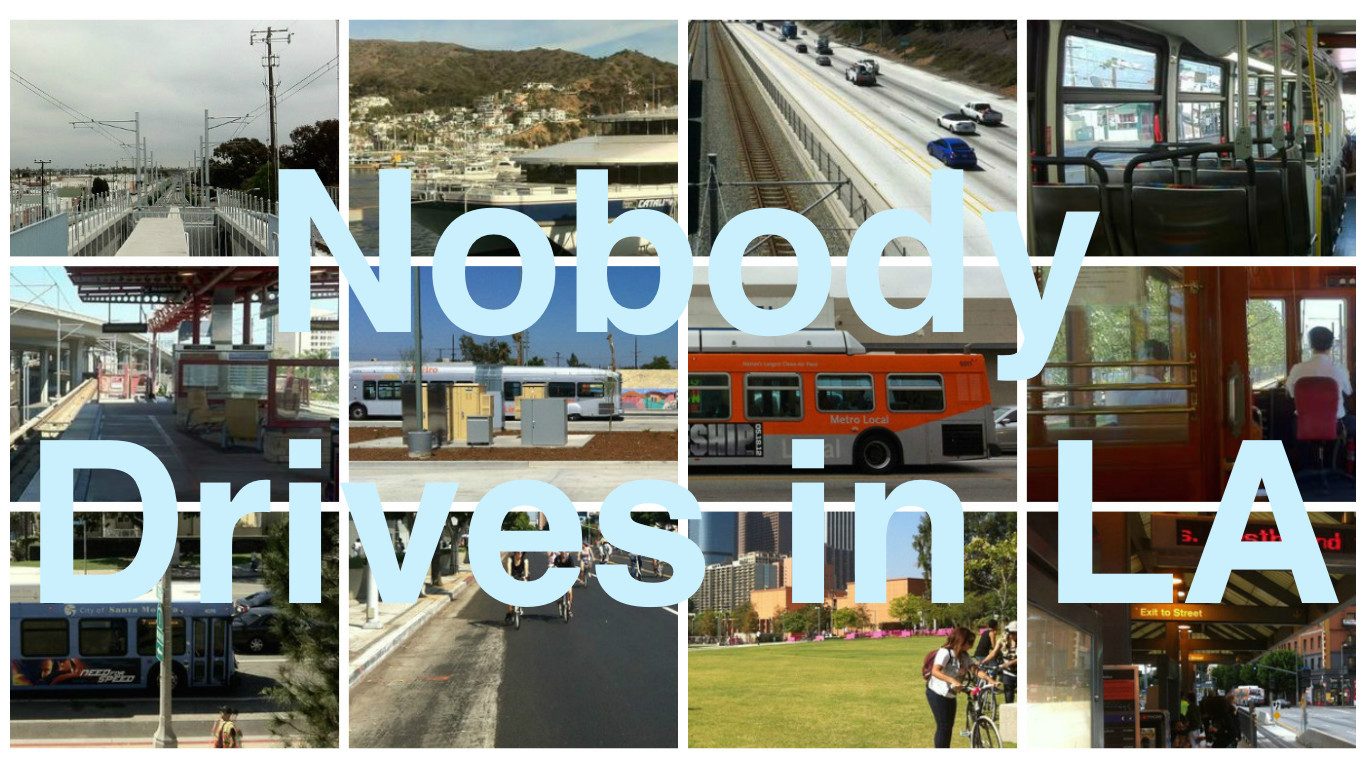
A few months ago, Nobody Drives in LA asked our listeners to “ask us anything.” One of the respondents submitted: “What bus or train experience would you take someone on to give them a good first impression of transit in LA? I have often said the A-Line between Memorial Park in Pasadena to DTLA is one of the nicest and most scenic.”
Although I do find both the northern and southern portions of the A Line scenic, in very different ways, I reckoned that it’s the E Line I would take someone on. My co-host, Kyle, also chose the E Line. So when my friends, Kate and Muffy, told me that neither of them have ever taken the train but wanted to — I thought we should take that line. Fellow Nobody Drives in LAer, Ivy Kwok, was also down to co-host these “tube newbs.” Then, I decided (with Muffy and Kate’s permission) to expand it into a group ride for other transit newcomers and anyone else who fancies it.. Even if you’re an E Line conductor who’s travelled this route every day since it began operation, you will doubtless find new information in this guide. So whatever your experience level, come with us on the ride and, if you don’t mind, reserve a free “ticket” on the Eventbrite page so we have a rough idea of who and how many to expect. All aboard!
THE EVENT
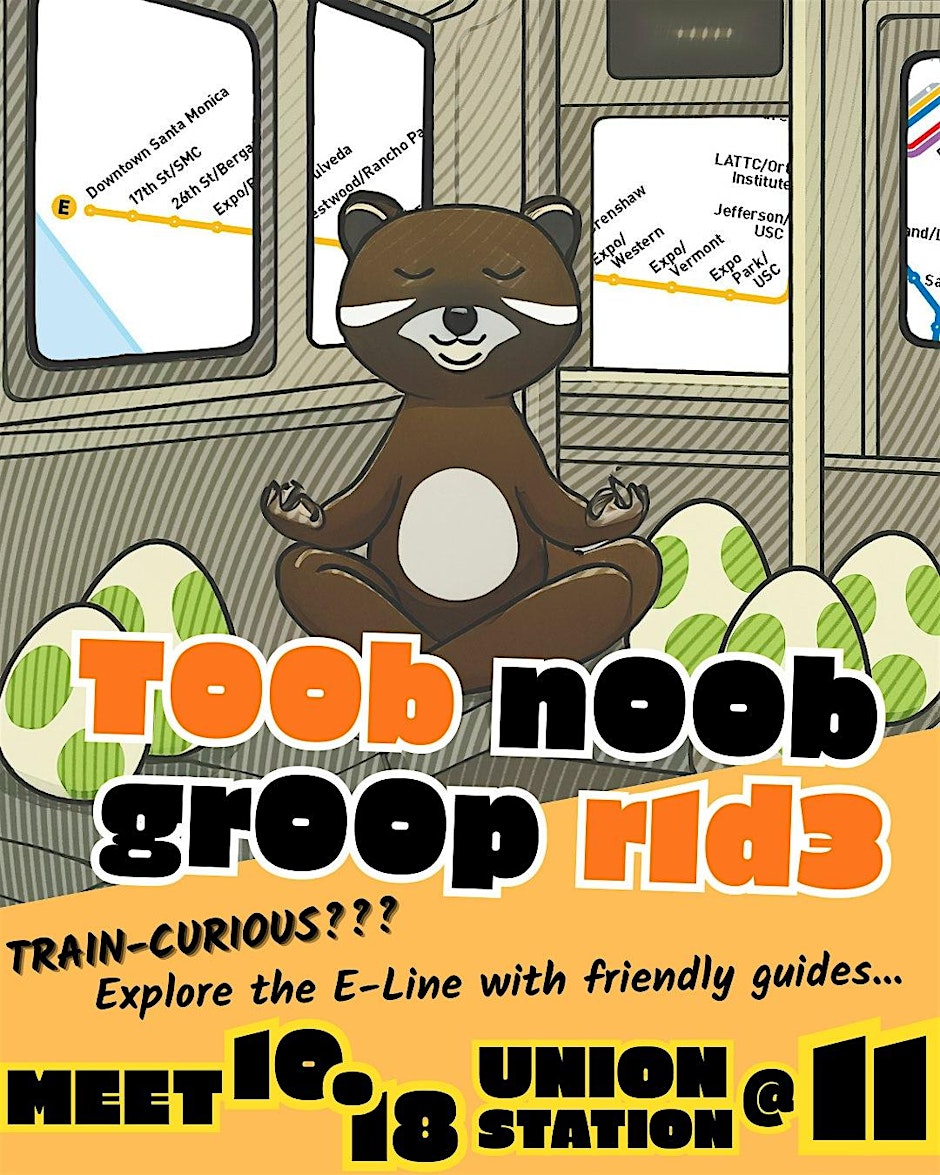
Meet inside the west entrance of Union Station at 11:00.
NB: 18 October is also the date of a No Kings protest against the Trump regime. If you’re a right-wing snowflake or Fascist bootlicker, you will definitely want to skip this ride and seek security in the safe space of your choice until its safe to reemerge.
From Union Station, we’ll head over to the E Line where we’ll head east to East Los Angeles, then west to Santa Monica (and back to Union Station). We’ll hop on and off to explore sites along the way. We’ll also grab bites and drinks as people desire — choosing our path based upon a democratic consensus and consideration for participants’ whims. Again, not very Fascist, I’m afraid. There are so many attractions along the E Line that we can’t see them all. I hope this guide will be useful for attendees — and future riders — as they decide what to check out.
BE PREPARED
Mass transit in Los Angeles is actually pretty good — but there’s still a lot of room for improvement. If you’ve ever been to China, Germany, Hong Kong, Japan, Korea, Russia, Singapore, Taiwan, the UAE; you may be disappointed to encounter stations that offer extremely little in the way of amenities and are no more destinations in and of themselves than is a multi-story parking garage. You won’t, in other words, find art galleries, bakeries, banks, clothing boutiques, convenience stores, electronics stores, gift shops, newspaper stands, noodle stalls, performance spaces, pharmacies, pop-ups, post offices, restaurants, showers, or vending machines. More troublingly, you’ll only occasionally find public restrooms — although they are thankfully becoming more common. You will more often find things like wi-fi and bike lockers — but certainly not at every station.
It’s also worth noting that not every station is located within a tourist area. Many are located in quiet, residential neighborhoods or because they connect with other transit lines. Not that wandering around a residential area with an open mind and sensitive attunement doesn’t yield its own rewards… but most people reading this are probably less interested in psychogeography than they are seeing historically important sites and recognized cultural points of interest.
Prepare for the ride beforehand. Download the Transit and Throne apps beforehand. It’s not the Trans-Siberian Railway but being unprepared or uncomfortable on even a short journey is the absolute worst. With that in mind, consider bringing binoculars, a book or other reading material, a phone charger, hand sanitizer, a face mask, a handkerchief, your medication, a multi-took knife, a nip or two, a parasol or umbrella, sunblock, pepper spray, a journal and pen, lip balm, a powerbank, water or tea, a vial of cologne/perfume, a wallet, and wipes. Check the weather beforehand and wear appropriate clothing and shoes. Remember that what’s appropriate at midday might be insufficient at night. Consider wearing a hat and/or sunglasses. Perhaps print out this guide beforehand.
And finally — before setting out toward a point of interest, check to make sure they’re open or still in existence. Check business hours. If you need to transfer, make sure transit information is up to date. All of the points I’ve added I believe to be within a fairly easy walk of the station — but I might have made errors. And when all else fails, take a deep breath and roll on.
Here’s the guide:
ATLANTIC STATION
Atlantic Station is located in unincorporated East Los Angeles, an historic Mexican American cultural hub. Were East Los Angeles to incorporate, it would be the tenth most populous city in Los Angeles County. It would also be larger than the most populous cities of Delaware, Maine, New Hampshire, Vermont, West Virginia, and Wyoming. The station is located fairly near East Los Angeles College (home to Ingalls Auditorium, the Vincent Price Art Museum, and other amenities).
Station amenities include station art (“Blissful Interiors” by Adobe LA) and bicycle facilities (lockers and racks). The station is also served by El Sol‘s City Terrace/East Los Angeles College and Whittier Boulevard/Saybrook Park lines; Metro’s 106, 260, and 261 lines; and Montebello Bus Lines‘ 10, 40, and Express 90 lines.
EAST LA CIVIC CENTER STATION
East LA Civic Center Station is located in Belvedere. It began in 1915 as a streetcar suburb called Belvedere Heights, created by the Janss Investment Company in 1915. The same company opened Belvedere Gardens in 1921. The combined tracts and surrounding area came to be known as Belvedere.
Nearby amenities include Belvedere Park, which is home to the East Los Angeles Civic Center and the East Los Angeles Public Library. Nearby eateries of note include Sofresh (Persian).
Station amenities include station art (“Through the Looking Glass or Traveling at the Speed of Light (Rail)” by Clement Hanami) and bike racks. The station is served by Metro’s 106 and 258 lines; and El Sol’s City Terrace/East Los Angeles College, Union Pacific/Salazar Park, and Whittier Boulevard/Saybrook Park lines.
MARAVILLA STATION
Maravilla Station is located in the community of Maravilla. The Maravilla Park Tract opened in 1911. The commercial core was designated “Old Town Maravilla” around 2013. Other attractions include the Chinese Cemetery. For many years, Chinese Angelenos were barred from purchasing burial plots in most public cemeteries and so, in 1922, the Chinese Consolidated Benevolent Association of Los Angeles raised funds to purchase land and establish their own cemetery, which opened in 1922. Nearby eateries include the second location of King Taco.
Station amenities are limited to public art (“Maravilla Hearts of Token” by Jose Lopez). There are NO RESTROOMS. The station is served by Metro’s 106, 251, and 605 lines.
INDIANA STATION
Indiana Station is located on the border between East Los Angeles and Boyle Heights. Boyle Heights is named after Andrew Boyle, and Irish immigrant who moved there in 1858. Boyle, Isaias W. Hellman, and William H. Workman opened the Boyle Heights Tract in 1875. Now almost entirely Latino, it was historically, famously diverse and nicknamed “the Ellis Island of the West Coast” for its large populations of Armenians, blacks, Chinese, Italians, Japanese, Jews, Russians, and others.
Nearby attractions include El Mercado de Los Ángeles (aka El Mercadito — a vibrant, three-story, indoor marketplace with live music and restaurants), Evergreen Cemetery (an historic cemetery that was inclusive — except to Chinese), El Pino (Vatos Locos forever!), and Morin Memorial Square — founded in 1968 and the city’s third oldest public square after Pershing Square (1918) and Plaza de Los Ángeles (1818).
Station amenities include bike racks and lockers. There are NO RESTROOMS and, apparently, no station art. Indiana Stations is served by Metro’s 106 and 665 lines; El Sol’s Whittier Boulevard/Saybrook Park Line; LADOT DASH‘s Boyle Heights/East LA Line; and Montebello Bus Lines‘ 40 Line.
SOTO STATION
Soto Station is located in Boyle Heights. North of the station, historically, the community was known as Brooklyn Heights. The development of Brooklyn Heights began in 1875 and, for decades, it was a thriving Jewish enclave. After the Second World War, however, most Jews (and Jewish businesses like Canter’s) moved west and it was absorbed into Boyle Heights. In 1994, Brooklyn Avenue became Cesar E. Chavez.
Nearby attractions include the Benjamin Franklin Branch Library, Boyle Heights City Hall, the historic St. Louis Pharmacy, Ross Valencia Community Park, Casa 0101 (a community arts space and theater company), the Queen Anne-style Peabody Werden House (named after journalist Josiah Peabody and bookkeeper William Werden), the North Italian-Byzantine-style St. Mary’s Catholic Church (1926). Nearby, too, is the intersection of Chicago Street and Cesar Chavez Avenue, where professional conjuntos norteños gather and play their music, hoping to be hired as entertainment.
Nearby eateries include Otomisan (the oldest continuously operating Japanese restaurant in Los Angeles, beginning with a different name in 1956), George’s (a classic Los Angeles Greek hamburger-pastrami-burrito stand founded by George Sedaris in 1966), and Al & Bea’s (Mexican, also established in 1966).
Station amenities include station art (“Landings” by Nobuho Nagasawa). There are bike racks and lockers. As of early 2025, there is a Throne restroom.
MARIACHI PLAZA STATION
Mariachi Plaza Station is also located in Boyle Heights. It’s named for its popularity with mariachis who gather and perform, hoping to be hired. Next to the station is La Casa del Mariachi, where owner Jorge Tello creates the distinctive trajes de charros worn by mariachis. There’s also the historic Cummings Block (aka Boyle Hotel aka Mariachi Hotel), built in 1889.
Other nearby amenities include Eastside Luv Wine Bar, 1st Street Pool & Billiard, Libros Schmibros Lending Library, the Byzantine Revival-style Breed Street Shul (1923), Espacio 1839 (a community media space founded in 2012), House of Trophies & Awards, and Hollenbeck Park (an historic park created in 1892 and sullied by the opening of the adjacent Golden State Freeway in 1960. Nearby eateries of note include J&F Ice Cream Shop and Jim’s Burgers (another classic Los Angeles Greek hamburger-pastrami-burrito stand that opened in 1972) — as well as numerous Mexican restaurants, including Un Solo Sol, La Parrilla, Guisados, Santa Cecilia Restaurant, and Birrieria Don Boni.
There are several pieces of public art at the station: “Hecho a Mano” by Sonia Romero and “El Niño Perdido” by Alejandro de la Loza. There are numerous murals in the station’s vicinity, too. There are also bicycle racks and lockers — but NO RESTROOMS. It’s also served by Metro’s 70 and 106 lines.
PICO/ALISO STATION
Pico/Aliso Station is located below the bluffs of Boyle Heights, down in the flood plain of Russian Flats. The neighborhood was so known because it was here that Russian Molokans (or Spiritual Christians as they refer to themselves) established a community in the first decade of the 20th century. As it became less Russian, the area gradually came to more often be referred to merely as the Flats. The area is mostly industrial aside from the residential Pico-Aliso Village but some of its old warehouses have been repurposed as breweries and art galleries. Other nearby attractions include a couple of historic churhces: Weller Street Baptist Church (1944) and The Mission of Nuestra Señora de los Dolores (1945). Nearby eateries of note include Purgatory Pizza.
Station amenities include station art (“About Face” by Rob Neilson). There are bicycle racks and lockers. There are NO RESTROOMS. There is free Wi-Fi. It’s also served by Metro’s 30 and 106 lines.
LITTLE TOKYO/ARTS DISTRICT STATION
Little Tokyo/Arts District Station is located in Little Tokyo — but within walking distance of the Arts District. The Arts District arose in the 1970s, when artists began squatting in the abandoned warehouses of Downtown East. In ’81, the Artists-In-Residence ordinance was passed, legalizing their presence. After the Adaptive Reuse Ordinance passed in ’99, the Arts District became highly desirable and most artists were subsequently priced out. Little Tokyo (小東京) was first settled by Japanese around the 1870s. Hamanosuke “Charles Hama” Shigeta opened the neighborhood Kame Restaurant there in 1884. The area was known as Little Tokio at least as early as 1907. Until the passage of the Immigration Act of 1924, Los Angeles was home to the largest Japanese community outside of Japan. During the forced interment of Japanese Americans in concentration camps during the Second World War, the neighborhood was briefly transformed into Bronzeville. After the war, many of the newly-established southern, black tenants were pushed out but Little Tokyo never fully recovered its pre-war Japanese dominance.
Although arguably diminished from its pre-war heyday, Little Tokyo remains a thriving community and one of the most amenity-rich areas of the city. Very near the station are the Japanese American Cultural & Community Center, Japanese American National Museum, The Geffen Contemporary at MOCA, Hauser & Wirth, Higashi Honganji, Japanese Village Plaza Mall, Little Tokyo Mall, 清流ーエン (Suriya-en), Southern California Institute of Architecture (SCI-Arc), Peter Lai’s Asian Village [BY APPOINTMENT ONLY], Little Tokyo Galleria, Los Angeles Hompa Hongwanji Buddhist Temple (Nishi Betsuin), Koyasan Buddhist Temple, and Weller Court.
Good places to eat (and drink) nearby include Far Bar, Angel City Brewery, Arts District Brewing Company, Boomtown Brewery, The Escondite, Baroo, OOmasa, Wurstküche, Hachioji Craft Ramen, Rakkan Ramen, One Piece Eigikutei, Rice & Nori, and Kaminari Goyza Bar. You could also pick up Japanese (or Korean) snacks from nearby markets including Nijiya, Marukai, the Little Tokyo Farmers’ Market, and Little Tokyo Market Place.
Station amenities include several works of station art: Will Power Allegory” by Audrey Chan, “Buffer Zone” by Hirokazu Kosaka, and pencil on panel artwork by Shizu Saldamando. There is a Throne restroom. There are bike racks, lockers, and a Metro Bike Share station, too. The station is served by Metro’s 30, 76, and 106 lines; LADOT DASH’s A and D lines.
HISTORIC BROADWAY STATION
Historic Broadway Station is located in Downtown‘s Historic Core neighborhood. “Historic” happens to be Los Angeles civic leaders’ second favorite marketing term (after “village”). Consider Filipinotown, South Central, West Adams — all of which the synonymophobic city insists upon prefixing with an unnecessary “Historic.” “Historic Core” was coined around 1990 by the Community Redevelopment Agency to promote the area that mostly developed between 1900 and 1930 — many decades after the actual core, surrounding Plaza de Los Ángeles. Historic Broadway Station opened in 2023.
Nearby amenities include the Million Dollar Theater (and Broadway Theater District: — an historic collection of picture palaces, historic theaters, and historic early cinemas), Gloria Molina Grand Park, City Hall (the observation deck of which is free and open to the public on weekdays), the Bradbury Building, Angels Flight Railway (an historic railway), the Los Angeles Times Building, and The Last Bookstore
Nearby restaurants of note include Suehiro (Japanase), and Grand Central Market; an historic food hall that is home to numerous truly historic eateries like China Cafe, Roast To Go, Sarita’s Pupuseria, Ramen Hood, the Donut Man, Miznon (Mediterranean), Tacos Tumbras a Tomas, Olio Pizzeria — and vendors like La Huerta Candy and Valeria’s:
Station amenities at Historic Broadway Station include bicycle facilities (bike lockers and racks, as well as a Metro Bike Share station) and station art (“Red Car Requiem” by Mark Steven Greenfield and “Migrations” by Clarence Williams). Historic Broadway Station is served by Metro’s 4, 10, 14, 28, 30, 33, 37, 40, 45, 48, 76, 78, 81, 90, 92, and 94 lines; LADOT DASH’s A, B, and D lines; LADOT Commuter Express’s 409, 419, 422, 423, 432, 437, 438, 448, and 534 lines; and Torrance Transit’s 4x Line.
GRAND AVENUE ARTS/BUNKER HILL STATION
Grand Avenue Arts/Bunker Hills Station is located in the Bunker Hill neighborhood. Development of Bunker Hill began in 1869, when Prudent Beaudry and Stephen Mott subdivided the Mott Tract there. It was an early affluent white suburb that, as it aged, became much more ethnically diverse and working class. It was almost completely obliterated in the name of urban renewal, beginning in 1955. The top-down Bunker Hill Urban Renewal Project was adopted in 1959 and, as of 2025, the costly redevelopment is nearly complete.
Bunker Hill was lowered roughly ten meters but Grand Avenue Arts/Bunker Hills Station is still, notably, the deepest station in the network. Incidentally, in 1934, a mining engineer named George Warren Shufelt claimed that he’d detected a 5,000-year-old network of tunnels and rooms used by Lizard People to store gold beneath the area using his “radio x-ray.” The lizards were, somehow, related to either the Maya or Mexica — although only the Chumash are known to have lived in Los Angeles in that era. Nevertheless, the Los Angeles County Board of Supervisors granted Shufelt permission to dig and the Los Angeles Times published a front page story about Shufelt’s oddly fruitless efforts. When I asked Metro if it was true that they were digging for lizard gold, someone there tellingly replied with a winking emoji. Inside the station, you will note doors marked “for employees only” that may, or may not, provide Metro employees access to this secret city.
There are several transit-related attractions, including the 3rd and 2nd Street tunnels — two of the oldest features of the neighborhood, having been completed in 1901 and 1924, respectively. There’s also the Calvin S. Hamilton Pedway system, built in 1975 for the never-finished Downtown LA People Mover. And, of course, Angeles Flight Railway— which opened in 1901, was dismantled in 1969, and re-opened in its current location in 1996.
Other attractions include the Music Center (the Ahmanson Theatre, Dorothy Chandler Pavilion, and Mark Taper Forum), the Walt Disney Concert Hall (including REDCAT and the Blue Ribbon Garden), California Plaza (home to the the Museum of Contemporary Art and Grand Performances), the John Ferraro Building, Zipper Concert Hall, and the Broad. Nearby eateries of note include Âu Lạc (Vietnamese), Saffron (Indian), Vespaio (Italian), and the Farmers Market @ Bank of America Plaza (Tuesdays).
Station amenities include som of the best station art in the system, including “over-under-over,” by Ann Hamilton, “Negative Space,” by Mungo Thomson, All is Flux,” by Samira Yamin, and Pearl C. Hsiung‘s exceptional “High Prismatic.” There are bike racks, and lockers. There are NO RESTROOMS. The station is also served by Metro’s A, J, 53, 55, 60, 62, 70, 76, and 78 lines; LADOT DASH’s B Line; Foothill Transit‘s Silver Streak, 490, 493, 495, 498, 499, and 699 lines; and City of Commerce Transit‘s 600 Line.
7TH STREET/METRO CENTER STATION
7th Street/Metro Center Station is located on the edge of the Financial District to the north and Downton’s South Park neighborhood to the south. It is officially known as 7th Street/Metro Center/Julian Dixon Station — but it’s a safe bet that fewer people refer to it as that than they do “7th AND Metro.”
The Financial District is dominated by corporate office towers and other skyscrapers. The tallest is the Wilshire Grand Center (2017). There’s also the Biltmore (1923), the Bonaventure (1976), and First Interstate Bank World Center (US Bank Tower, 1987). Many of the skyscrapers built in the 1980s and ‘90s host fine examples of plop art. In the other direction is South Park — although most of it’s attractions are closer to the next station and so it will be covered there.
Attractions here are mostly in the Financial District and include Los Angeles Central Library, Los Angeles Athletic Club, The Bloc (home to the Alamo Drafthouse Cinema), FIGat7th (home to TASTE food hall), Seven Grand, and the Barker Bros. Building. Nearby eateries include Casey’s Irish Pub (1970), Inka Wasi DTLA (Peruvian), Joyce (Southern), and Wild Living Foods (Vegan).
Station amenities include station art (“The Movies: Fantasies and Spectacles” by Joyce Kozloff, “Plantings” by Kipp Kobayashi, Marta Perlas, and Noel Korten, “Heaven to Earth” by Roberto Gil de Montes, and “Unity” by Thomas Eatherton). One of the few station eateries, a Dunkin’ Donuts, opened in the station in 2018… but closed a few years later.
There are NO RESTROOMS at 7th Street/Metro Center despite its being one of the busiest station in Los Angeles. The station is also served by Metro’s A, B, D, J, 14, 16, 18, 20, 37, 51, 53, 55, 60, 62, 66, 70, 76, 78, 81, and Rapid 720 lines; LADOT DASH’s A, B, E, and F lines; DASH Commuter Express’s 409, 422, 423, 431, 437, 438, 448, and 534 lines; Big Blue Bus’s Rapid 10; Antelope Valley Transit Authority‘s 785 Line; City of Santa Clarita Transit‘s 799 Line; Foothill Transit’s Silver Street and 490, 493, 96, 498, 499, and 699 lines; Montebello Bus Lines’ 40, 50, and 90 Express lines; and Torrance Transit’s 4x line. Eight transit agencies, 61 lines, tens of thousands of daily boardings and zero restrooms. Make it make sense.
PICO STATION
Pico Station is officially named Pico/Chick Hearn Station. I learned from Nobody Drives in LAer, Ivy Kwok, that in the past it was temporarily named both Kobe Station and LeBron Station. Maybe, to avoid confusion with Pico-Aliso Station, they should pick a name and stick with it. Maybe South Park Station. Then again, there are two Slauson Stations (one on the A and one on the J) and no one but me seems bothered. And, as I pointed out earlier, there are two South Parks — although the real one has no train stations.
Although a neighborhood of that name had existed south of here since 1899 — the Philadelphia-based planning firm of Wallace, McHarg, Roberts & Todd — seemingly unaware of anything south of the Santa Monica Freeway — drew up the plans for South Park Urban Village in 1970. The same must’ve been true of city leaders — although there are also two Manchester Squares in Los Angeles as well. This South Park, like the one that predated it by seven decades, was designed to be oriented around a park — but that park was never created. As a result, Downtown’s is a sort of Las Vegas without casinos, an Orlando without amusement parks — or a South Park without a park — separated from the neighborhood of the same name that does have a park by roughly 2.5 kilometers.
Nearby attractions include Oceanwide Plaza (the “Graffiti Towers”), the Alien Church, the Staples Center (Crypto.com Arena), the Los Angeles Convention Center, the Grammy Museum, the Los Angeles Herald Examiner Building, the Historic Streetlight Museum, and the Mayan Theater. Nearby eateries of note include The Original Pantry Cafe (1924).
Station amenities include a Metro Bike Share station and station art, “Neighborhood Portrait: The Art of the Commute,” by Paul Tzanetopoulos. There are NO RESTROOMS.
LOS ANGELES TRADE-TECHNICAL COLLEGE/ORTHOPAEDIC INSTITUTE FOR CHILDREN STATION
The Los Angeles Trade-Technical College/Orthopaedic Institute for Children Station (or LATTC/Ortho Institute Station if you’re into the whole brevity thing) is located in South Central. South Central is named, of course, after the famed South Central Avenue — but that historic thoroughfare is quite a few blocks east and better served by Metro’s A Line. This end of the neighborhood is closer (but still not that close) to the mostly forgotten Chinese enclave of East Adams.
Attractions near this station (too long to spell out even in its abbreviated form) include the Romanesque Revival St. John’s Episcopal Cathedral (1924), LA Mart (a wholesale market with a giant chair that, from 2003 until 2008, was the largest in the nation), Los Angeles Trade–Technical College, and Mount St. Mary’s College (home to the Doheny Mansion, built in 1899). Nearby, too, is the neighborhood of North University Park, which seceded from University Park in 1980 and which is home to many attractive homes.
Station amenities include station art (“The Intimacy of Place” by Christofer C. Dierdorff) and bicycle facilities (Metro Bike share, racks, and lockers). There are NO RESTROOMS. The station is served by Metro’s 14, 35, 37, 38, 55, and 93 lines; LADOT’s DASH D Pico Union/Echo Park Line; and Torrance Transit‘s 4X Line.
JEFFERSON/USC STATION
Jefferson/USC Station is located in the University Park neighborhood. The titular university is the University of Southern California, founded here in 1880. A streetcar suburb named the University Park Tract opened here in 1905. This is the first of three stations located closely together along the edge of USC’s campus.
The campus is not especially large so most of its amenities are nearby. Those closest, however (including off-campus) include the Galen Center, Shriner Auditorium & Expo Hall, Theosophy Hall, Thomas and Dorothy Leavey Library, and Village at USC. Nearby eateries of note include Kobunga (Korean).
Station amenities include station art (“Urban Dualities” by Samuel Rodriguez) and bike racks. There’s a Metro Bike Share nearby. There are NO RESTROOMS. The station is served by Metro’s 2, 81, and 102 lines; abd LADOT’s DASH F line and King-East lines.
EXPO PARK/USC STATION
Expo Park/USC Station is located on the border between University Park and Exposition Park. Exposition Park began, as Agricultural Park, in 1872. The park and surrounding community were annexed in 1899. On 17 December 1910, its name was changed to Exposition Park.
Attractions nearest this station include the Natural History Museum of Los Angeles County, Exposition Park Rose Garden, California African American Museum, Fischer Museum of Art, Doheny Memorial Library, California Science Center, Bovard Auditorium, USC Bookstore, and BMO Stadium.
Station amenities include station art (“On Saturdays” by Robbert Flick) and bike racks. There are NO RESTROOMS. The station is also served by Metro’s 2, 81, 102 and Express 460 lines; LADOT’s DASH F and Southeast lines; LADOT Commuter Express‘s 438 and 448 lines; and Torrance Transit‘s 4X Line.
EXPO/VERMONT STATION
Expo/Vermont Station is also located at Exposition Park. Attractions nearest to this particular station include the historic Los Angeles Memorial Coliseum, Masjid Omar ibn Al-Khattab, Jesse Brewer Jr. Park, and the Lucas Museum of Narrative Art (still under construction at time of writing).
Station amenities include station art (“Neighborhood Portrait: Reconstructed,” by Jessica Polzin McCoy). There’s a Metro Bike Share station and bike racks. There are NO RESTROOMS.
EXPO/WESTERN STATION
Expo/Western Station is located at the intersection of the Jefferson Park, King Estates, and University Expo Park West neighborhoods. Jefferson Street Park was another streetcar suburb. It opened in 1888. The “street” was soon after dropped from the name. After the Second World War, when an influx of black transplants from Louisiana, it came to be nicknamed “Little New Orleans.” King Estates is a product of the Naming Neighborhood Project and was named it 2001. It was also in 2001 that the area that historically had been the Japanese enclave of Seinan, the first Koreatown, and Little Belize was clunkily rebranded University Expo Park West by the Eighth District Empowerment Congress, in order to provide residents a sense of place.
Modern amenities for the casual visitor might not be numerous. If you’re interested in the layers of history and culture, though, there are several points of interest. Near that station are Belizean businesses (restaurants Joan & Sisters and Tracey’s; and Sea Breeze Records Tapes). The Japanese community is still represented at LA Holiness Church and remembered at the sites of former rooming houses, dry cleaners, dojos, language schools, a Buddhist temple, &c. Check out the Japanese Los Angeles map if you want to explore historic Seinan. If you’re interested in Old Koreatown, near the station are former sites of five Korean churches (including the still extant Korean United Presbyterian Church), and the historic Korean Academy, Korean National Association, and offices of Korean Independence News. Check out the Korean Los Angeles map for their locations.
Station amenities are limited to bike racks and station art: “Ephemeral Views: A Visual Essay” by Ronald J. Llanos. There are NO RESTROOMS. Expo/Western Station is served by Metro’s 102 and 207 lines.
EXPO/CRENSHAW STATION
Expo/Crenshaw Station is located at the intersection of four neighborhoods: Crenshaw Manor, Jefferson Park, Leimert Park, and West Adams. Crenshaw Manor is a streetcar suburb that opened in 1939. Leimert Park was developed by Walter H. Leimert and the Olmsted Brothers as a whites-only streetcar suburb. It opened in 1927. Since the 1950s, though, it’s been famous as a hub of black Los Angeles and is nicknamed “the Soul of Los Angeles.” West Adams, to the north, was only so designated around the early 2000s. Historically West Adams referred to the neighborhoods further down West Adams Boulevard, to the east. This area was home to more modest streetcar suburbs including the Du Ray Place (1912) and Home Villa (1923) tracts.
Nearby eateries of note include Earl’es on Crenshaw — a beloved institution (with vegan options) founded by Brooklyn-born brothers Cary and Duane Earle in the 1980s. There’s also District (New American) and The Grain Cafe (Vegan Mexican-American). Nearby attractions include celebrated black architect Paul R. Williams’s striking Angelus Funeral Home (1934), to the south. To the north is the foreboding West Los Angeles Cathedral — a six-story, granite-covered, pentecostal megachurch built in 1999 by the West Angeles Church of God in Christ. Further south are charming Leimert Park Village and Baldwin Hills Crenshaw Plaza (formerly known as The Broadway-Crenshaw Center) — which usually hosts the annual Pan African Film and Arts Festival — but both of which are served by the K Line.
Station amenities include station art (“Wanderers” by Willie Robert Middlebrook Jr.) and bike racks. As of 2024, there are Throne restrooms. In addition to the E and K Lines, Expo/Crenshaw Station is also served by Metro’s 209 and 210 lines; and LADOT‘s DASH Midtown line.
FARMDALE STATION
Farmdale Station is located on the border between Baldwin Hills and West Adams. Baldwin Hills, to the south, is a chain of prominences named after developer Elias J. “Lucky” Baldwin. The area around Farmdale Station is primarily residential. There are recreation centers and schools but little of obvious interest for casual visitors.
Station amenities include bike racks and lockers as well as station art: “All in a Day” by Michael Massenburg. Farmdale Station is also served by Metro’s 38 and LADOT DASH’s Midtown lines.
EXPO/LA BREA STATION
Expo/La Brea Station is also located on the border of Baldwin Hills and West Adams. There are not many obvious amenities for visitors.
Station amenities include “LA Metro Lotería,” created by Jose Lozano and bike facilities (racks and lockers). There are NO RESTROOMS. Expo/La Brea Station is also served by Metro’s 38 and 212 lines; and LADOT DASH‘s Crenshaw line.
LA CIENEGA/JEFFERSON STATION
The Southern Pacific Railroad’s Sentous Station formerly lent its name to this area, annexed by Los Angeles in 1915. In 2001, it was named Cameo Plaza as part of the Naming Neighborhoods Project. The source of the name, though, is not obvious; nor is it apparently detailed in public records. The surrounding area is mostly residential but there are a couple of nearby amenities including a See’s Candies and The Los Angeles Distillery — although tours and tastings at the latter must be booked in advance.
Station amenities include station art — “Engraved in Memory” by Daniel Gonzales — as well as limited bike facilities (racks and lockers). There are NO RESTROOMS. La Cienega/Jefferson Station is served by Culver CityBus’s 4 line, Metro’s 28, 105, 217, and 705 lines; the Baldwin Hills Parklands Shuttle.
CULVER CITY STATION
As the name suggests, Culver City Station is located within Culver City — a city founded by Nebraskan Harry Hazel Culver in 1914 and named after himself and, ultimately, derived from the Old English word “culfer,” meaning “pigeon.” In 1937, though, the chamber of commerce unsuccessfully tried to change Culver City’s name to Hollywood to capitalize on the fact that many “Hollywood” studios were located there.
The station isn’t located in Downtown Culver City, however, but the Lucerne-Higuera neighborhood. It was largely developed as Nolan Park, which opened in 1919 and was primarily built-out in the 1920s along two Pacific Electric lines. The original station here was built in 1874 and named La Ballona Station. It was later renamed Ivy Station — a name which lends itself to the large station-adjacent development that was completed in 2021 and replaced a parking lot that, for most of its existence, had been unpaved.
Nearby attractions include the Hayden Tract (an Deconstructivist architectural showcase of Eric Owen Moss’s designs), the Culver City Arts District, the Museum of Jurassic Technology (best left unexplained), the Center for Land Use Interpretation, Helms Bakery (an adaptive reuse of a 1930s bakery building), the Ivy Substation (since 1981 the home of the Actors’ Gang), and the Kirk Douglas Theatre. Nearby eateries of note include Kreung Kitchen (Cambodian) and Loqui (Mexican) — a chain that’s nevertheless worth considering.
Station amenities are limited to station art, “Synchronicities” by FAILE, and a Metro Bike Hub. There are NO RESTROOMS. Culver City Station is served by Big Blue Bus’s 14 and 17 lines; Culver CityBus‘s 1, 1C1, and 7 lines; LADOT Commuter Express‘s 437 line; and Metro’s 33 and 617 lines.
PALMS STATION
Palms Station is located within the neighborhood of Palms. Palms began as a town, founded in 1886 along the Los Angeles and Independence Railroad near the midway point between Los Angeles and Santa Monica. It was annexed by the former in 1915.
Nearby attractions include the Lawrence and Martha Joseph Residence and Apartments. Nicknamed the “Hobbit Houses,” they were created by former Disney artist, Lawrence Joseph, and are Storybook-style homes with nautical interiors . Not exactly similar to hobbit holes — or “smials” — which are built into a hillside. Other attractions include Irish Times, an Irish pub, and Woodbine Park. Nearby eateries of note include Simpang Asia (an Indonesian restaurant and market).
Station amenities are limited to station art in the form of “Artist Educators” by Shizu Saldamando and the presence of secure bicycle lockers and racks. As of 2025, there are NO RESTROOMS. Palms Station is served by Big Blue Bus’s 5 and 17 lines.
WESTWOOD/RANCHO PARK STATION
Westwood/Rancho Park Station is located in Rancho Park…. but not Westwood, which is located more than two kilometers north.. Bill Heyer opened a real estate office in 1927 and later named the surrounding area Rancho Park. In 1947, the Rancho Park Golf Course opened there and Felix Figueroa (a pseudonym of Freddy Martin) released the song “Pico and Sepulveda” about a Rancho Park intersection. In addition to notable intersections, the station is near the Palms/Rancho Park Branch Library, Palms Park, and the Westwood Neighborhood Greenway. Not too far from the station is The Apple Pan (a diner that opened in 1947)
Station amenities are limited to station art: “Panoramas” by Abel Alejandre and bicycle facilities (racks and lockers, as well as a Metro Bike Share station). There are NO RESTROOMS as of 2025. Westwood/Rancho Park Station is serve by Big Blue Bus’s 8 and 12 lines.
EXPO/SEPULVEDA STATION
Expo/Sepulveda Station is also located in Rancho Park. It is located fairly near the Little Osaka (小大阪) enclave — a small, vibrant, and arguably hipper western counterpart to Downtown’s Little Tokyo (just like big Osaka and Tokyo).
Nearby eateries of note include Zen Bakery (a vegan bakery). Station amenities include station art: “Right Above The Right-Of-Way” by Susan Logoreci. There is also a Metro Bike Share, as well as bicycle racks and lockers. As of 2025, there are NO RESTROOMS. Expo/Sepulveda Station is served by Big Blue Bus’s 7 and 17 lines.
EXPO/BUNDY STATION
Expo/Bundy Station is located in Los Angeles’s Sawtelle. neighborhood. It was originally its own town, named Barrett. The post office deemed Barrett too similar to Bassett and it was thus renamed Sawtelle, after Pacific Land Company manager William E. Sawtelle, in 1899. It was incorporated on 16 November 1906. It was later settled by many Japanese who nicknamed it “Soteru.” It was annexed by Los Angeles in 1922
This corner of Sawtelle, relatively far from Little Osaka, has few obvious attractions for visitors. The station has NO RESTROOMS. It does have station art, however: “And Here I Will Stay” by Nzuji de Magalhães. There is also Metro Bike Share station is available, along with racks and lockers for personal bikes. Finally, there is free Wi-Fi. Expo/Bundy Station is served by Big Blue Bus’s 5, 14, 15, 16, and 44 lines.
26TH STREET/BERGAMOT STATION
26th Street/Bergamot Station is located in Santa Monica‘s Pico neighborhood, which was created to be Santa Monica’s black enclave. It’s named after Pico Boulevard which, in turn, is named after black governor Don Pío de Jesús Pico IV — also the last governor of Alta California.
Nearby attractions include Ishihara Park (created in 2017), Water Garden (an “elevated” office park that opened in 1992), and Bergamot Station Arts Center (a collection of of over 30 independent galleries that opened in 1994). Nearby eateries of note include Tiato (Vietnamese-American), Birdie G’s (New American-Jewish), and Le Petit Chez Mimi (French).
Station amenities include station art — “Local Color, by Constance Mallinson. As of 2025, there are NO RESTROOMS. There are numerous bike racks and bike storage boxes. There is free Wi-Fi. 26th Street/Bergamot Station is served by Big Blue Bus’s 5, 16, and 43 lines.
17TH STREET/SMC STATION
17th Street/SMC Station is also in Pico, but notably adjacent to Santa Monica College, founded in 1929. Other nearby attractions include 18th Street Arts Center (founded in 1988), Highways Performance Space and Gallery (founded in 1989), and Memorial Park. Nearby eateries of note include Socalo (Mexican).
Station amenities include Throne restrooms. The station art is titled “What you wore, What you wear” and is by Carmen Argote. There is a Metro Bike Share station with racks and lockers available.. 17th Street/SMC Station is also served by Big Blue Bus’s 5, 41, and 43 lines.
DOWNTOWN SANTA MONICA STATION
Downtown Santa Monica Station is, as its name suggests, in Downtown Santa Monica… That might seem obvious but there’s a lot of geographic license taken locally. Hollywood Burbank Airport , after all, is in Burbank — but there is no such place as “Hollywood Burbank.” Universal Studios Hollywood is not, as you might expect, in Hollywood — but rather Universal City.
Downtown Santa Monica was so known at least as early as 1914. The area has also, since at least the 1950s, been referred to as :Little Britain. It’s British character is less conspicuous today, but still represented by British pubs, automotive shops, markets, a school, and the offices of The British Weekly
Nearby Attractions include the Third Street Promenade, created when cars were kicked off the street in 1965; the Santa Monica Pier, dating back to 1909; the Laemmle Monica Film Center; and Santa Monica Beach Nearby eateries of note include Fritto Misto (Italian), Ye Olde King’s Head (British, since 1974), and Bay Cities Italian Deli & Bakery (since 1925).
Downtown Santa Monica Station has Throne Restrooms (as of 2025). The station art is “The Crying Rock and Saint Monica” by Judith F. Baca. There is a Metro Bike Share station, bike racks, and bicycle lockers. It is also connected to the larger Santa Monica Bike Center, located nearby in Parking Structure 8. Downtown Santa Monica Station is served by Big Blue Bus‘s 1, 2, 3, 5, 7, 8, 9, 10, and 18 lines; and Metro’s 4, 20, 33, 134, and Rapid 720 lines.
Support Eric Brightwell on Patreon

Eric Brightwell is an adventurer, essayist, rambler, explorer, cartographer, and guerrilla gardener who is always seeking paid writing, speaking, traveling, and art opportunities. He is not interested in generating advertorials, cranking out clickbait, or laboring away in a listicle mill “for exposure.”
Brightwell has written for Angels Walk LA, Amoeblog, Boom: A Journal of California, diaCRITICS, Hey Freelancer!, Hidden Los Angeles, and KCET Departures. His art has been featured by the American Institute of Architects, the Architecture & Design Museum, the Craft Contemporary, Form Follows Function, the Los Angeles County Store, Sidewalking: Coming to Terms With Los Angeles, Skid Row Housing Trust, the 1650 Gallery, and Abundant Housing LA.
Brightwell has been featured as subject and/or guest in The Los Angeles Times, VICE, Huffington Post, Los Angeles Magazine, LAist, CurbedLA, LA Times 404, Marketplace, Office Hours Live, L.A. Untangled, Spectrum News, Eastsider LA, Boing Boing, Los Angeles, I’m Yours, Notebook on Cities and Culture, the Silver Lake History Collective, KCRW‘s Which Way, LA?, All Valley Everything, Hear in LA, KPCC‘s How to LA, at Emerson College, and at the University of Southern California. He is the co-host of the podcast, Nobody Drives in LA.
Brightwell has written a haiku-inspired guidebook, Los Angeles Neighborhoods — From Academy Hill to Zamperini Field and All Points Between, that he hopes to have published. If you’re a literary agent or publisher, please contact him.
You can follow him on:
Bluesky, Duolingo, Facebook, Goodreads, iNaturalist, Instagram, Letterboxd, Medium, Mubi, Threads, and TikTok.


I hope to this some day. Thanks for detailing. But as you point out on the No Kings Day, I’ll be doing my small bit to try to save democracy.
LikeLiked by 1 person