

INTRODUCTION
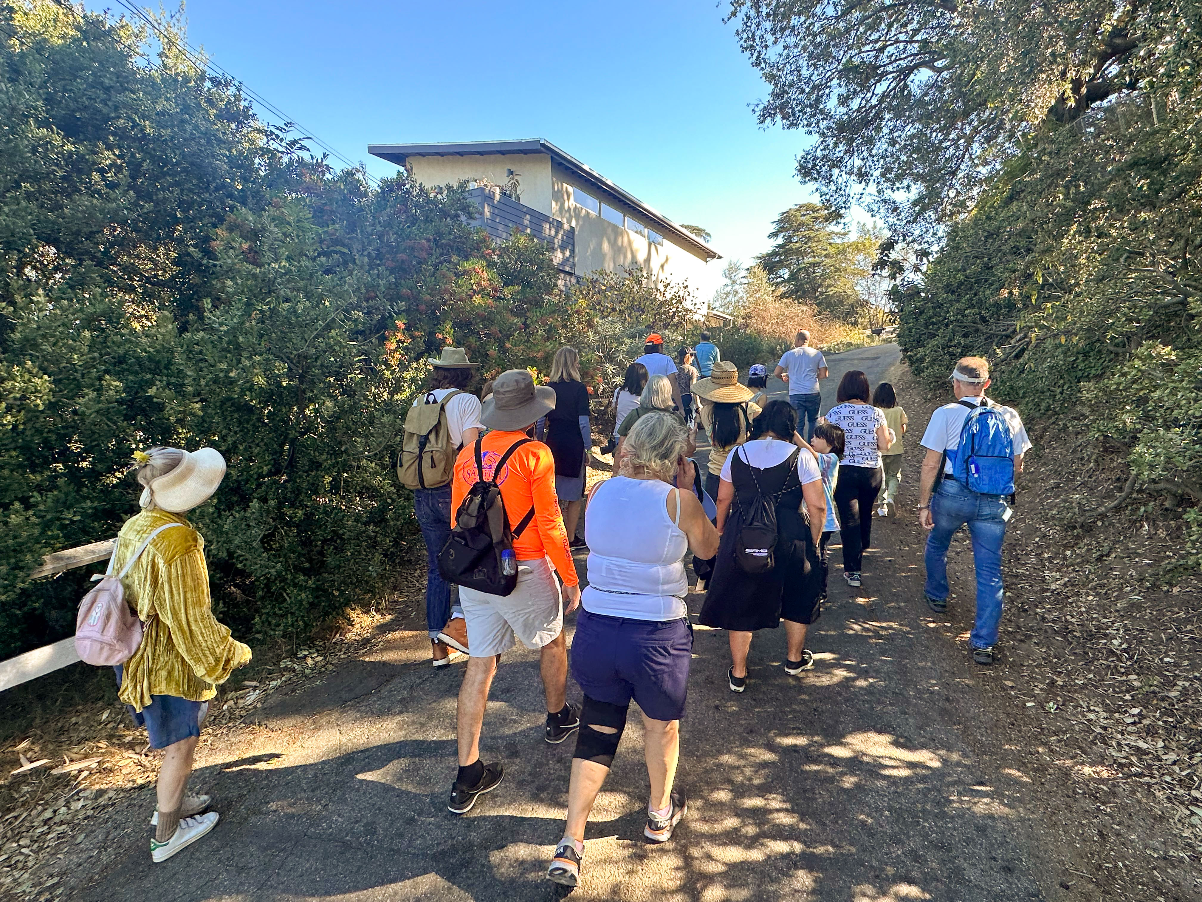
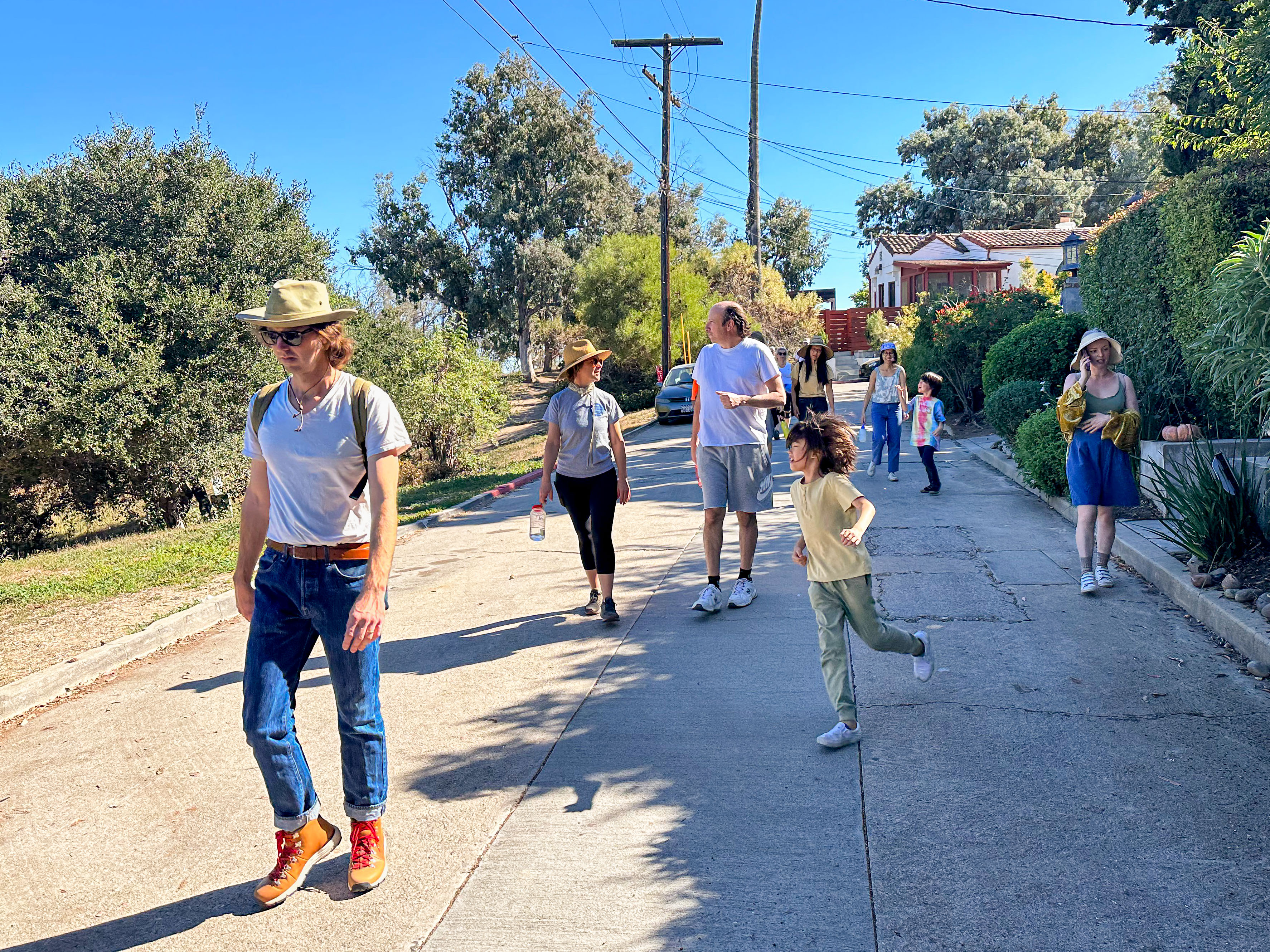
The other day I explored Elysian Heights, a small neighborhood in Mideast Los Angeles that’s usually characterized as being part of Echo Park — despite its having been subdivided before Echo Park was even constructed. It wasn’t exactly my typical California Fool’s Gold exploration but rather part of a group walk that I led with the intention — assuming it went well — of leading more. I think that it went pretty well — although the group of about twenty participants was halved by the exploration’s end.

I think a lot of the group who bailed during the walk were perhaps a bit overwhelmed by the hilliness of the neighborhood. After all, not every Los Angeles neighborhood with “heights” in the name is hilly at all. “Heights,” like “village,” or “historic,” is often just one of those words I reckon is tacked on by developers to make a place sound appealing to homebuyers — not to accurately capture its character. “Elysian,” for example, comes from the Greek “Elysium” and means, “relating to or characteristic of heaven or paradise” — and while Elysian Heights is bucolic and appealing, suggesting that it is an affront to the perfection of Heaven might be a bit of a stretch. Plus, in Heaven, the temperature is always between 7 and 17 C. When I scheduled the walk, it was because the weather app predicted a high of 18. It instead reached a sweaty 28. Happy unexpected late autumn heatwave to us.
Early on, Elsyian Heights came to be associated with artists and other bohemians. It was home to painters Edward Middleton Manigault and Philip L. Dike, engraver Paul Landacre, photographer Maynard L. Parker, and writer Carey McWilliams. In the 1930s, it was nicknamed “Red Hill” or “Red Gulch” on account of the communists and socialists that lived there. Most of the lots were developed by the 1940s.
❦
HISTORY OF ELYSIAN HEIGHTS
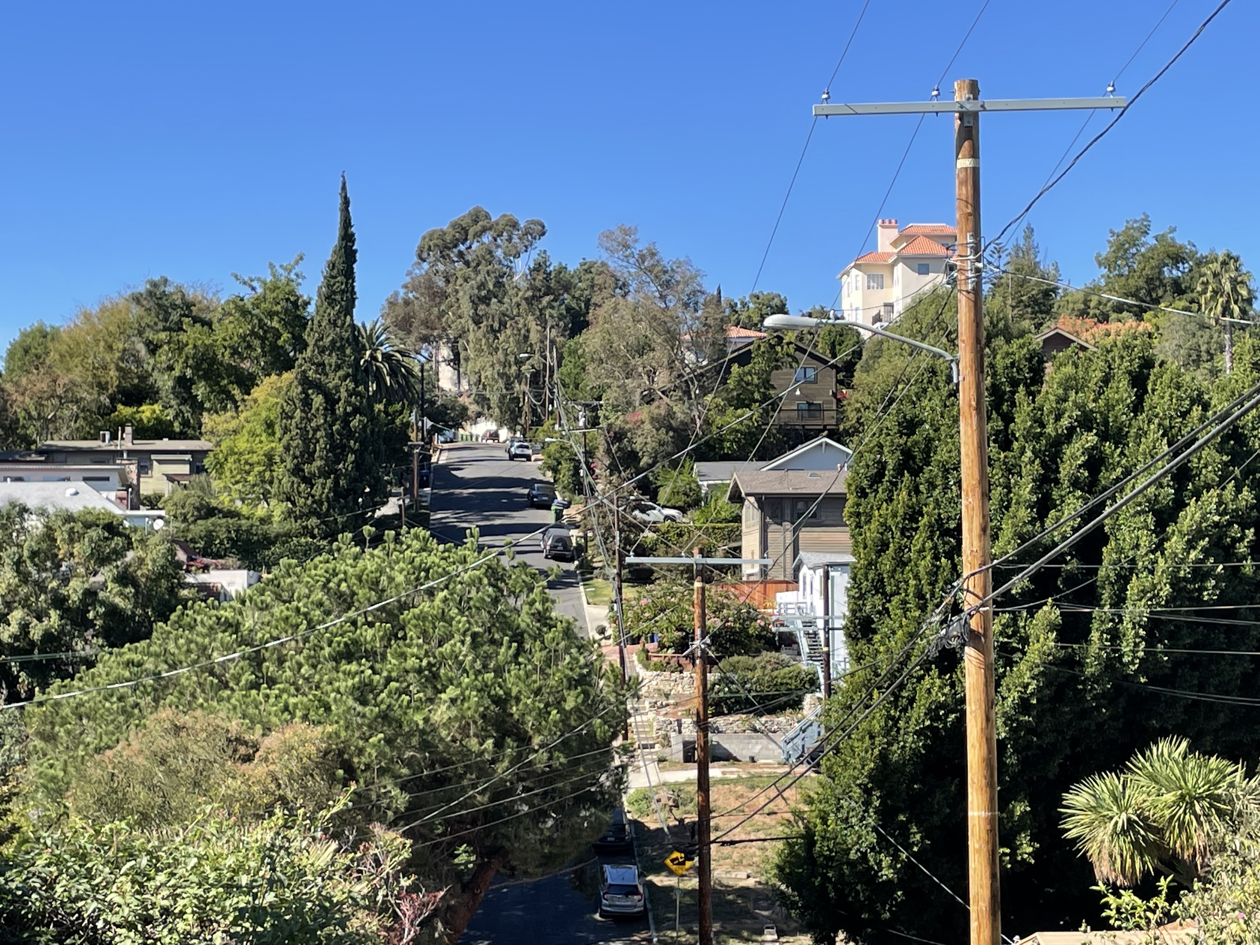
The Elysian Hills, in which Elysian Heights is located, are a chain of hills which rise from the west bank of the Los Angeles River. Native animals still found in the area include ash-throated flycatchers, Bewick’s wrens, bobcats, coyotes, gopher snakes, gray foxes, Nutall’s woodpeckers, Pepsis wasps, raccoons, skunks, and slender salamanders. We also saw native flora, including oak, walnut, sycamore, and toyon — among other trees — often sharing hillsides with non-native palms and eucalyptus. I suggested participants might want to bring binoculars, which MaryAnne did, although we didn’t see that much in the way of wildlife. I spied American Crows, Common Ravens, Red-tailed Hawks, Western fence lizards, and Western gray squirrels. There was also a Western alligator lizard that, sadly, had been squished in the road.
Non-human flora, fauna, and fungi flourished for thousands of years before the first humans arrived in the area. The first humans to live in what’s now the Los Angeles area were likely the Paleoamerican ancestors of the Chumash, who lived on the Channel Islands at least 13,000 years ago. I don’t know if anyone knows, definitively, who far inland their homeland stretched — although we know from skeletal remains that they travelled at least as far as the La Brea Tar Pits. The Tongva arrived from the Sonoran Desert to the east around 500 BCE and established numerous villages in the area near waterways. One of those waterways, the Elysian Spring, formerly flowed down a ravine to a wetland also fed by a stream that was later named Arroyo de los Reyes.
Spain claimed California for its empire in 1542 CE, as they sailed along its coast.They didn’t get around to the business of actually subjugating Los Angeles’s Native peoples until 1771, when they built the first mission in the what’s now Los Angeles County. Mexico declared independence from Spain in 1810. The US conquered one-third of Mexico’s territory, including California, in 1848. In 1868, the Los Angeles Canal and Reservoir Company scooped out earth and constructed a dam to create Reservoir No. 4. at the convergence of Arroyo de los Reyes and the Elysian Spring. The streams were channelized and entombed, underneath — for much of their lengths — Glendale Boulevard and Echo Park Avenue, respectively.
A map of Los Angeles from 1884, made by surveyor H.J. Stevenson, shows a checkerboard of properties. That land that would become Elysian Heights was then mostly owned by “Keller, Hansen & Childs.” Small slivers were the property of J.B. Braman; Frohlinger & Potts; and Babcock. Matthew Keller, George C. Hansen, and Ozro.W. Childs. Keller was a Cork, Ireland-born farmer, vintner, and distiller who’d arrived in Los Angeles via Mexico shortly after the conclusion of the Mexican-American War. He also served on the Los Angeles County Board of Supervisors and on the City of Los Angeles Common Council. Hansen was Fiume, Austria-born surveyor who arrived in Los Angeles via Peru in 1853. He soon after arrival was elected City Surveyor. Childs was a Sutton, Vermont-born Protestant banker, horticulturalist, and merchant who arrived in Los Angeles via San Francisco around 1850. In 1880, he donated a considerable amount of land for the establishment of the University of Southern California.
182 hectares of land, rejected as undevelopable, were designated Elysian Park on 5 April 1886. It’s often said to be Los Angeles’s oldest park — although it is not, having been preceded by Los Angeles Park (now Plaza de Los Angeles) and 6th Street Park (now Pershing Square). It was the first truly large park, though, predating the creation of Ernest E. Debs Park, Griffith Park, or O’Melveny Park.
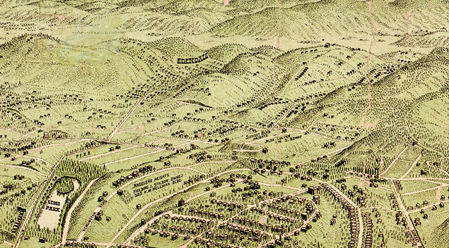
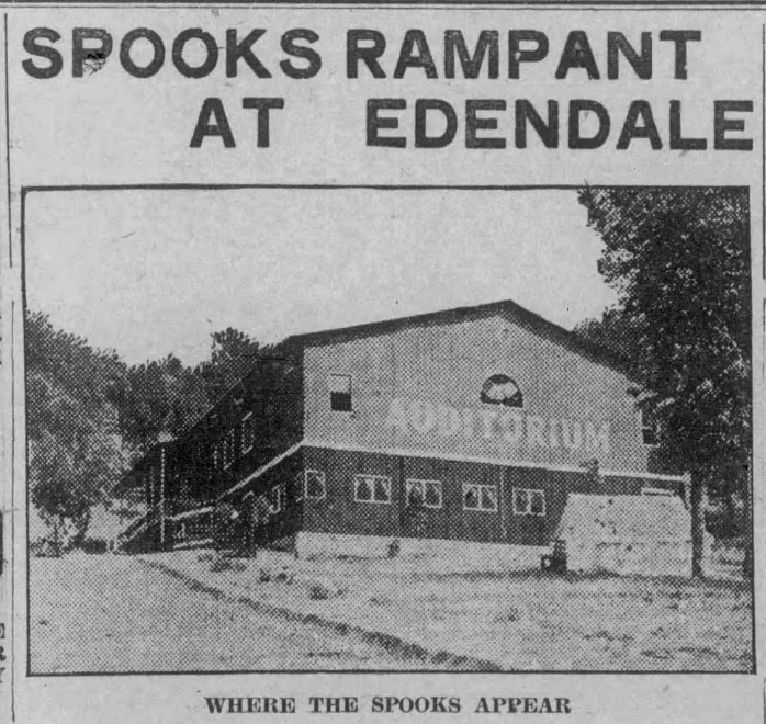
Scottish immigrant John S. Maltman subdivided the Elysian Heights Tract in late 1887/early 1888, just north of the city limits — then at Whitmore Avenue. Lot prices started at $150. A bird’s eye view map created in 1909 shows sparsely-developed hills beyond Angeleño Heights (still spelled with a tilde). The Edendale Tract opened next to Elysian Heights in 1902 and emerged as the first hub of the West Coast film industry. As such, its identity dominated the area and in this map (probably by cartographer Worthington Gates), Edendale appears but Elysian Heights does not. There were, by then, however, at least a few dozen inhabitants on the hill, although they didn’t always behave in a neighborly manner.
❦
THE TOAL FAMILY
One of the most notorious early residences of Elysian Heights was Frank Toal, an Irish immigrant and blacksmith. In 1889, he was arrested after slashing his wife’s face with a knife. It wasn’t his first brush with the law nor his first attack on his wife, Mary Ann. In 1882, when the Toals lived in Bunker Hill, Frank had kicked and beaten her into critical condition, a crime for which he was sentenced to five years in San Quentin. After an early release, he was charged in 1885 with assault with intent to murder his wife, earning him the nickname, “the wife-carver.” He didn’t limit his violence to knives, though; he also shot at and scalded her). He was again sentenced to five years at San Quentin but served none after Governor Robert Waterman pardoned him after his wife petitioned him on her abusive husband’s behalf. In 1888, he was once again charged with assault with intent to murder — this time of Frank Consulo — at whom he shot his gun. This time he was sentenced to ten years but yet again, he was released early.
Frank Toal was notorious in Los Angeles by this time and there were fears that angry Angelenos would lynch him. A reporter for the Los Angeles Herald wrote, in 1889, that “Frank Toal has been before the court for beating his wife probably as often as he has fingers and toes.” In 1890, he was sued by Stephen Richards over a real estate deal.
The Toal family settled in Elysian Heights around 1891. The final straw in their unhappy marriage came in 1894 when Frank shot at his wife three times and was sentenced to sixty days in jail. Mary Ann finally left Frank, taking with her their son. Frank later found employment when he was appointed by a member of the Governor’s Board of Trustees to a position overseeing inmates at Highlands Asylum.
❦
RESERVOIR No. 4 BECOMES ECHO PARK LAKE
The water from Reservoir No. 4 was never of the best quality and in 1891, the Los Angeles Canal and Reservoir Company donated their reservoir to Los Angeles, which on 26 February 1892 designated it Echo Park Lake — the centerpiece of Echo Park. By the early 1900s, most of the nearby tracts (e.g. Golden West Heights, Montana, Sunset Heights, and Washington Heights) came to be regarded as part of the Echo Park neighborhood. The name of Victor Heights, closer to Little Italy than to Echo Park, faded from daily use in the 1920s. Edendale never completely faded — but by the 1960s was usually employed to evoke nostalgia for the days before the 5 Freeway blasted its way through the district. Angeleno Heights retained enough of a distinct identity that it got signs designating it from the LADOT. Elysian Heights did not.
❦
ELYSIAN SPRINGS AND THE EDENDALE WATER TANK
In the meantime, there was a battle in the hills above over access to the Elysian Spring. Gicacoma Duni,whom the Los Angeles Times helpfully described as “an Italian,” was charged with trying to skewer J. J. Whitaker (“whitaker” is Anglo-Saxon for “wheat field”) with a pitchfork over a land dispute. Whitaker apparently prevailed because a year later he was bottling and selling “pure mountain water from Elysian Heights” at ten cents for 1 1/2 gallons. The Los Angeles Herald described it as “the purest and most healthful drinking water in the country.” Duni remained in the area. In 1894, he charged C.F. Lalet (probably a Frenchman) with assaulting him there and in 1895, he purchased a tract in Elysian Heights.
On 27 December 1904, a delivery person for the Elysian Springs Bottling Company, Thomas Champion, was shot and killed by his brother, Columbus “Lum” Champion. Lum was 67 and another notorious character. His neighbors were said to live in terror of him. The Los Angeles Times described him as “the Terror of the Neighborhood.” Several months before murdering his brother, he has abandoned by his wife, son, and father. Earlier that day, he’d shot at a niece and threatened to murder his family. Neighbors told the paper that Lum had “been using alcohol freely of late, and that this has made him even more quarrelsome and ugly than ever.”
The Edendale Water Tank that tops the springs, today, was built in the summer of 1906 at a cost of $4,994.92. It was also filled with water pumped from the Los Angeles River and the newly finished Ivanhoe and Silver Lake reservoirs. Neighbors complained that it was ugly, so in March 1911, its black steel walls were given an attractive, gray, concrete coating. The Los Angeles Times described the new and improved tank as “a real ornament to the region.”
❦
TRANSITING IN ELYSIAN HEIGHTS
I started and ended my walk at the northern terminus of LADOT’s DASH Pico Union/Echo Park line. In 1889, that was the northern terminus of the Elysian Park Street Railway Company’s horse and mule-drawn streetcar line. It was bought by the Los Angeles Pacific Railway Company in 1895. In 1902, the line was electrified by the Sherman Company. In 1911, it was acquired by Pacific Electric Railway. It ceased operation in 1950.
The western edge of the neighborhood was also served by Pacific Electric Railway. Construction of that line was begun, in 1903, by the Glendale and Montrose Railway. It was soon acquired by the Los Angeles Railroad, who opened it on 6 April 1904. It was taken over by the Pacific Electric Railway in 1908. It continued operation until 1955 and was replaced, afterward, by the terminus of the Allesandro Freeway (now the 2).
❦
ELYSIAN HEIGHTS IN THE 1900s
Elysian Heights was still mostly rural in the 1900s. Much of it was farmland and it was a popular weekend getaway destination for downtowners seeking to go camping or ride horses. The Elysian Heights and Echo Park Improvement Association was formed in 1902 and pushed for the installation of electric lights. A volunteer fire department formed around the same time. They stored their hand-pulled cart in the garage of Zeller’s Grocery, at 2240 Echo Park Avenue.
❦
LOS ANGELES FELLOWSHIP
In 1904, Reverend Benjamin Fay Mills founded the Los Angeles Fellowship, a New Thought (or Higher Thought) sect who established the Fellowship Parkway in Elysian Heights. New Thought was a metaphysical movement which practiced “right thinking” — a philosophy drawn from Christian Science, Hinduism, and Idealism. Mills was born in Rahway, New Jersey in 1857 and lectured in Boston before relocating to California in 1899. His wife, Mary Russell Mills, was his associate minister. The Fellowship counted over 1,000 members and had its own orchestra, schools, and a magazine, To-Morrow: For People who Think. The Los Angeles Fellowship was dissolved in 1911. The Mills left California in 1915 and the Reverend converted to Presbyterianism in 1915. He died a year later, in Grand Rapids.
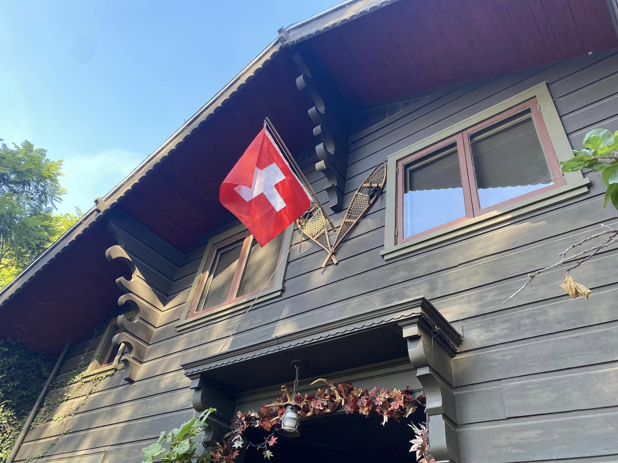
The former park is criss-crossed with walk streets: Ravine Road, a section of Lemoyne Street, and Fellowship Parkway. There are several homes and the walk street is narrow so I encouraged members on the walk to take a peek but not to disturb the residents. The home next to the Edendale Water Tank looks like a Swiss Chalet and was built in 1918. On Fellowship Parkway is the Harwell Hamilton Harris House. It was co-designed by Gregory Ain (one of my favorite architects) and Harris for Dr. S. Hunter but, after the deal fell through, became Harris’s residence that he shared with his wife, Jean Murray Bangs, until they moved out in the 1940s.
❦
THE SEMI TROPIC SPIRITUALISTS
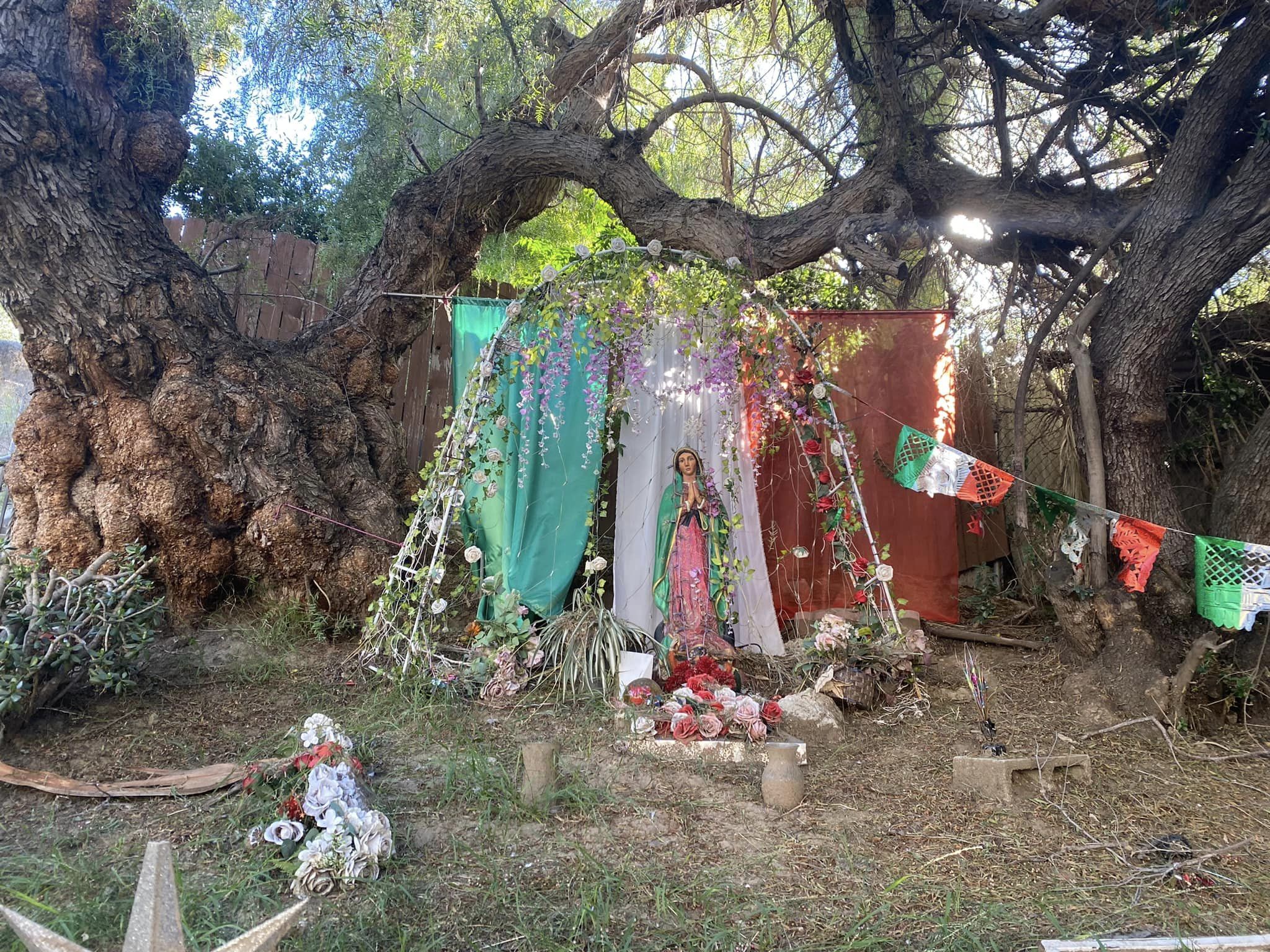
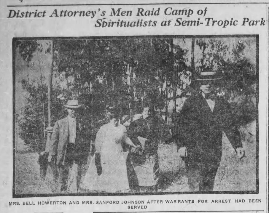
The Semi-Tropic Spiritualists were a Spiritualist sect who conducted seances and used other means to communicate with spirits of the dead. The advice the spirits provided was often to practice gender equality, vegetarianism, and free love. In 1907, 25 pounds of dynamite purchased to remove tree stumps vanished into thin air. They were frequently harangued by the authorities, members of the Anti-Fakir Society, and other Spiritualists — who alleged that they were phonies. After the area was annexed by Los Angeles on 28 February 1910, the spiritualists mostly dispersed or relocated to South Pasadena’s Mineral Park.
In 2012, part of their long-abandoned tract was developed with townhomes for a subdivision called Via Artis. It seems to have re-awakened interest in the Spiritualists. An art duo took to calling themselves the Semi-Tropic Spiritualists. A bar called the Semi Tropic opened… in the Pacific Electric Tract. Today, the most visible remnant of the tract, though, is an abandoned cabin.
❦
PAUL LANDACRE CABIN
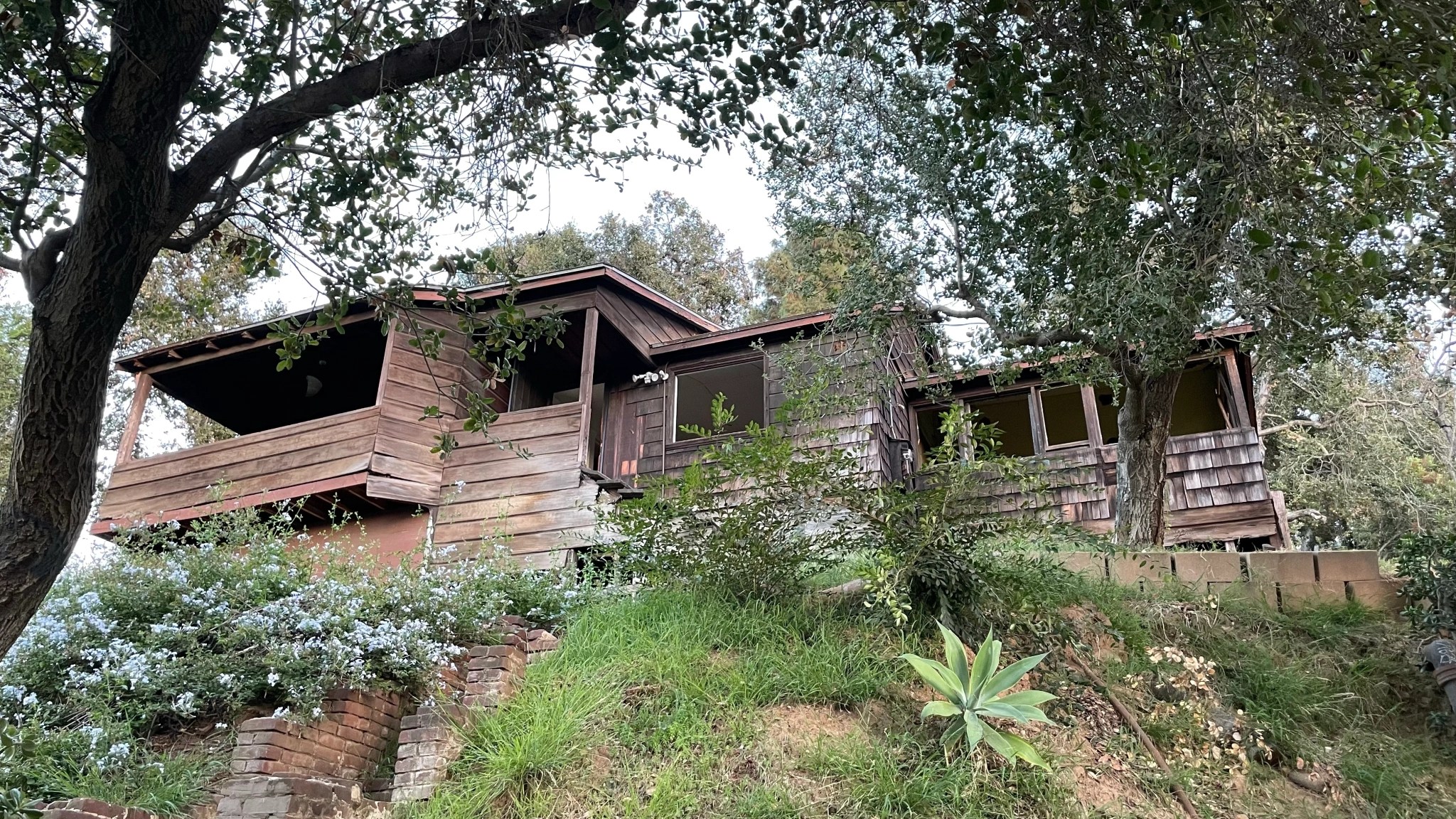
Paul Landacre was a wood engraver and printmaker. He was born in Columbus, Ohio in 1893. He moved to San Diego in 1917, where he met his wife, Margaret Gertrude McCreery (born in Missouri in 1891). They were married in 1925 and in 1932, moved into a cabin built in 1909 for Thomas C. Saunders. In 1963, Margaret died of cancer and a distraught Paul filled the cabin’s kithen with gas. Unfortunately, the gas ignited, covering Paul with burns, and he died two weeks later. The cabin was designated Los Angeles Historic-Cultural Monument No. 839 in 2006. Nevertheless, it’s utterly neglected and apparently being allowed to deteriorate until it returns to the soil.
❦
ELYSIAN HEIGHTS ORGANIZATIONS
The aforementioned Elysian Heights and Echo Park Improvement Association lasted at least until the 1950s. It was joined, around 1919, by the Elysian Heights Civic Club, which met at the Masonic Hall at the corner of Echo Park Avenue and Sunset Boulevard as well as at the home of members. Lecture titles include “The Spiritual Forces of Understanding,” “The Problem of the Movies,” “The Paving of Echo Park Avenue,” and “Why Shy At Politics.” They hosted “old-fashioned barn dances” (at which attendees were encouraged to wear overalls or gingham aprons), clothing drives, rummage sales, and carnivals.
The Elysian Heights PTA was formed by 1923. The Elysian Heights Coolidge-for-President Club probably formed shortly before his election in 1923 and likely dissolved soon after. By 1985, there was a Elysian Heights Residents Association, which that year sued to stop the replacement of three structures with apartments containing 46 residential units. They lost. The Echo Park Historical Society, which covers Elysian Heights, was formed in 1995. The Echo Park Neighborhood Council formed in 2002 as the Greater Echo Park Elysian Neighborhood Council.
❦
LADY BIRD CAFE – BIRTH OF THE GO-KART
The the walk I organized, our group headed south and stopped outside of Lady Bird Cafe. The spot has been home to the only restaurant in the neighborhood for years — although the tenants have changed. For a while, it was home to Fix Coffee. During the Great Australian Cafe Craze of the late 2010s, it was home to Pollen. I figured it would be a good place to grab a bite or a drink either before or after the walk — or both.
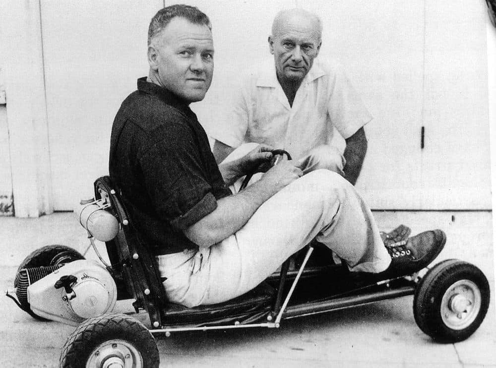
The building in which Lady Bird is located was constructed in 1939. In researching information for the walk, I was surprised to learn that it was here that Art Ingels invented the go-kart in 1956. He called it Kart #1. I suppose it might surprise people who know me as a happily car-free Angeleno — but I love racing go-karts. On a go-kart track, you never have to sit in traffic or look for parking.
❦
ELYSIAN HEIGHTS ELEMENTARY/ROOM 8
Our next stop was at Elysian Heights Elementary. In 1896, residents of Elysian Heights petitioned to use a room at the Elysian Springs Bottling Company as a schoolroom. Echo Park Elementary was built in 1915. In 1920, it was renamed Elysian Heights Elementary. The original school was damaged in the 1933 Long Beach Earthquake and the school was rebuilt.
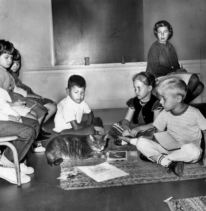
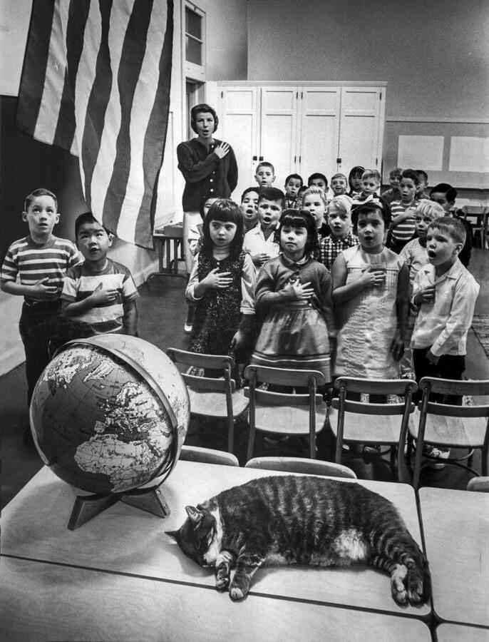
The school became famous when it received an unexpected visitor in 1952. That year, a gray, domestic short haired cat wandered into Room 8 — the classroom of the school’s sixth-graders. Day after day, he returned, a habit for which he became the subject of a considerable amount of attention. The students named him Room 8.
Room 8, like his fellow sixth-graders, would take a break in the summer but return again in the autumn — always to the same room. During his life, he was estimated to have received over 10,000 pieces of fan mail — including a letter from the wife of Winston Churchill. He had his portrait painted, his paws cast in concrete, and was awarded medals. He was featured on an Art Linklater production called “Big Cats, Little Cats.” He was the subject of a spread in Look Magazine. He was the subject of a children’s book, A Cat Called Room 8 and a Leo Kottke song, “Room 8.”
In 1963, Room 8 got in a fight with another cat and had to undergo surgery atthe Dr. Lockhart Small Animal Hospital. His Thanksgiving, spent in recovery, was covered by national newspapers, who noted that he celebrated the holiday with a meal of horse meat. In 1964, Room 8 got got pneumonia and missed his first class picture in eight years. That year, he moved in with the Nakano family, who lived right around the corner. By 1967, Room 8 was a respected, elderly cat, who was given to activities like taking tea with the University Women’s Club. He died on 13 August 1968 at the estimated age of 21. He was buried at the Los Angeles Pet Memorial Park near Calabasas.
Room 8’s memory lived on after his death. A bronze statue of Room 8 was unveiled in 1971. In 1972, more than 200,000 people signed petition to memorialize him on a postage stamp. That year, students at the school wrote poems and made drawings in the concrete in front of the school commemorating Room 8. A trust fund was set up in Room 8’s name at the Los Angeles Orthopedic Hospital. Today, there are still paintings of Room 8 at the school.
❦
ELYSIAN HEIGHTS GROCERY
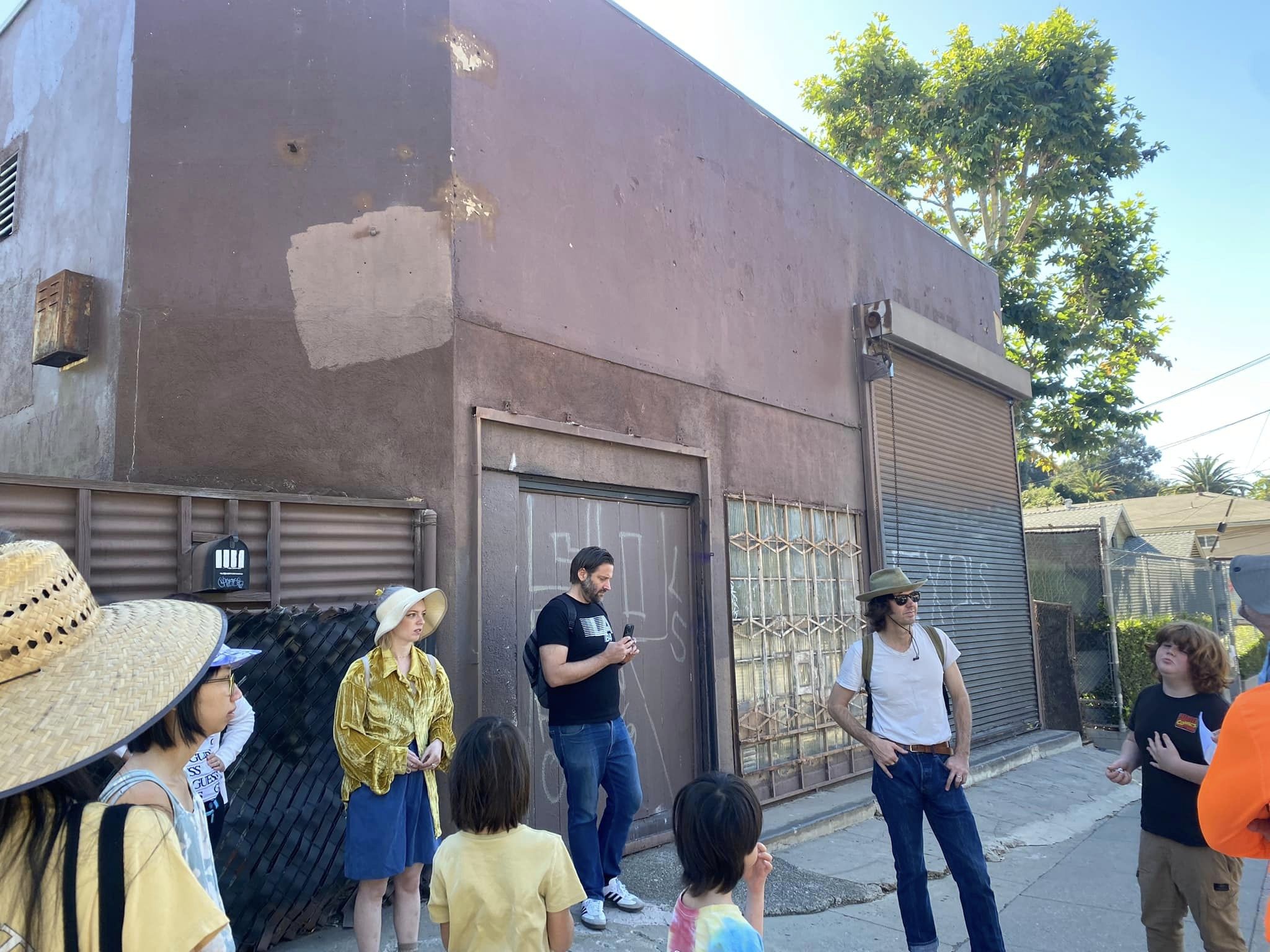
Just south of the elementary school is a nondescript, brown building. It was formerly the home of Elysian Heights Grocery, which was in operation at least as early as 1909. There were several reasons I wanted to point out this building — which is architecturally unremarkable. It is an example of adaptive re-use — in which a building constructed with one purpose — in this case to be a grocery store — is adapted for another — in this case, a residence. It’s a nice way of breathing new life into an old building but, if there’s a downside, its in the loss of commercial space and thus, reduction in walkability. Walking on Echo Park Avenue or Allesandro Street, one passes many former businesses that are now homes. And when there are so few businesses, there are few potential places to work or shop — and so people drive to other neighborhoods to work and shop. There were at least three grocery stores along this short stretch of Echo Park Avenue. I remember when I explored Angeleno Heights that I counted four former grocery stores converted into homes. Not surprisingly, 88% of Americans drive to get their groceries, rather than walk to them.
❦
ECHO FOOD MARKET
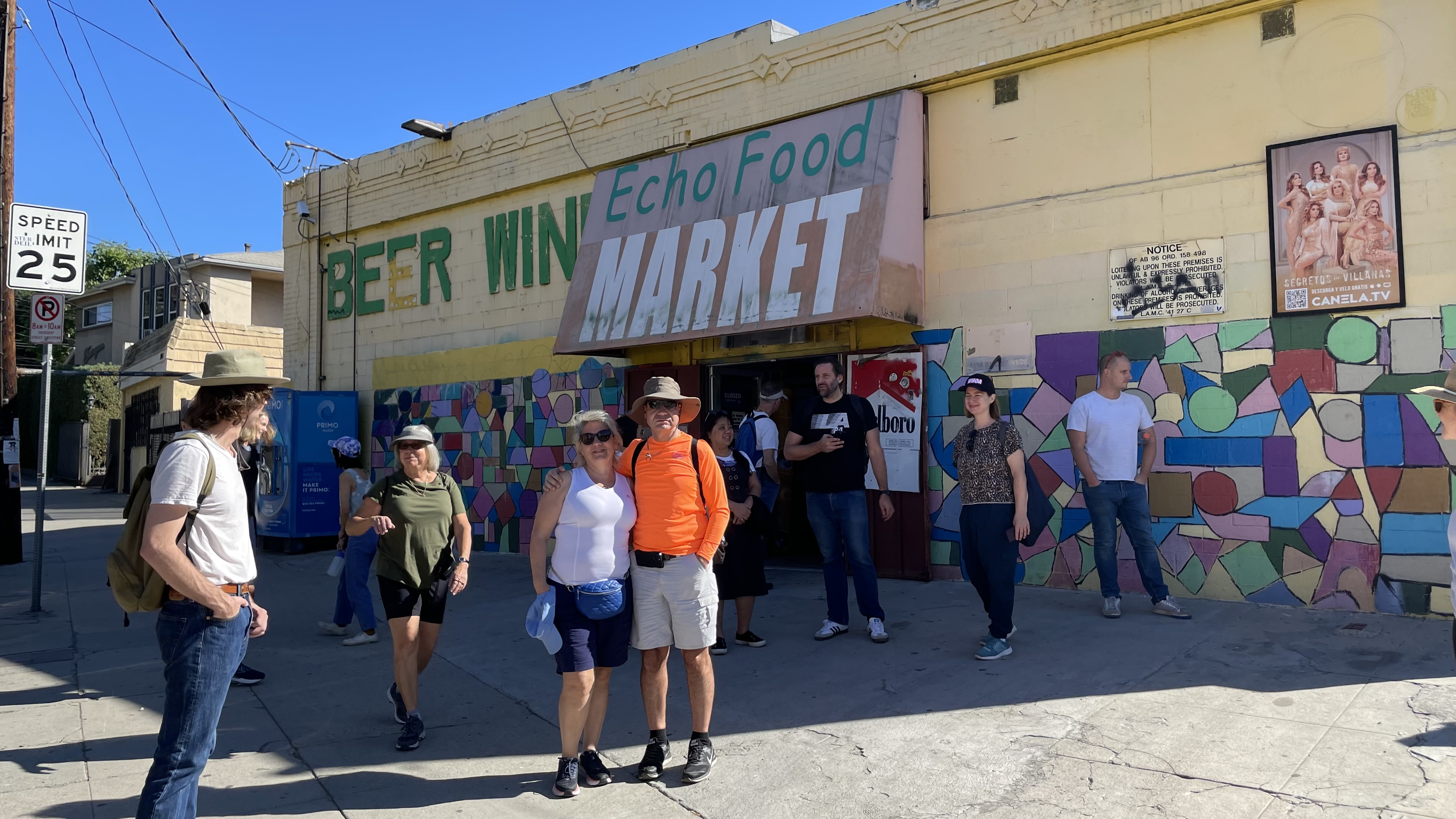
Just south of the former Elysian Heights Grocery is Echo Food Market, which has been a grocery store since at least 1905, and possibly, 1904. The County Assessor’s office says that the current building is from 1924 — but the brick structure appears older to me — and the Assessor’s office does contain the occasional error. Regardless, it seems always to have been a grocery store. in 1966 and ’67, newspaper ads for the market advertise a position for a delivery driver between the ages of sixteen and nineteen. The driver needed to be able to speak Spanish.
We stopped at the market and I encouraged participants to grab snacks or a drink because this would likely be their final opportunity to do so. My friend, Cindi, entered the market with her two sons — and they re-emerged with rather large bags of chips. I thanked them for buying large enough bags to share with the group.
❦
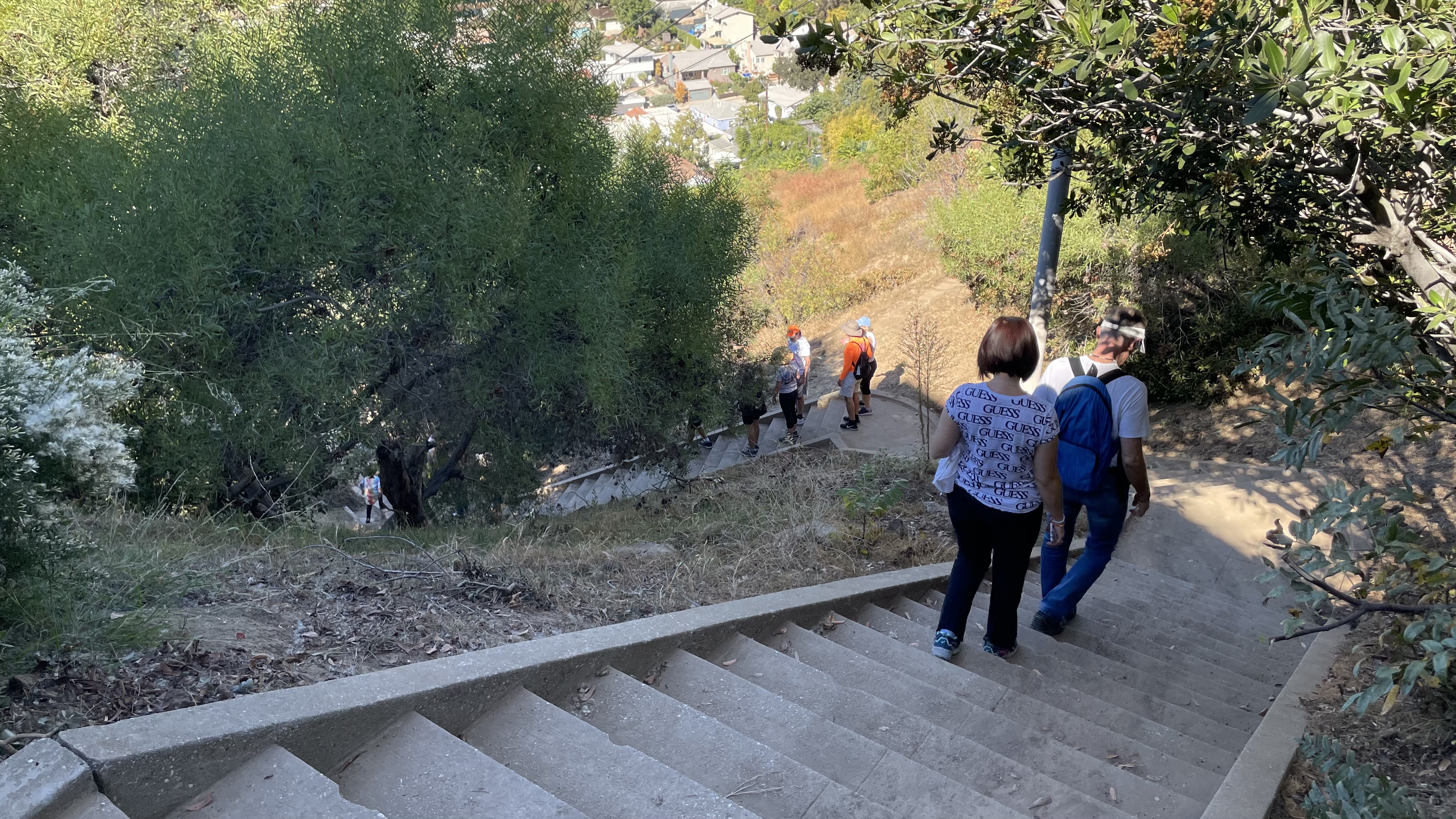
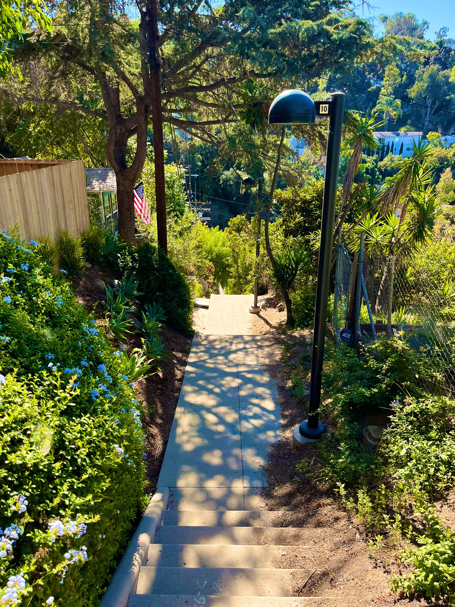
STAIR STREETS OF ELYSIAN HEIGHTS
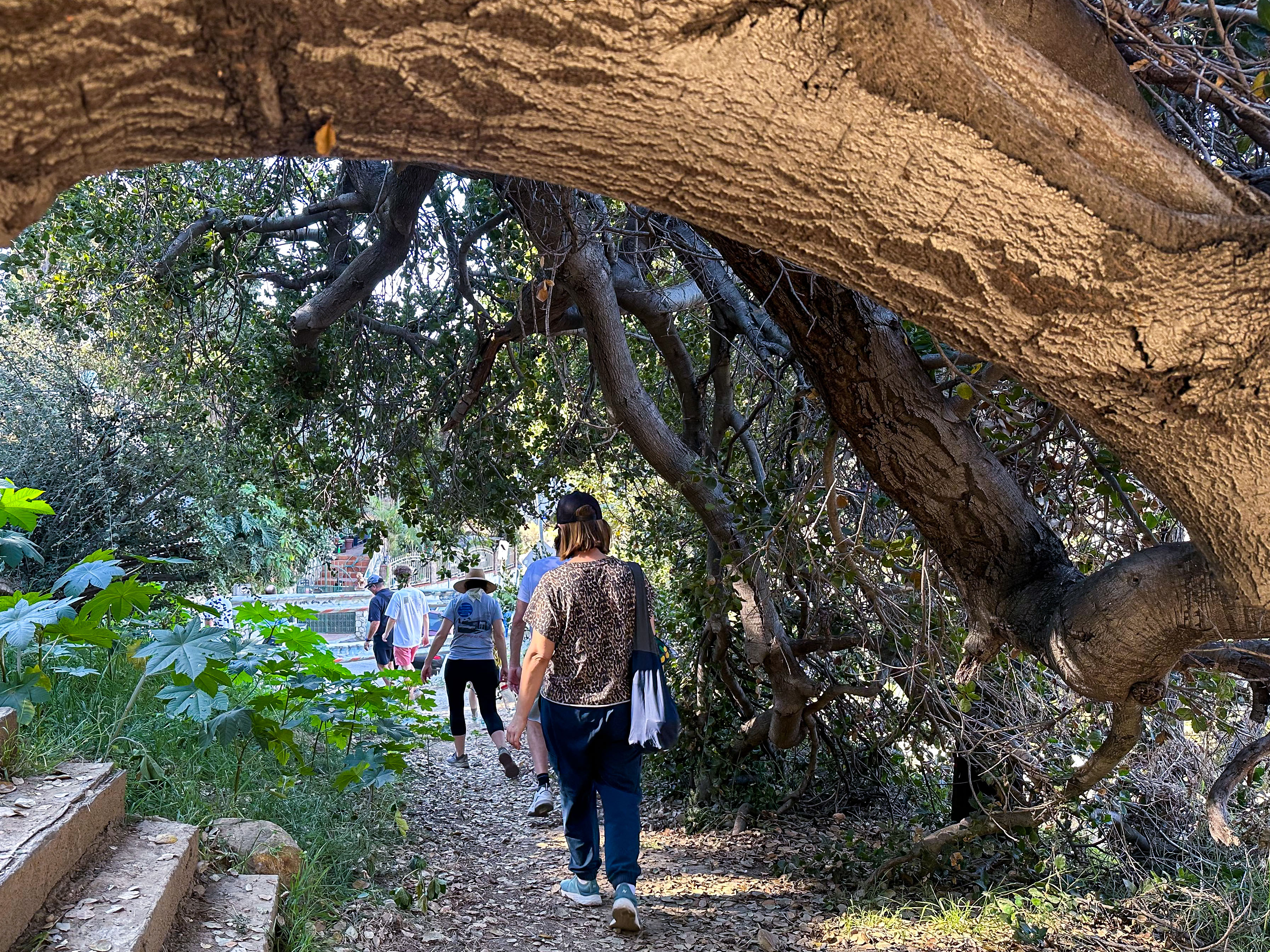
There are numerous stair streets — or public stairways — criss-crossing Elysian Heights. I counted seventeen. Most were built in the 1920s, so that residents could more easily walk to and from businesses and streetcar lines. We climbed the 129-step Avalon Stairway, which marks the Elysian Heights Tract’s southern border. The condition of that stairway — with its non-slip grooves and stair rail — suggest to me that it is relatively new compared to most. A search of old newspapers reveals that the Avalon Stairway was wooden until at least 1986.
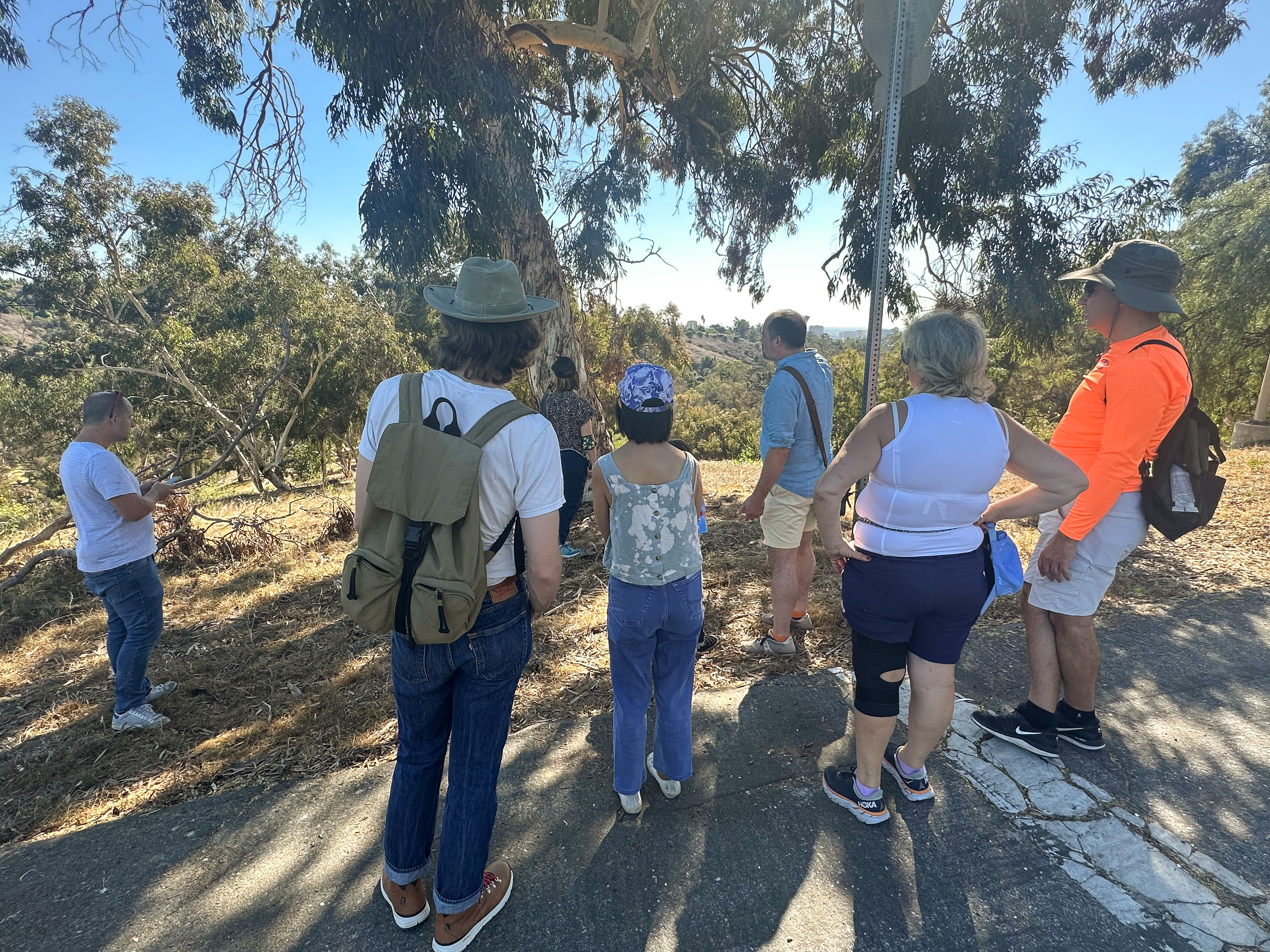
We stopped to rest at the top of the stairs. Some of the participants started to complain about the speed and difficulty of the walk — which, I believe, I had described as “moderately easy.” In the future, I will describe everything as two notches harder than it seems to me. I used to opportunity to point out some native trees. We then walked over to Park Drive and looked across Elysian Park to Downtown and Palos Verdes Peninsula. Barely visible in the hazy morning air was Peter Shire’s sculpture atop Angel’s Point, the Frank Glass and Grace E. Simons Memorial Sculpture (1994). Below us was the trail I used to walk with my friend, Natalya, that inspired me to explore and map the rest of Elysian Park.
We then walked to one of several hills in Elysian Heights colloquially known as Kite Hill, where we descended the second-tallest stair street in Los Angeles, the 231-step Baxter Stairs. They’re named, like steep Baxter Street, after a New York-born tin smith named Reuben Baxter (who had a daughter named Effie). Years ago, before going out for Rock ’n’ Roll Mondays, a few friends and I would often head over to these stairs to walk or jog up and down them a few times before going out. After the workout, a couple of beers would hit us pretty hard but I’d feel amazing.
❦
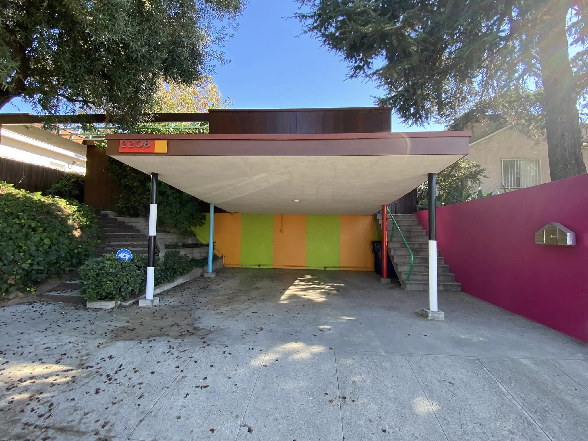
THE GARCETTI-WAKEFIELD RESIDENCE
At the bottom of the stairway is the Garcetti-Walkefield Residence. It was designed in 1953 by Daniel Leonard Dworsky. Dworsky was a wrestler and American football player who played for the Los Angeles Dons before pivoting, unexpectedly, into architecture. I have been inside and there are no obvious signs that it was designed by a wrestler. Dworsky died at the age of 94 in 2022.
❦
JULES SALKIN HOUSE
I meant to give people the option of walking up very steep Avon Terrace to see an early John Lautner home or waiting at the bottom for five minutes — but I overshot and and decided to skip it. I have walked to it before and, from the street, you can’t see much but the car port — which is striking, as car ports go, but still a car port. Were Kite Hill not currently fenced off by an actor who hopes to build a giant home with a freeway ramp-like driveway, we could’ve walked there more easily using a trail. Save Kite Hill.
Lautner is best known for his supervillain-style lairs like Jackie Treehorn’s home in the Big Lebowski or the Chemosphere from Body Double. Those were from the 1960s, though, and the Jules Salkin is an early and more modest design, from 1948. In 1949, it was sold to the Maxwell family, who owned it until 2014. It earned a Conservancy Preservation Award in 2018, but unless you’re a Lautner nut (like me), it might not justify the pain of a climb up a steep dead end.
❦
THE SHIRE ART HOUSE
The next house on our exploration was up another dead-end. I suggested that anyone in need of a break take one in the shade of a pepper tree at the corner of Avon and Cerro Gordo streets. A couple of men sitting on a wall on Vista Gordo Drive asked us what we were up to. When told that we were exploring and on their street to see the Shire Art House, one jokingly suggested that we check out his house and described it as the one with the weeds in the yard.
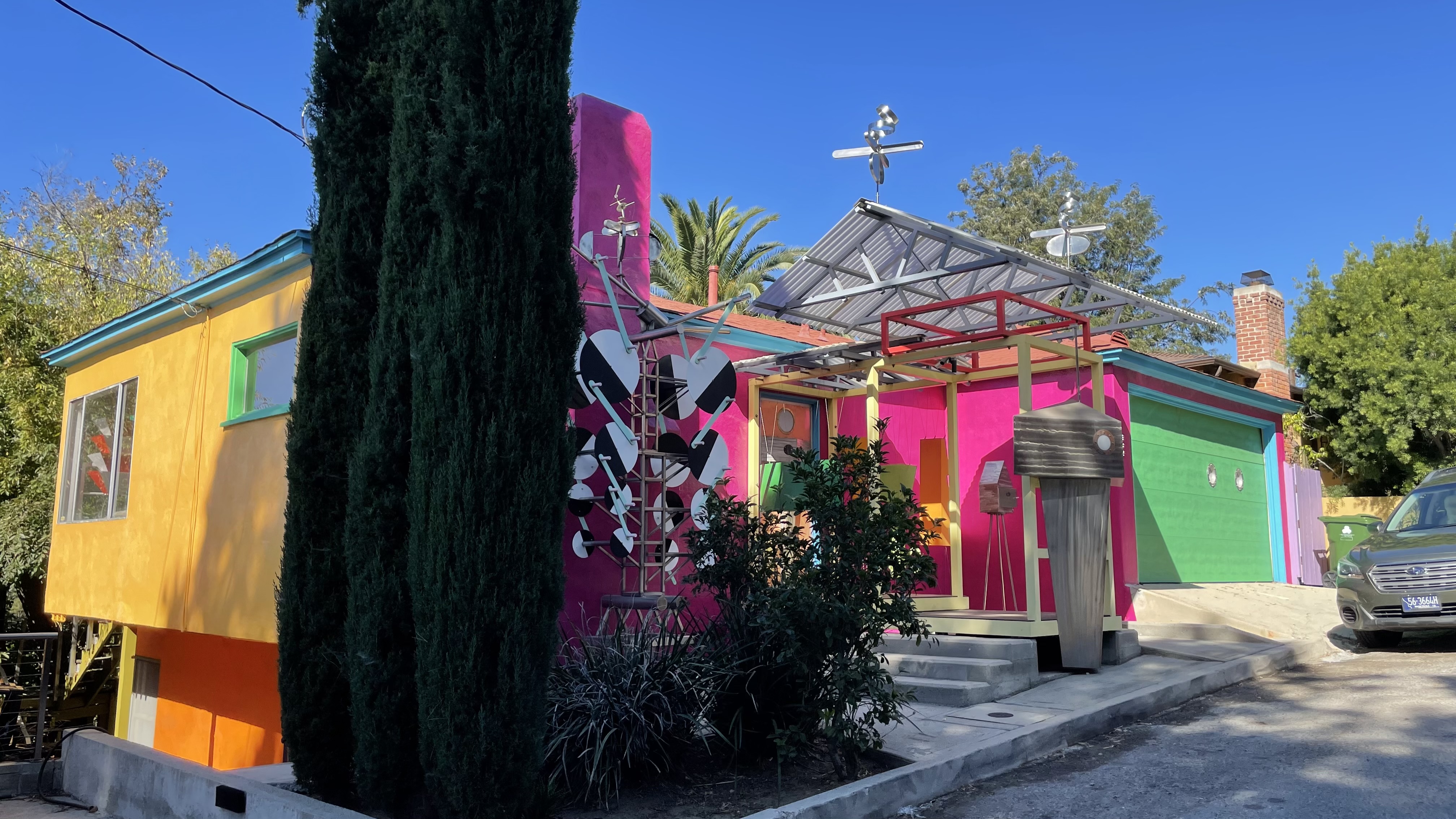
The Shire Art House is a Minimal Traditional-style home, built in 1938. The architecture isn’t what makes it exceptional, though, it’s the decoration, colors, and furniture visible inside. Peter Shire is an artist who was born in 1947 and associated with the Memphis Milano group. He also worked on the design team for the 1984 Summer Olympics, and Mike happened to be wearing T-shirt commemorating that event. Billy Shire, the artist/leatherworker and Luz de Jesus Gallery-founder who designed outfits for the New York Dolls and Elton John, was in the garage and closed its port-holed door.
❦
THE ROSS AND NAKANO HOUSES
As we headed back toward the pepper tree, we crossed paths with Leo, a cartographer who’d gotten a late start and met up with us by walking the route backward. We then headed southwest along an alley between Avon an Valentine streets. There was a pile of branches with persimmons lying in a driveway. MaryAnne grabbed one. I noticed, at Donaldson Street, that the alley continued along an unpaved path between the houses but we turned north and then south along Valentine. Stopping near the bottom of the hill, I pointed first to the Ross House.

The Ross House is a home, designed in the International-style, for William and Pauline Ross. It was later the home of film art director Albert Nozaki (When Worlds Collide, The Big Clock, Sorrowful Jones, Appointment with Danger, Pony Express, Houdini, The Buccaneer, and Loving You). The architect was Raphael Soriano, a Sephardic Jew born in Rhodes, Greece in 1904. Soriano emigrated to the US in 1924 and interned with both Richard Neutra and Rudolph Schindler. He also worked for Joseph Eichler. Soriano died in 1988.
The other home was owned by George Nakano. Nakano was born in 1935 and interned at both the Jerome and Tule Lake concentration camps. He went to California State University, Los Angeles, and was a city council person in Torrance before representing the 53rd district as a California State Assemblyman from 1998 to 2004. He also took in Room 8 after his bout with pneumonia.
Elysian Heights, today, is largely Latino — with most of either Mexican or Salvadoran ancestry. There is also a large Chinese minority and I’ve heard Khmer spoken and seen the script on a conspicuous number of signs in the vicinity. I was going to ask my friend, Cindi, if she knew anything about the Chinese and/or Japanese history of the neighborhood — as her father’s side is Japanese and her mother’s, Chinese… and one of her uncles is the landlord of several properties in the Echo Park area… but she and her young boys and thad split off from the walk a couple of blocks back with their giant bags of chips in tow — and thus depriving me of an opportunity to channel Jan Hooks as Tina, the tour guide from Pee-Wee’s Big Adventure… as in, “Are there any Japanese Americans here today? Well, Koe Knee Chee Wah!”
❦
HENRY SHIRE RESIDENCE
I designed the walk so that, at the halfway point, we’d find ourselves just a block from Lady Byrd Cafe and thus, presumably, no more than a block or two from the cars of those who drove. That way, if people were exhausted or for any other reason needed to bail, they could — and about half of the group did. After we bid farewell, those of us that remained were able to walk about more quickly. First, though, we had to climb steep Princeton Street.
At the top of the hill, we stopped at the Henry Shire Residence. It’s an International-style home designed by Josef Van der Kar and built in 1949. Van der Kar was a second generation Modernist who later taught at Pennsylvania State University. The landscape was designed by Garrett Eckbo. Eckbo often partnered with Gregory Ain. Henry Shire was the father of Billy and Peter and was blacklisted for drawing Leftist political cartoons. Henry and his wife opened the Soap Plant in 1971, which evolved into Billy Shire’s Wacko. He died in 1985.
❦
ESTELLE LAWTON LINDSAY RESIDENCE
Back next to the former Zeller’s Grocery, Ayda had the idea of checking its wall for a ghost sign. If there ever was one, it was painted over, likely a long time ago. We couldn’t see much of anything over the fence. We began walking up Echo Park Avenue and I recognized a scent that had struck me in the same place a week earlier. At the time, I’d thought that it smelled like someone was baking a rhubarb pie — as unlikely as that is in generally rhubarb-indifferent Southern California. Others in the party correctly identified it as the scent of guava, currently in season.
At the top of Echo Park Avenue is a group of dark brown homes. One, at 2416 Echo Park, was home to Estelle Lawton Lindsay — Los Angeles’s first female city councilperson and the first woman in the US to win a major municipal election. Lindsay was born in South Carolina in around 1868. She and her husband, Dudley Lindsey, moved to Los Angeles in 1908. She ran, unsuccessfully, for State Assembly in 1912 and ’14. She was elected, however, to City Council in 1915 — five years before the ratification of the 19th Amendment to the US Constitution granted women the right to vote.
❦
TACO BELL TOWER
Our next section of the walk was a loop up the Landa Street Stairway, through the Semi-Tropic Spiritualist Tract where were stopped by the Paul Landacre cabin before looping back. None of the remaining ten used to opportunity to enjoy a fifteen minute break. We headed over to check out the Fellowship Park and the Edendale Water Tank but stopped, briefly, at the base of “Taco Bell Tower.”
Taco Bell Tower is not the building’s official name — but if you’ve ever been to a Taco Bell and Elysian Heights, you probably know what I’m talking about. It was built in 1990 but the Spanish Colonial Stripmall architecture and cast ironwork make abundantly clear. It is visible from almost every corner of Elysian Heights except, somewhat humorously, at the base of its driveway. In this way, it reminds me of the black tower in John Smith’s short film, The Black Tower (1984).
❦
THE LEMOYNE HOUSE AND LARRY’S MEDIAN
Initially I had toyed with including a stroll past a house at 2047 Lemoyne Street, built in 1969. It was there that I met Mike — and my ex — and I imagined pointing to the driveway and saying “I threw up here after smoking a blunt” which someone would then lean in and snap a banal photo of. Another resident was our friend, Josh, who introduced me to surfing and The Whistler… and who hosted popular crêpe nights in the early 2000s. Aside from having met many of my oldest friends there (and my ex), at crêpe nights, though, the house isn’t especially important… although the median, Larry’s Median, was planted by Larry Pickens in 2006 after the city donated funds for its beautification. He died in 2007.
❦
DONALDSON STREET
A visit to the Lemoyne House might’ve amused me and maybe Mike, but I decided it would be more interesting to end our trip with a walk down the Donaldson Street Stairs. There are stairs, as you’d expect from the name, at the bottom — but most of the block is a steep hill with a sidewalk on one side. The grade of the street is about 24% but the bottom is steeper. My assumption is that the city never got around to paving it because it was too steep… and so it’s been planted with all sorts of foliage. It reminds me of a similar unpaved and planted block of Maltman Avenue, in Silver Lake. Surely Maltman is named after Elysian Heights’s developer, John S. Maltman, I figured, so it felt to me look a fitting bookend to this exploration and this essay. Until next time!
❦
FURTHER READING
“Elysian Heights Part One” by “the Hill Dwellers,” 1983
Support Eric Brightwell on Patreon

Eric Brightwell is an adventurer, essayist, rambler, explorer, cartographer, and guerrilla gardener who is always seeking paid writing, speaking, traveling, and art opportunities. He is not interested in generating advertorials, cranking out clickbait, or laboring away in a listicle mill “for exposure.”
Brightwell has written for Angels Walk LA, Amoeblog, Boom: A Journal of California, diaCRITICS, Hey Freelancer!, Hidden Los Angeles, and KCET Departures. His art has been featured by the American Institute of Architects, the Architecture & Design Museum, the Craft Contemporary, Form Follows Function, the Los Angeles County Store, Sidewalking: Coming to Terms With Los Angeles, Skid Row Housing Trust, the 1650 Gallery, and Abundant Housing LA.
Brightwell has been featured as subject and/or guest in The Los Angeles Times, VICE, Huffington Post, Los Angeles Magazine, LAist, CurbedLA, Office Hours Live, L.A. Untangled, Spectrum News, Eastsider LA, Boing Boing, Los Angeles, I’m Yours, Notebook on Cities and Culture, the Silver Lake History Collective, KCRW‘s Which Way, LA?, All Valley Everything, Hear in LA, at Emerson College, and at the University of Southern California.
Brightwell is currently writing a book about Los Angeles.
You can follow him on Ameba, Duolingo, Facebook, Goodreads, iNaturalist, Instagram, Letterboxd, Mastodon, Medium, Mubi, the StoryGraph, Threads, TikTok, and Twitter.


Eric I love your stories. I hope you are planning to do a similar article on Victor Heights. I grew up on Figueroa Terrace and I have researched a lot but you seem to able to find much more. I found an 1895 newspaper article about a reporter who took a trolley to Temple and Beaudry and ascended the hill to the “big white faced reservoir ” at the top of the hill. probably where the name White Knoll Ave came from. Then he makes observations of the city from this very high point. You have probably seen this if not let me know and i will send it to you, I printed a copy. I have also researched all the old water companies as there where a lot . anyway keep it coming Thanks Mark
LikeLiked by 1 person
Thank you!
I explored Victor Heights for California Fool’s Gold back in 2015. Could probably use an update/revisit. Hope you like it, though:
LikeLike
If you need a copy of that article send me an email mjojola@dslextreme.com thanks again Mark Jojola
LikeLike