

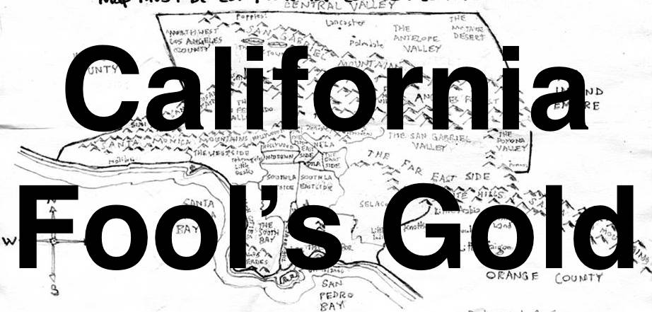
INTRODUCTION
The other day, Mike Morgan — a frequent companion in my neighborhood explorations — asked whether or not I’d like to explore a neighborhood… or to maybe go to a museum. He asked, too, what community was currently topping the California Fool’s Gold readers’ poll. I informed him that Torrance still occupies the top spot but that another occasional explorer, Matt Patsel, had requested that I pencil him in for that exploration on 9 June. The number two spot, on the other hand, was Miracle Mile — or is it the Miracle Mile? That struck me as ideal, because whilst Torrance does have its museums — is is both too distant and too sprawling to adequately explore in the few hours that Mike and I had available to us. Miracle Mile, on the other hand, is much closer, much smaller, denser, and home to a veritable accumulation of Museums. And so, without wasting another moment, we headed over to the Midtown to explore and to visit a then-still undetermined museum.
I’ve had a soft spot for the Miracle Mile ever since I noticed the striking, black and white, Art Deco neon signs at its western and eastern gateways. What, I wondered aloud to my friends, who were then showing me the sites of their native city, was so miraculous about this mile-long stretch of Wilshire Boulevard? Instead of responding, they enjoyed a laugh on account of my aggressively rhotacized and melodious pronunciation of the word “miracle,” owing to my having grown up in Missouri. This would’ve been in 1998, when I was first visiting, and a couple of years before Missourian like Nelly, Chingy, and J-Kwon would educate the coasts about our region’s dialect with songs like “Hot In Herre,” “Right Thurr,” and “Tipsy.”
I was to later learn that what made this mile, in particular, miraculous, was that it was designed around the automobile. Of course, people often say that Los Angeles was built around the car — which it was — albeit the streetcar. The city historically boasted one of if not the largest mass transit network the world has ever known, with networks like the Los Angeles Railway (LARy), Pacific Electric Railway (PE), and others. It was, for the most part, the suburbs of Los Angeles that were built around the car. The Miracle Mile, however, was different — and to this day it simultaneously manages to simultaneously evoke both cities and suburbs — or as a transition between the two. Reyner Banham termed it “the linear downtown.” Others called it “America’s Champs-Élysées,”
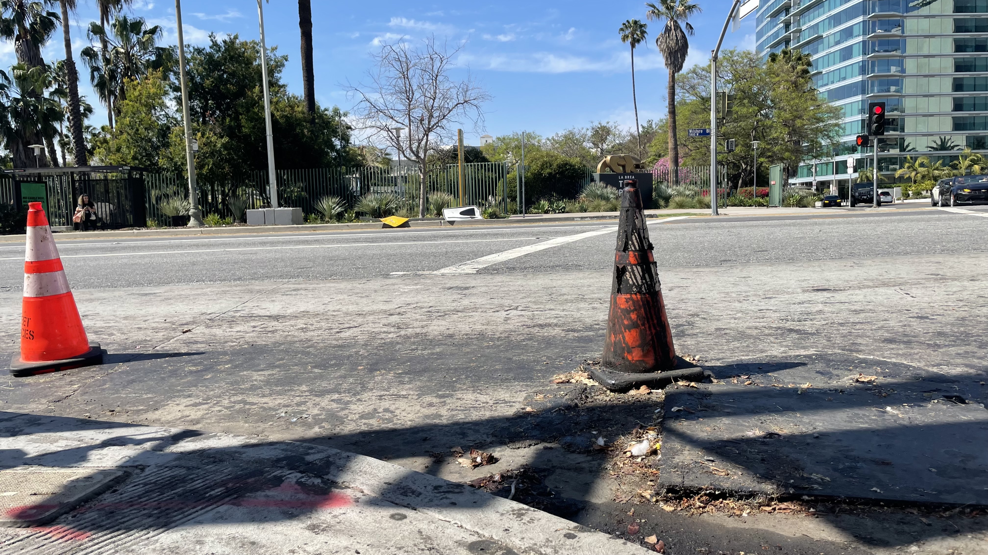
To appeal to the motorist; long, linear Art Deco buildings were constructed along Wilshire, with eye-catching towers, and surface parking lots in the rear. It was the first district in the city with dedicated left-turn lanes and timed traffic signals. The last of the department stores departed thirty years ago and I don’t imagine that they’re ever coming back. The automobiles, however, are still there — although the charming neon signs aren’t — thanks to them. The one at Wilshire and La Brea, you see, was destroyed by a car in 2005. Three months after it was replaced, in 2008, it was demolished by another car. The one at Wilshire and Fairfax was taken out by a car in 2013.

Although the construction of a subway underneath Wilshire will offer an alternative mode of travel for those not completely wedded to the automobile — or not determined to wipe out signs — it will not, although it is sold as such, likely reduce gridlock. As long as there are lanes for cars, cars will be driven or stored in them. That said, the completion of a subway — or at least a section of one — is itself practically (if sadly) miraculous in 21st century America, where any infrastructure project not specifically designed to accommodate and induce more automobile travel is invariably met with rabid hostility by people who characterize and mass transit improvement as a “boondoggle.”
And not exactly miraculous — as it’s not exactly unique — the Miracle Mile is one of those Los Angeles communities that feels a bit like a ride inside of a theme park — or a village within a series of villages — or as developer A. W. Ross promoted it, a “city within a city.” And its location is key, located as it is at the midpoint between other significant cities-within-a-city: Hollywood to the north, Koreatown to the east, the Crenshaw District to the south, and Westwood to the west.
A BRIEF HISTORY OF THE MIRACLE MILE
The first humans to live in what’s now Los Angeles were likely the Paleoamerican ancestors of the Chumash, who arrived in Southern California at least 13,000 years ago. Humans were not, of course, the first inhabitants of the region; they were preceded and lured here by other animals, who, in turn, were preceded and lured here by native fauna and fungi. Wilshire Boulevard — the city’s iconic avenue — was originally, likely, a trail created by animals. It was later adopted as a road by the humans who pursued them as game and to access the region’s famous tar pits, the asphalt of which the Chumash used the tar to make plank boats they called tomol in order to travel between the mainland and Channel Islands.
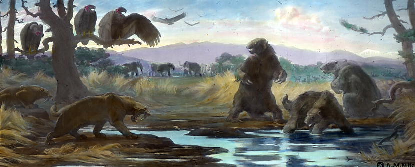
The La Brea tar pits formed more than 40,000 years ago, when viscous black liquid began to rise through cracks in the coastal plan. Wood and bones extracted from the asphalt have been dated to 38,000 years ago. Those bones have been identifies as having belonged to American lions, bison, dire wolves, ground sloths, horses, mammoths, saber-tooth cats, turtles, and other animal species, many of which went extinct long ago. The oldest human remains pulled from the pits were those of a young Chumash woman, whose partial skeleton was discovered in 1914, and whose age was estimated at between 18 and 25 years. They were dated to 10,220–10,250 years BP — about 8200 BCE — around the time the mainland Chumash population reached its peak —and before a mega-drought preceded their concentrating their populations along the coast and and offshore islands.
Around 1500 CE, the Tongva began to arrive in the region, having migrated from the east. To these desert people, the Los Angeles basin must’ve seemed, even during a drought, positively lush compared to their homeland in the hot, dry Sonoran Desert. The Tongva, too, used the tar to make deep sea-faring craft they called ti’at — a craft they presumably learned from the seafaring Chumash since the only other deep sea-faring peoples in the Americas were the Mapuche, whose homeland is about 9,300 kilometers to the southeast of Southern California — and because desert-dwellers don’t typically have a lot of use for deep sea-faring boats.
The first Europeans arrived in the region in 1542 CE, when Juan Rodríguez Cabrillo led a maritime expedition up the coast, claiming all that they saw for Spain. Despite their claims, they did nothing to establish them and the Tongva were unmolested by the Spanish for another couple of centuries. That changed in 1769, when Catalonian explorer Gaspar de Portolà i Rovira led the first overland expedition through the region. Franciscan missionary and fellow Catalonian explorer, Joan Crespí, recorded that Spanish scouts observed the regions tar pits and even tar geysers. Naturally, Crespí wished to see them for himself. Portolà, however, pressed northward — although they did christen them “Los Volcanes de Brea.”
The process of colonization and missionization followed and the Spanish crown began dividing Alta California into presidios, missions, pueblos, and ranchos. El Pueblo De Nuestra Señora La Reina De Los Ángeles De Pornicula was established in 1781. Mexico declared independence in 1810 and the process of dividing the land continued. Mexican independence was finally won in 1821. What’s now the Miracle Mile was part of the 4,439-acre (17.96 km2) Rancho La Brea, deeded in 1828 by the alcalde de Los Angeles to Antonio José Rocha and Nemisio Dominguez.
The US invaded Mexico in 1846 and conquered 55% of its territory, including all of Alta California. In 1850, the US made California its 31st state. Antonio José Rocha, José Jorge Rocha, and Josefa de la Merced de Jordan filed a claim for Rancho La Brea but it was rejected in 1860. Surveyor and lawyer, Henry Hancock, fought for “A. J. Rocha et al.” and their claim was re-established in 1873. The ranchers, however, were financially broken by the legal expenses and Antonio José Rocha’s son, José Jorge Rocha, sold the ranch land to Hancock for $20,000.
Hancock died in 1883 and his widow, Ida Hancock Ross, assumed ownership. In 1901, Union Oil geologist W. W. Orcutt recognized that many of the bones retrieved from the tar pits were fossils. In commemoration of his discovery, the La Brea coyote was given the scientific name, Canis latrans orcutti, in his honor. Systematic archaeological excavations began, in earnest, around 1913.
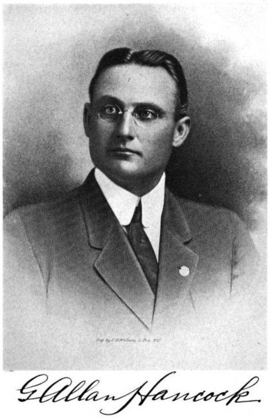
Some of Rancho La Brea had been sold in the 1890s to Arthur Gilmore. In 1902, whilst drilling for water on his dairy farm, he struck oil. Henry and Ida’s son, George Allan Hancock, began drilling for oil in 1907, ultimately establishing 71 productive wells on the property. Ida Hancock died in 1913. Most of what remained of Rancho La Brea was subdivided by George. In 1924, he donated the 23 acres that form the basis of Hancock Park (not to be confused with the neighborhood of the same name) to Los Angeles County in 1924.
What’s now the Historic Miracle Mile District became part of Los Angeles in phases. Part of the region became part of Los Angeles with the Palms Annexation (1915). The seeds of development were planted by Alvah Warren Ross, who bought eighteen acres along the south side of Wilshire Boulevard in 1921. There were those who mocked the purchase as “Ross’s Folly.” Most of the region was characterized by barley fields and oil wells criss-crossed by the occasional dirt road. The only passenger rail in the area was the PE’s Santa Monica via Sawtelle Line, which ran along a right-of-way that’s now San Vicente Boulevard.
Soon, though, Los Angeles began to annex more of the region, beginning with the La Brea Addition (1922). It was followed by the Hancock Addition and the Carthay Addition (both in 1923), and lastly, the Fairfax Addition (1924). Houses popped up throughout the area. Ross had been right, it turned out, and development of the Wilshire Boulevard Center exploded. In 1928, he re-christened it the development the Miracle Mile.
THE RISE OF THE MIRACLE MILE
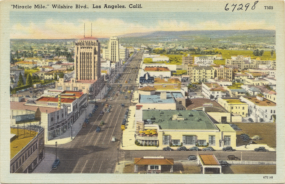
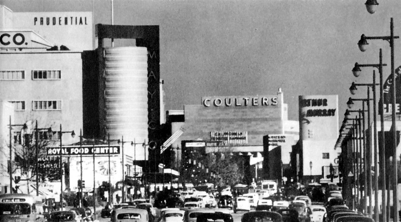
Tar pits aside, it was the department stores that migrated from Downtown to the Miracle Mile that really brought the traffic — although, arguably, the architecture was just as important in selling it. First department store to arrive in the Miracle Mile was Desmond’s, which opened a new location inside Gilbert Stanley Underwood’s Art Deco Wilshire Tower in March 1929. It was followed by Silverwood’s that September, which moved into the same building. In 1930, Myer Siegel moved into Morgan, Walls & Clements‘s Art Deco Dominguez-Wilshire Building. In 1938, Coulter’s closed its Downtown location and moved to the Miracle Mile into a striking Streamline Moderne designed by Stiles O. Clements. The May Company opened a location there in 1939 in a Streamline Moderne designed by Samuel Marx for A. C. Martin & Associates. Seibu, a Japanese department store, opened in a Welton Becket-designed space in 1962. In 1965, the space was taken over by a location of Orbach’s.

THE RISE OF MUSEUM ROW
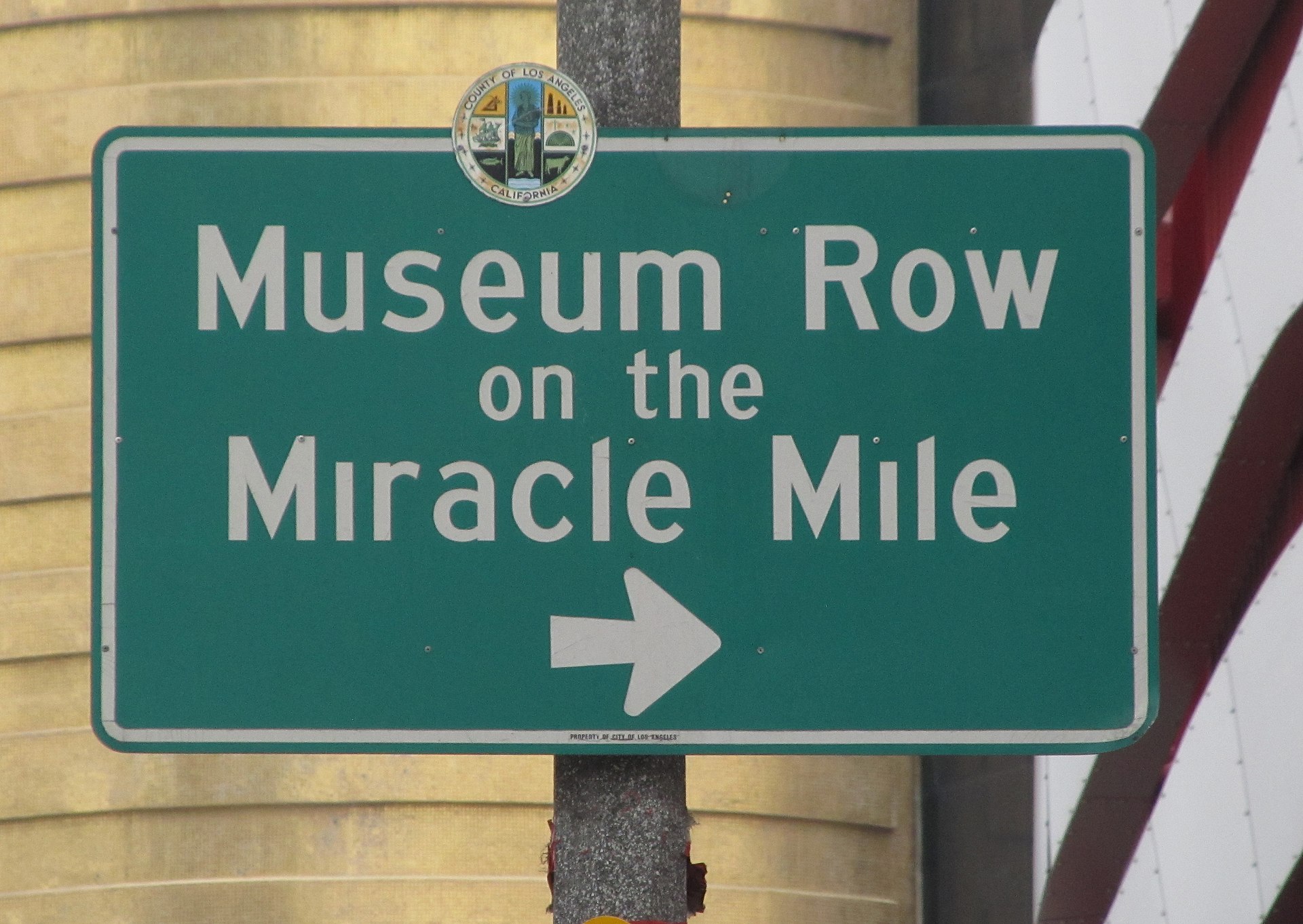
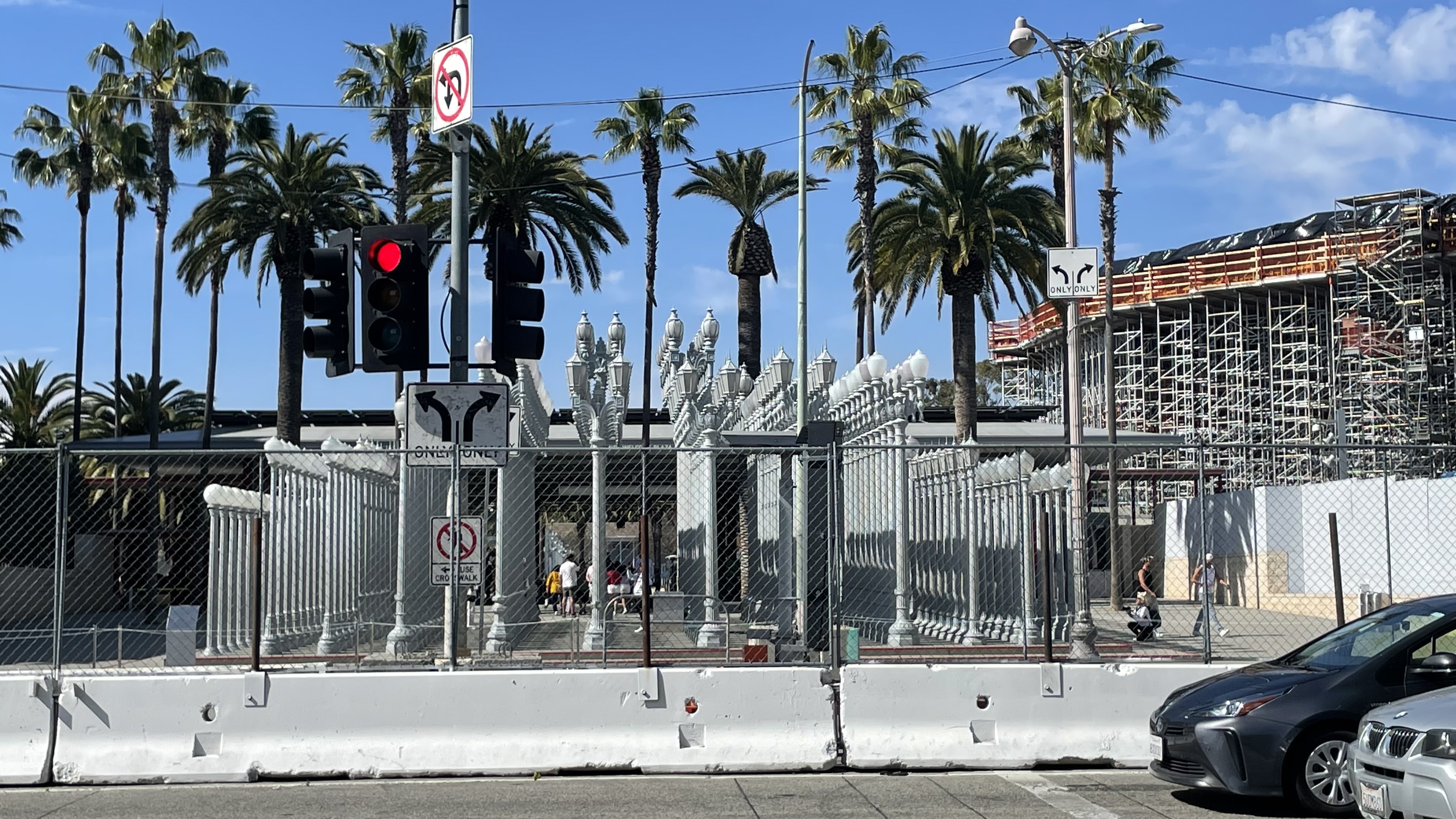
A. W. Ross lived until 1967, well after the Miracle Mile had become established as a major shopping district. When he died, it was just as it was beginning to transform into a cultural hub it remains today. In 1965, the Los Angeles County Museum of Art (LACMA) opened in Hancock Park, right next to the tar pits. The museum’s boxy, Late Modern architecture, designed by William Pereira, was not universally loved. It did, however, establish Miracle Mile as a nifty visual counterpart and rival to Welton Becket & Associates’ Music Center, then under construction on Bunker Hill — a cultural hub designed to lure back the same Angelenos who had abandoned Downtown for Midtown and the Westside.
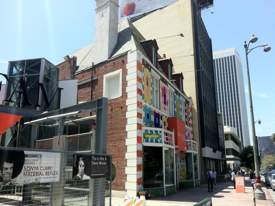
It was also in 1965 that the Egg and the Eye Gallery and Restaurant opened across the street from LACMA. In 1973, it evolved into the the Craft and Folk Art Museum. Back in 2011, I made a map for their Folk Art Everywhere exhibition series. In 2019, they changed their name to the Craft Contemporary. During our exploration, Mike and I popped into the gift shop, which I put on my list of places to shop for upcoming birthdays.
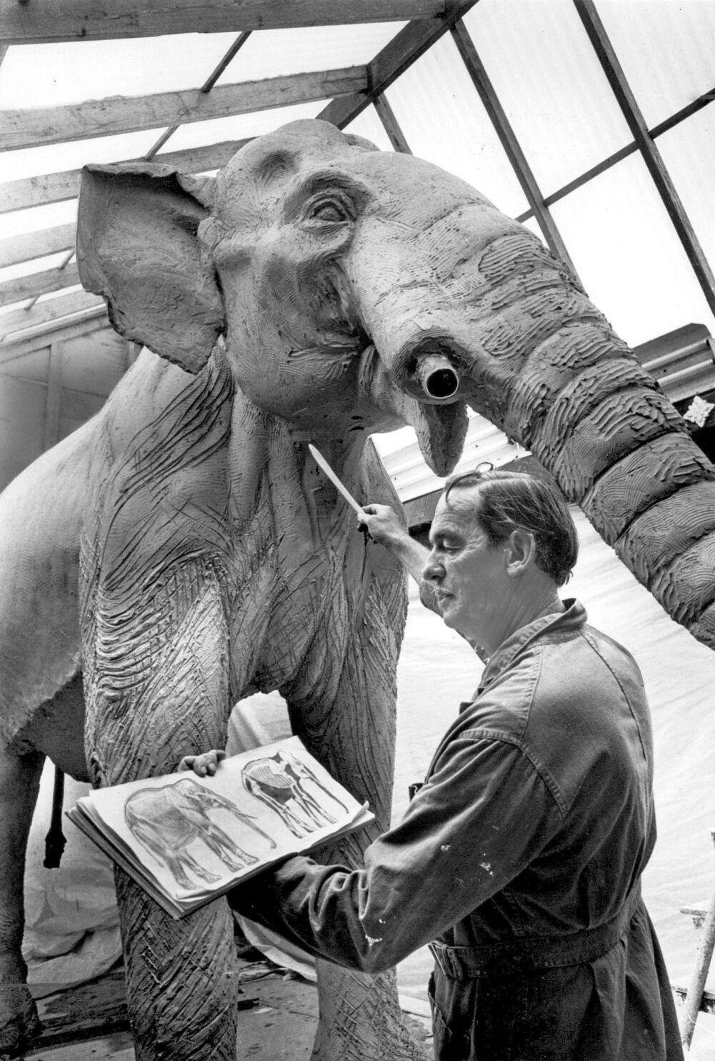
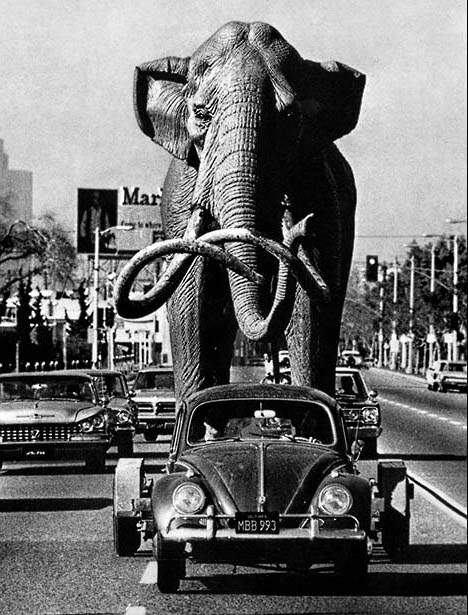
If all that weren’t enough, in 1967, sculptor Howard Ball dragged the first of his three iconic fiberglass mammoth sculptures into the pits using his 1958 Volkswagen and a trailer. Ever since, they’ve been one of the neighborhood’s primary attractions. The Willis Fagan and Frank Thornton-designed George C. Page Museum opened in 1977.
More than a decade would pass, though, before another museum opened there — and the department stores whose arrival signaled the Miracle Mile’s rise began, even more quickly, to depart. Desmond’s closed in 1980. So, too, did the Broadway Wilshire, which had occupied the old Coulter’s space since 19860. That beautiful building was demolished. Silverwood’s closed in 1985. Orbach’s closed in 1986. The May Company held on surprisingly long, ushering its last gasp in January 1993.

THE PETERSEN
The Petersen Automotive Museum opened in the old Orbach’s in 1994. This was the museum we decided to visit. I don’t actually hate cars, you see, I just think that they make more sense in the countryside and in museums.. If I were dictator of Los Angeles, I would obviously allow service vehicles like ambulances, moving trucks, and delivery vehicles to access our streets. But, being a benign dictator, I’d also make exceptions for the 16,000 Angelenos for whom a car is their primary residence. And finally, I’d allow the streets to be used by “art cars” — wiener-shaped cars, hippie vans, hot-rods, low-riders, shaggin’ wagons, and that sort of thing. And of course, race tracks and demolition derbies would be fine, even encouraged.

.The Petersen was created by magazine publisher Robert E. Petersen. In 2015, the museum spent $125 million to hide its Becket-designed facade with an MMA Revival-style stainless-steel ribbon assembly. The exhibitions, like those of any museum, change. I was disappointed when I found that the ground floor was taken up by a Tesla exhibition. First of all, I think Teslas are ugly. They remind me of PT Cruisers and Plymouth Prowlers. They’re also common. If I wanted to see them, I could save myself $20 and just stroll across any old parking lot. Not being a fan, I didn’t spend that long looking at the display. I did skim was some apologetic text about how the ugly truck’s indestructible window was smashed only because something else went wrong that no one could’ve possibly foreseen or something. I was reminded of Dan Quayle‘s biography, which was a treatise dedicated to proving that he was, in fact, a genius and that he, in fact, knows very well how to spell “potato.” There was also a timeline of Elon Musk‘s life, from his humble beginnings on his father’s Apartheid era emerald mine to his days as co-founder of X.com, which became PayPal. For some rummy reason, though, the image of a grinning young Musk had been digitally touched up to suggest that he’d never had a less than full head of hair. It was hard not to get the impression that Mr. Musk was a foundational figure at Tesla, when the company was actually founded by Martin Eberhard and Marc Tarpenning.

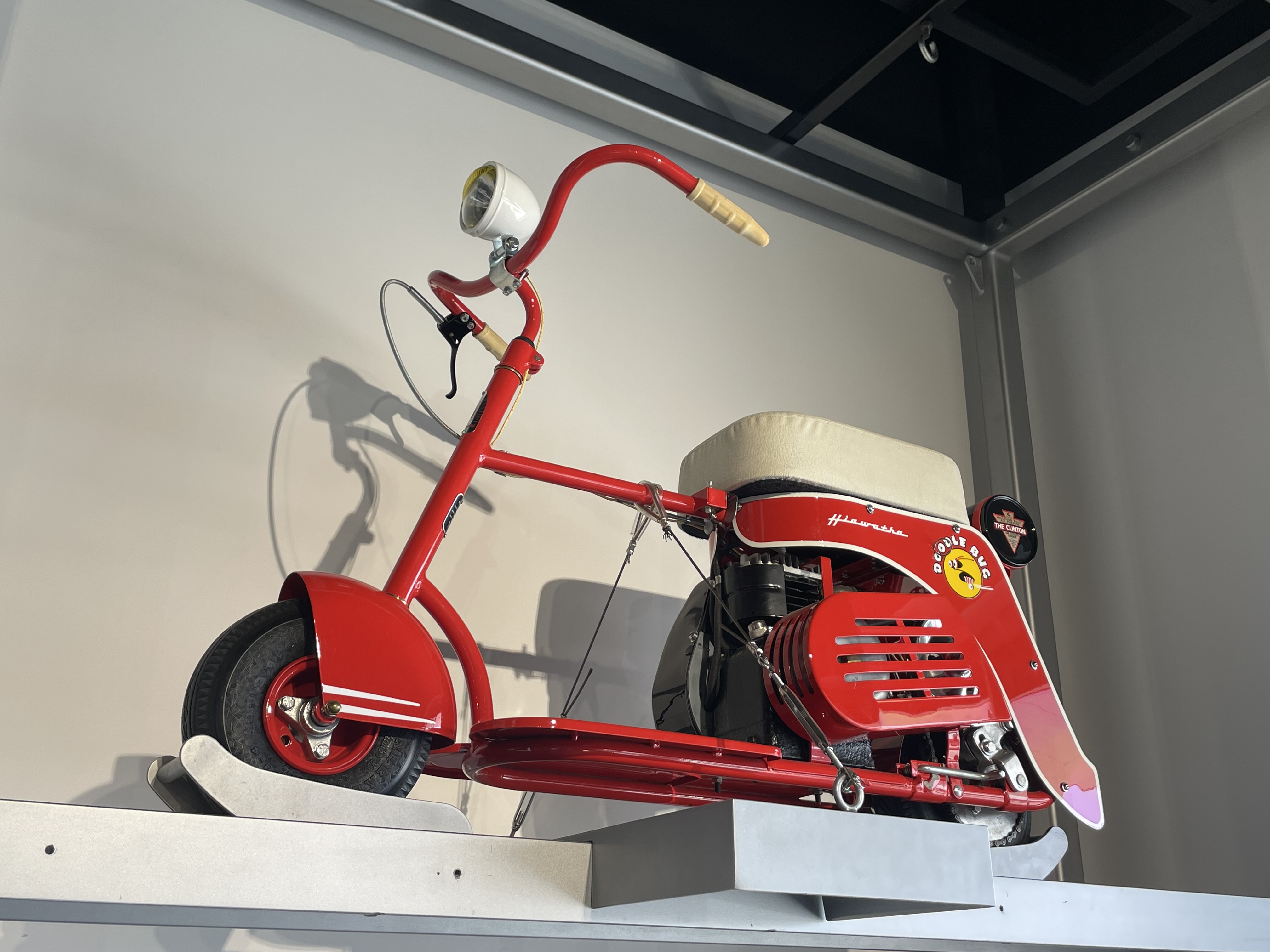
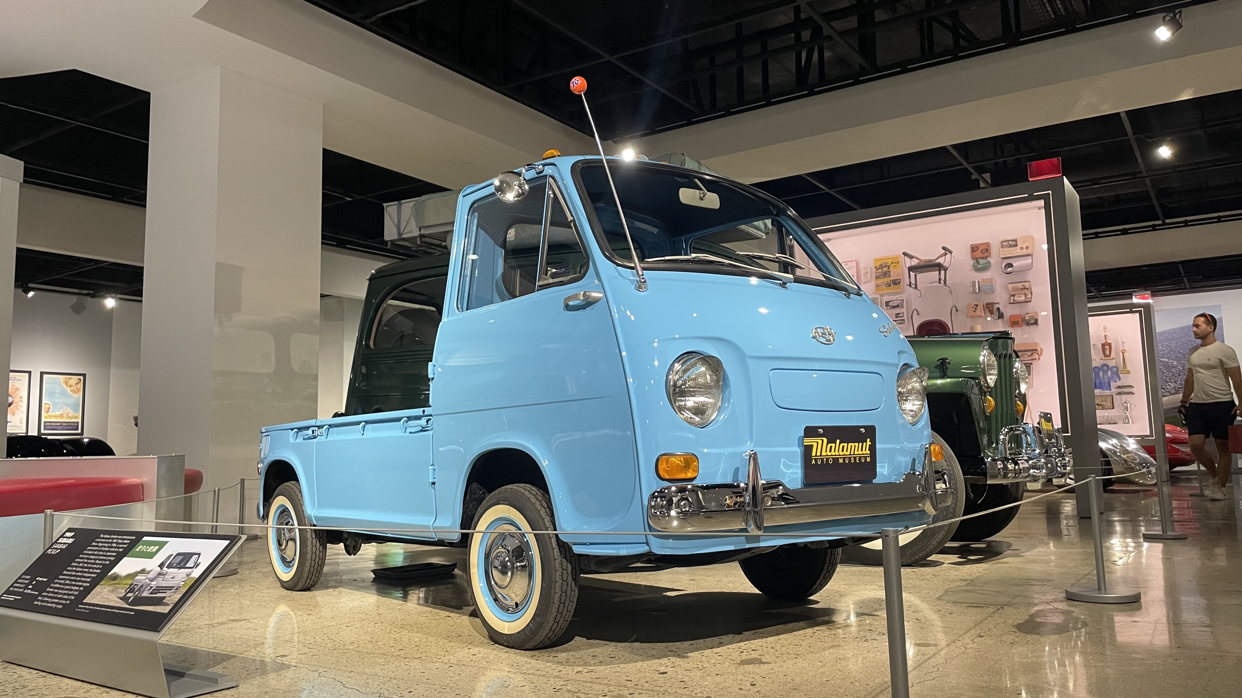
Thankfully, the floors above were home to more interesting vehicles, dominated by hot rods and Porsches of different eras. Cars from movies and television series. That sort of thing. Mike and I raced recklessly through the streets of Rio de Janeiro in the Forza Motorsport Racing Gallery. I thought about how it would be fun to have a more practical simulator in which the driver has battle gridlock without having a stroke in an unsexy four-door sedan. My favorite vehicles, I think, were a 1947 Doodle Bug Hiawatha scooter that looks like it would be at home in Pee-Wee Herman‘s garage and a 1969 Subaru Sambar, which despite its diminutive size, would be completely sufficient for nearly ever errand undertaken by Angelenos who think they need a Dodge Mega Cab Ram 3500 to pick-up a bag of corn chips from the corner store two blocks from their house.
OTHER MUSEUMS
The Architecture and Design Museum moved to Miracle Mile in 2006… and moved out in 2010 because it was displaced by the D Line station construction. It re-opened in the Arts District. Sadly, though, it closed in 2020.
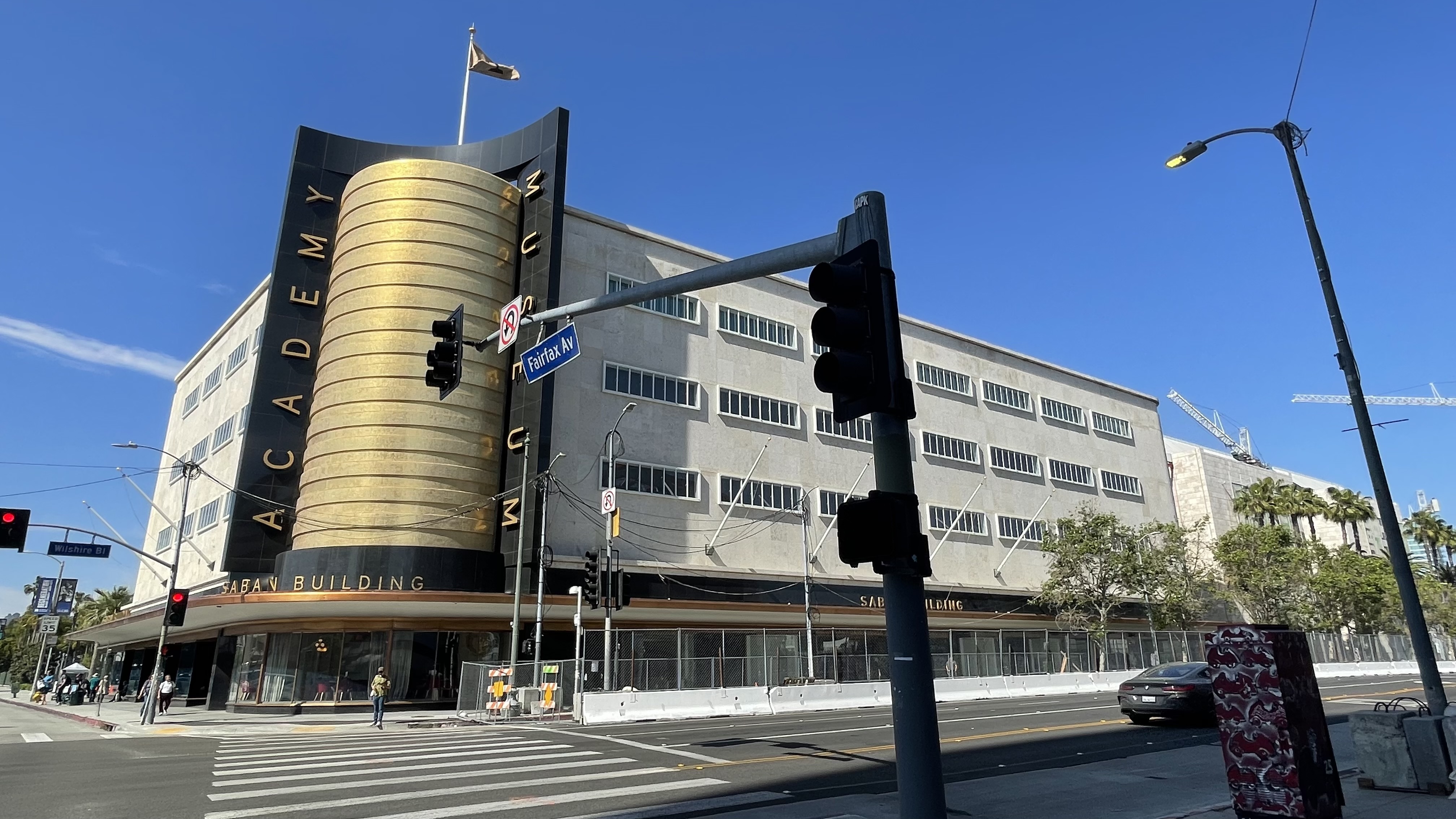
Most recently, the Academy Museum of Motion Pictures opened in 2021. I still haven’t visited but hope to rectify that soon. I initially assumed — wrongly — that the museum would be skewed towards the sorts of middlebrow commercial message movies that scoop up Oscars but the programming, so far, has really been a lot more interesting than that.
LACMA is undergoing a massive re-construction but is still open, although there’s less to see there since Pereira’s iconic “floating campus” was demolished in 2020. $750 million dollars later, the museum will open with less exhibition space and minus the beloved Leo S. Bing Theatre. I suppose the most popular feature at LACMA remains Chris Burden’s Vermonica-inspired assemblage sculpture, Urban Light, created in 2008. There used to be an online social media and social networking service called “TheFacebook” and it was de rigueur in the 2000s to use an image of oneself beguilingly draped on a lamppost within the installation for one’s profile picture.
NOTABLE BUILDINGS
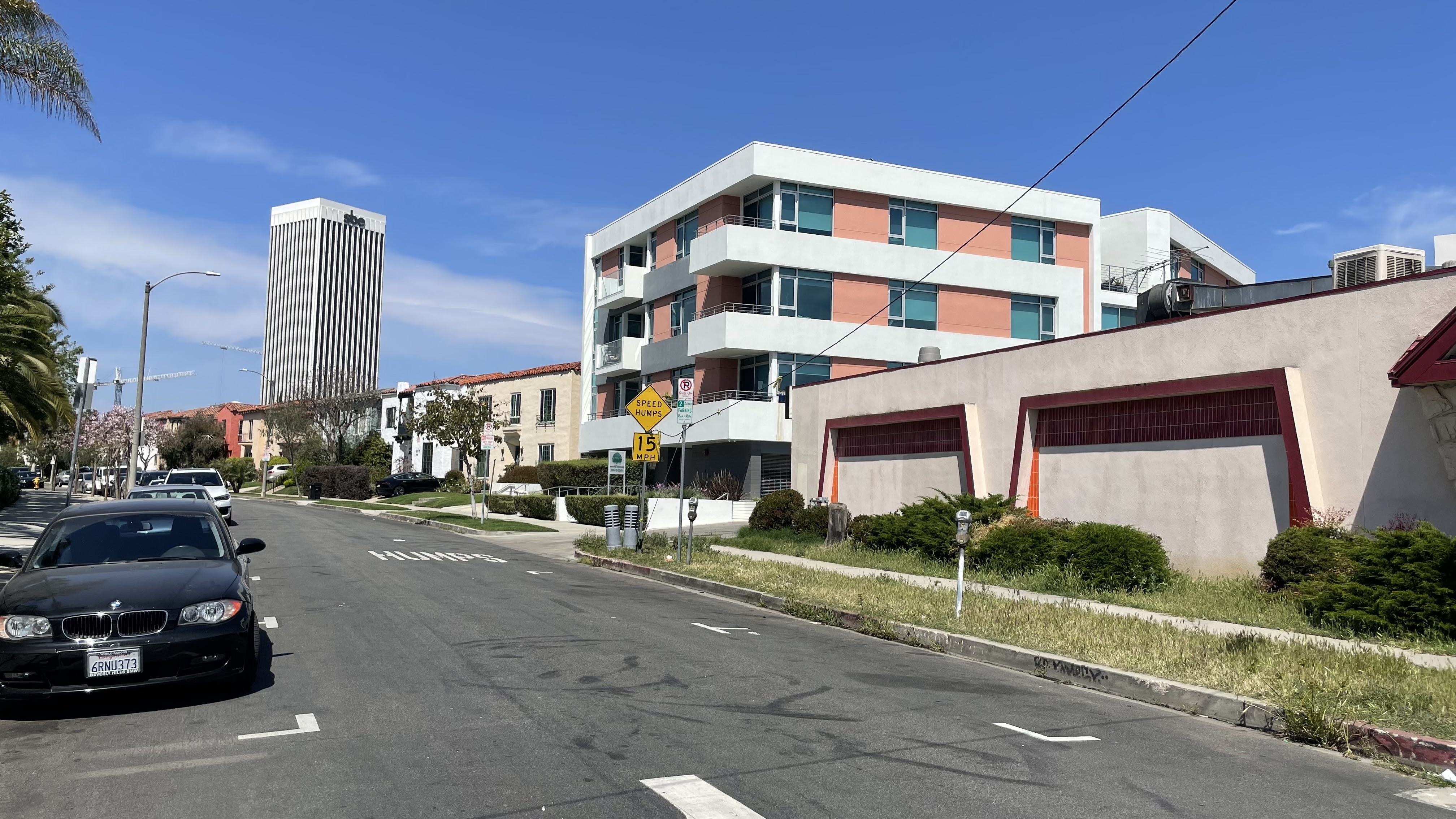
The tallest building in Miracle Mile is the 132-meter tall 5900 Wilshire, completed in 1971, which has since then loomed like an omnipresence over the neighborhood like the titular black tower in John Smith‘s short film. It was designed by Gin Dan Wong for William L. Pereira & Associates. With its thin columns and off-white Late Modern architecture that seems to float above a fountain, it felt like an extension of Pereira’s campus across the street (until it was demolished). It was built for Mutual Benefit Life. From 2009 until 2013, it was the west coast headquarters of Variety, as is reflected in my map. In 2014, Variety was replaced with Sam Nazarian’s company, SamyBoy Entertainment (SBE).
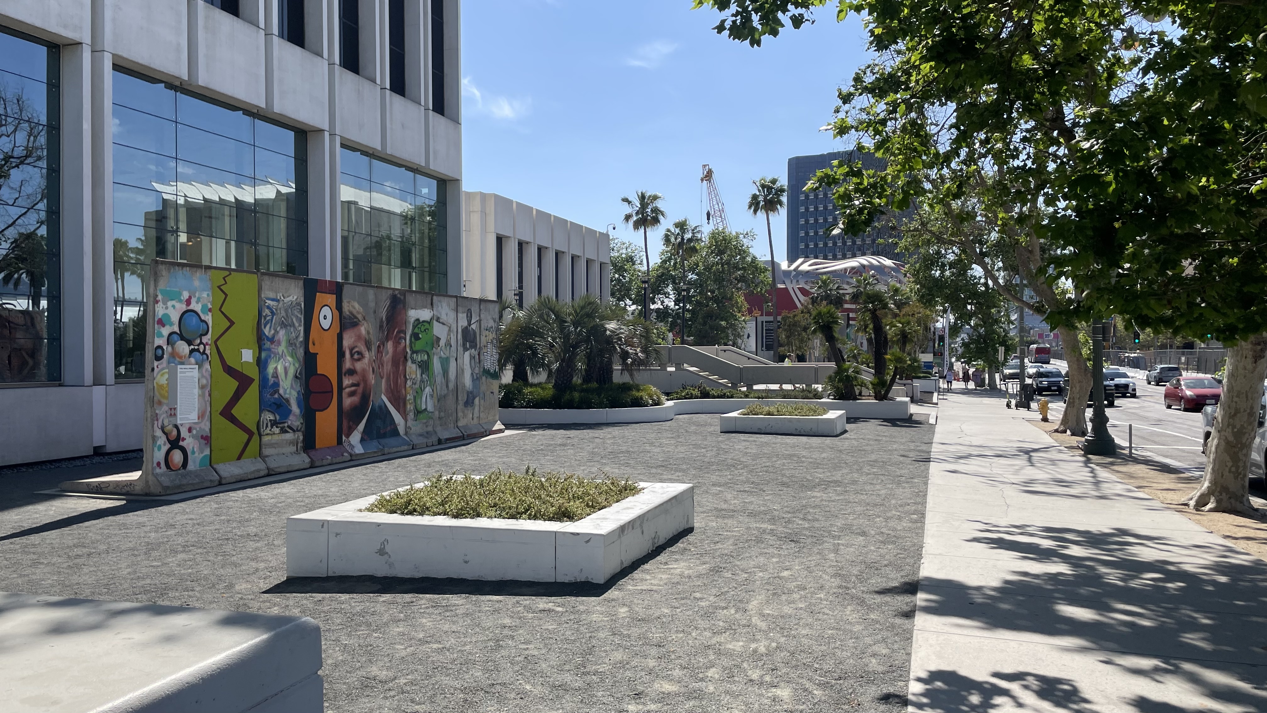
In front, since 2009, is a stretch of the Berlin Wall that was installed by the Wende Museum. It’s also home to the Sprüth Magers Gallery and a location of LA Fitness, connected to the main tower via short enclosed bridges.
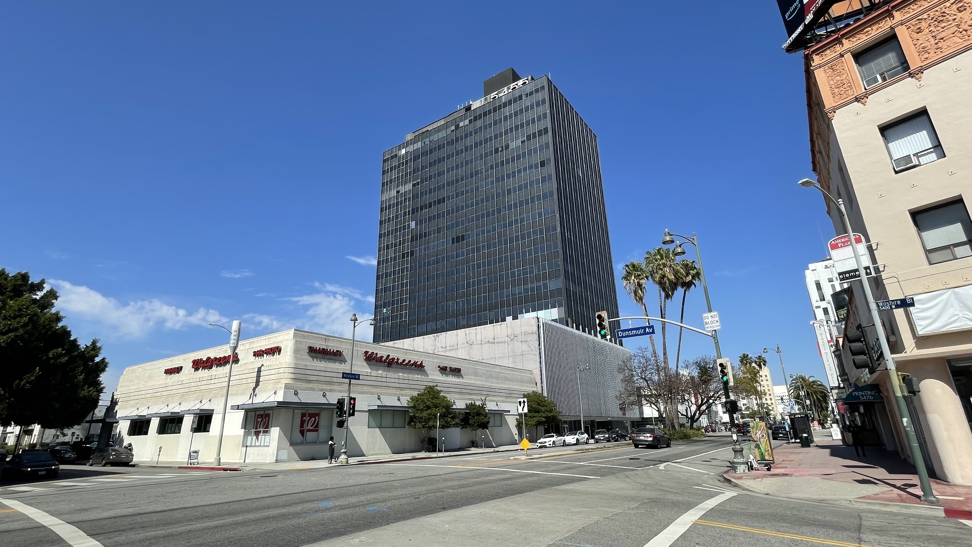
Other high-rises of note in the Miracle Mile include Museum Square (11 stories, Wurdeman & Becket, 1948) ACME Tower (20 stories, 1960), California Federal Savings & Loan Building (28 stories, Luckman Parternship, 1960), 6200 Wilshire (16 stories, 1970), Wilshire – Crescent Heights (21 stories, 2018), and One Museum Square (13 stories, Jerde, 2021).
GETTING TO AND AROUND MIRACLE MILE
Before millionaire socialist Henry Gaylord Wilshire died in 1927, he stipulated that no trucks or rail lines ever be allowed to sully his titular street, lest its unquestionably pleasant character be disturbed. Historically, though, rail transit did connect the neighborhood with the rest of the city — just not along Wilshire. The main mass transit line through the neighborhood, PE’s Santa Monica via Sawtelle Line, ended operation in 1940, allowing San Vicente Boulevard to transform into the noxious car sewer it remains 83 years later.
LARy’s New R Line, which had exerted to La Brea Boulevard in 1931, ended service in 1947. If Hank Wilshire could somehow experience the Miracle Mile today, I wonder if he’d still oppose rail on Wilshire. Not that I’d ultimately care that much, mind you, because I don’t think we owe it to long-dead developer’s to preserve their particular urban vision in amber for eternity. Wilshire, although it wasn’t known as such, existed before Henry and will continue to do so long after. Stipulating that not trains can ever travel along his road is a bit like selling your home and telling the new buyers that they have to keep it decorated the same way you did forever after. And if we were serious, as a city, about maintaining the street’s “pleasant character,” surely surrendering every inch to automobiles is undeniably counter to that goal. The most pleasant version Wilshire be one completely devoid of cars. I hereby stipulate that Wilshire shall only be open to bicycles, electric buses, pedestrians, scooters, and skaters. Now, make it so.
The city decided to get around Wilshire’s request by tunneling underneath Wilshire Boulevard, which he made no stipulations against. Three decades ago Metro opened the Red Line, which was intended to stretch to the Pacific Ocean — the so-called “subway to the sea.” In 2006, Metro renamed the 10.3 kilometer stub the Purple Line. And now, thirty years after it first opened — and renamed the D Line — it still terminates Wilshire/Western Station — a 20 kilometer stone’s throw from its goal. The lack of progress is owed, in part, to two politicians: Henry Waxman and Zev Yaroslavsky. Waxman, for his part, succeeded in designating much of Midtown a “methane zone” because, back in 1985, an accumulation of methane had ignited in an auxiliary room at a 3rd Street Ross Dress-for Less. Yaroslavsky, then a City Councilman, sponsored a bill to block the funding of subway construction.
Finally, in 2007, the live on tunneling through the Methane Zone was lifted. Seven years later, construction resumed. And now, tow D Line stations — Wilshire/La Brea Station and Wilshire/Fairfax Station — are poised to open in the neighborhood next year. After that, the D Line is supposed to reach the West Los Angeles VA Medical Center in 2027. At that point, construction will hopefully commence for the last seven kilometers between the VA and the sea… unless, of course, the sea has by then risen sufficiently to meat the subway.
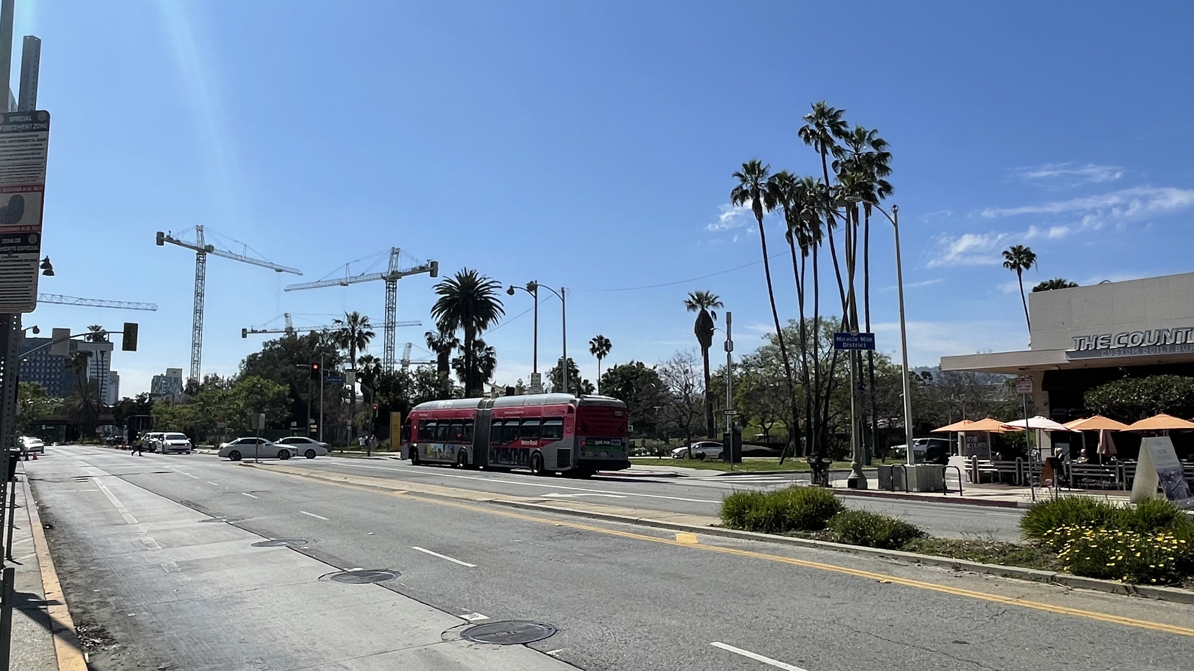
In the meantime, Miracle Mile is fairly transitable. It’s served by Metro’s 16, 20, 28, 212, 217, and 729 lines; LADOT’s DASH Fairfax Line, and AVTA’s 786 Line. The neighborhood is also pretty walkable, it has to be said. The sidewalks are generally well-maintained and sufficiently uncluttered — although the sun can be pretty unforgiving one some tree-deprived stretches.
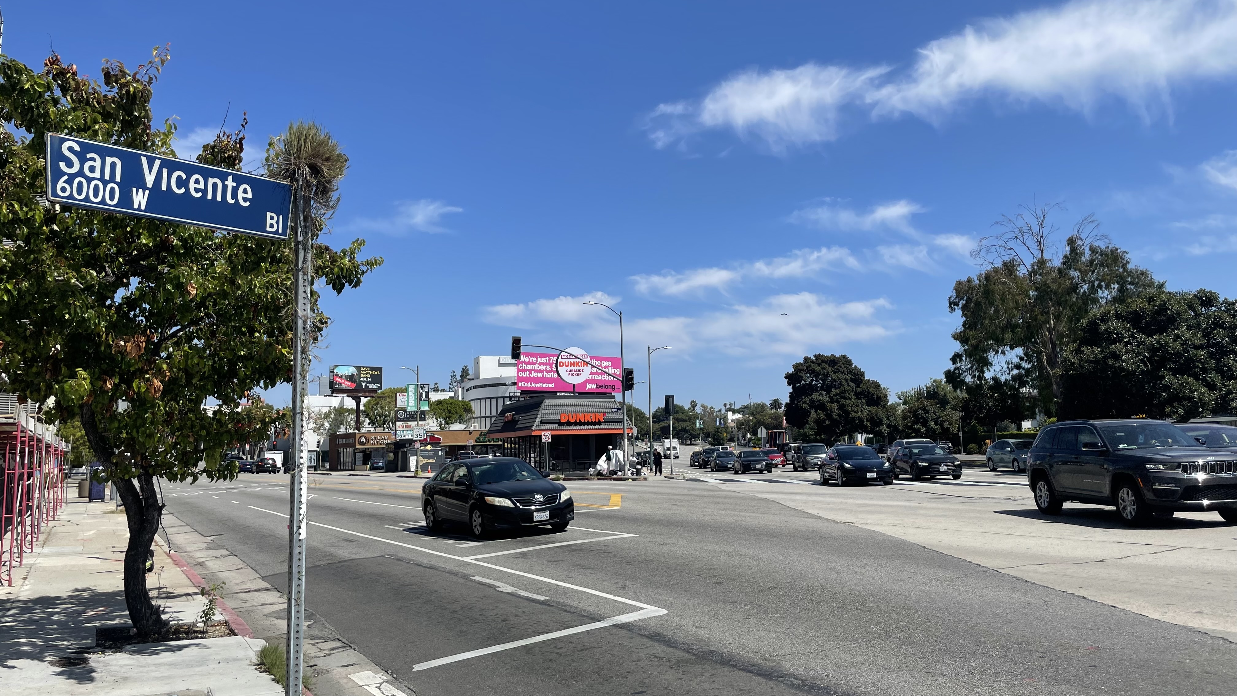
Bicycling infrastructure, on the other hand, is non-existent. In fact, there is not a single protected bike lane in the entire neighborhood. [UPDATE: Reader Zachary J. Brown writes “San Vicente has had parking protected bike infrastructure between Fairfax and La Brea for the past half year or so.”] The most egregiously hostile street has to be San Vicente Boulevard. At some points it reaches a whopping 40 meter width and accommodates eleven lanes for cars — including, at points, three for car storage. And yet, this freeway-like boulevard — although it’s worth restating a former a passenger train right-of-way — not only has zero bike lanes but zero bus lanes. Of course, that’s hardly surprising since this stretch also lacks bus service entirely. There is hope, though, for San Vicente. Michael Wacht, an architect at IntuArch, has proposed transforming it into San Vicente Park, a linear transit-route-to-park conversion along the lines of Paris’s Coulée verte René-Dumont or Seoul’s 서울로 7017.
THE MIRACLE AND ME
I first explored the Miracle Mile somewhat extensively around 2013. Back then, I was commissioned by Ra’anan Boustan to make a map of their neighborhood for his wife, Leah. As I recall, the Boustans weren’t sure, exactly, in what neighborhood they lived. That’s not to say that they didn’t know there address but what, exactly that neighborhood was. This is not an uncommon phenomenon, in my experience — especially in a city in which two-thirds of residents are immigrants, refugees, or transplants and neighborhood signs seem to be scattered casually and haphazardly by agencies in conflict with one another over both boundaries and spellings.
We all agreed the the Miracle Mile refers, at least primarily, to the almost-exactly-one-mile-long stretch of Wilshire between La Brea Avenue on the east and Fairfax Avenue by the west. Surrounding the area in which the Boustans lived, there were signs designating their neighboring neighborhoods — Beverly Grove, Carthay Circle, Carthay Square, the Fairfax District, Park La Brea, Wilshire Vista, and Wilshire Vista Heights. There were, also, breakaway neighborhoods like Citrus Square, La Brea-Hancock, and Sycamore Square — all of which seceded from Hancock Park for reasons I can’t imagine. I therefore decided to designate the area between these surrounding neighborhoods Miracle Mile for the purposes of the map. Today, there are both LADOT and HPOZ signs supporting my view. I also decided for this map to paint with oil paints instead of ink, which I’d always used up to that point. Ink has an annoying way of fading but I also liked that oil paint is a cousin to the tar that bubbles up from beneath the neighborhood and often provides it with a distinctive bouquet. One last innovation for the map was Leah’s idea to add the construction years to notable buildings.
A couple of years later, literary critic and author David Ulin contacted me as he was writing a book, Sidewalking: Coming to Terms with Los Angeles. It must’ve been after 2014 because Alan, may cat/son, was born that April and because Ulin was allergic, we spoke outside in my then lifeless patio. He and his publisher, University of California Press, ended up adapting my maps of Midtown and the Miracle Mile for the book’s cover. I highly recommend it — although there is no reason for you read it as I did — strolling along the Silver Lake passeggiata.
Back when I first explored the neighborhood, I asked the Boustans about some of their favorite spots— especially mundane ones — so that I could incorporate them into the map. They mentioned the mural at Harvey ‘s Guss Meat Co., the lonely Pioneer Chicken in the middle of San Vicente, and a couple of other places. Both of those have since closed. Harvey’s Guss Meat has been replaced with a newer construction. Part of the fun of a map, in my opinion, is.that it serves a record of a particular time. Back then, I remember, Ra’anan regarded the Variety sign atop 5900 Wilshire like a sort of beacon. It is gone, now, too, although the tower is still there.

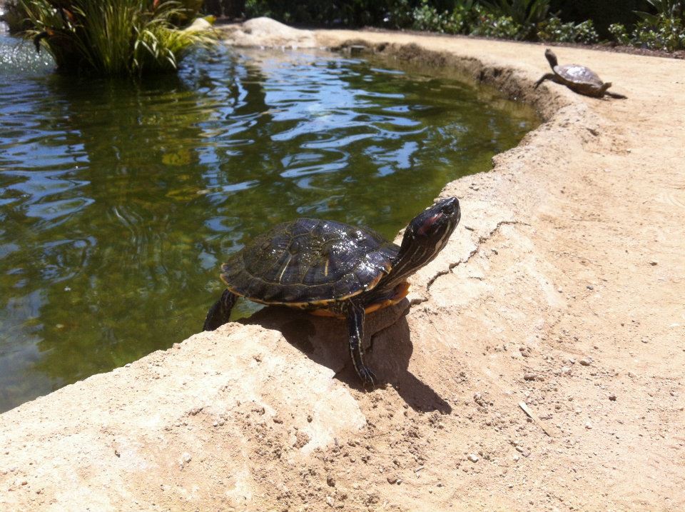
Most things that I remembered, though, were still there. There’s still the turtle pond at Wilshire Green Park, behind Wilshire Courtyard, although the last few times I’ve visited, there were not turtles obviously present. Mike and I walked north on Cochran and turned left. We walked into The Icon, a photo lab on Wilshire. We chatted with a man behind the counter. I asked if he knew where The Darkroom was, a camera shop on Wilshire that was designed, in 1938 to look like a camera. He assured us, gloomily but confidently, that there was no such building anywhere around there and had there been, it would undoubtedly have been destroyed long ago along with everything else in this city with no appreciation for beauty or history. “You must be new here,” he said, his confidence unflagging. “Yeah,” I said, “I just moved here 24 years ago.”
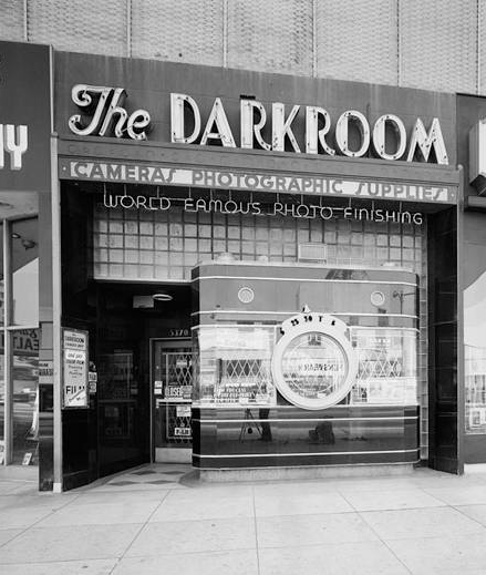
In fact, although the camera shop closed long ago, the Darkroom still stands, its black vitriolite facade relatively unchanged for over the last 85 years in this city with no appreciation for its history. In fact, this city with no appreciation for its history went to far as to designate it Los Angeles Historic-Cultural Monument No. 451 34 years ago. That doesn’t guarantee that it won’t be demolished, mind you, but for now it still looks much as it has since Edward J. Borgmeyer designed it to look like a three-meter tall 35-millimeter Argus C3 camera. And it’s located, for the record, at 5370 Wilshire Boulevard, just two blocks east of the Icon.
MIRACULOUS EATING AND DRINKING
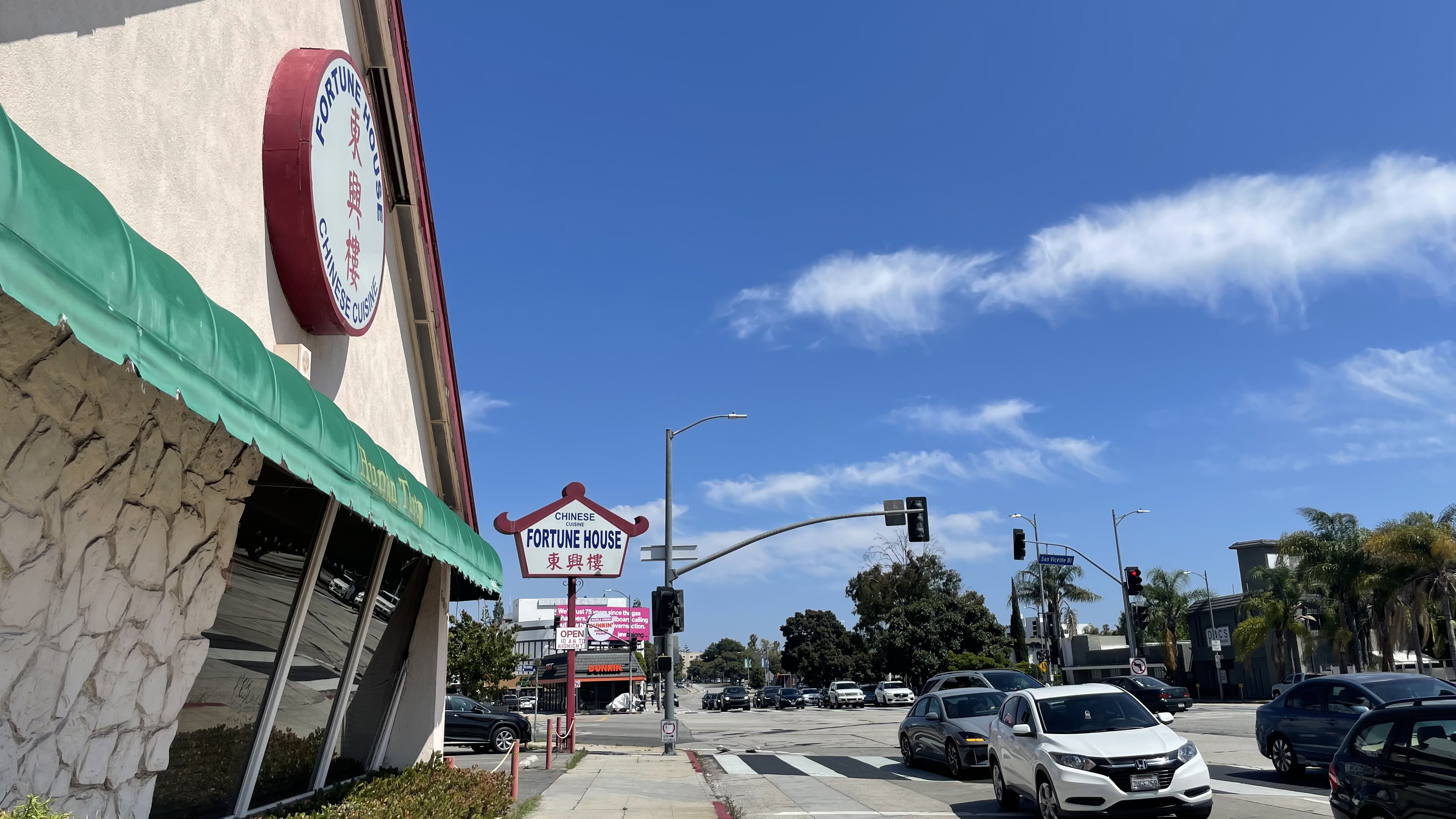
Back when I explored the Miracle Mile for my patrons, the Boustans, I remember I started with a lunch at a place called Hunan Tasty. It was gone, although in its place was another Chinese restaurant — this one called Fortune House.
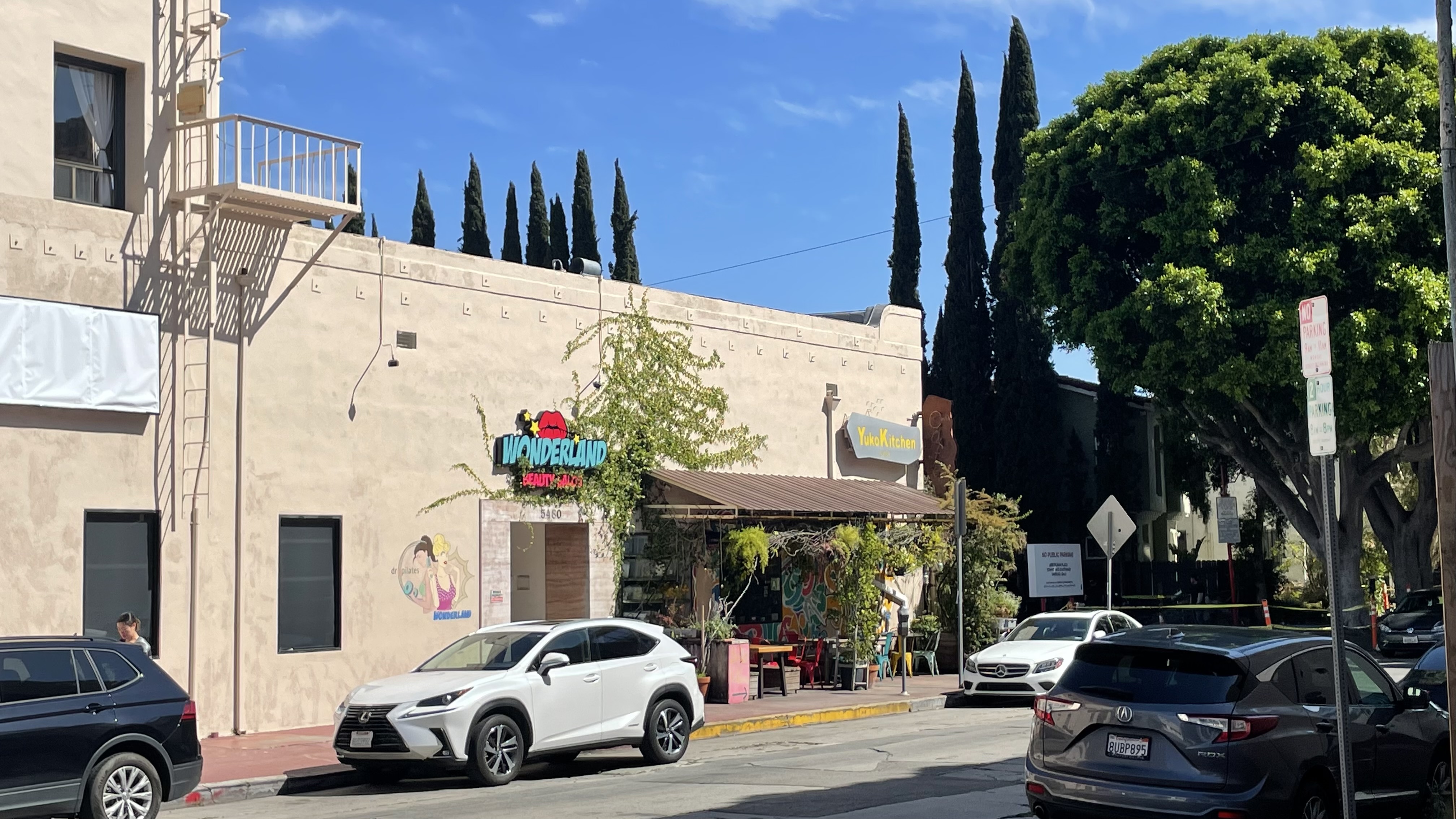
On the Boustans’ recommendation, I also stopped at Yuko Kitchen toward the end of my exploration. I don’t remember what I ate but I do remember being immediately enchanted by the space — a leafy Lewis Carroll-meets-Hayao Miyzaki realm in which tasty Japanese-ish food is served. I’ve returned to it many times since that first visit and it’s one of my favorite spots in Los Angeles and I suggested it to Mike but he was thirsty for something with more of a kick than mint and strawberry-infused water so we strolled on.
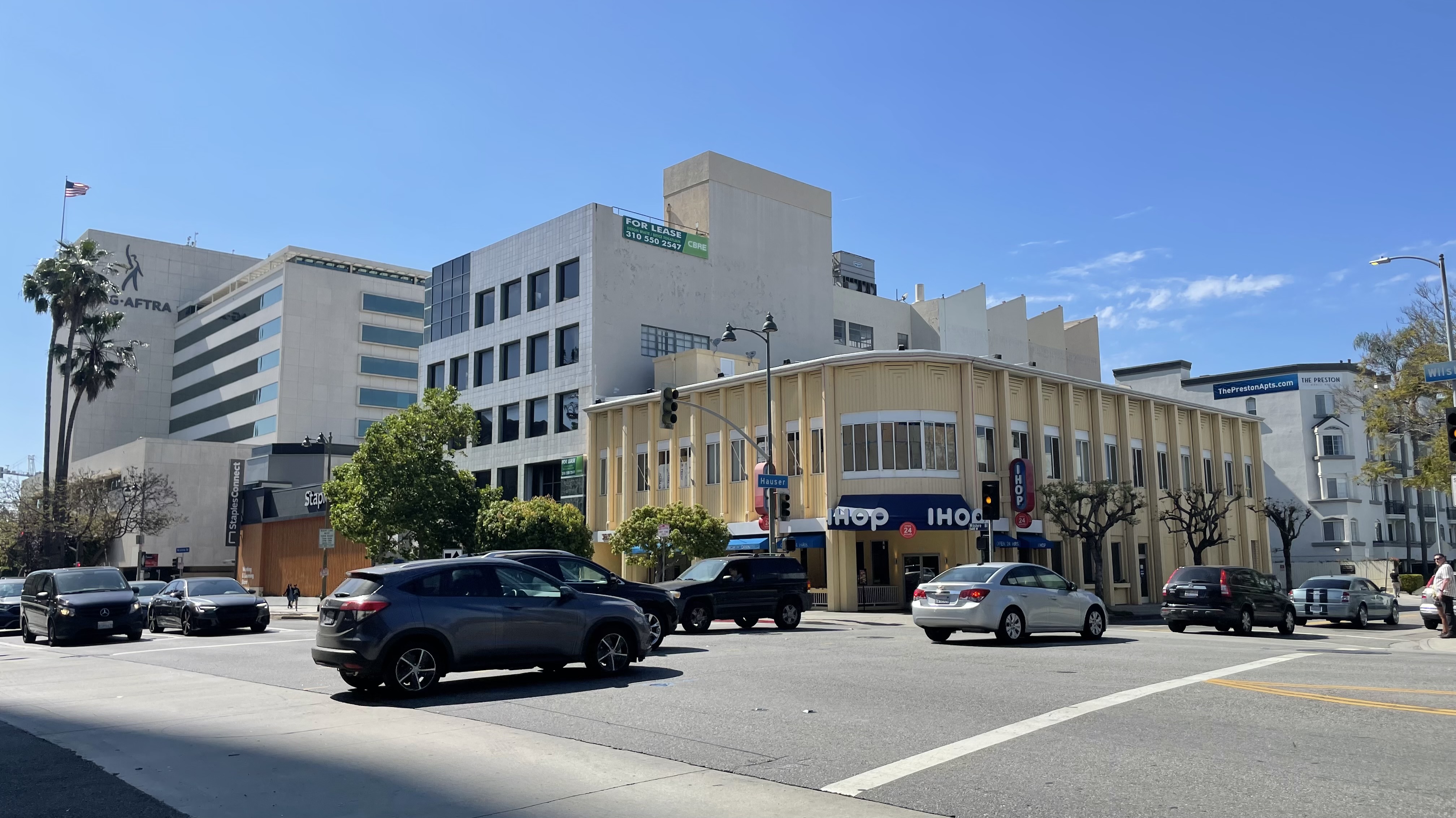
.It doesn’t serve beer but we also passed by an IHOP that is special to me. It must’ve been either my fifth or sixth birthday when I requested and was granted a birthday meal at an IHOP in Columbia. I remember getting a pancake with a face which I drowned with boysenberry syrup. After moving to Los Angeles, I actually ate at the IHOP in Cypress Park where I found, sadly, that my taste buds had changed sufficiently to make this same meal not at all enjoyable. However, although no longer a fan of the chain, I did visit the Miracle Mile location once, but for a cup of coffee and a side of cultural significance rather than overly-large portions of food.
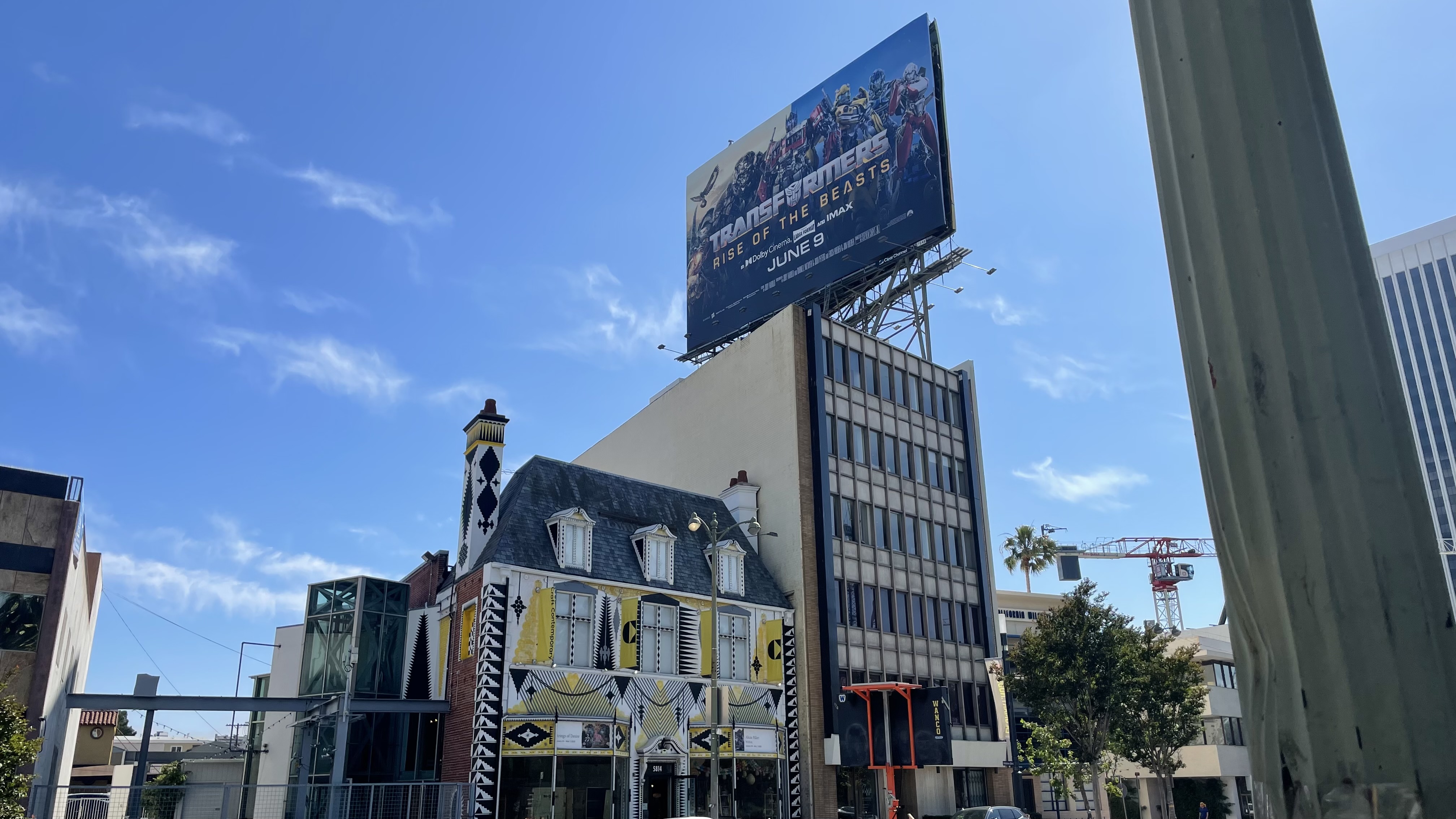
The attractive Art Deco building that is now home to the neighborhood’s IHOP originally housed the Western Auto Supply Company and a market called Pay’n Takit. It was later home to the drafting offices of Welton Becket and Associates. In 1952, the great Edward G. Robinson, who in addition to playing gangsters collected art, used the space to exhibit 51 pieces by Henri Matisse. The Art Museum Council was also founded there that year and later supported LACMA. Matisse died two years later.
TOM BERGIN’S
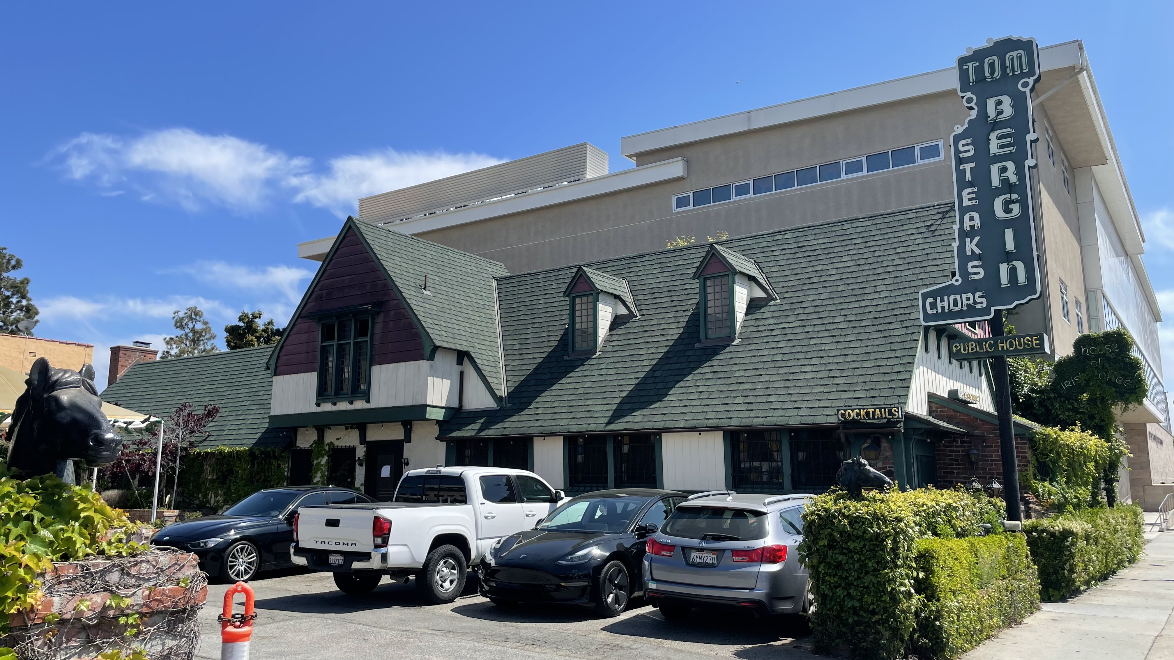
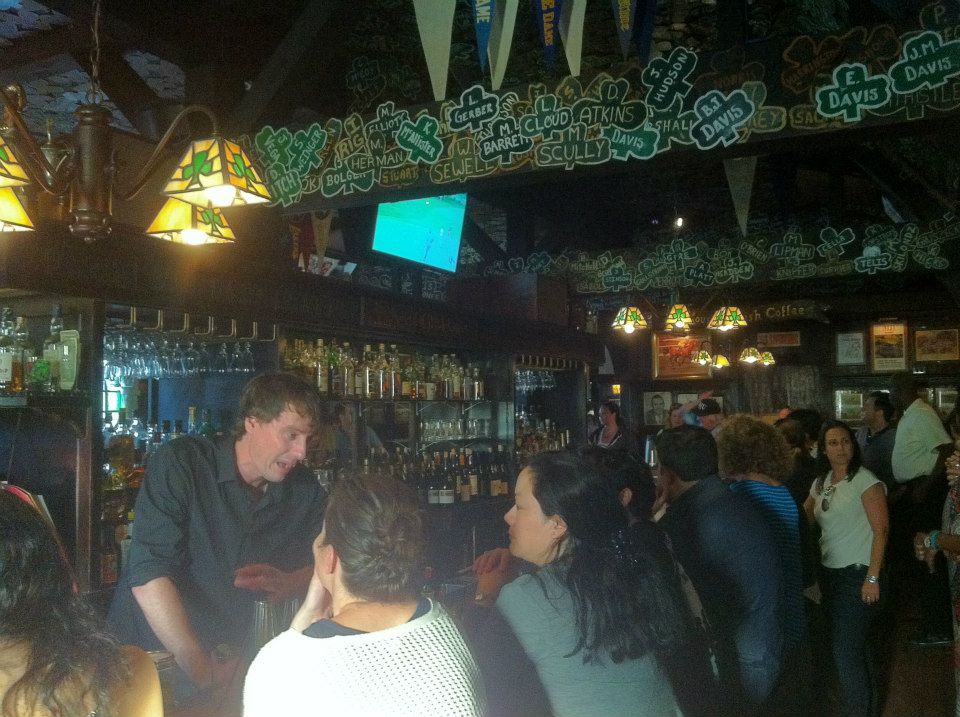
Mike had been in the mood for a beverage since we’d begun our walk near Tom Bergin’s. Tom Bergin’s is one of the city’s oldest and more charming bars. Tom Bergin’s, natch, is named after Tom Bergin — a Bostonian born in 1894 to immigrants parents from County Kerry. He came to Los Angeles in 1927 and found work as an entertainment lawyer. He was also a fan of horse racing and on 11 February 1935, he opened the Old Horseshoe Tavern & Thoroughbred Club at the corner of Fairfax and Wilshire. In 1945, he commissioned the construction of a larger, Tudor Revival structure to the south that Tom Bergin’s has been located inside since moving there in 1949. By then, everyone knew the bar as Tom Bergin’s Tavern or just Tom Bergin’s. Bergin retired in 1973. He died in 1978. It’s gone through a few ownership changes since then but was closed when Mike and I stopped by. I feared the worst. Luckily, a helpful man sitting in a pick-up truck in the parking lot informed us that was merely closed that day and would re-open on Thursday.
Mike said that the Counter is good, if you’re ever in the mood for a burger, but it was by then getting to late so we skipped eating and drinking altogether. The neighborhood is also home, though, for those with an appetite and time, to Indian Curry & Kabob, and Supremo Ristorante. There’s a bar called Met Her at a Bar, Sake House Miro (which I added to my mental list), and inside of the Petersen, Meyers Manx Cafe. Across the street, inside the Academy Museum, is a place called Fanny’s.
EL REY THEATRE
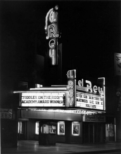

Miracle Mile is also home to the El Rey Theatre, an historic, Zig Zag Moderne/Art Deco theater designed by the prolific Clifford A. Balch. It was constructed in 1936 as a cinema and despite the redundancy of two definite articles, it has nearly always been referred to ever since as “The El Rey.”
The El Rey opened, on 24 March 1937 as part of the Fox West Coast Theatre chain. It was taken over by Mann Theatres in 1973. It seems to have ended its run as a cinema in 1983. It appeared in the 1984 film, Night of the Comet, as the workplace of the character, Regina. It appeared as a nightclub in 1988’s License to Drive. It was designated Los Angeles Historic-Cultural Monument No. 520 on 26 February 1991. El Rey was for a time in the early 1990s, reborn as a Russian restaurant. By 1995, it had been revived as a live music venue and that year, it was featured prominently in the Cowboy Junkies video for “Angel Mine.”
Going to the El Rey for the first time was one of the experiences that convinced me to stay in Los Angeles. I was there for Club Shout! When the DJ played Fatboy Slim’s “Praise You” — then a new song — all of the helmet-haired cosplay retro mods skulked off of the dance floor in disgust, leaving a group of young ladies to compete for my attention — something I was unused to but happy to oblige. Years later, I saw the Vaselines there, and blurted out “Duffel coat!” in response to a sartorial inquiry made by Eugene Kelly. It was also there that I saw Ian Brown perform, and I suppose because I was yet again one of the only people dancing (aided by an E or two), a couple of Brits assumed that I was a foreigner and tried to sell me a fake green card.
KOREAN CULTURAL CENTER
Next to the El Rey is the only remaining cinema in the neighborhood — since the destruction of the Bing — is the one inside the Korean Cultural Center, Los Angeles (KCCLA). The KCCLA opened in 1980 — one year after the opening of the Korean Cultural Center, New York. It seems a bit perplexing that the South Korean government’s Ministry of Culture, Sports and Tourism would choose, first, to open a cultural center in an aging Atlantic backwater with a significantly smaller Korean population than the one found in Los Angeles — which is, of course, the largest outside of Korea. But then the KCCLA’s location, too, is a bit of a surprise. Why the Miracle Mile, then, and not Koreatown or Little Seoul — or Cerritos, Gardena, Glendale, Hacienda Heights, La Cañada Flintridge, Rowland Heights, or somewhere else with more of a Korean presence. But, for better or worse, here it is, on the Miracle Mile, a neighborhood whose other main Korean cultural outpost is a location of Caffe Bene. And whatever the reason for it’s being here, the KCCLA is for me one of the main attractions in the neighborhood.
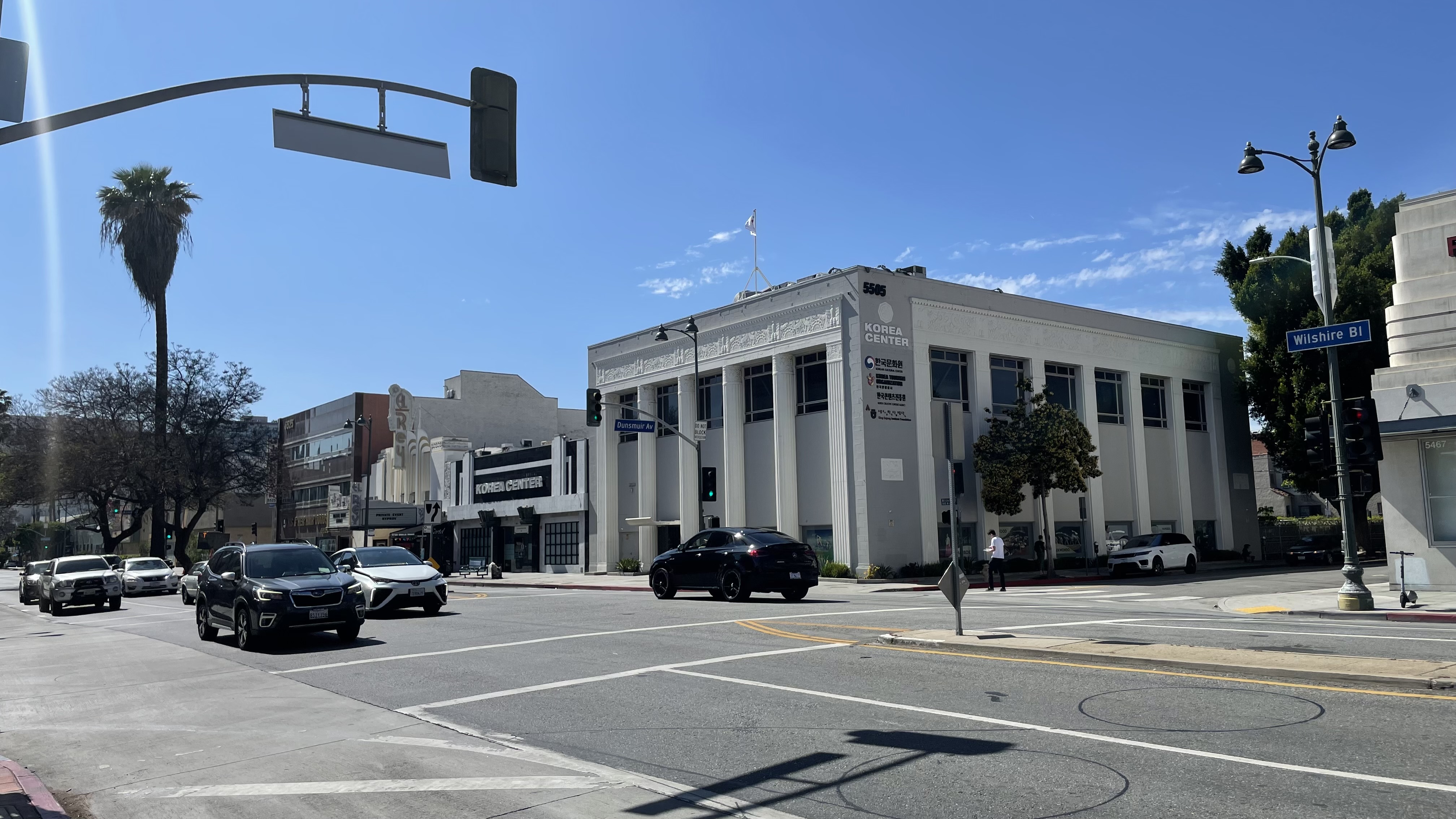
I have not yet returned post-COVID but I used to go semi-regularly because there are free film screenings and sometimes there was even free coffee and pastries (possibly from Caffe Bene). The films always have English subtitles. Despite these enticements, though, I don’t recall ever having seen a single attendee who didn’t appear to be Korean. Back when I had a car and thought nothing of driving it everywhere, the parking lot attendant more than once yelled at me not to park in KCCLA’s lot, apparently assuming that I was in the neighborhood for some other reason. Or maybe he, like I, was embarrassed by my rusted out Subaru Loyale station wagon. I have seen excellent films there, though, as well as forgettable films whose titles escape me. There was even one that I disliked so much that I walked out… but then when it’s free, you’re free from concerns with getting your money’s worth.
THE WILSHIRE COURTYARD

Around the corner is a building which is associated with a television series so good that not only did I never walk out of a screening, I’ve seen every episode — Melrose Place. In fact, I used to drive, during college, from the University of Iowa campus to Des Moines, just to watch it at a bar there with fellow tastemakers. The building is Wilshire Courtyard — an aggressively ‘80s building that was designed by McLarand, Vaquez & Partners and built in 1987. It’s all invasive palms, fountains, and geometric hedges; shiny red-brown granite; extreme boxiness. And, although a stumpy six-story mid-rise you might expect to find in a suburban office park, thanks to its location in an urban center, surrounded by high-rises, it pulls off the feat of standing out by being short.
The Wilshire Courtyard is (or was) the headquarters of E! Entertainment, Variety, and Aaron Spelling Productions. On account of the latter, it also portrayed the headquarters of D&D Advertising, the high stakes advertising agency that employed Alison Parker, Amanda Woodward, and Billy Campbell during the Golden Age of Television on what was surely the heir to Luis Buñuel’s surrealist classic, El ángel exterminador.
THE MACKEY APARTMENTS
It involved a bit of a walk away from everything else, but without much effort, I pressured Mike into heading over the the Mackey Apartments. Having served on a neighborhood council, I’ve heard more than my fair share of uniplex owners griping about the horrors of mutli-tenant housing. In my opinion, though, much of Los Angeles’s best residential architecture is to be found in its bungalow courts, courtyard apartments, garden apartments, and high-rise apartments. Who and why would anyone, if given the choice, rather life in some boring mansion than in a Mid-Century modernist masterpiece designed by the likes of Gregory Ain, Edward Fickett, or in the case of the Mackey, Rudolph Michael Schindler?
Schindler not only was a great architect, but one of the few in Los Angeles who even dressed in a manner that suggested he really got the place. The Mackey Apartments are every bit as subtle and stylish. They were built in 1939 for Pearl Mackey. There are three apartment units and a two-story penthouse. When Mike and I strolled up, we were greeted by a trio of women who were enjoying the front courtyard. One inquired as to our purpose. We explained that we were merely interested in architecture and exploration. They, we were informed, were recipients of the MAK Center’s residency program. Architect Simona Ferrari graciously invited us inside and granted me permission to take a picture and also us some of the apartment’s ingenious features. It was one of those experiences that — in part because of its unexpectedness — really makes exploring neighborhoods a rewarding, if not profitable, experience.
I knew that there was another Schindler in the neighborhood but couldn’t remember what it was — and so we didn’t visit. And then I wondered if I was getting confused with Ain’s Dunsmuir Flats, a bit further south, still, and in another neighborhood. There is also, though, the Buck House, which Rudolph Schindler also designed in 1939.
MIRACLE MILE ORGANIZATIONS
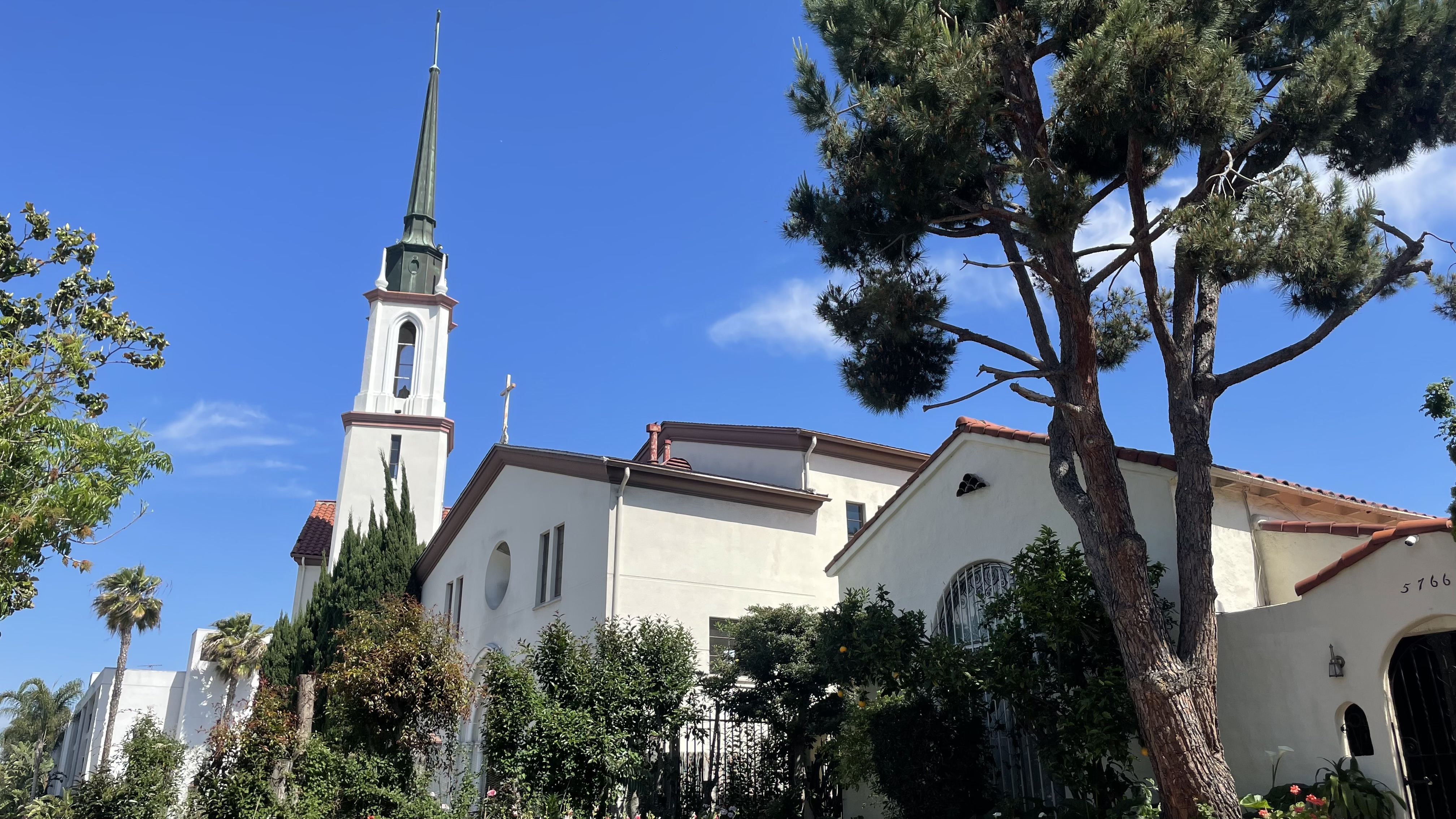
If you want to be get more involved with the neighborhood, it has since 1986 been represented by the Miracle Mile Residential Association. It’s also divided between four neighborhood councils: Greater Wilshire, Mid City West, Olympic Park, and People Involved in Community Organizing (PICO). It is represented in City Council by City Council District 4. The neighborhood is also home to the Westside Jewish Community Center and several churches.

So there you have it, the California Fool’s Gold exploration of Miracle Mile. If you want to vote for any other Southern California communities to be explored, let me know which in the comments.
Support Eric Brightwell on Patreon

Eric Brightwell is an adventurer, essayist, rambler, explorer, cartographer, and guerrilla gardener who is always seeking paid writing, speaking, traveling, and art opportunities. He is not interested in generating advertorials, cranking out clickbait, or laboring away in a listicle mill “for exposure.”
Brightwell has written for Angels Walk LA, Amoeblog, Boom: A Journal of California, diaCRITICS, Hey Freelancer!, Hidden Los Angeles, and KCET Departures. His art has been featured by the American Institute of Architects, the Architecture & Design Museum, the Craft Contemporary, Form Follows Function, the Los Angeles County Store, Sidewalking: Coming to Terms With Los Angeles, Skid Row Housing Trust, and the 1650 Gallery.
Brightwell has been featured as subject and/or guest in The Los Angeles Times, VICE, Huffington Post, Los Angeles Magazine, LAist, CurbedLA, Office Hours Live, Spectrum News, Eastsider LA, Boing Boing, Los Angeles, I’m Yours, Notebook on Cities and Culture, the Silver Lake History Collective, KCRW‘s Which Way, LA?, at Emerson College, and the University of Southern California.
Brightwell is currently writing a book about Los Angeles.
You can follow him on Ameba, Duolingo, Facebook, Goodreads, iNaturalist, Instagram, Mastodon, Medium, Mubi, the StoryGraph, TikTok, and Twitter.


I’ve also heard the term “Miracle Mile” used to describe places in other cities and towns, it usually described the commercial strip that started to appear at the edge of town along the main road in the decade or so after WW2. It became almost generic for that development pattern. Today we have another word for it – stroad. In places where the term survives, you’re looking at the oldest stretch of stroad in town.
LA’s with its’ museums is better than most which are steep in decline, packed with check-cashing, car-title-loan places, Dollar Generals and other poverty-exploiting places that were, along with their clientele, priced out of the core city by gentrification a decade or more ago.
LikeLiked by 1 person
I wonder where the first Miracle Mile was. Los Angeles’s is, despite it’s car centricity (or maybe because it’s no more car centric than 98% of Los Angeles streets), much more charming to me than most stroad-oriented neighborhoods. I’m sure the museums are a big part of it — and the respite of its fairly quiet side streets… which are nice for strolling if not home to many businesses or obvious attractions. San Vicente becoming a park is a pipe dream — but would be amazing.
LikeLike