

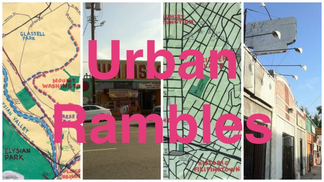
For my tenth year of exploring Los Angeles with the series, California Fool’s Gold, I’ve been reaching out to fellow explorers to see where they’d like to explore for another of my series, Urban Rambles. So far all of my rambling companions have had names that start with “M” — Marvin, Maya, Mike, and Machiko. Keeping the them going, this ramble was undertaken with my friend Marya Villarin.
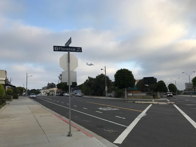
Marya and I met about seven years ago through the Echo Park Time Bank, but for whatever reasons, we’d not accompanied one another on an exploration previously. Marya suggested walking the length of Florence Avenue in Inglewood. I have walked that route before, with my brother, back when we walked the length of the Metro‘s Crenshaw/LAX Metro transit corridor, so I was curious why Florence in Inglewood. Marya recounted that her lola from the Philippines had lived there in the 1930s — after stints in the Bay Area, New Jersey, and Filipinotown. In the 1940s, she moved to San Diego, where she lived on Florence Street. Naturally, when she had a daughter, she had to name her, Marya’s aunt, Flo.
I’m not terribly familiar with Inglewood. I’ve walked and driven through it and eaten there but I’m familiar enough to form an opinion of a fairly pleasant suburb, as suburbs go, with characteristics of (and borders with) both the South Bay and South Los Angles’s Westside, both regions in which it is sometimes included. As of the last census it had a population of 109,673. More than half the population is Latino of any race (mostly of Mexican or Salvadoran origin), and about 44% is black.
I’ve heard more than one person report with surprise, after visiting Inglewood, that “parts of it are nice” or that it’s “not that bad.” I’m not sure why anyone would presuppose the birthplace of Brian Wilson and Foster’s Old Fashion Freeze to be bad. To be sure, it might be functioning below its potential, but that’s true of most working class suburbs which survived deindustrialization a bit bruised but not beaten.
Honestly, I can’t think of anything I’ve heard that would make me think that Inglewood should be avoided. I’ve been to the Forum, Edward Vincent Jr Park, Stuff I Eat, Dulan’s, the now-closed Veg-It-Up, the Crenshaw Imperial Shopping Center, and The Serving Spoon and the worst thing I ever saw was some road kill on the verge next to a sidewalk. I do remember East Harlem-born Tupac Shakur rapping “Pasadena where you at? Yeah, Inglewood. Inglewood always up to no good” in the song, “California Love.”
As I thought about what Tupac might’ve considered “no good,” I developed an unlikely theory — that “California Love” is a period rap set in the 1920s. Consider, in the song  Tupac gives a shout out to the “city of good ol’ Watts,” a Lost Angeles neighborhood which hasn’t been its own municipality since 1926. He also refers to “Chucks” and Eliot Ness. Ness began his law enforcement career in 1927 and “Chucks” are Converse All-Stars, which Chuck Taylor began emblazoning with his name in ’23. A little more scrutiny and my theory breaks down. Tupac also compares himself to the famous, flamboyantly gay pianist, Liberace, who though alive and performing in the 1920s didn’t begin performing extensively in public until the 1930s. Oh, there’s also the fact that he raps “Now it’s ’95 and they clock me and watch me.” Maybe it’s set in 2095.
Anyway, Inglewood really was up to no good in the 1920s. If this were the 1920s and Marya had suggested walking through Inglewood I might’ve passed. In the bad ol’ days, Inglewood was infested with Klansmen. A 1922 raid on Inglewood bootleggers lead to the arrest and trial of 36 bootleggers, all members of the KKK, and the death of one — who’d also been an officer in the Inglewood Police Department.
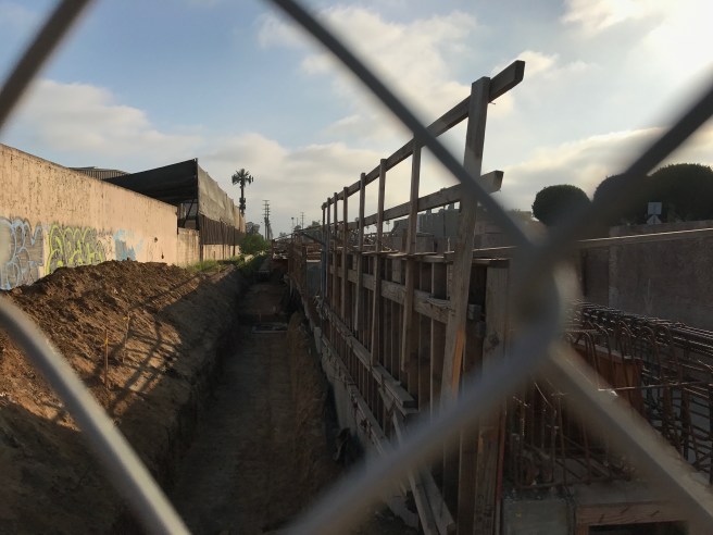
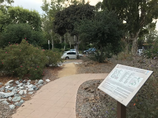
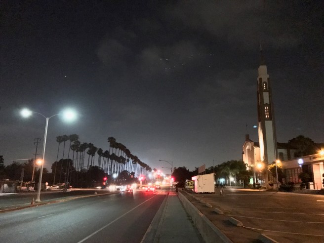
Like many pre-World War II suburbs, Inglewood really came into being thanks to passenger rail. Marya and I began our ramble near the site of Fairview Heights Station, a rail stop currently under construction. Inglewood’s passenger rail history stretches all the way back to 1887, when the Inglewood Division of the Los Angeles and Redondo Railway began operation. The right-of-way which will serve Metro’s Crenshaw/LAX Line was from 1911 until 1955 used by the passenger trains of the Pacific Electric Railway. After 64 years without, the Crenshaw/LAX train is scheduled to restore passenger service to the city in 2019.
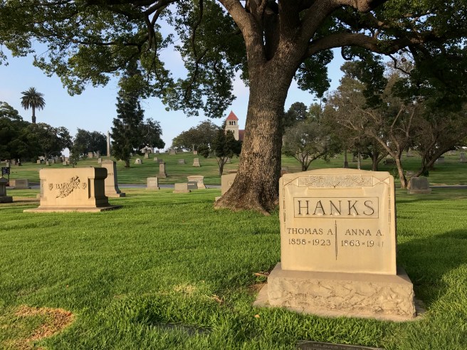
The stretch of Florence one which we began our exploration is dominated by Inglewood Park Cemetery on the south and Edward Vincent Jr Park on the north. The park was originally named Centinela Park, and the Centinela Springs located there sustained some of the region’s first inhabitants, the Tongva, who established the village of Sa’anga (meaning “place of tar”) not far from there. In 1822, the Mexican government granted Ygnacio Avila the Rancho Aguaje de la Centinela and Avila’s home, Centinela Adobe, still stands nearby in Westchester. In 1997, Centinela Park was renamed to honor the city’s first black mayor.


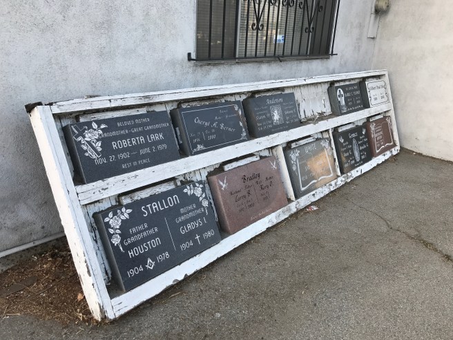
Inglewood Park Cemetery was founded in 1905. Quite a few prominent Angelenos are buried there including Chet Baker, Ray Charles, Ella Fitzgerald, Etta James, Sylvester, architect Paul R. Williams, and three former Los Angeles mayors.
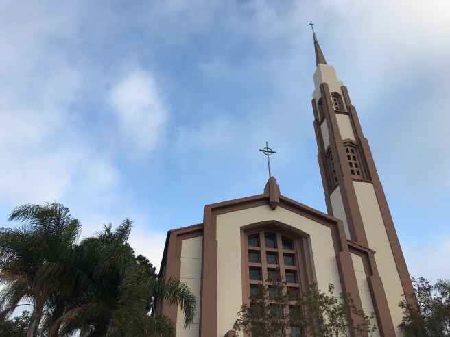
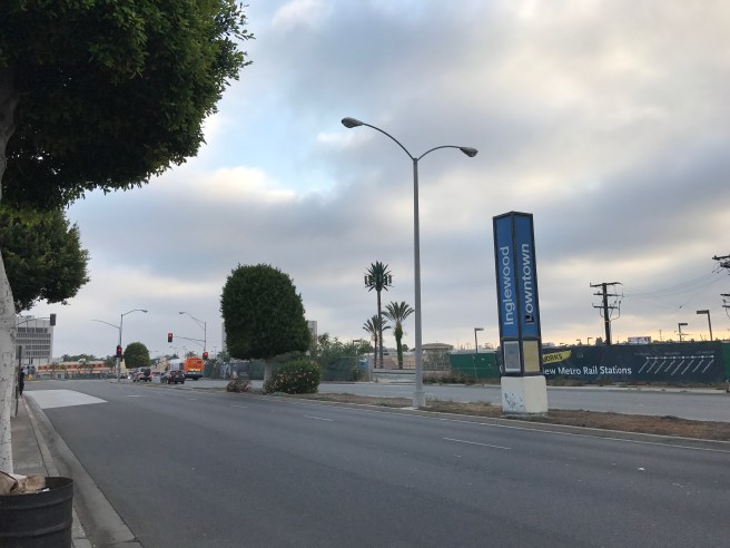
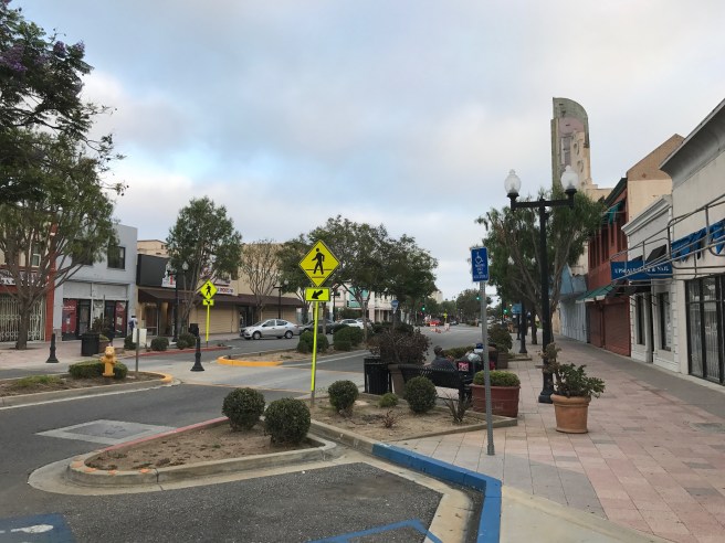
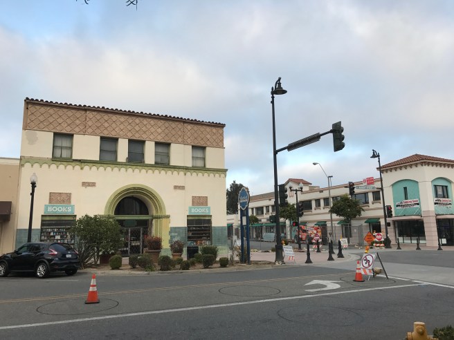
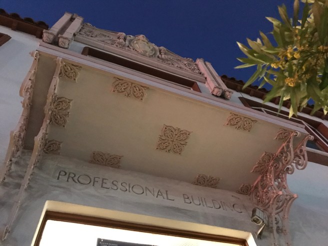
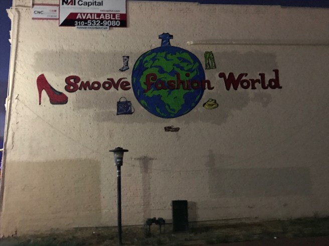
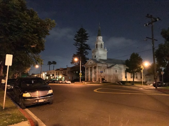
Just west of the cemetery, the striking St. John Chrysostom Church marks the approximate eastern edge of Inglewood’s small downtown. Most of its buildings seem to have been built in the mid-20th century. There are some restaurants and several strip malls — plus a haunted looking Payless. Marya and I decided to break from Florence and head south down Market Street. It was a Friday evening, the weekend before Independence Day, and I was a bit taken aback at how disquietingly empty it was.
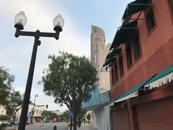
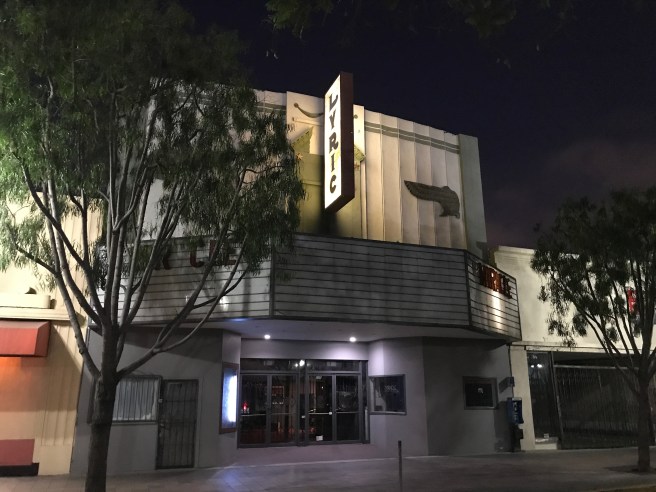
Most of Inglewood’s buildings are no more than one or two stories tall, so the Art Deco details of the abandoned Ritz and Fox theaters stand out from their surroundings. The 708-seat Ritz Theater opened in 1937 and went through stints as Loews Cine, a Pussycat Theater, and a church before being abandoned in 2008. The 1,008-seat Fox Theater opened in 1949 on the site of the Granada Theatre, which had been destroyed by a fire. It’s Streamline Moderne design was created by noted theater architects Simeon Charles Lee and Carl G. Moeller. After later operating as a Mann theater, it’s sat abandoned since 1984. Inglewood has in its existence supported eight other cinemas: the Academy, the Arcade, the Century Drive-In, the 5th Avenue, the Imperial, the Inglewood, the Seville, the United Artists Inglewood. Today it supports none.
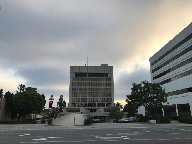
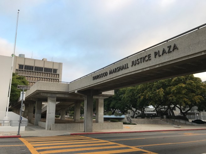
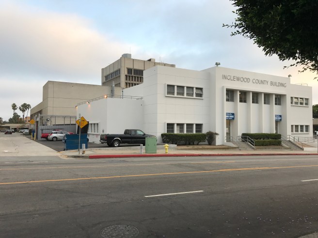
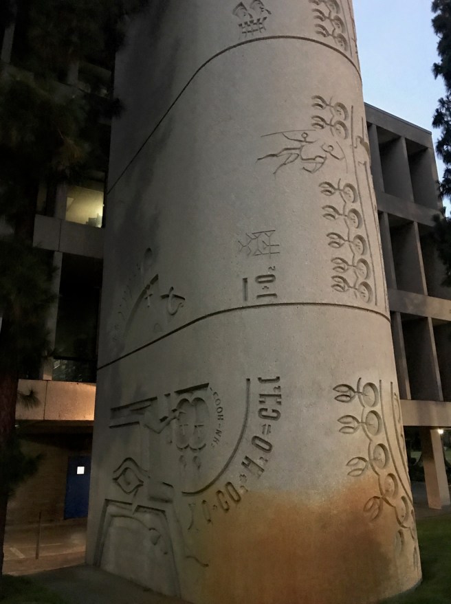
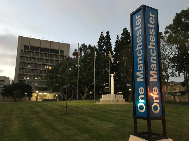
Next we made our way toward Inglewood’s civic center. On twelve hectares sit Inglewood’s city hall, main library, Los Angeles County Fire Dept. Station 171, a police facility, a public health complex, and a parking complex — all designed by Charles Luckman Associates in the Brutalist architectural style and built in 1973. Almost as important, in my view, are the open, expansive lawns of the center, designed by landscape architect Robert Herrick Carter. In front of the library is a tall structure decorated with what seem to be a sort of hieroglyphics. The artist on that project, known as “The Written Word” was sculptor Tom Van Sant.
Given their resemblance to impregnable fortresses, it’s natural to assume that Brutalist buildings got their name from their brutal designs. In fact, though, the term is derived from béton brut, French for “raw concrete” — the preferred material of the Swiss-French architect Le Corbusier, who championed the material’s fantastic versatility. Most of his followers, though, used concrete to create civic buildings like police stations and prisons. In the instances where brutalism was used for residential architecture, it was most often tower blocks.
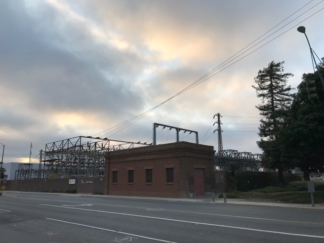
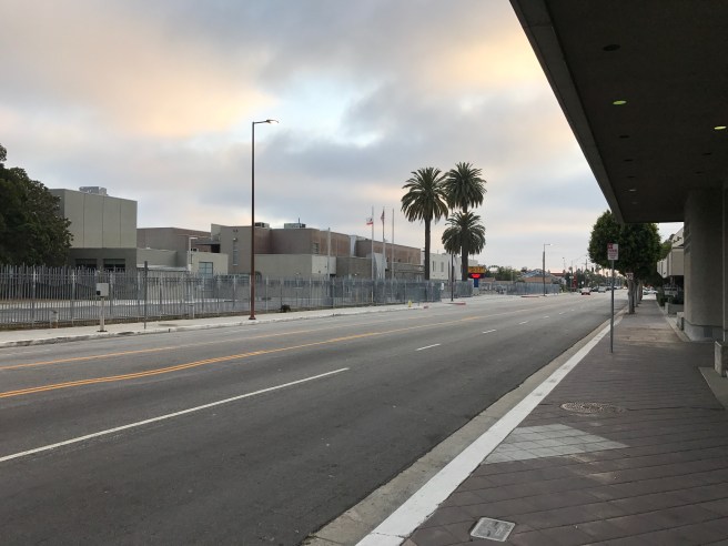
As we approached Inglewood Avenue, Marya whether it was better to walk all of Florence or to grab a bite to eat. Having walked it before, I explained that the rest of the avenue, which becomes Aviation Boulevard at the intersection with Manchester, is mostly lined by small warehouses and factories, electrical substations, and finally, a selection of restaurants at a strip mall called Airport Plaza and that, while not without its charms, might be less appealing than eating dinner. A proper ramble, after all, is adaptable and has no set route. It’s not a marathon or even a hike.
He turned south down Fir in search of food. We first tried Tortuga Bay, only to find that they were already in the process of closing. Around the corner we placed our order at El Compa. As we ate, they flipped the sign in the door to “closed.” I think Marya remarked that it was like in Western, right before a shoot-out. Luckily, no shoot-out proved forthcoming so I’m left to believe that the average Inglewoodian (if that’s what residents of Inglewood are indeed called) eats supper at a weirdly early hour.

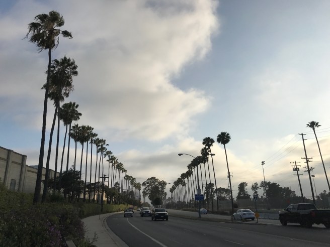
After finishing, we headed east down Manchester Boulevard, along the southern edge of the civic center and past a WPA-looking Inglewood High School. By this time it was dark. Earlier it had been dark because the thick marine layer had obscured the sun but dramatically curled and churned around airplanes approaching LAX. Now, however, the sun was down… and I still hadn’t fed Alan (my cat), who was no doubt preparing to let me have it.
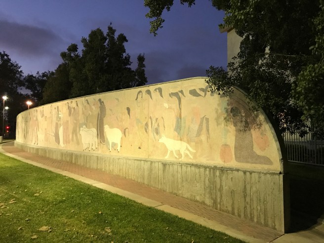


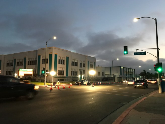
Still, a DUI check point caught our eye, and behind it, Grevillea Art Park. We didn’t see anyone pulled over and most of the police seemed to be socializing and eating food grilled by a sidewalk vendor — not everyone, it seems, has dinner before 9:00. Behind the check-point was a 75 meter long mural, “History of Transportation,” created by the WPA and artist Helen Lundeberg between 1939-1942. A little research revealed that the mural formerly stood at Centinela Park and that it’s the largest petrachrome mural in the world.
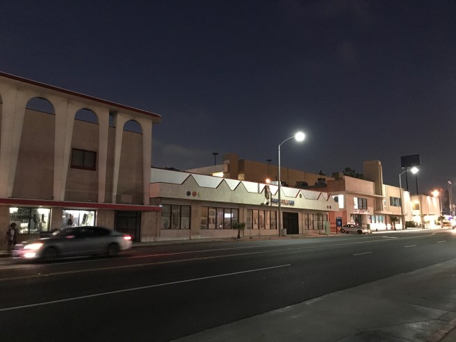
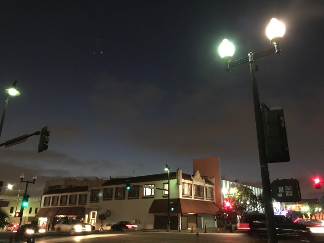
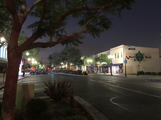
Making our way down Manchester, again, I found the street to have more appeal than Florence. One of the most striking buildings is the old Sheri’s Coffee Shop, a Googie-style structure designed by Martin Stern, Jr and built in 1958. Today it houses a Salvadoran restaurant called Cafetales. Most of the buildings in the area looked to have been built in the 1920s, ‘30s, and ‘40s and together give Inglewood a sense of place separate from that of the neighboring city of Los Angeles.
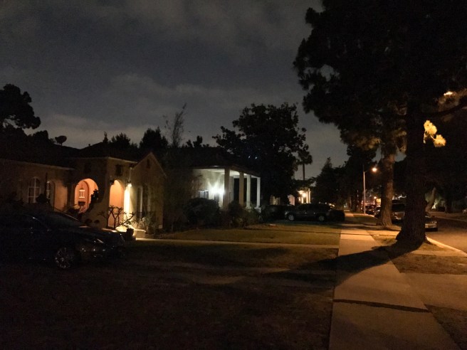
The last leg of our ramble was north up Hillcrest Boulevard, where I stopped to admire First Presbyterian Church, built in 1946. The rest of the street proved to be a quiet, residential one, lined mostly by homes built between the 1920s and ‘50s. In the middle of the road was a median shaded by stately trees. Periodically, fireworks exploded above us, lit in every instance by unseen, unheard people. The air we breathed smelled strongly of marijuana and sulphur smoke.
At Florence we headed east toward Marya’s truck, sometimes opting for the service road which runs along it, tellingly passing a fireworks stand in the parking lot of a church. We hopped back in the truck and took off — albeit naturally taking a different route than the one which brought us there.
FURTHER READING
“Welcome to Inglewood — Leave Your Aspirations Behind,” by Erin Aubry Kaplan


Marya! I don’t know what’s cooler, her vision or her eyeballs.
LikeLiked by 1 person