

This article was written for the Silver Lake Neighborhood Council feature, “Ask Silver Lake.” “Ask Silver Lake” is dedicated to exploring the history and insights of our community. If you have questions or ideas you’d like us to consider, please drop a comment or send them to outreach@silverlakenc.org.
Los Angeles is widely known for its many hills and mountains, which account for the city having the greatest elevation range of any. During its rainy season, water flows down the faces of these chains toward the Santa Monica and San Pedro bays. Most early maps of Los Angeles depict a vast network of creeks, streams, and rivers that had, back then, not yet been channelized or entombed beneath the city. On a map of Los Angeles from 1884, we can recognize a few familiar roads and streets (even if their names often changed), properties (with some names more familiar than others), and waterways that might surprise you.

Flowing downhill from headwaters located east of Reservoir No. 2 – a pre-Silver Lake Reservoir body located along what’s now Silver Lake Boulevard – we see an unnamed arroyo pass along the northwestern edge of the property belonging to L. A. Carey before joining another stream. Together, and joined along the way by more streams, they will flow to Ballona Creek, which ends in a coastal wetlands that some 8000 years earlier supported the largest known mainland village of the Chumash. Two diagonal streets converge there at Canal Street. In the bottom right corner, we see that this is Temple Road. Today, Canal is known as Bellevue Avenue. The diagonal section of Temple is today divided by the Hollywood Freeway. The southern end is part of Park View Street. The northern end is part of London Street – the site of the London Street Garden which is, the subject of this piece.
L. A. Carey was Lewis A. Carey (sometimes spelled “Cary”), a man from Newark, New Jersey who – along with his wife and two children – ran a dairy farm there. By the 1870s, the Carey Family had relocated to Los Angeles. Here, at least as early as 1882, they established the Hill Top Dairy. Mrs. Carey died a short time later, around 1885, and was buried in Boyle Heights’ Evergreen Cemetery. A distraught Lewis returned east and left the dairy in the hands of his eldest son, John L. Carey.
Lewis remarried but his second marriage ended again with the death of his wife. He returned to the Hill Top Dairy and, by all accounts, was suffering from the ravages of alcoholism. John kicked his father out and he found work where he could. A newspaper article from 1887 reported that he was raising cattle near Santa Ana. He also found work on the ranch of Anson Rose.
In 1887, John and his wife invited the West End Congregational Mission Sunday School to hold Sunday services at their home. In 1888, the Careys donated an area in the southeast corner of their property for the construction of the West End Congregational Church, which was completed that April. The West End Congregational Church was demolished in 1970. The new, Congregational Christian Church was built there in 1973.
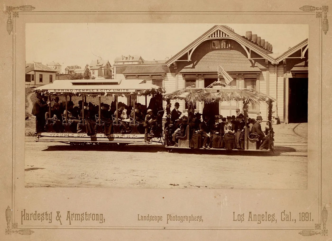
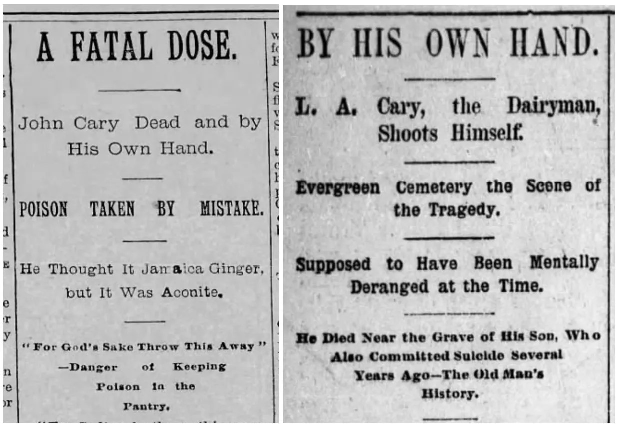
On 30 April 1889, the popular Temple Street Cable Railway extended its service from Angeleno Heights to Hoover Street in Dayton Heights, along Temple Road. The property values in the area, with the arrival of mass transit, were sure to increase. John Carey wouldn’t reap the rewards, though. On 27 November 1889, the then 39-year-old poisoned himself with a large dose of aconitum (aka monkshood, wolfsbane, devil’s helmet, &c), leaving his wife, two children, and brother, William H. Carey, to run the dairy.
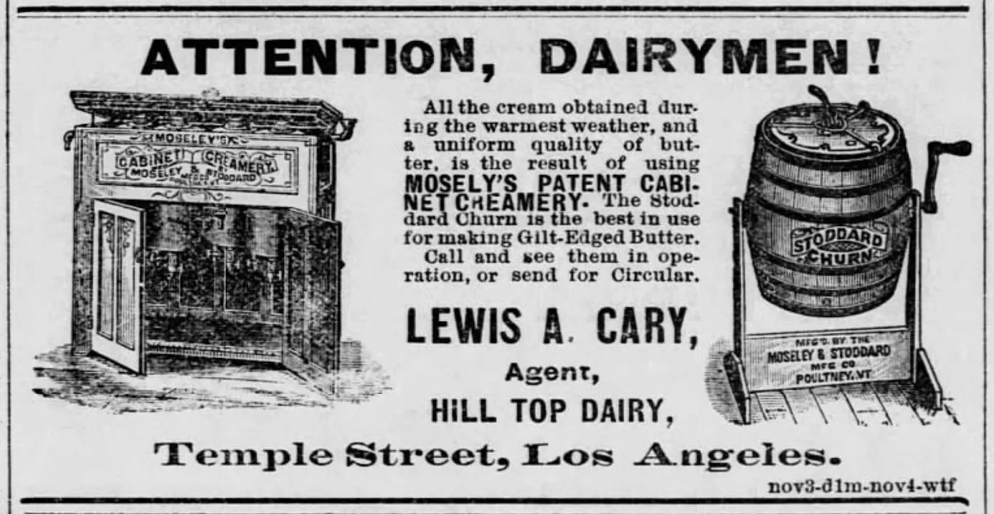
Temple Street was regraded, widened, and apparently re-routed along the southern edge of the dairy, so that it continued on a straight course to Hoover instead of along jagged Temple Road, which was renamed Old Temple Road. Lewis Carey, meanwhile, returned to live on the dairy and, in 1892, opened a small creamery south of 5th and Main streets where he churned Anson Rose’s butter and made butter that was served at many local restaurants. Despite his apparently improved state of business affairs, his alcoholism was destroying his mental state. He claimed to his employees at the creamery that he’d been cheated out of his land by one of his sons. He was variously described as “sort of mixed up” and “not right” to reporters after he visited his first wife’s grave and, there, shot himself through the skull with his .38 revolver on 25 April 1893.
The Temple Street Cable Railway was sold on 28 February 1898. On 2 October 1902, it was acquired by Henry Huntington, who replaced the cable cars with electric trains. Huntington’s interest in trains was more to do with real estate than public transit and his rail lines were the amenity that fueled the development of streetcar suburbs. The old Hill Top Dairy was subdivided into the Temple Street Villa Tract around August 1904. The Walbrook Park Tract opened to its north in 1911.
There were two sections of London Street in the area, at least as late as 1911. One section ran between Hoover and Reno Street; the other ran between Casco Street (now Rosemont Avenue) and Sonoma Street (now Coronado Terrace). London Street was later extended to Ida Street (now Coronado Street) and to Old Temple Road, which was absorbed into it.

In 1924, plans were made to develop a “stop-free express highway” between Los Angeles and the San Fernando Valley. Nearly all of the existing homes in the vicinity were built during this era – between 1922 and ‘27. The main commercial building (home to The Harbor, Psychic Wines, and Maury’s Bagels) was built in 1925. Walls lining Occidental Boulevard and Parkman Avenue were built using river rocks excavated from the historic arroyo.
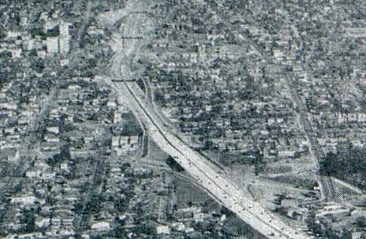
The non-stop express highway, then known as the Cahuenga Pass Freeway, opened through the Hollywood Hills in 1940. Construction of the section through Silver Lake began in 1947. Rubble and detritus from demolished homes and streets was dumped into Chavez Ravine, now buried beneath the parking lot of Dodger Stadium, which opened in 1962.

London Street now terminated in a cul-de-sac next to the Hollywood Freeway. A contractor stamp indicates that it was built by N.M. Ball Sons in 1950 — possibly on 22 March or May. The hand-scrawled numbers are hard to read. Around the corner, on Vendome, the date of construction is clearly “5-23.” An online search reveals that N.M. Ball Sons were also contracted — in June 1949 — to construct “a section” of the Hollywood Parkway (as it was originally known). A chain link fence that separated the street from the freeway was later replaced with a cinderblock wall.

Don Tony Mendez moved to the neighborhood in 1977. His future wife, Diane, moved there two years later. The Mendezes and neighbors joined forces to keep the cul-de-sac free of illegal dumping. At the same time, a few hearty plants had taken root in the cracks of the cul-de-sac’s traffic circle. In 2000, Tony (an avid gardener) exploited a hole in the traffic circle’s asphalt to plant a peach tree. More asphalt was removed and more trees were planted. Don Tony was surely aware of his role as someone who brought life to a space made hostile to life. Whether he knew it or not, he was also reviving the area’s long dormant agricultural history.

London Street Garden Plans
The Mendez’s daughter, Mariah, returned to the neighborhood in 2020. Inspired by her father’s guerrilla gardening, she installed raised beds on the island. Another neighborhood resident and Neighborhood Council Green Committee member, Nicole Antoine, got involved after a neighbor at Maury’s told her about Mariah’s efforts and introduced them to one another. Together they devised a plan and worked with the Green Committee to secure approval and grants for the project. City Council District 13, Streets LA (the Bureau of Street Services), and the Office of Community Beautification (through its Adopt-A-Median program) also joined in the effort, which is ongoing. If you’d like to get involved, check them out.
Support Eric Brightwell on Patreon

Eric Brightwell is an adventurer, essayist, rambler, explorer, cartographer, and guerrilla gardener who is always seeking paid writing, speaking, traveling, and art opportunities. He is not interested in generating advertorials, cranking out clickbait, or laboring away in a listicle mill “for exposure.”
Brightwell has written for Angels Walk LA, Amoeblog, Boom: A Journal of California, diaCRITICS, Hey Freelancer!, Hidden Los Angeles, and KCET Departures. His art has been featured by the American Institute of Architects, the Architecture & Design Museum, the Craft Contemporary, Form Follows Function, the Los Angeles County Store, Sidewalking: Coming to Terms With Los Angeles, Skid Row Housing Trust, the 1650 Gallery, and Abundant Housing LA.
Brightwell has been featured as subject and/or guest in The Los Angeles Times, VICE, Huffington Post, Los Angeles Magazine, LAist, CurbedLA, LA Times 404, Marketplace, In a Minute With Evan Lovett, Office Hours Live, L.A. Untangled, Spectrum News, Eastsider LA, Boing Boing, Los Angeles, I’m Yours, Notebook on Cities and Culture, the Silver Lake History Collective, KCRW‘s Which Way, LA?, All Valley Everything, Hear in LA, KPCC‘s How to LA, at Emerson College, and at the University of Southern California. He is the co-host of the podcast, Nobody Drives in LA.
Brightwell has written a haiku-inspired guidebook, Los Angeles Neighborhoods — From Academy Hill to Zamperini Field and All Points Between, that he hopes to have published. If you’re a literary agent or publisher, please contact him.
You can follow him on:
Bluesky, Duolingo, Facebook, Goodreads, iNaturalist, Instagram, Letterboxd, Medium, Mubi, Threads, and TikTok.


In the 1884 map of Los Angeles by Henry Stevenson, reservoir #4 is the future Echo Park lake.
LikeLike
In the 1884 map of Los Angeles by Henry Stevenson, reservoir #4 is the future Echo Park lake.
Which leads me to believe reservoir #3 is somewhere on top of the hill to the west, which we called Kent Hill back in the 1960s.
LikeLiked by 1 person
The street going up the middle of Reservoir No. 3, I believe, is Alvarado. Canal became Bellevue so the upper end of the reservoir was probably around Santa Ynez or Kent. Do let me know if you ever come across more info about these early forgotten reservoirs, please.
LikeLike