

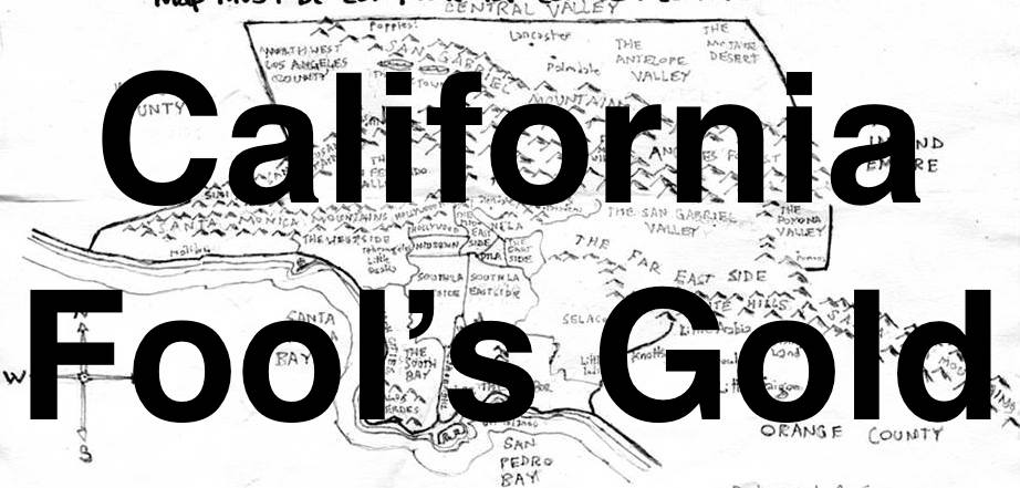
SEASON 10, EPISODE 1: “MONTECITO HEIGHTS”
Yesterday, compelled by voters like you, I explored the Los Angeles neighborhood of Montecito Heights in Northeast Los Angeles. It was unseasonably hot — especially considering Angelenos had been told to brace for a “Godzilla El Niño.” Instead, we have a record-breaking heatwave and Santa Ana winds carrying a brown layer of dust into the region.
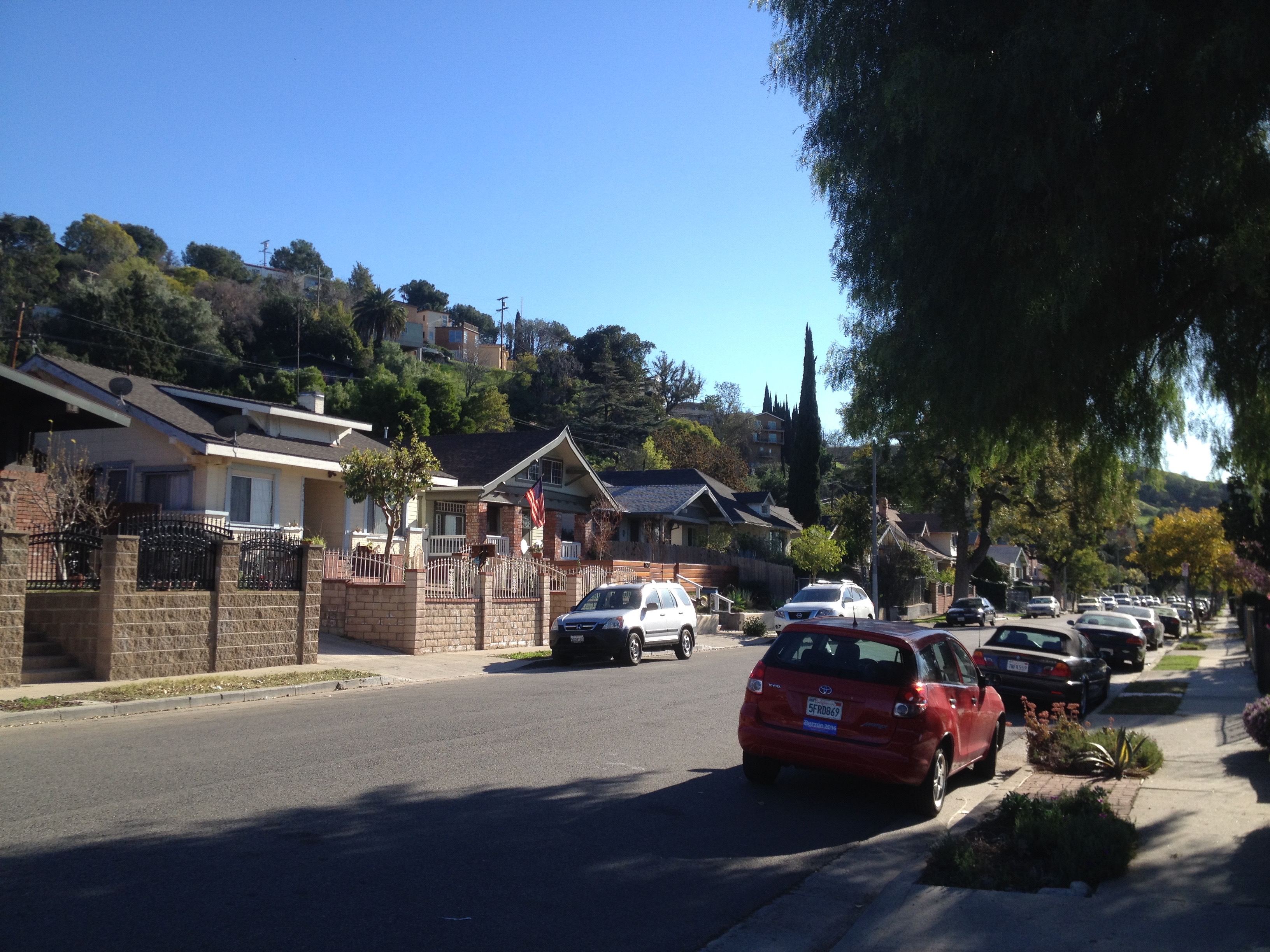
The argument could also be made that Montecito Heights and indeed all of Northeast Los Angeles are part of the Eastside but with its Arroyo Seco orientation, location in the Repetto Hills, preponderance of river rock-incorporating Craftsman homes, it seems to me to have more in common with Hermon and Mount Washington than Eastside neighborhoods like Boyle Heights and East Los Angeles.
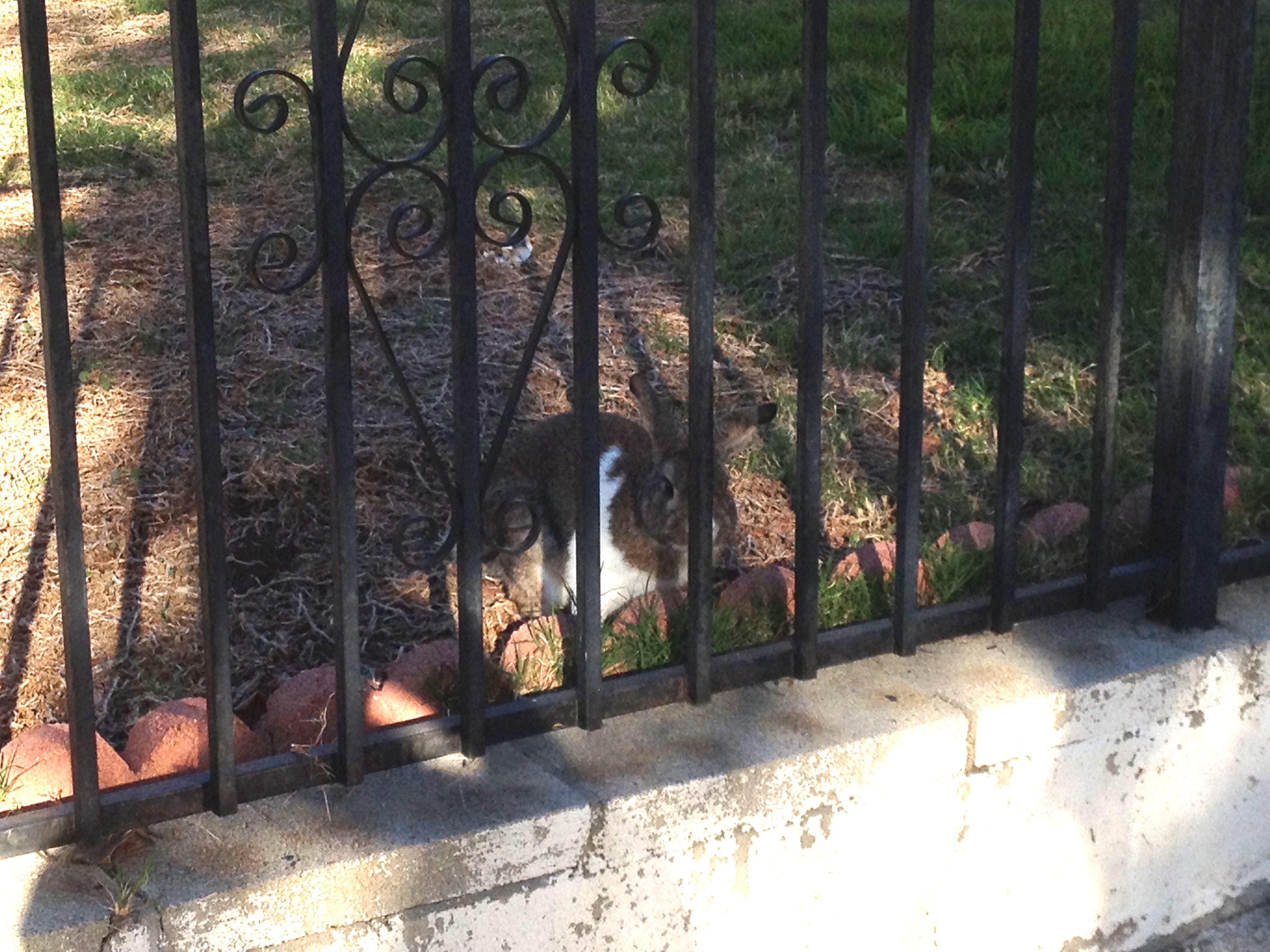
There are also fewer dogs guarded by teams of chihuahuas and pit bulls. Although there are many “BEWARE OF DOG” signs posted, most of the dogs were small, fluffy, and not particularly aggressive. I was, however, startled by the rustle of a guard animal moving quickly toward me which turned out to be a very large bunny. Thankfully, a set of bars separated us.
LOCATION
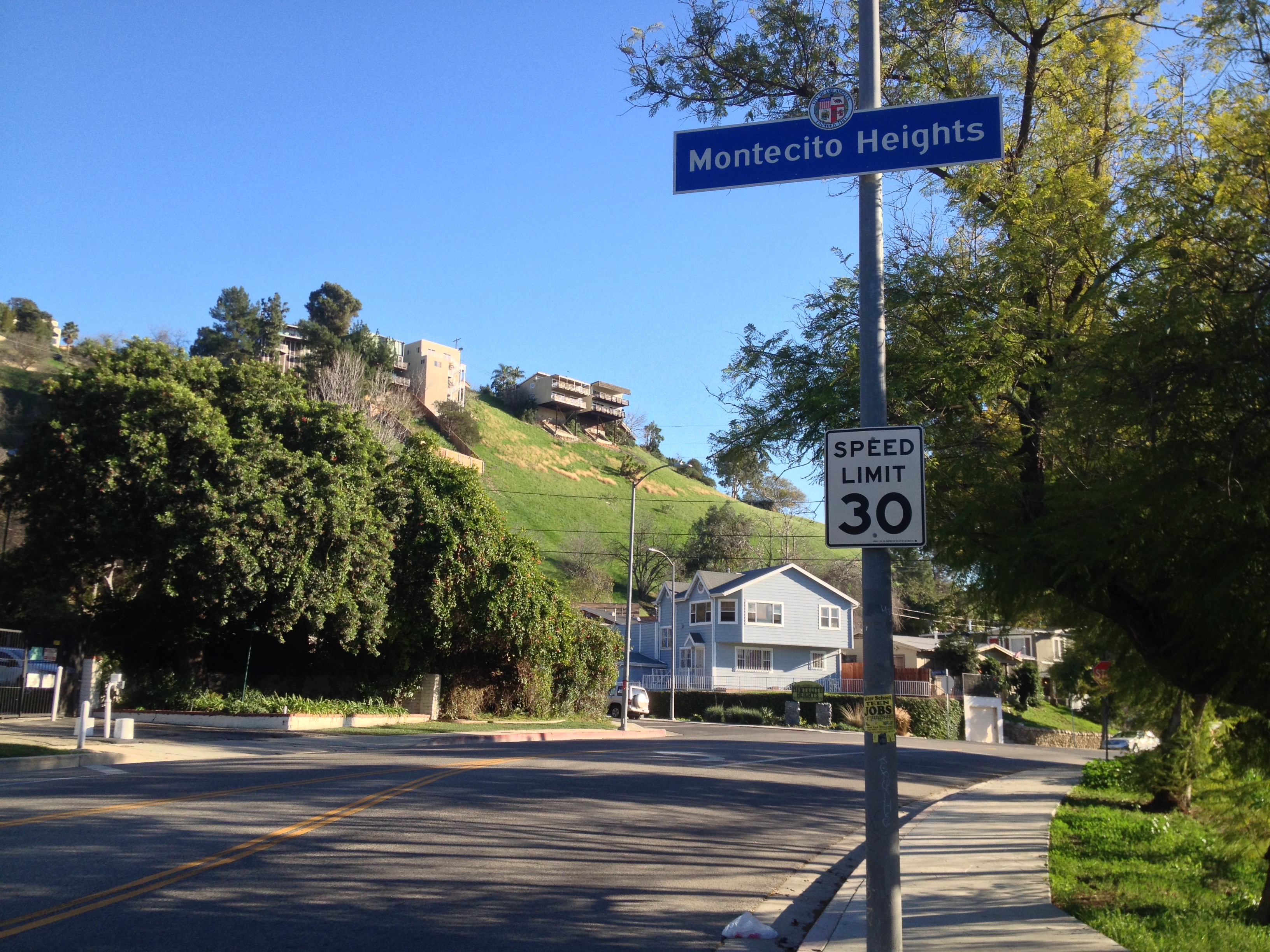
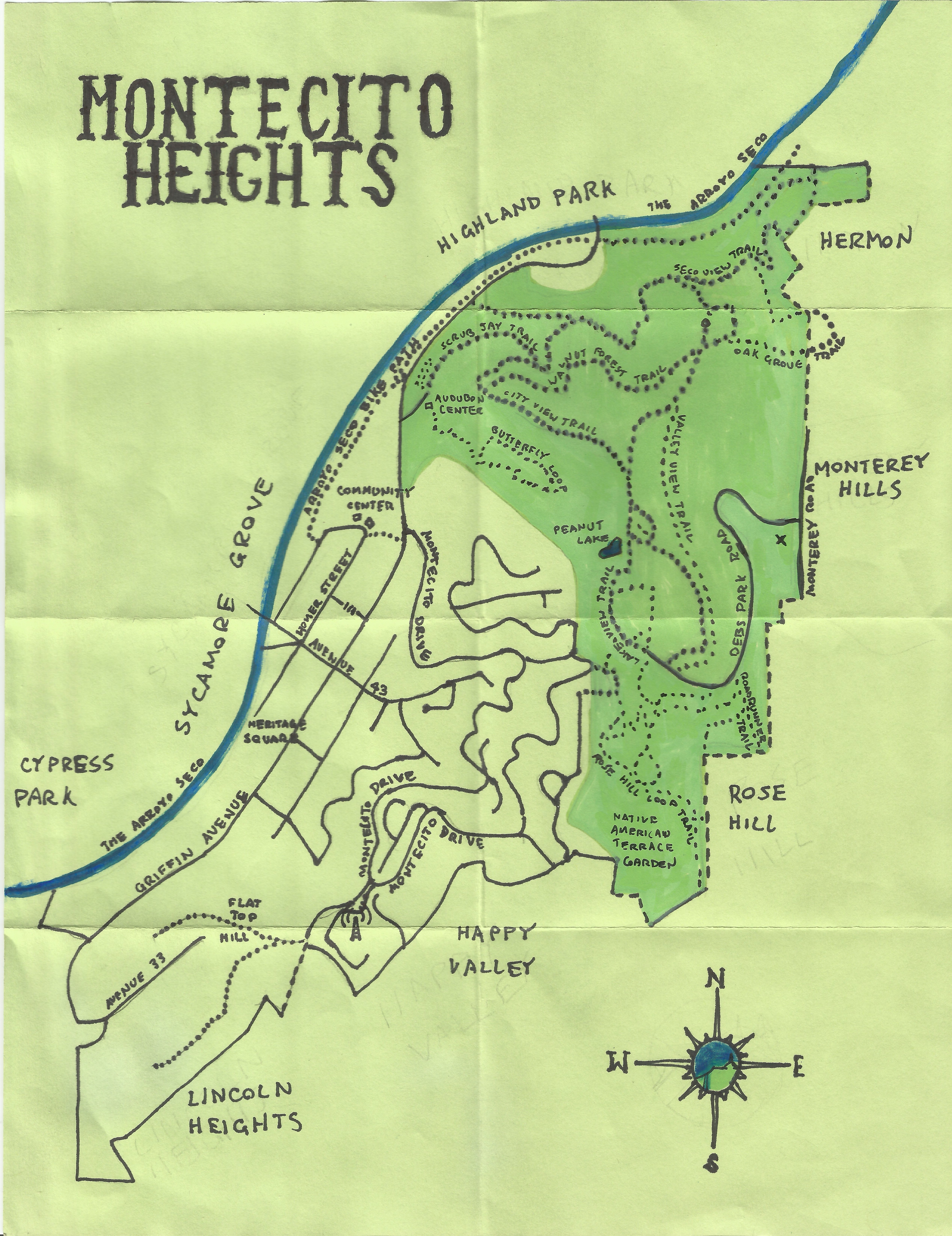
Most definitions of Montecito Heights depict the western border as being defined by the Arroyo Seco, with Cypress Park, Sycamore Grove, and Highland Park on the other side of the river. Ernest E. Debs Park is generally included in the north, with Hermon, Monterey Hills, and Rose Hill to the east. To the south are Happy Valley and Lincoln Heights. The border, if there is one, between Lincoln Heights and Montecito Heights is debatable too, with the local Avenue 43 gang and Los Angeles Department of Transportation taking different views and me tending to side with the former, at least in questions of geography.
HISTORY
The “heights” in “Montecito Heights” are the low, rolling Monterey Hills (technically part of the Repetto Hills that stretch from the vicinity of the San Rafael Hills, Elysian Hills, and Arroyo Seco down to the Whittier Narrows and San Gabriel River). Before the arrival of humans, the area was home to black walnuts, bobcats, California Kingsnakes, California Lilac, Coastal Whiptails, Flowering Gooseberry, Garter snakes, Gopher snakes, grizzly bears, Matilija Poppy, Mountain Kingsnakes, mountain lions, oaks, steelhead, sycamores, Western fence lizards, and other forms of life.
The first humans, the ancestors of the modern Chumash, entered Southern California at least 13,000 years ago. Some 3,500 years ago the ancestors of the Tongva arrived from the east. There is evidence of battles between the two nations on the Channel Islands, but for the most part the Chumash seem to have by the time of the Tongva’s arrival abandoned the interior Los Angeles basin. The Tongva established many villages, including one in the vicinity of modern day Montecito Heights known as Otsungna.
The Spanish claimed the hill and everything else for their vast empire in 1542 but it wasn’t until 1769 that they got serious about their claim and sent an overland expedition across California. The expedition crossed a mostly-dry river bed in 1770, near what’s now Montecito Heights, which Gaspar de Portolá i Rovira named the Arroyo Seco, Spanish for “dry creek.” The Arroyo Seco is a 40 kilometer-long seasonal river which flows from the San Gabriel Mountains to a confluence with the Los Angeles River where it forms the border between Cypress Park and Lincoln Heights. Indeed dry for much of the year, it was formerly used as a wagon trail between Pasadena and Los Angeles.
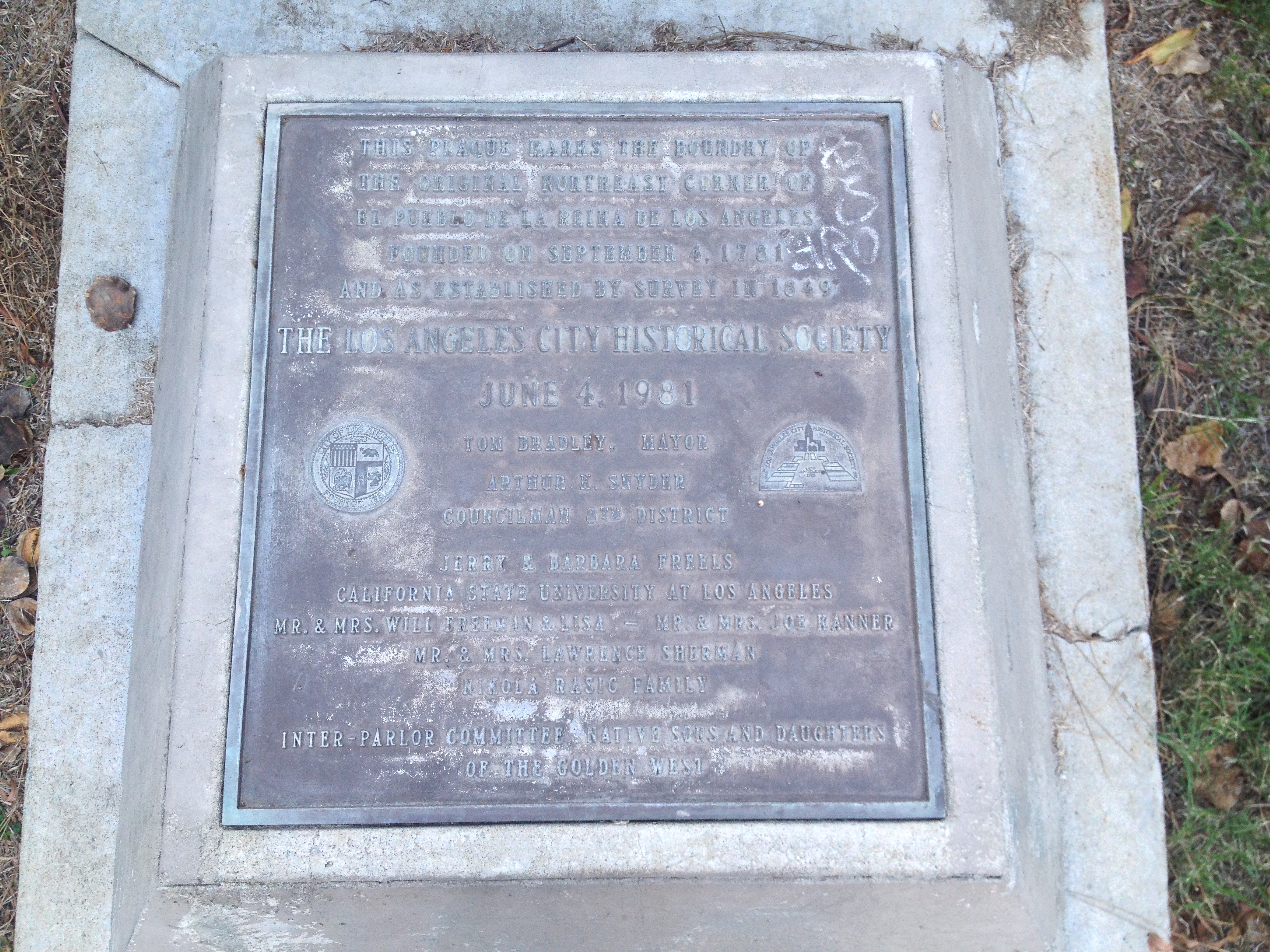
A Spanish town, El Pueblo de Nuestra Señora de Los Angeles de Porciuncula, was founded in 1781. Its area included four square leagues and northeastern-most corner was in what became Montecito Heights. All four corners of the original pueblo are today marked by plaques and the northeast one can be found in Ernest E. Debs Park. The area beyond the northeast corner was administered by Mission San Gabriel Arcángel, which still stands about ten kilometers east.
Mexico declared its independence from Spain in 1810 and achieved victory in 1821. The missions’ holdings were secularized and the northeast corner of Los Angeles remained undeveloped. The United States invaded Mexico in 1846, conquering California and other lands in 1848. California was granted statehood and became the 31st state in 1850. The rest of what would become Montecito Heights was annexed by Los Angeles in 1895 as part of the Highland Park Addition.
3537 GRIFFIN AVENUE RESIDENCE
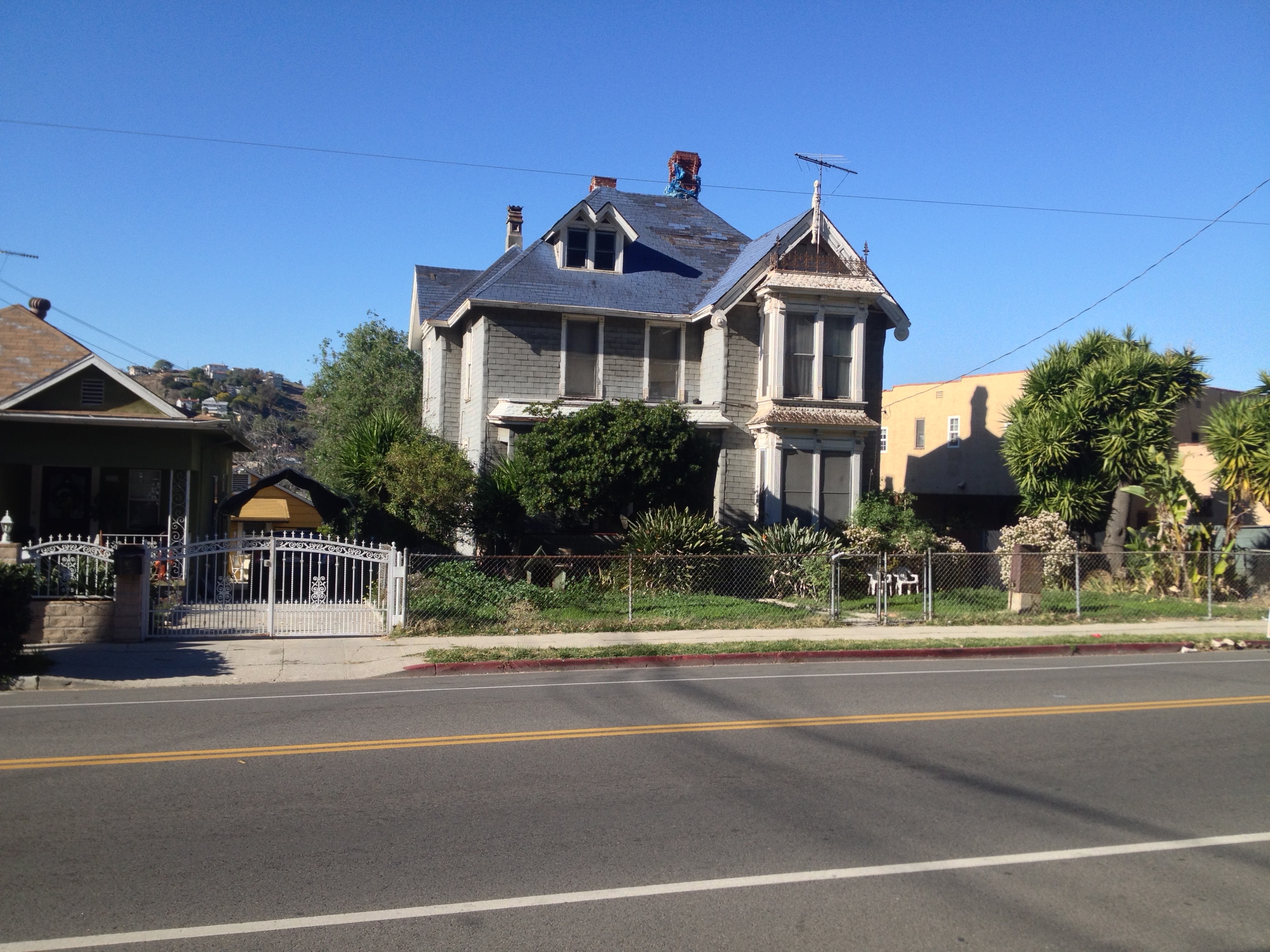
One of the oldest human-made attractions in Montecito Heights isn’t much of an attraction at all. Although designated Historic Cultural Monument No. 145 in 1975, little is known about the Queen Anne-style residence at 3537 Griffin Avenue which makes it obviously noteworthy of being singled out. It may or may not have been designed by architect Joseph Cather Newsom. It was probably built within a few years of 1886, when the area was still known as Sawyer Mesa. Its been in an apparent state of disrepair, its exterior encased in roof shingles and its holes patched with tarps, for at least eight years. (For more, check out this Big Orange Landmarks post).
MONTECITO PARK
The Montecito Park Tract was established in 1906 along Griffin Avenue. Plans were drawn up for a development called Montecito Hills in 1910, which would’ve in included the construction of a group of homes built around a hilltop resort hotel. It was never built and in 1929 the company which had planned it went bankrupt. The rest of what’s today Montecito Heights was annexed by Los Angeles in 1912, as part of the Arroyo Seco Addition.
By then the 2 Line of the Los Angeles Railway extended up Griffin Avenue, connecting the streetcar suburb with Echo Park and Downtown Los Angeles. In 1923, another streetcar suburb in Glendale, adjacent to Sparr Heights, began being promoted as Montecito Park and perhaps this led to residents re-naming the neighborhood Montecito Heights — even though a local and now inactive gang retained the Montecito Park moniker for years after. The Los Angeles Railway ended operation and today Montecito Heights is served by a single Metro bus, Line 252.
1150 RADIO TOWER
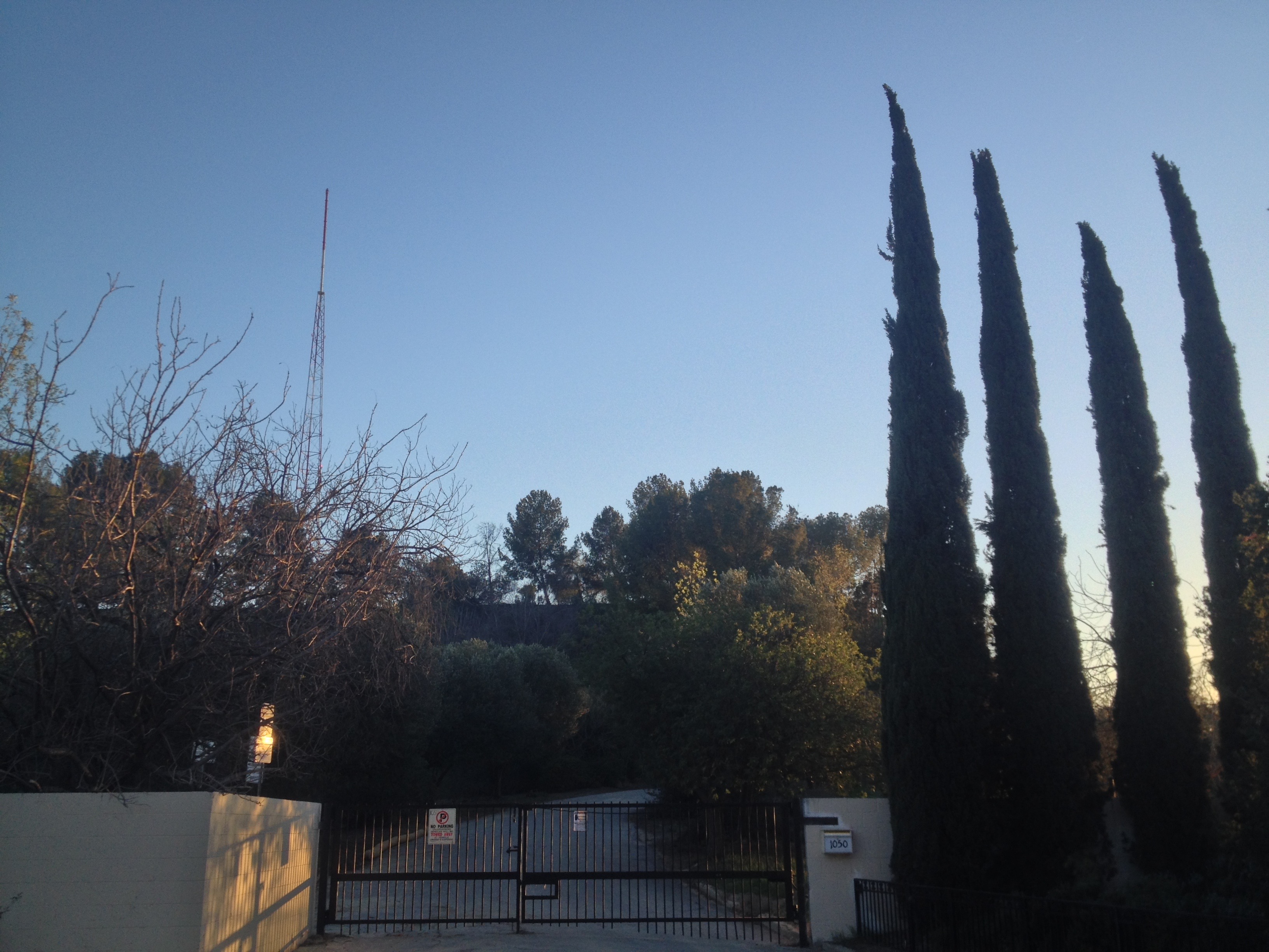
The KRKD (1150 AM) radio transmitter was installed on top of Mount Olympus in 1948, after formerly broadcasting from the Arcade Building downtown (thus its call letters). Today it’s also home to some Los Angeles Police Department transmitters. It was purchased in 1961 by the evangelical Pentecostal Foursquare Church, which had formerly transmit as KFSG in Echo Park. In 1970 it was again sold and rebranded KIIS (“IIS” resembling the numbers “115”). In 1975, KIIS moved to the FM dial and 1150 merged with KKDJ 102.7. Recently, the organization North East Trees acquired much of Mount Olympus I & II (although not the parcel containing the radio tower) with the purpose of maintaining the area as parkland.
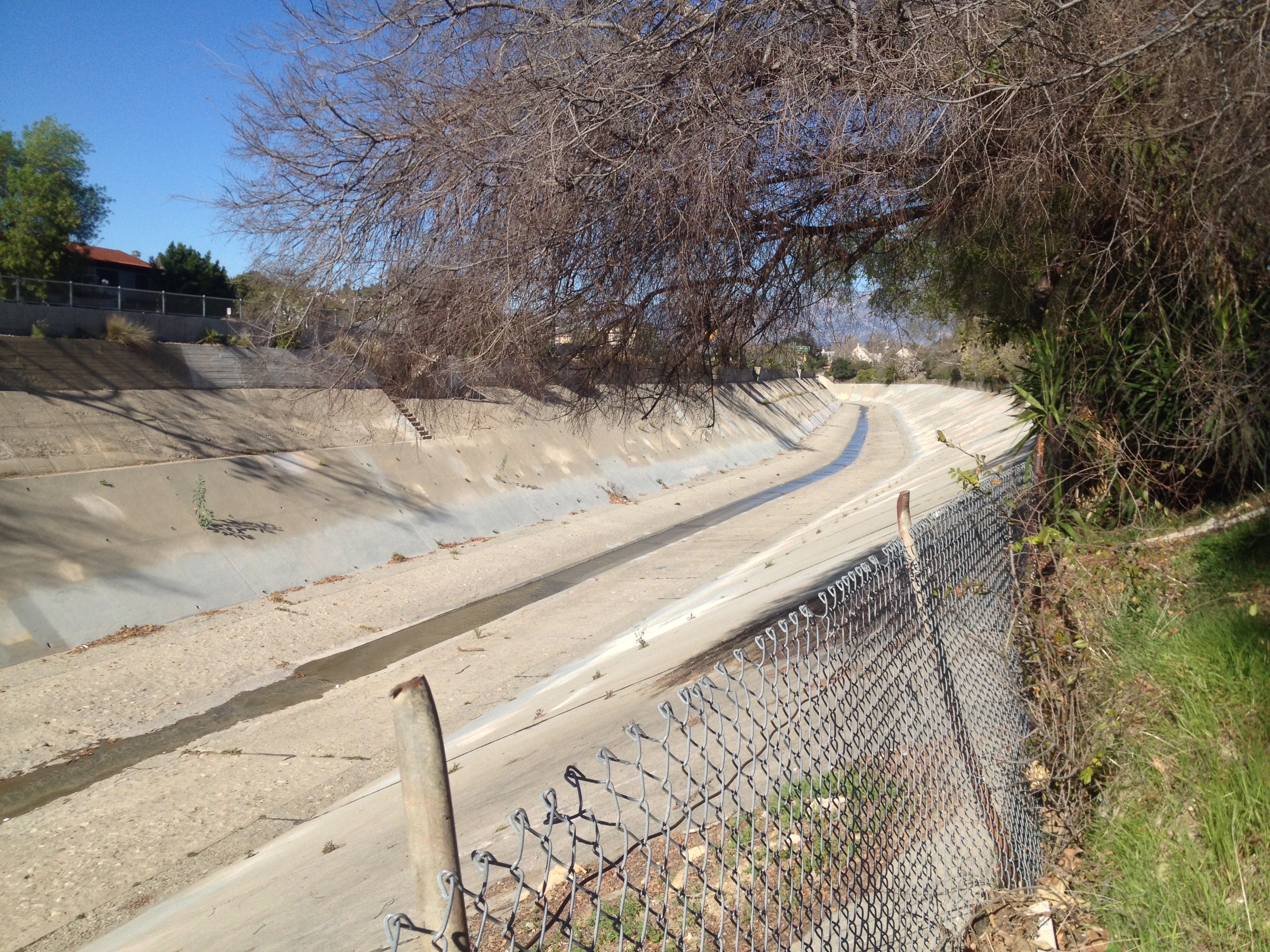
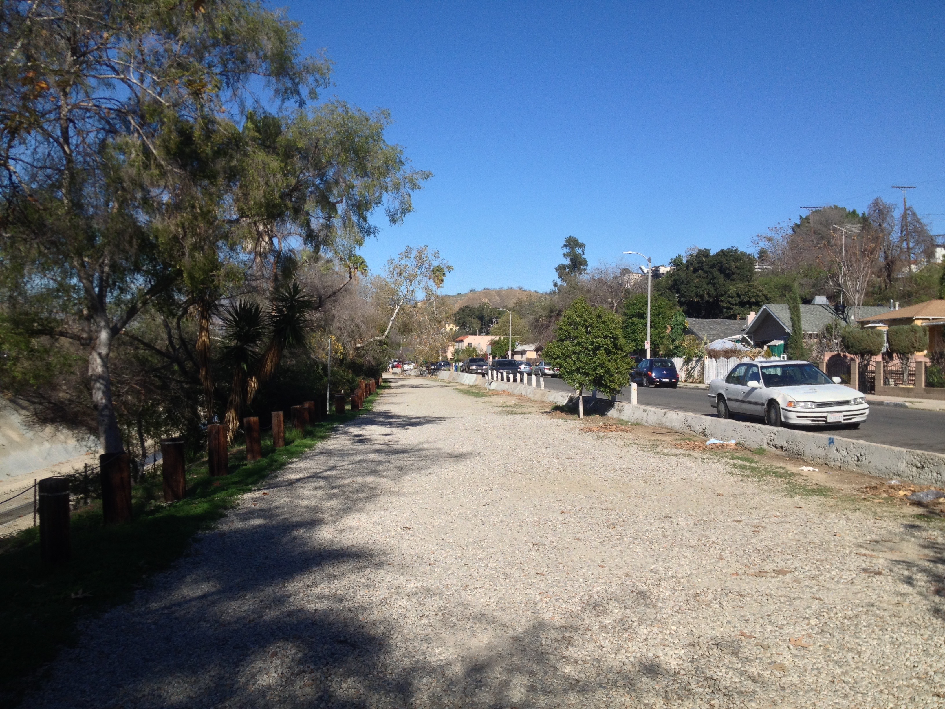
ARROYO SECO PARKWAY
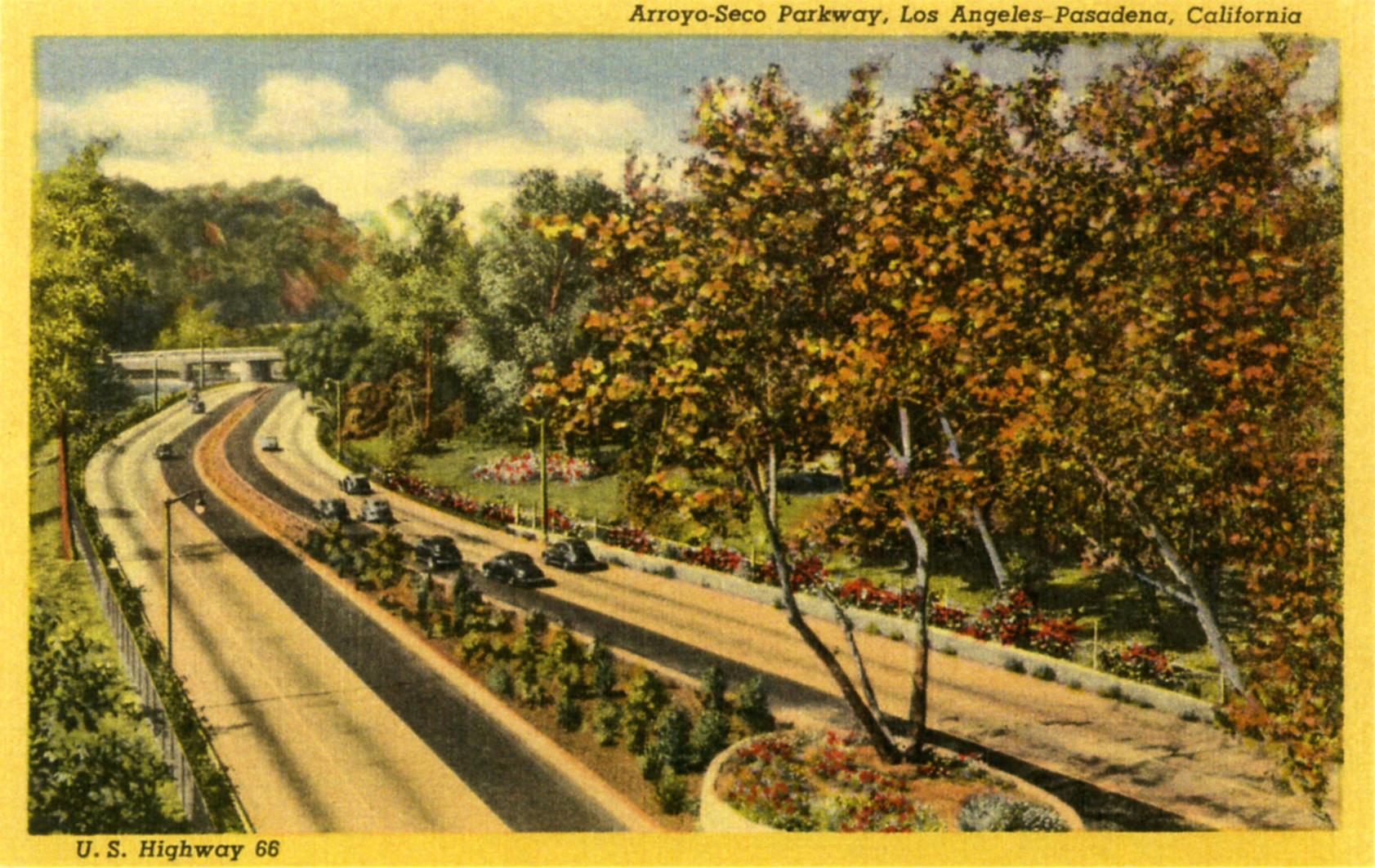
The Arroyo Seco Parkway opened in 1940, running alongside the Arroyo Seco between Pasadena and Los Angeles. In 1954 it was renamed the Pasadena Freeway. The name reverted to its original designation in 2010. When I first visited Los Angeles, as I was driven down the parkway I looked out the window in curiosity about Highland Park on one side of the road and Montecito Heights on the other and I remember looking at a Thomas Guide and Mapquest, trying and failing to find out anything about those communities. The Arroyo Seco Parkway was built to be a scenic route, with gentle curves designed for a top speed of 45 miles per hour (72 kilometers per hour). Exits require motorists to come to a nearly complete stop. It’s safe to say that almost no modern motorists today drive at that speed or less and instead of being a pleasant experience, it’s now often made harrowing by impatient, dangerous drivers. If one looks closely enough, nestled in the native foliage planted along the narrow shoulders are several memorial crosses for those killed along the road.
BROADVIEW SANITARIUM
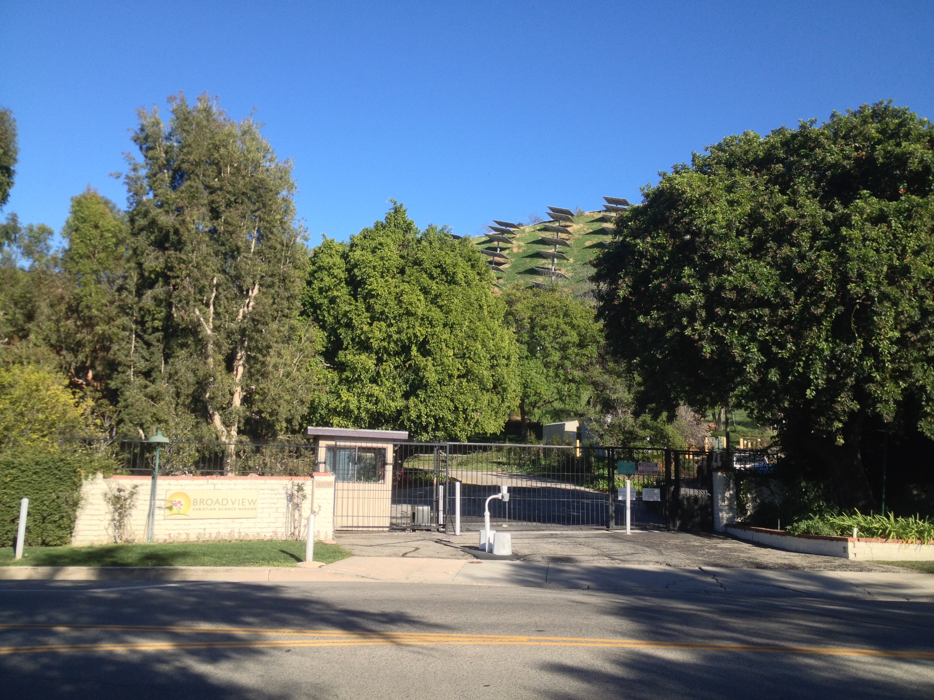
The Southern California Foundation, Inc., whose name was later changed to Broadview, is a Christian Science organization established in Los Angeles in 1936. Christian Scientists are a metaphysical sect who believe that illness is an illusion which can be corrected by prayer. In 1946 they began construction of the Broadview Sanitarium in Montecito Heights. When it opened its doors in 1947 it contained only thirtreen rooms. Today it has expanded to 39 rooms which offers Christian Science nursing care on a 4.5 hectare parcel covered with flowers, fruit trees and, since 2010, 1,441 solar panels which cover the hillside above.
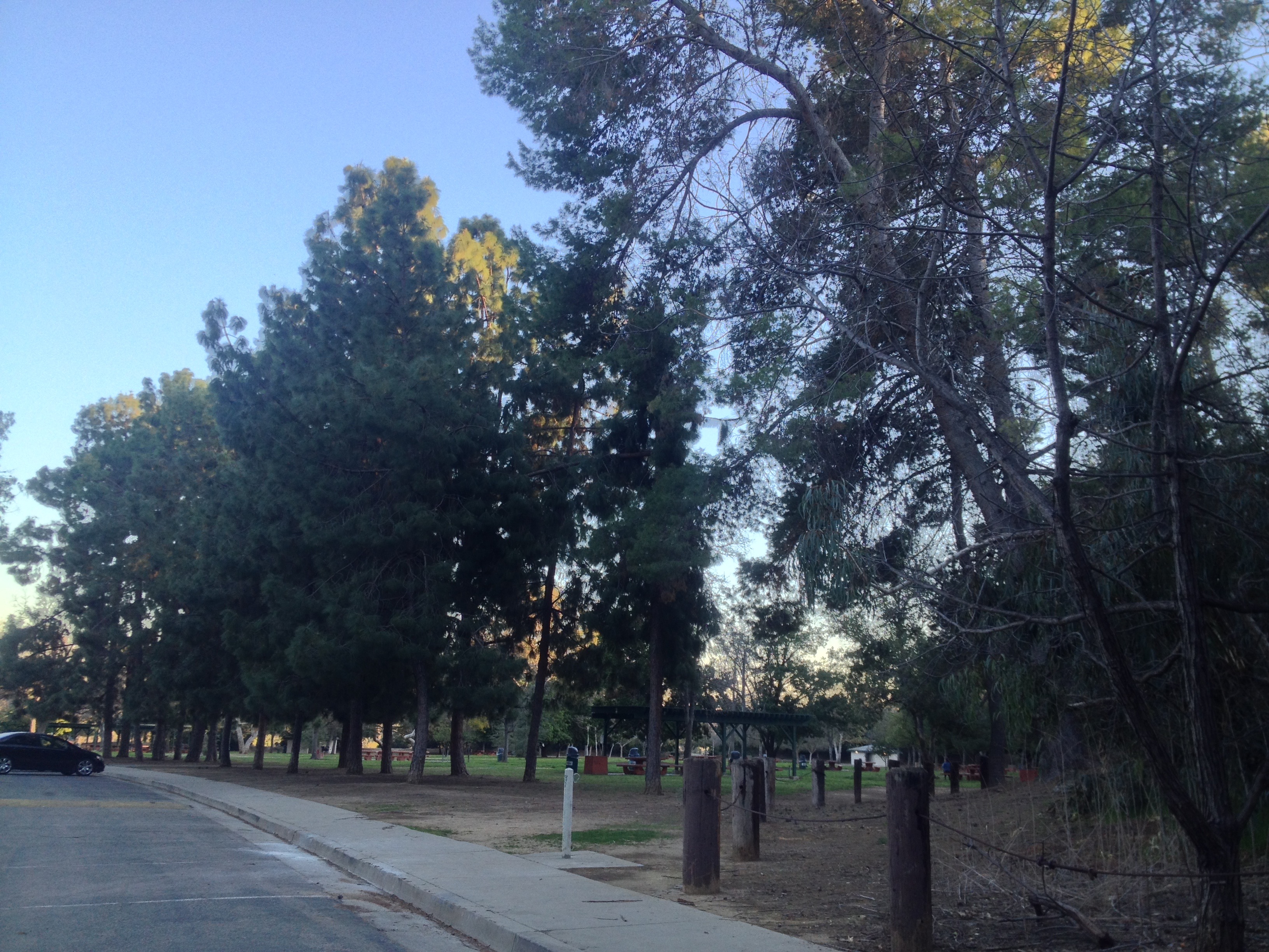
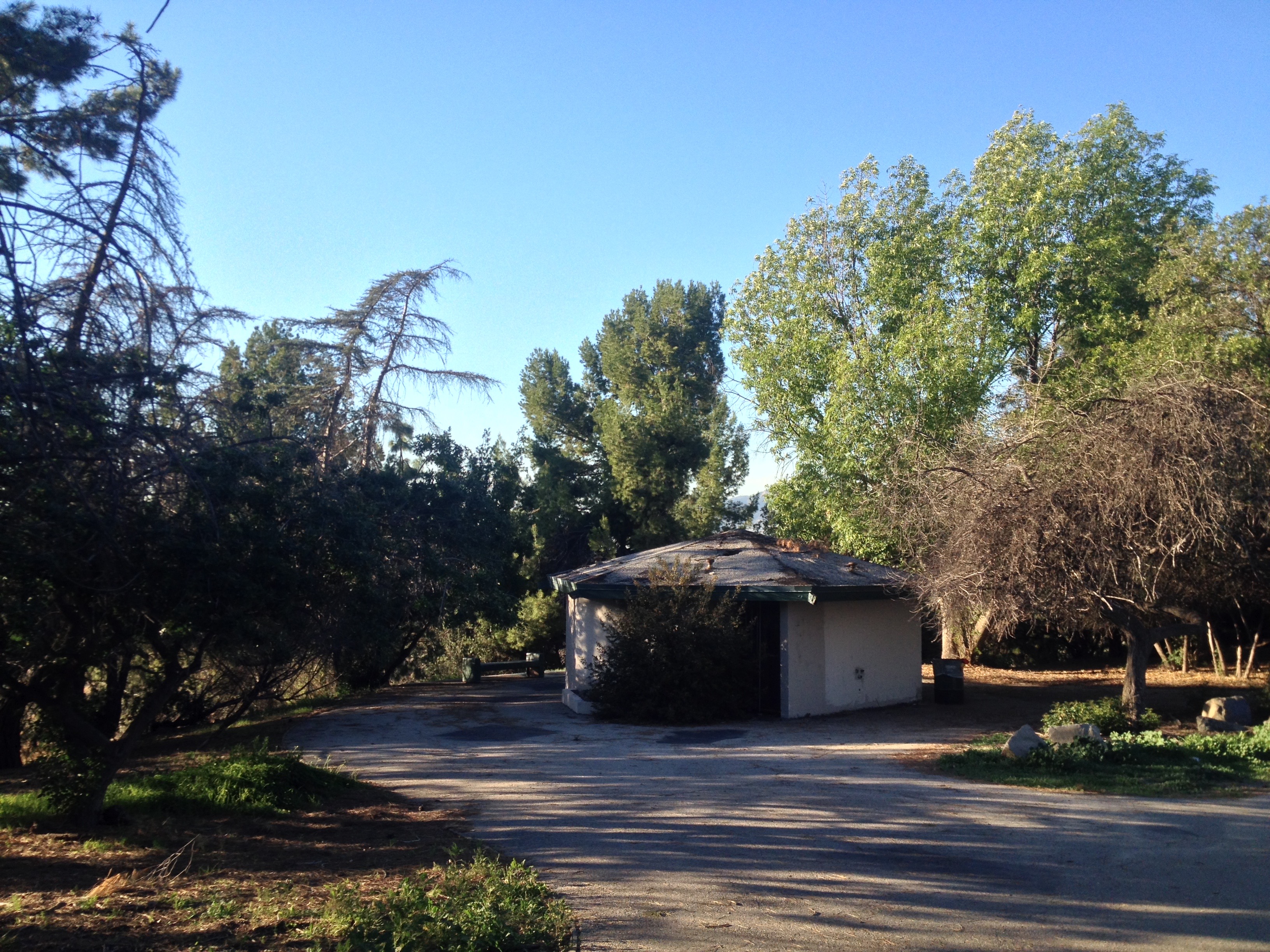
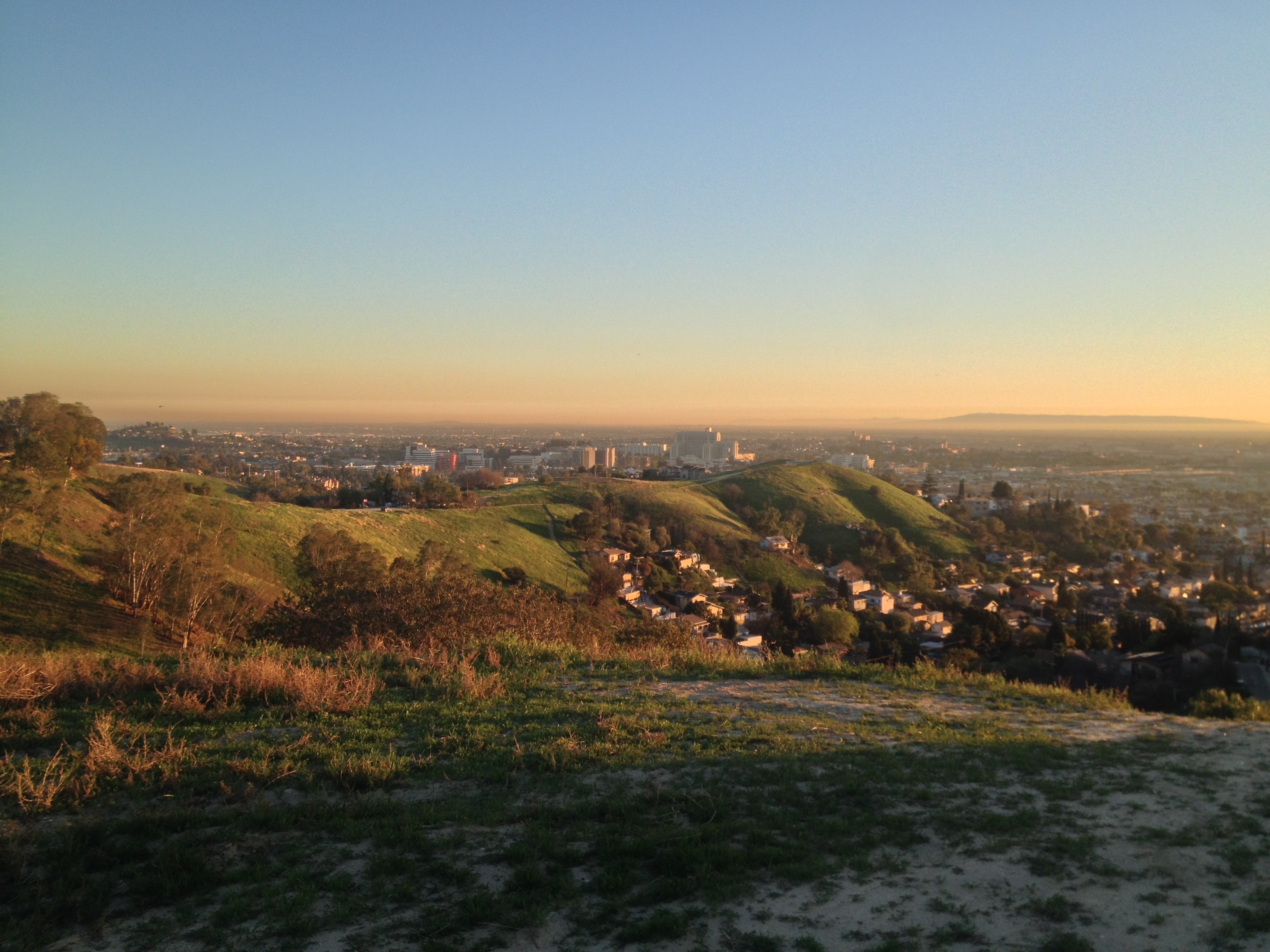
ERNEST E. DEBS PARK
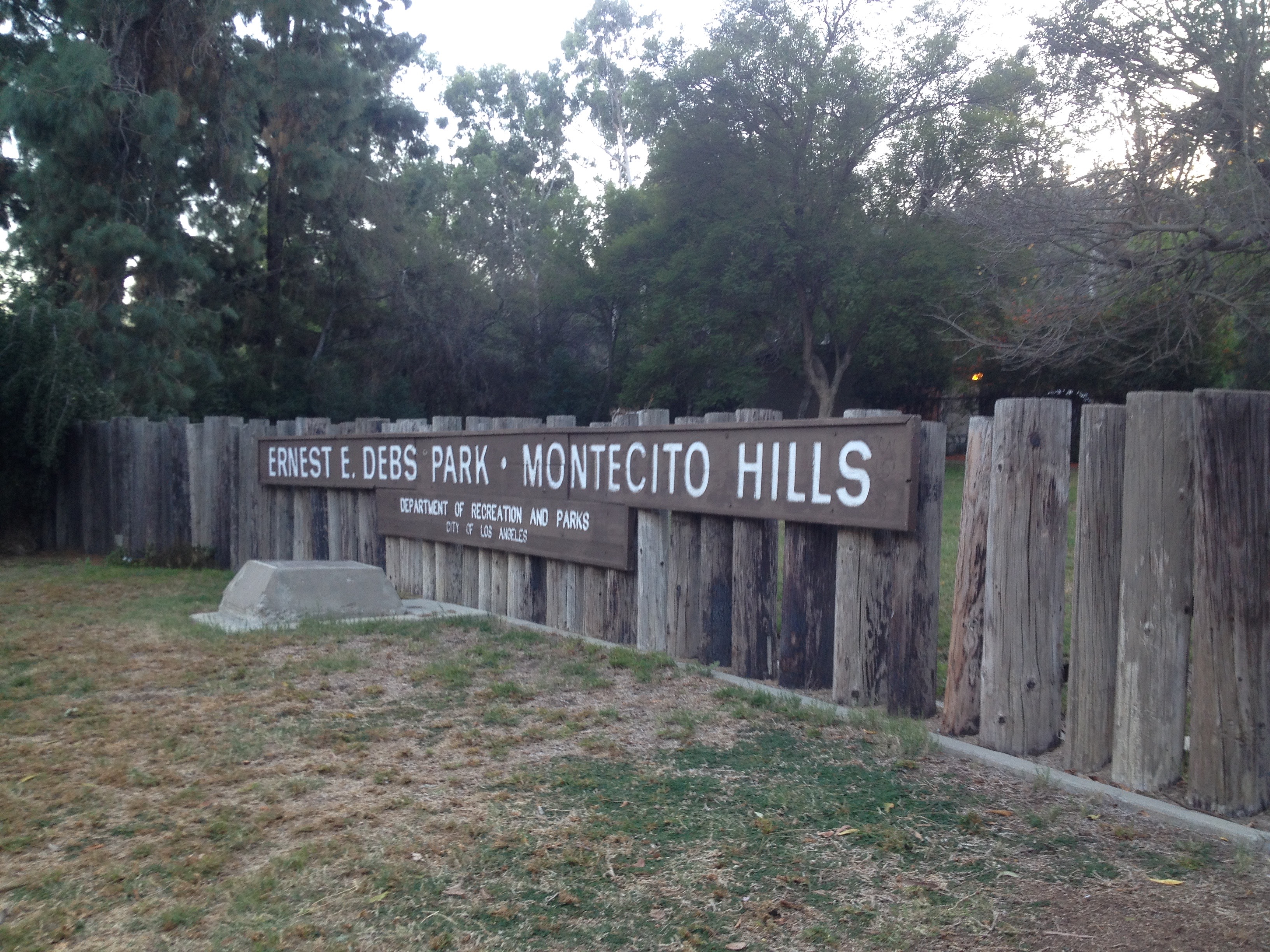
Ernest E. Debs Park, or as it is more often known, simply “Debs Park,” is (after Topanga, Griffith, Sepulveda, Hansen Dam, O’Melveny, and Elysian) the seventh largest park in Los Angeles. It gives Montecito Heights its not-quite-suburban character (subrural?) and is a treasure in this notoriously park-poor city. However, its creation came at a cost of another precious resource, public housing.
After the passage of the 1949 Federal Housing Act, Los Angeles saw a wave of public housing construction, including in the Rose Hill neighborhood, Rose Hill Courts. Rose Hill Courts is one of the city’s smallest housing projects, consisting of just 100 units. 90 homes in what were then known as the Monterey Woods were razed in the name of slum clearance to make way for 2,000 more units before the formation of the Monterey Woods Improvement Association which, along with the election of Republican mayor in 1953, halted their construction on the grounds that providing housing was anti-American. Not that I agree with those who would suggest that helping those who are most in need is somehow anti-American, the planned location in Monterey Woods does seem like an isolated place to house several thousand people.
Interestingly, there is a path in the north end of the park, off Via Marisol, which appears as if development began. The path was clearly intended to be a road and there are tree planters lining it. It’s far from Rose Hill so I doubt it has anything to do with the scuppered public housing and there are several “paper streets” that show up on the border with Hermon.
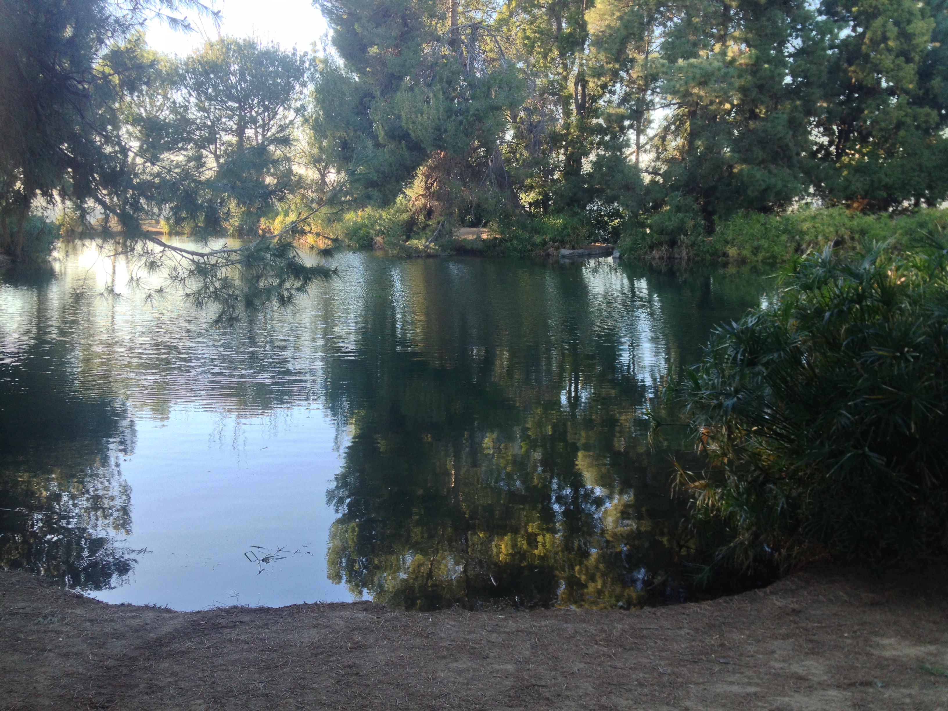
The Monterey Woods instead became a park, initially known as Rose Hill Regional Park and later renamed Ernest E. Debs Regional Park, a California State Assembly member from 1942 to 1947, a Los Angeles City Councilman from 1947 to 1958, and a member of the Los Angeles County Board of Supervisors from 1958 to 1974. Today the park is an important green space and although seemingly dominated by evergreens and the non-native (despite its name) California Pepper Tree, it’s also the home to California Walnut (Juglans californica) and California oak woodlands (Quercus wislizeni) habitats. I tried to identify bird calls, recognizing mourning doves, crows, and humming birds. There were all kinds of floral smells although all that I could positively identify were some sort of evergreen and, near Peanut Lake, marijuana smoke.
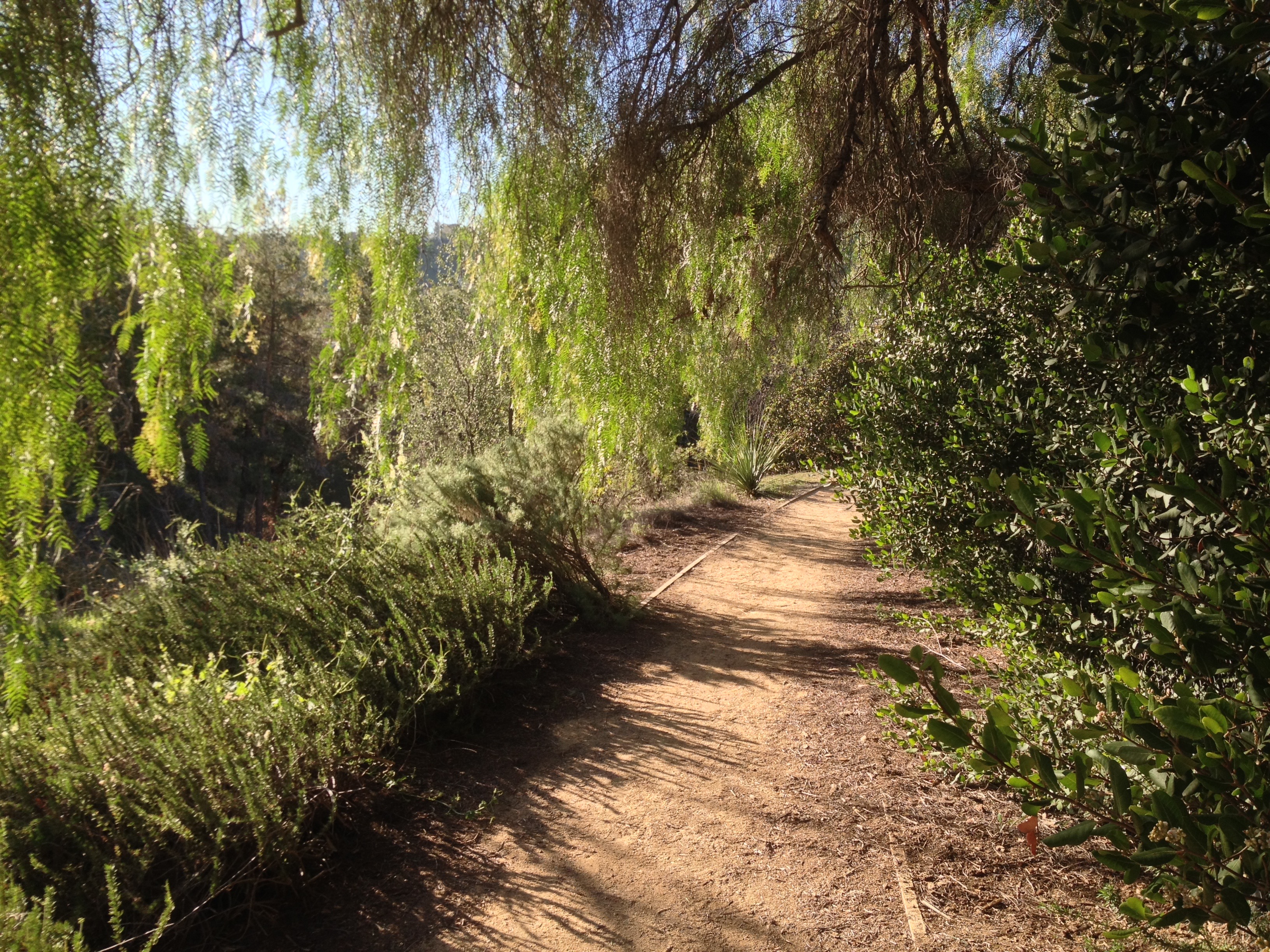
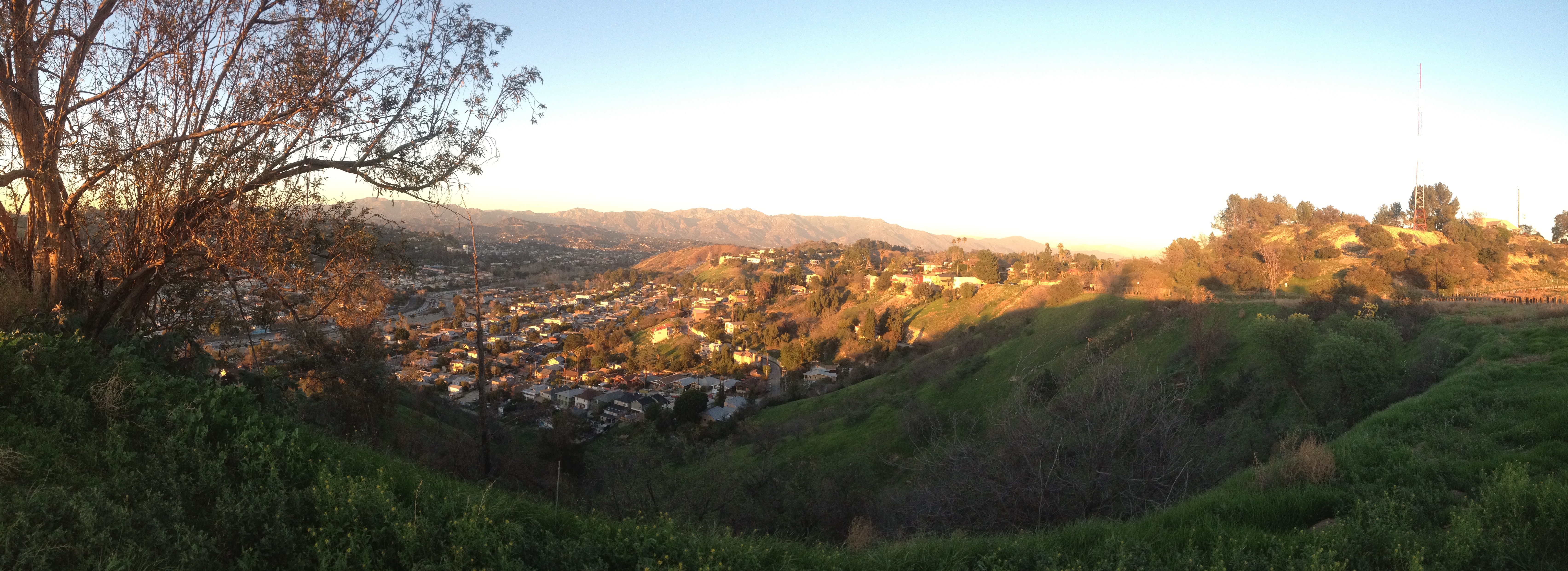
Montecito Heights is also home to a 69 hectare network of undeveloped hillsides collectively protected as Montecito Heights Open Space.
HERITAGE SQUARE MUSEUM
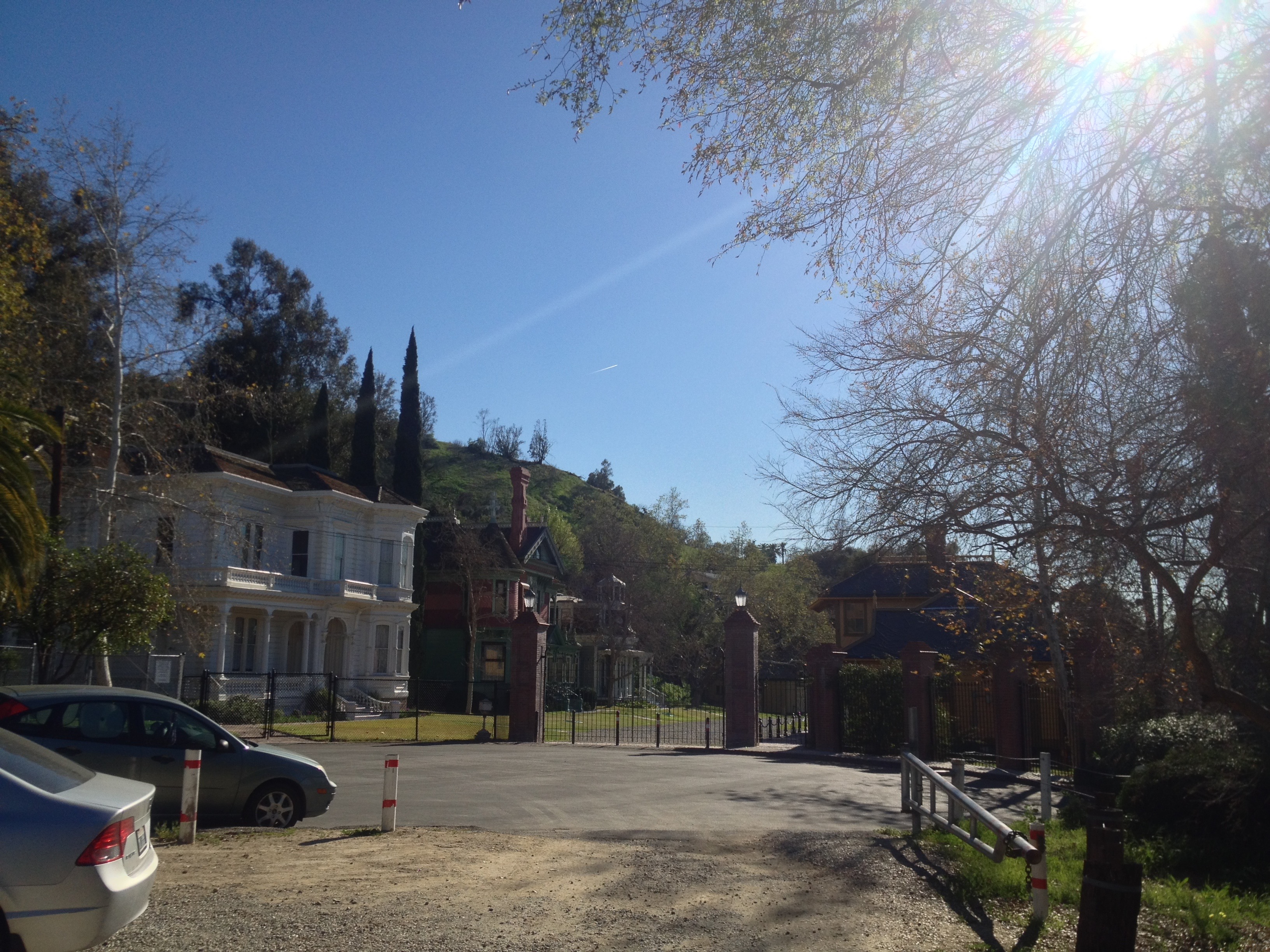
Those distinctly Victorian rooftops which I first spied from the Arroyo Seco Parkway when visiting Los Angeles turned out to be part of another sort of protected habitat, Heritage Square Museum. Heritage Square is a “living history museum” that was created to preserve structures which were in danger of being destroyed in the face of rapid, urban expansion. The Los Angeles Historic-Cultural Monument program had been established in 1961 with the purpose of identifying and registering significant properties, but with no power to save them. In 1969, the Cultural Heritage Foundation was created which led to the establishment of Heritage Square that same year. The last two Victorian homes from Bunker Hill (Salt Box and the Castle) were relocated there shortly after but soon destroyed by an arsonist. There are still, however, many impressive buildings there and the museum regularly hosts the Vintage Fashion Show and Tea, L.A. Heritage Day, and Silent and Classic Movie Nights.
MONTECITO HEIGHTS COMMUNITY CENTER
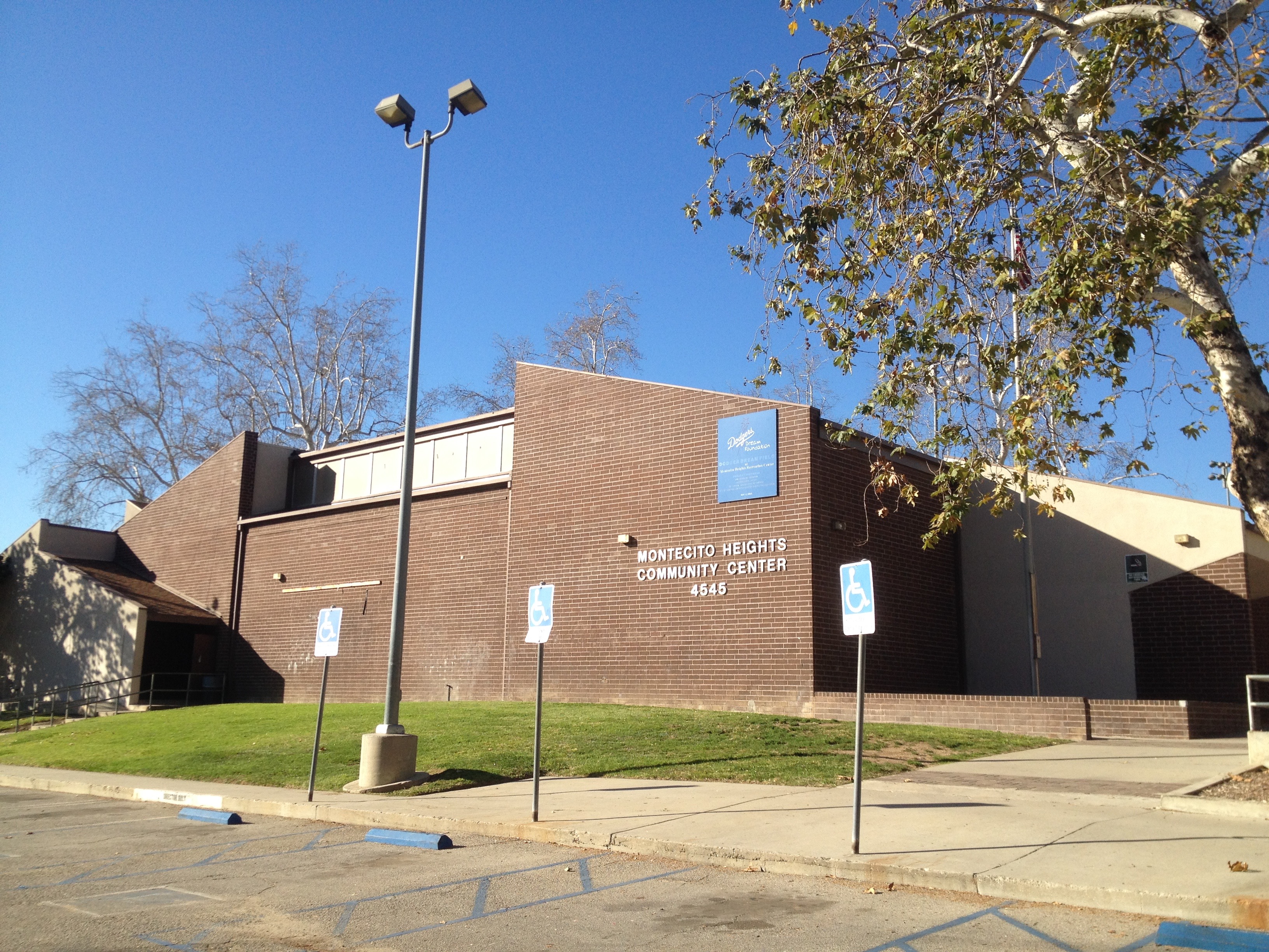
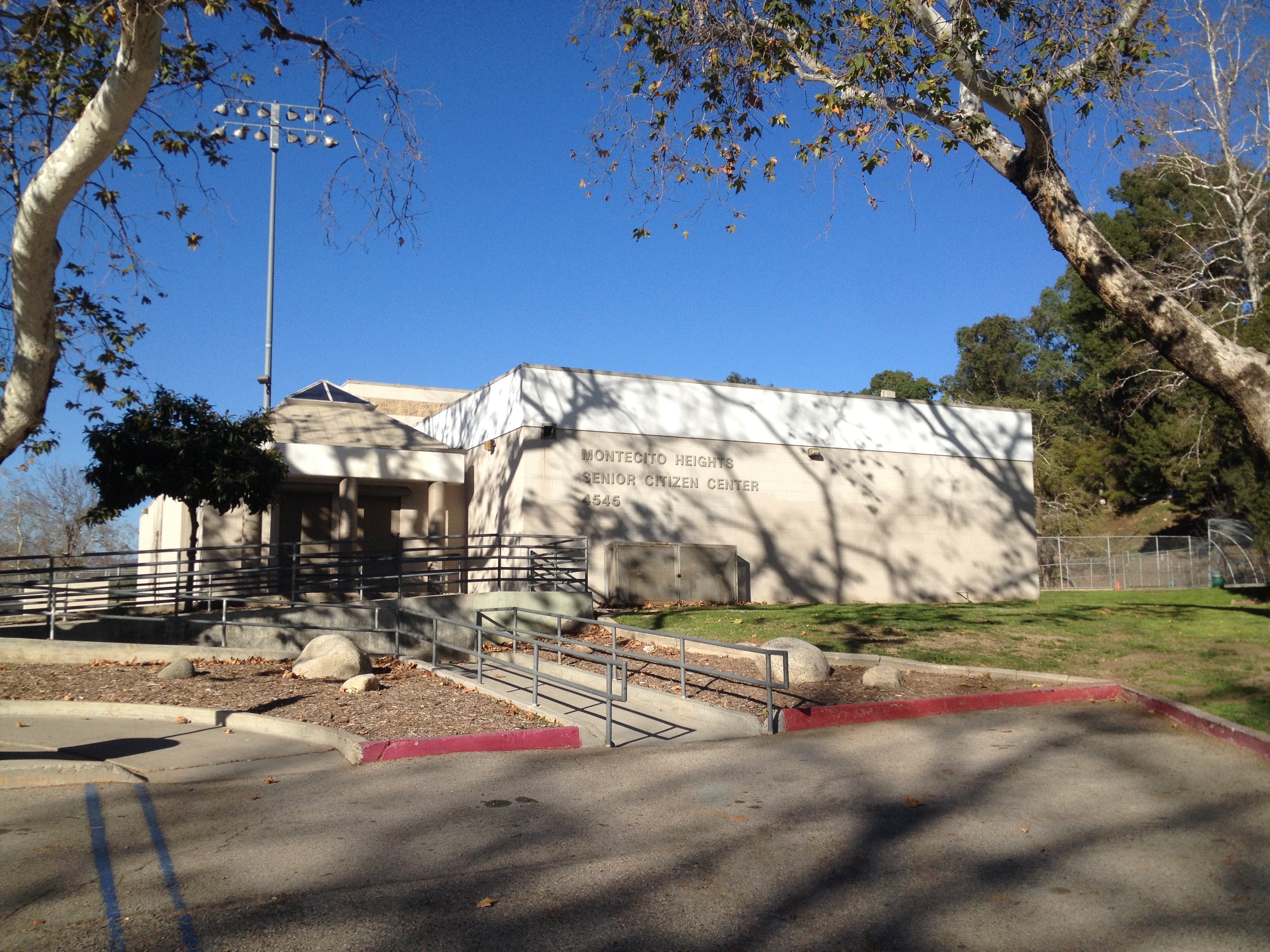
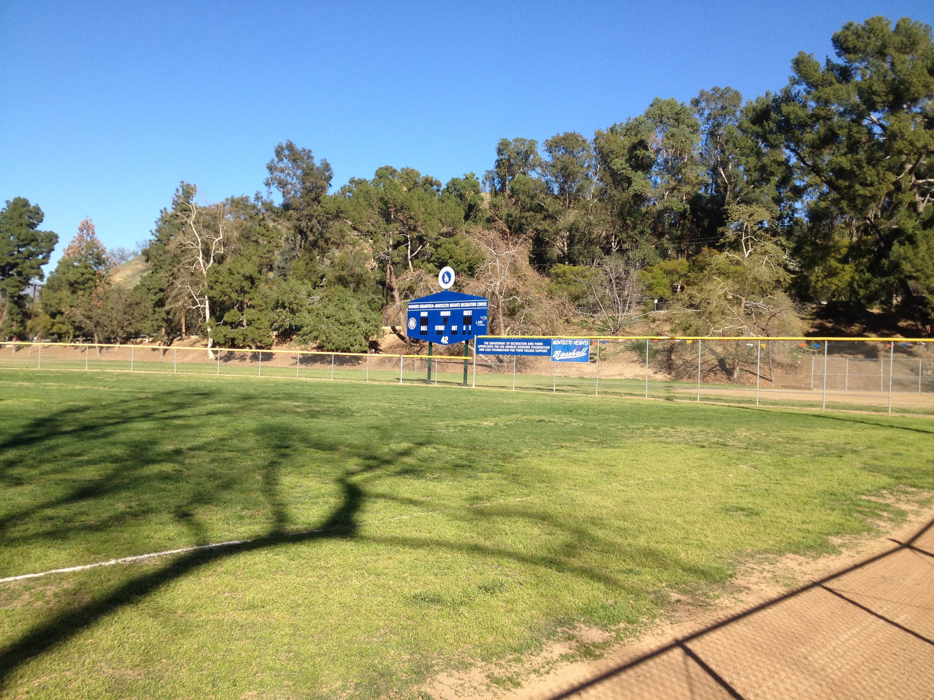
The Montecito Heights Community Center is home to the Montecito Heights Senior Citizen Center, an auditorium, basketball courts, a children’s play area, an indoor gym, picnic tables, tennis courts, volleyball courts, a weight room, a soccer field, and two baseball diamonds. In 1995, six members of Cypress Park were shot at one of the baseball diamonds by members of the Avenues. In response, City Councilman Mike Hernandez, invited a group of Tibetan Monks to help solve the violence. I don’t know what effect it might have had but although I saw several Avenue 43 placas on the walls and scratched into the sidewalk, no one was shot during my visit to the community center.
AUDUBON CENTER
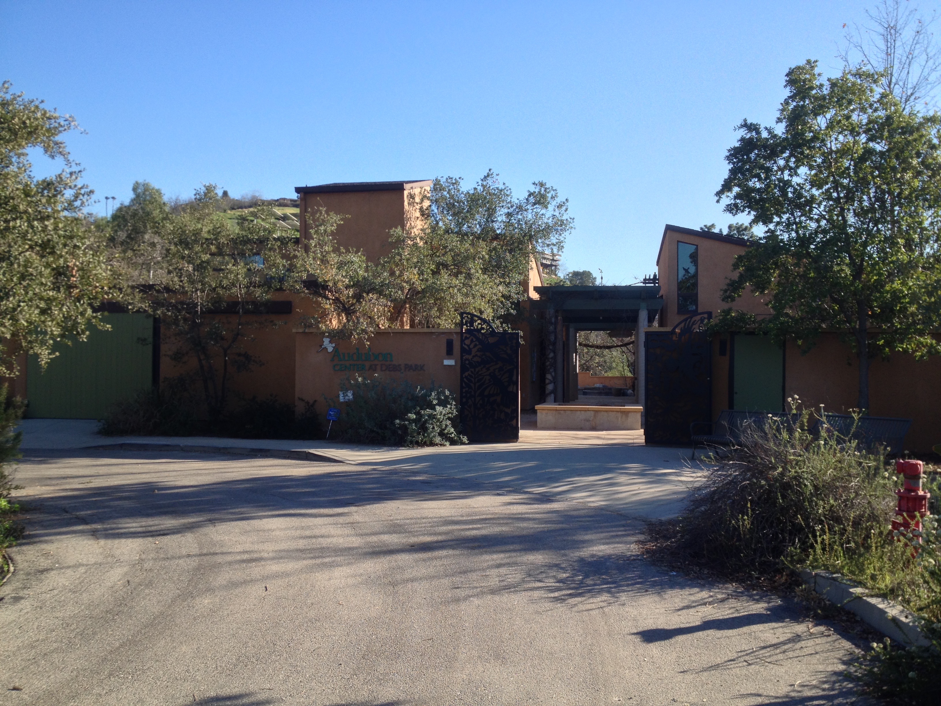
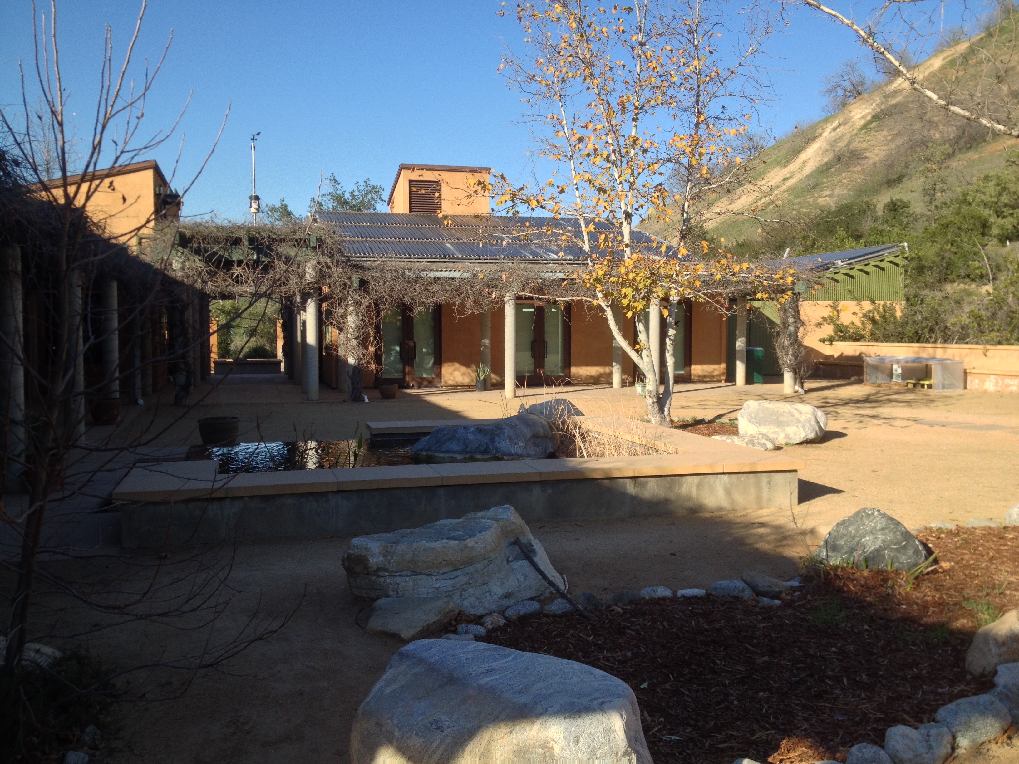
Up the hill (a public staircase here would do wonders) from the community center on Homer Street is the Audubon Center at Debs, the first carbon-neutral building constructed in the US. The National Audubon Society is a non-profit environmental organization dedicated to conservation, incorporated in 1905. The center, which opened in 2003, is open Tuesday through Saturday from 9am to 5pm. It, too, seems to function a bit like a community center (another reason to link them via a public stair) — hosting and co-hosting events like the 4 Mile Hill Challenge, free classes, and other events.
CHARACTER TODAY
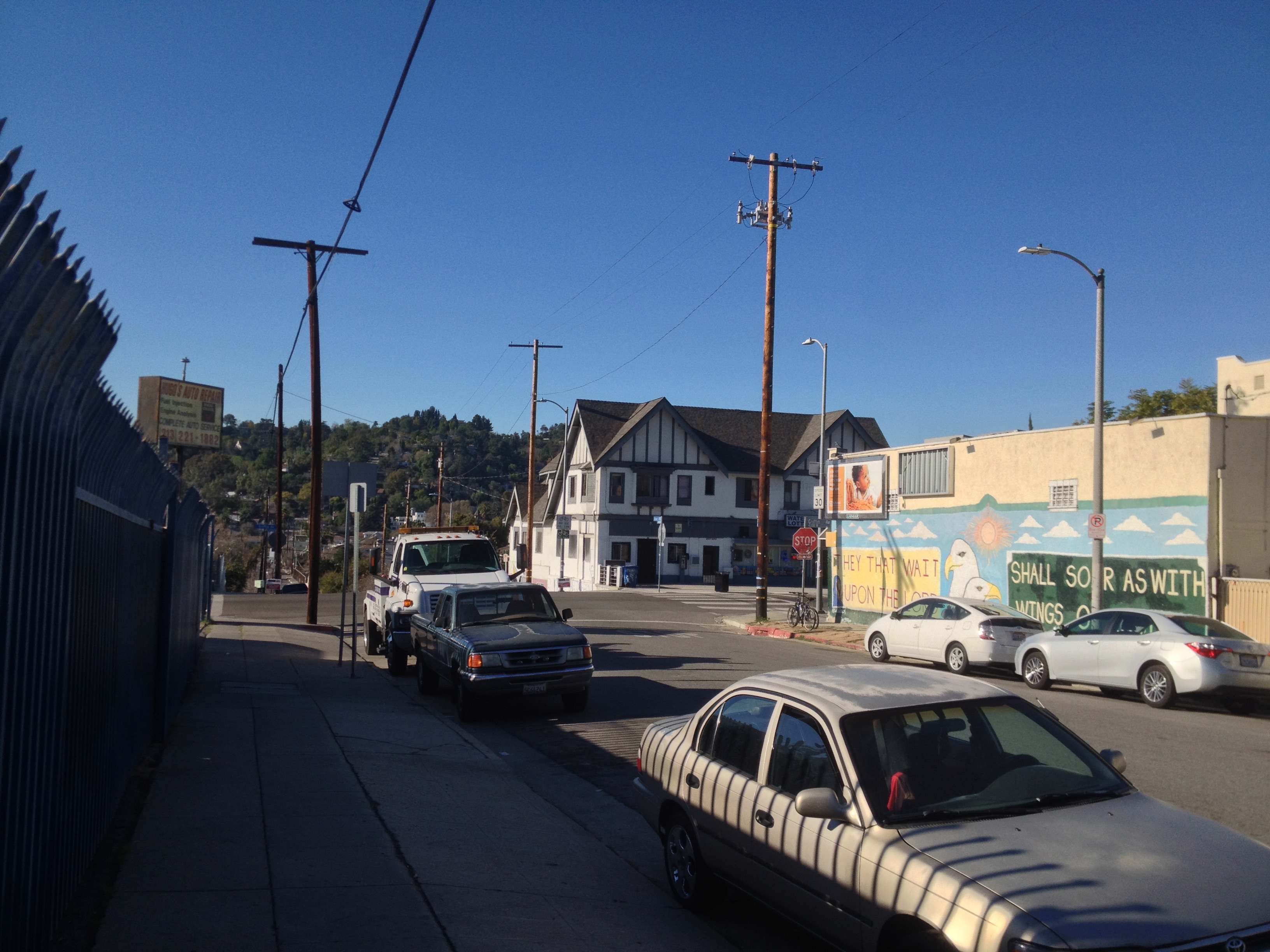
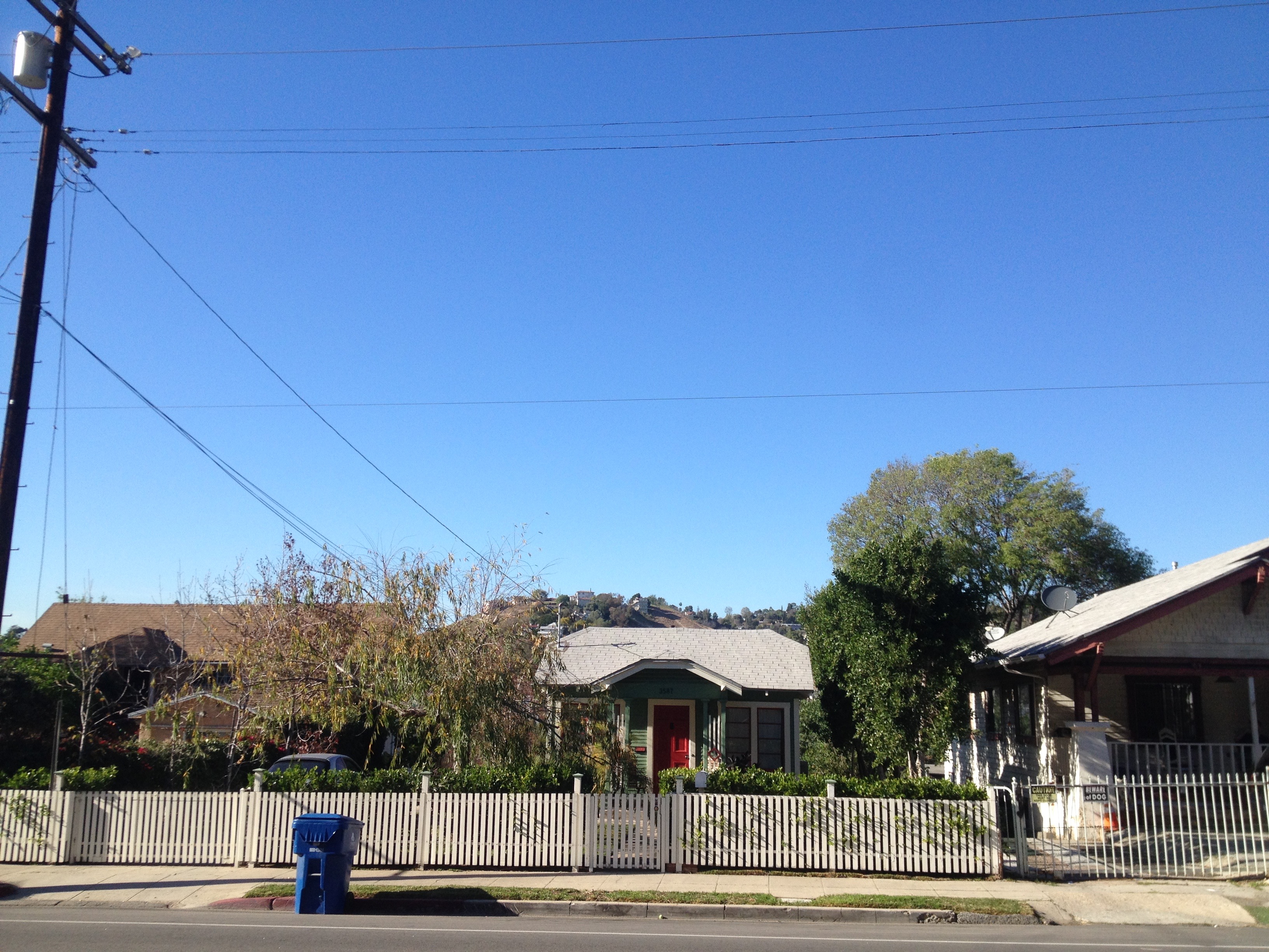
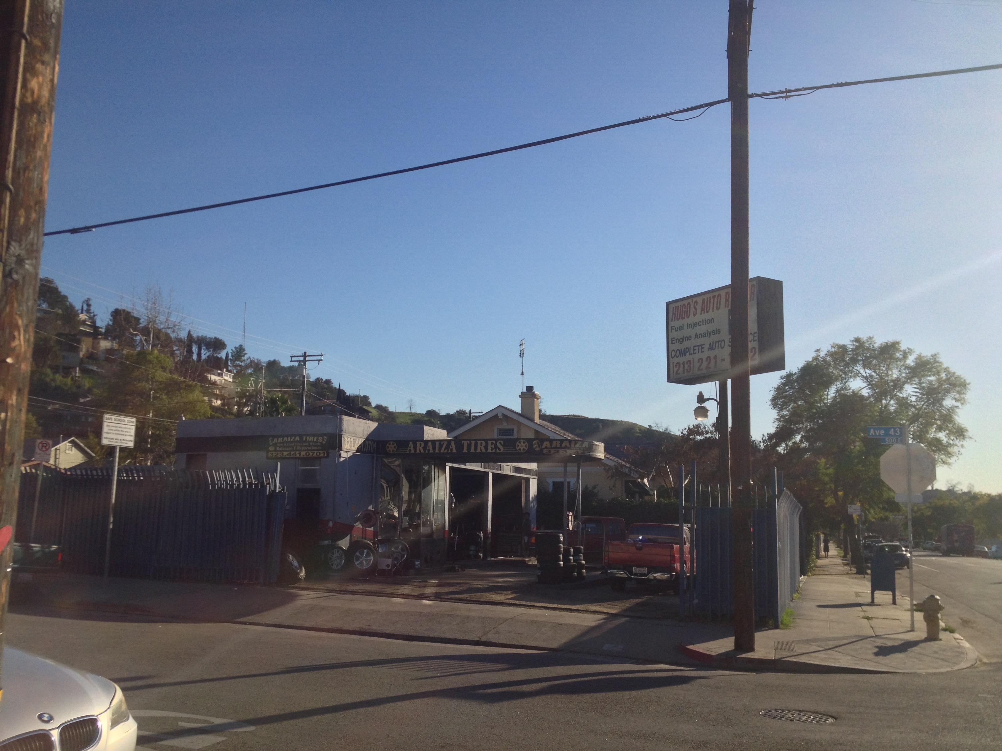
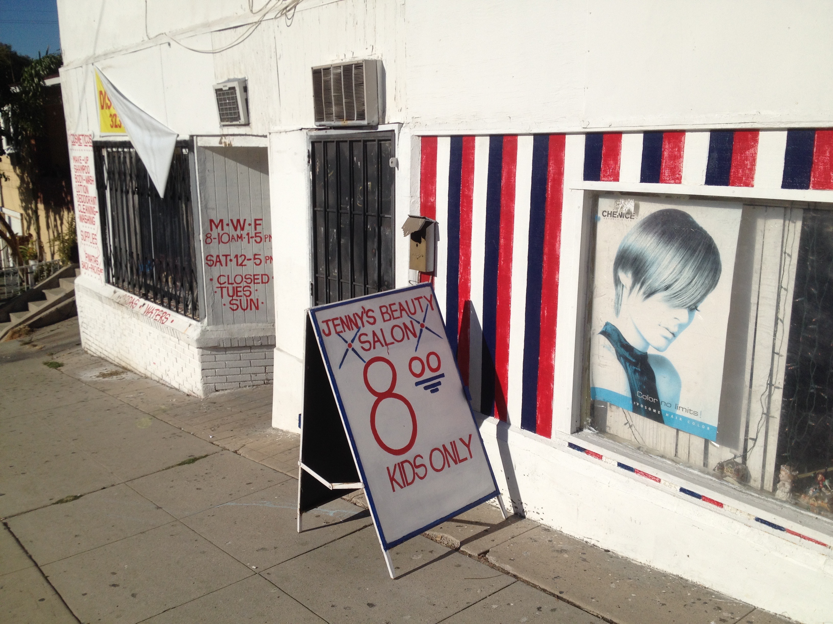
Excluding Debs Park, Montecito Heights is almost entirely residential. There is a tiny “downtown” located at the intersection of Avenue 43 and Griffin Avenue. That small area is home to CK Sunrise Market, Rodriguez Market, a Metro bus stop, Araiza Tires/American Motor Trends, Vanessa’s T-shop, Jenny’s Beauty Salon, J&S Marin Discount Store, and around the corner is an elementary school, Latona Avenue School. It has a charm but it’s hardly bustling and doubtful that most Montecito Heights residents head there on most errands.
In fact, due to its hills, lack of businesses, lack of bike lanes, lack of public transit, and not-quite-suburban (sub-rural?) character, it’s probable that most Montecito Heights residents are almost completely car-dependent — just like the real country! Indeed, in the hours that I spent exploring just about the only pedestrians I encountered were seemingly obligated by their dogs to walk and I suspect that a few of them would walk and pick up after their canines from their cars if they could figure out how to do so. It is possible, I suppose, to live car-free in Montecito Heights as there are businesses along Figueroa over in Sycamore Grove and the 252 bus connects to Boyle Heights, Sycamore Grove, Lincoln Heights, Rose Hill, and El Sereno as well as the 251, Gold and Silver lines. As of the 2010 census, 42% of Montecito Heights were foreign born, mostly in either Mexico or El Salvador. About 73% of the population is Latino of any race, 14% of residents are white, and 12% are Asian — mostly Chinese.
It should be mentioned that there are people who come to Montecito Heights for the express purpose of walking. Charles Flemming’s Secret Stairs involves walking along the public stairways and stair streets of Montecito Heights and Happy Valley to which the author ascribes a difficulty rating of five out of five. The website Modern Hiker offers instructions for an 8.4 kilometer hike which author Casey Schreiner rates Easy-Moderate.
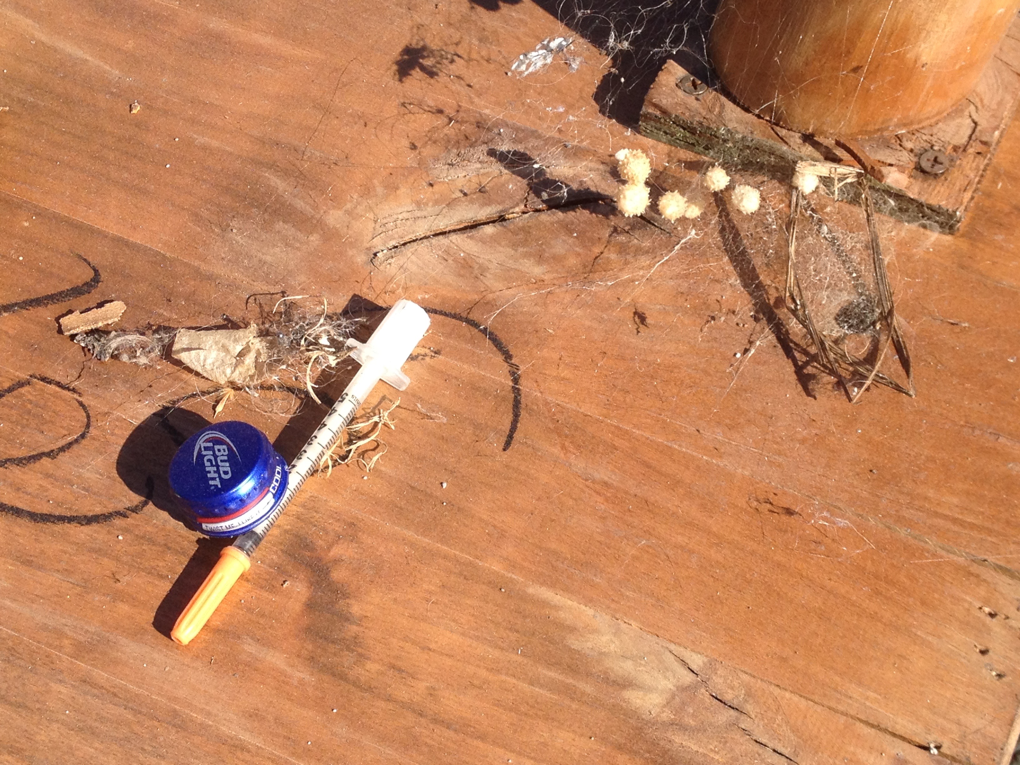
Loren MacArthur’s 1984 book, L.A. bike rides: a guide to 37 specially selected bicycle routes in Los Angeles County includes both a seven and a 10.6 kilometer ride through that involve rides through Montecito Heights. Currently the Arroyo Seco Bike Trail only parallels a 3.4 kilometer stretch from Mosher Avenue in Montecito Heights’ north to Lower Arroyo Park in South Pasadena. There are undeveloped areas south of the bike trail, although it was littered with garbage including old CRT television sets, wheels and tires, bedding, needles, and (perhaps symbolically) a kitchen sink. The area is currently served by City Councilman Gil Cedillo, who has a track record of opposing cycling infrastructure improvements, claiming they only benefit bicycling “extremists.”
SOCIETIES, ORGANIZATIONS, FURTHER READING, &c
Montecito Heights is part of Los Angeles City Council District 1. It is also served by Montecito Heights Improvement Association, established in 1964. In 2001, the Arroyo Seco Neighborhood Council was founded to serve residents of Hermon, Montecito Heights, Monterey Hills, Mount Washington, and Sycamore Grove.
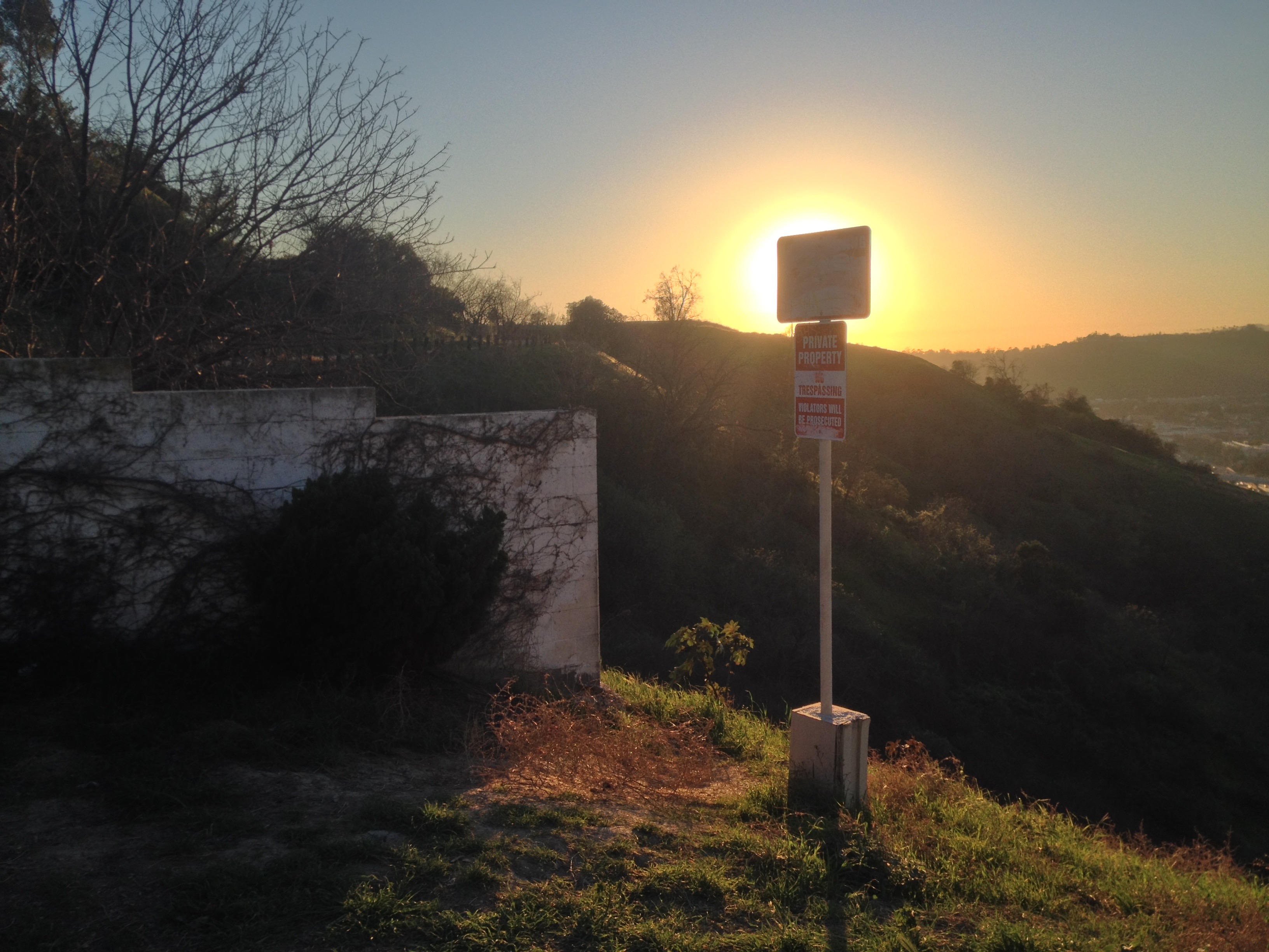
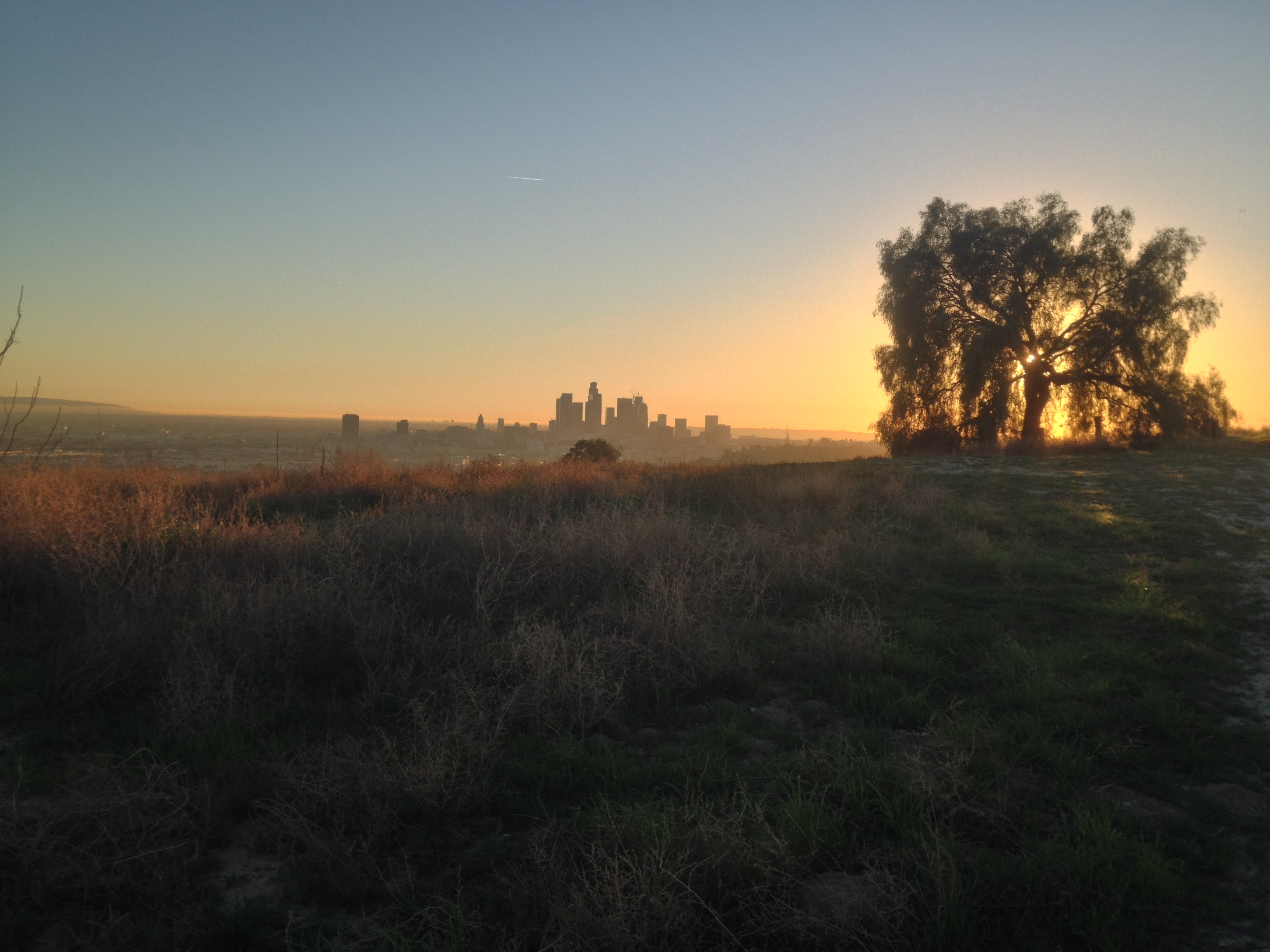
I decided to end my exploration by watching the sunset from Mount Olympus, known to most as “Flat Top” or “Flattop” hill. There was a family up there. Someone named Ruben posted a sign imploring visitors to people to keep the area clean, which it mostly was (a few solo cups aside). Not only could I see Downtown Los Angeles but Downtown Glendale, Downtown Alhambra (distinguishable by the presence of the shiny, “blue cube“), Century City, Downtown Long Beach, and the Pacific Ocean, shimmering in the golden glow.
To vote for any communities you’d like to see covered in California Fool’s Gold, name them in the comments.
Support Eric Brightwell on Patreon

Eric Brightwell is an adventurer, essayist, rambler, explorer, cartographer, and guerrilla gardener who is always seeking paid writing, speaking, traveling, and art opportunities. He is not interested in generating advertorials, cranking out clickbait, or laboring away in a listicle mill “for exposure.”
Brightwell has written for Angels Walk LA, Amoeblog, Boom: A Journal of California, diaCRITICS, Hidden Los Angeles, and KCET Departures. His art has been featured by the American Institute of Architects, the Architecture & Design Museum, the Craft Contemporary, Form Follows Function, Los Angeles County Store, the book Sidewalking, Skid Row Housing Trust, and 1650 Gallery.
Brightwell has been featured as subject in The Los Angeles Times, VICE, Huffington Post, Los Angeles Magazine, LAist, CurbedLA, Eastsider LA, Boing Boing, Los Angeles, I’m Yours, and on Notebook on Cities and Culture.
Brightwell has been a guest speaker on KCRW‘s Which Way, LA?, at Emerson College, and the University of Southern California.
Brightwell is currently writing a book about Los Angeles.
You can follow him on Ameba, Duolingo, Facebook, Goodreads, iNaturalist, Instagram, Mastodon, Medium, Mubi, the StoryGraph, and Twitter.


I am particularly interested in the plaque marking the pueblo’s corner. Can you tell me where the other three are located?
LikeLike
amazing… thanks so much for the history of our home.
LikeLike
Thank you for the kind words. Always nice to hear. Glad you enjoyed and hoped you learned a little about the community, as I did.
LikeLike
hi. lincoln hts equity police here- the map presented is incorrect and a danger to our community.hear me now .the legal border of montecito hts and lincoln hts council district lies directly in front of fenn tower. in a straight line that runs parallel with the fault line clean east to west and bisects the hill laterally. everything south of amy semple mcphersons antenna and all up 28 and johnston is lhts. lincoln heights flattop on thomas is the og iconic flattop and the other ones ours too . so . .Lincoln Heights doesnt undersstand why montecito heights in the 90s put up a gate on our road restricting the indigenouse poc lincoln hts to the bone from their right to public right of way on their land. montecito hts said too many gangsters and partying. and now well they stole the name of our historic cultural asset. beloved Flat Top . they made national news saying they saved flat top as public space. thats is untrue and dangerous. when its not protected and its not even in their jurisdiction. its private property being hoarded by developers.,..now our struggling community is up against 10 luxury mega developments up there because we got set up.. its not a park and its not saved. and its not montecito heights. somebody needs to call up hilda solis and cedillo and tell them to retract the fale press “Gil cedillo saves beloved Flat top as public park” . the map on this page is the same one thats on nextdoor. hate to say it but the only people buying our houses are rich and non poc. they have seized our hills and they also just straight up call us montecito hts on google maps. its a reeal estate gentrification tool. moving boundaries is theft. and they just keep callin us montecito hts. the irony is the difference is, lhts has the lowest home ownership rate in la and 64 % of kids are in poverty. thts our land our backyard. #environmentaljustice and #endwhitesupremacy. #FREEFLATTOP
LikeLiked by 1 person
not fenn. i meant radio rd
LikeLiked by 1 person
If you check the Arroyo Seco Neighborhood Council Bylaws, the boundaries for the southern boundary of Montecito Hts. runs from Mercury to Sierra St.
Click to access Arroyo-Seco-Neighborhood-Council-Map1.pdf
LikeLike