

FOREWORD
Most of the communities that I explore and feature in California Fool’s Gold were chosen by popular vote but I explored Victor Heights for different reasons. Firstly, as one of the more obscure corners of Mideast Los Angeles (MELA), it’s long-held for me a certain appeal. Secondly, Big Red’s check engine light went on and so I decided to walk its streets whilst the car was serviced by Donny at Far East Auto Repair.
INTRODUCTION TO VICTOR HEIGHTS
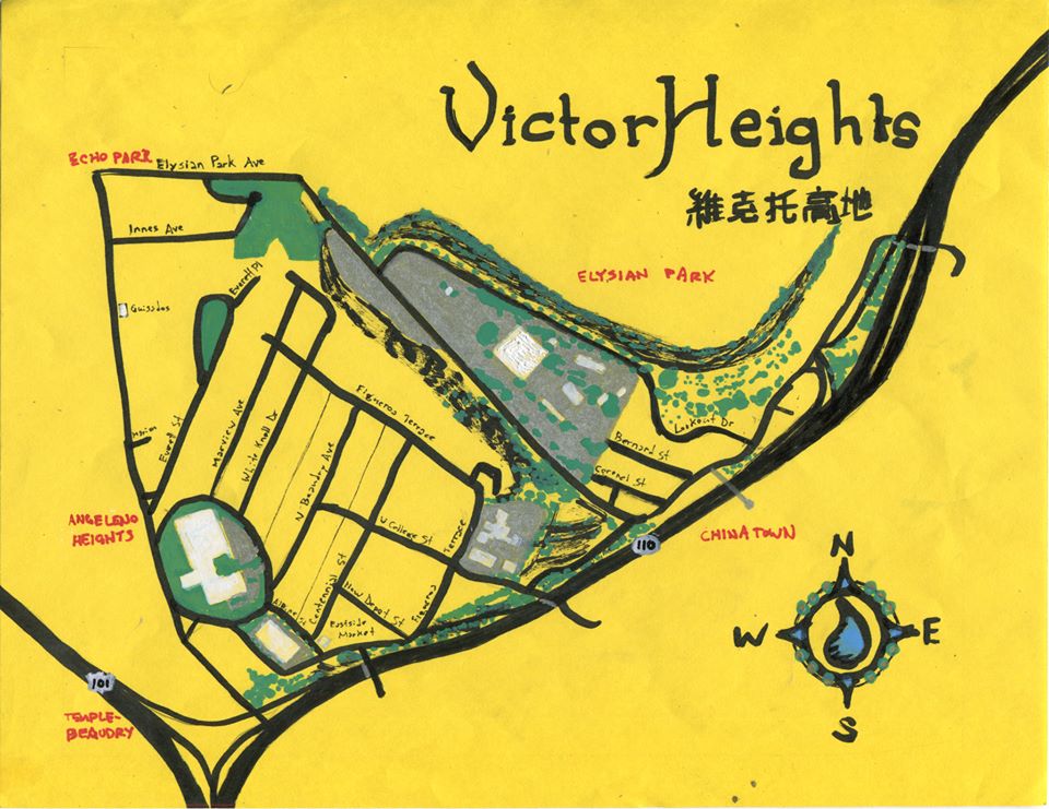
Victor Heights is a small neighborhood located east of Echo Park proper, northeast of Angeleno Heights, southwest of Elysian Park, and northwest of Chinatown. For those who don’t live within Victor Heights, it’s often thought of as being part of either Chinatown or Echo Park. For those that do live within it’s sometimes jokingly referred to as “Forgotten Edge.” East of Centennial Street, road signs are written in both English and Chinese and there are banners hung welcoming visitors to Chinatown. West of Centennial, street signs are written only in English — except when someone takes it upon her or his self to translate them with chalk… which I have observed in the past. Down along Sunset Boulevard is a hideous (and hideously expensive) electronic sign that claims the neighborhood for Echo Park and does little else; not only does it not say Victor Heights, it doesn’t even perform its intended function of providing traffic information and only cost $240,000 dollars more than any number of free apps that actually do. There are no blue signs recognizing Victor Heights but neighborhoods don’t require recognition from the LA DOT to exist.
HISTORY OF THE AREA
Victor Heights is situated near the southern terminus of the Elysian Hills, a small chain of sandy siltstone landforms with minor imbedded conglomerate that stretches from the Santa Monica Mountains (the portion known as the Hollywood Hills) in Griffith Park down to the Bunker Hill neighborhood of Downtown. For many thousands of years, the mountains were home to black walnuts, bobcats, California Kingsnakes, Coastal Whiptails, Garter snakes, Gopher snakes, grizzly bears, Mountain Kingsnakes, mountain lions, oaks, steelhead, sycamores, Western fence lizards, and other forms of life.
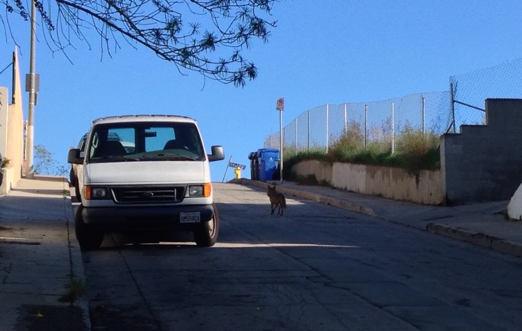
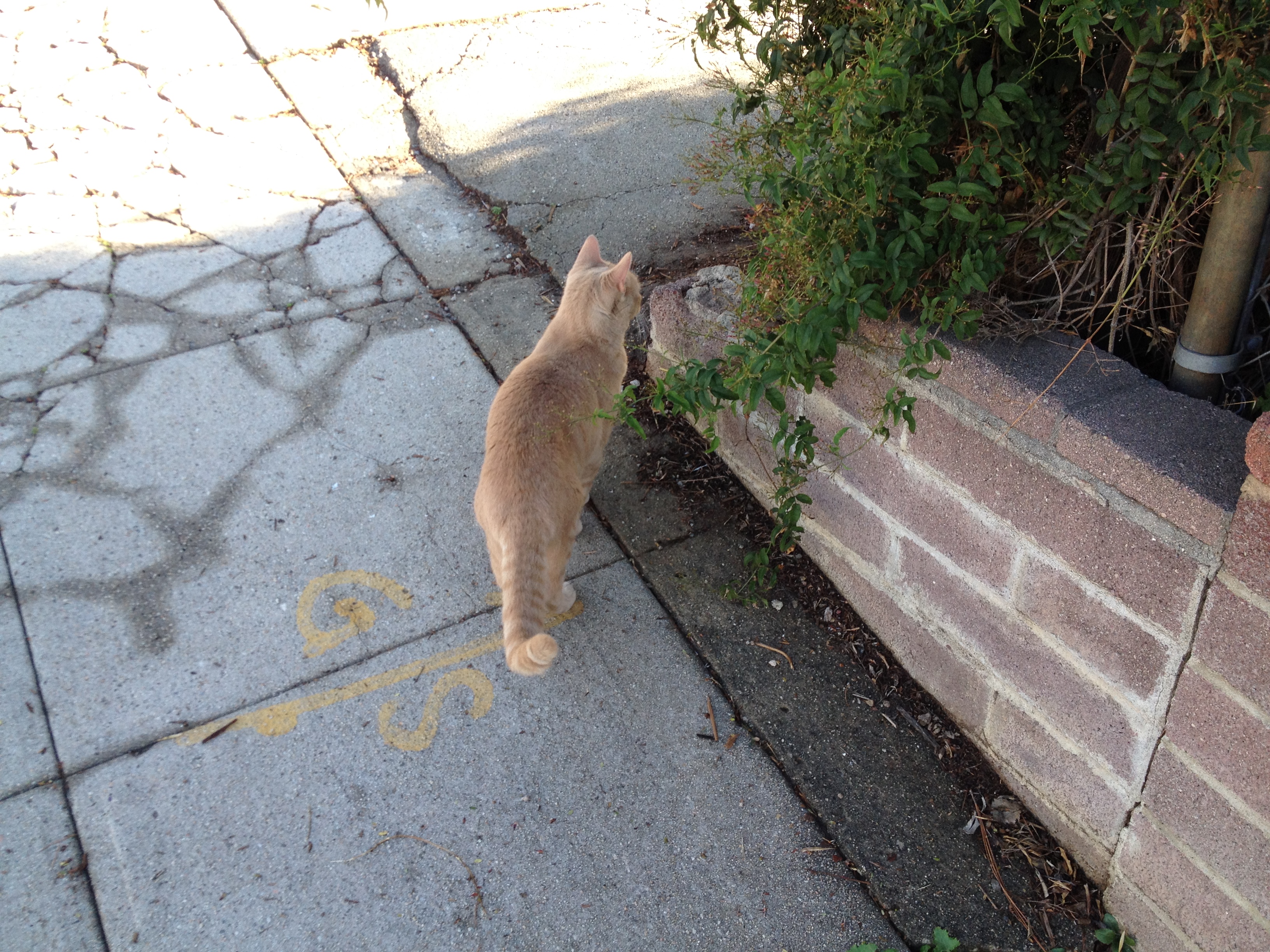
As I climbed Mariview Avenue, a coyote trotted past me, impatiently hopping off the sidewalk to pass me on my way up and making certain that its species was added to the list of natives. There are also lots of cautious cats, in spite of the coyotes, and tellingly, a few “Missing Missy” posters too.
The first of the human transplants were the ancestors of the Chumash, who arrived in the area at least 13,000 years ago. By the time the Tongva arrived from the Sonoran Desert, some 3,500 years ago, the Chumash were primarily situated along the coast and the Channel Islands, possibly having abandoned much of the Los Angeles Basin in the face of a prolonged drought. The Tongva remained the dominant people in the area for some three millennia, until the Spanish came.
The groundwork for the Spanish invasion began in 1542 when Juan Rodríguez Cabrillo claimed all of California for the Spanish Empire — although in actuality he did little beyond setting foot in a few areas of the coast and islands and setting the stage for conquest. The Spanish were motivated to actually establish a presence in their till-then mostly nominal possession out of fear of encroachment by the English and Russians and in 1769 Spain sent explorer Gaspar de Portolà de Rovira on an overland exhibition of what’s now California. Not long after, military presidios and civic pueblos were established. El Pueblo de Nuestra Señora de Los Angeles de Porciuncula (Los Angeles) was founded near the banks of the Los Angeles River in 1781, about a kilometer south of what is now Victor Heights.
Los Angeles remained a small, dusty backwater for several decades after its establishment. In 1820 the pueblo’s population was only 650 people. On 27 September 1821, after eleven years of fighting, Mexico achieved independence from Spain, and in 1835, Los Angeles was made the capital of California. US forces invaded in 1846 and in 1848, Mexico was defeated. In 1850, California became the 31st state and Los Angeles was incorporated.
VICTOR BEAUDRY
Quebecois brothers Prudent and Victor Beaudry first increased their fortunes (having been born wealthy) in Northern California with a variety of business pursuits before moving to Los Angeles where Prudent entered politics (from 1874 to 1876 he served as Los Angeles’s thirteenth mayor). Victor mined, developed waterworks, and worked in real estate before moving to Los Angeles in 1855. He and his mining partner (and fellow Quebecois) Damien Marchessault built an ice house in Los Angeles in 1859 — the year Marchessault became mayor — and sold ice to saloon keepers and others.
In the 1860s, the Beaudrys bought land in and around the French Town section — an historic neighborhood centered around Alameda and Aliso streets whose existence today is mainly seen in street names like Bauchet, Ducommun, and Vignes. Beaudry went on to increase his fortunes in silver mines and simultaneously earned the nickname the “water king” as he developed water transportation systems for both mines and in town. After the mines began to prove less profitable, Victor moved to Montreal in 1876 where he married Angelica Le Blanc. The couple and their family moved back to Los Angeles in 1881 where he remained until 1886.

In Los Angeles, the Beaudry brothers built a water reservoir in the Elysian Hills and used it to hydrate their properties there including Bunker Hill (subdivided in 1876), and what would become Angeleno Heights and Victor Heights. To make their properties more appealing to potential homebuyers, the Beaudrys created two parks, Bellevue Terrace and Beaudry Park. Beaudry Park was a 3-hectare oval property designed by landscape architect/gardener Francis Tamiet and included many Mexican limes, gums, cypresses, oranges, and Monterey pines. (Further reading: Nathan Masters’s Bellevue Terrace and Beaudry Park: L.A.’s Two Lost Hilltop Gardens and Glen Creason’s CityDig: Prudent Beaudry’s 1868 L.A.)
In the canyon behind Victor Heights, the scene was less Edenic. There the canyon confluence of Chavez Ravine and Sulphur Ravine was home to a “pest house” and the old Hebrew Cemetery. Smallpox had first arrived in Los Angeles in 1862 and the pest house was built to house the indigent (mostly Irish, Mexican, and Native American) sufferers beyond the city’s borders. In 1870, however, the Daughters of Charity of St. Vincent de Paul moved the Los Angeles Infirmary to Dogtown and at their request, the pest house was relocated nearby to the land near what’s now the edge of the parking lot of Dodger Stadium.
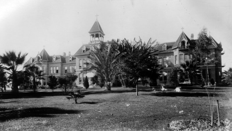
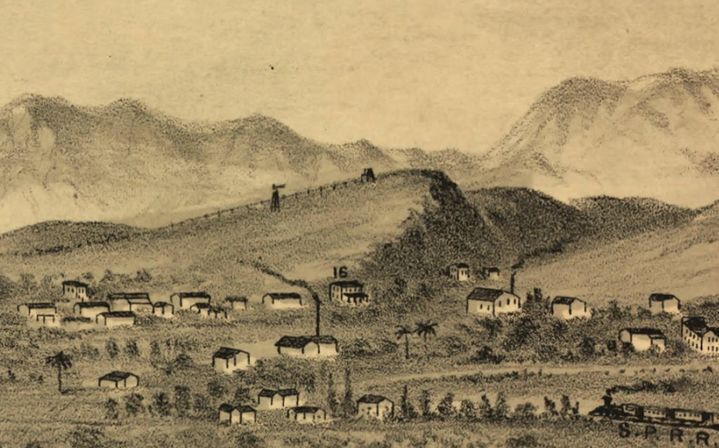
The Southern Pacific Railroad opened the city’s first transcontinental railroad depot in Dogtown in 1875, nicknamed the Ellis Island of the West for the many European and Chinese immigrants who passed through it. The presence of a massive train yard in the vicinity of the infirmary proved less than ideal for patient wellbeing and in 1883 the sisters began selling off lots of their New Depot Tract and Infirmary Tract to fund the purchase of new properties. In 1884 they bought Beaudry Park for $10,000 and it became home to St. Vincent Hospital, which was colloquially known as Sisters Hospital and there remained until 1927 when it was damaged by a fire. Afterward, the sisters and their hospital moved over to Westlake.
TRACT SUBDIVISION
In 1886, William W. Stilson and Everett E. Hall subdivided their tract, Angeleno Heights, on land purchased from Prudent Beaudry. Although the tract included Everett Park, today few if any think of that area as Angeleno Heights. There are no signs designating it as such and it is not included within the Angeleno Heights Historic Preservation Overlay Zone. Victor Heights was also subdivided in 1886, by a consortium comprised of Alex Penny, C.E. Day, Dr. Lotspeich, J. H. Hinton, M.L. Wicks, M.P. Snyder, H. T. Newell, and T.C. Narramore. That year of the sale was the same year that Victor Beaudry returned to Montreal, where he died two years later.
At that time Chavez Ravine, Dogtown, Lincoln Heights, Solano Canyon, Sonora Town, and Victor Heights were colonized by an influx of Italian immigrants whose community had largely been displaced by the construction of another train station, Southern Pacific Arcade Railroad Depot, in 1888. The neighborhoods of Bishop, Chavez Ravine, La Loma, and Solano Canyon were also home to largely Mexican immigrants and their descendants (what’s now Chinatown was home to the Mexican neighborhood of Sonora Town and later, Little Italy). (Further reading: Nathan Masters’s Sonoratown: Downtown L.A.’s Forgotten Neighborhood and my own Exploring The Remains of L.A.’s Little Italy).
The rival Southern Pacific and Santa Fe depots were replaced by Union Station, the construction of which spelled destruction for the old Chinatown. Most of Los Angeles’s Chinese-American population was relocated to Little Italy, where in June 1938, both China City and Old Chinatown Plaza opened and planted the seeds of what became new Chinatown.
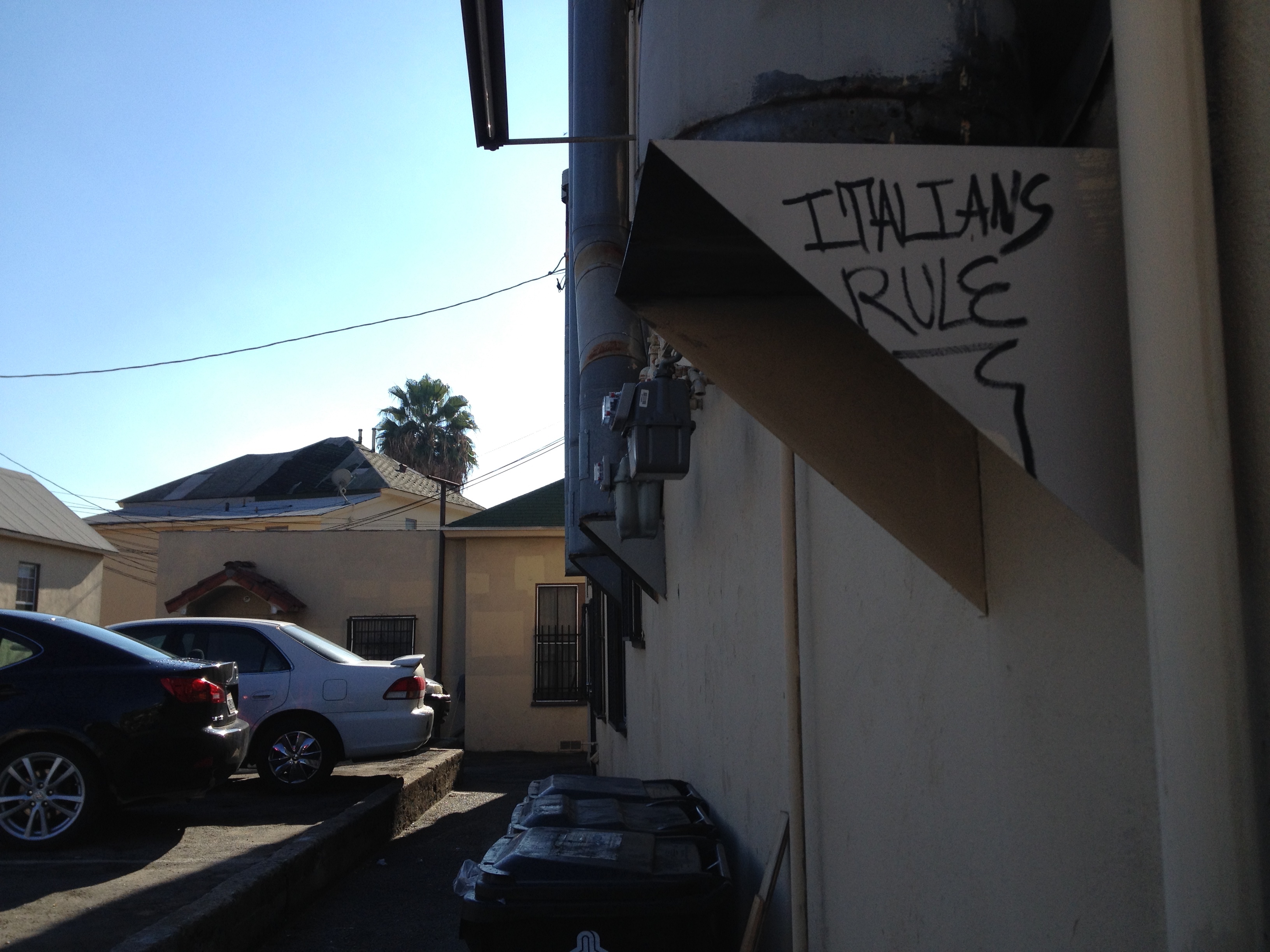
Around 1945, definitions of whiteness were sufficiently relaxed to no longer exclude Catholics, Jews, and Orthodox Christians from living in most of Los Angeles. Some of the Italians and Croatians who’d until then made Victor Heights moved east to communities like Alhambra, Arcadia, El Sereno, Monterey Park, San Gabriel, and San Marino (still home to some of the most celebrated Italian establishments including Bollini’s Pizzeria and Claro’s Italian Market). Some Italians remained in the area and in 1947 a new Saint Peter’s Italian Catholic Church was built just down the hill which in 1971 was joined by Casa Italiana.
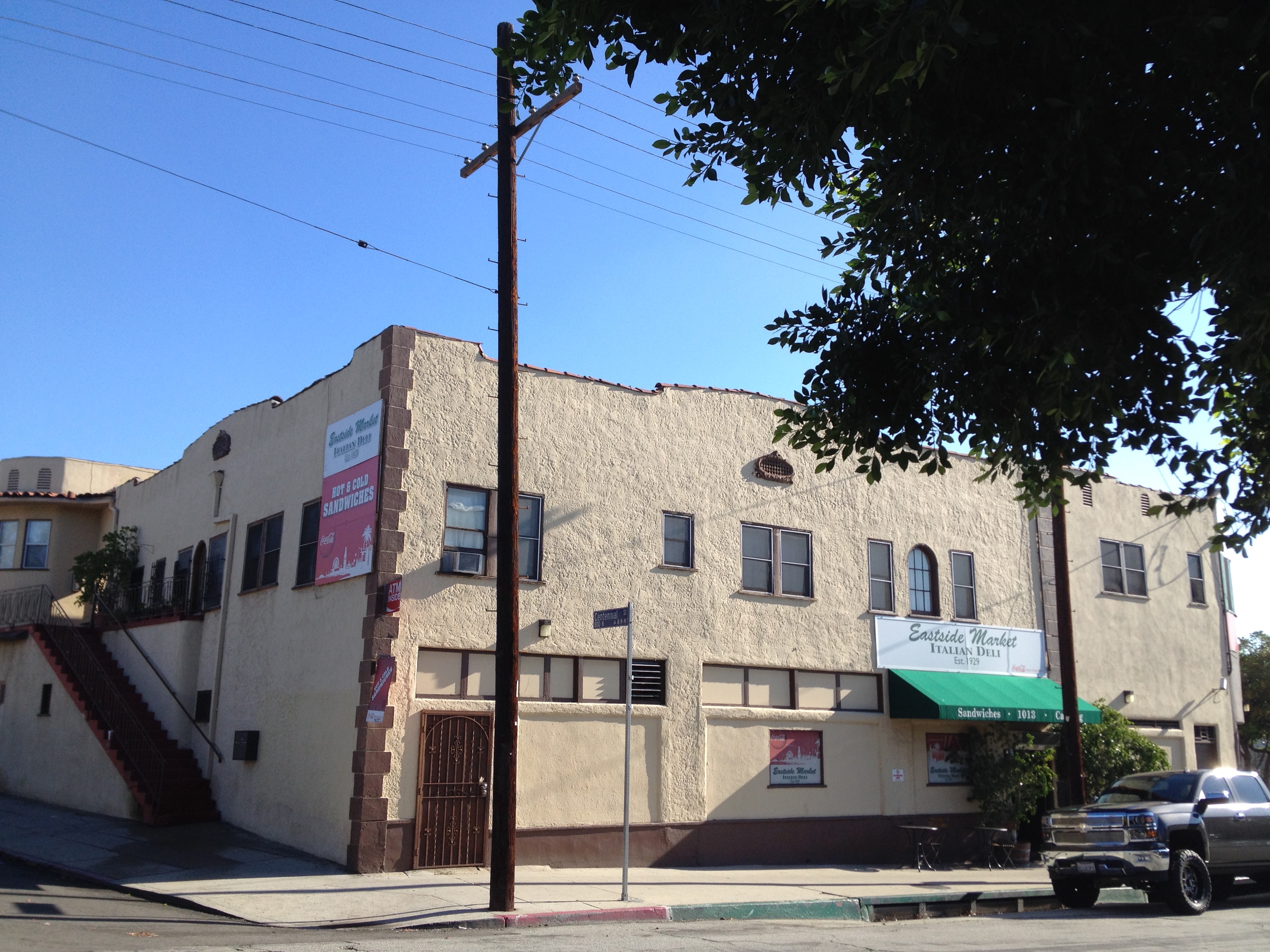
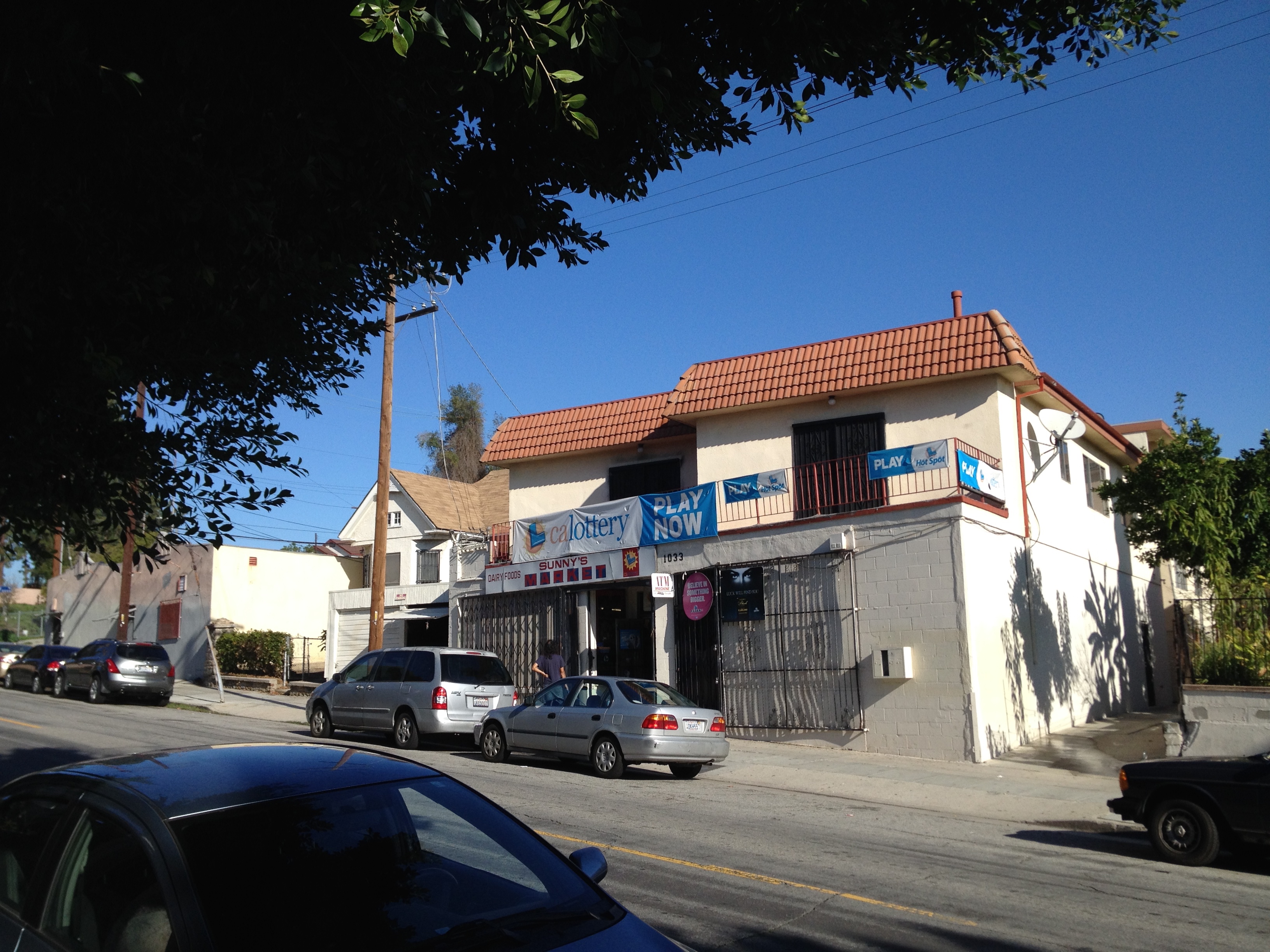
In Victor Heights, the most visible reminder of the neighborhood’s once strongly Italian character is Eastside Market and Deli. It was opened in the 1920s by Puglia-born Domenic Pontrelli across the river in the Eastside (Lincoln Heights) before moving to its current location in the Mideast in 1929. Back then Alpine Street was home to three other Italian Markets, none of which remain (although I know nothing about the history of neighboring Sunny’s Market, which seems likely to have been home to one). It was from within Eastside Deli that Pontrelli’s son-in-law launched Pontrelli & Laricchia Sausage Company which moved out of the neighborhood in 1973. Shortly after, a former clean-up boy for the sausage company, Johnny Angiuli, took over the market with his brother, a former delivery driver, and they reorganized the establishment around a new deli counter, which is its focus today.
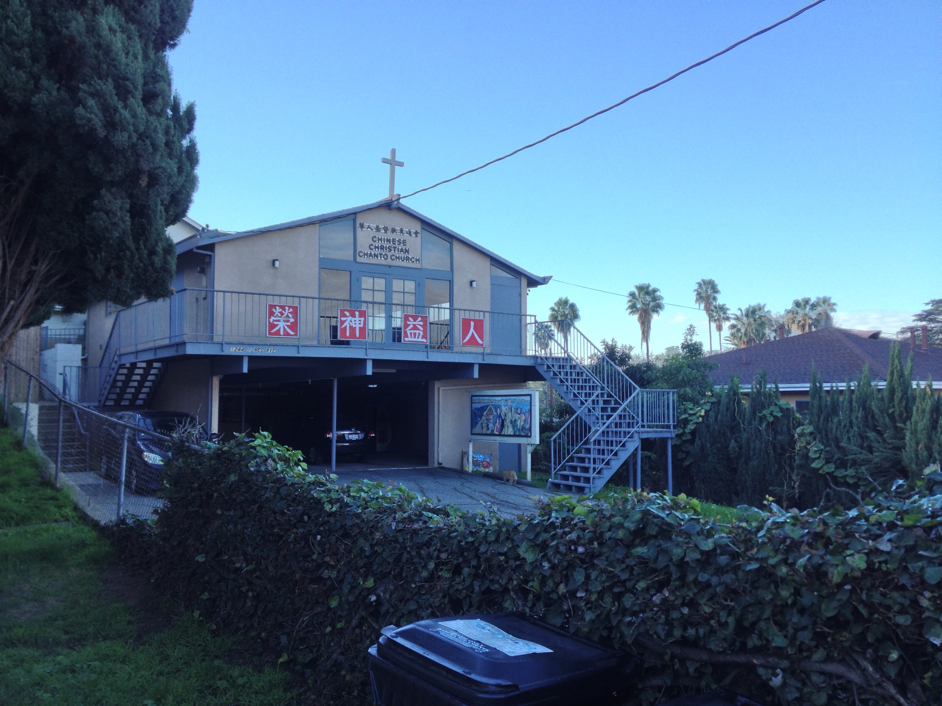
In 1945, following the formation of the Republic of China (Taiwan), an amendment to the 1945 War Brides Act allowed Chinese-American veterans to bring their wives to the US, which increased the population of Chinese and Taiwanese by about 5,000. In 1948, the US Supreme Court officially stepped in to ban the enforcement of racist housing covenants altogether, which on paper at least, opened up Los Angeles to people of all backgrounds. Located as it is just above Chinatown, Victor Heights grew increasingly Chinese in character. Today 57% of the neighborhood’s roughly 5,500 residents are either Chinese or Taiwanese. Shòu (壽) motifs, representing longevity, are found in many of the neighborhood’s security bars and fences. Shī (獅), or “Chinese Guardian Lions” protect many of the homes and apartments. The only church in the neighborhood is Chinese Christian Chanto Church (華人基督教真道會).
In 1949, the Housing Authority of the City of Los Angeles was given the task of constructing public housing for World War II veterans and the mostly-Mexican-American populations of Bishop, Chavez Ravine, Dogtown, and La Loma, which were described as blighted and were destroyed. To house the displaced, a development called Elysian Park Heights (designed by Richard Neutra and Robert Alexander) was to be built to house the displaced and others. Not only was the development to include 24 thirteen-story buildings and more than 160 townhouses, but schools and playgrounds as well. However, political conservatives mobilized to successfully shut down its construction (charging such development as socialist) the newly homeless Latinos and veterans were forced to fend for themselves and settled nearby in Victor Heights. Instead of Elysian Park Heights, in 1962 Dodger Stadium opened with room for 56,000 baseball fans and 16,000 of their automobiles.
After immigration laws regarding Asians were relaxed in 1965, many Cambodians, mainland Chinese, Hoa Chinese, Lao, Taiwanese, and Vietnamese moved to the neighborhoods of Chinatown, Victor Heights, and Echo Park. I’ve heard Khmer being spoken in auto shops, liquor stores, and grocery stores, especially along Sunset. The Vietnamese presence in the neighborhood is evinced by the presence of Den Chúa Xứ Thánh Mẫu and Phuoc Hing Mini Market, both located just across the street in what’s technically Angeleno Heights. As I walked through the neighborhood I also heard someone playing a recording of Lệ Quyên singing “Hàn Mặc Tử.”
NAVAL AND MARINE CORPS RESERVE CENTER, LOS ANGELES BUILDING
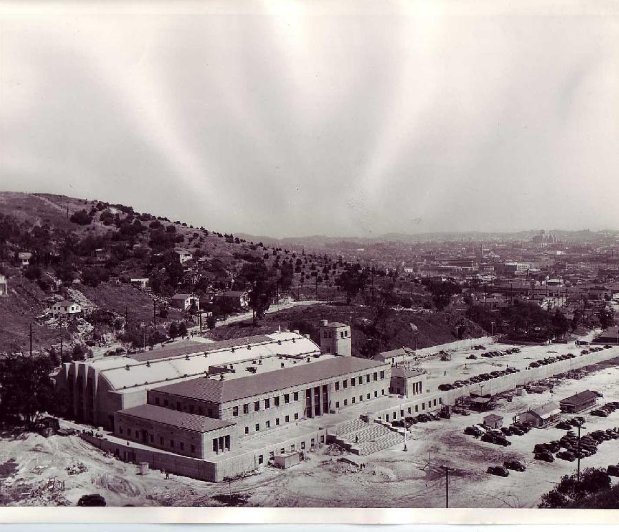
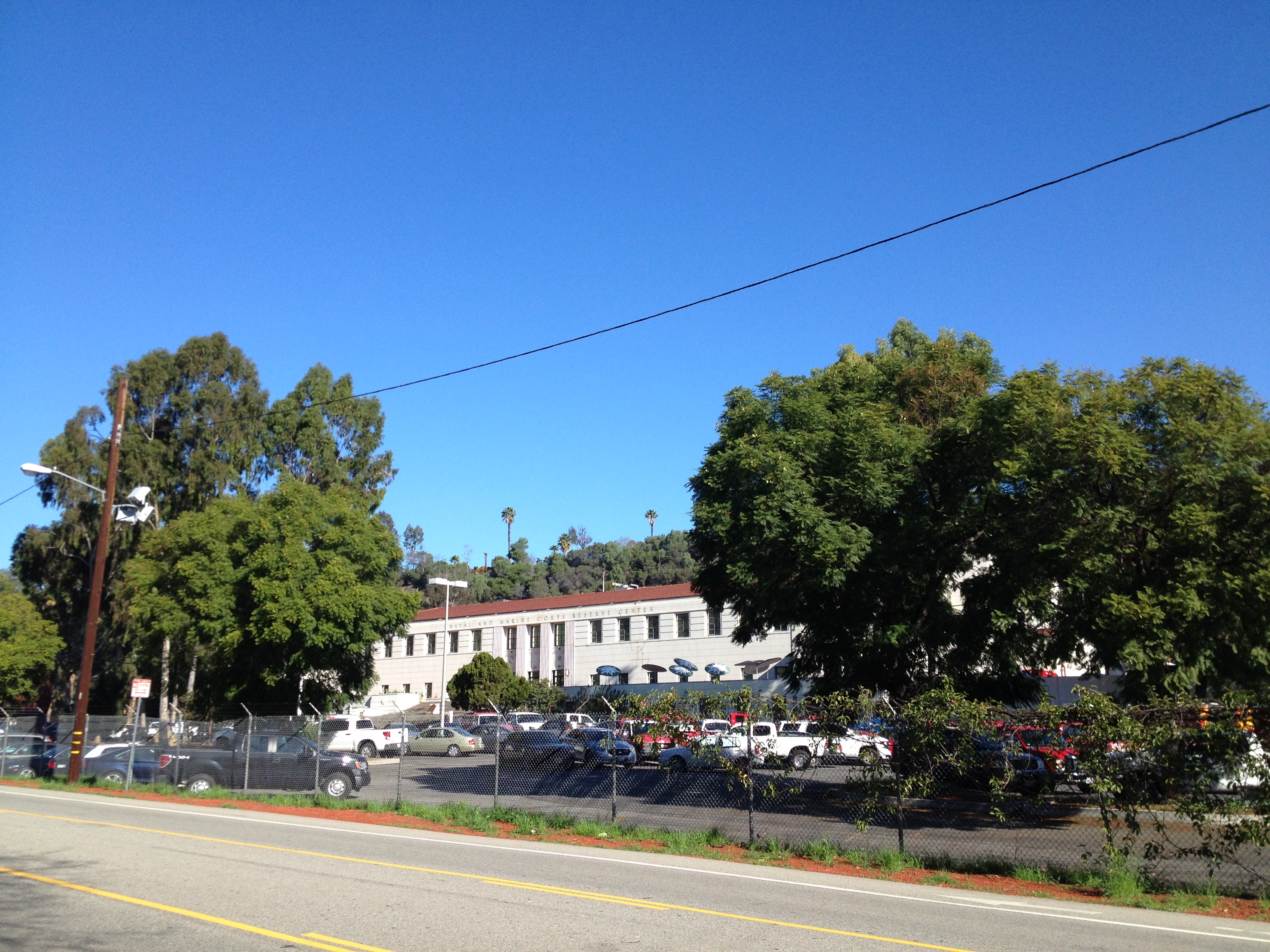
Located near the site of the old pest house is the Art Deco-style Naval and Marine Corps Reserve Center, Los Angeles Building, designed to be the largest enclosed structure without walls in the world by architects Robert Clements and Associates. It was constructed by the WPA between 1938 and 1941 as one of the country’s largest naval armories, its secluded location was chosen to shield it in the event of an air attack. During World War II, more than 20,000 sailors passed through the training center. In 1980, an electrical fire heavily damaged the interior, which reopened in 1986 after a renovation. It was designated California State Historic Landmark #972 in 1989. The military left in 1995 and it’s now home to the LAFD’s Frank Hotchkin Memorial Training Center, named after the firefighter who died fighting the 1980 conflagration.
METROPOLITAN WATER DISTRICT BUILDING
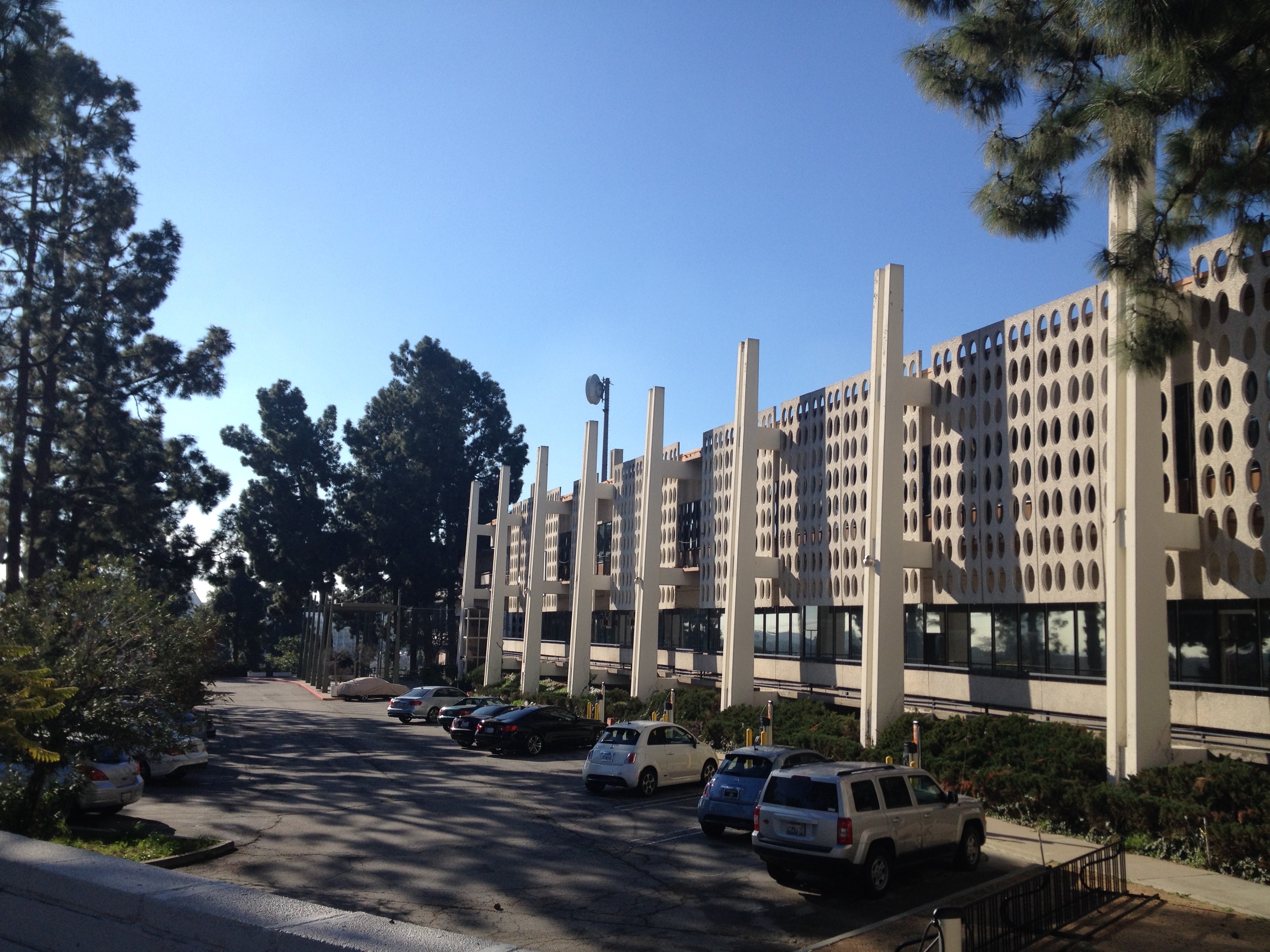
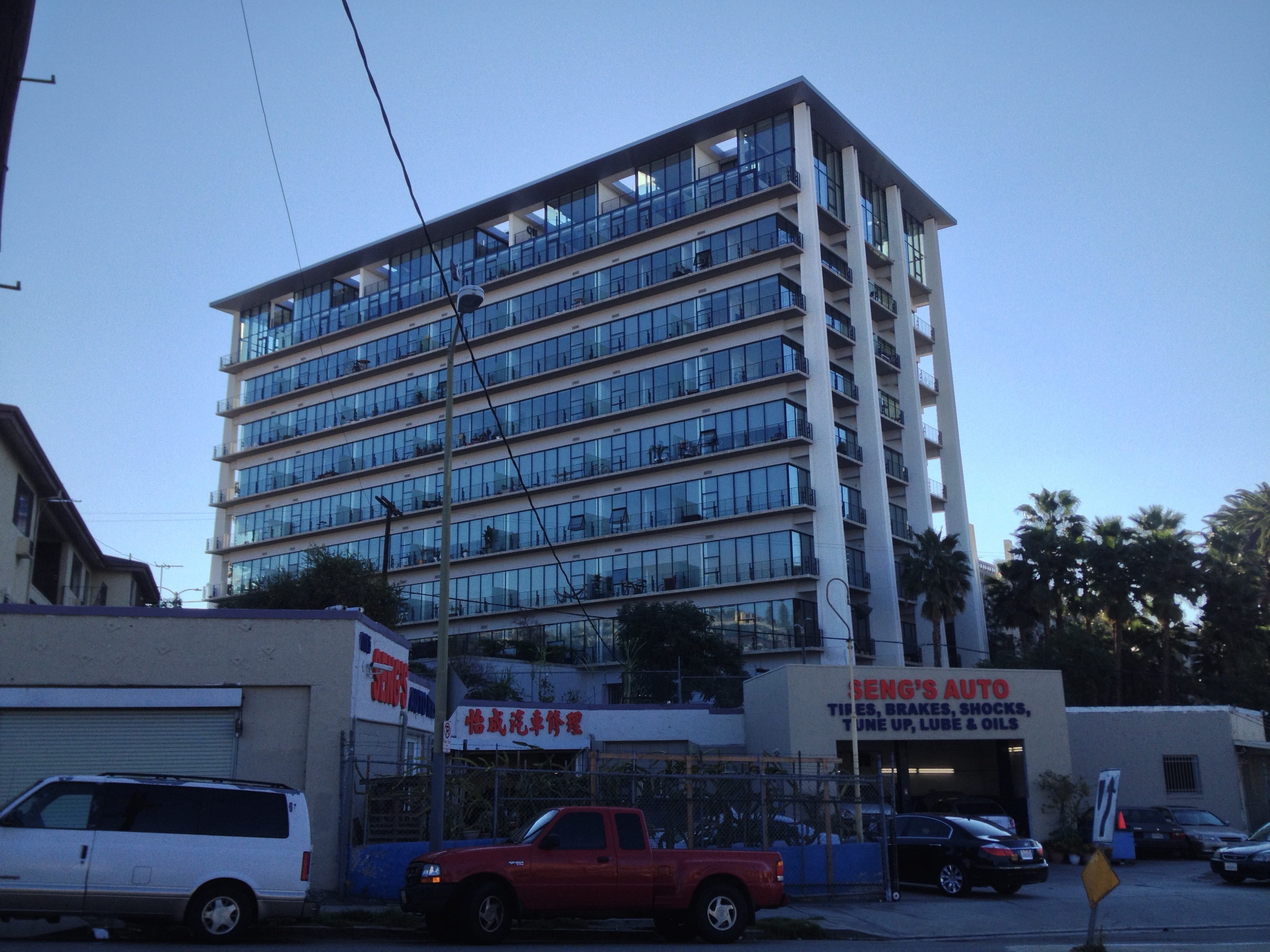
The Metropolitan Water District Building was designed by the great William Pereira in 1961 and completed in 1963. In 1973, an adjoining tower was completed which served as the department’s headquarters until 1993, after which it sat vacant for 18 years. Even whilst vacant, with its height it was easily the most eye-catching feature of the neighborhood and its neglect underscored Victor Heights’ “forgotten” reputation. Holy Hill Community Church moved into the original building in the 1990s or around 2000 but always left the tower empty and by the 2000s it had taken on the appearance of a lonely, heavily-tagged, post-apocalyptic tower block. In 2011 the tower was purchased by Linear City Development who gave it a good scrub and turned it into a residential high-rise called The Elysian.
VICTOR HEIGHTS TODAY
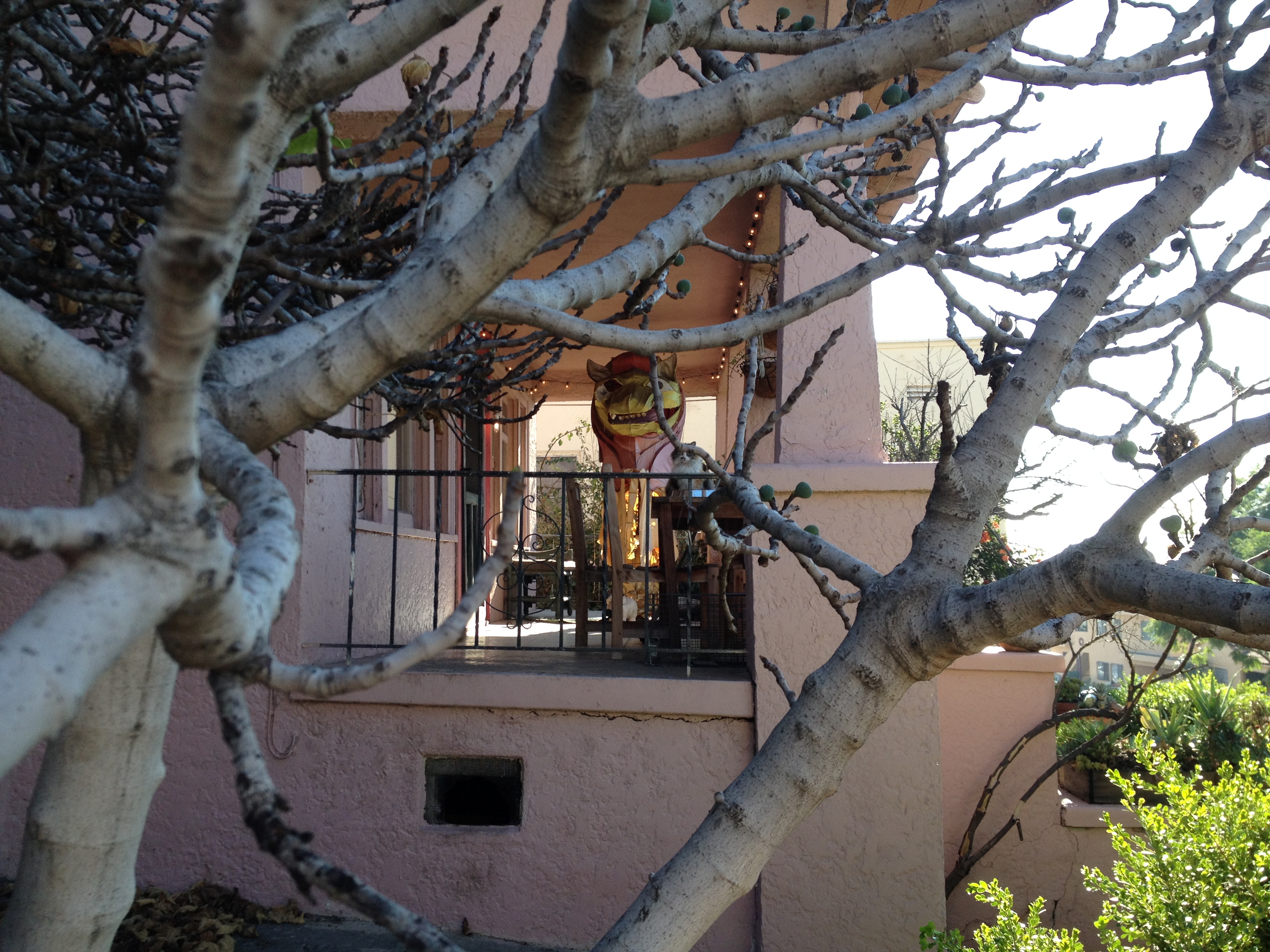
Victor Heights still exudes a sort of laissez-faire laid-backness. When I first began walking it was quite quiet except for the cacophonous clatter of a large and evidently diverse population of birds. The only bird calls that I recognized were, though unseen by me, made by a flock of feral parrots. What I didn’t hear or see on that particular day, which surprised me, were the peafowl for which the neighborhood is also known. The birds, usually heard squealing or seen perched or parading up the hill, were introduced in the 1970s by a resident named Charlie Ruiz.
Although Christmas had passed more than a month earlier, there were so many Christmas trees waiting to be collected that their air smelled strongly of pine — albeit mixed with the aroma of joss sticks, sesame oil, and garlic. Judging by their brittleness, brownness, and in some cases, soggy flocking, the Christmas trees have spent more than a few weeks on the streets, and one block alone, I counted seven of their corpses. Although out of place in most neighborhoods, in Victor Heights they were features of a sort of greater, seasonal confusion. Not only did I spy Christmas trees and strings of lights sharing space with decorative fall gourds, and Valentine’s Day decorations but there were deep red poinsettias and blooming magnolias indicating that even nature was apparently unconcerned.
As the morning wore on, the fog burned off, my sweater came off, and the variety of noises increased. I could make out the clatter of gunshots coming from the nearby police academy, familiar to anyone who has hiked through Elysian Park. The occasional plane and train in the distance combined with the din of cars speeding along the roads below but the interior of Victor Heights remained strangely quiet. There were signs of life, though, and parasols popped open shielding elderly Chinese from the sun as young white people emerged from their homes to wait for their dogs to poop and then return to the great indoors.
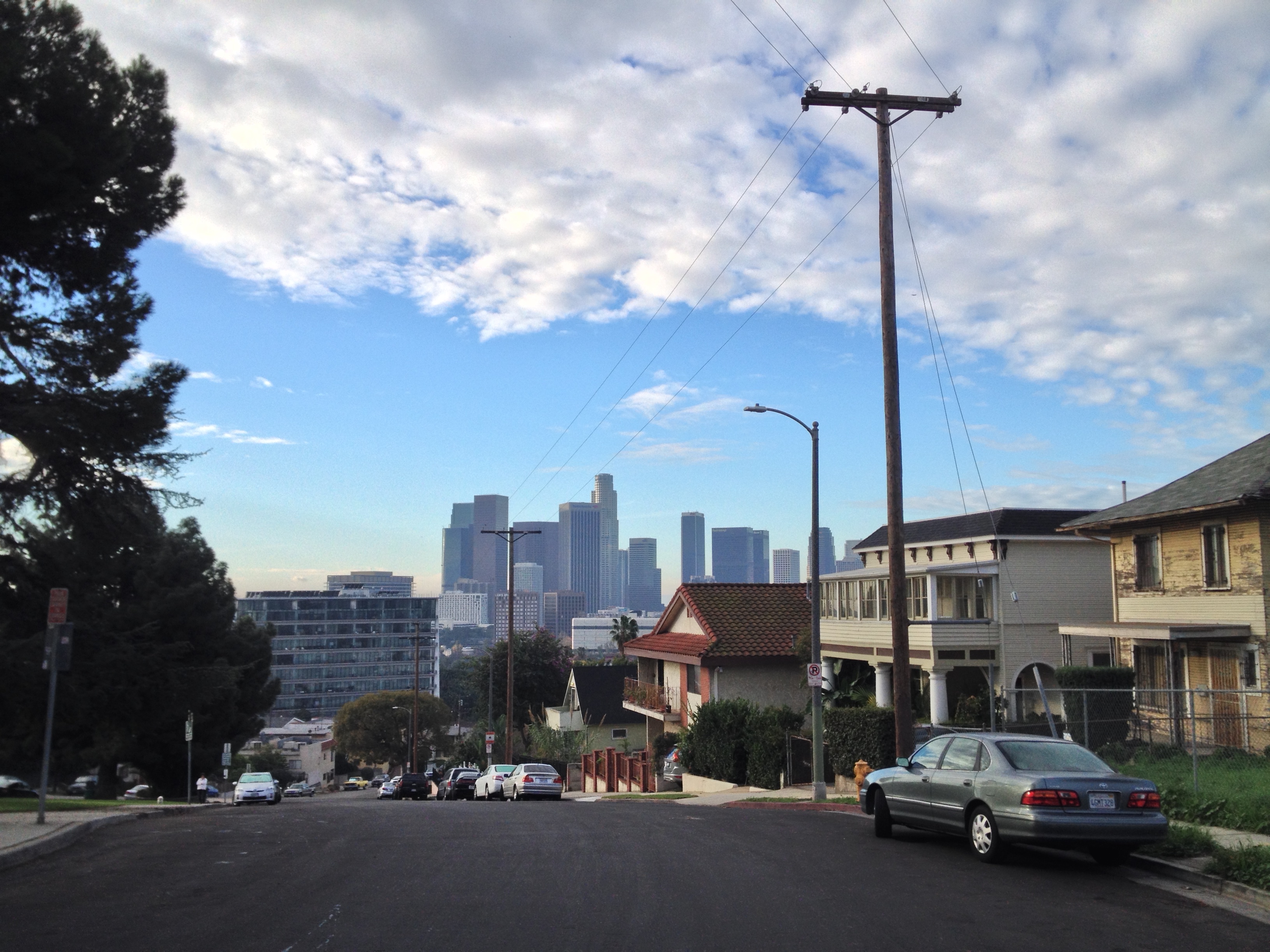
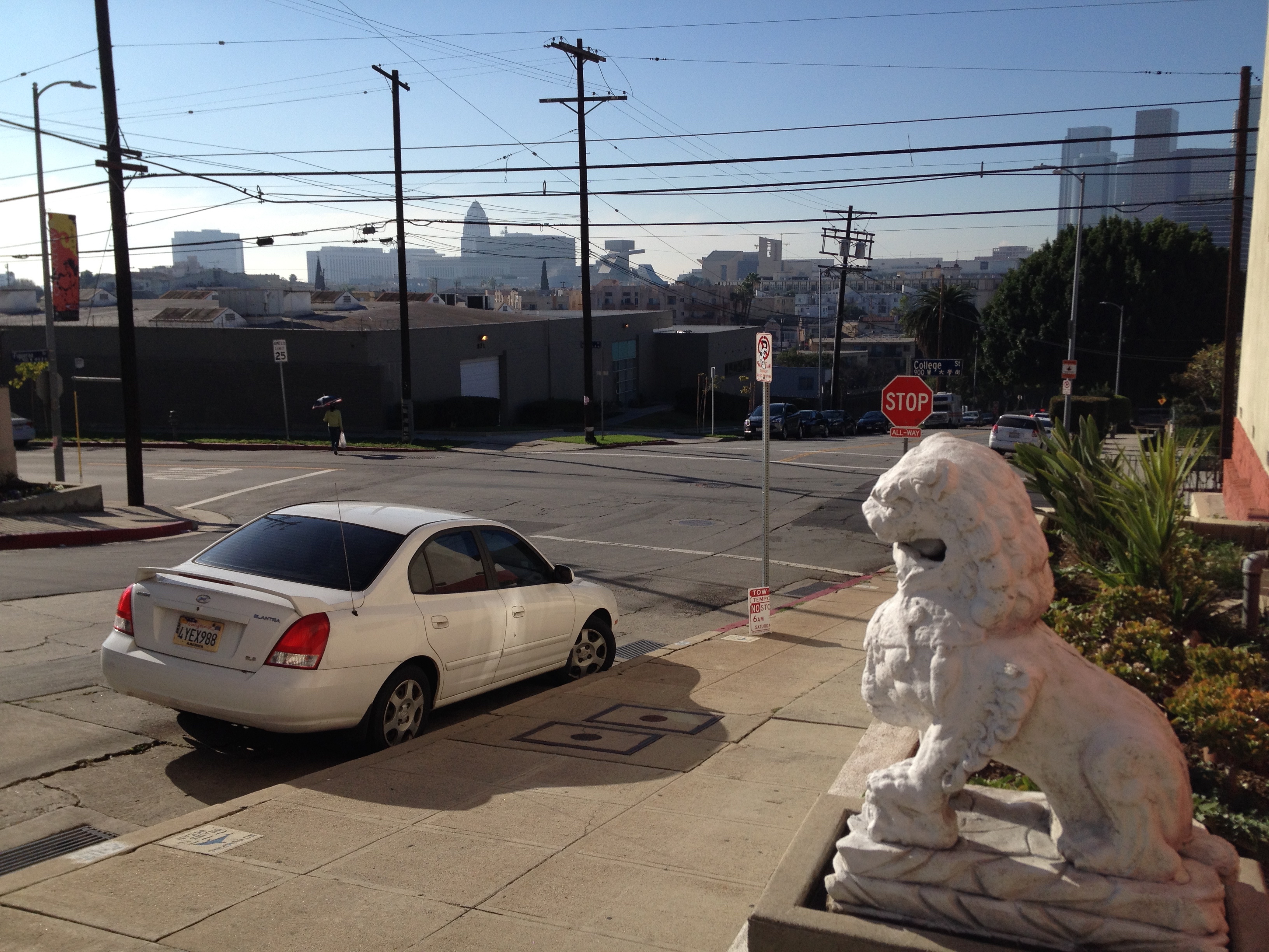
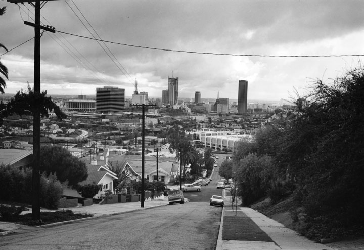
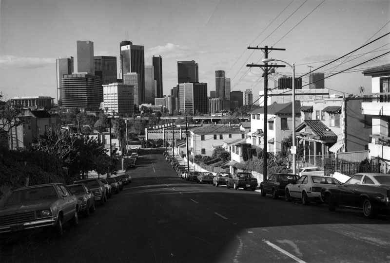
A young woman sat at the edge of Figueroa Terrace with her sketch pad, no doubt rendering the Downtown skyline. Though small, the bottom and top of Victor Heights are separated by 80 meters and the view of Downtown is unmatched except, perhaps, by the view from Dodger Stadium, which one can also get a nice view of from that street.
GETTING TO AND AROUND VICTOR HEIGHTS
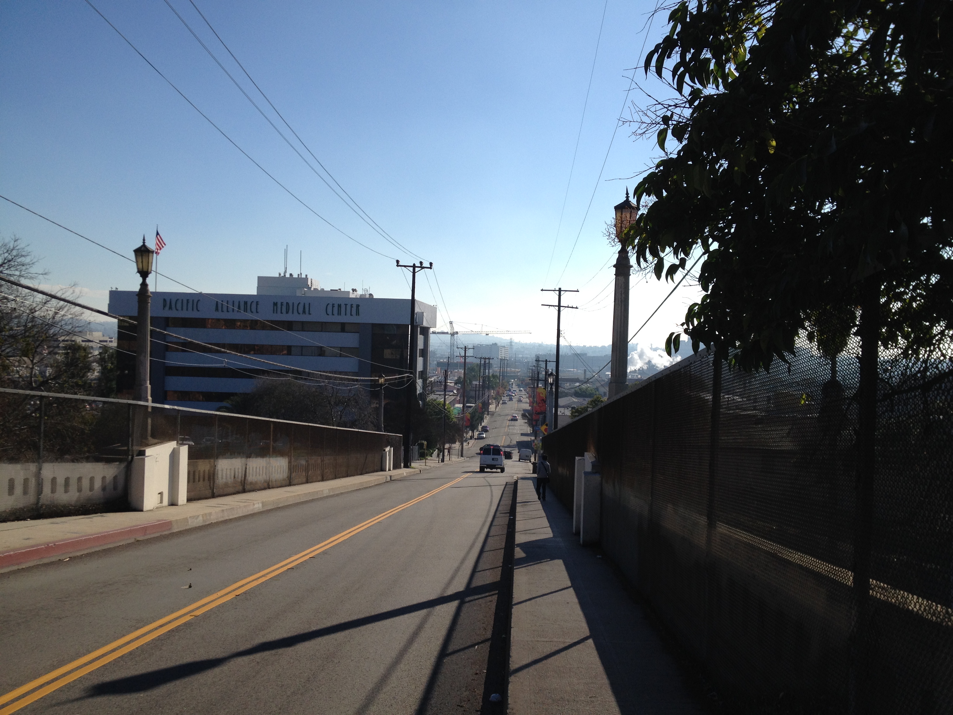
Although the terrain is rather steep, for the physically capable and mentally willing, Victor Heights is small and walkable. In addition to the bridges along Alpine, College, and Sunset which connect it with Chinatown, there’s a small pedestrian bridge over the Arroyo Seco Parkway which connects walkers to Yale Street just behind Chungking Road.
It’s also a short walk to Temple-Beaudry, Angeleno Heights, Echo Park, and Dodger Stadium — although if you walk into that sports venue rather than drive you will arouse the suspicion of security apparently not used to seeing sports fans who are not dependent on cars. (See my Exploring Dodger Stadium Without Baseball).
Historically there were several streetcar lines (e.g. The Los Angeles-Pacific Railway Company, The Los Angeles Ostrich Farm Railway Company, and The Pacific Electric Railway) which traveled along Sunset Boulevard but as far as I know, only the Los Angeles Railway‘s yellow cars ventured above Sunset into Victor Heights — even then only along Alpine and Beaudry streets. The A Line was abandoned in 1950 and today the neighborhood is served by LADOT’s DASH Lincoln Heights/Chinatown bus and Metro’s 2, 4, and Rapid 704 lines.
ARCHITECTURE OF VICTOR HEIGHTS
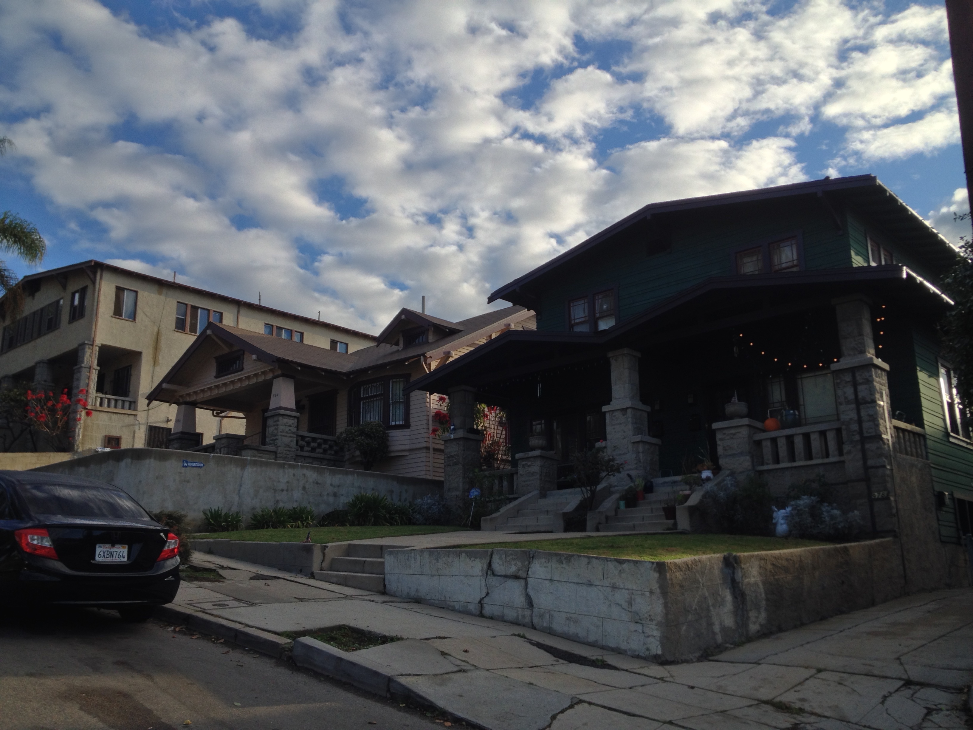
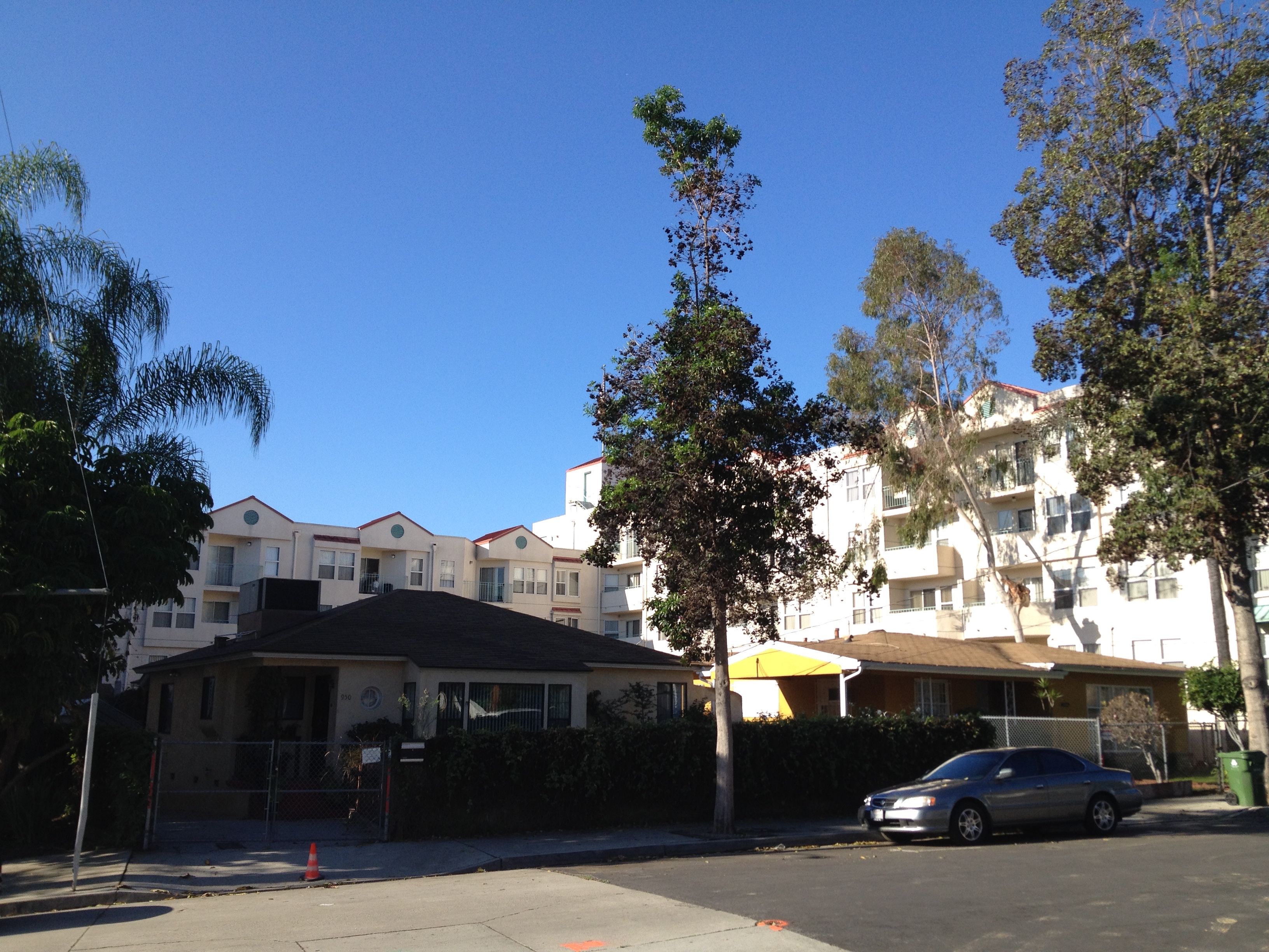
Although Victor Heights was subdivided the same year as neighboring Angeleno Heights it lacks that neighborhood’s Victorian charm. On the other hand, it also doesn’t include within it a massive hillside slum (i.e. the Angeleno Heights Favela). The architecture of Victor Heights is more of a hodgepodge. There are Craftsman bungalows, Spanish Colonial Revival houses and apartments (some quite pretty), mid-60s apartments with mid-60s ornamentation, and fairly big late ‘80s/early ‘90s complexes that though possessed of little to recommend them aesthetically do have size on their side and Skyline Terrace is the neighborhood’s Kowloon Walled City (九龍寨城).
Recently, another Canadian developer (who is not a Beaudry) has proposed building a large, residential development on the site that were until recently home to Reliable DO It Center and The Warehouse LA.
It has predictably been met with protests about its lack of commercial space as well as its planned size, which is described as being out of step with other residences in the neighborhood — which is completely true if one chooses to ignore everything along the north side of Figueroa Terrace or the converted MWD building.
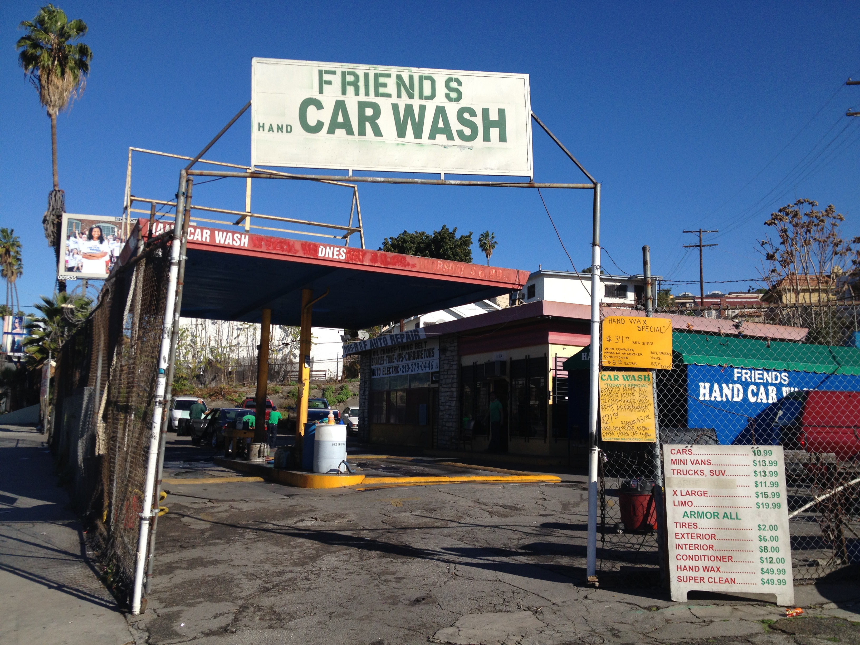
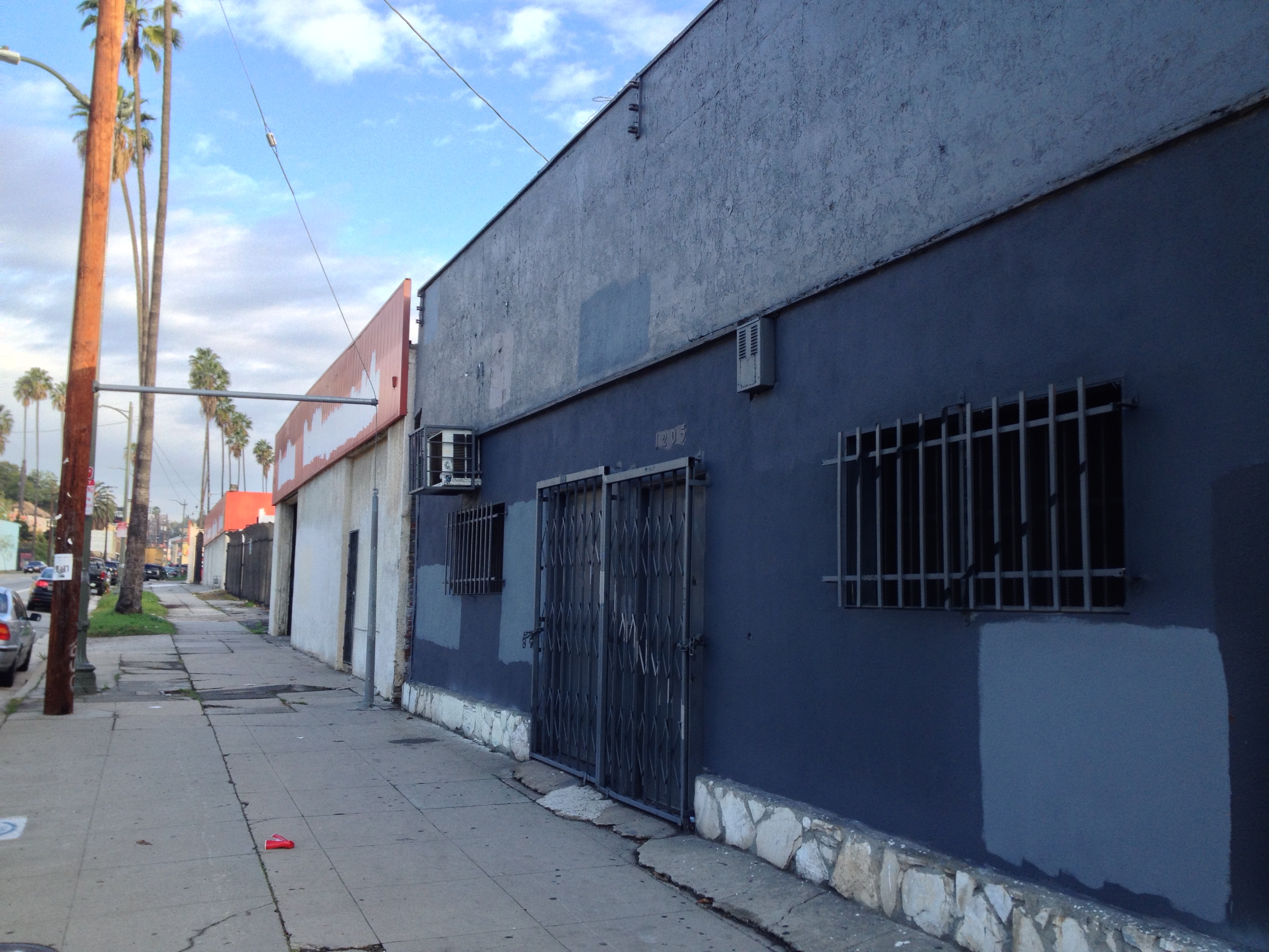
For now, that stretch of Sunset Boulevard remains home to empty buildings, auto shops (Seng’s Auto Repair, Far East Auto Repair, Friends Hand Car Wash, and Fernando’s Tires) as well as a couple of art galleries (Dodger Art and Subliminal Projects).
VICTOR HEIGHTS EATERIES
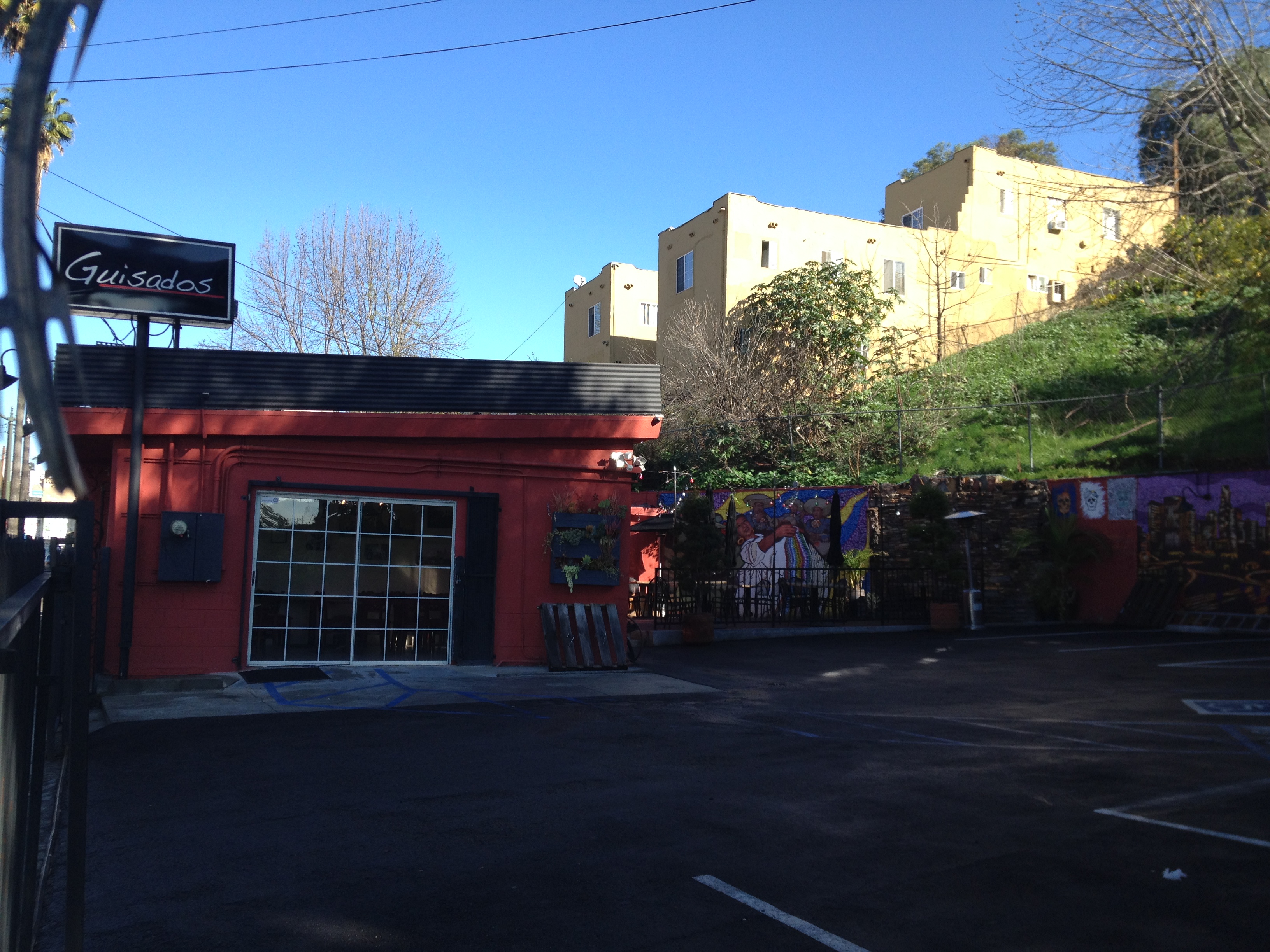
Sunset Boulevard is also home to Guisados, one of the only restaurants in the neighborhood. The not-quite-a-chain restaurant started, like Eastside Market, on the Eastside before heading west (in the case of Guisados, from Boyle Heights. There’s also one in Gallery Row now). It arrived in 2013, replacing La Esquinita, and I’ve eaten there a couple of times and enjoyed it. When I passed it in the morning it wasn’t yet open but as I passed it again I could make out the accordianated strains of Celso Piña, who like good tacos always gets a thumbs up.
If there is another restaurant in the neighborhood, it’s Sarang Cafe, which there’s a business listing for in the old Metropolitan Water District building. However, that may have been part of Holy Hill, who entered bankruptcy proceedings in 2014 and presumably either moved out or is in the process of doing so so best call before popping in. You can probably grab something lactic from Sunny’s since the outside says “Dairy.”
EVERETT PARK
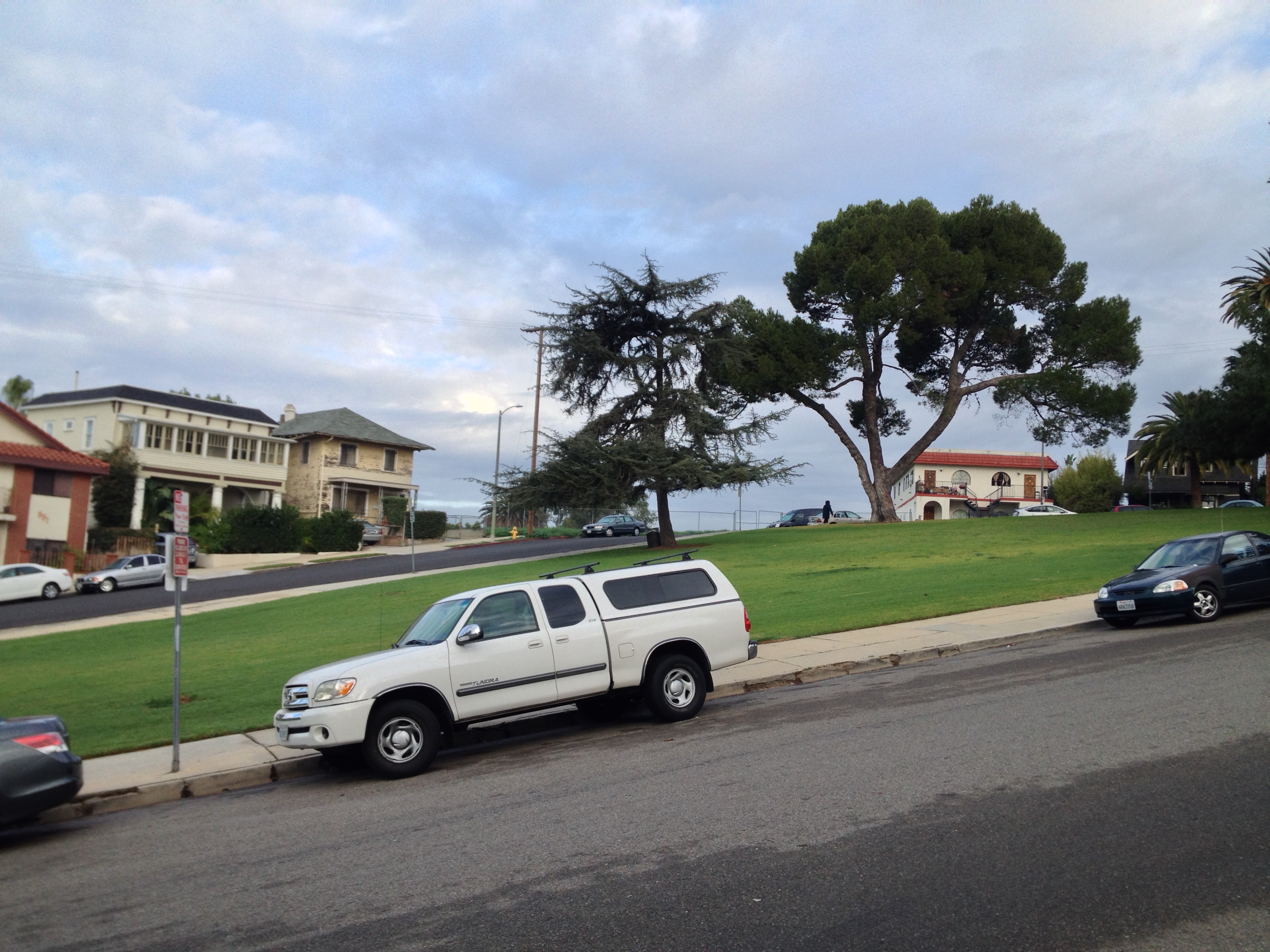
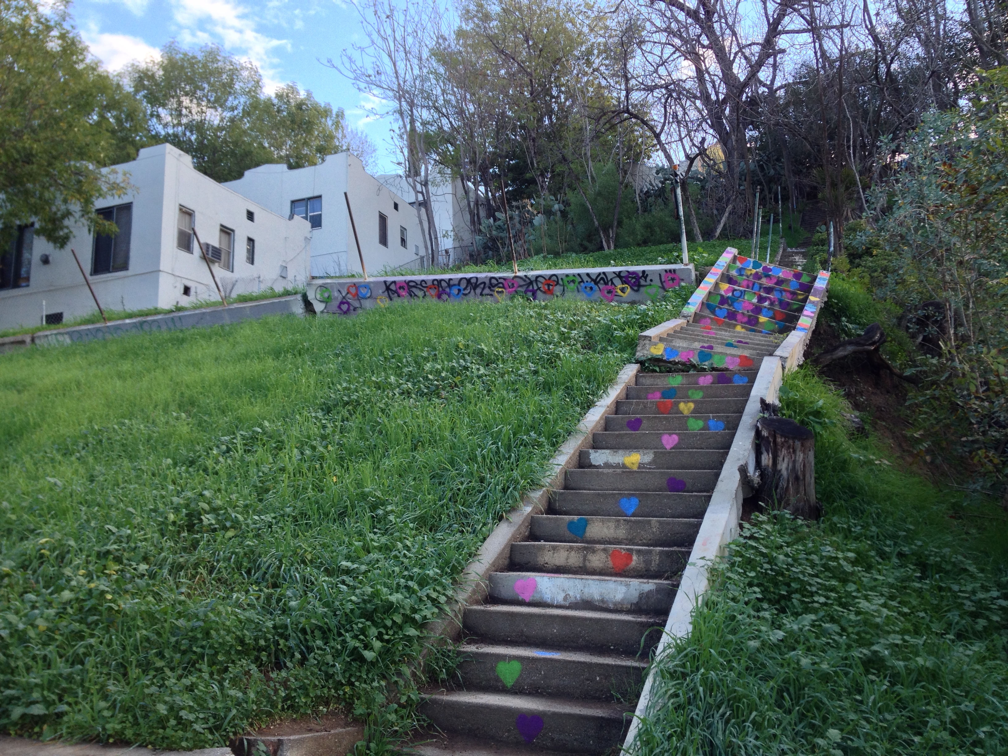
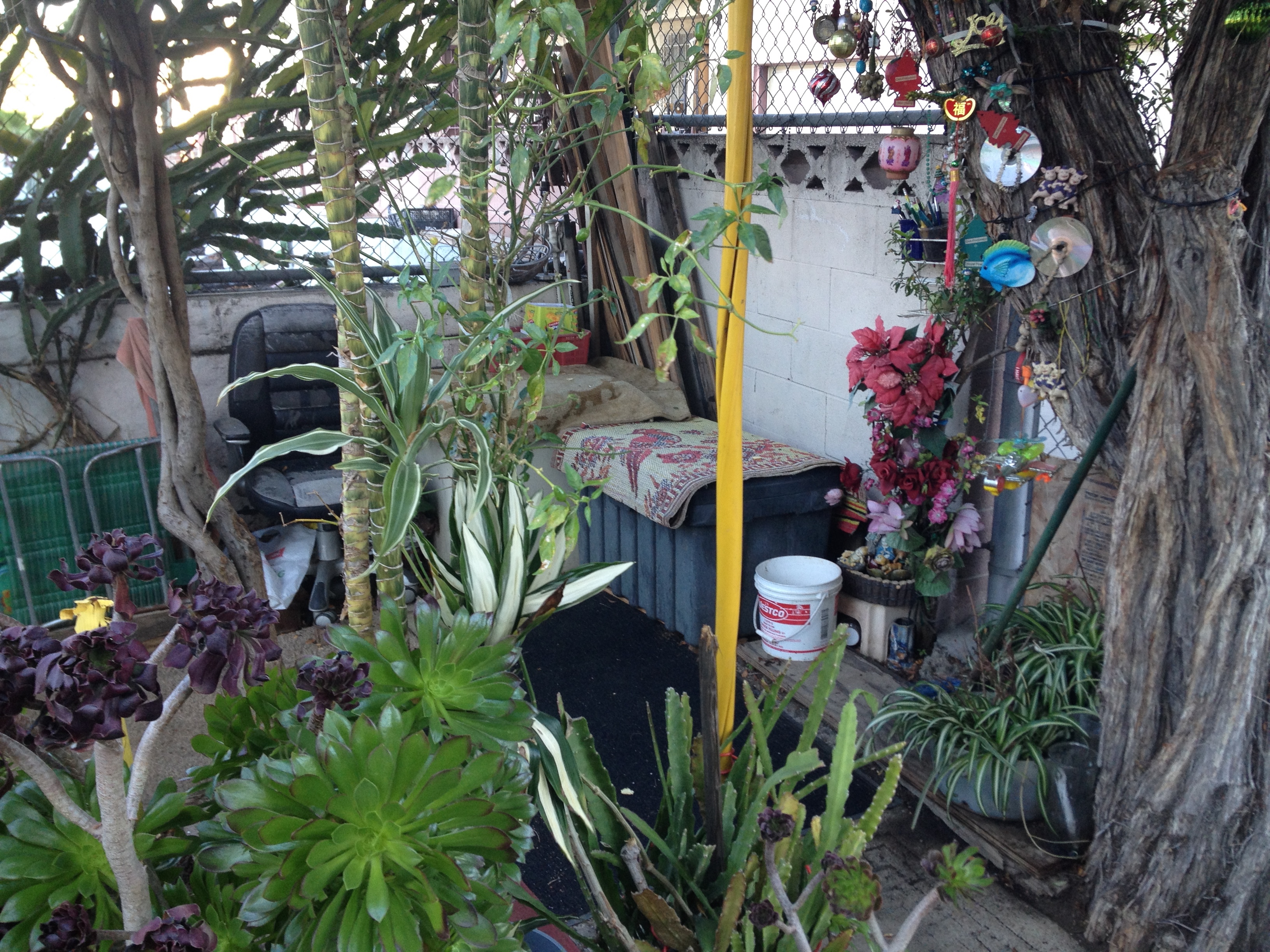
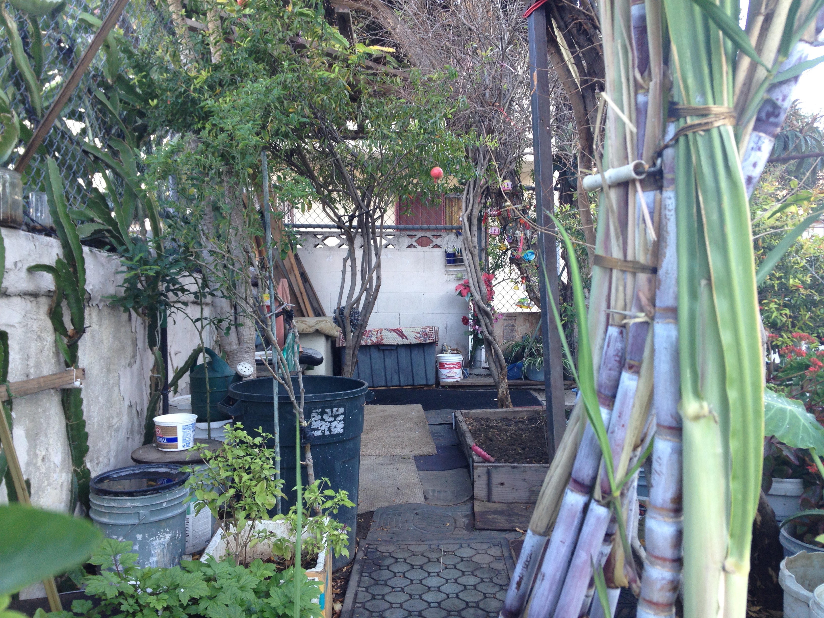
The area of Victor Heights around Everett Park that was subdivided as Angeleno Heights is sometimes itself referred to as Everett Park. Unstaffed Everett Park is too steep for a game of croquet or boules but like Figueroa Terrace, it affords great views of downtown. One of Los Angeles’s greatest parks, Elysian Park, is located in Victor Heights’ backyard, which may explain why Victor Heights is itself a bit park poor — but that doesn’t stop the residents from creating their own tiny plazas and gardens in the yards, alleys, and even stairways of their residences.
Especially common are container gardens — a five-gallon bucket designed to hold Pearl River Soy Sauce can easily be transformed into a flower pot which can, in turn, transform just about any outdoor space into an urban oasis.
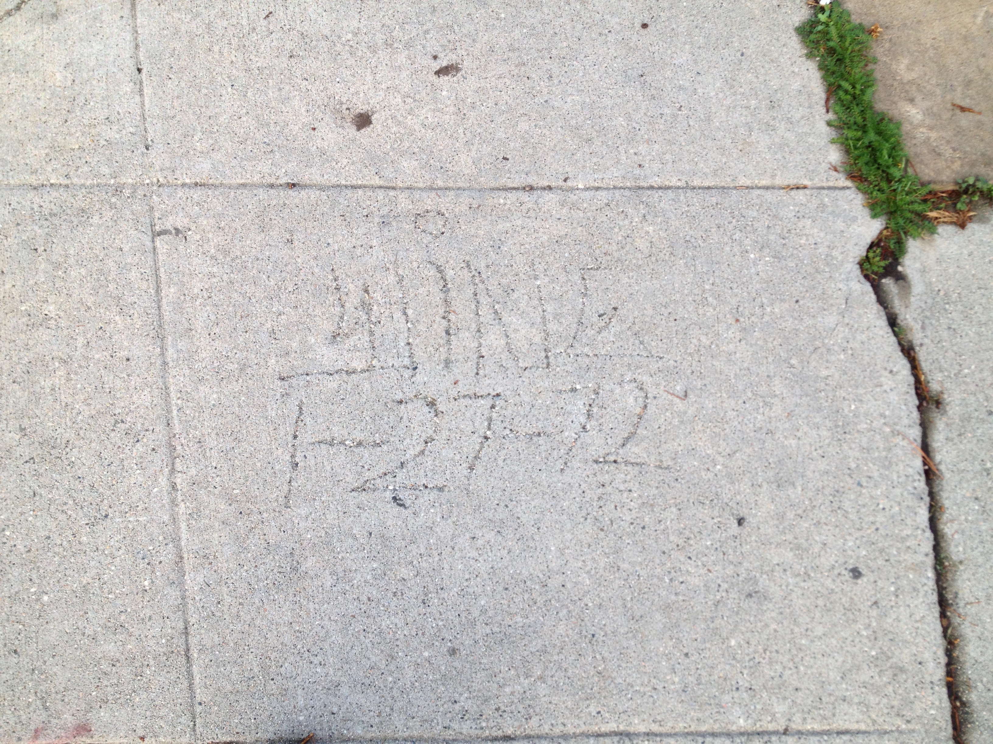
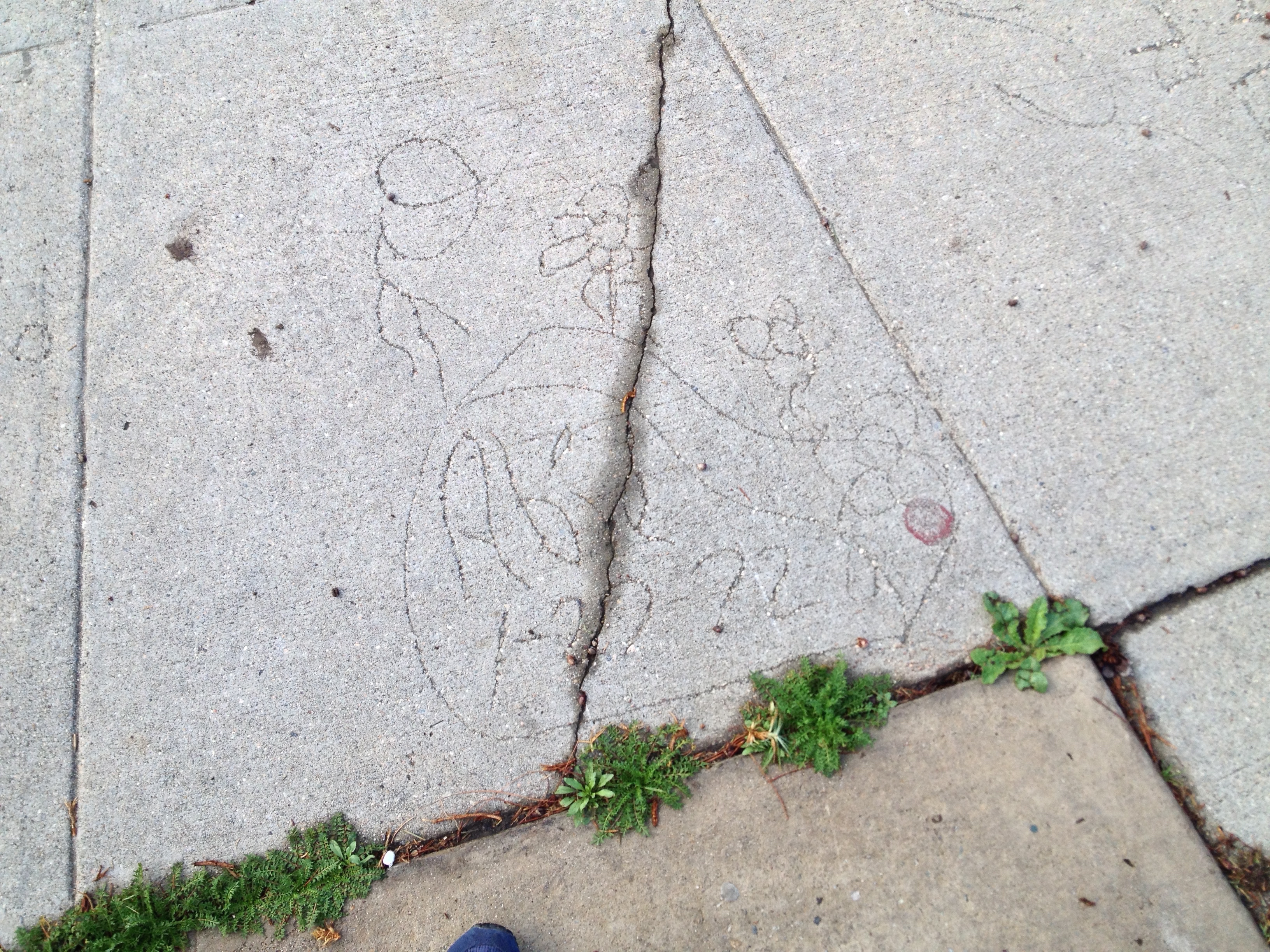
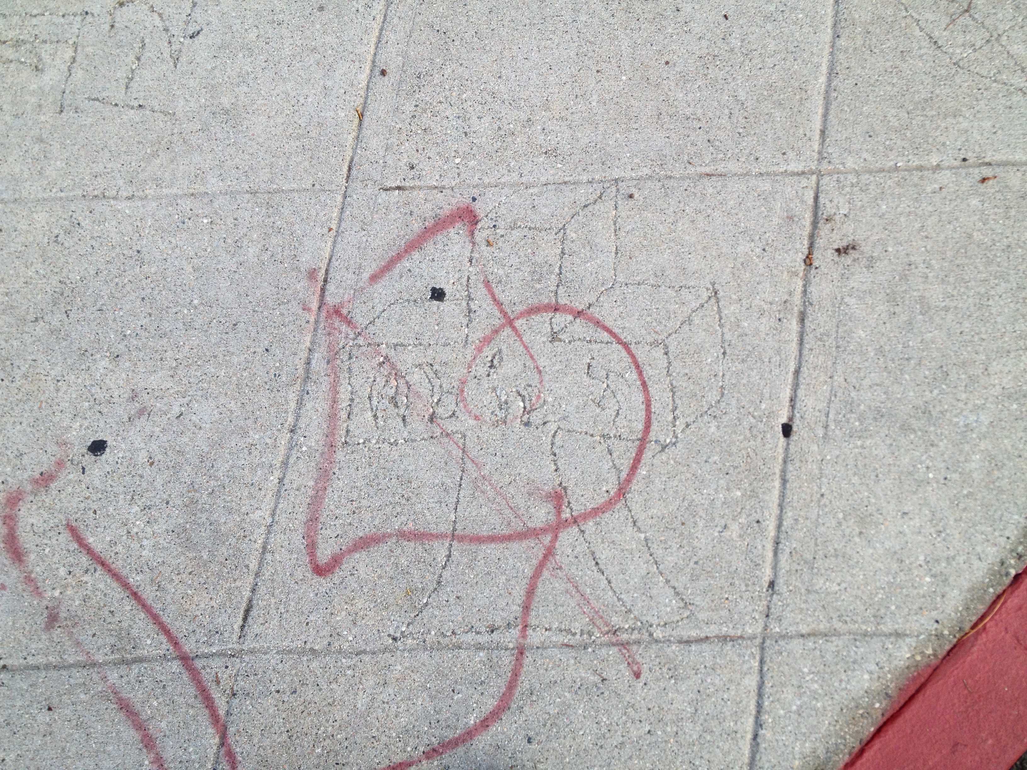
I’m not sure how the local gangs stake their territorial claims or which are even still in existence. Everett Park is shaped like a teardrop and I wonder if it’s from that which the Teardrop Locos took their name. In the past, other gangs included Osiri Boys and their rivals, Oriental Lazy Boyz (some of whose members were arrested in the 1996 murder of Khmer actor, physician, actor, and author Haing S. Ngor). Perhaps the most infamous gang in Victor Heights is the long-defunct Varrio Alpine Street, who it seems were responsible for the sidewalk scrawlings at the base of the park. I was surprised to find a memorial for someone whose life apparently ended exactly 43 years earlier. I’m not sure how much of a gang presence there is now, although, in Training Day, Roger’s house was played by the real-life Victor Heights residence at 1031 Everett Street.
COMMUNITY ORGANIZATIONS OF VICTOR HEIGHTS
If you’re interested in getting involved in a community organization that is still around and is designed to bring the neighborhood up, the Victor Heights Tract portion of Victor Heights is represented by the Historic Cultural Neighborhood Council. The Angeleno Heights Tract portion of Victor Heights is represented by the Greater Echo Park Elysian Neighborhood Council. Over a decade ago, the Forgotten Edge Neighborhood Watch changed its name to Victor Heights Neighborhood Improvement Association. It still seems like an under-recognized gem of a neighborhood, though, and just about the only account that I found of living there is Christina C. Martinez’s Why I Love Living in Victor Heights.
Support Eric Brightwell on Patreon

Eric Brightwell is an adventurer, essayist, rambler, explorer, cartographer, and guerrilla gardener who is always seeking paid writing, speaking, traveling, and art opportunities. He is not interested in generating advertorials, cranking out clickbait, or laboring away in a listicle mill “for exposure.”
Brightwell has written for Angels Walk LA, Amoeblog, Boom: A Journal of California, diaCRITICS, Hidden Los Angeles, and KCET Departures. His art has been featured by the American Institute of Architects, the Architecture & Design Museum, the Craft Contemporary, Form Follows Function, Los Angeles County Store, the book Sidewalking, Skid Row Housing Trust, and 1650 Gallery. Brightwell has been featured as subject in The Los Angeles Times, Huffington Post, Los Angeles Magazine, LAist, CurbedLA, Eastsider LA, Boing Boing, Los Angeles, I’m Yours, and on Notebook on Cities and Culture. He has been a guest speaker on KCRW‘s Which Way, LA?, at Emerson College, and the University of Southern California.
Brightwell is currently writing a book about Los Angeles and you can follow him on Ameba, Duolingo, Facebook, Goodreads, Instagram, Mubi, the StoryGraph, and Twitter.


Thank you so much for this write-up, Eric. I’ve lived here for almost a year and wasn’t able to put a name to almost anything about it – whenever anyone asked where I live, I’d tell em “by Dodger Stadium.” I guess now I can say “Victor Heights…it’s by Dodger Stadium.” It’s nice you got to meet our coyote, too! I’m hoping he did away with the skunks that were briefly rooting around up here.
LikeLiked by 1 person
Thanks for this blog! I’ve lived here my entire life and never knew much about its history. Growing up, I always told people I lived in Chinatown. Now I can finally tell people where I’m really from.
LikeLiked by 1 person
Glad that you liked it!
LikeLike
Great blog post. I always enjoy learning about neighborhoods in LA, and little did I know about this one that I regularly drive through on my way to Dodger Stadium.
LikeLiked by 1 person
Thank you. I like that neighborhood. Passed through it for fun just last night on my way back from the Mid-Autumn Festival in Chinatown.
LikeLike
i grew up on top of the hill at 1013 Figueroa Terr the market at Beaudry and Alpine was Joe’s run by mean old Joe Demasio east of him was Pat’s meat market .He was a real nice guy and Joes brother in law. The Eastside market back when I was a kid was not a very friendly place and I remember that they had all these cheese balls hanging a the place reaked a bit .Across fro the Eastside market was Dotties store a small little store that everyone went to because the hated Joe’s I could tell you a bunch more if itereseted
LikeLiked by 1 person
I’d love to hear more. I’m sure the other readers would too!
LikeLike
When I was a kid late 50s we never heard of Victor Heights, everyone just called it “the hill”
we did not know it had a name. Over the the last 20 years or so I have done a lot research about the hill. I have found lots of old maps and even a newspaper story from the 1890s about a reporter who walked to the top of the hill just to write a story about what he saw. Back in the early 1900s there where 2 reservoirs up on the hill, one was at the top of White Knoll ,in the article the reporter talks bout climbing the hill to the “white faced reservoir” hence the name White Knoll . it seems that all these tracts back then had to have their own source of water as the city water companies did not service the outlying areas back then. So V.Beaudry built 2 reservoirs ,one at the top of Whit Knoll an the other at the SE corner of what is now Figueroa Terr and Centennial st .To get the water up to reservoirs Victor built a combination pump house and fire station where Figueroa Terr curves down toward College st. This building was there when I was a kid and probably there to the mid 70s. If you go on you tube and look up an old episode of Highway Patrol called “false confession “you will see this building , this whole episode was shot on the “hill” you might like it. As best as I can find the White Knoll reservoir was gone by the 20s and the Figueroa Terr reservoir was empty by 1938 . I Know this because I was able to ask the uncle of one of my friends about the “hill” before he passed and he told me that the lower reservoir was empty when they moved in in 1938. also note the fire station /pumphouse at the end of our block was yellow which might seem odd for a fie station but i come to find out that yellow was a common color for a fie station back then. hope you enjoyed this . thanks Mark Jojola
LikeLiked by 1 person
Love this.
LikeLike
Appreciate thiis blog post
LikeLike